Trip Journal: West Virginia State Parks Mini-Meet-up
Canaan Valley Resort Park and Blackwater Falls State Park, West Virginia
Thursday, May 16 - Sunday, May 19, 2019
Thursday, May 16 - Sunday, May 19, 2019
Lynn and I got an invitation to for another springtime meet-up with a few of the TripAdvisor Gang. Actually, it seems that Lynn may have started the discussion on this gathering by mentioning getting together this spring in her Christmas card to Rhonda. Whatever the impetus, Rhonda first contacted me about the idea in January. She and Donna had been discussing it and had zeroed in on Canaan Valley and Blackwater Falls State Parks in West Virginia. That's a good location as it is fairly central for us all. This would be the first time that Lynn and I have been to that area since our honeymoon, so over 30 years ago. Donna had a few VRBO options lined-up. The trick would be finding a time that we were all available. Donna had tossed out a weekend that worked well for her and Oscar and Rhonda and Chris and miraculously that fit our schedule as well, albeit it followed right after one of my business trips to D.C. Lynn and I discussed it briefly and decided to give it a whirl. The plan is to converge on Canaan Valley on Thursday the 16th and depart on Sunday. Alright then, another trip added to the 2019 docket.
Over the next couple of months we worked sporadically on the planning and trip details, although there really was not that much to do. We all quickly concurred on the house option, but our number one pick was missing a key feature that the ladies just cannot live without, air conditioning. So Donna made an executive call and locked in the second pick. The back-up choice really was just as nice as the first, so not a big deal. A three bedroom, three bathroom cabin with a nice big deck; https://www.vrbo.com/4831583ha. The bonus was that we got an additional free night if we could use it. With my business trip schedule the best we could realistically do was the planned Thursday arrival, but at least the rest of the gang could take advantage of the freebie.
As the time for the trip grew short, the emails between Donna, Rhonda and me started to flow. We're connected due to our history through TripAdvisor. This now the time to talk details on food and drink. OK, I have handle the beer decisions, but Lynn needs to be in the loop for the dining. I got the ladies connected via email just to get the middle man out of the dinner planning. They got it all sorted out very quickly. They are all very organized and used to traveling, so this little excursion is a no-brainer.
I did a little prep work for the West Virginia trip while I was packing for the D.C. trip. The weather a week out was looking iffy at best with a high potential for rain over the weekend. Shoot, Saturday looks like a washout. We have dealt with wet weather during our previous two mini-meet-ups in Gettysburg and Ohiopyle, so we will endeavor to persevere. It has been a very wet spring so this is really not a shock, but the weather can change. We'll just see how it plays out.
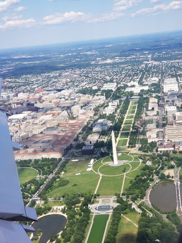
Wednesday, May 15, 2019 - One trip ends and another begins. I'm coming home from D.C. this afternoon following the AIAA Annual Business meeting in Arlington, VA. A busy day, shoot, a busy week and it is only Wednesday, but a couple post-meeting beers with Craig and John got things back in order. I was on the road at 2:30, and rolled to my gate at DCA just as boarding mob 3 was being called so I just walked right on to the plane (I was part of the already loaded mob 2) and got situated for the short hop to CLE. The bonus was a nice view of the National Mall as we climbed away from Reagan National. Too bad that Lynn could not have made this trip with me as we could have drove and combined DC with West Virginia into one big road-trip loop. But that idea had its own set of pros and cons so we kept these two short trips separate.
Over the next couple of months we worked sporadically on the planning and trip details, although there really was not that much to do. We all quickly concurred on the house option, but our number one pick was missing a key feature that the ladies just cannot live without, air conditioning. So Donna made an executive call and locked in the second pick. The back-up choice really was just as nice as the first, so not a big deal. A three bedroom, three bathroom cabin with a nice big deck; https://www.vrbo.com/4831583ha. The bonus was that we got an additional free night if we could use it. With my business trip schedule the best we could realistically do was the planned Thursday arrival, but at least the rest of the gang could take advantage of the freebie.
As the time for the trip grew short, the emails between Donna, Rhonda and me started to flow. We're connected due to our history through TripAdvisor. This now the time to talk details on food and drink. OK, I have handle the beer decisions, but Lynn needs to be in the loop for the dining. I got the ladies connected via email just to get the middle man out of the dinner planning. They got it all sorted out very quickly. They are all very organized and used to traveling, so this little excursion is a no-brainer.
I did a little prep work for the West Virginia trip while I was packing for the D.C. trip. The weather a week out was looking iffy at best with a high potential for rain over the weekend. Shoot, Saturday looks like a washout. We have dealt with wet weather during our previous two mini-meet-ups in Gettysburg and Ohiopyle, so we will endeavor to persevere. It has been a very wet spring so this is really not a shock, but the weather can change. We'll just see how it plays out.
Wednesday, May 15, 2019 - One trip ends and another begins. I'm coming home from D.C. this afternoon following the AIAA Annual Business meeting in Arlington, VA. A busy day, shoot, a busy week and it is only Wednesday, but a couple post-meeting beers with Craig and John got things back in order. I was on the road at 2:30, and rolled to my gate at DCA just as boarding mob 3 was being called so I just walked right on to the plane (I was part of the already loaded mob 2) and got situated for the short hop to CLE. The bonus was a nice view of the National Mall as we climbed away from Reagan National. Too bad that Lynn could not have made this trip with me as we could have drove and combined DC with West Virginia into one big road-trip loop. But that idea had its own set of pros and cons so we kept these two short trips separate.
The original thinking for once I got home on Wednesday evening was to get packed and ready for an early departure on Thursday, but plans have a way of changing. First, I had to address a few items at the office after I got back from DC which slowed things down a bit. Then I was sort of beat by the time I finally rolled into back to the ranch. So we did a little trip prep this evening but left the bulk of the work for Thursday morning. Rhonda had texted the address for the cabin (she and Chris were already there and Donna and Oscar were on their way since we got a bonus night stay). I let her know that we'll be on our way in the morning, but not at the crack of dawn as initially planned.
|
|
Thursday, May 16 - Heading to West By God. I'm not moving quickly this morning, as expected. While I'm looking forward to seeing our friends my motivation to travel first thing today is lacking. But I got through my chores and completed my packing (not that there was much to do for a relaxed, weekend hiking excursion). The nice thing about a road trip is that the packing is actually easier in that there are fewer decisions to make. Do I take an extra pair of shoes or the rain gear? Shoot, take it all, there's plenty of room in the Edge so just toss it in! Yeah, we probably took too much stuff but this way we have it if we need an and there are no fees for having over weight bags!
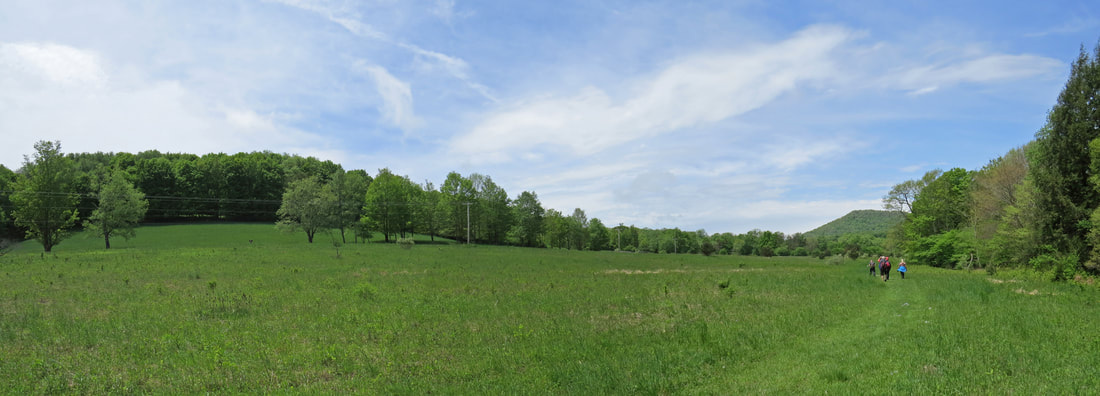
We left Medina at 10:20. Rhonda had texted just as we were about to get on the road, so good timing there. I had mapped the route already. Baby indicated that this was right at a five-drive, so I figured our ETA was about 4:00 PM including the inevitable stops along the way (at least one to fill the Edge and two or three to empty Lynn). Since we got a late start we decided just to snack as we drove for lunch, rather than stopping any where. We were toying with the idea of detouring to the Fat Head's location in Pittsburgh for a break, but opted to save that as an option for the return trip. Lovely day for a drive and it was an easy drive with Interstate for much of the trip, until south of my old stomping grounds in Morgantown, WV. Of course we were looking for critters as we drove and saw several hawks, including at least one Red-tail and a couple Great Blue Herons in the waterways along the Ohio Turnpike. The most interesting sighing was a heron that had just taken off and was flying low over the road so we got a good look at it. Definitely not a Great Blue. When we made our next rest stop I did a quick search on the phone and confirmed it was a Little Blue Heron. That's a first sighting for 2019, so a good start to the trip.
Just south of Morgantown, we exited the highways for the winding back roads of West Virginia for the remainder of the drive. These are the types of roads that I grew up on, so I have an idea on how to drive them. Of course the locals feel that they know how to drive them even better as we were passed a couple times by impatient kids in pickup trucks. I guess I might have done that a time or two in my youth, but today I am content to cruise along at the speed limit, or maybe a little less, and just enjoy the drive, the scenery and the company. Lynn and I chatted about the views and our travel plans for the summer and later in the fall. We trundled through a series of small towns, most of which having seen their heyday, but there was still plenty of activity. The little berg of Thomas looked like it had some interesting shops to explore, antiques and such. Oh, and there's Mountain State Brewing. Bonus! That might be an option for us if this does turn out to be a rainy weekend (upon further review, I've tried the Seneca "Indian" Pale Ale from Mountain State, which was pretty darn good as I recall).
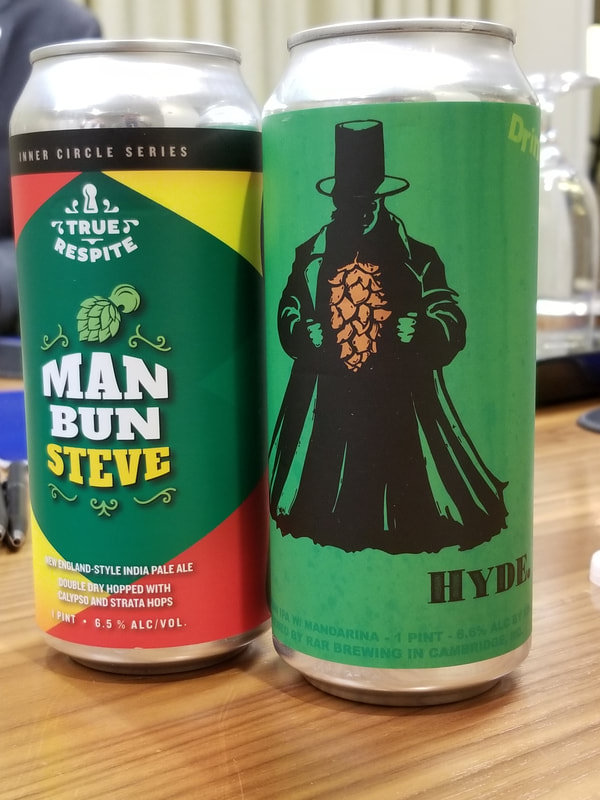
We arrived at the cabin at 4:03, right as predicted. After a round of hugs and handshakes we unloaded our stuff. The other two couples had taken the upstairs accommodations, saving the downstairs "wing" for Lynn and me. That works. We all sort of had our own suites, more or less. Now that we're all settled in, it is time for a beer (or wine for the ladies). Oscar, Chris and I started our bottle sharing weekend by sampling a variety of brews (plus I drank a couple others for good measure). one of the first beers of the WV weekend was called #Adulting. I liked the name as it was something we would not have to do for the next couple of days!
Donna was in charge of dinner tonight but Rhonda and Lynn pitched in as needed (Me? My job is to stay out of the way!). Jambalaya tonight and it was excellent. My kind of meal. I reckon this would come under the heading of comfort food. Well, it makes me comfortable, that's for sure!
After dinner most of the gang went for a walk down to the ski lodge and along the lower part of one of the slopes. Very quiet here tonight which seemed sort of surprising. But we speculated that this would change over the next few days and certainly by Memorial Day as folks would start shifting into summer vacation mode. We meandered around for about an hour and covered a couple miles, just enjoying the pleasant evening air and checking out the houses along the slopes.
|
Back out the cabin we continued to visit for a bit and discussed options for tomorrow. The weather is iffy, but we'll make the best of whatever Mother Nature throws at us. Eventually the hours on the highway overcame us. Lynn and I crashed a little after 11:00.
Friday, May 17 - Canaan Valley Resort Park. I rolled out of bed at 0620, and was the first one out in the living room. It is raining this morning. Not a heavy deluge or anything of that sort, just a steady rain that would be less than ideal for hiking. I checked the forecast for today. Looks like we have a window of dry weather between 10:00 and 2:00. Well, that is certainly enough time to get in a hike at one of the nearby state parks. Once the rest of the group was vertical we discussed options, had breakfast and got ready for the day. We'll head to Canaan Valley this morning to see what they have in terms of hiking options. |
|
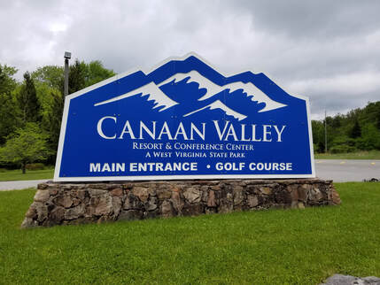
We were on the road about 10:00. Donna and Oscar rode with us in the Edge, since we were the first ones out of the driveway, with Chris and Rhonda following in their pick-up. Canaan Valley Resort Park is just a few miles away from our cabin (6.5 miles from the cabin to the lodge). We drove to the lodge to see if we could get a park map and an idea or two on hiking (particularly trails that would be less soggy). Not much going on here this morning. Ours were practically the only cars in the lodge lot. I reckon we really are here early in the season. We dismounted and ambled toward the lodge, just chatting about nothing, but using the name "Canaan" a few times. Interesting point was the variations in our pronunciations. I grew up in southern West Virginia and had always heard the name of the park pronounced ka-NAYN. Rhonda was saying ka-nan and in the Bible it is KAY-nun. OK, just call it like you see it. Moving on.
Once inside the lodge we resumed our primary mission of finding a trail map and hiking suggestions. We were successful on both points. The young lady at the front desk indicated that most of the trails would be on the wet side due to the recent rains, besides the fact that the area in general tends to be boggy. She did point out the trails that started around to the side of the lodge building were good options. OK, that gives us a starting point. Plus we looked through the gift shop and found a park pin to add to the collection board.
We wandered back out the parking lot to study the map. The weather is clearing, just as predicted, so it looks like we will get some trial time in today. After studying the map, we decided to try the Deer Run Trail that starts on the other side of the lodge and ends down at the Nature Center (at least according to the map). There are a couple other trails (Abe Run and Mill Run) that make a loop from the Nature Center back to the lodge so that might work nicely for a short hike. We all got our packs and cameras and started off in search of the trailhead. I handed the map to Lynn since she likes to be the navigator and asked her to lead the way, dubbing her "Sacagawea" as I always do when we are hiking.
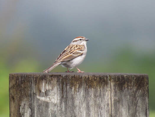 Chipping Sparrow near the Canaan Valley Lodge
We meandered off around to the right of the lodge building looking for the trailhead or a sign pointing to the trailhead. There was nothing. While we paused to get our bearings, I spotted a little brown bird sitting on top of a fence post. It was willing to pose so I got a nice burst of shots. Chipping Sparrow, I think. First critter sighting of the day. Plus the sky is clearing a bit as there are patches of blue peaking around the fluffy white and grey clouds. Looks like we'll be in good shape for a while. Now we just need to get on the trail. The map was not an exact representation either as it shows the old footprint of the lodge building. But that's all OK, we figured it out eventually as we just continued around the building toward the pool area. Rhonda asked a park employee who pointed her in the right direction just about the same time that we saw the start of the trial down below us. OK, that-away!
Nice views out across the valley from our starting vantage point. The pool was just below us on the hillside and the golf course stretched out to our left in the distance. Looks like a nice course, but I have not played since we were in Sedona last spring. I was not tempted to drop my pack and go rent clubs.
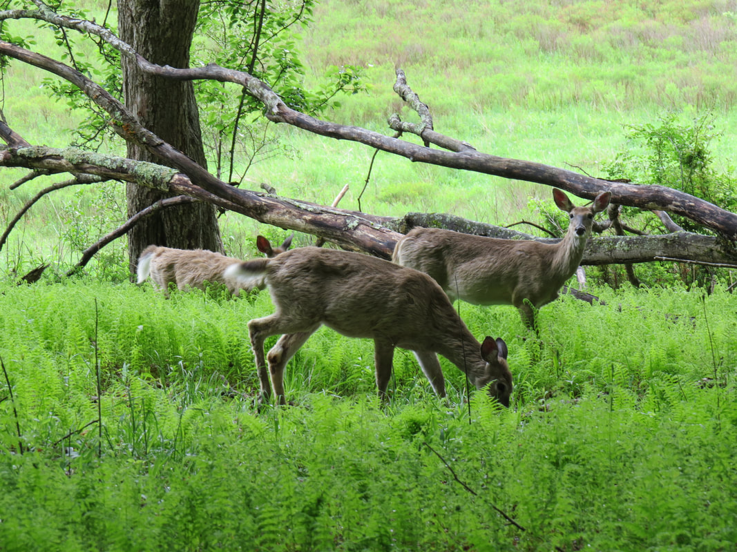
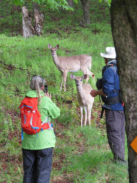
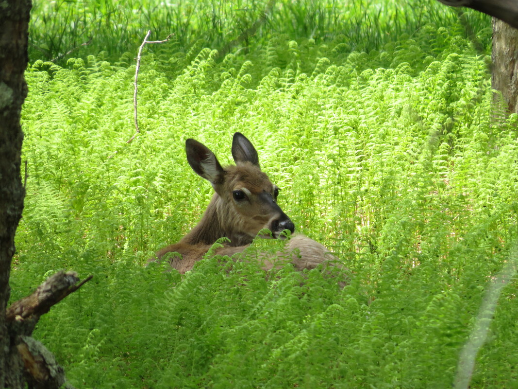
There were several deer scattered along the edge of the far side of the valley, probably a dozen or so. We started down the slope toward the start of the trail, through the ankle-high and very wet grass, and into the trees. Once in the trees the trail became a dirt path which was more than just damp. We did not have to wait long for the next critter sighting as there three deer in the woods just below the trail. These are obviously state park deer as they were not worried about us at all an in fact came over closer to the trail to see if we had any food. Sorry kids, no one in this group feeds the wildlife. But we will take your photo.
Nice views out across the valley from our starting vantage point. The pool was just below us on the hillside and the golf course stretched out to our left in the distance. Looks like a nice course, but I have not played since we were in Sedona last spring. I was not tempted to drop my pack and go rent clubs.
There were several deer scattered along the edge of the far side of the valley, probably a dozen or so. We started down the slope toward the start of the trail, through the ankle-high and very wet grass, and into the trees. Once in the trees the trail became a dirt path which was more than just damp. We did not have to wait long for the next critter sighting as there three deer in the woods just below the trail. These are obviously state park deer as they were not worried about us at all an in fact came over closer to the trail to see if we had any food. Sorry kids, no one in this group feeds the wildlife. But we will take your photo.
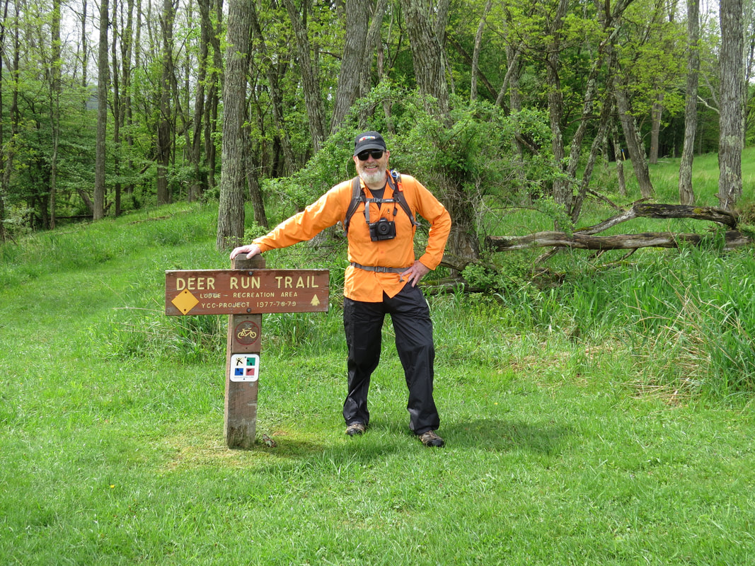
Nice job, Chris! Obviously it took some serious outdoorsy skills to find the trailhead.
|
|
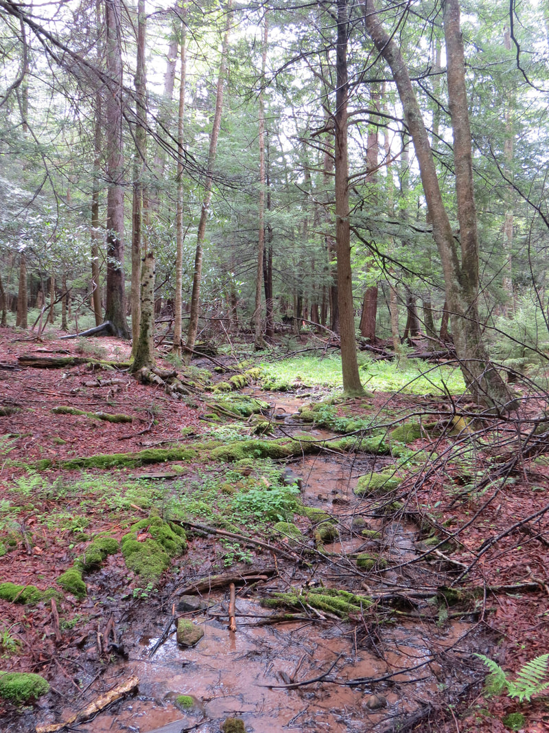
Once we were down the initial slope, the trail just wound through the woods and was generally level, just sort of rolling. The trail surface was very damp, actually quite wet in places but nothing that we could not step over or around or use well placed rocks and logs for a walkway. But it was quite mushy along the low-point of the trail, where the marshes and creeks collected. Pretty boggy. But also a pretty walk. The birds were serenading us, sort of. The singing of the songbirds birds was quite pleasant, but there was also the loud, raucous cawing of a flock of crows somewhere nearby. They were apparently harassing a hawk or an owl. We never saw them, but the crows were fairly close.
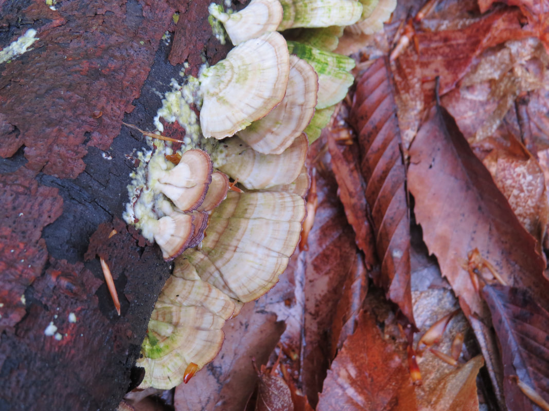
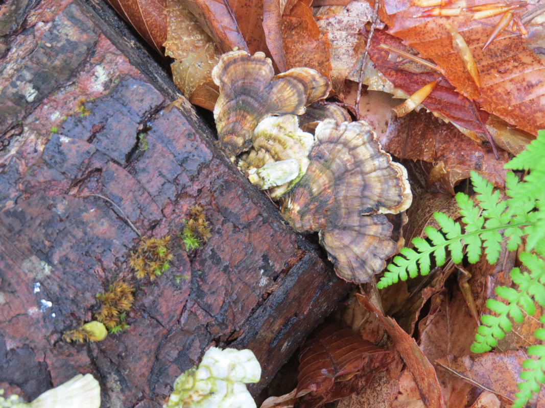
Other than at the trailhead, this is not a trail of big vistas. It is a bit of an adjustment hiking in the eastern forests after spending so much time in the wide-open spaces of the desert southwest or the big parks of the mountain west. This is really a walk through the woods, so the focus is on the near-views and the details. We were watching for little critters along the trail. I figured that we would spot those bright orange salamanders the we used to see in the backyard when I was a kid. Oscar and I checked the pools and creeks when we crossed. No luck this morning on the little crawly varmints. But there were some pretty fungi growing on the old, rotting logs. Not colorful but very interesting patterns of white, grey and brown.
Other than at the trailhead, this is not a trail of big vistas. It is a bit of an adjustment hiking in the eastern forests after spending so much time in the wide-open spaces of the desert southwest or the big parks of the mountain west. This is really a walk through the woods, so the focus is on the near-views and the details. We were watching for little critters along the trail. I figured that we would spot those bright orange salamanders the we used to see in the backyard when I was a kid. Oscar and I checked the pools and creeks when we crossed. No luck this morning on the little crawly varmints. But there were some pretty fungi growing on the old, rotting logs. Not colorful but very interesting patterns of white, grey and brown.
|
|
As this was a nature trail, there were a few marker along the way explaining some of the sights and providing a little of the science here in the woods. I noted the information from a few of the markers:
- Balsam fir is common in Canaan Valley, but is rare in the rest of West Virginia. Growing to a height of 40-60 feet, balsam fir develops best in a cool, moist climate. Often found growing in close association is another conifer, the red spruce. In winter, the evergreen boughs provide protection and cover for animals. In summer, red squirrels, or "fairy diddles", as they are known in West Virginia, feed on the seeds contained in the developing cones. These active mammals often cache these seeds for winter food supply.
- Underground streams or springs are the source of these wet areas or pools called seeps. The water slowly oozes from the ground supplying water for turkey and grouse as well as forming microhabitats for blue crayfish and salamanders. Salamanders are clawless amphibians that have smooth, moist skin. Although some live only in water even the land dwelling types survive only in moist environments. They hide under stones or logs by day, moving around mainly at night. Salamanders can be colorful, ranging from bright red, yellow-green to brown and black, and are harmless to humans.
- Toward the end of the trail we came across a natural opening in the forest that was described as follows: Openings in the forest are valuable to wildlife. In this case, a yellow birch was blown down creating a breach in the forest canopy. The increased sunlight allows for growth of a variety of plants. Such openings add to the diversity of the forest and causes diversity in wildlife species.
- There was one short side trail down along the bottom area that led to an observation tower, well more of a viewing platform, overlooking a meadow area. There was another marker here that provided some details on what we were seeing: Once a beaver pond, this cattail marsh is an example of what happens during natural succession from one type of habitat to another. As sediment and organic material washed into the pond, the depth of water decreased. As this process continued, grasses and pond weeds invaded, today there is little evidence of open water and many plants typical of march wetlands now dominate the area. Marshes not only support many species of plants, but are favorable habitats for many species of wildlife including muskrats, redwing blackbirds, swamp sparrows and marsh wrens. The cattails provide convenient perches for the male red-wing blackbirds to sing and display their red wing patches in defense of their territories.
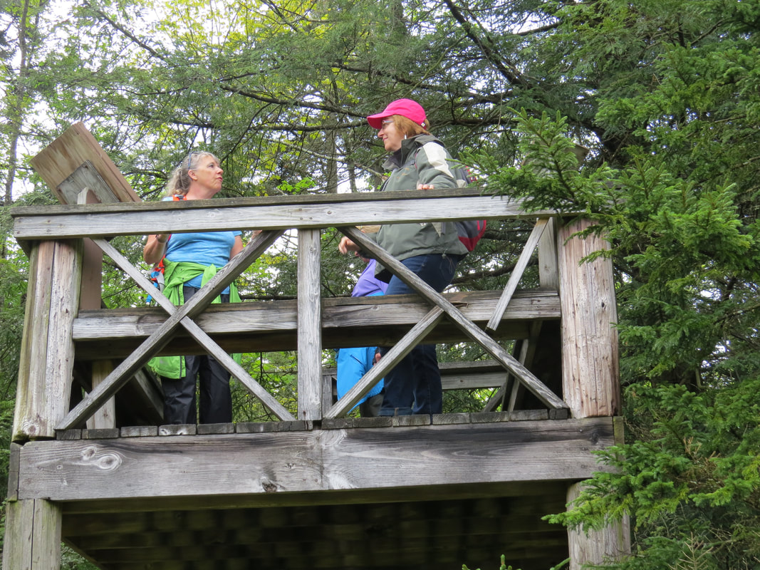
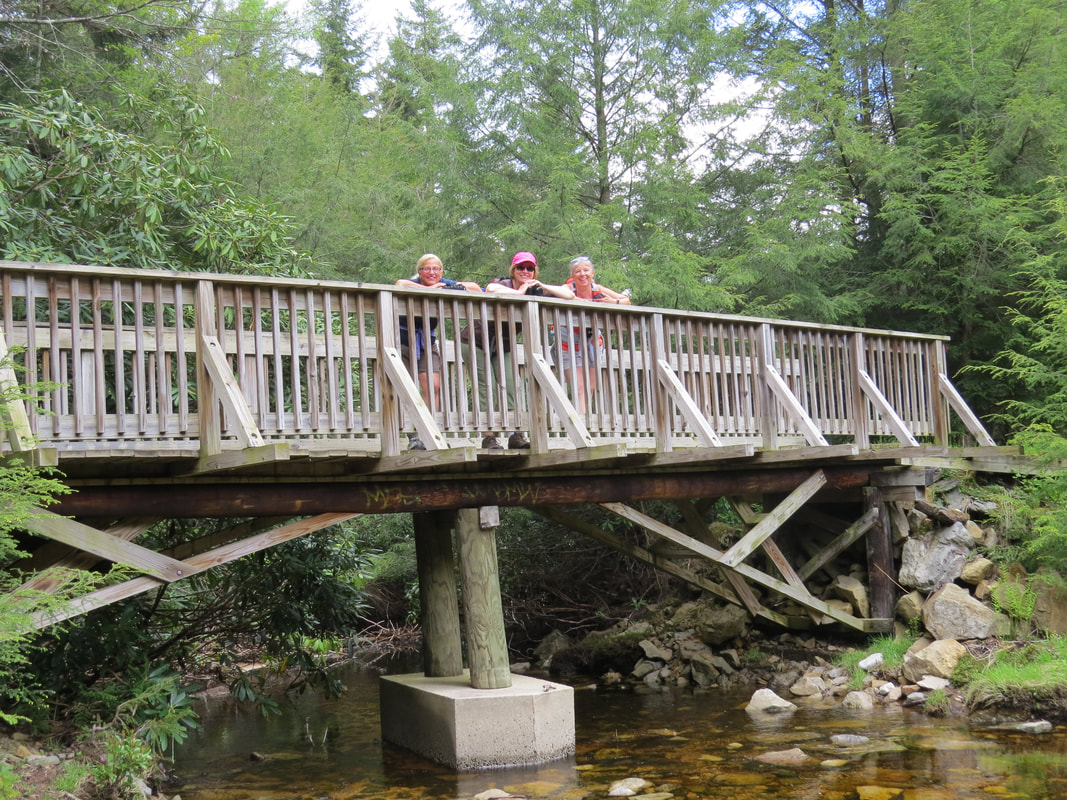
The girls in the observation tower
|
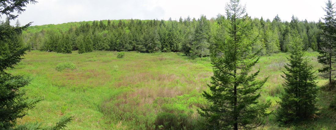
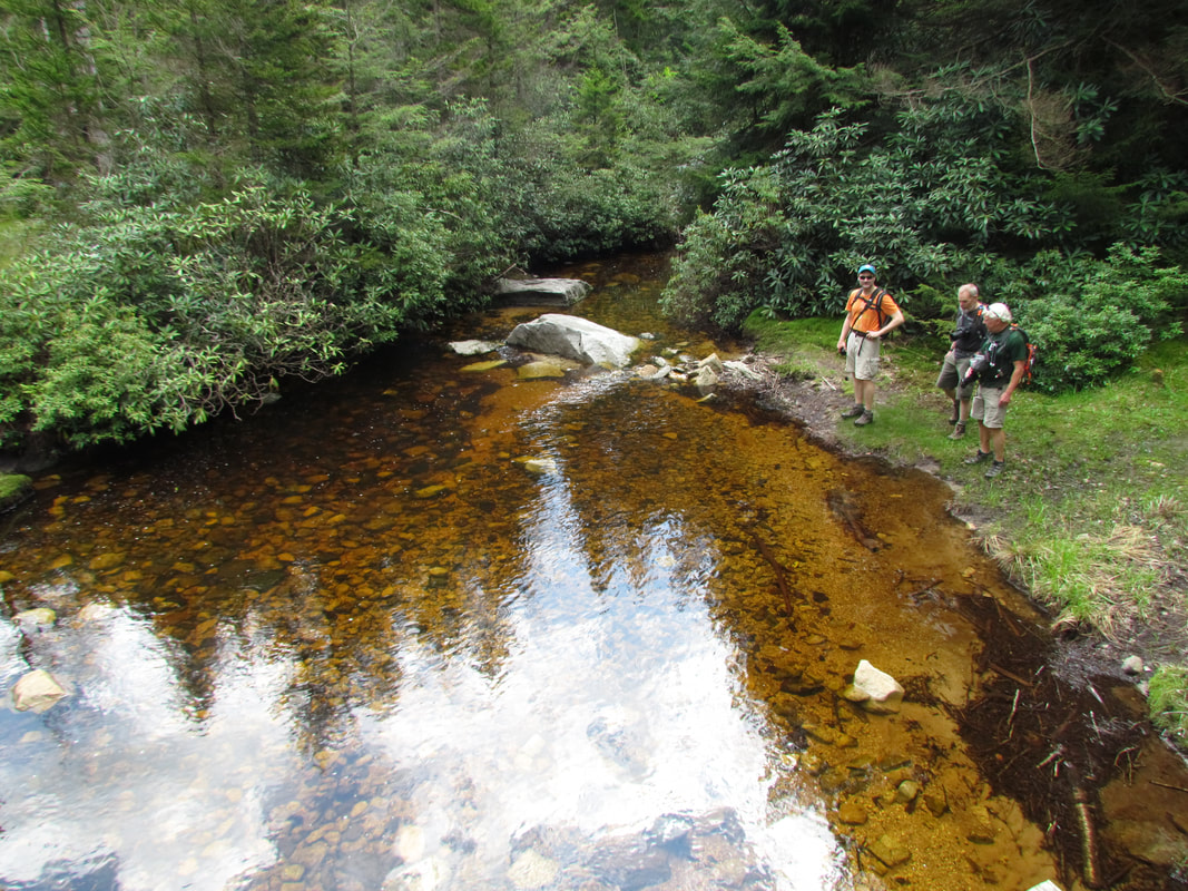
View from the observation tower looking over what was once a beaver pond.
|
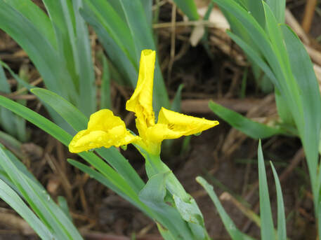
After the beaver pond area, we came out of the trees for a short stretch then crossed a bridge that spanned a little creek. We paused here for a moment to enjoy the scene and the yellow flowers (some sort of iris, I reckon) along the bank. Then it was back into the trees for the last little walk before coming out at the campground. We found a convenient picnic table under a tree to regroup and have a quick snack. Sacagawea nixed the idea of returning along Abe Run or Mill Run as she deduced those trails would be wetter than Deer Run due to closer proximity to creeks, ponds and boggy areas, as portrayed on the map. She suggested going the long way back along Black Hollow Trail. That would be longer but still not a really long hike. Sounds like a good idea. We figured we could walk over to the Nature Center and confirm that this was a drier route back to the lodge.
Not a lot of activity at the Nature Center, but the area was built for fun. There was a putt-putt course adjacent to the building, the typical, old-time course made of 2-by-4s, green, outdoor carpet and simple structures for obstacles. We chided Donna about this since she had taken a tumble at a putt-putt course during recently. But while the miniature golf was sort of out of date, there was a newer toy, a portable, hydraulic rock climbing wall. The wall was not set up yet, not that we were interested in climbing. I guess it was just another sign that the season was about to open. I also paused to read another marker:
This wildlife observation area offers you an opportunity to experience some of the wildlife found in Canaan Valley. By keeping your senses alert, you may observe a wide variety of animal species supported by the diverse habitats occurring in this mountain valley. You many see the large, familiar game animals such as deer, but as fascinating and certainly more secretive, are the many nongame species of wildlife that reside in this area from ground squirrels to frogs and from salamanders to chickadees. Use and enjoy this special area. It was set up specifically for park visitors to observe and study wildlife and their habitat. The area was jointly developed by the Division of Parks and Recreation and the West Virginia Nongame Wildlife Program.
After reading the marker, I joined the group inside the building. Turns out that the Nature Center is now the camp store, so another detail that is out of date on our trail map. We went in for a look around anyway and chatted with the staff. One of the park employees was a very friendly lady from Kentucky. We asked her about hiking options. She indicated that the Black Hollow Trail should be fairly dry so we'll try that for the hike back to the lodge. She also recommended Blackwater River Trail saying that this was her favorite in the park. It is short but it takes you right down to the river where you might see beaver and there are some interesting rock formations along the trail. Well, that gives us an option for a second hike if the rain holds off.
Back outside, we crossed the field in front of the camp store then walked along the road a short distance to the intersection with the Black Hallow Trail. OK, I know where we are. The trail runs right by the construction area we passed on the drive in this morning. Looks like they are dredging the ponds or maybe doing some reclamation work on a small wetlands. Our trail followed the dirt road that led toward the ponds for a very short distance, then split to the right, up a short bank and into a grassy field. This looks like the complete opposite to the trail we were just on. It sits higher so it should be a drier and it is out in the open working along and through meadows. So a great combination to get a nice variety and a better sample of the park. The trail surface was still dirt but there was only one real muddy spot that we had to detour around, and there were a couple sections were we were walking on the road for short stretches.
Not long after we got on to the trail, I found a couple old bottles. Looks like maybe a trail crew had collected them and place them by a trail marker to be picked up later. Nothing special about the bottles. One looked like a beer bottle with an old style lip, but they did not look that old. I hated to leave them as there was a chance they were get busted and scattered about the area. They were heavier than I wanted to carry back to the lodge and it was just a bit too far to run them back to the camp store. Someone suggested that we just leave them for now and pick them up on the way out of the pack as it is not that far from the road. Excellent idea. I placed the bottles back next to the trail marker and we continued on our way.
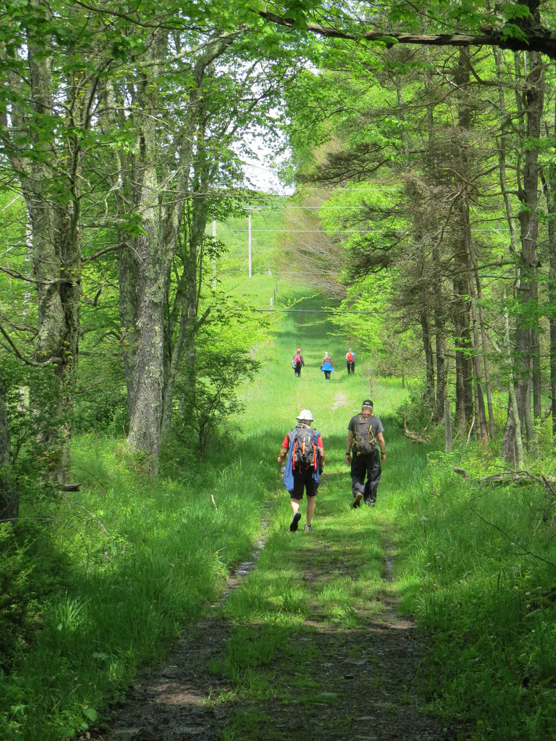
For whatever reason, I was at the front for the hike out along Deer Run, but now I'm in my more favored location near the back of the pack. I guess I like to keep an eye on everyone else in the group, plus I'll stop to take a photo or study some detail and can easily catch-up. The girls were leading and the guys were bringing up the rear. Oscar and Chris also like to shoot and study while hiking. And there was plenty of details to look at: wildflowers, birds, butterflies. Plus we had decent view as the trail cut across the rolling, open meadow.
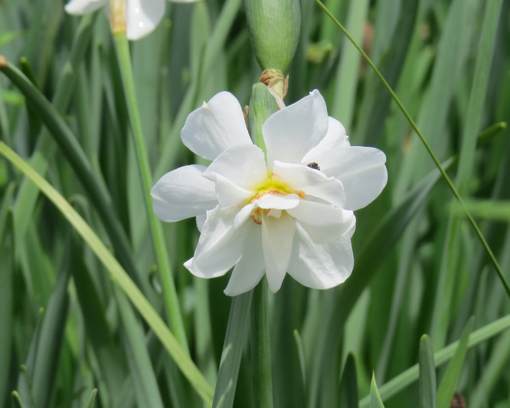
At one point, the trail met with one of the park roads for a short spell before working back into the meadow. We paused along the road to look at some interesting flowers and spotted a little bird flitting about in the adjacent shrubbery. Turned out to be a Common Yellowthroat, so a nice sighting. A lady in an old Ford pickup stopped and asked if we were looking for ramps. I'm not, but the cooks in the group were intrigued and wandered over to chat. I went the other way and got a better look at the flowers. Looked like some sort of daffodil.
Not a lot of activity at the Nature Center, but the area was built for fun. There was a putt-putt course adjacent to the building, the typical, old-time course made of 2-by-4s, green, outdoor carpet and simple structures for obstacles. We chided Donna about this since she had taken a tumble at a putt-putt course during recently. But while the miniature golf was sort of out of date, there was a newer toy, a portable, hydraulic rock climbing wall. The wall was not set up yet, not that we were interested in climbing. I guess it was just another sign that the season was about to open. I also paused to read another marker:
This wildlife observation area offers you an opportunity to experience some of the wildlife found in Canaan Valley. By keeping your senses alert, you may observe a wide variety of animal species supported by the diverse habitats occurring in this mountain valley. You many see the large, familiar game animals such as deer, but as fascinating and certainly more secretive, are the many nongame species of wildlife that reside in this area from ground squirrels to frogs and from salamanders to chickadees. Use and enjoy this special area. It was set up specifically for park visitors to observe and study wildlife and their habitat. The area was jointly developed by the Division of Parks and Recreation and the West Virginia Nongame Wildlife Program.
After reading the marker, I joined the group inside the building. Turns out that the Nature Center is now the camp store, so another detail that is out of date on our trail map. We went in for a look around anyway and chatted with the staff. One of the park employees was a very friendly lady from Kentucky. We asked her about hiking options. She indicated that the Black Hollow Trail should be fairly dry so we'll try that for the hike back to the lodge. She also recommended Blackwater River Trail saying that this was her favorite in the park. It is short but it takes you right down to the river where you might see beaver and there are some interesting rock formations along the trail. Well, that gives us an option for a second hike if the rain holds off.
Back outside, we crossed the field in front of the camp store then walked along the road a short distance to the intersection with the Black Hallow Trail. OK, I know where we are. The trail runs right by the construction area we passed on the drive in this morning. Looks like they are dredging the ponds or maybe doing some reclamation work on a small wetlands. Our trail followed the dirt road that led toward the ponds for a very short distance, then split to the right, up a short bank and into a grassy field. This looks like the complete opposite to the trail we were just on. It sits higher so it should be a drier and it is out in the open working along and through meadows. So a great combination to get a nice variety and a better sample of the park. The trail surface was still dirt but there was only one real muddy spot that we had to detour around, and there were a couple sections were we were walking on the road for short stretches.
Not long after we got on to the trail, I found a couple old bottles. Looks like maybe a trail crew had collected them and place them by a trail marker to be picked up later. Nothing special about the bottles. One looked like a beer bottle with an old style lip, but they did not look that old. I hated to leave them as there was a chance they were get busted and scattered about the area. They were heavier than I wanted to carry back to the lodge and it was just a bit too far to run them back to the camp store. Someone suggested that we just leave them for now and pick them up on the way out of the pack as it is not that far from the road. Excellent idea. I placed the bottles back next to the trail marker and we continued on our way.
For whatever reason, I was at the front for the hike out along Deer Run, but now I'm in my more favored location near the back of the pack. I guess I like to keep an eye on everyone else in the group, plus I'll stop to take a photo or study some detail and can easily catch-up. The girls were leading and the guys were bringing up the rear. Oscar and Chris also like to shoot and study while hiking. And there was plenty of details to look at: wildflowers, birds, butterflies. Plus we had decent view as the trail cut across the rolling, open meadow.
At one point, the trail met with one of the park roads for a short spell before working back into the meadow. We paused along the road to look at some interesting flowers and spotted a little bird flitting about in the adjacent shrubbery. Turned out to be a Common Yellowthroat, so a nice sighting. A lady in an old Ford pickup stopped and asked if we were looking for ramps. I'm not, but the cooks in the group were intrigued and wandered over to chat. I went the other way and got a better look at the flowers. Looked like some sort of daffodil.
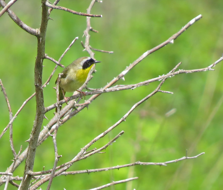
Common Yellowthroat
|
Looks like a daffodil of some sort.
|
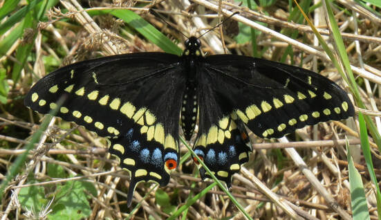 Black Swallowtail
Once across the open meadow, we hiked along a dirt road. As we were approaching the road, which was shaded by the trees flanking each side and ran along an old fence line, we spotted a single hiker, the only other person we saw on the trail today. I guess it really is still early in the season for this area. But this was a nice section of the trail, sort of rolling along the dirt road. There were several varieties of wildflowers in the fence row and a few more butterflies. We crossed the main road and finally back through the woods on a trail parallel to Deer Run Trail. We were right above where we hiked out this morning. We ended this nice hike when we arrived back at the lodge at about 1:30. I think my hiking boots have gotten too accustomed to desert trails as they seemed to ignore trying to keep my feet dry. Well, it was pretty damp all along the trail even though we avoided getting in any deep mud or standing water. We covered 4.8 miles along the Deer Run and Black Hollow Trails which took us right at three hours, including our stop at the camp store.
|
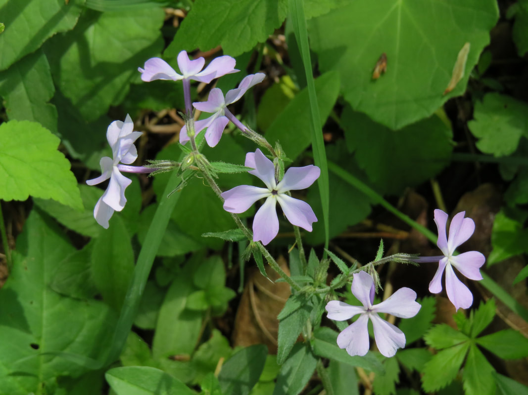
Blue Phlox

Wild Geranium
|
Back at the vehicles we took stock of the weather. Earlier reports indicated that rain might roll in about 2:00 but the sky was pretty clear and not threatening at all. The phone concurred. It looks like we have time for another short hike so we decided to take the advice of the lady at the camp store and try the Blackwater River Trail. We checked the map, loaded up and drove toward the next trailhead over by the golf course. OK, while we only saw one other hiker on the trail so far today, there are at least a few folks out on the links. Looks like a nice course. Pretty open and relative flat, plus it seemed to be in nice shape based on the view from the road. Nope, still not feeling the urge to play, Let's go for a hike.
The Blackwater River Trail is just a short little loop marked with red blazes. The trails this morning were also well marked with color-coded blazes, orange for Deer Run and white for Black Hollow. The blazes made it very easy to follow each trail, well for the most part. These markers were particularly useful along the Deer Run Trail as there were a few intersections with other trails that were not exactly obvious on the direction we should go had we not had the blazes.
The trailhead for the Blackwater River Loop is along the woods across from the driveway for the golf course parking. It is advertised as a one-mile loop but I tracked it at just under that (0.9 miles). Since this was a short hike and it was a pleasant day, most of us left our packs in the vehicles and just grabbed cameras for this little stretch of the legs.
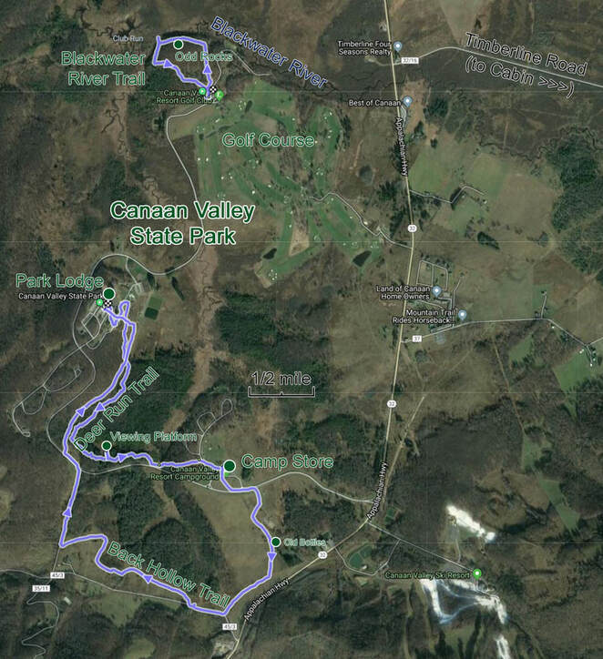
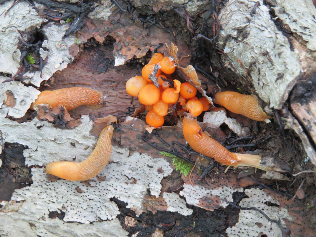
We walked counterclockwise around the little loop. The trail had a little undulation to it, going sort of downhill toward the river then regaining the minor elevation loss on the return to the trailhead, but really it was a flat hike. This is again a walk in the woods, so the views are more down and in rather than up and out. There were three more white-tails in the woods near the trailhead but those were the only varmints we spotted. Well, other than the bright orange slugs I saw on a rotting log. Pretty and ugly at the same time.
Ah, those are the rocks that the lady at the camp store was speaking about. Odd formation the way the way it has weathered and eroded to form nearly straight channels through the rock. Sort of a checkerboard pattern. I commented that the shape reminded me of the sculptures on Easter Island just laying over on their backs, like they had not been stood upright. Chris quipped that perhaps these sculptures had been knocked over.
We paused next where the trail reached the river. We really did not see anything that looked like the remains of a beaver dam or lodge. Nice view here as we were out of the trees here along the riverbank. As we continued up the hill around the loop to the trailhead, we saw the tree deer again. This was obviously their hangout for today, but they did not seem to be too worried about us.
|
|
|
Once we were reassembled at the vehicles, we decided it was time to head back to the cabin. Still not raining but the sky was getting darker, so we figured there was not time for another walk. Besides, there was beer and wine waiting for us. I did remember to stop for the bottles. Surprisingly, no one else volunteered to walk out the trial with me to retrieve the litter. No worries. I doubled-timed it. It was a little further than I thought it would be, almost a half mile round-trip, but I was able to do this little hike in my "mission from God" mode of hiking so it did not take too long.
Back at the cabin, we stored our geared an got out of our wet hiking boots then settled in for a little snack. The table in the dining area was plenty long enough for all six of us to gather around. Rhonda whipped up some Soylent Green, I mean guacamole. Donna had brought some homemade salsa and I broke out a jar of Mrs. Renfro's habanero salsa. Mixing those two made for a very nice combination. So we had a nice snack and chatted for the afternoon. Rhonda asked if I was going to try the guac, to which I replied that it just was not my thing; I'm not a fan of the taste or the texture. After a little additional chiding from Rhonda, I relented and decided to give it a shot, since she went to all the trouble of making it. Lynn was shocked. I merely reinforced the fact that I'm not a guac guy.
The ladies eventually moved off to the deck or maybe the living room. I sort of lost track of them as us guys were focused on the beer! We started on Oscar's variety of beers for sampling this afternoon. He brought a special release six-pack from Lord Hobo that included a variety of their beers. First time I had seen a mix-and-match six-pack that was packaged like that from the brewer. Nice concept. Unfortunately the execution in terms of the beer quality was lacking. I don't recall that there were any really good beers in the set. The Boom Sauce IPA was better than average, but the rest were 'meh' at best and a couple were just poured down the drain they were so bad.
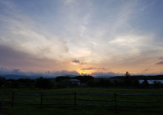 We had a nice sunset during our after dinner walk.
Tonight was Lynn's turn as the chief chef. She's very good in the kitchen but we just don't cook that much for ourselves and certainly not for a group. So we came up with a pretty easy menu but something that everyone seemed to think was a winner: steak, baked potato and asparagus. The house only had a charcoal grill so Oscar brought their portable gas grill and also served as the grill master. The ladies had the kitchen humming. Another great meet-up meal!
After dinner we took another lap down to the ski lodge but this time stayed off the hillside and walked a couple of the house-lined roads to check out the vacation homes. There was a little more activity tonight as there were now residents in a few of the houses. Maybe the season is starting to open up here in Canaan Valley.
Back at the cabin, we watched Chris's slideshow of photos from their most recent road trip. His photos are outstanding. But the music is too relaxing. I fell asleep, again, just like last year at Ohiopyle. At least I'm consistent.
Here's the link to the photo gallery from our day in Canaan Valley State Resort Park.
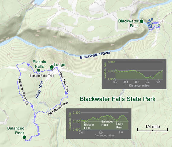
Saturday, May 18 - Blackwater Falls State Park. I was up at 0600 and again the first one out into the living room. It is a bit wet out this morning, but forecast is for sun and 76 F. Should be a nice day for hiking. The rest of the crew eventually started to stir and get ready for the day; grab some breakfast and load the packs. I did likewise, just having a bagel then getting my gear in order. I reckon we were on the road about 10:00. Same vehicles and occupants as yesterday, but I waved Chris to take point as it seemed like he might have some ideas on where he wanted to go. Short drive back to Davis for the park entrance. The house that Donna picked for the weekend really was ideally located for exploring Canaan Valley and Blackwater Falls.
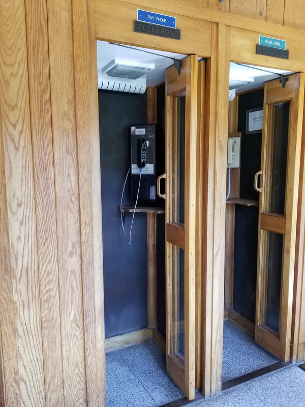
Our first stop was the lodge. They're doing a bit of remodeling on the exterior of the building, but it still looks vaguely familiar from our honeymoon visit over 30 years ago. Looks like there is some updating that could be done on the inside as well as we walked by a couple of phonebooths, complete with folding doors. At least these were not rotary dial, but one was a payphone. Talk about nearly extinct.
After dinner we took another lap down to the ski lodge but this time stayed off the hillside and walked a couple of the house-lined roads to check out the vacation homes. There was a little more activity tonight as there were now residents in a few of the houses. Maybe the season is starting to open up here in Canaan Valley.
Back at the cabin, we watched Chris's slideshow of photos from their most recent road trip. His photos are outstanding. But the music is too relaxing. I fell asleep, again, just like last year at Ohiopyle. At least I'm consistent.
Here's the link to the photo gallery from our day in Canaan Valley State Resort Park.
Saturday, May 18 - Blackwater Falls State Park. I was up at 0600 and again the first one out into the living room. It is a bit wet out this morning, but forecast is for sun and 76 F. Should be a nice day for hiking. The rest of the crew eventually started to stir and get ready for the day; grab some breakfast and load the packs. I did likewise, just having a bagel then getting my gear in order. I reckon we were on the road about 10:00. Same vehicles and occupants as yesterday, but I waved Chris to take point as it seemed like he might have some ideas on where he wanted to go. Short drive back to Davis for the park entrance. The house that Donna picked for the weekend really was ideally located for exploring Canaan Valley and Blackwater Falls.
Our first stop was the lodge. They're doing a bit of remodeling on the exterior of the building, but it still looks vaguely familiar from our honeymoon visit over 30 years ago. Looks like there is some updating that could be done on the inside as well as we walked by a couple of phonebooths, complete with folding doors. At least these were not rotary dial, but one was a payphone. Talk about nearly extinct.
|
Our primary mission here was to find some information on the hiking options. I did not see anything like a trail map sitting out, so I asked at the desk. The old guys are running the desk this morning, but the gentleman I talked with was more than happy to provide a couple maps for the group. That will do the trick as it shows the main trails and primary points-of-interest.
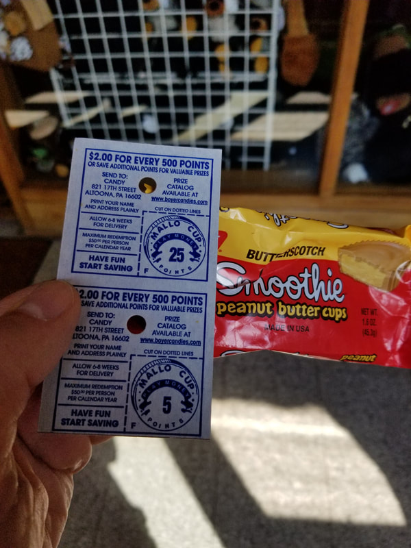
Of course we made the mandatory stop in the gift shop where we found a park pin. Oooh, they have Smoothies. No, not pureed fruit, but rather a confection from my youth. Looks like a Reece's cup and has peanut butter filling, but a Smoothie is coated with butterscotch instead if chocolate. Hey, don't knock until you have tried it. Not that I needed it, but I still got one for old time sake. Yep, still as good as I remember. |
|
|
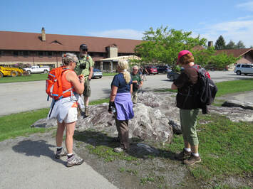 Parking lot skull session; which way do we go?!?
Once everyone was done shopping and had made their last trip to the little girl's or boy's rooms, we reconvened at the vehicles to figure out our first trail for the morning. Chris was interested in photographing the waterfalls, which was fine with the rest of the gang. Turns out that the Falls of Elakala is nearby and the trail starts right here at the lodge. How convenient is that! Off we went.
We crossed the corner of the lawn from the parking lot to the trailhead sign at the edge of the trees. This was another pretty wooded trail. Just a sort distance, less than a quarter mile to the falls. We paused on the bridge over Shays Creek directly over the falls. Chris intended to get down to creek level for a better perspective of the falls. Oscar and I decided to go, the girls opted to stay on the trail. When I asked Lynn if she wanted to scramble down, she commented that we are just a couple weeks away from leaving for Alaska and that this was no time to break a leg. OK, that's not the best thought to have in my head but still good advice.
We crossed the corner of the lawn from the parking lot to the trailhead sign at the edge of the trees. This was another pretty wooded trail. Just a sort distance, less than a quarter mile to the falls. We paused on the bridge over Shays Creek directly over the falls. Chris intended to get down to creek level for a better perspective of the falls. Oscar and I decided to go, the girls opted to stay on the trail. When I asked Lynn if she wanted to scramble down, she commented that we are just a couple weeks away from leaving for Alaska and that this was no time to break a leg. OK, that's not the best thought to have in my head but still good advice.
 Elakala Falls
To get down to the creek took a steep route across roots and a few rocks, but was not technical, extreme or particularly hazardous. We made it down with no issues. Chris was first and he continued to work across the rocks to get the shots that he wanted. This was the more treacherous aspect of the excursion as the rocks in and along the creek were quite slick due to the moss covering and also had some sharp edges. Chris and I both ended up with a scrape or two on our ankles, but otherwise no one was any worse for the wear. Lynn's words of caution kept replaying, so I did not take any serious chances. Besides, the light was not that good for photos of the falls. I played with the filters that I had purchased following the Ohiopyle trip based on Chris's recommendations. Unfortunately I never took any time since buying the filters to figure out how they worked or how to set up the camera to get the images I was looking for. I reckon I am currently just a point-and-shoot photographer (really, I'm a hiker who tries to take pictures). I'll have to work on learning more of the tricks of the trade. Fortunately, the landscapes and critters are beautiful so even I can get a decent photo from time-to-time!
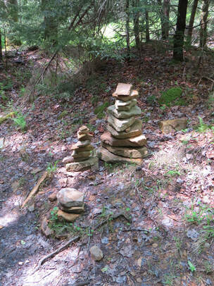
After enjoying the views of the falls from the creek, we scrambled back up the slope and rejoined the girls at the trail. We took a look at the map and quickly decided to continue along this trail to Balanced Rock. This sounded like something up my ally, as I do so like the similarly named formations out west. Pretty easy hike, just rolling through the woods and skirting the wet areas along trail. We saw a few tracks in the mud, but figured they were most likely just dogs hiking along with their people. We paused by a small version of Buddha Beach, where previous hikers had made a few extra cairns. Not nearly as extensive as the original in Sedona. And the cairns were not particularly helpful, which is so often the case of the little stone monuments that are set up by Joe hiker instead of park personnel.
Hey, there's Balanced Rock. Just sitting out here in the forest. A completely different perspective than what we see in in the Grand Circle, but still pretty cool. I guess this formation is limestone instead of sandstone. But an impressive stack of two big boulders. We looked around the formation for a bit, paused here for a quick snack and took a team photo.
After our short visit at Balanced Rock, we retraced our steps along the trail to the intersection with the Red Spruce Trail where we took a right turn to take a new route back to the lodge along Red Spruce and the Water Tank Trails. We got another bridge crossing of Shays Creek where we paused to look for aquatic critters. None were seen. But further along the trail, Rhonda spotted a little orange salamander on the trail. I figured we should see some of these little guys. Another blast from the past for me as we used to see these brightly colored little guys all the time back home. I Googled it when we got back to the cabin and learned (or relearned really) that is was a Red Eft, the juvenile stage of the Eastern Newt.

The gang at Balanced Rock: Chris, Rhonda, Allen, Lynn, Donna and Oscar.
The girls on the bridge over Shay Run.
|
The boys looking for critters in Shays Run.
|
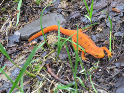 Red Eft
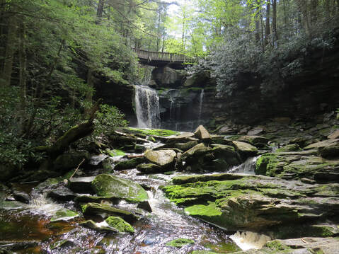
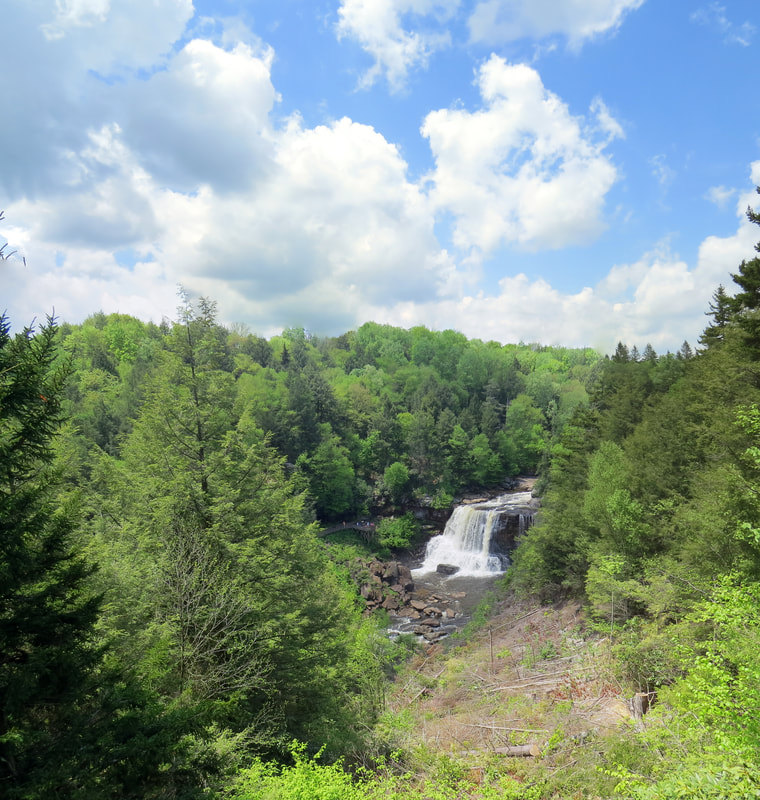
We completed our little loop; 2.6 miles with minimal elevation gain and the only tough part was the scramble down to the river and back. Once at the lodge, we checked options for our next stop. Chris wanted to bag another waterfall, this time the namesake for the park. So we loaded up and drove to the overlook. Nice view from the rim of the river valley. The informational marker here described the origin and route of the river running in the valley below us:
The Blackwater River - Where doe it start and where is it going? Blackwater Falls State Park lies just west of the Allegheny Front, a high escarpment that acts as the drainage divide between the Ohio and Potomac River systems. The Blackwater River springs to life in the southern end of the nearby Canaan Valley and travels north and then west to reach this spot, where the water plunges 57 feet to form Blackwater Falls. From here the river begins its tumultuous descent through the Blackwater Canyon. The Blackwater River is headed west. It will join the Dry Fork River 12 miles downstream at Hendricks, then begin a northward trek to the Ohio River, eventually reaching the Mississippi River and the Gulf of Mexico.
The Blackwater River - Where doe it start and where is it going? Blackwater Falls State Park lies just west of the Allegheny Front, a high escarpment that acts as the drainage divide between the Ohio and Potomac River systems. The Blackwater River springs to life in the southern end of the nearby Canaan Valley and travels north and then west to reach this spot, where the water plunges 57 feet to form Blackwater Falls. From here the river begins its tumultuous descent through the Blackwater Canyon. The Blackwater River is headed west. It will join the Dry Fork River 12 miles downstream at Hendricks, then begin a northward trek to the Ohio River, eventually reaching the Mississippi River and the Gulf of Mexico.
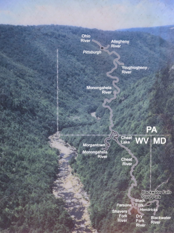
The inset map on the marker provided part of the route described. I had lost my situational awareness of where we were and did not realize how close we were to the border with Maryland. I guess I thought we were more south and west, more toward the interior of West Virginia. I guess I'll have to work on my location reckoning skills. Hey, look, there's Shavers Fork on the map. I used to trout fish there with the boys back when I was in school in Morgantown. Good times.
After the viewpoint, we walked back to the parking area and sized up the hill to get down to the river. There were a few Eastern Swallowtails flitting about on the ground. They acted like they were figuring out how to use their wings so I wonder if they had just recently emerged from the chrysalis. I guess it is that time of year.
While our scramble to the Falls of Elakala was maybe 30 or 40 feet, the climb here was on the order of 200 feet. Both were tough climbs but there were plenty of handholds, however these were still full-body workouts with the scrambling. Rhonda came down to the river this trip but Lynn and Donna only came about halfway down the hill. Rhonda and I caught a glimpse of a black snake a the rocks but it was too quick to make any sort of identification. Just like the earlier climb to see Falls of Elakala, the real challenge was once we got down to the river and were negotiating the slippery yet sharp-edged rocks to find the best views of the falls. Oscar made the most progress upstream, but I again heeded Lynn's sage advice and minimized my exploration along the river. Still, it was a pretty view here at the river's edge back up toward the falls. We enjoyed the sights while the roar of the falls and rush of the swiftly moving river drowned out any other sounds there might have been (check out the videos below to get an idea of the sounds down at river level).
Vista of Blackwater Falls from the viewing deck...
|
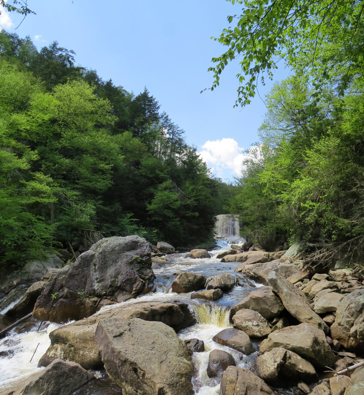
...and from down on the river.
|
|
|
|
After extricating ourselves from the canyon (the climb was not difficult but it was strenuous; it was a good work out) we looked at options for the rest of the afternoon. The time was about 2:30 by now. We opted out of Pendleton Falls and decided to head back to the cabin, making one quick stop for ice. Once back at the cabin, we ditched our packs, iced down the coolers then settled in for a snack around the big dining table. Cheese and crackers, chips and salsa, that kind of stuff. No need to get too extravagant as we were in for another big dinner tonight. After our light lunch, we all adjourned to the back deck. The guys talked beer and the girls talked about the guys…maybe. Actually they probably had better things to talk about.
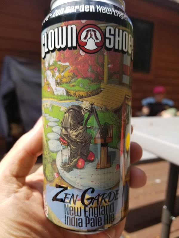
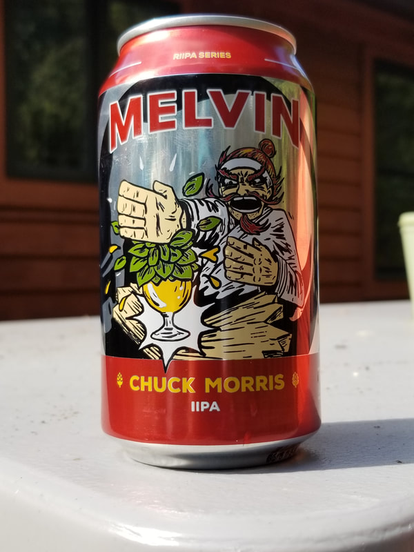
The guys were up for another round of beer sampling. With three of us, splitting the beers works out well. A decent size sample for each of us out of a 12 oz. can, but since it is still smallish we can try a larger variety. And we went for the large variety. We worked on the singles that I brought. Mostly IPAs, of course, but a sour and a fruit beer thrown in for fun. In the end we split eight beers, a mix of pint and 12-ounce cans. There were no dogs in this bunch, at least nothing that was undrinkable. My favs were the Chuck Morris IPA from Melvin Brewing and the Tail and Tooth IPA collaboration produced by Coronado and Belching Beaver (a couple great San Diego breweries). Chris liked the Falling Fruit from Masthead Brewing in Cleveland (I have had this one before and liked it a lot, that's why I brought it for the guys to try). Chris says "it does not take itself seriously" and that it is light airy. OK, I see where he's coming from on that. So a very pleasant afternoon out on the back porch.
Rhonda was in command of the kitchen for dinner tonight. She made seafood pasta alfredo accompanied with broccoli and a tomato salad. It was awesome! I paired dinner with a Benjamin Danklin (for me, everything goes well with a good Fat Head's IPA). We really ate well these past three days. I am not looking forward to stepping on the scale when we get home.
Rhonda was in command of the kitchen for dinner tonight. She made seafood pasta alfredo accompanied with broccoli and a tomato salad. It was awesome! I paired dinner with a Benjamin Danklin (for me, everything goes well with a good Fat Head's IPA). We really ate well these past three days. I am not looking forward to stepping on the scale when we get home.
|
|
|

|
|
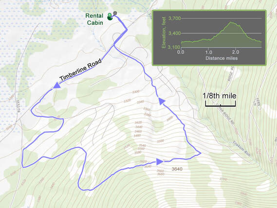
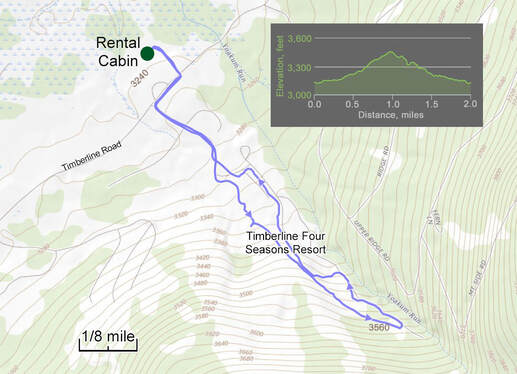
While great food and too much of it has become the standard for this short excursion, so have our after dinner walks through the ski resort. Tonight we kind of over did it as we just started up the hill along a random road and just kept climbing. There are some really nice houses arrayed on the hillside, but it is a pretty darn steep hillside. But it makes for a good walk, well, more of a hike due to elevation change involved. It was more than we were aiming for, but we all survived. We ambled around the hillside for well over an hour, covering 2.9 miles and climbing 400 feet. Sure, it does not sound that extreme but we were carrying around all that extra after-dinner weight.
Back at the cabin we staggered over to the TV area to relax and chat about our travels. Donna had mentioned looking at my travel slideshows. My shows are not nearly as good as Chris's, but they are still fun to watch. We ran through all the shows I had linked to my website. They all ran, but they are not optimized for a really big screen so they looked as little fuzzy. Still, they conveyed the point of the trips. We all ran out of steam around 10:30.
Photo gallery from our day at Blackwater Falls State Park.
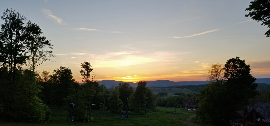
Sunset from the ski slope near the high-point of our hike on the last night in West Virginia.
Sunday, May 19 - Heading Home. I was up a little before 0600, showered and mostly packed by about 0630ish. We all spent the morning getting our gear in order, loading the vehicles and cleaning up the house (not that it was in bad shape). Before hitting the road, Oscar and I had a bottle and can exchange. I also gave Chris the rest of the Bloodhound Orange IPA as he seemed to enjoy that one. Might as well share the love.
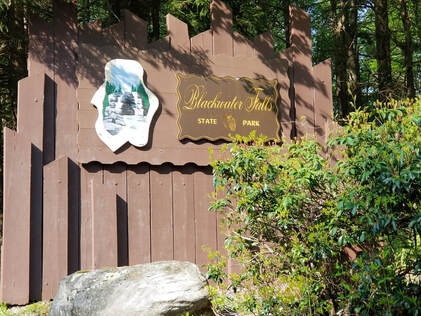
Lynn and I were on the road at 9:01. We were the last to arrive and the first to leave. We made a quick detour to Blackwater Falls State Park to get a photo of the entrance sign. As Donna and I discussed yesterday, you have to get the passport stamp photo of the park entrance sign or the trip just does not count! That was the only tourist stop of the drive home, although we did make one fuel stop and at least one other rest stop. We were back at the ranch about 2:35. First order of business was a check of the felines. They ignored us. That's normal, so all is well. We unloaded the Edge and started unpacking. I was mowing by 3:20. Well, what do you expect, I've been on the road for over a week in May. The grass does not stop growing!
Lynn and I were on the road at 9:01. We were the last to arrive and the first to leave. We made a quick detour to Blackwater Falls State Park to get a photo of the entrance sign. As Donna and I discussed yesterday, you have to get the passport stamp photo of the park entrance sign or the trip just does not count! That was the only tourist stop of the drive home, although we did make one fuel stop and at least one other rest stop. We were back at the ranch about 2:35. First order of business was a check of the felines. They ignored us. That's normal, so all is well. We unloaded the Edge and started unpacking. I was mowing by 3:20. Well, what do you expect, I've been on the road for over a week in May. The grass does not stop growing!

|
By the numbers. OK, this was a short trip, just a weekend getaway, but there were still numbers to tally, for what it's worth:
And in conclusion.... That was fun! We are already thinking of doing this mini-meet-up thing again next spring. We just have to find a location that is convenient for us all. Perhaps a state park in central Pennsylvania or maybe Harper's Ferry in West Virginia. Plenty of time to figure that out. Right now it is time to shift gears and get ready for the big trip of 2019.... Alaska!
|