Trip Journal: UTAH Meet-up in Page, AZ, plus Chinle and Winslow
Wednesday, September 27, through Sunday, October 8, 2017
Here's the second half of the journal describing the tour that Lynn and I took after leaving Page. We meandered to Chinle to see Canyon de Chelly National Monument then continued on to Winslow. We used the lovely La Posada Hotel as our base to explore the area.
Day 7, Tuesday, October 3 - Moving on to Chinle. Full tank of gas and we are ready to roll, cruising generally southeast from Page on route 98. We have a plan for today, more or less, with the end goal of arriving in Chinle in the late afternoon so that we will have a little time to drive along one rim of Canyon de Chelly. The only other stop we have in mind is to check out Navajo National Monument. And that is where we are heading at present.
Well, it is just another a lovely day in northern Arizona. Basically a carbon copy of the past few days in Page, with a bright blue sky, not a cloud to be seen, comfortably warm and the wind has died down. Great for driving but I'm glad I have my Maui Jim's. We're driving through some beautiful country. We talked about those four great excursions we completed with our Herd-mates over the past four days, three of which we probably would have never done unless we were going with Howie. Yes, we have seen some of Mother Nature's best during the first half of this trip. Plus there was just the fun of the meet-up in general. Good times for sure.
We're changing gears just a bit for the second half of the trip. Sure, we'll still see some spectacular natural wonders over the next few days, but the focus will be more on Native American history. Hey, we're always learning and there is plenty to study where we're going.
As for the plan for this portion of the trip, well, we got some tips from our friends to help fill in the details. Since we were starting in Page and flying out of Phoenix, we figured that the northeastern corner of Arizona would make a good place to explore. Canyon de Chelly and Petrified Forest were on the list for sure and there were a couple other National Monuments that we can add to the itinerary. Alex and Frankie were particularly helpful as then made a couple key suggestions when they visited us in Ohio last summer. First was their advice to get Adam Teller as a guide for Canyon de Chelly as they had toured with him in the past and were really impressed with his knowledge of the area. Alex suggested a short stop at Hubbell Trading Post after we left Canyon de Chelly as it was an interesting historical site and on the way to Winslow. They also clued us in on the Rock Art Ranch, one of the best kept secrets in the region. This is a privately-owned, working ranch but is covered with Native American history, particularly petroglyphs. They had a great time there and highly recommended this for one of our day trips. Finally, as I was already leaning toward staying in Winslow for probably three nights as a base for exploring the area, and they provided a great recommendation for lodging, the La Posada. Shoot they even suggested room numbers that had balconies and views. Frankie also reminded us during the meet-up to make sure to eat at the restaurant in La Posada, the Turquoise Room, as it is the best place in town. I'm glad she reminded us as I was looking for brew pubs in town in order to check out any local beers. So we'll certainly give the Turquoise room a whirl at least one night.
Not a lot of traffic this morning so we made good time as we drove through the Navajo Nation on our side trip to Navajo National Monument. As we turned north onto the access road we started seeing a lot of cars parked randomly along the side of the road, plus a couple other folks sitting in pull-off areas with signs stating "buying pinion nuts." OK, I get it. This is what Danny was talking about this morning at breakfast. He said that we were likely to see folks out gathering the nuts and that is exactly what is going on. There were cars scattered all along the side of the road, indicating that there were nut gatherers out in the area. I wonder what the going rate is for a pound of freshly gathered pinion nuts.
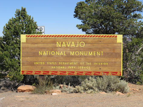
We arrived at the entrance to Navajo National Monument right at noon, as indicated by the time stamp of my passport photo. There was also a sign at the entrance to the park, NO PINION NUT GATHERING. I reckon the nuts in the park will be left for the birds and squirrels. We made the short drive to the visitor center to get the lay of the land and find out what the tour schedule was for today. The flags whipping briskly in the breeze in front of the building were flying at half-staff. That must be in honor of those killed at the Las Vegas concert shooting. The note on the door let us know that we missed the one Ranger-led hike into the canyon to see the ruins up close. Oh, well. Since we missed the tour, we just walked the short Sandal Trail down to the viewpoint. Wide paved path on a downhill trajectory from the visitor center to the canyon rim, about a half-mile one-way. We passed one other couple on the trail and there was a family at the overlook when we arrived. They were just getting ready to walk back up the hill so we ended up having the overlook to ourselves for a few minutes.
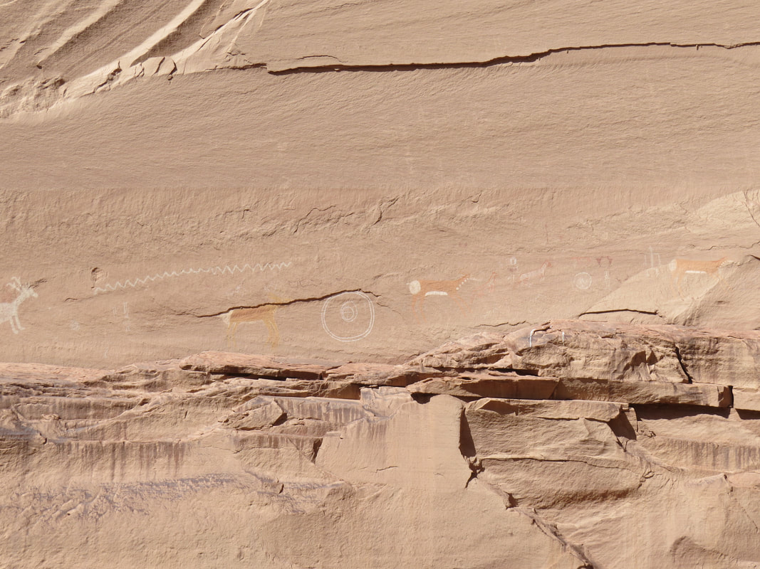
Impressive view over the deep canyon from the end of the Sandal Trail. I reckon the canyon is about 600 feet deep and 800 feet across at this point. The huge, arched rock canopy that wall houses the ruin site is in the opposite wall of the canyon almost directly across from the view point where we are standing. The alcove is 370 across and 452 feet high. It faces to the south which I believe is a plus. The huge size of the alcove allowed for the construction of a large dwelling and the ancient ones took advantage of the site. The interpretive signage provided some details:
Voice in the Canyon. By 1286, Bétatakia village had grown to fill even the most precarious shelves and niches in the alcove, and house 100 to 125 people clustered into 20 to 25 households. Looking down at this sheltered site today you can still see most remnants of the village's original 135 rooms, built of stone, wood and clay. It's clear that the Tsegi Canyon farmers came to stay and built to last. Like their Pueblo neighbors in the Mesa Verde and Chaco regions, Tsegi farmers raised corn, beans and squash, and supplemented their diets by hunting and plant-gathering. Their material legacy embraces a surprising diversity. They fashioned objects of utility and beauty from the wood, clay, bone, stone and fibers that lay close at hand. They cultivated an impressive, intimate knowledge of the plants, animals and cycles of the land.
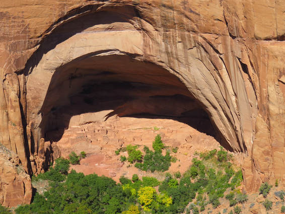
Into the memory. Who was here? Descendants of the Hopi people who built this place call it Talastima, a Hopi work for "Place of the blue corn tassels." They call their ancient relatives "Hisatsinom." Zuni, also pueblo builders, know that several of their clans began in the area. Later, San Juan Southern Paiute, famous for their baskets, moved into this area and lived near the cliff dwellings. "Bétatakin" is a Navajo - or Diné , as they call themselves - word, meaning "House on a Ledge." Today this place is surrounded by the Navajo Nation, as it has been for hundreds of years.
Outside Sources. The Ancestral Puebloans were great traders. Here they made excellent ceramic pottery for trade. Rocks from elsewhere were used for grinding stones, tools or arrowheads. They traded for turquoise, shell, parrots and macaws. You can admire some of the carefully worked pottery inside the visitor center.
Rock Art. Hopi say that large pictographs painted on the right-hand wall of the alcove tall us who built this place: The Deer Clan, the Fire Clan, the Flute Clan and the Water Clan. There are also some petroglyphs of large bighorn sheep pecked into the rock. Some of the rock are serve as a calendar, too, as sunlight at different times of year casts shadows on it.
We could not make out any of the rock art on the opposite wall, but the ruins of the ancient dwelling made for an impressive sight even from this distance. The canyon floor was green and lush so there is obviously water available down there and apparently this area made for good farming. No wonder these folks moved into this canyon. We pondered the view and the history for a little while longer then made the short walk back up the hill to the visitor center.
This was a nice little trail for critter sightings. On the way down Lynn pointed out a big whiptail lizard right along the trail, getting a little warming from the midday sun. We also saw several birds flitting about in the junipers and pines. Most were gone birds, but we did identify a Mountain Chickadee, Juniper Titmouse and Scrub Jay, although we only got a really decent photo of the Jay.
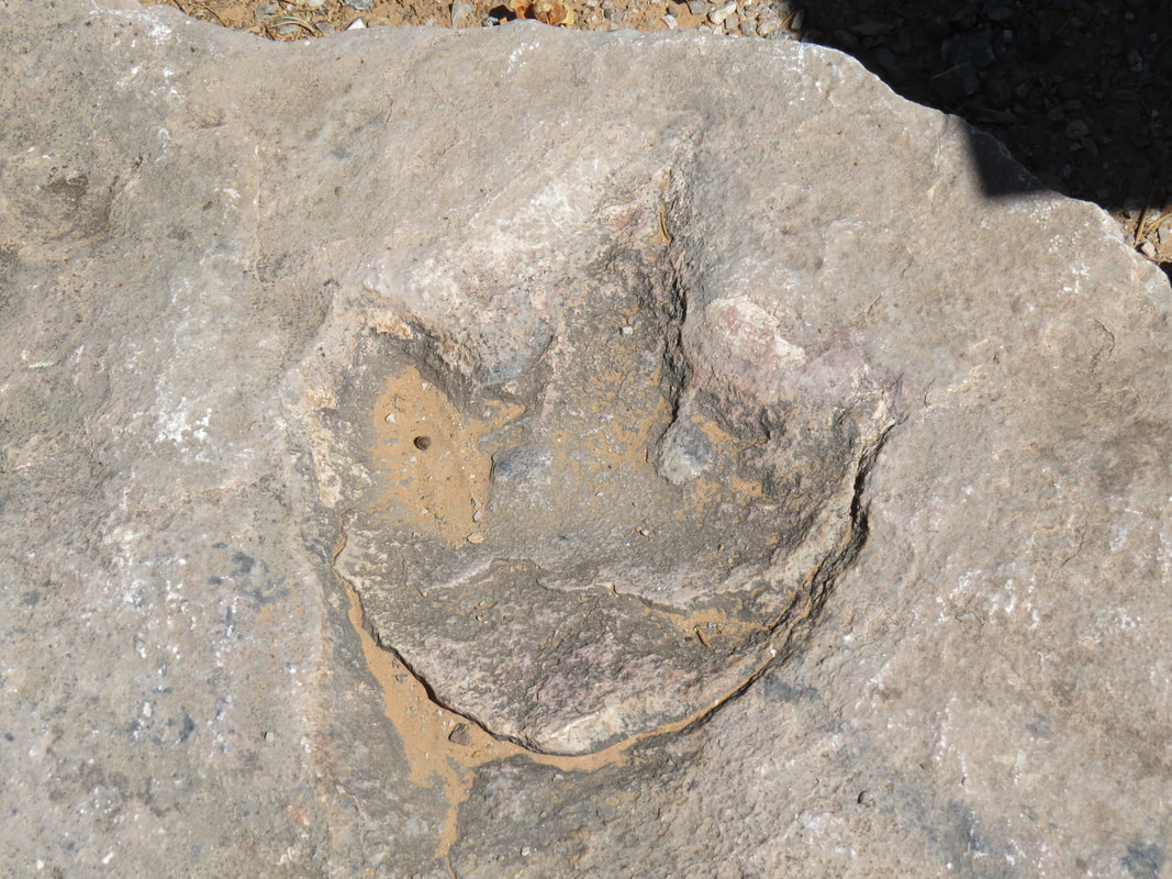
Back at the top of the trail, we stopped to look at the dinosaur track behind the visitor center. Again the signage describing the track told the story:
Footprints of a small dinosaur that walked on his hind legs. About 180 million years ago, he left a lasting signature by walking through the mud. The print then filled with sediment, and both the print and cast (upside-down here) eventually turned to stone. Tracks of these three-toed Jurassic reptiles are very common in the limestone formations of the Navajo Country.
Outside Sources. The Ancestral Puebloans were great traders. Here they made excellent ceramic pottery for trade. Rocks from elsewhere were used for grinding stones, tools or arrowheads. They traded for turquoise, shell, parrots and macaws. You can admire some of the carefully worked pottery inside the visitor center.
Rock Art. Hopi say that large pictographs painted on the right-hand wall of the alcove tall us who built this place: The Deer Clan, the Fire Clan, the Flute Clan and the Water Clan. There are also some petroglyphs of large bighorn sheep pecked into the rock. Some of the rock are serve as a calendar, too, as sunlight at different times of year casts shadows on it.
We could not make out any of the rock art on the opposite wall, but the ruins of the ancient dwelling made for an impressive sight even from this distance. The canyon floor was green and lush so there is obviously water available down there and apparently this area made for good farming. No wonder these folks moved into this canyon. We pondered the view and the history for a little while longer then made the short walk back up the hill to the visitor center.
This was a nice little trail for critter sightings. On the way down Lynn pointed out a big whiptail lizard right along the trail, getting a little warming from the midday sun. We also saw several birds flitting about in the junipers and pines. Most were gone birds, but we did identify a Mountain Chickadee, Juniper Titmouse and Scrub Jay, although we only got a really decent photo of the Jay.
Back at the top of the trail, we stopped to look at the dinosaur track behind the visitor center. Again the signage describing the track told the story:
Footprints of a small dinosaur that walked on his hind legs. About 180 million years ago, he left a lasting signature by walking through the mud. The print then filled with sediment, and both the print and cast (upside-down here) eventually turned to stone. Tracks of these three-toed Jurassic reptiles are very common in the limestone formations of the Navajo Country.
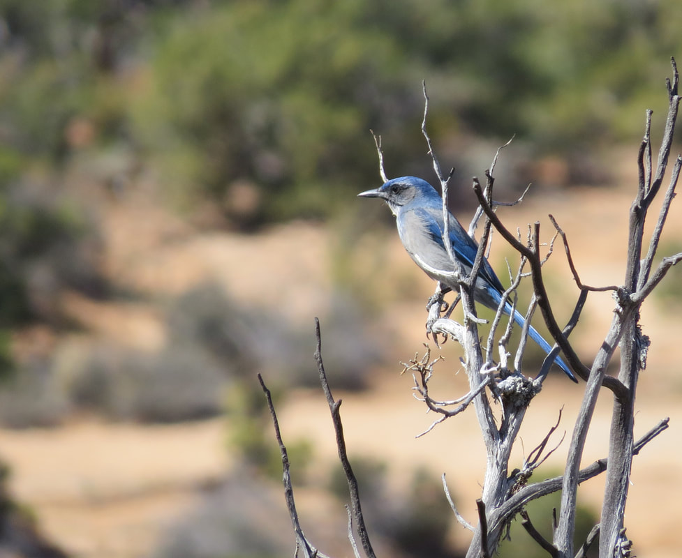
Scrub Jay.
|
|
Lynn made a quick spin through the gift shop but nothing caught her eye, so we got on the road. Photos from Navajo National Monument.
Back on route 160, we continued our somewhat zig-zag route through the Navajo Nation. A short jaunt driving northeast on 160 through Keyenta, where there must have been every possible fast food franchise option imaginable. We did not stop to eat. If there was a Chipotle then I might have been tempted. Instead, we polished off a tray of fig bars during the drive. Probably better than fast food any way. Not far past the sprawling metropolis of Keyenta we turned south in Indian Road 59. The sign pointed to Many Farms.
The drive through the Navajo Nation was easy, the roads were in great shape and there were plenty of very scenic views, but we did not see much in the way of wildlife. Sure, there were plenty of Ravens and Crows out patrolling the area, but not much else that we could see. We spotted one Red-tailed Hawk during the drive, but that was about the extent of the variety of animals.
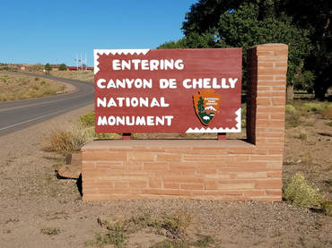
We rolled through the sleepy, little town of Chinle in the late afternoon. Sort of typical of any small, country town, but at the same time somewhat different. We followed the signs to the National Park then on to Thunderbird Lodge, pulling in the parking lot right about 4:00. We were quickly checked-in to our lodge room (number 8 in one of the buildings adjacent to the trading post and main desk building). Once we had ditched our gear in the room, we drove back out to the park entrance to check out the visitor center, with a quick detour to get the required photo of the park welcome sign (It is getting to the point that if I don't get that photo, then the visit does not count. I know, I have some mental issues). Back at the visitor center I asked which rim drive was better in the late afternoon. South rim was the advice from the friendly Native American Ranger staffing the information desk. She also pointed out the road construction signs posted at the front door. Some of the pull-outs will be closed over the course of the next few days. Looks like this is more of an issue on the north rim, but there is still construction along the south rim road as well. Something to factor into our planning.
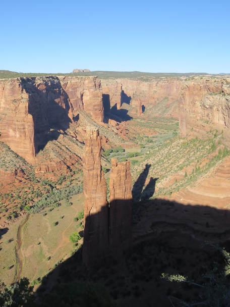 View from the Spider Rock Overlook along the south rim of Canyon de Chelly.
Lynn's the navigator now. She has the park map in hand and a plan in her head. Baby can take a rest. We're driving to the end of the road to the final overlook point and will work our way back. It is nearly a 20-mile drive to get to the end of the south rim drive and the speed limit tops out at 45 mph, as I recall, but the road was in great shape. There are a few houses clustered in places along the drive but not much in terms of local traffic. Still it after 5:00 by the time we reached the end of the line at the Spider Rock overlook. There were a few other cars in the parking lot when we arrived but far from crowded at this time of the afternoon. We made the short walk at to the canyon rim to take in the view. OK, I recognize that rock spire from the old western movie "Mackenna's Gold." But the bad news was that the sun had dropped low enough to be casting long shadows across the canyon, so while the views were still lovely the photos were just OK. No worries, we're still getting to see the sights. We made a quick stop at the Face Rock Overlook and finally at Sliding House Overlook before bagging the tour for the evening. We've got the flavor now. We'll get to see the canyon from the down and in perspective tomorrow. We did add one last animal sighting to the list with a couple Peregrine Falcons swooping about in the early evening along the edge of the canyon at Sliding House Overlook.
We opted for dinner at the Thunderbird cafeteria since it was right there at the hotel. We really did not see any better options as we drove through Chinle, so we might as well just make it east. Actually a pretty decent menu in terms of variety. Lynn went with the Navajo taco and I had the green chili stew, hoping for something that had a little heat but was not too heavy. I got half of the equation figured out. Very bland food this evening. I wonder if the Navajo have contracted the kitchen work out to the Amish. Only they could drain the flavor out of green chilies.
We opted for dinner at the Thunderbird cafeteria since it was right there at the hotel. We really did not see any better options as we drove through Chinle, so we might as well just make it east. Actually a pretty decent menu in terms of variety. Lynn went with the Navajo taco and I had the green chili stew, hoping for something that had a little heat but was not too heavy. I got half of the equation figured out. Very bland food this evening. I wonder if the Navajo have contracted the kitchen work out to the Amish. Only they could drain the flavor out of green chilies.
We were back in the room at 7:15. Time for a beer I think. Since this all part of the Navajo Nation, we just had a beer in the room rather than sit outside. Not that there was really any place to sit outside. Well, the setting may be mundane but at least the beer is good. A Dirt Wolf Double IPA from Victory Brewing. One of my favs.
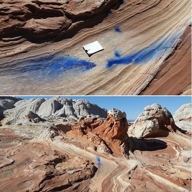
I checked Facebook and the meet-up website just to see if the Herd had started any post-meet-up discussions. Pixie posted a link on FB about the vandalism at White Pocket. Looks like blue paint or residue from a smoke device. There was speculation that this might have been done by some photographers, maybe the nude photo shoot group trying to add something to their images. C'mon, the beauty in those rocks is all any decent photographer would need to get great images. Hopefully the BLM law enforcement folks will catch the morons who made that mess.
Lynn turned on the TV. This is the first time I've seen a TV powered on since we left Ohio. But Lynn likes the noise so what the heck. At least she found something entertaining, "Jurassic World." Somehow I made it to the end of the flick. Lynn had passed out long ago.
Day 8, Wednesday, October 4 - Canyon de Chelly. We slept in this morning. Well, all the way to 0530. It's all relative. No great rush as our tour of Canyon de Chelly is not until 0900 so we just got ready for the day then wandered over to the cafeteria for breakfast about 0700. We arrived just a few minutes after the joint opened but there was already a line of retirees ahead of us. But the folks on the other side of the counter knew what they were doing and moved us all right through with a very minimal wait. Really just enough time to study the menu and make our choices. I kept it simple with French toast and Lynn tried the blue corn pancakes. Much better than dinner last night.
We still had time to kill before our tour pick-up, so I walked around the grounds a bit as there were plenty of little birds out this morning. Many gone birds, of course, but I identify a few, even if the photos were not that great: Rock Doves, Ravens, House Sparrow, House Finch and Starlings.
We were ready to roll at 8:40 and went out to wait for our guide in front of the trading post where a few other folks had gathered for their tours. Most were on the half-day group tour out of the lodge but there was one fellow going out on the full-day cruise. We had thought about doing that but in the end opted for the half-day figuring that would be more than enough time bouncing along over rough terrain in a Jeep. There were a couple dogs out here with the tourists as well. I thought these mutts might have belonged to the tourist couple sitting out on next to the lawn but as it happens the dogs were locals, reservation dogs. Just before 9:00 the unique, 6-wheeled, open air truck arrived to take the folks for the Thunderbird Lodge half-day tour, then a second truck for the one guy on the full day tour. The guides got the tourists loaded then walked into the trading post to check-in for their tours. The first guide, a very tall, stout, Navajo wearing a cowboy hat asked us who we were waiting for. "Adam Teller," I replied. The big Indian sort of turned up his nose and just kept on walking without a word. That was an interesting, and certainly unhelpful reaction. Perhaps there is some history there. I had called Antelope House Tours yesterday afternoon to confirm our tour and get the pick-up location. The lady I spoke with just said that Adam would meet us at Thunderbird Lodge, but no other detail. Well, we're at Thunderbird Lodge so I guess we'll wait. 0900 and no guide. The second Native guide also asked us which tour company we were waiting for, but he was much more helpful and indicated that the other companies generally met at the camp grounds. Well, that would have been helpful to hear from the lady I talked to yesterday. We thanked the gentleman and starting walking across the parking lot toward the camp ground area. We were about halfway across the lot with a white Jeep Wrangler whips in. This must be our guy, but the company information on the door stated Ancient Canyon Tour. But the slightly built Navajo in the beat up baseball cap jumped out of the Jeep and asked if we were looking for Antelope house Tour. OK, that's our ride and our guide, Adam Teller. We later found out that Adam is just a year older than me, but he is well weathered from his time out in the elements here in the canyon. We loaded up and drove over to the Navajo Nation permit station. Only 9:10 so just a minor delay.
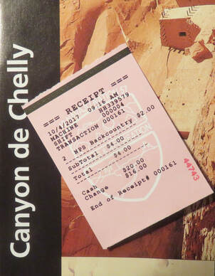
I knew we needed a permit and had to have a Navajo guide to enter the canyon, but I figured that the guide would have already taken care of the permit. Once we got over there and went through the process, it all made sense. A tourist is the group leader and buys the permit and the guide is just taking the group into the canyon. OK, that makes sense. I paid the fee, four bucks, and we moved on.
Adam was an excellent guide with boundless knowledge on the history of Canyon de Chelly and the Navajo people. However, his version of the history is sometimes quite different from what is commonly believed. He made no bones about this point. Maybe he is right, maybe not. I'm no expert. I'm just going to recount the information that I can remember that Adam presented during the tour and leave it at that.
We drove across the road and onto the sandy track that leads into the canyon. There were a couple other outfitters set up at the canyon entrance, most for horseback tours. We passed one equestrian tour group as we proceeded into the canyon. Our first stop was at Smoke Signal Point. This was a cylindrical pile of rocks located right at the entrance to the canyon and was used as a look-out position. If an enemy was sighted approaching a signal fire would be lit and the smoke would alert the residents of the canyon to the danger.
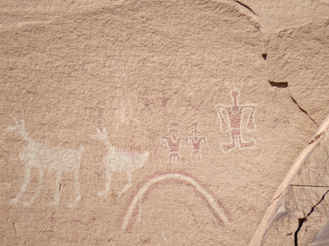
The next stop was a rock art panel and burial site. Adam indicated that common folks were cremated while royalty had lavish burials. He also stated that the Kokopelli lying on its back and the frog man glyphs indicated the end of a rein for a line of leaders.
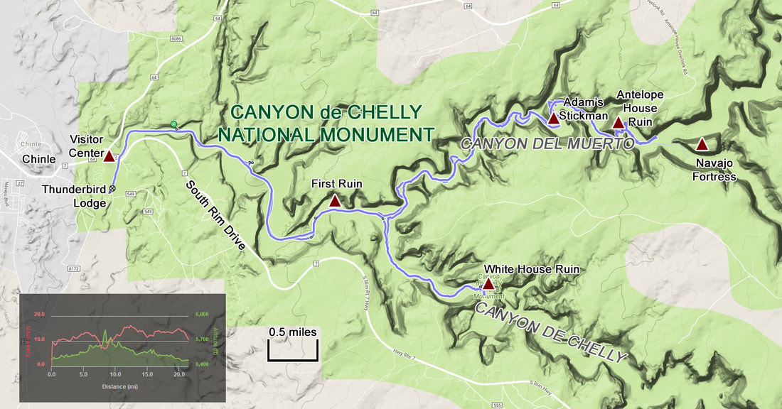
The major stops along the tour were rock art panels and dwelling ruin sites, some of which were quite impressive. Nothing as large as the big cliff dwellings in Mesa Verde, but several multi-room sites. I started tracking the route that we took through the canyons just a little ways into the tour (probably after the second stop). The route of the tour took us first well into Canyon del Muerto, then later a short distance into Canyon de Chelly.
One of the next stops was at another very pretty rock art panel, this one high up on a sandstone formation. This was the first stop where we got out of the Jeep for a look around. Near were we parked was a pool of water that had attracted several Yellow-rumped Warblers. The first panel that we came too was etched into the narrow end of the formation and depicted a hunting scene with warriors on horseback chasing deer or antelope. Further around and much higher up on the same formation was another larger panel comprised of a variety of images; anthropomorphic figures, deer, birds, dogs (I think) and handprints. This was a very large panel but the images grew fainter as I scanned from left to right.
Adam was an excellent guide with boundless knowledge on the history of Canyon de Chelly and the Navajo people. However, his version of the history is sometimes quite different from what is commonly believed. He made no bones about this point. Maybe he is right, maybe not. I'm no expert. I'm just going to recount the information that I can remember that Adam presented during the tour and leave it at that.
We drove across the road and onto the sandy track that leads into the canyon. There were a couple other outfitters set up at the canyon entrance, most for horseback tours. We passed one equestrian tour group as we proceeded into the canyon. Our first stop was at Smoke Signal Point. This was a cylindrical pile of rocks located right at the entrance to the canyon and was used as a look-out position. If an enemy was sighted approaching a signal fire would be lit and the smoke would alert the residents of the canyon to the danger.
The next stop was a rock art panel and burial site. Adam indicated that common folks were cremated while royalty had lavish burials. He also stated that the Kokopelli lying on its back and the frog man glyphs indicated the end of a rein for a line of leaders.
The major stops along the tour were rock art panels and dwelling ruin sites, some of which were quite impressive. Nothing as large as the big cliff dwellings in Mesa Verde, but several multi-room sites. I started tracking the route that we took through the canyons just a little ways into the tour (probably after the second stop). The route of the tour took us first well into Canyon del Muerto, then later a short distance into Canyon de Chelly.
One of the next stops was at another very pretty rock art panel, this one high up on a sandstone formation. This was the first stop where we got out of the Jeep for a look around. Near were we parked was a pool of water that had attracted several Yellow-rumped Warblers. The first panel that we came too was etched into the narrow end of the formation and depicted a hunting scene with warriors on horseback chasing deer or antelope. Further around and much higher up on the same formation was another larger panel comprised of a variety of images; anthropomorphic figures, deer, birds, dogs (I think) and handprints. This was a very large panel but the images grew fainter as I scanned from left to right.
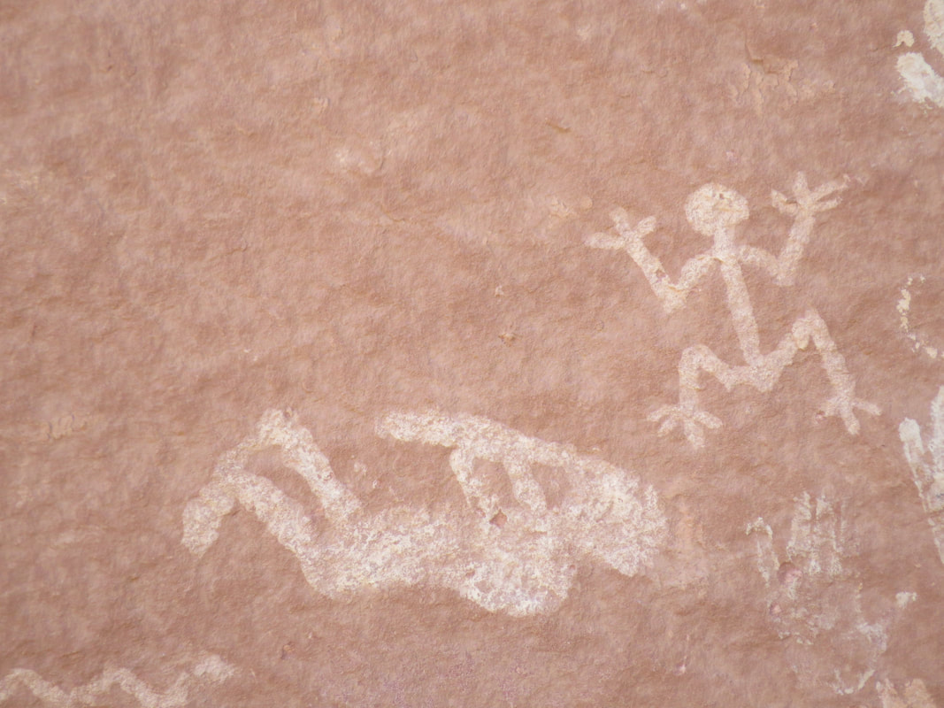
Reclining Kokopelli and Frog Man
|
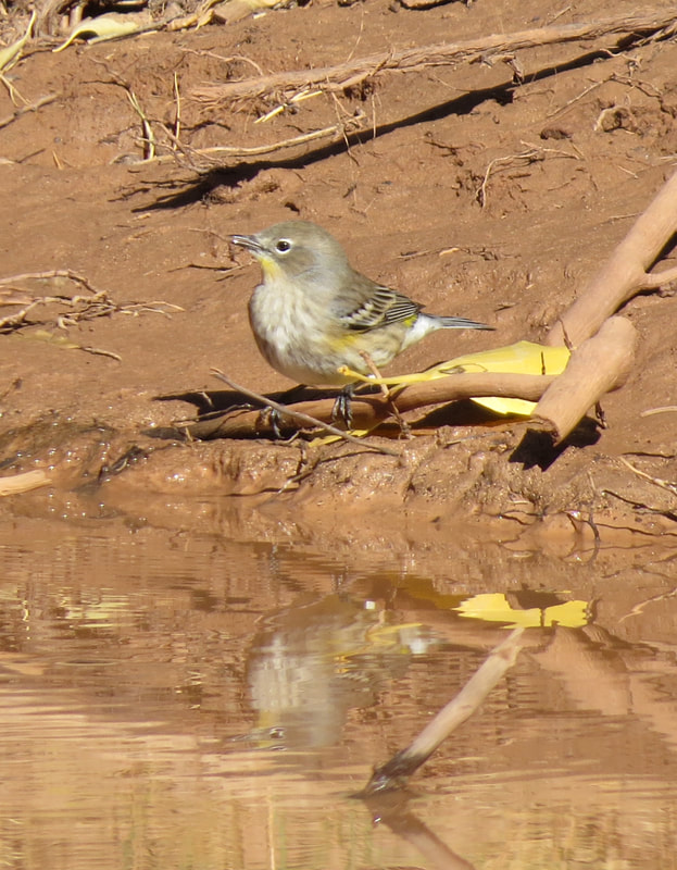
Yellow-rumped Warbler
|
Adam pointed out that many of the rock art panels and most of the ruin sites were located well above the canyon floor. He said that he has explored through the canyon since he was a kid and it is very difficult to gain access to many of these sites. His theory differs from the commonly accepted one that the dwelling sites were built high above ground level for defense and were accessed by ladders or otherwise climbing to the structures. Adam thinks originally the structures and panels were at ground level but that over time with centuries of flash floods that erosion was carried away much of the sand and dirt and lowered the canyon floor. This theory would surely explain the location of Nature Monster's panel along the Buckskin Gulch Trail.
There are often times interesting, naturally occurring images in the desert varnish, sort of like looking for familiar objects in the clouds. Adam pointed out one varnish painting that looking strikingly like an Egyptian figure that could have been painted on a temple wall. This was his segue to talking about Egyptian artifacts that had been found here in Canyon de Chelly and a Sumerian Crystal with writing that was translated by Egyptologists. He was seemingly tying together these ancient cultures separated by not only thousands of miles but also a few millennia.
Adam had a distrust for the National Park Service. His feeling was that the history portrayed by the Park Service made the traders and soldiers out to be heroes, but Adam believes that these were bad men out to enslave the Natives. The white men would steal Indians for slaves and then when the Indians would try to rescue their kin the white man would claim the Indians attacked for no reason and that was the story relayed back to the U.S. Government which made for the hostilities between Washington and the Native tribes.
A little further up the canyon, Adam told the story of White Woman Trail, I think that was what he called the area, named for the white woman who was captured by the Navajo and brought to live in the canyon. Adam indicated that years later when (so a bit of the pot calling the kettle black when tied to the previous discussion). According to Adam, the white woman was found living with the Indians in the canyon that she decided to stay with the Indians rather than return to her former life in the white man's world.
Adam also had a different opinion of J. L. Hubbell who established the Hubbell trading post south of Canyon de Chelly. Adam indicated that Hubbell was disliked and not trusted by the Navajo. He stated that Hubbell cheated the Navajo craftsman. He also said that Hubbell had 12 wives. I sort of got the feeling that maybe one of Adam's ancestors had an ax to grind with Hubbell.
Adam showed us a stick man petroglyph that he had carved on the canyon wall when he was young, some 40 years ago. He said that the figure was only two feet above the grade of the canyon floor when he drew it but now it is over 20 feet up the canyon wall. He said he also showed the drawing to the archaeologists who studied the area. They dated Adam's rock art dated at 500 years old.
We got to see several ruin sites, but all from the canyon floor. Most of the ruins were reconstructions and Adam's grandfather had rebuilt some of the sites. Adam shared several stories about his family, past and present, as they have lived in the canyon for generations. He showed us where his family property in the canyon was located and told how the women in the clans controlled the land and made the important decisions. His mother is the matriarch of the family but there is some friction with some of the "aunties" as one aunt and uncle want to develop the land for some business venture.
We stopped at Antelope House, near the end of our drive into Canyon del Muerto. Adam's family had gift stands set up here, his sister near the ruin and his auntie (the one they were feuding with) across the canyon. This was a very nice setting. The canyon floor was shaded and cool. Adam told us to explore on our own for a few minutes and that he would meet us at his sister's gift stand. Antelope House is named for the antelope pictographs that were pained in 1864 to designate the four clans. We studied the panel and the ruins for a while (from the far side of the fence that protected the area), then crossed the bridge that spanned the wash to get to the craft stands and take in the views of the ruins from this angle. There was a nice field of wildflowers in the sandy plain at the base of the canyon wall behind the gift stand. A small sea of yellow with a few specks of orange thrown in. I tried to line of a photo with the flowers and the ruin in the background but the light and distance were against me. Adam's family was selling jewelry and small pottery figures, plus they had Gatorade, water and snacks. They had some nice pieces. Lynn liked one of the pottery pieces but we really had no way of getting it home easily. I guess we could have shipped it but now we're getting in to more work than it was worth. She ended up with a pendant or some other trinket. I bought us a couple Gatorades for the road.
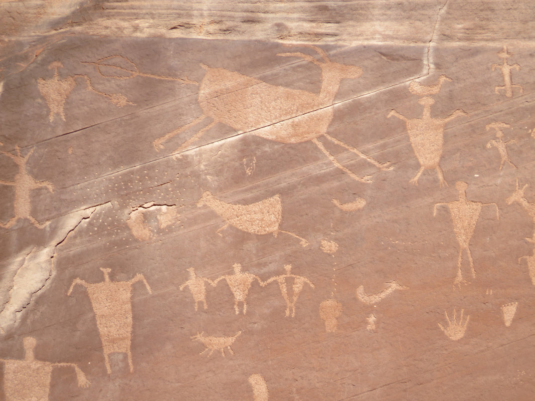
Antelope pictographs.
More pictographs at Antelope House.
|
Antelope house Ruin.
|
As we were leaving Antelope House, Lynn spotted a rock that looked like a howling coyote and asked Adam if that was the name. She was close. I think Adam said the rock was named for a wolf. This tied in nicely to a couple other natural formations that Adam had pointed out along the way that resembled other critters, such as one that had the noggin of a bear.
Other and the rock images of animals, we did not see much in the way of critters during the tour. A lizard or two, a few butterflies, a handful of gone birds, the warblers and the ever present Ravens. The best sighting was the Golden Eagle that we saw soaring overhead near where we turned around in Canyon del Muerto.
Canyon del Muerto translates to canyon of the dead, and this seems to be an appropriate name as there were several reasons why the canyon could have picked up this moniker. Apparently there is a large burial ground further up the canyon. That would be reason enough. Adam also told us how a Spanish expedition killed many natives in the early 1800s and through the dead bodies over the canyon wall. This was also referred to on the park map, which described the site of Massacre Cave where 115 Navajo were killed during the winter of 1805 by the Spanish military detachment led by Antonio Narbona. The Navajo took shelter on a ledge above the canyon floor but the Spanish found them and fired down from the canyon rim, killing everyone on the ledge.
The final stop in Canyon del Muerto was at Navajo Fortress where the clan of Adam's ancestors survived on top of the sandstone formation for nearly 3 months while besieged but the U.S. Cavalry. Adam indicated that the clan had stocked piled food and water at the top of the rock, but eventually ran out of water. They had to make water runs in the dead of night in order to stay alive.
Adam said that his grandfather was one of the Chiefs who signed the 1868 treaty with the U.S. Government (I think Adam tended to use "grandfather" sort of generically, as I guess there had to be at least one "great" if not two in mix to get the generational timing to work out).
Throughout the tour, Adam would throw in some words of wisdom from his relatives including his grandmother (I think his mother's mother). Anyway, one such story answered the question as to why squirrels tend to run out in front of moving vehicles on the road. It seems that the squirrel knows that it is being watched by hawks who are just waiting for the furry varmint to run out in the open so the raptor can swoop in and snag it for dinner. Grandma's theory is that by waiting to cross the road when a car is coming, provides the squirrel with cover as well as distracts the hawk, giving the squirrel time to safely cross. I am not making this up.
On the trip out of Canyon del Muerto, Adam stopped to show us another rock art panel of red colored figures. He called this the line of death and said that the pictographs were painted with Ute blood and was meant to be a warning for all enemies to stay out of the canyon.
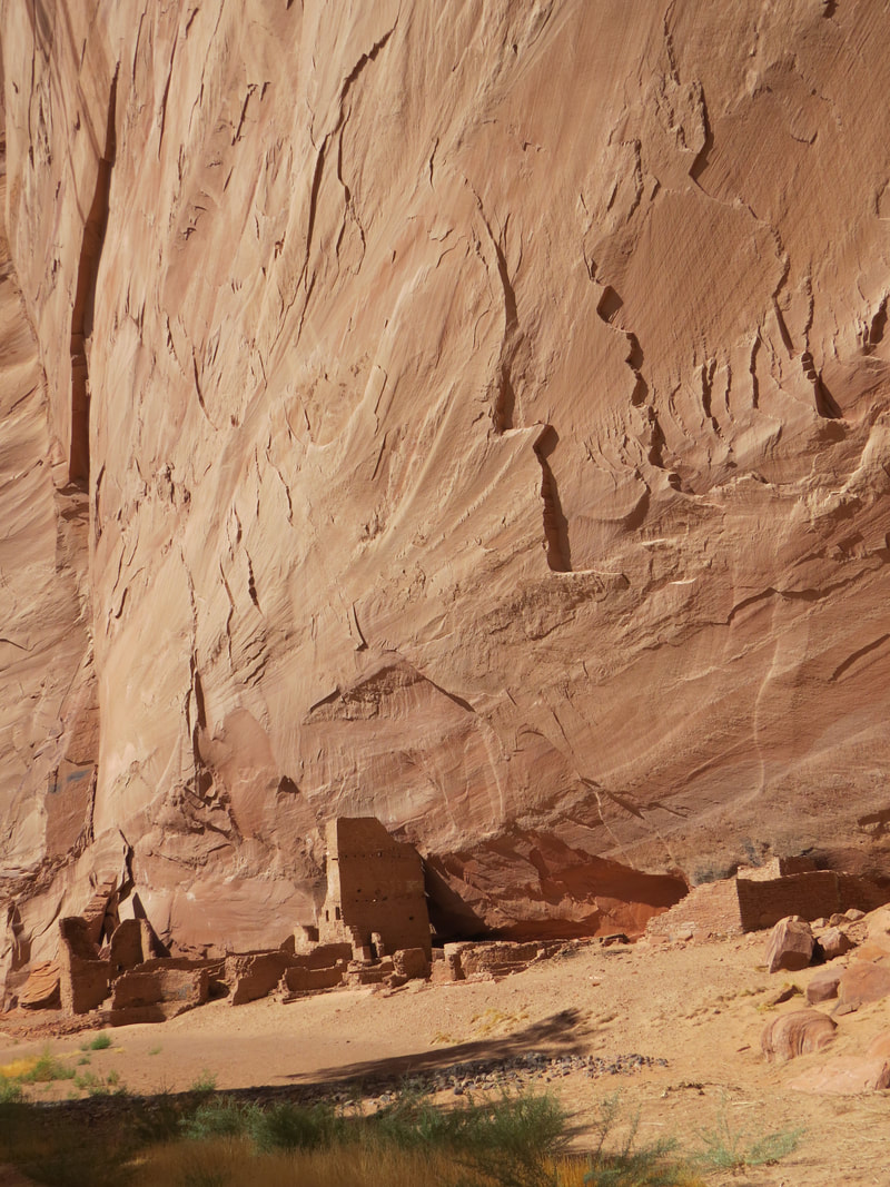
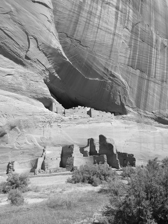 White House Ruin.
Once we turned into Canyon de Chelly we did not really make any stops until we got to White House ruin, which was as far as we went in this canyon. But this one stop was worth the drive. The ancient Puebloans built the dwelling 1,000 to 1,200 years ago. The ruin gets its name from the white plaster on the walls. This ruin was one of the places photographed but Ansel Adams. An impressive site and the only place that can be visited without a Navajo guide. There is a trail from the rim that descends down to the canyon floor. The end of the trail is marked with signs that make it clear the extent of the unguided area. Adam showed us around the area (the ruin site again fenced off for both its protection and the safety of the tourists), pointing out more rock art.
He also pointed out one more interesting natural sculpture, that of a chipmunk up on the ridge above us. He told us another Navajo tale about how a squirrel had helped one clan defeat an enemy. The squirrel wore war paint and these markings became the stripes on a chipmunks face. So basically, a chipmunk is a squirrel with war paint.
The time was now 1:00 PM, so it was time to make tracks out of the canyon. We loaded back into the Jeep and started going down canyon. Back at the junction of Canyon del Muerto and Canyon de Chelly, we came to a rather muddy spot in the track. Now obviously we had detoured around this obstacle on the way into Canyon de Chelly but as we were heading out of the canyon Adam was making a bee line toward the mud. OK, this seems like a really bad idea to me as this just has that look of the kind of mud that will suck the tires right off a Jeep. But Adam is the expert so I'll give him the benefit of the doubt that he can pilot us through the muck. Not so much. I'm guessing the mud patch was probably 70 yards long. We made it about 50. Well at least we are stuck in a shady spot. Adam got out to survey the situation. Yep, mired up to the hubs. And apparently no useful equipment in the Jeep. So all he could do was but it in four-wheel-drive-low and see if you can work our way out. I think he was successful only in breaking a few teeth off of gears in his transmission. Luckily, Adam's uncle came by in a big Suburban; he was also guiding a tour. Adam's sister and niece from Antelope House also joined the party a few minutes later. Adam's uncle was well stocked with towing gear and his sister added a shovel, so we now had the appropriate equipment and just enough rope to reach out to the Jeep. Still the mud was not going to give up its prize easily and it took a couple attempts to dislodge the one clean Jeep from the sticky muck. But finally we were out. The pretty white Jeep is now browner but at least we are on dry sand. But the damage was done as Adam was still having trouble getting the vehicle in gear. He had to back up a couple times and get a run through the sand. I was a bit concerned that he was going to reverse it right back into the mud! But eventually we got back on track, even if the gears were grinding a bit. I guess we got the bonus tour as the mud bath added about 30 minutes or so to the overall time. We stayed on the firm part of the trail the remainder of the trip.
Adam gave us a little movie history on the drive out of the canyon. There have been several movies filmed in Canyon de Chelly over the years. One of the more recent films was the "Lone Ranger" remake starring Johnny Depp as Tonto. Adam said that his grandfather was a stunt rider in "Mackenna's Gold" as the Hollywood stunt men would not ride on the steep trail going into the canyon at the end of the movie. We've got that old classic on DVD back home so we'll have to watch it when we get back. He relayed a story from the filming of a scene where the Apache are attacking on horseback where Omar Sharif, the bad guy in the movie, was supposed to shoot one of three Indian attackers as they road by. On the first take the Indians rode in, Omar pulled the trigger and none of the Indians dropped from the saddle. The director had a talk with the stunt riders. On the next take, the attackers rode in, Omar aimed and fired and all THREE Indians fell from their mounts. That made Omar the sharp shooter for the day!
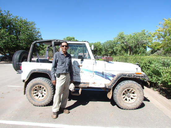 Adam Teller and our muddy ride.
We were back at the lodge a little after 2:00. Between the mud and the road construction along the south rim drive intersection and down to the lodge we were a little past the planned return time. No big deal for Lynn and me as we had nothing else planned for today but Adam is now running late for that 2:00 radio interview that he had mentioned during the tour. But he volunteered for stand for a portrait next to his now quite muddy Wrangler. Adam was excellent as a guide; very interactive and more than willing to provide commentary on the history of the canyon and his people. He is passionate about the history and culture, wants to share, and wants to change the way his people's history is written.
Canyon de Chelly photo gallery.
The road construction around the lodge was a bit of a mess so we decided to call it a day on touring. Besides, we agreed that being in the canyon was the best view so no need to visit the remaining viewpoints along the rim. We just chilled in the room for a while, got cleaned up and had a beer. I had an Easy Jack IPA from Firestone Walker Brewing. Quite smooth with a great aroma and nice flavor. Great after a day of 4-wheeling through Canyon de Chelly.
Dinner again at the cafeteria. I had the Albuquerque Turkey sandwich which was pretty darn good; Lynn just had a simple burger. And I finally got some greens with a side salad. This was the first time I've had crinkle cut fries in ages but they were quite good. I think they were baked rather than fried.
After dinner we sat a while out in front of the trading post, just enjoying the pleasant evening. We made a swing through the trading post, where I met a couple from Wickliffe. He asked about the lodge and tour. I gave them both high marks.
We went out for the dance demonstration by the Dineh Tah Navajo Dancers at 7:00, but they were running a little behind. The event started at 7:15. The leader of the troupe who was also the master-of-ceremony for the evening was a bit abrasive in his delivery. One of the first statements he made was that they were native people, not Native Americans since they did not ask to be part of the United States. He went on to say that the dancers were not here to entertain as these dances are part of their religion and culture. Also, the dancers are not wearing costumes but rather attire based on the religion and cultural beliefs. We did get the ok to photograph and video the event but not post on the web. The leader is on a mission to "once and for all" get tribal and federal laws in place to "end the exploitation of native people." He also talked about next year being the 150th anniversary of the treaty with the US. But he just seemed to have a negative slant. I don't know, maybe it was just me. And yes, the First Nation people probably got a bad deal from the US in the late 1800s, but it is 150 years later. Why not take a more optimistic approach.
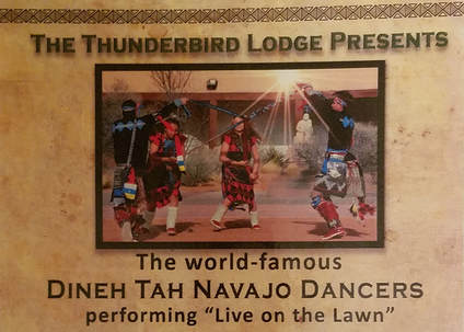
The group performed three dances. The first was the ribbon dance. The leader said that the ribbon used to be a feather until Wal-Mart came along (hey, I guess he does have some sense of humor). The second dance as the sash. The leader stated that the sash was used by women after pregnancy to help them regain their feminine for and lost weight. He seemed to be digging a hole for himself with women everywhere. The final dance was the Navajo gourd dance, which was tied to ancient Navajo teachings. The fable was related to the choice that man was given by the gods to choose a yellow powder. One option was from the crops, the pollen from corn. The other powder came from underground. OK, I figured he was referring to gold, but he went in another direction: uranium. Really? I'm not sure I'm buying an ancient story that ties to uranium. That has a more modern day connotation.
There were four dancers in the troupe, two young men and two young women. Their attire was quite elaborate with lots of heavy silver and turquoise. The leader provided the timing and beat for the dances through chanting and playing a drum. The full moon rose behind the dancers at the start of the program. The dances were very aerobic and rhythmic, but perhaps a little repetitive. Still it was a very interesting event in addition to being educational and a bit thought provoking based on the commentary from the leader of the group. The leader closed by talking about blessings using yellow and white corn meal, I think yellow was for the morning as it matched the sun and white was the night blessing, and provided packets of each for the audience to take with them. We did not stick around for the post-demonstration photo-op. We just added something to their donation basket and went back to our room.
As is her habit, Lynn turned on the TV. I give her credit and she certainly knows how to play it since she found "Revenge of the Jedi." OK, we can certainly end the day with this.
Day 9, Thursday, October 5 - Wandering to Winslow. I was awake a little before 0500. Lynn was snoozing still. That's the problem with a standard motel room, there is no place to go other than the bed. So I got on the phone checked email, current events and worked on the journal until she woke up a short while later.
The plan for today is to drive south from Chinle to Winslow with stops at Hubbell Trading Post National Historic Site and Meteor Crater. I figure we'll explore around Winslow this afternoon and maybe find that corner Glen Frye was standing on and singing about in "Take It Easy."
We got ready for the day and were mostly packed by the time the cafeteria opened for breakfast. We walked in a little after 0700. Lynn said that the blue corn pancakes were really good, so we both had a short stack this morning. They are blue. And very tasty. Good start to the day. Back in the room, we finished packing, loaded the Rogue and were checked out about 8:15. We decided that we had covered the park well enough, so no more touring along either rim was required. It was time to head into new territory.
Once on the road we discussed the native people's dance exhibition. The attire was beautiful, the dancing well-choreographed, and the program overall was educational, but Lynn and I were on the same page regarding the attitude of the leader of the group. He was abrasive, off-putting and arrogant. Sort of a name dropper since he mentioned that he had a meeting prior to the dance exhibition with the President of the Navajo Nation. I think we both understood the points he was trying to make, no issue there. However, his delivery needs work. Remember, you can catch more flies with honey. That said, it is probably a good thing that the Navajo have some strong voices and folks like the leader of the dance troupe and Adam Teller who want to make a difference and tell the story of their people.
We arrived at Hubbell Trading Post right at 9:00. As indicated on the NPS.gov website, there was construction on the access road leading to the National Historic Site so I could not stop to get the passport photo on the way in. Hopefully I'll get an opportunity on the way out. Not a lot of activity here this morning, I think there was just one other car in the parking lot when we arrived. Another gorgeous morning here in northern Arizona, very pleasant with white clouds scattered across a dark blue background, but with plenty of gaps so that the sun was shining brightly. We started our tour at the visitor center to get the history of the trading post and determine if there were any activities scheduled for today. We got a completely different story about Hubbell from the displays here than what Adam relayed to us during the Canyon de Chelly tour, just as he said we would. Again, not saying either is correct or either is wrong, but the stories are vastly different. Here are some of the main points from the displays in the visitor center:
Hubbell Trading Post, established in 1878, is the oldest continually operated trading post on the Navajo reservation. J. L. Hubble, whose family operated the trading post for nearly 90 years, was known among the Navajo as trustworthy and honest. His trading post became a pillar of the community, playing a large role in helping Navajo families rebuild their lives after the Long Walk.
Subjugating the Navajo. Throughout much of the 1700s and 1800s, the Navajo lived a life of conflict, fighting wars to protect their children and homes against Utes, Comanche, Spanish, Mexican and American soldiers. In 1848, the United States claimed New Mexico Territory which included the Navajo's ancestral homeland. The Navajo resisted and the U.S. Government assigned General James Carleton to overpower them. Carlton recruited Colonel Christopher "Kit" Carson tor the task. In February of 1864, Kit Carson ordered the burning and destruction of all Navajo property and homesteads, including crops and livestock. His soldiers killed those Navajos who resisted. The soldiers told the Navajos to go to Fort Defiance for shelter and food. Thousand came from all directions and gathered there. On March 4, 1864, the assembled Navajos were forced on a nearby 400-mile-long march to Fort Sumner, also called Bosque Redondo. This was the notorious Long Walk of the Navajo. Many Navajos died on the trek or while held captive at Hwéeldi, the Navajo name for Fort Sumner. The Navajos were imprisoned at the fort for four years, enduring in their incarceration despair and suffering of a kind they had never experienced before. Many died from unfamiliar diseases and starvation. They lived in crude, dug-out holes in the ground. They tried to farm, but the barren land barely yielded crops. An alkaline stream made them sick but was the only source of water they had. The Navajo call this bleak period of the history "the time of fear and suffering."
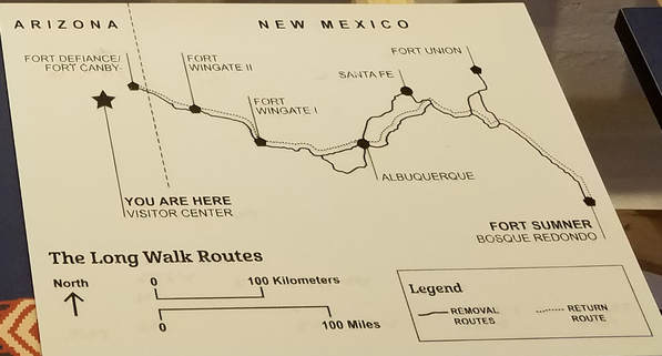
Route of the Long Walk. The nearly 400-mile trek from Fort Defiance to Fort Sumner was a brutal forced march through unforgiving landscapes. The map shows the route along which the Navajo marched. Some Navajos resisted the order to assemble at Fort Defiance and did not make the Long Walk to Hwéeldi. They suffered fear and reprisal as they wandered without homes for as long as six years.
Treaty and Return. Eventually, Navajo and U.S. leaders agreed to the Treaty of 1868 ending the war between the United States and the Navajo people. After four years of imprisonment, the Navajo at Fort Sumner were finally allowed to return home. The treaty was signed on June 1st, 1868. On June 18th approximately 7,000 Navajo survivors - led by Ganado Mucho and other Navajo leaders - started to walk back home to Diné bikéyah (Navajo land). Upon arrival at Fort Defiance, some were too grief stricken to return to their original homes. Some remained in the vicinity of For Defiance and some moved on to start new lives elsewhere. For some, it would be as many as ten years before they felt they could return home. Nearly 11,500 Navajos were imprisoned at Hwéeldi (Fort Sumner). Seven thousand Navajo survivors were released in 1868 and made the return trek to Fort Defiance. From there, many remained in the vicinity and others journeyed elsewhere to start a new life. It is not known how nay returned to their original homes and communities.
All is Not Lost. On the return home, the sight of the sacred turquoise mountain, Tsoodzit (Mount Taylor Peak), reminded the Navajo people that all was not lost. Those who came back found burnt fields and charred remnants of their former homes. They buried those who had been killed defending home and family. Despite these sorrows, many also felt great relief to finally be back home.
A Prediction is Made. "If you come to the wash and start trading you will do good business." - Ganado Mucho to J. L. Hubbell. Navajo peace leader Tótsohnii Hastin (Big Water Man) – or Ganado Mucho (Many Cattle) as he was commonly known – first met the young J. L. Hubbell at Fort Defiance in 1874. Hubbell was working at the time for the U.S. Government translating Navajo into English and Spanish. Together, Hubbell and Ganado Mucho helped settle several disputes between ranchers and local Navajo people. In the summer of 1878, a violent conflict broke out between Ganado Mucho's clan and a rival one from Canyon de Chelly. Hubbell was called up on the U.S. Army to mediate a truce. In the fall of that year, Ganado Mucho invited Hubbell to relocate his recently established trading post to the area known as Lok'aahnteel (Wide Reeds), alongside Pueblo Colorado Wash. The town that grew around the trading post was originally called Pueblo Colorado, Arizona. IN 1895, to avoid confusion with the similarly named Pueblo, Colorado, Hubbell renamed the town Ganado in honor of his friend.
An Invitation is Accepted. John Lorenzo Hubbell - known to the Navajos as Naakaii Sání (Old Mexican) - came to the area in 1876 and, following the suggestion of his friend Ganado mucho, established Hubbell Trading Post at this site in 1878. His trading post soon became a hub of activity. Hubbell's understanding of Navajo life and culture and his ability to speak Navajo earned him the trust of the Navajo people. Some of them moved closer to his trading post and together they built the community of Ganado. J. L. Hubbell lived here with his wife - Lini Rubi - and their children. The Hubbells were known for reaching out to the Navajo community and were respected for their efforts. J. L. Hubbell remained here until he died in 1930 at the age of seventy-seven. He and other family members are buried on Hubbell Hill. J. L. Hubbell grew up in New Mexico speaking Spanish. He learned Navajo at an early age, perhaps from Navajo laborers working on his family's ranch. As a young adult he spent several years wandering the southwest and living with the Paiute and Hopi before arriving on the Navajo reservation in 1874.
There is a distant tie between this trading post and space exploration, but you have to trace the family tree back to New England in the late 1600s. That's where the branches of the family tree split for J. L. Hubbell and Edwin Powell Hubbell, the famed astronomer for whom the Hubbell Space Telescoped is named.
In addition to the historical displays, there was a small gallery of art, a few paintings and Navajo weaving. One of the artists was demonstrating her weaving skills. We chatted briefly. She was the resident weaver, I think her name was Ruby Hubbard. I’m guessing she was in her 50s. She asked where we had visited so I told her we were coming from Canyon de Chelly and on our way to Winslow for a few days. She commented that she had never been to Canyon de Chelly. Interesting that someone who has lived here all their life has not visited a place so close that would seem to be very historically and culturally important.
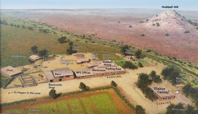
After finishing in the visitor center, we walked through the trading post and around the grounds. We started in the general store which reminded me of some of the old stores in the small towns back home. All the basics. There was a small NPS-related gift store section where we bought a pin to commemorate our visit. The adjoining room had some jewelry and was otherwise full of historical artifacts including a rack of old guns, baskets, pottery, rugs, an old telephone (I told Lynn that most kids would not know what that was) and a couple mounted animal trophies. We walked down to the old barn which was obvious still in use as it had the familiar odor of hay and manure, then to the corral where there were two skinny horses and one very friendly cat. Of course if there is a cat in the area Lynn will find it. He followed us around as we walked through the rest of the grounds. The Ranger we passed said that we would be conducting a tour of the Hubbell home in a few minutes. We decided to skip the house and just looked around the rest of the grounds. Mr. Cat tagged along with us. In the area behind the trading post and barn were a several old wagons and pieces of rusty farm equipment along with a few more structures to support the trading post operation, including the manager's house, bunkhouse and chicken coop, complete with chickens. We walked around the front of the Hubbell home which was very nice with a green yard; quite the contrast to the desert landscape all around the rest of the trading post. And this brought us back to the front of the trading post and the parking lot, so we climbed back into the Rogue and continued our drive for the day. The road construction we had passed on the drive into the trading post had moved even closer to the entrance sign, so I had to take what I could get from out of the driver's side window. Not ideal, but I was able to fix it up with a little Photoshop work. Here are a few photos from Hubbell Trading Post.
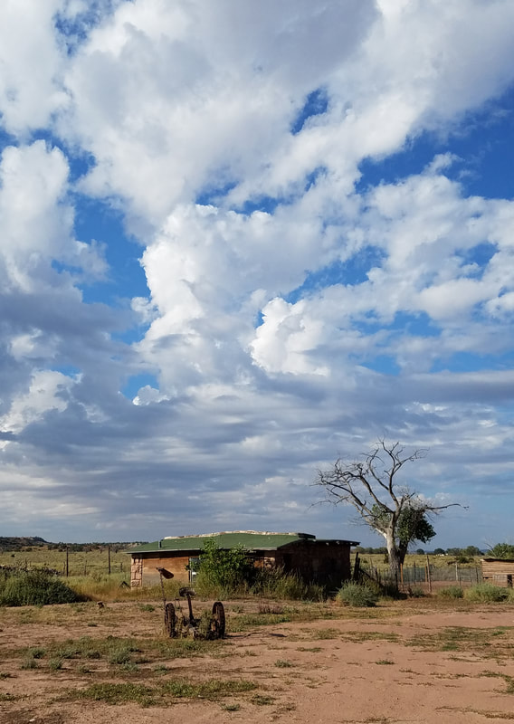
|
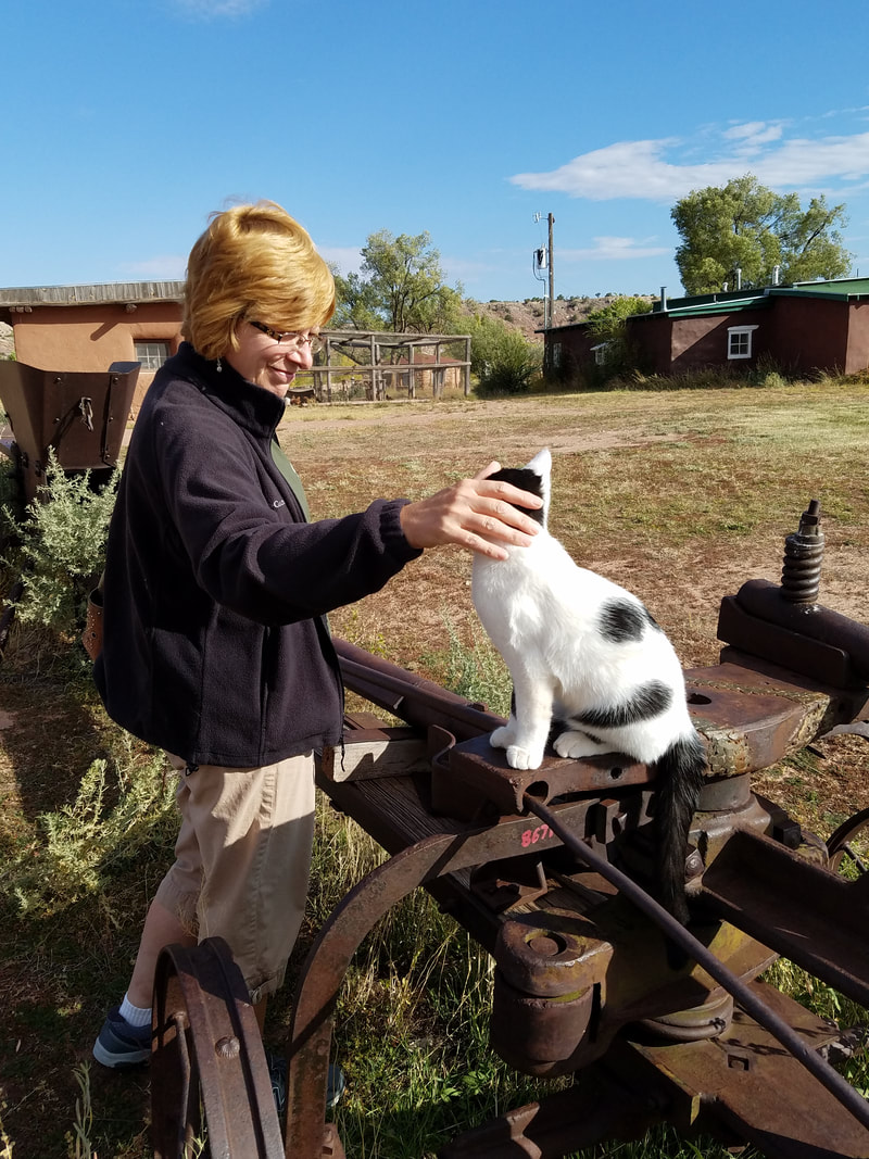
|
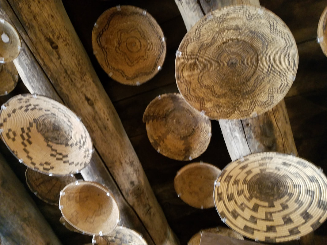
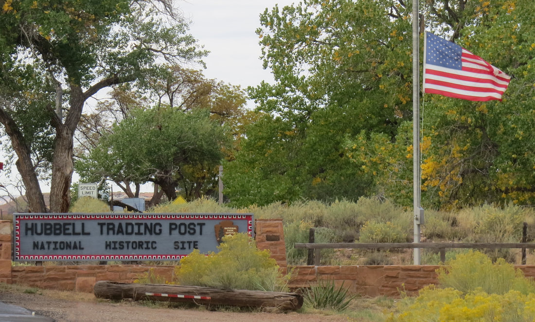
|
We were on the road heading south right at 10:00 AM. Baby had us on a route to Winslow where we would jump on I-40 west to Meteor Crater. The time zones keep switching as we pass in and out of daylight saving time between the Navajo Nation and plain, old Arizona. Whatever time zone we're in, it was just after 11:00 AM according to the timestamp on our ticket stub when we paid the admission to enter Meteor Crater Natural (not National) Landmark. This is a privately owned tourist site. I remember looking into the massive crater when stopped during the family road-trip back in the summer of 1975, but I do not remember any other details. There was probably some sort of visitor center here at the time but I do not recall if it had all the displays. Hey, I was a kid, so I did not really care about looking at the exhibits back then.
So once through the entrance we wandered through the gift store (amazing how all these places route you through the gift store either coming into or exiting the exhibit. They really had it well set up here as I think we had to enter and exit through the gift store!). We skipped through the shop and continued on to the more historical and scientific exhibits to get and overview of this great hole in the desert.
So once through the entrance we wandered through the gift store (amazing how all these places route you through the gift store either coming into or exiting the exhibit. They really had it well set up here as I think we had to enter and exit through the gift store!). We skipped through the shop and continued on to the more historical and scientific exhibits to get and overview of this great hole in the desert.
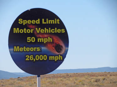
Simply put, the crater was created about eons ago when a rock from space smashed into the Earth. That's the short version. The more detailed account is that 50,000 years ago, an iron-nickel meteorite about 150 feet across and moving at 26,000 miles per hour entered the Earth's atmosphere and crashed into what is now the northern Arizona desert with an explosive force greater than 20 million tons of TNT! The force of the impact created a crater 700 feet deep, over 4,000 feet across and 2.4 miles around. As for the meteorite, any material that did not vaporize or melt during the extreme conditions of the impact was intensely fragmentized, about half of which was thrown out of the crater and the other half is mixed in at the bottom of the crater.
The first written report of the crater was made in 1871. In 1902, a mining engineer from Philadelphia named Daniel Moreau Barringer became convinced that the crater had been formed but a large, iron meteorite and assumed that bulk of the rock was buried under the crater. He came to Arizona in 1903 and spent the next 26 years searching for the giant iron meteorite. While great scientific discoveries were made, there was no huge iron rock to be found under the crater, as the meteorite had totally disintegrated.
The crater has continued to be the sight of study as well as training. NASA has used the site for training astronauts. The crater is a source of information for impacts throughout our solar system. And while bodies such as our own Moon are covered with impact craters and dozens of impact sites have been found on the Earth, a display in the museum indicated that there are currently no known objects on a collision course for our home planet. At least we've got that going for us.
We finally made it through the maze of displays and found the access to the rim of the crater. It was quite warm here today, 92 degrees F, but it was not oppressive due to the lack of humidity. But it was very windy, certainly a hold-on-to-your-hat kind of day. We took in the views from a couple of the vantage points along the rim. I believe this is where we saw the signage that explained about how the Barringer family partnered with the local ranch, Bar T Bar, which owns or leases the surrounding lands. The ranch company formed Meteor Crater Enterprises, Inc. and entered a long term lease with the Barringers. All the facilities at the crater were built but the company.
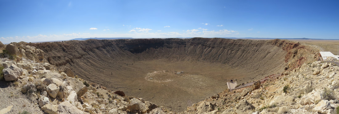
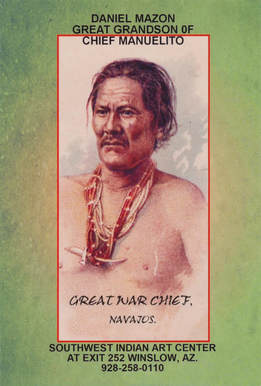
By 12:15 we had seen all we wanted to see and were back at the car on our way to Winslow. We knew we were well ahead of schedule for check-in at the La Posada, so we figured we would see what we might find along the way. When we exited the highway we saw a sign for the Southwest Indian Art Center and decided to check that out. Basically a jewelry store but some other interesting artifacts as well. The place was run by Daniel Mazon, the great grandson of Chief Manuelito, a great war chief of the Navajo. We had a nice chat with Daniel and Lynn got a good deal on some earrings.
After the jewelry stop, we crossed the street to fuel up the Rogue. While pumping the gas, I heard the familiar whomp-whomp-whomp of a helicopter main rotor. That has to be military, and more than one aircraft by the sound. Sure enough not one but two Chinooks were making a low level pass then circled around and landing just to the south of us (I checked the map later, that is where the airport is located). That's quite the variety for today, from the trading post to the crater and now a mini-airshow. And it is only about 1:00. What else might we yet find?
We were heading east on Historic Route 66 into the heart of Winslow. The first areas of town that we drove through were a bit rough around the edges, sort of run down, but as we continued things starting looking more visitor friendly and better kept. Oh, look, there's the corner and the flatbed Ford. Plenty of tourists out with cameras on this sunny day. The La Posada was just a block further up the street, right off of old route 66. We pulled in right at 1:00. I did not think that our room would be ready but we're here so might as well check. I was correct, the room not ready. But they now know that we are coming so maybe that will move room 208 up the priority list a bit. So what to do to kill a couple hours? Lynn remembered passing a park on the outskirts as we came into town this morning so we checked the map, got our bearings and drove over to Homolovi State Park.
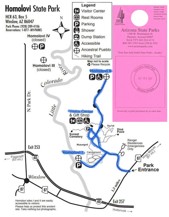
The park is a mile or so east of Winslow on Arizona 87. We started at the visitor center to pay our entrance fee and find out what we might see, do and learn out here. Due to the heat and the completely exposed nature of the park we decided that hiking would not be a great idea. Seriously, this was a fairly flat and very open expanse of desert; there were a few small hill scattered about and a little roll to the terrain along the river, which fits since Homolovi means "place of the little hills." We just took a driving tour through the park and did a couple short walks to view the ruin sites. There were two sites that were open to the public, Homolovi II at the end of the road going north through the park, and Homolovi I, south of the visitor center passed the campground. After the visitor center we drove up to Homolovi II ruin site then stopped at Homolovi I on the way out of the park.
While the majority of the park focuses on the villages and lives of the ancient inhabitants, there was one other display at the visitor center that paid tribute to another very important group of Native Americans, the Hopi Code Talkers of World War II. I knew about the Navajo Code Talkers but had never heard of the vital contributions to the war effort that were carried out by men of other tribes.
Between the displays at the visitor center and the signage at the ruin sites we picked up a lot of interesting information about the area and the people who have lived here over the centuries. We did notice some inconsistencies between the information from the visitor center and out in the field (dates did not always match and there were two Hopi words cited as their name for the Little Colorado River, "Palavayu" and "Paayu". Maybe they used both? Also, out on the field signage the names of the ruin sites were spelled Homol'ovi). Here's the compilation of information from the places we visited in the park starting with a timeline of the habitation and other significant event at Homolovi from ancient times to present day:
- A.D. 620 - 890: The first farmers at Homolovi. These people built and lived in large, round pithouses. They grew corn and beans near the Little Colorado River. The moved seasonally to the nearby mountain to hunt and gather food. They stored food in huge pits.
- A.D. 1000 - 1225: Late Pithouse Villagers. During this period the dwellings were small, square pithouses but the people also built large community structures. They traded for pottery with groups over 75 miles away.
- A.D. 1260 - 1400: Ancestral Hopi. During this period, the inhabitants built villages that were organized around central plaza. Their structures were made of masonry and adobe walls. The also created special rooms for ceremonies. They grew many crops including cotton in the fields near the river.
- 1540 - Spanish Lieutenant Don Pedro de Tovar was the first European to see the Hopi villages.
- 1629 - Spanish Friars established San Bernardo Mission at Awatovi.
- 1680 - The Pueblo people revolt and expel the Spanish.
- 1876 - 1888: Mormon pioneers settled at Fort Sunset where they farmed collectively and shared meals. They constructed dams across the Little Colorado River for irrigation. They grew sorghum to make molasses. This was the site of the first post office in the area.
- 1881 - Winslow founded.
- 1882 - U.S. government created the Hopi reservation.
- 1890s - Jesse Walter Fewkes lived in the Hopi village of Walpi during this period to study the Jopi traditions. During this time he excavated the ancient village of Sikaytki on First Mesa. He also learned about the Homolovi area from the Hopi clan histories. In 1896 he excavated and named the Homolovi pueblo sites. [Fewkes was a prominent archaeologist who also studied ruin sites in Mesa Verde, as we learned when we visited there last year].
- 1912 - Arizona became a state on February 14th.
- 1936 - U.S. government recognized the Hopi Tribal constitution.
- 1986 - Homolovi State Park is created to protect the Hopi ancestral sites from looting. The park opened in 1993.
There are four pueblo sites that are being studied within the park; they are listed below by age, oldest to newest:
- Homolovi IV (A.D. 1260 - 1285); 30 - 40 household: The families at this site used pottery and architectural designs similar to people who lived to the north. Based on these similarities, archaeologist think that the residents of Homolovi IV migrated here from the Hopi Mesa and neighboring areas.
- Homolovi III (A.D. 1285 - 1305, 1330 - 1385); 10 - 15 household: In the early 1300s, flooding from the Little Colorado River damaged parts of this village, and the families moved away. After A.D. 1330, people returned and lived at this site during the farming season. The rest of the year they live at Homolovi I.
- Homolovi I (A.D. 1290 - 1400); 100 - 125 households: In the early 1300s, the village increased in size. Families built new rooms out of adobe bricks, as construction technique invented in this area. The large southern plaza was added after A.D. 1350 by raising the ground to avoid river flooding.
- Homolovi II (A.D. 1360 - 1400); 200 - 250 households: Many of the rooms in this large village were built at the same time. Archaeologists think that families from the Hopi Mesas, about 60 miles north, migrated to this site together (the sing at the ruin site indicated these people first arrived in Homovoli around A.D. 1330). These people built a 1200 room village; 750 to 1000 people lived in this pueblo. The people farmed in the flood plan and in the sand dunes. They grew corn, beans, squash and cotton. Then also gathered wild foods such as pigweed, Indian rice grass, cactus and yucca fruits, and pinion nuts. Cotton cloth was exchanged with the inhabitants of villages north and west. Research and excavations reveled three plazas, outdoor activity areas, possibly 40 kivas and living, working and storage areas. The oldest section of the pueblo was the Central Plaza. At one time, the rooms surrounding the plaza may have stood as high as three stories. Traditionally, the plaza area symbolized the Center of the Universe and played an integral part in the lives of the people who lived here. This area was also a location for kivas, ceremonial structures used for religious purposes. In Hopi oral tradition, the kiva was always the most important area of the village. The East and West Plazas were added after construction of the central room block, possibly to accommodate an expanding population. Secondary plazas were also built for special needs such as women's ceremonial performances. Paintings on pottery and in the kivas depict katsinas, which became increasingly important in religious ceremonies during the 1300s. Prior to A.D. 1400 the people of Homolovi II along with others, left the middle Little Colorado River valley. Hopi oral history and archaeological clues suggest that the people made their way back to the ancestral villages on the Hopi Mesas after leaving the Homolovi area. Their descendants return periodically to gather wild resources and visit shrines.
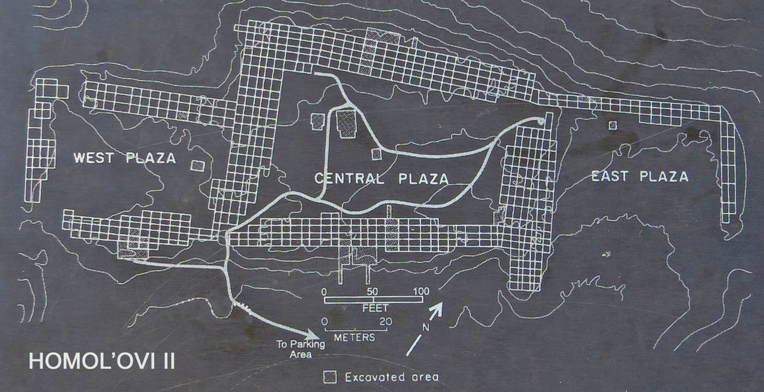
What is a Kiva? A kiva is a special room in a pueblo village used for religious purposed. Kivas are also used by Hopi people as gathering places to meet and for other activities such as weaving. Every Hopi village has several kivas dedicated to the various religious societies. Archaeologists working at the large Homolovi pueblos found kivas in the plazas of each village. This large room is built below the ground with the roof at ground level. The only entrance to the kiva is through a ladder, location in the middle of het roof. A sipapu is a small hole in the floor of kivas used by ancient and modern-day Pueblo people. It symbolizes the portal through which their ancestors first emerged into the present world and is a connection to ancestors in Hopi ceremonies today.
The largest of the kivas in Homolovi II measures 19.7 by 32.8 feet and is 6.6 feet deep. The pit near the south end of the structure is a hearth, and the small stone wall deflects and circulates air coming in from under the bench. The large pit at the north end of the kiva may represent a sipapu, symbolic of the hole of emergence.
Weaving in Kivas. The Hisatsinom, the ancestors of the Hopi people, started to grow cotton in the Homolovi area 700 years ago. Archaeologists have found the remains of cotton plants, textiles, weaving tools and looms. Rows of holes in the flagstone floor of kivas were used to anchor looms stretched between the floor and ceiling. Homolovi II kivas contained more loom holes than any others. This village was a center of cotton production and weaving.
The Hopi call "people of long ago" Hisatsinom. The Hopi believe that all the Hisatsinom who lived at Homolovi are their ancestors.
Growing Cotton. The Little Colorado River was an asset to the ancient people who lived at Homolovi. Cotton needs substantial and consistent water to grow, so it was planted in the floodplain of the river. Farmers who grew cotton needed to carefully water their fields using the river and protect the plants, especially during periods of flooding in the late summer. The Hisatsinom grew enough cotton at Homolovi to trade for non-local goods, such as yellow pottery mode on the Hopi Mesa.
The Little Colorado River was a year round source of water. Even when dry, water can be found a few feet below the sand. The river supported a variety of plant and animal resources, including beaver, elk, antelope, deer and waterfowl, important to the diet and rituals of the people who lived here. Then inhabitants of Homolovi II used the floodplain of the river to plant crops and harvest native plants for food, medicinal herbs and ceremonial use.
The San Francisco Peaks (12, 670 feet), the highest mountains in Arizona, are visible on the horizon looking southwest from Homoloi II. The Hopi call them Nuvatukya'ovi and believe they are the home of the Katsina spirits. Katsina are supernatural beings with the power to bring the rain needed to make crops grow and produce a bountiful harvest. They played an important role in the religious beliefs of the people who live here. Katsina ceremonies are still conducted in the village plazas on the Hopi Mesas.
Looking north from Homolovi II, off in the distance, are several mesas. There are called Tuutukwi or the Hopi Buttes, sacred places in Hopi religion. Today, they are used as eagle gathering areas by certain Hopi clans.
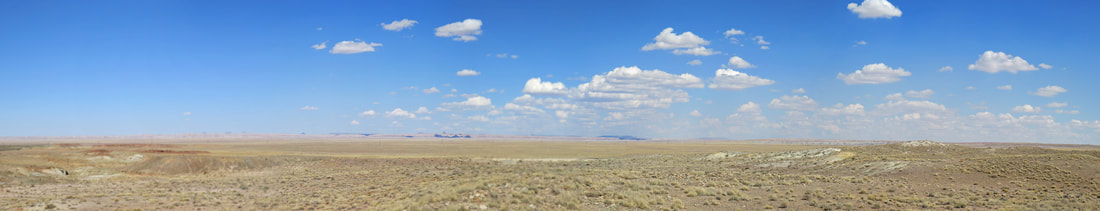
View looking north from Homolovi II.
Homolovi II was an impressive site and an expansive community. The site was on top of a little knoll just to the east of the river. The excavation work (and probably some reconstruction) made it fairly easy to see the layout of the village. The remains of the plazas, surrounding rooms and the kivas were evident and there were pottery sherds strewn all about the site. In several spots the sherds had been collected and arranged on flat rocks to show the variety of colors, patterns and textures in the pottery. The flat rocks were probably at one time part of the walls of the pueblo.
We had the place pretty much to ourselves. There was one other couple leaving Homolovi II when we were walking up the hill, then when we were leaving a fellow in a classic car pulled into the parking lot. The only other person we saw was a guy on horseback, probably out checking on the cattle or inspecting fences (not that I recall seeing much in the way of fences). He had parked his rig near the Homolovi II parking area, truck and trailer detached. While we were at the ruin site we saw him arrive at the truck then the next time we looked in that direction he was gone. Could not have been more than a couple minutes and he had the trailed hooked-up, the pony loaded, his gear stored and he was gone. I always had to plead with Mason for 30 minutes to get his sorry carcass on a trailer. This guy must have been the freakin' horse whisperer. Our last stop in the park was at Homolovi I, and there was no one else at the site. However I was surprised to see that the campground was rather full. Not a lot of activity during the heat of the day but a lot of RVs and trailers parked about the area.
Not much in the way of wildlife sightings while out in the park. Granted it was the middle of the day and quite warm. Shoot, we did not even see any lizards. We did spot a Great Egret along the river and saw a few Mourning doves and Rock Doves, plus a little hawk or falcon of some sort. We did see some rather impressive cattle, longhorns and they were well named. They are actually quite striking with their headgear and patterned hides. They were scattered along the rode as we drove to Homolovi II, and were ranging freely so caution was in order in case some bovine was standing in the middle of the road as we rounded the next bend. Fortunately there were no such encounters for us today.
Homolovi I was much smaller than Homolovi II and not as well defined in terms of how the village was laid-out. Tons of sherds again scattered around. We walked the short trail through the site then headed out of the park as it was now nearly 3:00. Homolovi photos.
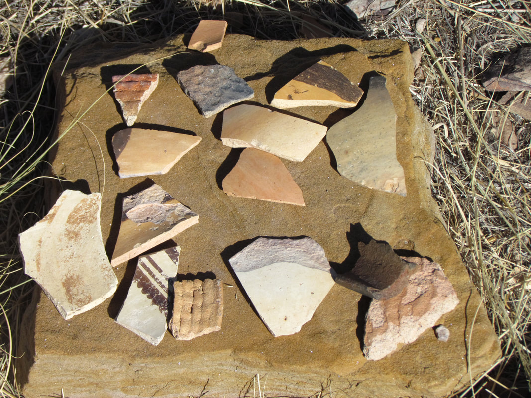
Sample of pottery sherds from Homolovi II.
|
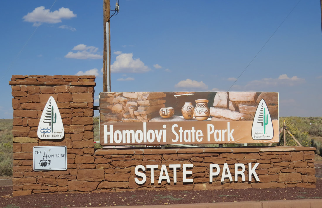
I got our state park passport stamp on the way out of Homolovi.
|
Back at La Posada, the parking lot was getting jammed and many of the slots were filled with classic cars, a high percentage of which were Corvettes. Pretty cool. They must be on some sort of cruise. Well, this is Route 66.
The bad news is that our room is still no ready. What's up with that? According to the status board behind the registration desk indicated that room 208 was the last one to be cleaned, but we were assured that it was nearly ready. OK, we've some time to start exploring this very interesting hotel. This place will take a while to thoroughly check-out. Our room was finally ready at 3:20. We collected the old school keys and lugged our gear upstairs to our room. The keys were not the only old school feature, or lacking feature, as there was no elevator, not that we cared. We stored the bags and checked out our room. Not a huge room, but still plenty of room. Small balcony, but again enough space for us both to hang out and enjoy the day. We needed to get some ice for the remaining beer and wine. Lynn took that assignment while I confirmed with Rock Art Ranch. We're on for tomorrow at 10:00. Brantley reminded me to pick up a map to the ranch at the hotel registration since GPS will not get us there.
Since Lynn was not back yet I went out in search of her but caught her as she was coming up the slightly curving staircase. "So what took so long,” I asked, "couldn't you find the ice machine?" Turns out getting to the ice machine is a bit of a hike, back to registration desk, through the gift shop, down another hallway and there is it, tucked away in a room off the end of that mirror lined hallway. She had filled two bags of ice. I don't blame her since it was an adventure finding the ice machine. As we were walking up the hall one of neighbors was coming our direction, an older gentleman wearing a military veteran hat. We exchanged pleasantries and chatted for a minute. Turns out that he was also in search of ice. Lynn gave it the path to the machine. His eyes glassed over. "OK, I guess I really don't need ice," was his response. Fortunately Lynn had two bags of ice, so we gave him one. Our good deed for the day. One bag was sufficient to get us started. I went back later and topped off our cooler. Gotta take care of those last few beers. Speaking of which, it was time to go in search of something to drink.
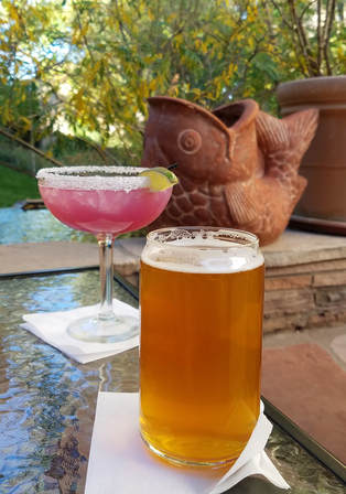
We walked down to the bar and looked at the options. Lynn had a prickly pear margarita and I went with a Tower Station IPA from Mother Road Brewing. We asked about taking our drinks out to one of the outdoor area; perfectly fine, we could carry our drinks anywhere we wanted. Excellent! We went out to a little courtyard area and landed in a couple of comfy chairs. Ideal for a relaxing afternoon drink. There were a few other guests out there, reading books or tablets in lounge chairs. Lynn and I were just enjoying the pleasant afternoon. We went over our plans for the last days of our trips, Rock Art Ranch tomorrow and a road trip to Petrified Forest on Saturday. We'll check out Winslow at some point as well. The bonus was that there were several birds flitting about in the trees and shrubs in the courtyard, including a Townsend's Warbler, a new sighting for our list.
After finishing our drinks we still had some time to start looking around this fascinating hotel before our dinner reservation. All of the rooms in the hotel are named for a famous person, mainly Hollywood types and other entertainers but some politicians, athletes and other historical figures. Our room, 208, was the Bob Hope room. We'll have to survey the rest of the hallways to see who all we recognize.
Lining the first floor hallway in our wing of the hotel were painted panels by Santa Fe artist Ernesto Martinez. These painted panels were created by Martinez for the La Fonda Hotel. These panels were once used as headboards for beds in La Fonda guestrooms. Mr. Martinez was hired part-time by La Fonda Hotel in 1954 and for over 50 years he worked to decorate the hotel with hand crafted tin work, furniture and paintings. Over that time Mr. Martinez completed over 1000 art works for the hotel and his trademark style is considered a significant influence in the development of Santa Fe style. In 2012 La Fonda Hotel underwent a major restoration project. The owners of La Fonda contacted La Posada Hotel's owner Allan Affeldt and asked if he would be interested in purchasing the spare Ernesto Martinez painted furniture left over after renovations. Mr. Affeldt purchased over 900 Ernesto Martinez items and today these pieces can be found in the guest room and public areas of La Posada Hotel, as well as Hotel Castaneda and The Plaza Hotel in Las Vegas, New Mexico.
We also got our introduction to the Tina Mion artwork that is featured throughout the hotel. The first one we studied was the large painting at the base of the stairs leading up to our floor, "Louisa Adams, the Six of Clubs" with the subtitle "Foreigner." The placard next to the painting provided some historical perspective on the subject of this painting:
Louisa Adams was the only foreign born first lady, born in England to an American father and an English mother [Melania Trump is now the second]. She was raised in England and France and did not set eyes on the United States until she moved there with her husband of five years - John Quincy Adams - when she was twenty-seven.
Louisa felt trapped in an unhappy marriage. She found her husband's reserved, abrupt manner coarse and insensitive - especially towards women. Louisa struggled to retain her individuality while remaining a devoted wife. As a young woman she was discouraged from studying astronomy because she was told it would be too difficult. She was an avid reader, sketched, wrote plays, prose and poetry, played the pianoforte and harp, and raised silkworms.
Louisa had twelve pregnancies and seven miscarriages; only three children, all sons lived to maturity. The losses of her children and the emotional loneliness she felt in her marriage contributed to her depression, fainting spells and periodic reclusion.
Louisa and her husband did share a belief in abolition and had many abolitionist friends. Louisa's feelings of entrapment, brought on in park by the limits placed on women of her time, undoubtedly made her even more sensitive to the horror and injustice of slavery.
Painted headboard by Ernesto Martinez.
|
"Louisa Adams, the Six of Clubs" by Tina Mion.
|
|
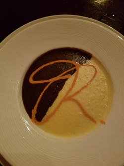 The signature soup from the Turquoise Room.
The Turquoise Room in the La Posada was a great choice for dinner, just as Frankie and Alex indicated. There were plenty of interesting items on the menu to fill three days. Our server was Vanessa and she was exceptional. I had the soup, a combo black bean and corn chowder, followed by the shrimp pasta. Lynn had a salad and grilled chicken. The plan was to split these as we were both interested in each. Good plan! The shrimp pasta was the favorite for tonight.
We were done with dinner about 7:15. We wandered about the hotel some more, carrying the remainder of my beer. We were back in the room about 7:45, broke into our stash of dark chocolate for dessert....then we crashed.
Day 10, Friday, October 6 - Rock Art Ranch. You know the drill by now. I was awake at 0445. Lynn finally stirred a little after 0500. We puttered around in the room and got ready for the day, then went down for breakfast in the Turquoise room when it opened at 7:00. I had oatmeal and a bagel, but Lynn went all in with the fancy bread pudding loaded with fruit and topped with prickly pear syrup. She said it was excellent. Afterward, we looked about the grounds briefly but it was quite chilly this morning under the clear blue sky, so we went back up to the room for our jackets then sat out on the balcony. Plenty of birds out this morning but tough to get clear views in the trees, but we did spot Juncos, Mourning Doves, Starlings, a Downy Woodpecker, a Yellow-bellied Sapsucker (identified once we got home where I could study the photos on a larger screen) and several others that we could not clearly identify.
At 9:10 we got rolling. The parking lot was pretty empty already; all those Corvettes we saw yesterday must be out for a cruise already. We figured getting on the road at this time would give us plenty of time to get out to the ranch, but a misdirection getting to route 87 south ate up our contingency time. Once we were on track we had no other issues and made good time. Fortunately the dirt roads we were driving to get out to Rock Art Ranch were in great shape so I made really good time in the Rogue (which was now getting a more of a reddish-brown tinge from all the dusty back roads we've been on this week). The flyer that we had picked up yesterday from the hotel was very helpful in finding the location of the ranch, once we got on to route 87 south. We were only a few minutes late, so no harm done.
There were four other folks on the tour. During the course of the tour we figured out that the couple who were a little older than Lynn and I were a retired dentist and his wife, a semi-retired lawyer. The other two were a guys who had grown up in the area and were back here for a visit. It seemed like they were working on some sort of historical research on the area. Our guide for today was the long-time owner of the ranch, Brantley Baird. Brantley is a true character, a throw-back to the old west, a real cowboy. He was ably assisted today by Brandy the wonder dog.
The tour started at the museum at the ranch house. We started looking at a variety of Indian artifacts that were found on the ranch by Brantley and his family over the years. There were dozens of large pottery pieces, tools and weapons. He demonstrated some of the tools, such as a primitive drill. Outside he showed us an example of an old bunkhouse that the cowboys might use after brining the herd into town. This was the last remaining bunkhouse of the Hashknife Cattle Company, one of the largest ranching operations in Arizona in the 19th century. There was a collection of random farm equipment and a couple old cars, a Pontiac sedan and a Chevy pick-up, both from the 30s or 40s. He indicated that he's received some very good offers for those rusted old hulks but he's not selling as he likes them just as they are. There was also many sections of petrified logs scattered about the grounds. He had these colorful rocks scattered all around his outdoor displays. As we were walking out to the cars to continue the tour, Brantley showed use the memorial he had built to his wife of 60 years and two other dear friends who he had lost in the past year. A touching tribute.
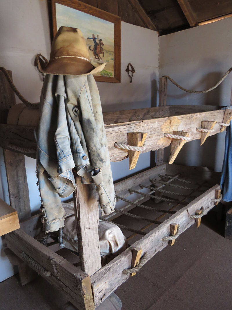
|
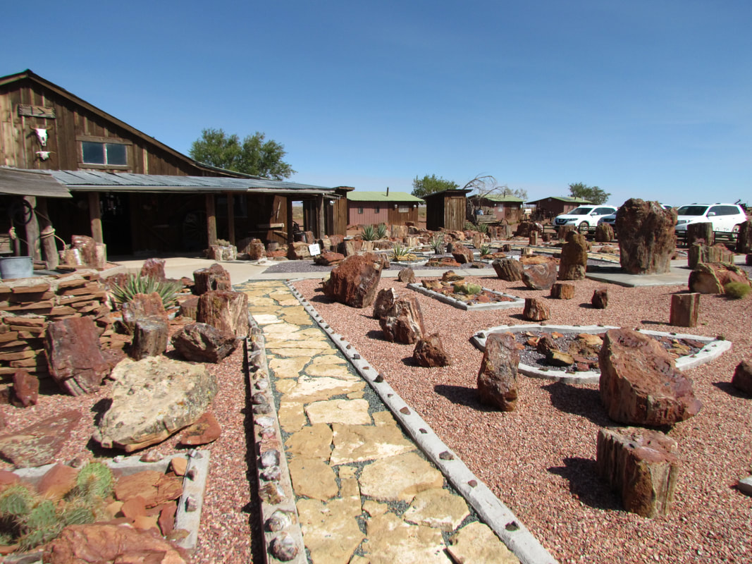
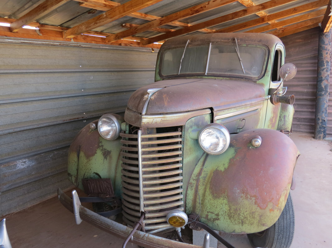
|
We had a lovely day on the desert for the tour. The stops we made were all out in the open, so it would probably be brutal in the summer but today the temperature ranged from the upper 60s to the upper 70s under clear, blue sky. I don't think that we saw cloud all day. Plus there was a slight breeze blowing which also kept it comfortable. For the tour to the other locations around the ranch, we drove our own cars and followed Brantley and Brandy as they lead the way in their utility truck, ATV gizmo. They led us to several sites on the way to the rock art canyon. Here's the summary:
- As we were leaving he said we would make a quick stop to see Shauna's alligator. Sure enough, there it was. Well, at least it looked like and alligator.
- Next was an archaeological excavation of a pueblo site. I bet there are dozens of these sites scattered over Brantley's ranch. There were pottery sherds and stone tool pieces all over the area. Brantley hosts archaeologists, including students, to study the sites on his ranch. He had built the structure over the site at the request of the archaeologists to protect the excavation. Seems they had a little issue with the structure just before it was completed when a wind storm blew it over, but they got it all back in order. The archaeologists have dated the dwelling sites as about 1500 years old. The rock art dates back as far as 7500 to 6000 BC, so as much as 9500 years old. Brantley also had a story of the archeologists incorrectly dating an object. A Navajo boy who worked for Brantley made an arrowhead using the same techniques that the ancient inhabitants used. Two weeks later, Brantley presented this "artifact" to the scientist and asked about the age. 4000 years old was the answer given.
- A short distance from the pueblo was another dig site, this one of a kiva.
- We drove a little further to an area the Navojo used in more recent times for herding cattle and sheep. There were remains from old rock-walled houses and a sheep pen. The Navajo had also built hogans and a sweat lodge. These are current day structures, but built in the style of Navajo tradition. Brantley said that he has some of the local Navajo women come out and repair the structures and it was past due for the work.
- An extremely fascinating find was an ancient map to a water source. This was a large petroglyph panel but rather than being on a vertical wall of a canyon as is usually seen, these etchings were in a rock that was lying flat in the wash bed. The symbols were hard to make out in the direct sun, but Brantley pointed out the flow of the map and how it matched the bends in the canyon to provide directions to a permanent water hole in the canyon.
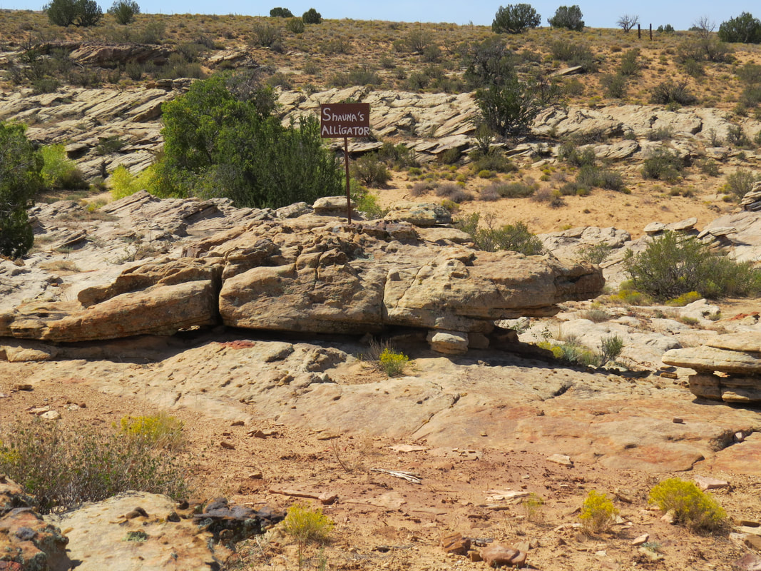
Shauna's Alligator.
|
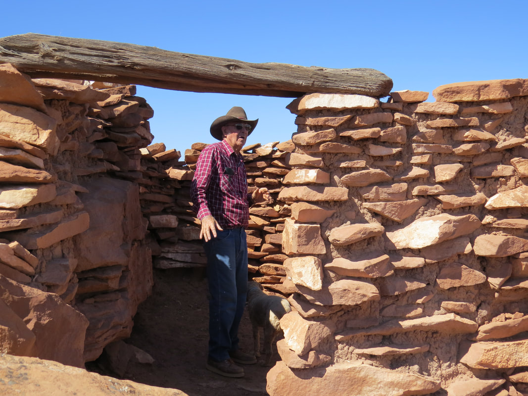
Brantley telling us about the old rock houses.
|
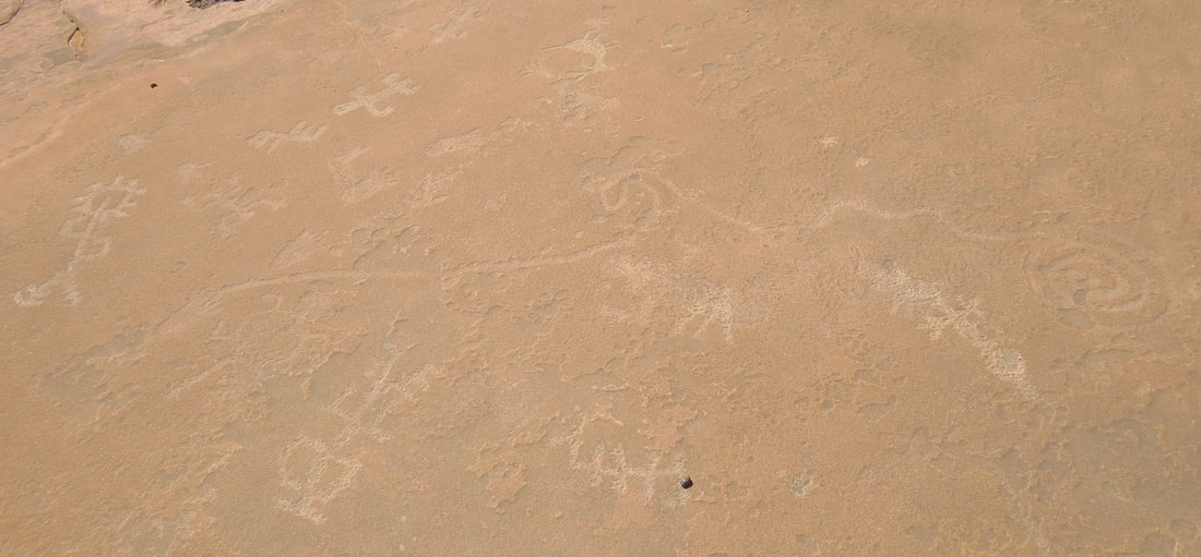
The map to water.
The final stop was at Chevelon Canyon to see the rock art. Brantley had built a covered viewing platform with picnic tables at the canyon rim for folks to take a break and have lunch. They had also built metal stairs leading down into the canyon. They were sturdy enough and had sufficient railings, but still I'm not sure they would be OSHA approved. Brantley gave us a bit of an overview of the canyon and pointed out were several of the more unique panels were located and what to look for while in the canyon. Then he turned us loose. Yep, we are on our own to explore in the canyon for as long as we wanted. He just asked that the last ones to leave to give him a call so he can come out and lock the gate.
Now that we have the lay of the land and the ground rules, we walked back up the hill to the parking area to get our packs. We stopped to say good-bye to Brantley and Brandy. He took the time to show us the buckets full of sherds and tools in the back of the utility truck that he had collected. He indicated that these had all been cataloged by the archaeologists. He picked out a couple of pretty pieces and gave them to Lynn. A very nice gesture and a couple of really cool souvenirs.
We got our packs and headed down into to the canyon. Time to check out the rock art up close! It is estimated that there are 3000 petroglyphs on the canyon walls. Now that we've been down there for a look around, I wonder if that number is high enough. The varnish covered walls of the canyon are positively filled with etchings of all matter of images. There are everything from deer and antelope to human figures, geometric designs…just about anything imaginable. There were just some really cool panels and some really weird stuff as well. Brantley has photos of several of the key panels at the observation deck. He never provided any interpretations of the carved images, stating that we just do not know exactly what message the ancient people were trying to convey. I get that. Still, the meaning of some of the images are probably not that deep, just a record of an event like a hunt. But many, if not most, of the others are certainly a mystery.
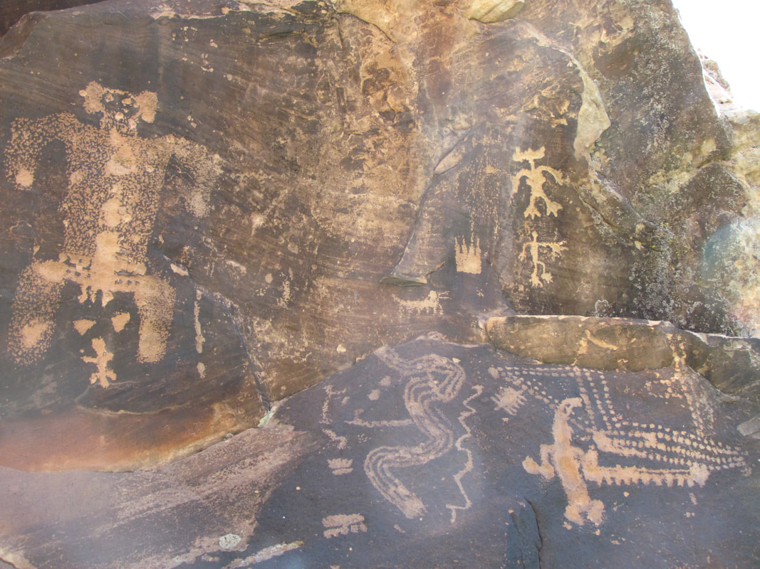
|
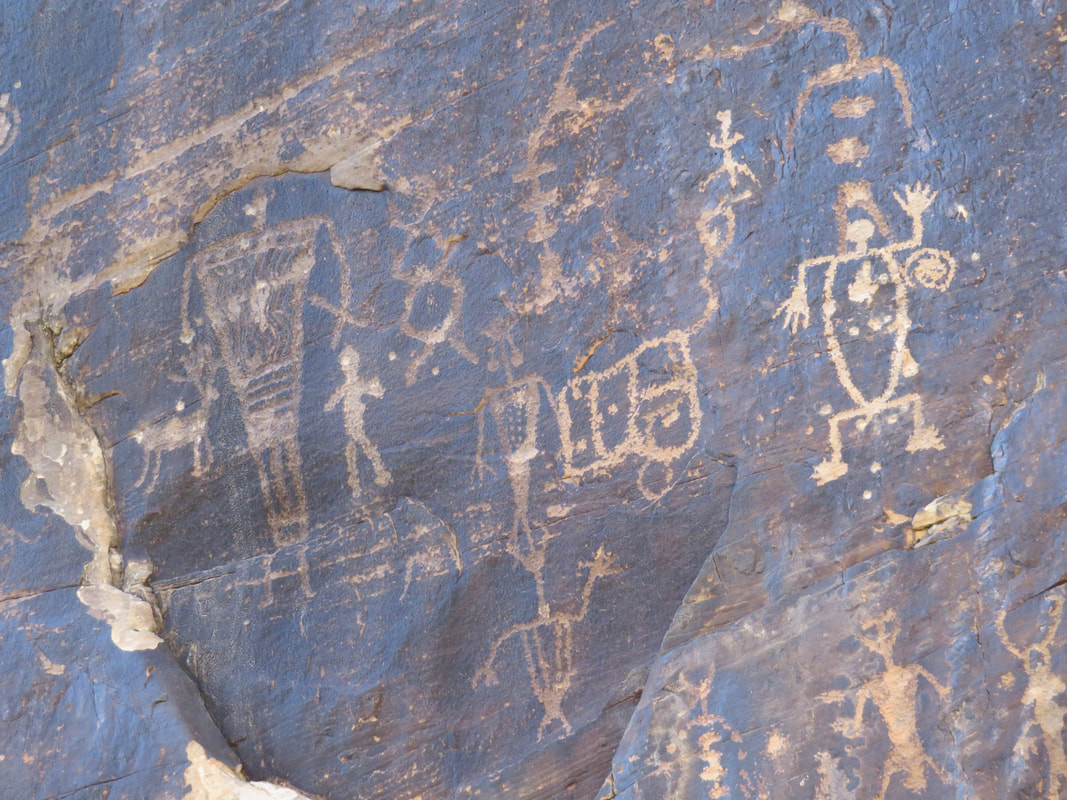
|
 Common Buckeye.
Not much in the way of critter sightings today. Maybe in part because we were out in the middle of the desert in the middle of the day. Of course we saw plenty of Brantley's cattle roaming about, particularly when we were at the hogans, plus there were a few gone birds there as well. In the canyon we saw a lizard or two and a few butterflies (Common Buckeye and a Painted Lady). Lynn also spotted a jack rabbit scurrying about as we were touring about.
After we toured the canyon, we chatted with the retired dentist and semi-retired lawyer on the observation deck. We were all having a snack before getting on the road. They asked what we do for a living so we let them know that we are engineers at NASA. This prompted them to share that their son is a physicist. He said that that with the Higgs boson all the major discoveries have been made in physics (funny as this was the theme of “Big Bang Theory” this week, which we did not see until we returned home and saw the recording).
That was a fun little adventure. It did take most of the day, but it was well worth it. Brantley was a great guide and excellent host. He really enjoys sharing his collection and informing folks about the history that took place on his ranch. And now that we've paid the entrance fee, we are part of the family, according to Brantley, and are welcome back at any time. Photos from Rock Art Ranch.
We were done at the ranch at 3:30 and one our way back to Winslow, arriving back at La Posada at 4:00. OK, now this all makes sense. There's a classic car rally going on in "downtown" Winslow. That explains all the great old cars we have been seeing at La Posada and elsewhere in the area. There were several beautiful old rides parked at La Posada. Gold, no bronze, maybe copper, yeah let's go with copper Riviera in the parking lot; amazing paint job and sleek look with no chrome adornments. Then a Studebaker Lark VIII just a few slots away. Really lovely old vehicles. We were on our balcony with a beer by 4:20. At 5:00 I walked down to the Turquoise Room and made dinner reservations for 6:45. Then back to the balcony for a second Upslope IPA.
We got cleaned up then went out about 6:00 to finish exploring the hotel. Fascinating place with a very interesting history. Between the signage in the hotel and the printed tour guide provided to the guests, we got a good snapshot of story of the hotel. The La Posada is part of the Fred Harvey hospitality empire, the series of hotels, restaurants and gift shops that he built and managed along the route of the Santa Fe Railroad. During the 1920s, Harvey decided to build a major hotel in the center of northern Arizona. “La Posada”—the Resting Place—was to be the finest in the Southwest. Construction costs alone exceeded $1 million in 1929. Total budget with grounds and furnishings was rumored at $2 million (about $40 million in today’s dollars). They chose Winslow, then (as now) the Arizona headquarters for the Santa Fe Railway. Winslow was ideally situated for a resort hotel since everything to see and do in northern Arizona is a comfortable day’s drive. They asked Mary Colter to design the new hotel. Colter worked for the Fred Harvey Company from 1905 until her retirement in the 1950s. Although famous for her magnificent buildings at the Grand Canyon, she considered La Posada her masterpiece. Here she was able to design or select everything from the structures to the landscape, furniture, maids’ costumes, and dinner china. Many people consider this the most important and most beautiful building in the Southwest.
La Posada opened May 15, 1930, just after the stock market crash of 1929, and remained open for just 27 years. In 1957, the hotel closed to the public. The museum-quality furnishings were auctioned off in 1959. In the early 1960s, much of the building was gutted and transformed into offices for the Santa Fe Railway. Several times over the ensuing 40 years, the building was nearly demolished, as recently as 1994 when the railway announced its plans to move out for good.
The National Trust for Historic Preservation found out about La Posada’s peril and added it to their endangered list — where it came to the attention of Allan Affeldt. But La Posada was never for sale. Allan Affeldt purchased it from the Santa Fe Railway after learning that the property was in danger. He visited the hotel in 1994 and decided to help local preservationists save it. This daunting task entailed negotiating for 3 years with the railroad and resolving various legal, environmental, and financial obstacles. He established La Posada LLC to take on the enormous risk and complexity of the estimated $12 million restoration. Allan and his wife Tina Mion moved in April 1, 1997. Daniel Lutzick became the third partner and General Manager. Although none of the partners is a hotelier by training, they have accomplished what once seemed impossible—transforming a forgotten but magical place into a living museum. Allan oversees the overall rehabilitation—design, architecture, financing, and planning. Tina, a renowned artist, paints in her studio upstairs; her art is now an integral part of La Posada experience. Dan, a sculptor, maintains day-to-day operations of the hotel as general manager and coordinates exhibits and events.
All I can say is that it is an amazing place. It is wonderful that it was saved from the wrecking ball. There is a lot of history in its hallways. There is a long list of famous folks who have stayed here, actors, aviators, politician, scientists; sort of a "who's who" from back in the day. Here's the short list of the folks that was most interesting to me: Gene Autry, James Cagney, Mary Elizabeth Jane Colter, Jimmy Doolittle, Amelia Earhart, Albert Einstein, Clark Gable, Howard Hughes, Charles Lindberg, Wiley Post, Will Rogers, President Franklin Roosevelt, Jane Russell, Jimmy Stewart, President Harry Truman, and John Wayne.
We saw more of the artwork by Tina Mion, the wife of hotel owner, displayed about the hotel. Bizarre stuff for the most part. While interesting, perhaps even thought-provoking, there was nothing that I would hang in my house (but that's the case with most art that I see). I did enjoy her work and took the time to read about many of the pieces that were on display. There were whimsical themes but most of the paintings had were sort of dark. She had a couple of interesting series of paintings going, one was tied to a deck of cards (like the Louisa Adams - 6 of clubs) and there was a series of famous women spoons. I found this blurb about the spoons on the artist's website: The women on these spoons live on in America’s collective memory. They are the guilty ones, even though the details are rather sketchy. Were these women actually criminals, or were they just convenient scapegoats, outside the conventional roles allotted to women of their time?
The website also had this background on Mion's King of Heart's painting: In the 1940s, Harold Edgerton invented stroboscopic photography, which allowed him to create “stop-action” images such as a bullet piercing a card. In 1963, television made it possible for an entire nation to witness the stop-action assassination of President John F. Kennedy, and Jackie’s reaction. In a deck of cards, the King of Hearts is the “suicide king” — so-called because he is nearly always thrusting a sword through his head. Some called JFK suicidal because he insisted on riding in public without bulletproof protection. I painted two swords for the theory that two bullets were fired from different directions. This painting represents the instant President Kennedy was hit. Jackie doesn’t know what has happened yet, but she knows it’s bad. The painting is meant to capture the last moment of innocence for Jackie — and for an entire generation.
Some of her paintings were huge, like the 7-by 18-foot oil on linen that she did in 2004 of a “New Year's Party in Purgatory for Suicides, in which Liberace makes a guest appearance down from heaven just for the hell of it.” She also included herself in scene, so the artist and Liberace are the only ones at the party who did not commit suicide. Ms. Mion provided this background about the painting on her website: Early in the 14th century, Dante Alighieri placed suicides in the second lowest level of his Inferno. Many major religions likewise condemned suicides to hell; my feeling is that this only adds to this pain of the families and shuts the topic behind closed doors. By taking an empathetic view of suicide, I chose to herald them into purgatory, and throw them a New Years party. Since a suicide defined the end of each guest’s time on earth, a party that marks the passage of time seemed somehow relevant. The guests bear the reminders of their final act. Liberace did not commit suicide but loved a party, especially one with so many interesting people, so he is visiting from heaven. One of his poodles sits on his lap, thus answering the question, “Do dogs have souls?” I’ve included all kinds of suicide: death by substance abuse, unbearable grief, a sudden deadly depression, a rational end to pain, a loss of hope, overwhelming loneliness. I do not condone suicide, but it has touched all our lives, mostly in silence. It is so prevalent in our society that it deserves to be depicted and discussed.
|

|
|
|
Time for dinner, so we made our way to the Turquoise Room. Vanessa was again taking care of us tonight. Elk medallions for me, steak for Lynn. Very good but last night was better. We started with the squash blossoms as this was the seasonal appetizer and came very highly recommended from Vanessa. The green chili salsa made it for me. We split a crème brulee for dessert; it which was a small serving, but delicious. Actually just enough to top off another fabulous meal in the Turquoise Room.
After dinner, we just meandered back to the room and called it a day. Lights out at 8:30.
Day 11, Saturday, October 7 - Petrified Forest Nation Park. Lynn is really sleeping in this morning. It is almost 0600 and she is still out. No worries as we are not on a schedule today. I just worked on the trip journal while I waited. Yet another advantage to keeping the notes in OneNote on my phone since I can type in the dark. She was finally up at 0600 and immediately got dressed and headed downstairs for coffee. She came back with two cups (I don't drink coffee).
I went out on the balcony at 0700. We have a beautiful day in store for us but it is brisk at present! There were lots of birds, but none posing for the camera although I got enough to identify a Red-breasted nuthatch. The ever present freight trains were rumbling by behind the hotel. Lynn and I both grew up living around trains, so we really did not notice them that much. To me these were just everyday sounds. I actually find the rhythmic cadence of a train rolling along the tracks rather soothing. Compared to the railroad, there was not much in the way of traffic on the streets. Overall, this was just a peaceful Saturday morning in a small town.
Lynn asked if I was hungry. I guess I could skip the big breakfast and just grab a Pop-Tart on the way to the park or just snack on the nuts and trail mix we already have. That might get us on the road sooner. And it did, as we were loaded up and heading to I-40 east at 0745.
Our plan for Petrified Forest National Park was pretty simple. We would enter the park at the entrance off of I-40 near the Painted Desert visitor center then follow the park road through the Painted Desert then south through the park, stopping at any of the viewpoints and other points-of-interest that caught our eye. Our last stop would be at the Rainbow Forest visitor center and we would exit there at route 180 and take that back to Holbrook where we would catch 40 west. Baby said the drive time was about 50 minutes. Ready. BREAK!
I-40 is certainly a main artery for commerce and tourism. There was plenty of traffic already at this relatively early hour, particularly the big rigs. And there will be more piling on soon as the rest areas and several exits were lined with trucks. But it was still an easy road to drive. I had the cruise set at about three over the limit which seemed to fit the flow of traffic.
The rails were also busy this morning. We passed a couple mixed freights on the tracks that parallel the highway. That took me back to our big family "out west" road trip when I was a kid. Probably 1975. Six of us piled in to Uncle Jim's Ford LTD. We made the big loop, going west along the southern route through Texas, New Mexico and Arizona before turning north into Utah and on to Yellowstone and through the Badlands. We traversed this section of I-40, I'm sure. In fact, one of those childhood memories that has always stuck with me is from a section of Interstate in the desert southwest with the mainline railroad running alongside, just like this. Granted, we were driving west back then, but I still recall pulling onto the shoulder and the two railroaders getting out and watching an eastbound freight train rumble by. Dad was an engineer and Uncle a conductor, so the railroad is what they knew. I remember thinking that they were on vacation from the railroad and this is what they are doing for fun. Well, who am I to judge. Seems that I was just watching two Chinooks cruising overhead recently.
Nothing else of great interest along the drive. Just cruising through the desert, past a few tourist trap stops, by a couple small bergs and another power plant. Looks like another coal-fired facility, maybe also a Navajo enterprise.
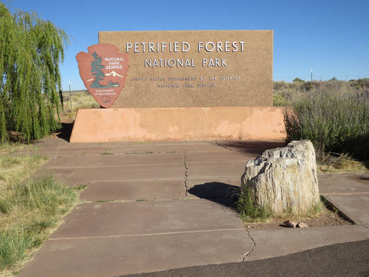
We arrived at Petrified Forest right at 8:35, just as Baby predicted. We made a short stop at the entrance sign for the obligatory passport stamp and then drove to the visitor center for a quick peek. There were only a handful of cars in the lot. The little gift shop had our souvenir lapel pins, so Lynn picked out her favorite then we went to checkout. That's when the bus tour showed up. Lynn decided to go over to the larger shop in the next building before it was completely over run. Fine by me, as I'm not interested in that stuff.
So I'm just waiting in line with my pins until it is my turn. The family in front of me are getting the run down on things to see and do in the park from the volunteer. She is also trying to tempt the little boy with the Junior Ranger program. Shoot, I think that would be fun to do. Anyway, it is all good info. They have their questions answered and their map in hand, thank the volunteer then turn to leave. Just as I am stepping up to the counter an older lady from the bus tour just cuts me off. Totally oblivious that I was waiting in line. I just shook my head and let her go, no sense in me calling her out just because she's clueless. Fortunately she did not take long. I finally bought my pins and went out to find Lynn. She was just finishing up in the big store. No loot this time. I suggested we get moving to put some distance between us and the bus. Lynn had overhead that the tour was not coming into the park, the visitor center was their only stop as they were going to the Grand Canyon. Ok, good news for us, I reckon.
I presented my America the Beautiful pass at the entrance station, collected the map and proceeded into the amazingly diverse little park. I know that we stopped here 40-plus years ago during our family adventure, but that was before I had an appreciation for these places so I don't recall any specifics. Well, I now appreciate the National Parks and the desert southwest, and Petrified Forest will not be forgotten. There is so much to see and such a variety of points-of-interest scattered throughout the park; the colorful landscapes, pueblo ruins, petroglyphs, geology, tourism history, dinosaurs and fossils and of course petrified trees. This was mostly a driving tour. We cruised along the park road and hit most overlooks and points of interest. Many of the views were right at the parking lot, just step out of the car and take it all in. Some required a short walk to get to the focal point and a couple had options for longer walks. Those were the best. Blue Mesa and Crystal Forest were highlights for me, but the variety in the park truly made this a special and educational day. Plus the park was not crowded at all. Granted we were here on the early side as it was right about 9:00 AM when we went through the entrance gate. The map shows the route we took and the stops we made. The highlights are detailed below.
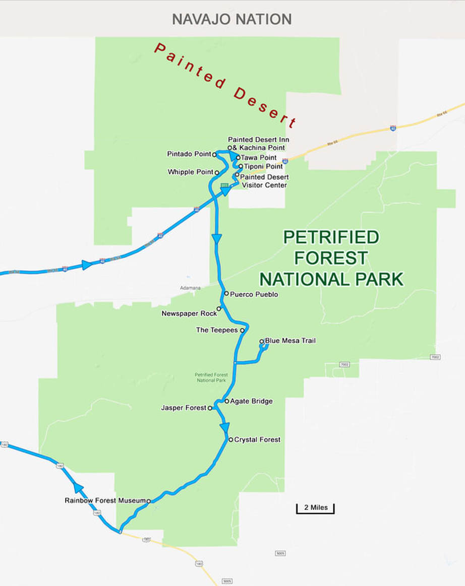
Our first couple of stops on our drive through the park were viewpoints looking out over the Painted Desert, Tiponi Point and Tawa Point. Great first look out over the dark red rolling mounds at Tiponi Point. There was a little more variation in the color of the dirt at Tawa Point, with white edges and some lighter hues of red and pink mixed in with the maroon. Also at Tawa Point we got a little geology lesson regarding the black basalt layer of rock. This basalt, called the Bidahochi Formation, forms the rim of the plateau we were standing on. It was deposited by local volcanoes between 16 and five million years ago, and forms a protective cap over the soft, red rocks of the much older Chinle Formation. The Bidahochi basalt shelters this area from the effects of weather like an umbrella, while the rest of the desert is left exposed and vulnerable to erosion, carving the badland topography. There is a stark contrast where the black basalt of the Bidahochi Formation meets the red sedimentary rocks of the Chinle below. This abrupt transition from black to red highlights the change between these two formations which divides rocks of two vastly different ages. This junction represents a gap in the physical rock record called an unconformity. Geologists believe there are more than 1,000 feet of missing rock layers that were deposited and then eroded over 200 million years between these formations.
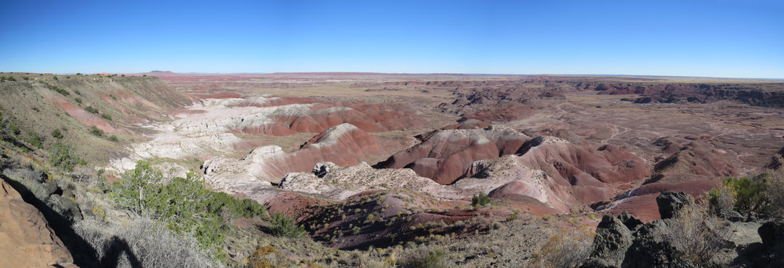
Tawa Point vista.
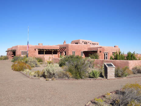 Painted Desert Inn National Historic Site.
Just past Tawa Point was the Painted Desert Inn, a National Historic Site. Between the signs and the very informative docent we got a pretty good overview of the history. The short story starts with the building of the "Stone Tree House" in the early 1920s. The house was built by Herbert David Lore using, you guessed it, petrified wood. Lore operated the "Stone Tree House" as a tourist attraction for about 12 years. He operated a lunchroom, taproom, gift shop, motor car tours and lodging (there were six very small rooms available). The bad news for Lore was that he had chosen poorly in terms of the building site and had built on clay which expands and contracts with changes in the weather and caused the foundation of the structure to shift and resulted in cracks in the walls. Lore sold the building to the National Park Service in 1936. Lyle Bennett, the NPS architect, created a new look for the Painted Desert Inn based Puebloan and Spanish Colonial cultures. Once the redesign was set, the men of the Civilian Conservation Corp (CCC) made the plans a reality. The inn reopened on July 4, 1940, and was a popular stop along Route 66. However with the start of the Second World War, the inn closed in October 1942. Fred Harvey reopened the inn in 1947 and brought in the company's famed architect, Mary Elizabeth Jane Colter, to renovate the facility. Fred Kabotie, a renowned Hopi artist, was hired to paint murals on the dining room and lunchroom walls. The scenes are glimpses into Hopi culture: the Buffalo Dance, a trek to a sacred salt lake, planting time, and Tawa—the Hopi sun god. The Painted Desert Inn was in operation until 1963 when severe structural damage to the facility forced the inn's doors to close. A debate ensued over demolition versus preservation. In 1975 the park had the demolition scheduled but a public campaign landed the building on the National Register of Historic Places in 1976. It became a National Historic Landmark in 1987 because of its fine examples of Pueblo Revival Style design by Bennett, historic work by the CCC, touches by Mary Colter, and Kabotie’s murals. While no longer operated as an inn, it is still a very interesting stop for both the history of the site and the wonderful views from the inn and Kachina Point. The docent at the inn, pointed out many of the key details about the inn, including the murals, the decorative glass over the stairs leading to the lower level, and some of the repair areas. There was also a Navajo weaver getting set up for the day. While we did not stick around to see the demonstration, some of the rugs that were on display were truly beautiful. The skill and vision that is required to make the intricate designs on these textiles is remarkable.
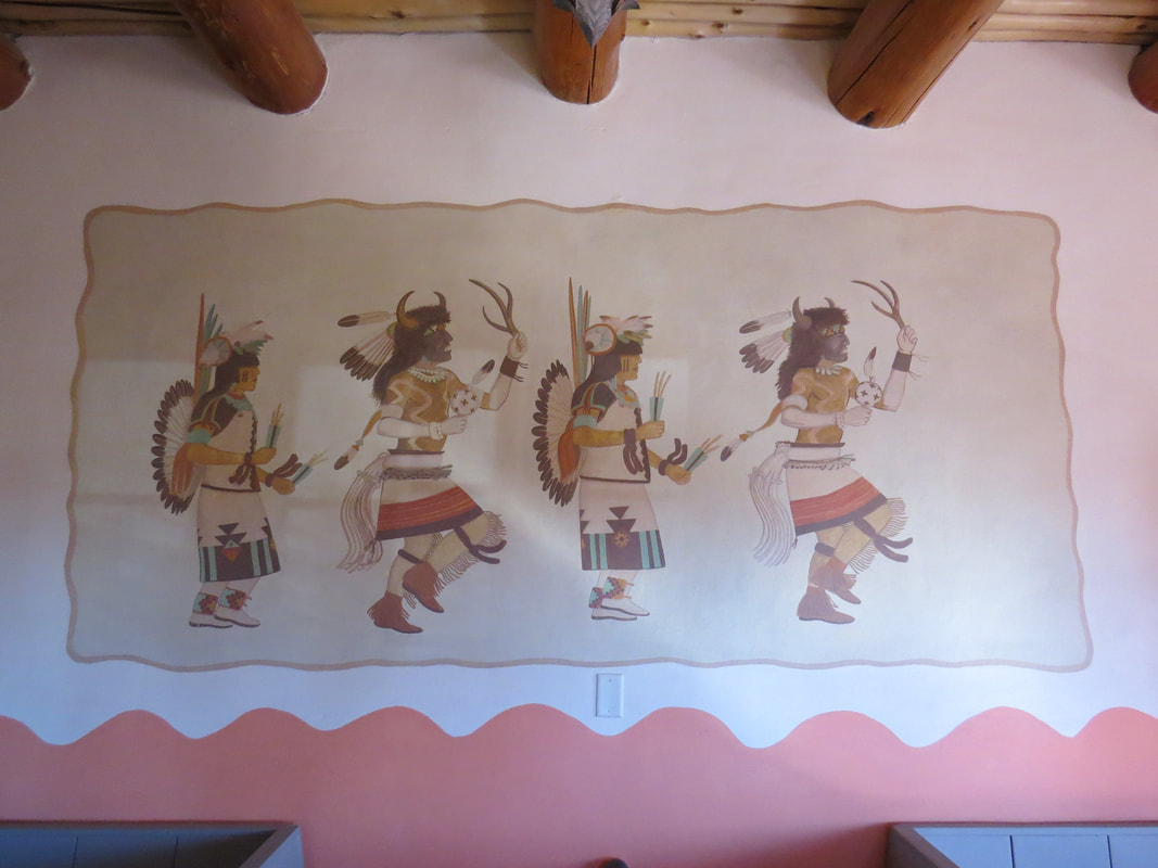
Buffalo Dancers mural by Fred Kabotie.
|
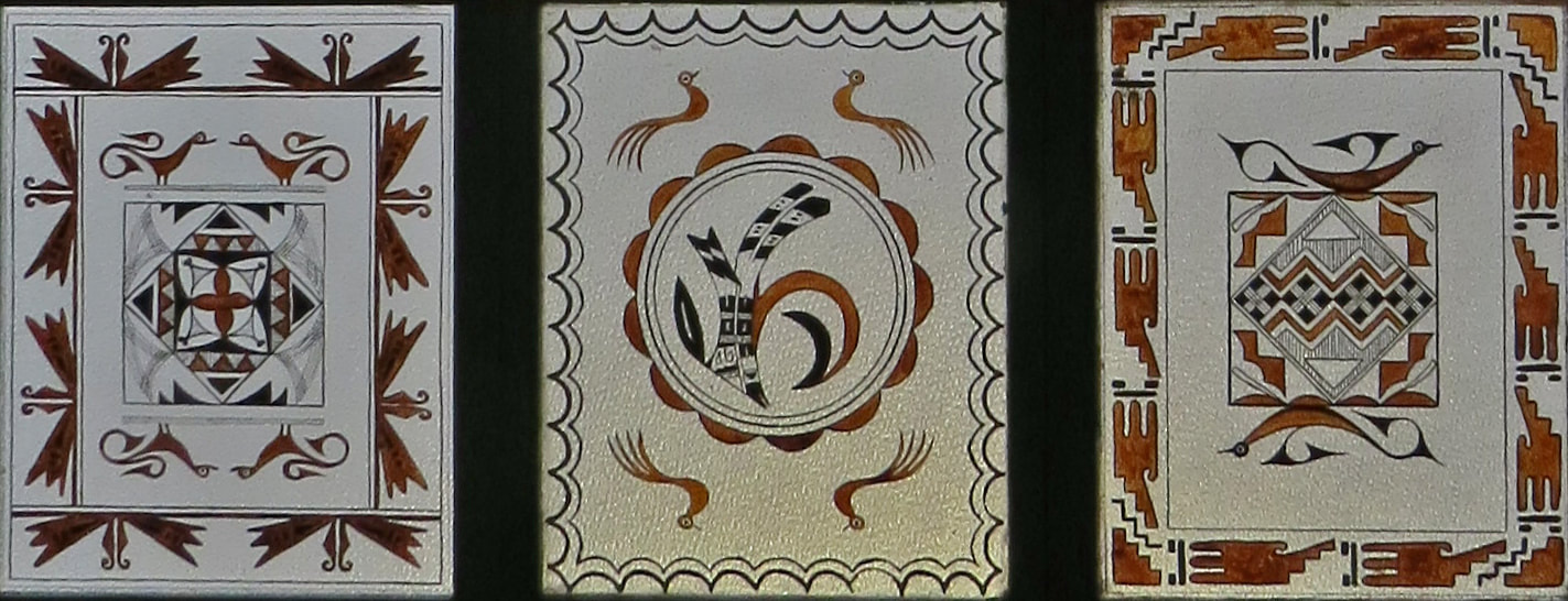
Sample of glass ceiling tiles at the Painted Desert Inn.
|
After taking in the view from Kachina Point out on the rim behind the inn we returned to the Rogue and continued along the park road. There were yet another classic car in the parking lot, a very pretty white sedan probably from the 1930s. No idea what it was, but I'm guessing it was a higher-end vehicle for its day. The classic cruiser was parked next to our white ride, sort of giving the impression of a family photo from across the generations.
There were several more viewpoints along the road beyond the Painted Desert Inn. We just picked a couple, as there was no need to stop at then all since they were so closely spaced. As I recall we took in the views from Pintado Point then Whipple Point before heading into the southern part of the park. We missed the Old Route 66 stop. Looked like there was an old derelict vehicle there where the old highway cut through the park. We decided not to back track. We'll save that for the next visit.
The view from Pintado Point was particularly impressive since the view point sat atop a small rise. Talk about sweeping views! This was a vista that called for a panoramic photo, and I stitched a six-shot image that turned out pretty nice. In fact, the image I ended up with was a little clearer than the one the Park Service had posted to highlight the clear views that were available from Pintado Point. The sign pointed out that thanks for clear air and big skies, land forms and mountain over 100 miles away can be seen from Pintado Point. We had all of the defined landmarks in view today, including the San Francisco Peaks off to the west. Click on the image below to get a larger image complete with markers pointing out some of the key landmarks.

View from Pintado Point. Click the image to get a larger version with the points-of-interest labeled.
Continuing south along the park road we crossed over I-40 and entered the southern part of the park on the way to our next stop. Lynn was studying the park map. Looks like the next location of note is just a few miles away and adjacent to the road so another convenient stopping point on our tour of this amazing area. We pulled in to the parking lot for Puerco Pueblo. OK, the crowd is starting to pick up a bit as there are more cars in the lot plus a few big motor coaches and campers. Still plenty of space for us, so it's not like it is really packed. The bonus is that we'll get a little stretch of the legs as we explore the ruin site (only a 0.3 mile walk, but that's still a break from mostly being in the car). Again, between the signage at the site and the information on the map (plus some post-trip review of the NPS website) we got a good overview of the history here.
So this was not exactly one we were expecting to see highlighted at a park called Petrified Forest, but as mentioned this place is full of surprises! That said, it really was not a shock to come across pueblo ruin sites here after what we have seen at Homolovi and Rock Art Ranch. The fact is that the area that now encompasses Petrified Forest National Park has been inhabited for over 13,000 years. Research here has shown a continuous timeline going back to Paleoindian period. In archeology, this is known as a "persistent place" as it was the site of repeated human activity throughout time.
So this was not exactly one we were expecting to see highlighted at a park called Petrified Forest, but as mentioned this place is full of surprises! That said, it really was not a shock to come across pueblo ruin sites here after what we have seen at Homolovi and Rock Art Ranch. The fact is that the area that now encompasses Petrified Forest National Park has been inhabited for over 13,000 years. Research here has shown a continuous timeline going back to Paleoindian period. In archeology, this is known as a "persistent place" as it was the site of repeated human activity throughout time.

A series of droughts in the 1200s, during the Pueblo IV period, led ancestral Puebloan people to move away from small, scattered hamlets and instead build large pueblo communities. The Village on the Rio Puerco (or Puerco Pueblo, for short) is a 100+ room pueblo site located near the Puerco River, a major drainage that bisects the park. The river would have been a reliable source of water for crops. Farming of corn, beans, and squash took place on the floodplains and terraces along the river. The river also made a natural travel corridor, meaning travelers and traders frequented Puerco Pueblo, carrying new ideas as well as goods.
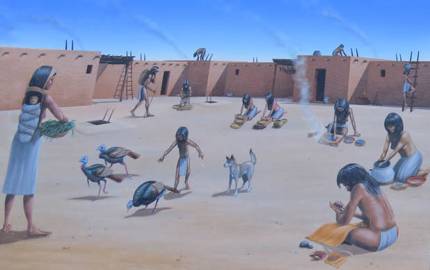 Puerco Plaza as it would have looked in the 14th century; painting by Scott Seibel.
At its largest size, around 1300, Puerco Pueblo may have been home to about 200 people. The one-story high village was built around a rectangular plaza. The building materials for the pueblo were blocks of native sandstone, shaped by hand, and mortared together with mud. The exterior and interior walls were finished with plaster. There were no doors or windows in the plaster-covered exterior walls of the pueblo. Entry into the village was by ladders over the wall and across the log, brush, and mud roofs of the room blocks. The structure above ground served as living quarters and storage rooms. There were also several subterranean rooms, or kivas. Kivas are ceremonial and religious structures. These likely had flat roofs with a square entrance above a hearth. As the smoke rose through the entrance, fresh air was drawn through a small ventilation shaft. The plaza was the center of activity in the village. By examining artifacts and structures found at Puerco Pueblo and their context, researchers are able to reconstruct the daily life of its inhabitants. Everyday tasks such as preparation of food and the manufacture of tools, pottery and baskets occurred in this space. In addition, ceremonial activities took place within these walls that tied the community of Puerco to their ancestors and to neighbors in the region.
The walk around the pueblo site provided good access to the old structure, well, the remains of the foundations and walls of the ancient village anyway. Plus there was an area of jumbled boulders that the ancient inhabitants had used to etch images into the desert varnish. There were several interpretive signs along this section of the path to provide insight from the study that has been done of this old rock art.
The walk around the pueblo site provided good access to the old structure, well, the remains of the foundations and walls of the ancient village anyway. Plus there was an area of jumbled boulders that the ancient inhabitants had used to etch images into the desert varnish. There were several interpretive signs along this section of the path to provide insight from the study that has been done of this old rock art.
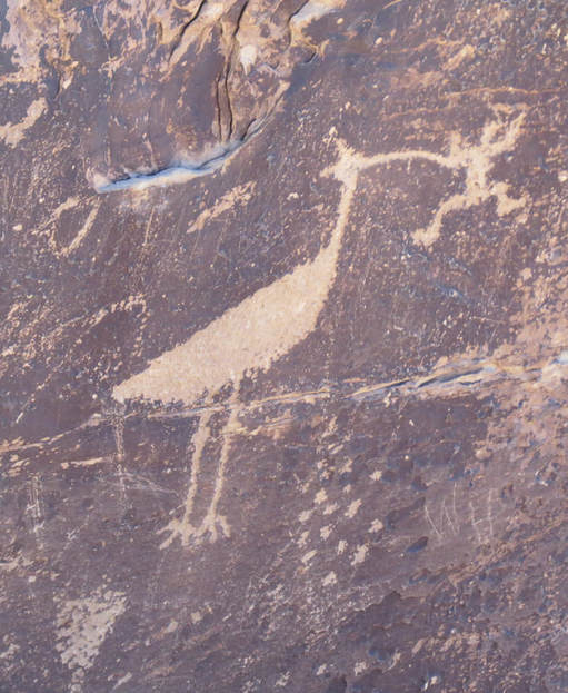
A Canvas for Ideas: The dark coating on the boulders is desert varnish - a concentration of mineral (primarily iron and manganese oxides), clay and organic material that accumulates over time. Prehistoric artists created rock art by exposing the lighter material underneath. But what do this symbol mean? Unlike contemporary writing, petroglyphs are not letters or sounds. Instead they represent the ideas of the artist. Like all of us, the creators of these petroglyphs were trying to communicate with the world around them. Present day indigenous oral traditions help us understand what petroglyphs might mean. Members of the Zuni tribe believe that this rock art depicts clan ties of the artist - perhaps a mother from the Crane Clan and a father from the Frog Clan. An alternative Hopi interpretation recalls stories of a giant bird that came to village to eat bad children. Visitors often say "a stork and a baby," which is a European oral tradition with a different cultural history. Yet the image is similar to a native bird at Petrified Forest. The white-faced ibis is a water bird that eats frogs and other small animals. If you look closely, you can see what might represent water drops below the frog. Instead of a literal interpretation, this petroglyph likely represents aquatic resources and fertility. Around the world, people in arid regions show reverence and give thanks for water through symbols such as fish, tadpoles and dragonflies.
Whispers from the Past: For thousands of years, indigenous people have used rock faces as a means of communication. Petroglyphs are images, symbols, or designs scratched, pecked, carved or incised on the surface of rock. These features are like whispers from the past and there are thousands of them at hundreds of sites in Petrified Forest National Park. How do we know what petroglyphs mean? Interpreting images that are hundreds to thousands of years old is not easy. Once method involved asking contemporary indigenous communities about the meaning of these images. On the rocks below are several examples of petroglyphs, including one that tribes have identified as a migration symbol, which was an important theme in Puebloan oral history. The image on the right depicts circular faces on a dark rock surface. Modern groups identify these as Kachinas, or spirit beings in Pueblo religion and cosmology. Research suggests that the "Kachina Culture" arrived in this region circa A.D. 1300. Similar symbols, found on modern Puebloan pottery and weavings remind us of the continuity between prehistoric sites, like Puerco Pueblo, and the present.
Whispers from the Past: For thousands of years, indigenous people have used rock faces as a means of communication. Petroglyphs are images, symbols, or designs scratched, pecked, carved or incised on the surface of rock. These features are like whispers from the past and there are thousands of them at hundreds of sites in Petrified Forest National Park. How do we know what petroglyphs mean? Interpreting images that are hundreds to thousands of years old is not easy. Once method involved asking contemporary indigenous communities about the meaning of these images. On the rocks below are several examples of petroglyphs, including one that tribes have identified as a migration symbol, which was an important theme in Puebloan oral history. The image on the right depicts circular faces on a dark rock surface. Modern groups identify these as Kachinas, or spirit beings in Pueblo religion and cosmology. Research suggests that the "Kachina Culture" arrived in this region circa A.D. 1300. Similar symbols, found on modern Puebloan pottery and weavings remind us of the continuity between prehistoric sites, like Puerco Pueblo, and the present.
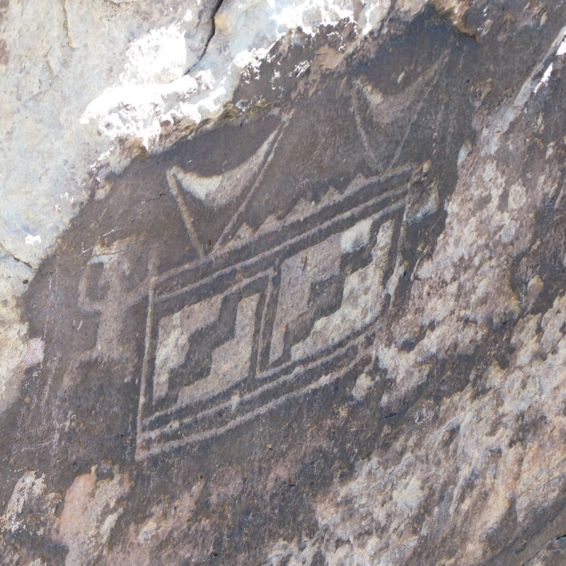
Migration symbol.
|
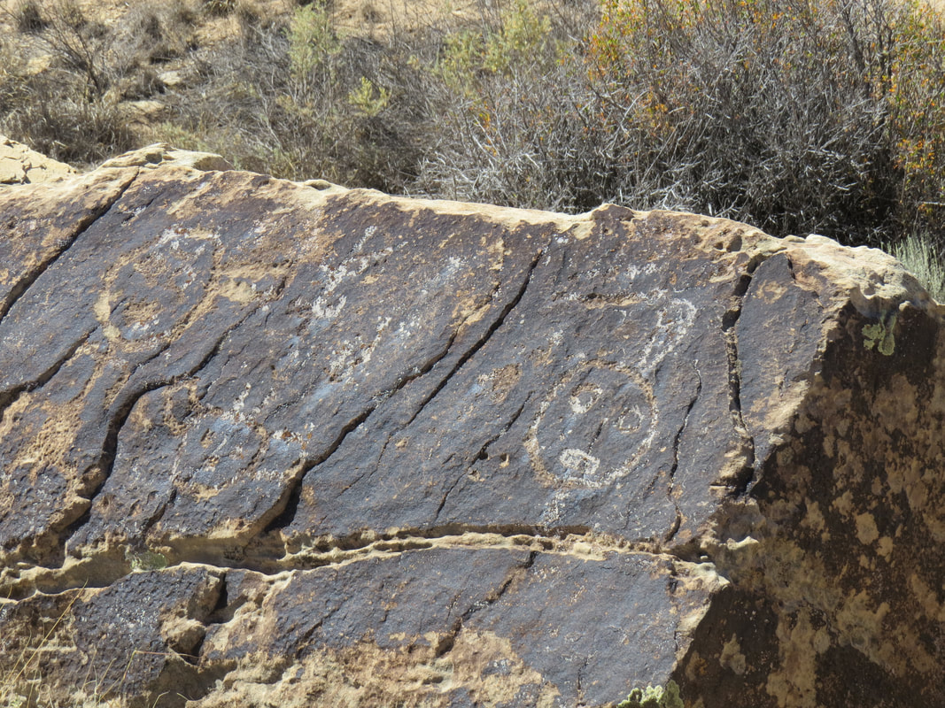
Kachina panel at Puerco Pueblo.
|
Summer Solstice Marker: A solstice is an astronomical event that happens twice annually as the Sun reaches its highest or lowest points in the sky. In the Northern Hemisphere, June 20th is usually the longest day of the year and is referred to as the summer solstice. There photographs illustrate how sunlight from the rising summer solstice Sun flows down the cleft in the boulder. The play of light and shadow on the spiral petroglyph changes as the Sun rises and moved across the sky. From between June 14th to the 28th a shaft of light forms, moving down the side of the adjacent boulder, until it touches the center of the spiral within a few minutes of 9:00 AM. The full intersection of the spiral marker takes about an hour. Why would the inhabitants of Puerco Pueblo want to mark the date of the solstice? Prehistoric peoples used solar calendars to plan their lives around the changing seasons. For agricultural people knowing when to plant crops or expect summer rains is vital for survival. Solstice days marked important points in the seasonal calendar and formed the cornerstones of annual ceremonial cycles. This importance persists in the ceremonial calendars of contemporary indigenous communities where the year is divided in two by summer and winter solstices. In Petrified Forest National Park researchers have identified over a dozen calendric petroglyphs sites and many more exist throughout the Southwest. These features demonstrate the importance of marking the passage of the changing season to the prehistoric peoples and their descendants.

As we completed the loop around the ruin site, continuing our study of the old pueblo and petroglyphs, we did spot a current resident of the area, a Collared Lizard sunning itself on the paved walkway. She did not seem to be bothered by the tourists walking around the site. Maybe the people were keeping the predators away so that the lizard could relax a bit. That's probably what Adam's grandmother would have figured.
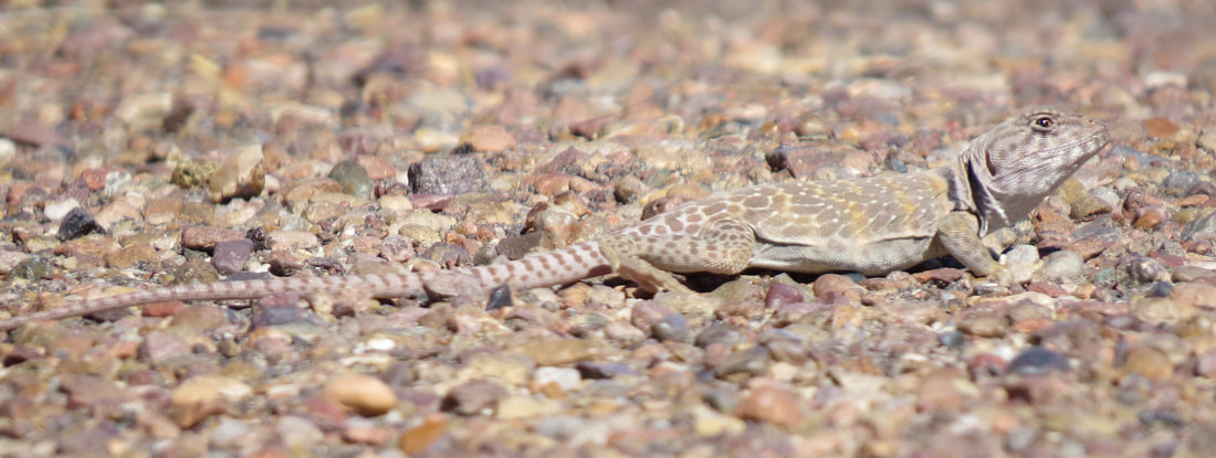
Our next stop was another highlight from the ancient human occupation of the area, a communication station of sorts, Newspaper Rock. This is just a short distance (half mile or less) south of Puerco Pueblo, then a short drive on the access road and a very short walk to the viewing platform. A Junco was there to greet us as we walked out the trail to see the rock art. The petroglyphs are on the varnish covered rocks on the slope below the viewing area and while in view, binoculars or a camera with decent zoom capability really helps to see the etched figures, symbols and animals. Lynn and I had no issues seeing the old etchings with our superzooms. The park map and interpretive signage state that there are over 650 petroglyphs on the boulders strewn about, some dating over 2,000 years old. These images were created by ancestral Puebloan people living, farming and hunting along the Puerco River between 650 and 2,000 years ago. It is likely that residents of Puerco Pueblo were among the creators of these glyphs. The concentration of glyphs around Newspaper Rock suggests that many generations of ancestral Puebloans contributed to the messages on the sandstone bluffs. The images represent ideas rather than a language. These representations include many types of glyphs: Anthropomorphs (human-like figures), Zoomorphs (animal depictions), spirals and other geometric shapes, and hand- or footprints. The variety of images and ideas point to a rich cultural history which continues today. As discussed at the Puerco Pueblo displays, the exact meaning behind each petroglyph is unknown, but collaboration with contemporary American Indians provides insight into the significance of these glyphs. Modern groups interpret petroglyph themes to include family or clan symbols, territorial boundaries, important events and spiritual meanings. The movement of the sun, moon and stars are also charted in a special group of glyphs used to manage ceremonial and agricultural calendars.
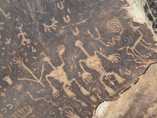
We did not stay here long, it does not take but a few minutes to scan over the rocks and see the petroglyphs. There were many interesting images, but the ones that caught my eye were a pair of anthropomorphs with elongated limbs and very long necks. Hey, maybe these are Kaminoans and they were scouting for cloning material. No, wait, that would have been a long time ago in a galaxy far, far away.
Back in the Rogue, Lynn said the next thing on the map were The Teepees, then we'll head over to Blue Mesa. Good deal as it was now 11:00 and Blue Mesa was one of the top places on my list of things to see here in the Park. I did not do a lot of studying of Petrified Forest before our visit, except to check out the hiking trail potential. Since we were just planning a day trip, I did not look at the back country options and there really are not many other hikes in the park other than short walks. But that's what we're looking for on a first visit, just to get the flavor of the park. That said, I did see the photos for Blue Mesa. Wow! That is the one place that we have to get to today. Looks like we'll be there soon, but first, The Teepees.
This is probably the prettiest part of the drive along the main road through the park. Going south, the road in on a very gradual downhill grade so that we were dropping into the area of oddly colors mounds. I say oddly colored because these area was no dominated by the more standard reds, browns, oranges and yellows that we usually see in the strata. No here, while there was still stripes of red and brown, there were greys, and purples and even almost blue tints to the dirt that made of these formations. Again, not what I was expected but oh so cool! It was sort of like when we were first introduced to Death Valley, not knowing what the park would offer then being completely blown away with the beauty and diversity. I throttled back on the Rogue a bit just to take it all in and to be ready for a pull out when one came along so that we could spend a minute and enjoy the view. Except there was no pull out in sight. OK, a rolling road show. We continued down and into the blunted cones then around a sweeping curve in the road. Ah, there's the pullout. Only a couple other cars, so no worries about fitting the Rogue in there. We made a quick photo op stop. From the signs along the pull-out that's all the Park Service wants you to do as the signs asked "please do not climb on the geologic formations." Glad to see those signs as it would not take much to damage the teepees. I had noted other formations scattered about northern Arizona as we've been driving around the past several days that were similar looking in terms of the layered strata but had been significantly scarred by ATV and dirt bikes. It might take a little longer, but hiking boots would have the same effect.
We also got a little geology lesson from the interpretative sign at the pull-out: The Teepees are the exposed portion of one of the lowest and thus oldest rock members within the park and the Painted Desert. These badlands show the erosional pattern of the Blue Mesa Member of the Chinle Formation. Sediments of the Blue Mesa Member were deposited by a vast, tropical river system that flowed through this area during the Late Triassic Period, similar to the Amazon River Basin today. So how do we know that this area was like 225 million year ago? Several characteristics about a rock - like color, type, stacking patterns and fossils they contain - give clues to geologists and tell a very specific story about the past environments and how those environment shifted and changed through time. The blocky brown and yellow sandstone layers were deposited in the river channel, showing us where the river flowed over time. The blue and red mudstone layers were laid down in the river's floodplain. The white ash layer record volcanic eruptions that took place in the area and are used to determine exact ages of the rock. Fossilized plants and trees, like horsetails and ferns, show that this area was a tropical environment during deposition.
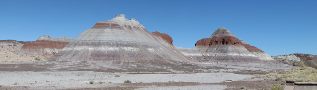
The Teepees.
Onward to Blue Mesa! The Teepees have now whetted by appetite for more beautiful rocks. The access road to Blue Mesa is just a couple miles south of the Teepees then about a two-mile drive from the main road. Just a little lollipop route that is lined with a few viewpoints before getting to the trailhead that provides access to these spectacularly colored formations.
The Blue Mesa area was really the only place where we encountered any serious crowds in the park. The first couple of pull-outs were packed but we were able to squeeze into the end of the second pullout; we were close enough here to walk between the two viewpoints. These viewpoints were just at the start of the lollipop loop. The view here was out over a jumble of rocks, little hoodoos and rolling, mounded formations. The colors here were muted shades of grey and brown, probably in part due to the harsh, midday lighting, but there were some hints of purple scattered about in the stripes of dirt. This is also where we got our first real sightings of petrified wood as there were logs scattered all about the area. None were close enough for a close inspection, but there were plenty mixed in with the landscape. It appears that the dirt is softer than the logs as there were several examples showing the petrified wood being exposed as the dirt is eroded away. Some logs were laying on top of the ridge, being the hardest layer so it becomes the cap. There were several logs sticking out from the middle of a mound of cliff face; many of these logs finally broke off under their own weight once the supporting dirt layers were removed. Over all it was an otherworldly view out over this little valley filled with its little grey goblins and red chucks of rock-wood.
The Blue Mesa area was really the only place where we encountered any serious crowds in the park. The first couple of pull-outs were packed but we were able to squeeze into the end of the second pullout; we were close enough here to walk between the two viewpoints. These viewpoints were just at the start of the lollipop loop. The view here was out over a jumble of rocks, little hoodoos and rolling, mounded formations. The colors here were muted shades of grey and brown, probably in part due to the harsh, midday lighting, but there were some hints of purple scattered about in the stripes of dirt. This is also where we got our first real sightings of petrified wood as there were logs scattered all about the area. None were close enough for a close inspection, but there were plenty mixed in with the landscape. It appears that the dirt is softer than the logs as there were several examples showing the petrified wood being exposed as the dirt is eroded away. Some logs were laying on top of the ridge, being the hardest layer so it becomes the cap. There were several logs sticking out from the middle of a mound of cliff face; many of these logs finally broke off under their own weight once the supporting dirt layers were removed. Over all it was an otherworldly view out over this little valley filled with its little grey goblins and red chucks of rock-wood.
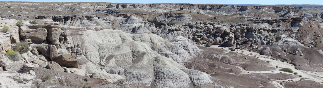
Views from the first viewpoint we took in along the Blue Mesa Scenic Road.
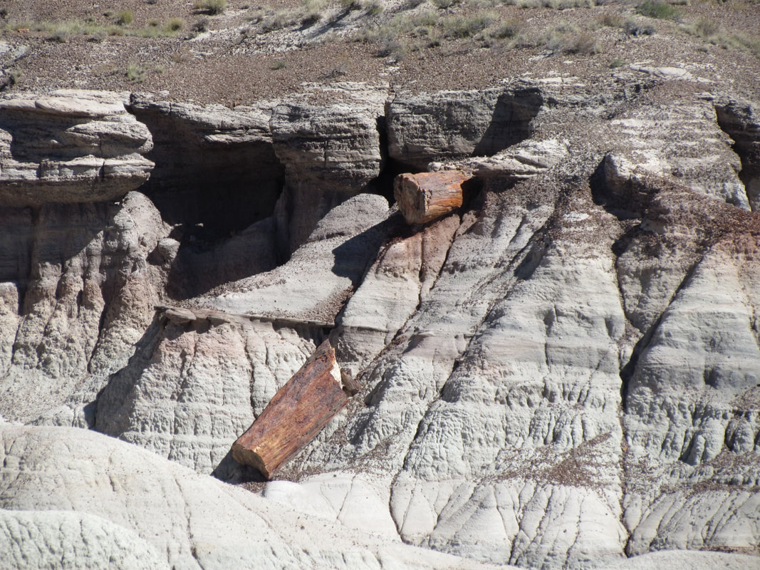
|
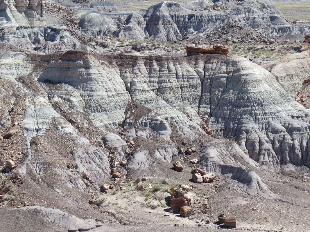
|
We have not seen any stupid people tricks this trip (other than the aftermath of the desecration of the rocks at White Pocket by some unknown idiots). However we did see a couple folks here at these viewpoints who decided that the rules were for everyone else. There were signs along the edge of the viewing areas stating that the area beyond the signs was closed, yet there were a couple tourists, an Asian lady with a long-lensed camera being the most flagrant violator, who felt the warning did not apply to them. She had to get closer to the edge and well into the closed area in order to get that perfect shot. C'mon people, the signs are there for a reason, and safety is usually the main purpose for closing and area. I mean, anyone can see that the area is heavily eroded so the edges are most likely unstable, so use a little common sense and stay away from the edge. Rant off.
The next viewpoint we stopped at provided a wonderful view out over a vast flat area that was bounded on the left by the purple, grey and blue striped cliff face. This cliff boundary was our first real look at the beautifully colored striping of the formations in the Blue Mesa area. It was a grand vista. While the Blue Mesa layer of rock had eroded away to expose the wide, flat canyon bottom there was still a tinge of purple spread over the open area. Words can't do it justice….just check out the photo below.
The next viewpoint we stopped at provided a wonderful view out over a vast flat area that was bounded on the left by the purple, grey and blue striped cliff face. This cliff boundary was our first real look at the beautifully colored striping of the formations in the Blue Mesa area. It was a grand vista. While the Blue Mesa layer of rock had eroded away to expose the wide, flat canyon bottom there was still a tinge of purple spread over the open area. Words can't do it justice….just check out the photo below.
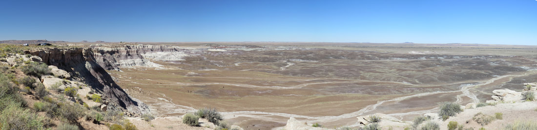
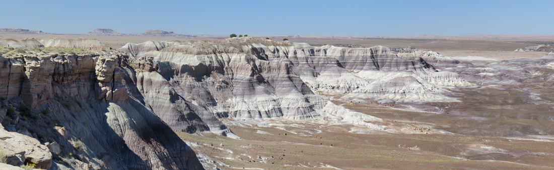
Vistas from the second viewpoint we took in along the Blue Mesa Scenic Road.
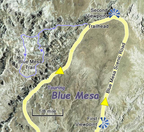
Again the Park Service came through with an educational nugget: The colorful bands of the Chinle Formation represent ancient soil horizons. While the red, blue and green layers generally contain the same amount of iron and manganese, differences in color depend on the position of the groundwater table when the ancient soils were formed. In soils where the water table was high a reducing environment existed due to a lack of oxygen in the sediments, giving the iron minerals in the soil a greenish or bluish hue, such as at Blue Mesa. The pink and reddish layers were formed where the water table fluctuated, allowing the iron minerals to oxidize (rust).
Next was went over to the trailhead parking which was packed but again we found the last legal parking slot at the far end of the lot. We walked over to the trailhead sign; yep, this is the place that I wanted to explore. The loop through the mounded formations below us is only about a mile and while the sky is completely clear, it is a cool day with a slight breeze, so we just got a swig of water, grabbed an extra battery for the cameras and left our packs in the truck. The only hard part about this little paved loop trail is the initial downhill section, which is sort of steep (and of course means an uphill climb at the end), but the rest of the trail is basically level; rolling due to the influence of the mounds the trail meanders through, but nothing major in terms of elevation change once down in the canyon (so figure about 150 elevation change from the trailhead to the loop section of the trail). Surprisingly, given the number of cars at the trailhead parking lot, there were not many folks one the trail. It seemed that we had the area almost to ourselves, which was very convenient for reducing the number of tourists in my photos.
What can I say, this was the place that I wanted to see and it was worth every second. Each step along the trail brought in something new, whether it was a view looking down onto the striped mounds from the top of the trail, a panoramic vista looking across the canyon from floor level, or the details of the rock, the petrified logs or the smattering of wildflowers along the trail. There was even a brown and orange butterfly flitting about in the flowers, adding a bit of contrasting color to the blue hued rocks.
So this is a completely exposed trail so I imagine it would be a brutal hike in the heat of summer, but today it was just a pleasant stroll. We just meandered around the loop taking in the colors and formations. Lynn ended up well in front of me as is often the case on this type of trail with so many interesting things to see and shoot. Besides, it's not like she's going to get eaten by a bear in this park. As mentioned, there were great views all along the trail, but my favorites were from the far end of the loop looking back up into the formations. I captured several series of shots that were stitched into some very nice (if I do say so myself) panoramic images. I used one for the header of this page and others are shown below. The widest view is a 6-shot image and the other is 5-shots.

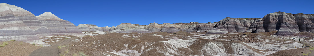
There were many sections of petrified logs arrayed in this little canyon, some in the drainage paths where the rock formations have eroded and others just scattered randomly about the canyon floor. There were a few slabs of tree-rock that were acting as capstones on little mounds of dirt, creating little toadstools.
On the way back up the trail we spotted a Rock Wren skipping up the side of the canyon wall above the trail. I thought I was going to have to classify him as a gone bird as he was not willing to sit still for a portrait but he finally settled down and I got decent enough shot for identification purposes.
On the way back up the trail we spotted a Rock Wren skipping up the side of the canyon wall above the trail. I thought I was going to have to classify him as a gone bird as he was not willing to sit still for a portrait but he finally settled down and I got decent enough shot for identification purposes.
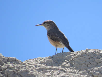 Rock Wren.
OK, that was phenomenal. We've seen a lot of great stuff on this trip and Blue Mesa ranks right up at the top of the list. Anything else we see today is gravy.
The parking lot was still packed to overflowing when we got back to the trailhead. Still surprising as we still did not pass any folks going down the trail; I reckon their all enjoying the vistas from the viewpoints on this level. We saw a lady looking for a parking spot so we flagged her down as we were packing to go. She waved thanks and slipped right into our wake as the Rogue pulled away.
Back on the main road, our next two stops were quick peeks at the natural attractions at points adjacent to the park road. First was Agate Bridge, a 110-foot long petrified log that forms a natural span across a wash. The NPS interpretive sign tells the tale:
Water Under the Bridge: Water created Agate Bridge and will destroy it. The fossilized tree that now forms Agate Bridge grew in a lush subtropical forest 217 million years ago. When the tree died, it washed into a river and its quick burial by river sediments prevented decay. Volcanic ash dissolved in groundwater provided silica, which reacted with the log and slowly crystallized it into quartz. Millions of years later, rivers and streams eroded massive layers of rock strata to expose this fossilized tree. Inevitably, water now carving the small gully under Agate Bridge will cause its collapse. The supportive concrete span, constructed in 1917, is a tenuous attempt at preservation. Water will always have its way.
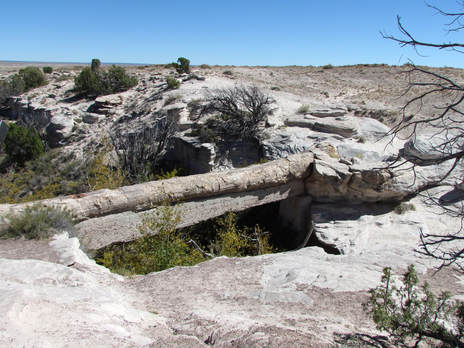
Agate Bridge.
|
Also on the sign was a quote by Lau Tzu, Chinese philosopher from around the 5th century BCE: "In the world there is nothing more submissive and weak than water. Yet for attacking that which is hard and strong nothing can surpass it." I had to Google him when we got back to see who he was. He has a couple other travel-related quotes attributed to him that seem appropriate for our meet-up trips:
"A good traveler has no fixed plans, and is not intent on arriving."
"A journey of a thousand miles begins with a single step." Sort of reminds me of Hans.
After checking out the old log bridge, we hit our second quick stop to take in the view at Jasper Forest which was just around the next big bend in the road. Just a short drive off the main road to the viewpoint parking. |
There are actually views far and near at this stop, with a couple of petrified logs on one side of the parking area then the big vista looking west on the other side; we took in only the latter. The viewing area looked down and over another badland-type landscape, with the rolling, mounded formation flanked by collections of taller, weathered little hills. The purple tint to the dirt had followed us from Blue Mesa although there were also a few mounds that were distinctively green. All of this under the bright blue and cloudless sky that we has been with us all day. The stone remnants of the ancient forest were scattered randomly all throughout the area in front of us. It amazes me how much petrified wood there is just lying about.
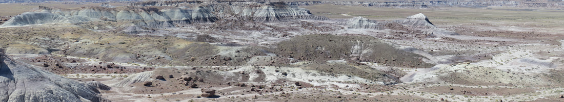
View looking west over the Jasper Forest area of Petrified Forest National Park.
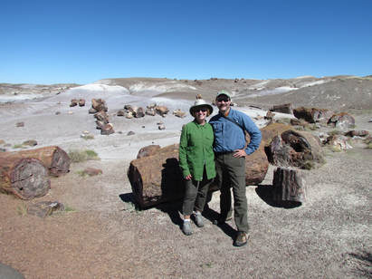
Again southward along the park road. Time for that gravy I mentioned earlier with a stop at the Crystal Forest. This is where got up close and personal with the rock wood as the short paved trail through the area wove passed many logs and piles of petrified wood sections. The trail just makes a loop from the parking lot through the desert landscape where the logs are strewn. Most of the logs are sitting in the drainage paths, being slowly washed downhill when the rains come. The trail was easy, but did have a little slope to it. Nothing major but certainly noticeably. There were plenty of tourists walking the trail, but not so many that it was crowded. In fact most folks were just checking out the logs and displays near the parking lot so the further along the trail we went the fewer folks we saw. We did chat with a trio of retirees from Texas as we started our counterclockwise tour around the loop, two ladies and a gentleman. The ladies were quite talkative and just puttering along; the man was moving out, obviously more interested in the history and natural wonders than his companions. We exchanged photo ops with the ladies, which was timely since as usual Lynn and I had not taken many photos of each other today and had not worried about a team photo. But that box is now checked so we're good to go.
The attraction here is the abundance of petrified wood and how close it is to the trail for up close inspection. The colors in cross-section of many of the logs were just so brilliant and varied. I did find a sign back at the start of the trail that provided some information on the colors in the petrified wood. Basically, the coloration is all due to contamination; the mineral impurities within the quarts that gives the wood the various colors:
The attraction here is the abundance of petrified wood and how close it is to the trail for up close inspection. The colors in cross-section of many of the logs were just so brilliant and varied. I did find a sign back at the start of the trail that provided some information on the colors in the petrified wood. Basically, the coloration is all due to contamination; the mineral impurities within the quarts that gives the wood the various colors:
The volunteer docent also provided some insight. I asked her what kind of trees these were to which she answered coniferous. She also stated that the reddish colored logs were not fully petrified. Hmmm, that sounds like being sort of pregnant. What do I know? One thing for certain was that this was a nice easy walk and a great way to see some excellent examples of the ancient trees that have turned to stone.
Once back at the start of the loop, I read the signage that provided the history of this place, sort of a synopsis of how this spot in present day Arizona transformed over nearly 220 million years: |
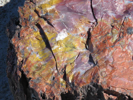
|
When Crystal Forest was a Forest: During the Triassic Period, the area containing Crystal Forest was not the semi-arid grassland it is today, but rather a lush, green rain forest much like those found in Costa Rica. At that time, this area resided on the supercontinent of Pangea at approximately 10 degrees north of the equator, the same latitude as present day Costa Rica. As Pangea broke apart, the North American continent drifted northward. Some 218 million years later, Crystal Forest is at 35 degrees north latitude. The Colorado Plateau uplifted slowly over millions of years, raising the park land about a mile above sea level. This is why the park is so arid today. If Crystal Forest had not moved and uplifted it would still be a forest, but like the rain forests of Costa Rica.
So this little loop was just under a mile and we spent a little over half an hour cruising around the paved trail. Very easy trail with less than 100 feet elevation (more like 50 feet), but an enjoyable and educational little walk. Oh, and we spotted another Rock Wren just as we were coming off the trail, just a little after 1:00 PM.
Our last stop in the park was at the Rainbow Forest Museum. While driving there, we discussed hiking the trail to see the Long Logs and Agate House but Lynn nixed that idea. We'll save those for the next visit. We also agreed that for our next visit we should try to get to Blue Mesa earlier in the day to see what the colors there looked like under less severe light. Looks like we have a few reasons to return to this park.
The Rainbow Forest Museum has a wealth of information with the scientific displays focusing on the evolution of the area in terms of plate tectonics, climate and critters. This material has always fascinated me. We meandered through, noting several very interesting tidbits on the signs as well as a few terrifying looking animals that used to live in the park millions of years ago. I am particularly happy that the crocodile relatives that used to roam the area are no longer around. Here's a selection of factoids we picked up in the museum:
- How old are the rocks? Beginning about 225 million years ago, rocks and fossils found in Petrified Forest National Park began to be deposited but ancient rivers near the Earth's equator. It took 18 million years to lay these rock layers down - about one third of the Triassic time period. The first dinosaurs had evolved only five million years earlier in what is now South America. The first true mammals appeared about five million years later. The first flowers would not evolve for another 105 million years. Distant relatives of crocodiles rule the land and waters and the dinosaurs were small in size and rare in numbers.
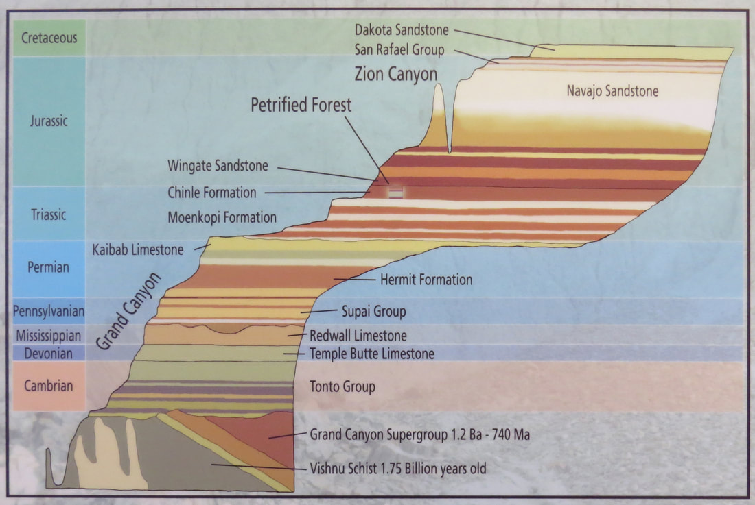
- Climate: Spheres in Harmony. The earth's climate in a complex system, continually evolving and changing. Climate is the weather of a region over a period of 30 years or more; weather is the local conditions over just a few days. Climate is the product of several interrelated systems: the atmosphere (air), lithosphere (earth), hydrosphere (water), cryosphere (ice) and biosphere (life). The interaction of these spheres and energy from the sun is responsible for precipitation, temperature, movement of air and ocean currents. Local conditions of an area that affect its climate include latitude, altitude, terrain, and proximity to large water bodies. Large changes in climate can cause extinctions and promote evolution of new species, while small changes in climate can alter ranges and habitats of living organisms. Ultimately, climate plays a major role in the arrangement of past and present ecosystems.
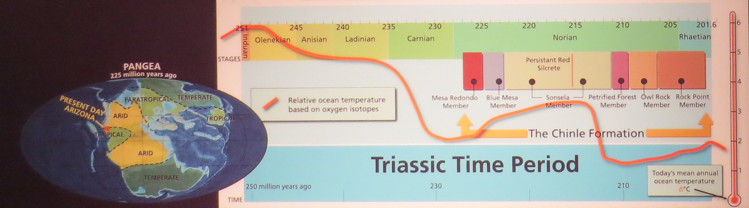
- The overall paleoclimatic signature preserved in the rocks of the Petrified Forest records a general decline [in temperature?] that took place over a period of 20 million years. As ancient Arizona drifted north along with the North American Plate the area became more arid. At the same time global temperatures slowly warmed, cooled drastically and then warmed slowly again. Fossils demonstrate how the plants and animals responded to these changes. The more humid Blue Mesa Member has a different fauna and flora than the younger, more arid members of the Chinle Formation.
- Three and a half billion years ago all living things were single celled organisms. Multicellular plants, animals and fungi have only existed on Earth for the last 630 million years. This time period is known as the Phanerozoic Eon and represents the time that macroscopic creatures diversified and ultimately filled the oceans and covered the land. These living organisms cover our planet and greatly influence our various ecosystems.
- Petrified Forest National Park preserves some of the earliest known dinosaurs in the world. Dinosaurs first evolved in the Triassic Period and went on to dominate terrestrial ecosystems for the next 180 million years. The first dinosaurs were small, bipedal meat-eaters. Dinosaurs are divided into two main groups, or clades: Saurischia (lizard hipped) and Ornithischia (bird hipped). Only saurischians have been discovered at the park.
- Appearances can be deceiving. Not all dinosaur-looking terrestrial carnivores are actually dinosaurs. Like dinosaurs, these animals had an upright posture and their legs tucked beneath their body. But although similar in appearance, these animal are not dinosaurs. They are related to crocodiles. This mistake can be made even by the experts unless the right clues are present. Whey later crocodilians abandoned the land and returned to the water remains a mystery.
- There were a few complete skeletons on display of the animals that used to roam the area, some dinosaurs, some not. One was an example of the Rauisuchids (raw-ih-SOO-kids) that ranked as the top terrestrial predators of the late Triassic, thanks to huge skulls armed with powerful biting jaws and 3-inch long serrated teeth. Some rauisuchids grew up to 20 feet in length.
- Another was listed as "Not Quite a Mammal": Placerias hesternus (plu-SAYT-ee-us hess-TERN-us; "broad body of yesterday") was a dicynodont therapsid. Therapsids were large "reptiles" that possessed many mammalian characteristics including a "cheek" bone, enlarged canine teeth and specialized attachment of the skull to the spine. This massive plant-eater was up to 9 feet long and might have weighed as much as two tons.
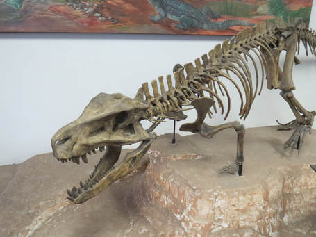
|
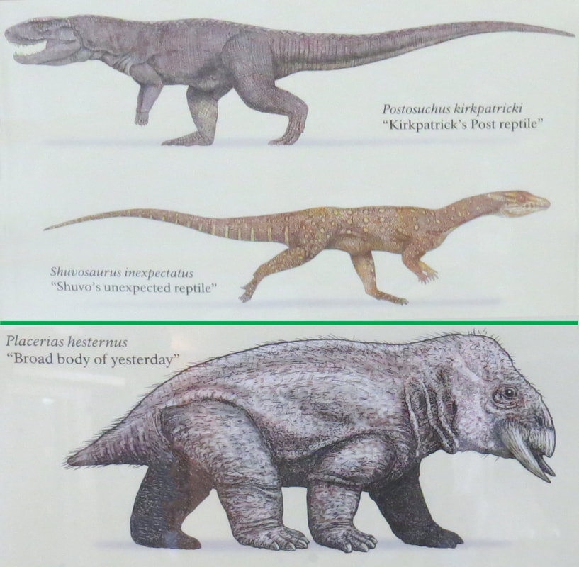
|
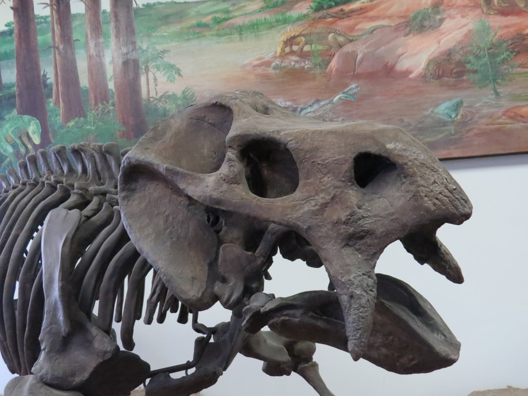
|
- One point that I have always found interesting is the inferences and extrapolations that scientists can make based on seemingly limited data (I get it, we just call it "engineering judgment" at work). There were several examples in the displays of how some of these long extinct creatures have been rebuilt with just a few pieces: In 2011, paleontologists working in the park found the first evidence of pterosaurs, flying reptiles whose wing was comprised of one long finger and a flap of skin. The evidence consists of one section of jawbone, some isolated teeth and a few other elements of the skeleton. The bones offer a tantalizing glimpse of what might be one of the oldest pterosaurs from North America.
- There was a great graphic that provided a long timeline of history of visible life, which included the points of the mass extinctions. I could not get a decent photo of this big sign, but did get enough to mark the points of some of these major events, like at the end of the Permian period when 96% of the species on the planet were wiped out then again at the end of the Triassic when 49% of the species went extinct and finally 65 million years ago at the end of the Cretaceous when 50% were obliterated, including the dinosaurs. The ominous point of this chart was that there was another extinction marker shown on the timeline, downstream of today, with a question mark for the percentage of species that will go the way of the dinosaurs. A human skull was used as the marker. Will we be part of that number?
We toured until 2:00, including a stop at the gift store across from the museum, then started back toward Winslow. We spotted a few businesses with tons of petrified wood for sale along route 180 on our way to Holbrook. Some of these places had huge stockpiles of petrified wood. It was amazing to see how much of this stuff existed. Holbrook also had a bit of the stereotypical, albeit run down Route 66 look to it as we cut across Navajo Avenue to get back to the Interstate. Old motels lined the road and there were signs for diners, gas stations, pawn shops, tourist trinkets and rocks for sale. There was a high percentage of these places that had seen better days and many of the storefronts were dark and idle. We just drove through then turned west on I-40.
Here are the photos from our day in Petrified Forest National Park.
Here are the photos from our day in Petrified Forest National Park.
We were back at La Posada right at 3:00 following a fuel stop as we exited the Interstate. Based on the fuel economy of the Rogue, starting out tomorrow with a full tank should put us back at PHX with at least a half tank of gas which is what we need when we turn the car in. I love it when a plan comes together. We were on our balcony with a beer by 3:05. I finished off the last Lost Highway Black IPA. I'll have to remember this one for the next trip out here.
Around 4:00 we walked to the "corner in Winslow Arizona" for a photo op. The bonus was the car rally. There was quite the variety of old classics. And these were obviously all cars that were babied; they were all spotless, with beautiful paint and immaculately cared for. They were lining the main drag through town, old Route 66, as well as down the side streets. All makes and models and a rainbow of colors. The festivities were wrapping up as the announcer for the rally was going through the winners of the various categories. The announcer stated that there were 180 entries of all types. The only downside was that the flat bed Ford was moved down the street to make more room for the rally, so we did not get the full impact of "standing on the corner in Winslow, Arizona," but it was close enough. That old truck is also a beauty, a red Ford F-500. I never even heard of an F-500 before. Interesting that in the mural building façade that the "girl in the flatbed Ford" is driving from the wrong side of the cab. Here are the rest of the photos from our time in Winslow, including around La Posada.
Around 4:00 we walked to the "corner in Winslow Arizona" for a photo op. The bonus was the car rally. There was quite the variety of old classics. And these were obviously all cars that were babied; they were all spotless, with beautiful paint and immaculately cared for. They were lining the main drag through town, old Route 66, as well as down the side streets. All makes and models and a rainbow of colors. The festivities were wrapping up as the announcer for the rally was going through the winners of the various categories. The announcer stated that there were 180 entries of all types. The only downside was that the flat bed Ford was moved down the street to make more room for the rally, so we did not get the full impact of "standing on the corner in Winslow, Arizona," but it was close enough. That old truck is also a beauty, a red Ford F-500. I never even heard of an F-500 before. Interesting that in the mural building façade that the "girl in the flatbed Ford" is driving from the wrong side of the cab. Here are the rest of the photos from our time in Winslow, including around La Posada.
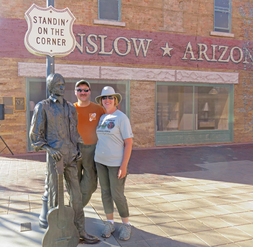
|
|
We did not stay out long as the rally was breaking up and the drivers were trying to get out of Dodge, or Winslow in this case, so we figured it would be safer back at the hotel. We got started on the packing then hit the balcony for another beer then cleaned up for dinner. When Lynn went in for her shower I finally had my chance to sneak down to the gift store and buy her the turquoise cuff she likes. Anniversary gift secured! Oh shucks, I forgot my room key so I had to race down to the front desk and get a spare. I managed to get back with the spare before she knew I was gone. Mission accomplished.
Last night of the trip and we'll have dinner again at the Turquoise Room. And why not? It was great the past two nights and tonight was no different, except that the place was really hopping tonight. Because it is Saturday night? Maybe the end of the car show? Hard to say. I had asked for Vanessa again for our server; she's a sweetheart. Even though the joint was jumping, we had a relaxed time and a wonderful meal. Great to end on a high note.
We were again wiped out and crashed early. Lynn found "Crocodile Dundee" on TV. She was out quickly but I got hooked and watched the remainder. No idea why as I've only seen that flick about 20 times. But it is entertaining and fun to look back at life in the 80s. I finally clocked-out at 10:00. I think this was the latest I was up for the entire trip.
Day 12, Sunday, October 8 - Heading Home. I was awake at 5:00. No need for an alarm clock. Lynn was still asleep so I gave her a few more minutes since most of the packing was done. But she was soon wiggling and talking so we got the day rolling. We wanted to get on the road as soon as we could, but were still not in a hurry. Dressed, packed, checked-out, loaded-up and pulling away from La Posada at 6:25, so well ahead of schedule. Another chilly morning (41 F) but it looks like a nice looking day in the making. There were still a few classic cars in the parking lot, but no time for other a passing glance as we are ready to get back east.
The drive to Phoenix was pretty easy. I-40 was very busy with truck traffic. But they were moving along at or above the 75 mph speed limit. Somewhere between Winslow and Flagstaff we hit a wide open stretch of straight road with a BNSF container train rolling westbound along the tracks parallel to and just south of the highway. This was just the situation we had 40 years ago during our family trip "out west" when Dad and Uncle Jim pulled over to watch a passing Santa Fe mixed freight cruise passed. I miss those guys.
Traffic was lighter on I-17 South. Not nearly as many big rigs. As was the case driving north, I think this is our first time on this stretch of road, again as we are typically on our way to Sedona and would be on 89A by now. We toyed with the idea of diverting to route 179 to the Village of Oak Creek and a stop at Mike's for breakfast but decided that we should stick to the plan and get to the airport sooner rather than later.
Not much in terms of critters but we kept looking as there were elk, deer and burro crossing signs all along our route. The only sighting of note was a big, I mean really big, bird of prey. Lynn got a better look at it and was convinced it was not a vulture due to the lighter coloring in the breast. We're going with Golden Eagle, second likely sighting of the trip.
Traffic was spotty as we neared Phoenix, always moving at a good clip, but alternating between crowded roads to nearly having the highway to ourselves. There was a huge issue of some sort in the northbound lanes that closed the highway in that direction. An accident I suppose, but there were several police vehicles arrayed across the road. I hope everything is OK there. But there was no impact to the southbound traffic so kept moving.
Baby got us to the airport but she gets confused on the route to the rental car return so we gave her the rest of the day off and followed the signage. We pulled into the garage in exactly three hours, just as our slightly befuddled GPS estimated. Much warmer here at 77 F, but still clear blue sky. A nice looking day in the Valley of the Sun.
From the time we arrived at the rental car return to walking out of the TSA checkpoint only took 40 minutes. That's remarkable. But the lines were short and the folks all pleasant and helpful particularly at Southwest check-in. TSA Pre-check helped as well. It is always nice getting to keep shoes on during the security process. I quipped to Lynn that they probably knew we were hiking in the desert and just did not want us dumping sand all over their spiffy airport.
Once in the C gate area we scouted for food. PHX has installed interactive information kiosks which were quite handy. Looks like a Panera near our gate. That should work. We walked across the enclosed bridge connecting the low and high numbered C gate areas. Really cool etched glass showing elevation and plan views of several classic civil transports: Boeing 747, 377 and 314 Clipper, Lockheed Constellation and others. Pretty cool. Once across the bridge we also walked by a Zinc Brassiere and checked the menu. Shucks, too late for breakfast but there other items of interest. We'll check Panera to see if breakfast us still an option there. I mean they always have bagels. We found Panera, but they were using tablets to take orders. OK, we deal with technology on a daily basis but after 12 days computer free, this was just more than we wanted to deal with. Back to Zinc. The ham and cheese baguette was tasty as were the fries. I really liked the dipping sauce for the fries. Lynn had the grilled chicken baguette. I ended up with most of her fries (still on vacation; diet starts tomorrow...or the day after that).
1100 at the gate. Early bird check-in snagged us boarding slots B12 and B13. We would have been in the high C's otherwise since we were out in the middle of the desert yesterday at noon. It was packed in the gate area, and the flight was full, but boarding went pretty smoothly. I snagged seat 2F, so front of the bus. Lynn was further back in row 10 but she caught an aisle seat like she wanted, but we were on the 737 and on time. To pass the time, I worked on the journal, polished off a few cross-sums and finally completed level 194 on Angry Birds Blast (what a dumb game). We must have had a tail wind as we arrived in CLE about 20 minutes early. From here the process was sort of slow (deplaning took longer than it should, the bags seemed to be delayed getting to the claim area and the shuttle to the off-site parking was dragging), but in the grand scheme of things not too bad. It is raining in Cleveland, first time in weeks, so no complaints as we need the water. We went directly to Lagerheads to grab dinner. The dining room was already closed for the evening so we sat in the bar with the Tribe fans watching the playoffs which made for much more noise than I was ready for after 12 days of relative peace. But the High Five IPA was welcome at the end to the day. Lynn commented that it was the best beer of the trip. I think she is correct.
By the numbers. Yeah, I’m a geek, I just have to add up some of the numbers for the trip (just not the cost; that I’d rather not worry about).
We did pretty well on critter sightings this trip. Not the huge numbers or the mega-fauna like we get Yellowstone or the Tetons, but not bad for the desert southwest. We did add two more birds (Chukar and Townsend’s Warbler) to the "life list" bringing us to 321. total. The following is the list of animals that we could reasonably well identify (there were several other birds, butterflies and little furry varmints that we were not sure what exactly they were):
Last night of the trip and we'll have dinner again at the Turquoise Room. And why not? It was great the past two nights and tonight was no different, except that the place was really hopping tonight. Because it is Saturday night? Maybe the end of the car show? Hard to say. I had asked for Vanessa again for our server; she's a sweetheart. Even though the joint was jumping, we had a relaxed time and a wonderful meal. Great to end on a high note.
We were again wiped out and crashed early. Lynn found "Crocodile Dundee" on TV. She was out quickly but I got hooked and watched the remainder. No idea why as I've only seen that flick about 20 times. But it is entertaining and fun to look back at life in the 80s. I finally clocked-out at 10:00. I think this was the latest I was up for the entire trip.
Day 12, Sunday, October 8 - Heading Home. I was awake at 5:00. No need for an alarm clock. Lynn was still asleep so I gave her a few more minutes since most of the packing was done. But she was soon wiggling and talking so we got the day rolling. We wanted to get on the road as soon as we could, but were still not in a hurry. Dressed, packed, checked-out, loaded-up and pulling away from La Posada at 6:25, so well ahead of schedule. Another chilly morning (41 F) but it looks like a nice looking day in the making. There were still a few classic cars in the parking lot, but no time for other a passing glance as we are ready to get back east.
The drive to Phoenix was pretty easy. I-40 was very busy with truck traffic. But they were moving along at or above the 75 mph speed limit. Somewhere between Winslow and Flagstaff we hit a wide open stretch of straight road with a BNSF container train rolling westbound along the tracks parallel to and just south of the highway. This was just the situation we had 40 years ago during our family trip "out west" when Dad and Uncle Jim pulled over to watch a passing Santa Fe mixed freight cruise passed. I miss those guys.
Traffic was lighter on I-17 South. Not nearly as many big rigs. As was the case driving north, I think this is our first time on this stretch of road, again as we are typically on our way to Sedona and would be on 89A by now. We toyed with the idea of diverting to route 179 to the Village of Oak Creek and a stop at Mike's for breakfast but decided that we should stick to the plan and get to the airport sooner rather than later.
Not much in terms of critters but we kept looking as there were elk, deer and burro crossing signs all along our route. The only sighting of note was a big, I mean really big, bird of prey. Lynn got a better look at it and was convinced it was not a vulture due to the lighter coloring in the breast. We're going with Golden Eagle, second likely sighting of the trip.
Traffic was spotty as we neared Phoenix, always moving at a good clip, but alternating between crowded roads to nearly having the highway to ourselves. There was a huge issue of some sort in the northbound lanes that closed the highway in that direction. An accident I suppose, but there were several police vehicles arrayed across the road. I hope everything is OK there. But there was no impact to the southbound traffic so kept moving.
Baby got us to the airport but she gets confused on the route to the rental car return so we gave her the rest of the day off and followed the signage. We pulled into the garage in exactly three hours, just as our slightly befuddled GPS estimated. Much warmer here at 77 F, but still clear blue sky. A nice looking day in the Valley of the Sun.
From the time we arrived at the rental car return to walking out of the TSA checkpoint only took 40 minutes. That's remarkable. But the lines were short and the folks all pleasant and helpful particularly at Southwest check-in. TSA Pre-check helped as well. It is always nice getting to keep shoes on during the security process. I quipped to Lynn that they probably knew we were hiking in the desert and just did not want us dumping sand all over their spiffy airport.
Once in the C gate area we scouted for food. PHX has installed interactive information kiosks which were quite handy. Looks like a Panera near our gate. That should work. We walked across the enclosed bridge connecting the low and high numbered C gate areas. Really cool etched glass showing elevation and plan views of several classic civil transports: Boeing 747, 377 and 314 Clipper, Lockheed Constellation and others. Pretty cool. Once across the bridge we also walked by a Zinc Brassiere and checked the menu. Shucks, too late for breakfast but there other items of interest. We'll check Panera to see if breakfast us still an option there. I mean they always have bagels. We found Panera, but they were using tablets to take orders. OK, we deal with technology on a daily basis but after 12 days computer free, this was just more than we wanted to deal with. Back to Zinc. The ham and cheese baguette was tasty as were the fries. I really liked the dipping sauce for the fries. Lynn had the grilled chicken baguette. I ended up with most of her fries (still on vacation; diet starts tomorrow...or the day after that).
1100 at the gate. Early bird check-in snagged us boarding slots B12 and B13. We would have been in the high C's otherwise since we were out in the middle of the desert yesterday at noon. It was packed in the gate area, and the flight was full, but boarding went pretty smoothly. I snagged seat 2F, so front of the bus. Lynn was further back in row 10 but she caught an aisle seat like she wanted, but we were on the 737 and on time. To pass the time, I worked on the journal, polished off a few cross-sums and finally completed level 194 on Angry Birds Blast (what a dumb game). We must have had a tail wind as we arrived in CLE about 20 minutes early. From here the process was sort of slow (deplaning took longer than it should, the bags seemed to be delayed getting to the claim area and the shuttle to the off-site parking was dragging), but in the grand scheme of things not too bad. It is raining in Cleveland, first time in weeks, so no complaints as we need the water. We went directly to Lagerheads to grab dinner. The dining room was already closed for the evening so we sat in the bar with the Tribe fans watching the playoffs which made for much more noise than I was ready for after 12 days of relative peace. But the High Five IPA was welcome at the end to the day. Lynn commented that it was the best beer of the trip. I think she is correct.
By the numbers. Yeah, I’m a geek, I just have to add up some of the numbers for the trip (just not the cost; that I’d rather not worry about).
- 1280 miles on the Rogue.
- Not a lot of hiking miles, but in the end we had 24.0 miles logged on the trails:
- 9/28: Walnut Canyon: 1.9 miles total (1:45)
- 9/29: White Pocket: 1.5 miles (2:19)
- 9/30: Lower Antelope: 1.6 miles (2:00)
- 9/30: Page Rim Trail: 3.6 miles (1:35)
- 10/1: Howie's Hoodoos: 5.4 miles (4:12)
- 10/2: West Clark Bench: 6.9 miles (Lynn had 5.8) (5:43)
- 10/3: Navajo NM, Sandal Trail: 1.1 miles (0:44)
- 10/7: Blue Mesa: 1.1 miles (0:37)
- 10/7: Crystal Forest: 0.9 miles (0:32)
- We added five National Park Service sites to our list:
- Walnut Canyon National Monument
- Navajo National Monument
- Canyon de Chelly National Monument
- Hubbell Trading Post National Historic Site
- Petrified Forest National Park
- Number of pages for this journal: 77.
- Number of photos: 3475, after some culling, editing and creation of panoramic images.
We did pretty well on critter sightings this trip. Not the huge numbers or the mega-fauna like we get Yellowstone or the Tetons, but not bad for the desert southwest. We did add two more birds (Chukar and Townsend’s Warbler) to the "life list" bringing us to 321. total. The following is the list of animals that we could reasonably well identify (there were several other birds, butterflies and little furry varmints that we were not sure what exactly they were):
|
Mammals:
|
Birds:
|
|
Final thoughts…. That's the end of the travel season for Lynn and me, although I still have a couple short business trips to attend to still in 2017. But this was a great end to a wonderful year of vacations. While all the UTAH meet-up events are special in their own way, the time that the Herd spent in Page was really outstanding. This gathering was very low stress and a whole lot of fun! The hikes that Howie led were all amazing adventures and having that big house where the gang could congregate each evening was just ideal. Too bad we can't find a place like that to rent at each of our meet-up destinations. We'll see what we can work out for 2018 when we converge on Torrey.
The post-meet-up tour of northern Arizona was both fun and educational. Hey, we’re always looking to learn something on these trips. Between the ruins and rock art, the Navajo culture and geology, we learned a something new every day. We enjoyed staying at La Posada so much that we’ll certainly make that a destination sometime in the near future, probably following another meet-up. We already know that we need to get back to Petrified Forest again, so the start of another trip is in the making.
The post-meet-up tour of northern Arizona was both fun and educational. Hey, we’re always looking to learn something on these trips. Between the ruins and rock art, the Navajo culture and geology, we learned a something new every day. We enjoyed staying at La Posada so much that we’ll certainly make that a destination sometime in the near future, probably following another meet-up. We already know that we need to get back to Petrified Forest again, so the start of another trip is in the making.