Trip Journal: UTAH Meet-up in Page, AZ, plus Chinle and Winslow
Wednesday, September 27, through Sunday, October 8, 2017
Introduction. Lynn and I talk about our travels quite a bit, sometimes planning the next trip, or tossing around ideas for future trips and of course remembering the highlights of past trips. We found ourselves doing just that, thinking of four great excursions we had just completed with our friends, while we were still in the middle of that trip. Granted, we had time to kill as we were touring through the northern Arizona desert, but these must have been some outstanding adventures for us to start reliving those memories before I had even downloaded the pictures. And they were. In fact the first half of this trip has been a ball. No stress, lots of fun, wonderful activities shared with fantastic folks and still plenty of time to chill. But those four excursions to four completely different geologic masterpieces were truly a travel highlight that I won't soon forget. White Pocket, Lower Antelope Canyon, Howie's Hoodoos and Edmaire's Secret gave us four consecutive outings that all focused on Mother Nature's sculptures and were each unique and beautiful. Three of these were places that we probably would have never seen without the help from our friends and that made it even better. Yes, we are already reliving those great excursions and we're just to the halfway point of the trip. What wonders await us during the rest of our little road trip? As usual I am getting ahead of myself. Let me start from the beginning…
The reason we are out in the northern Arizona desert is for the 8th annual fall meet-up of the Utah Trip Advisor Herd. The Herd selected Page, the gateway town for the Glenn Canyon National Recreation Area, as our gathering point. This made a lot of sense as John, one of the new cats in the Herd, is the expert on Lake Powell and had a lot of great ideas for boating excursions on the lake. And John came through in a big way with two days of adventures out on the water, a relaxed day on a pontoon boat and a more dynamic exploration of the lake using a speedboat. There were plenty of takers for these excursions.
But not all the cats were interested in getting out on the lake, Lynn and me included. The good news there is that Page offers a lot of other options with plenty of hiking to some amazing rock formations, just like the four excursions mentioned above. You just have to know where to look. One place that we did look was the Wave, as probably all of the Herd members put in for permits. But unlike our remarkable success with these highly prized permits in 2011 at the Kanab meet-up, we were completely shutout this year. Hey, it was worth a shot. But we found a few other destinations that rivaled the Wave for their beauty and intriguing natural rock art. Howie gets the credit here as he guided us into three simply amazing areas to marvel at the sandstone wonders.
But the meet-up was not all the Lynn and I had planned. We added a few days following our adventures in Page to tour around parts of Northern Arizona that we have not explored previously. I had at least been through part of that area as a kid when my family made our big vacation "out west" in 1975 (or was is 1976?), but that was so long ago that it really does not count. There were a couple National Park Service units that we wanted to visit, Canyon de Chelly and Petrified Forest were the top of the list, and Alex and Frankie turned us on to the Rock Art Ranch near Winslow as a great place to spend a day and see some wonderful petroglyph panels. They also suggested the La Posada Hotel in Winslow as the place to stay while exploring the area. These were two excellent suggestions.
After it was all said and done, we had a great trip, covered a lot of ground, saw a lot of beautiful rocks, drank many good beers and spent some quality time with some truly great friends. While every meet-up is wonderful and has many special memories, the Page meet-up ranks near the top of the list for me.
The Plan. Planning began even before the Bluff meet-up since we had a line-up for the next couple of locations (Bluff, Page, and then probably Torrey). We were looking into houses in Page in July 2016 when Alex and Frankie were in town for her high school reunion and stayed with us for a couple days as well. Through VRBO we found two great houses right next to each other that could have held most all of the Herd, however when we checked with the owner of the more grand house we would have had to pay an extra fee to host a party of over 15 folks. Let me get this straight, you have a party house and won't allow parties? "No, sorry." That's just crazy. Turns out they got burned on this a couple times so they are protecting themselves. OK, I get that, but we'll just have to look elsewhere. And we did. And I later found another great house for the Herd to use as a focal point and the owners there were much more amenable. In fact, they built this house specifically for large gatherings. While not as fancy as the grand house, this place looked ideal for the Herd and could easily hold four couples (six bedroom, five bathroom, but four were configured as suites, so we'll start with that arrangement and see how it works out). Alex and Frankie were in for the house and we invited meet-up regulars Howie and Deb and Donna and Oscar to join us, and later our Mother Hen, Max, was added to the mix. That will be a great crew.
Over the course of the next several months the Herd worked out the details of daily activities. John had the boating excursions covered, so no worries there. Howie suggested a trip out to White Pocket for the first day and we were able to organize a convoy of vehicles appropriate for the 4WD track (I did look into outfitters who could get us out there as well, just in case we did not have enough drivers and high-clearance vehicles to get everyone out there, but as it happens we had more than enough bandwidth to transport everyone who wanted to go). Howie also had a couple other ideas for hikes and Lynn wanted to see Lower Antelope Canyon, so that should fill our dance card for the meet-up. I did do a little research on hikes in the area, but the only other interesting hike that I found that did not require a 4WD to reach the trailhead was Bucktank Draw to Birthday Arch. We'll keep that open as an option if needed.
Once all the planning was done, we had a nice looking itinerary for the trip. Here's the summary:
Wednesday, 27 September - Later afternoon travel to PHX. We decided to fly out Wednesday evening so that we could have all day on Thursday for the drive to Page. That would give us more time to buy supplies and to perhaps explore a bit along the drive. We had a direct flight on Southwest, departing CLE at 6:25 PM and arriving at PHX at 7:40 PM. I found a nice looking Comfort Suites near the airport and our offsite rental car pick-up, so we were able to take the hotel shuttle from the airport and just get the car the next morning (walking distance to the rental car place).
Thursday, 28 September - Driving to Page. I'll pick up the rental car from Enterprise at 8:00 AM (it is less than a mile away from the hotel) and we'll be on our way. Planned stops as we head north include buying supplies, exploring Walnut Canyon National Monument near Flagstaff and Cameron Trading Post. We'll have a cook-out at the rental house this evening.
Friday, 29 September - Hike with Howie to White Pocket. First day of the meet-up and we'll head to White Pocket with the Herd with Howie as our leader. Tonight will be the official opening dinner at our VRBO.
Saturday, 30 September - Lower Antelope Canyon. Since the majority of the Herd will be out on the Lake today, this might be a good time for Lynn and I (and anyone else who wants to go) to tour Lower Antelope Canyon. We'll figure out dinner as we go since the boaters are planning a big lunch out on the lake.
Sunday, 1 October - Hiking somewhere. This is sort of an open day, but we'll be on the trail somewhere. There are plenty of options, it is just a matter of picking a good one. We'll tap into the collective knowledge of the Herd to find a winner. The thinking is that we'll have a group dinner at The Dam Bar and Grill.
Monday, 2 October - Hike with Howie. We'll make the trek out to the West Clark Bench from the Wirepass Trailhead along the House Rock Valley Road to see Edmaiers Secret. This sounds like a great hike! We'll finish up the leftovers for dinner, supplemented with pizza if necessary.
Tuesday, 3 October - Drive to Chinle. I bet we'll have breakfast at the VRBO the Herd will disperse. Lynn and I will make the drive from Page to Chinle. We'll be staying at the Thunderbird Lodge at the entrance of the park. We will probably stop at Navajo National Monument along the way and tour one rim of Canyon de Chelly in the late afternoon.
Wednesday, 4 October - Touring Canyon de Chelly. We have a tour scheduled with Antelope House Tours at 9:00 AM. Looks like Adam Teller, the owner, will be our guide for our 4-hour, 4x4 tour through the canyon.
Thursday, 5 October - Transition to Winslow. More touring along the rim of Canyon de Chelly in the morning then we'll start the drive toward Winslow, with stops at Hubbell Trading Post National Historic Site and Meteor Crater. We have three nights reserved at the La Posada in Winslow. Frankie says that the dining room at the hotel is excellent so we'll check that out for dinner.
Friday, 6 October - Rock Art Ranch. Tour scheduled for 10:00 AM and should last most of the rest of the day.
Saturday, 7 October - Petrified Forest. We'll spend the day at Petrified Forest National Park. This will be mostly a driving tour, I think, with a couple short hikes. The Blue Mesa area looks very interesting.
Sunday, 8 October - Back Home. We have a 12:15 flight out of PHX on Southwest, so plenty of time to get to the airport from Winslow, but we'll get on the road as early as practical to avoid any delays. Direct flight but with the time change it will be 7:00 PM before we arrive in CLE. I bet we stop at Lagerheads for dinner on the way home.
Monday, 9 October - Holiday. Bonus! Monday is a holiday so we get an extra day at home to rest up from our adventures.
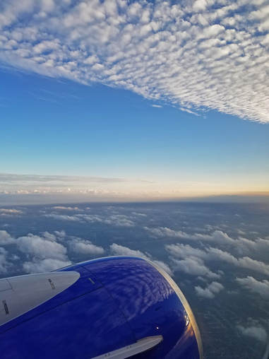
The general route planned for the 2017 trip to Arizona (and some of the actual tweaks made during the trip).
As usual, the plan was meant to be flexible, as we'll adjust on the fly as needed. Plus there is plenty of downtime built in for afternoon beers.
Day 1, Wednesday, September 27, 2017 - Evening flight to PHX. Finished up the packing details this morning, took out the garbage, fed the cats, packed a lite lunch and we were on the road, just a little later than usual heading to work. This is certainly one trip that it really worked out well that we got most all of our packing done over the weekend. That made Monday and Tuesday evenings much less hectic, particularly Tuesday since we were late getting home and still had some yard chores to complete. The very dry weather meant that we have to water the newer trees regularly and tonight was our last chance before we headed west. The funny thing is that we are heading to the desert southwest where it has been much cooler than here in northern Ohio. Shoot we are coming off a string of record breaking high temperatures in the low 90s. But this morning was fairly pleasant. I was enjoying the deep red color of the leaves on the maple trees lining the driveway on by walk to the barn before heading off to work.
A fairly easy and relaxed work day. I made some final tweaks to a presentation I making at a conference at the end of October. I think it is in good shape so I can forget about that until I get back. My final meeting let out 15 minutes early which got us out the door on schedule. Lynn had already called and she was ready to go and feeling chipper. She successfully completed her last action and was now ready for vacation. At 3:05 I was walking out of my office and to the parking lot so that I could collect Lynn and head over to Hopkins. Bummer, all the on-site lots are full so we continued over to Snow Road and stashed the Edge at Park Place. Parking offsite is still pretty convenient, but just not as quick as the orange lot at CLE. Even with the additional few minutes to get back to the terminal from the parking, the rest of the process was pretty quick and we were through check-on at Southwest and security in less than an hour, so not too bad. I'm still trying to figure out how Lynn, who only flies a couple times a year got TSA precheck and I did not. What's up with that? Since she had precheck, we went through different checkpoints (the standard line at the United end of the terminal was very short, so I went there). I chatted a bit with the lady in front of me while we were waiting for our bags to come down the scanner conveyer belt. On the upstream side of the checkpoint the stack of grey trays was depleted, so she informed one of the TSA agents that we were out of "BEE-inns." Hey, I speak that language, that's southern for "bin." Turns out she is from Mississippi.
A fairly easy and relaxed work day. I made some final tweaks to a presentation I making at a conference at the end of October. I think it is in good shape so I can forget about that until I get back. My final meeting let out 15 minutes early which got us out the door on schedule. Lynn had already called and she was ready to go and feeling chipper. She successfully completed her last action and was now ready for vacation. At 3:05 I was walking out of my office and to the parking lot so that I could collect Lynn and head over to Hopkins. Bummer, all the on-site lots are full so we continued over to Snow Road and stashed the Edge at Park Place. Parking offsite is still pretty convenient, but just not as quick as the orange lot at CLE. Even with the additional few minutes to get back to the terminal from the parking, the rest of the process was pretty quick and we were through check-on at Southwest and security in less than an hour, so not too bad. I'm still trying to figure out how Lynn, who only flies a couple times a year got TSA precheck and I did not. What's up with that? Since she had precheck, we went through different checkpoints (the standard line at the United end of the terminal was very short, so I went there). I chatted a bit with the lady in front of me while we were waiting for our bags to come down the scanner conveyer belt. On the upstream side of the checkpoint the stack of grey trays was depleted, so she informed one of the TSA agents that we were out of "BEE-inns." Hey, I speak that language, that's southern for "bin." Turns out she is from Mississippi.
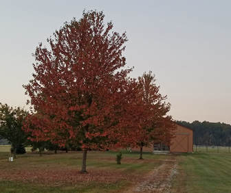
 First beer of the trip with my best friend.
I met Lynn as she was walking through the food court. She had time to check out the bookstore before I got through security. But now it was time to find a beer and officially start this vacation. We were at Bar Symon at 4:00, a tall Headhunter IPA in hand. Yep, vacation has begun. We both ordered the Cobb salad although I had mine with blue cheese dressing instead of the vinaigrette. Lynn ate the avocado off my salad (remember, Soylent Green is people!). Great beer. Good start to the trip. While a bit on the expensive side, the salad was very good with fresh ingredients so plenty of crunch in the veggies (as there should be for $15). The tall IPA also was not cheap at $12. Airports just get away with murder when it comes to prices. Hopefully those proposed tax cuts that were being discussed on the news will be put in place so that I can afford the airport food.
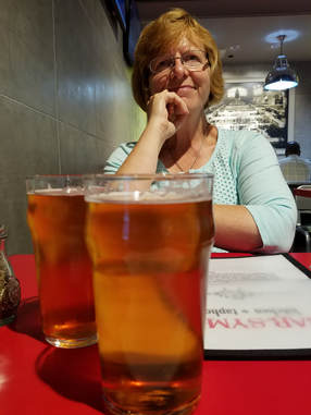
After our late lunch, we made a lap through the airport, first through the C then down to the A concourse just for a stretch of the legs. Looks like United has given up more gates and American has moved into the main hall in C Concourse. A concourse was pretty quiet. There's a Christmas tree and lights up already at the end of A Concourse where Frontier resides. What's up with that? But overall Hopkins is pretty nice with the updated interior, interesting artwork and some very good dining options. Lynn and I were just commenting on this the other night how the airport service and experience is on the upswing while that of the carriers is dwindling. I mean United has really fallen apart. Sure the individual employee is doing a fine job but the company seems to have lost its way. We finished our tour of the airport and then settled in at gate B11 with just a few minutes to go before boarding starts. I had secured boarding slots B28 and B29 when I checked-in yesterday evening. Those seem like reasonable numbers so we should be able to get decent seats as well as space in the overhead BEE-inns. I was able to get seat 10a, so not too bad...actually pretty good. Lynn was looking for an aisle seat and had to go a few rows further aft but not too far. We settled in for the flight. Pretty views out the window this evening, with the clouds reflecting in the brightly colored engine nacelle of the 737. I passed the time on the plane working on the trip notes from Glacier, working a few puzzles and listening to my odd mix of tunes. Hmmmm, is there a conflict of interest listening to "Rhapsody in Blue" on a Southwest flight?
After our late lunch, we made a lap through the airport, first through the C then down to the A concourse just for a stretch of the legs. Looks like United has given up more gates and American has moved into the main hall in C Concourse. A concourse was pretty quiet. There's a Christmas tree and lights up already at the end of A Concourse where Frontier resides. What's up with that? But overall Hopkins is pretty nice with the updated interior, interesting artwork and some very good dining options. Lynn and I were just commenting on this the other night how the airport service and experience is on the upswing while that of the carriers is dwindling. I mean United has really fallen apart. Sure the individual employee is doing a fine job but the company seems to have lost its way. We finished our tour of the airport and then settled in at gate B11 with just a few minutes to go before boarding starts. I had secured boarding slots B28 and B29 when I checked-in yesterday evening. Those seem like reasonable numbers so we should be able to get decent seats as well as space in the overhead BEE-inns. I was able to get seat 10a, so not too bad...actually pretty good. Lynn was looking for an aisle seat and had to go a few rows further aft but not too far. We settled in for the flight. Pretty views out the window this evening, with the clouds reflecting in the brightly colored engine nacelle of the 737. I passed the time on the plane working on the trip notes from Glacier, working a few puzzles and listening to my odd mix of tunes. Hmmmm, is there a conflict of interest listening to "Rhapsody in Blue" on a Southwest flight?
 A nice view from the port side of Southwest flight 1933 as we journey west.
The flight was a little behind schedule. Not sure how that happened as we seemed to have an on time departure. We must have hit a head wind. But we were here at PHX safe and sound and that's what is important. A short wait for our bags then I called the hotel for the shuttle pick-up. The good news was that the hotel shuttle was already at the airport collecting other guests so we had no wait. That more than makes up for the slightly delayed flight arrival. Check-in at the Comfort Suites was quick. We grabbed a couple cookies and a bottle of water and were in the room to stay at 8:45. I had a message from Enterprise that came in while we were on the plane looking for confirmation of our reservation but they were closed by the time I got the voice mail. I hope they have our car ready at 0800. We tweaked our plan for the morning to get us out of Phoenix a little sooner, assuming that our ride is available. We'll head straight to Walnut Canyon, then pick up provisions in Flagstaff make a quick stop at Cameron Trading Post and finally continue to Page for the meet-up. This way our beer and groceries are not sitting in the car while we are exploring the park. I had already done a little research with this contingency in mind, so I had a couple Flagstaff beer stores queued up.
Day 2, Thursday, September 28 - Drive to Page. As expected, we were awake early local time, like before 0300. But we just catnapped for a while and finally started the day a little before 0500. Plenty of time before I can get the rental car so we got ready for the day, tried out the breakfast bar, which was just like every other free breakfast offered at this class of chain hotel. Still the bagel and banana were filling and will provide fuel for this morning.
At 7:40 I started my walk over to get the rental car, arriving just before they opened but I could see the appropriate size SUV getting a bath in the back. Looks like they have our chariot. After the paperwork was completed, I had to wait a few minutes for them to clean the windows of our SUV. It must have a LOT of windows. But I was still out of there in short order, back at the hotel where we loaded up and we were on the road at 8:35.
We had a very nice day for a drive, cruising north under a clear blue sky. We've taken the stretch of I-17 north from Phoenix to Sedona several times and I always enjoy the scenery. Granted it is not the most spectacular that we have seen in the desert southwest but there is nice variety along the route due to the elevation change. We'll get a bit of a bonus this trip as I don't think we have driven the section of I-17 between the route 179 exit and Flagstaff, as we are usually heading to Sedona and thus miss this stretch of road. Now we are heading into even higher elevation, reaching about 7,000 feet above sea level by the time we get to Flagstaff. The Saguaro cactus petered out at about 3,000 feet, then the junipers came into view before giving way to the Ponderosa Pines as we climbed. The only clouds in view now were those seemingly tied to the peaks of the San Francisco Mountains off to the northeast.
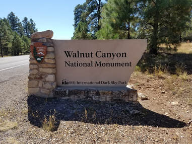
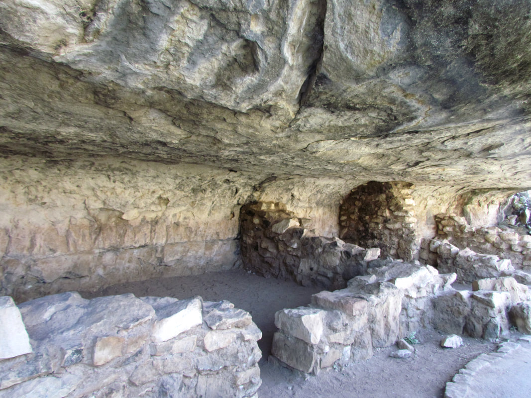
We made a short detour east on I-40 to Walnut Canyon National Monument, arriving right at 11:00 AM. This was about the halfway point of our drive today so good timing for a break. Our first stop in the park was to get our "passport stamp" photo of the entrance sign where I was greeted by a pair of noisy Stellar's Jays. We then continued to the visitor center and the short trails that would give us some access to the area. Walnut Canyon is a small monument but is contains a lot of ruins left by the ancient inhabitants who once lived in the canyon. It was an interesting and educational stop for us, but not a long one as we covered the main area of the park and walked to the two short trails in about two hours.
Ideal conditions for our visit. Still clear, blue above us and the temperature here at nearly 7,000 feet was in the low 60s. We grabbed our cameras and headed to the visitor center and trailhead. We checked in with the Ranger at the information desk, showing our National Park's Pass (still the best deal on the planet!) then continued inside. Not much in the building so we continued outside to the overlook and the start of the Island Trail. The island is a really more of a peninsula of rock extending from the main canyon wall following the contour of the canyon floor where the creek once ran. This is an area with a high concentration of ruin sites. The trail works its way down the canyon wall then loops around the peninsula to allow great access to the ancient dwelling sites. The trail is only a mile long, give or take a little, and it paved, but there is a 185 foot elevation change that is rather steep to get down to the level of the ruins and at nearly 7,000 feet above sea level it was a bit strenuous.
There was very good signage along the Island Trail that told of the history of the people and their community in Walnut Canyon. We took our time and reviewed most of the signs as we went and I've tried to summarize the main themes below.
The Island Trail follows a sharp meander of Walnut Creek. Many cliff dwelling rooms, unique in this area, were built throughout the canyon at the level of the trail. On both rims are numerous pithouses and pueblos. On the very top of the rock promontory or "island" are more rooms. Walls were constructed to block easy access to these rooms. Maybe this intriguing arrangement of sites met seasonal, security, social, or ritual needs. People lived here in the canyon as recently as the mid-1200s. These families tended crops on the rim, traveled throughout the area to gather food and collected water from the creek in the canyon floor as part of their daily routine. The farming community of Walnut Canyon flourished between about 1125 and 1250. The various communities across the southwest were united by corn, cultivation and village life, but the architecture, pottery, and tools differed across space and time. Archeologists used these different traits, which occurred in pattern on the landscape, to describe and label cultural traditions such as Ancestral Puebloan (Anasazi) and Sinagua. Walnut Canyon, with its compact villages of adjoining, rectangular room blocks (called pueblos by the Spanish) and plain brown pottery lies within the heart of the Sinagua tradition. A map showed that the Sinagua culture was in an area that is now central to north-central Arizona with the San Francisco Peaks roughly in the middle of the area.
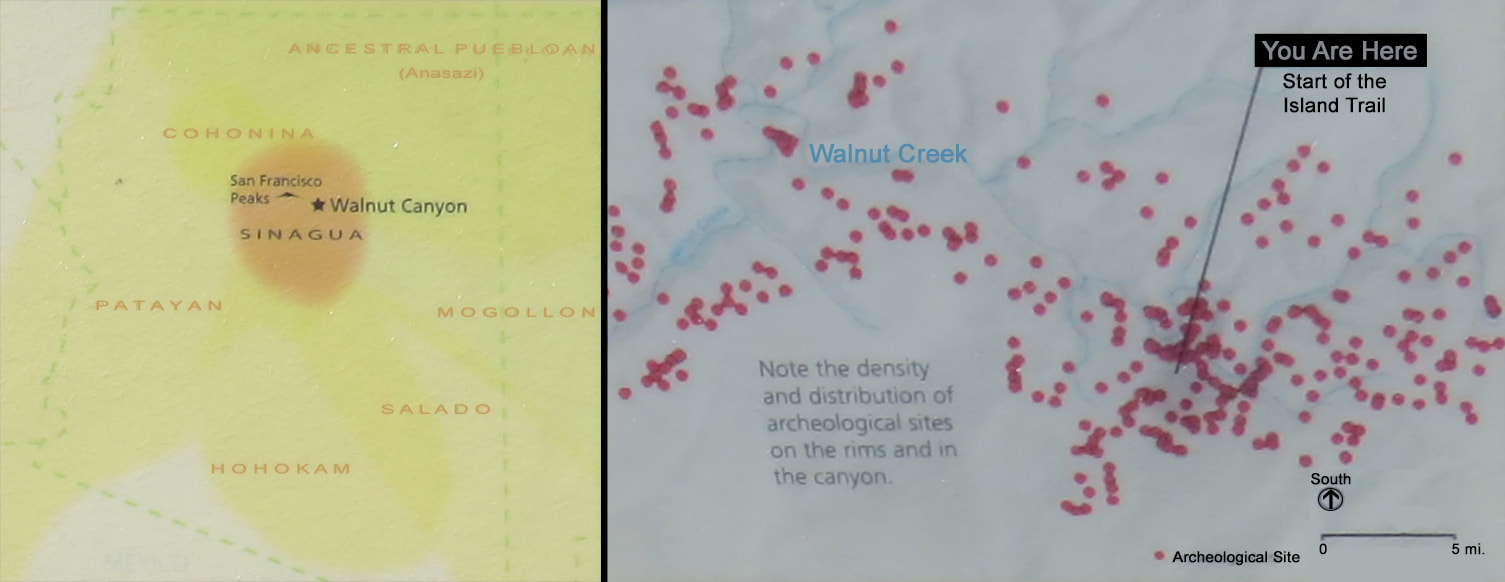
The population in Walnut Canyon during its occupation is estimated to be between 75 and 400 people. Maybe the folks living here 800 years ago called this place Wupatupqa or "the long canyon" as it is known to some of their descendants, the Hopi. This was certainly known as a place of abundance, given its wealth of plant and animal life and the presence of water in the canyon. Interestingly, the creek no longer flows through Walnut Canyon as its water have been impounded for use by the city of Flagstaff since 1904.
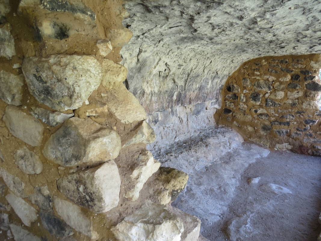
Walnut Canyon was known and used by people for thousands of years before it became a focal point for a community during the 1100s. Changing natural and social conditions across the region undoubtedly played into the decision to settle here. By 1100 the Southwest's population had swelled. People were looking for new places to live and farm. There may have been other attractions. Some tribal consultants believe people built here for refuge and protection or for isolation and ceremonial preparation. The steep, shear walls of Walnut Canyon provided building advantages and controlled access which was important for the defense of the community. The natural alcoves in the limestone provided the back wall, floor and leak-proof ceiling of the dwellings; no excavation was needed. The builders used unshaped blocks of limestone for the side walls and enclosed the front with the doorways open to the canyon. Both the inside and outside of the stone walls were plastered, the exterior to keep moisture out and the walls sound and the interior to seal the rooms and make them brighter. They even applied layers of clay to the uneven bedrock ledges to create smooth and level floor surfaces.
The rock layer in which the natural alcoves formed is limestone which was formed by deposits of calcium carbonates in a shallow sea about 250 million year ago, give or take a few 10s of millions of years. Harder layers formed the upper and lower surfaces while softer, silty layers in between have eroded away to create the alcoves. The 300-plus cliff dwelling rooms in Walnut Canyon were all built in these natural alcoves. Most of the rooms in the community did not house people. It is thought that most of the rooms were used to store tools, food and water. Large pottery vessels were used for water storage. The residents could have easy kept a 100-day supply of water given the large storage space available in all of these rooms. The larger rooms were typical living spaces where the people slept and sought shelter from bad weather. Most of the work was done outside, weather permitting.
|
|
The water flowing through Walnut Creek was the lifeblood of the community. During the spring thaw, the creek swelled due to the snowmelt. The creek was also flowed during the summer monsoon season. Shaded pools held water after the flow decreased. But water had to be collected and stored for the dry months. Women and children probably had the task of retrieving water from the creek. They likely supplemented their supply by packing snow into large pots and collecting runoff from overhanging cliffs.
A number of rooms in Walnut Canyon were destroyed by visitors who came armed with shovels and left with souvenirs, an acceptable, even promoted practice during the late 1800s. Meanwhile, other visitors and local citizens, so moved by this canyon and its cliff dwellings, and outraged by the looting, lobbied for federal protection. On November 30, 1915, President Woodrow Wilson proclaimed the establishment of Walnut Canyon National Monument.
The final sign that we passed had the heading "Migration is not abandonment" and contained a message about the canyon both past and present: Walnut Canyon was once filled with sounds of a busy community as families hunted, planted and harvested with the seasons. Children were born, grew up, and raised children of their own. They were neither the first nor the last to use and value what this canyon has to offer. But they left behind the greatest legacy.
When they moved on they did not give up their responsibility to cate for the ancestral village and those left behind. Sites were and are revisited by descendents. Prayers are still offered. Plants are still ritually gathered.
Walnut Canyon was - and is - a place that resonates with life.
So one funny occurrence along the trail. We were sort of following three other tourists around the trail; they were also stopping to read the signs. As we were approaching a sign that talked about how the ancient inhabitants collected water in the canyon, one of the ladies asked "do you think they made their own pots?" Maybe she was thinking there was an ancient Home Depot somewhere in the canyon.
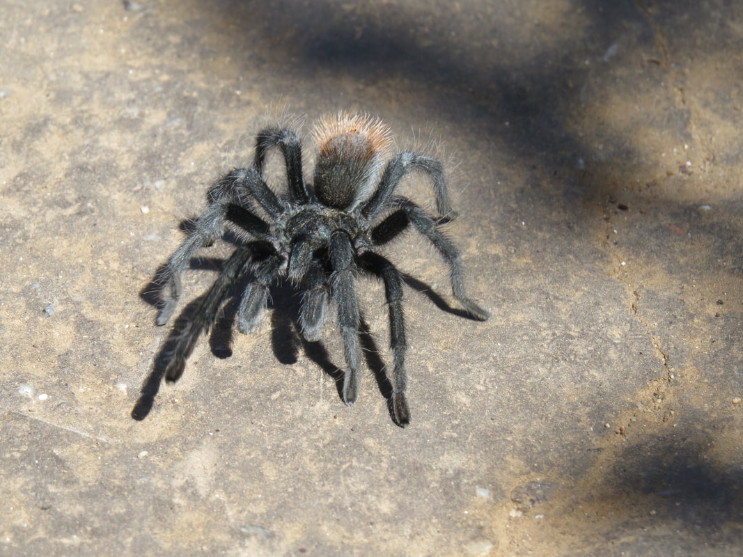
This was a nice little walk and provided great access to the old ruins. The trail runs right along the site of the ancient alcoves housing the remains of the pueblos. We could also see a number of other ruins on the far wall of the canyon, mostly all located at the same elevated of those along the Island Trail. But the trail also afforded lovely views up and down the canyon and gave us a few critter viewing opportunities. The most interesting was a Tarantula just cruising down the center of the trail. I think this was the first time that we have seen one of these big spiders out in the wild (well, other than a long distance view of one on the golf course cart path behind Alex's and Frankie's place in Sedona). These guys can really move! There were also a lot of birds in the area and they were serenading us all during our hike, but they were not coming into view so I have no idea what we were hearing. The one bird sighting that we did get was of a hawk soaring well above the canyon rim. Maybe a Redtail, but it was just too high to tell for sure.
After completing the loop around the Island Trail and making the climb through the switchbacks up to the visitor center, we paused for a bottle of water from the strategically located vending machines before taking the short walk along the Rim Trail. As the name implies, this is a flat trail along the rim of the canyon that leads to a couple viewpoints. It is less than a mile roundtrip. There were a few signs that provided information on the plant and animal life in the area, but I did not see anything else pertaining to the ancient inhabitants. We did spy a chipmunk as we walked out the trail and a Fence Lizard sunning itself on the trail as we returned, but otherwise it was pretty quiet. The trail and the overlooks did provide nice views into the canyon. Nothing spectacular. While there were a few other tourists on the Island Trail, the only other visitor we saw on the Rim Trail was an older gentleman sitting at the viewpoint at the end of the line. We chatted with him a few minutes then moved along.
Here's the link to our photos from the tour around Walnut Canyon.
For whatever reason, the Ramblr app on the phone did not track our walking tour of Walnut Canyon, but I figure the total distance (both trails and to/from car) was about 1.9 miles. Back at the car, I got Baby set up to direct us to the stores in Flagstaff, starting with McGaugh's Smoke and Bottle Shop. It took her a little while to find the route but I knew that we had to be heading west in I-40 back toward town and that gave her a chance to get her bearings (I guess the signal strength is lacking in the park, probably why Ramblr did not work). But once on the case, she led us right to our desired destination. McGaugh's is a small place but it is really focused on beer (they also sell cigars and a little bit of wine, but the craft beer seems to be the main theme here). I was like the proverbial kid in a candy store. So many beers, so little time. They had a great selection of craft beers from all over the place including many local and regional breweries. Plus they had a lot of IPAs, our favorite. And the bonus was that they were set up for the patrons to build their own six-packs. So we built three. Or was it four? And bought a couple other sixers as well. OK, a case and a half of beer. That should get us started. But Lynn was not happy with the wine selection, so we will have to check-out the other shop as well. Bonus!
The other beverage store that visited was Majestic Marketplace which was located in a shopping center area, one of those set up like a little town business district. Majestic is a larger store, again with a very nice assortment of craft beers as well as too many crap beers. I browsed while Lynn looked through the wine offerings of which there were many. They have a bar area with plenty of beer on tap, but I resisted the temptation since we still have a couple hours of driving ahead of us. Lynn made her wine selection and we headed for our final stop in Flagstaff, Fry's Food Store which was just a short drive away. Baby again got us there with no problem. Just a quick stop for breakfast food and trail snacks. Hey look, they have the trailmix that I like, the Wholesome Medley from Second Nature. Unfortunately there was only one bag left on the shelf and that went into my buggy, but Lynn spotted a box of single serving packs so we added that to our loot as well. We toyed with the idea of buying a cheesecake but we talked ourselves out of it since we knew that the Herd would collectively be bringing way to much food to the meet-up.
Back at the Rogue, we loaded our supplies, placing the perishable items in the cooler, then plugged our next destination into the phone. Baby was a little confused when we were leaving Fry's so it took her a few minutes to get on track. Fortunately I had reviewed the map a bit and just followed old route 66 to route 89. We could have jumped on I-40 and got there a skosh quicker but this was a more interesting drive. To our right were the railroad tracks which were quite active with bright orange locomotives of the BNSF. Two diesels sitting alone on one track looked to be brand new as they were so clean and shiny, but we soon passed four old veterans pulling a mixed freight westbound, over 24,000 horses dragging the rest of the train along. On our left was a series of diners and shops that seemed to be doing a good business based on the number of cars in the lots and the folks milling about. Several were reminiscent of the heyday of Route 66, based on what I know of that era (that was before my time). While it is not my preferred cup of tea, I do appreciate the effort of saving the flavor of that time as it is something that many travelers enjoy. Shoot, we might have looked around here more today but we need to make tracks toward Page.
As we made our way along the short section of historic 66, I caught sight of the red and white checkerboard-patterned logo on the side of the tall concrete silo at the Purina pet food plant. That's my marker for route 89 north, as the place sits basically at the intersection of 89 and I-40. Old route 66 faded away and we rolled smoothly into 89 north. A couple more traffic lights as we left Flagstaff then we were back to the open road. We were now reversing the view in terms of vegetation as we dropped in elevation over the next several miles, leaving the big pines and continuing back into the juniper. Off in the distance we could see the pink and white sandstone ridge. Gotta love those colorful rocks. We will get to enjoy them from close range shortly.
Baby has her act together now. Straight sailing north on 89 to Cameron, although she shows that our next "turn" is to pass through a traffic circle just a mile or so before the trading post. That must be new and meant to help traffic flow toward the Grand Canyon. I reckon we'll see when we get there.
We were watching the temperature as we were cruising along. From the low 60s at Walnut Canyon to now varying between 65 to 71 degrees F at the higher elevations around Flagstaff. There was a slight increase in the temperature as the elevation dropped, but the day was also starting to wane so I never noticed a reading over 80 F. Sunglasses were definitely required as we drove along under the bright blue sky. There were a few more fluffy white clouds scattered about overhead now, not just hanging over the mountains like this morning. I pointed out a flying pig to Lynn. She wasn't buying it at first, but she eventually got the picture.
Not much in the way of animals along 89 this afternoon. We did see a Red-tailed and one other hawk but most of the other sightings were Buzzards, Ravens and Crows. Lynn spotted a snake along the shoulder of the highway. Not sure if it was sunning itself or roadkill. We did see a dead porcupine. We typically don't keep track of dead animal sightings but Lynn thought this deserved a mention as it was unusual. So chalk this one up under the heading of "rare roadkill." As far as live animals, here's the list if sightings for today (most at Walnut Canyon but a few along the drive to Page).
A number of rooms in Walnut Canyon were destroyed by visitors who came armed with shovels and left with souvenirs, an acceptable, even promoted practice during the late 1800s. Meanwhile, other visitors and local citizens, so moved by this canyon and its cliff dwellings, and outraged by the looting, lobbied for federal protection. On November 30, 1915, President Woodrow Wilson proclaimed the establishment of Walnut Canyon National Monument.
The final sign that we passed had the heading "Migration is not abandonment" and contained a message about the canyon both past and present: Walnut Canyon was once filled with sounds of a busy community as families hunted, planted and harvested with the seasons. Children were born, grew up, and raised children of their own. They were neither the first nor the last to use and value what this canyon has to offer. But they left behind the greatest legacy.
When they moved on they did not give up their responsibility to cate for the ancestral village and those left behind. Sites were and are revisited by descendents. Prayers are still offered. Plants are still ritually gathered.
Walnut Canyon was - and is - a place that resonates with life.
So one funny occurrence along the trail. We were sort of following three other tourists around the trail; they were also stopping to read the signs. As we were approaching a sign that talked about how the ancient inhabitants collected water in the canyon, one of the ladies asked "do you think they made their own pots?" Maybe she was thinking there was an ancient Home Depot somewhere in the canyon.
This was a nice little walk and provided great access to the old ruins. The trail runs right along the site of the ancient alcoves housing the remains of the pueblos. We could also see a number of other ruins on the far wall of the canyon, mostly all located at the same elevated of those along the Island Trail. But the trail also afforded lovely views up and down the canyon and gave us a few critter viewing opportunities. The most interesting was a Tarantula just cruising down the center of the trail. I think this was the first time that we have seen one of these big spiders out in the wild (well, other than a long distance view of one on the golf course cart path behind Alex's and Frankie's place in Sedona). These guys can really move! There were also a lot of birds in the area and they were serenading us all during our hike, but they were not coming into view so I have no idea what we were hearing. The one bird sighting that we did get was of a hawk soaring well above the canyon rim. Maybe a Redtail, but it was just too high to tell for sure.
After completing the loop around the Island Trail and making the climb through the switchbacks up to the visitor center, we paused for a bottle of water from the strategically located vending machines before taking the short walk along the Rim Trail. As the name implies, this is a flat trail along the rim of the canyon that leads to a couple viewpoints. It is less than a mile roundtrip. There were a few signs that provided information on the plant and animal life in the area, but I did not see anything else pertaining to the ancient inhabitants. We did spy a chipmunk as we walked out the trail and a Fence Lizard sunning itself on the trail as we returned, but otherwise it was pretty quiet. The trail and the overlooks did provide nice views into the canyon. Nothing spectacular. While there were a few other tourists on the Island Trail, the only other visitor we saw on the Rim Trail was an older gentleman sitting at the viewpoint at the end of the line. We chatted with him a few minutes then moved along.
Here's the link to our photos from the tour around Walnut Canyon.
For whatever reason, the Ramblr app on the phone did not track our walking tour of Walnut Canyon, but I figure the total distance (both trails and to/from car) was about 1.9 miles. Back at the car, I got Baby set up to direct us to the stores in Flagstaff, starting with McGaugh's Smoke and Bottle Shop. It took her a little while to find the route but I knew that we had to be heading west in I-40 back toward town and that gave her a chance to get her bearings (I guess the signal strength is lacking in the park, probably why Ramblr did not work). But once on the case, she led us right to our desired destination. McGaugh's is a small place but it is really focused on beer (they also sell cigars and a little bit of wine, but the craft beer seems to be the main theme here). I was like the proverbial kid in a candy store. So many beers, so little time. They had a great selection of craft beers from all over the place including many local and regional breweries. Plus they had a lot of IPAs, our favorite. And the bonus was that they were set up for the patrons to build their own six-packs. So we built three. Or was it four? And bought a couple other sixers as well. OK, a case and a half of beer. That should get us started. But Lynn was not happy with the wine selection, so we will have to check-out the other shop as well. Bonus!
The other beverage store that visited was Majestic Marketplace which was located in a shopping center area, one of those set up like a little town business district. Majestic is a larger store, again with a very nice assortment of craft beers as well as too many crap beers. I browsed while Lynn looked through the wine offerings of which there were many. They have a bar area with plenty of beer on tap, but I resisted the temptation since we still have a couple hours of driving ahead of us. Lynn made her wine selection and we headed for our final stop in Flagstaff, Fry's Food Store which was just a short drive away. Baby again got us there with no problem. Just a quick stop for breakfast food and trail snacks. Hey look, they have the trailmix that I like, the Wholesome Medley from Second Nature. Unfortunately there was only one bag left on the shelf and that went into my buggy, but Lynn spotted a box of single serving packs so we added that to our loot as well. We toyed with the idea of buying a cheesecake but we talked ourselves out of it since we knew that the Herd would collectively be bringing way to much food to the meet-up.
Back at the Rogue, we loaded our supplies, placing the perishable items in the cooler, then plugged our next destination into the phone. Baby was a little confused when we were leaving Fry's so it took her a few minutes to get on track. Fortunately I had reviewed the map a bit and just followed old route 66 to route 89. We could have jumped on I-40 and got there a skosh quicker but this was a more interesting drive. To our right were the railroad tracks which were quite active with bright orange locomotives of the BNSF. Two diesels sitting alone on one track looked to be brand new as they were so clean and shiny, but we soon passed four old veterans pulling a mixed freight westbound, over 24,000 horses dragging the rest of the train along. On our left was a series of diners and shops that seemed to be doing a good business based on the number of cars in the lots and the folks milling about. Several were reminiscent of the heyday of Route 66, based on what I know of that era (that was before my time). While it is not my preferred cup of tea, I do appreciate the effort of saving the flavor of that time as it is something that many travelers enjoy. Shoot, we might have looked around here more today but we need to make tracks toward Page.
As we made our way along the short section of historic 66, I caught sight of the red and white checkerboard-patterned logo on the side of the tall concrete silo at the Purina pet food plant. That's my marker for route 89 north, as the place sits basically at the intersection of 89 and I-40. Old route 66 faded away and we rolled smoothly into 89 north. A couple more traffic lights as we left Flagstaff then we were back to the open road. We were now reversing the view in terms of vegetation as we dropped in elevation over the next several miles, leaving the big pines and continuing back into the juniper. Off in the distance we could see the pink and white sandstone ridge. Gotta love those colorful rocks. We will get to enjoy them from close range shortly.
Baby has her act together now. Straight sailing north on 89 to Cameron, although she shows that our next "turn" is to pass through a traffic circle just a mile or so before the trading post. That must be new and meant to help traffic flow toward the Grand Canyon. I reckon we'll see when we get there.
We were watching the temperature as we were cruising along. From the low 60s at Walnut Canyon to now varying between 65 to 71 degrees F at the higher elevations around Flagstaff. There was a slight increase in the temperature as the elevation dropped, but the day was also starting to wane so I never noticed a reading over 80 F. Sunglasses were definitely required as we drove along under the bright blue sky. There were a few more fluffy white clouds scattered about overhead now, not just hanging over the mountains like this morning. I pointed out a flying pig to Lynn. She wasn't buying it at first, but she eventually got the picture.
Not much in the way of animals along 89 this afternoon. We did see a Red-tailed and one other hawk but most of the other sightings were Buzzards, Ravens and Crows. Lynn spotted a snake along the shoulder of the highway. Not sure if it was sunning itself or roadkill. We did see a dead porcupine. We typically don't keep track of dead animal sightings but Lynn thought this deserved a mention as it was unusual. So chalk this one up under the heading of "rare roadkill." As far as live animals, here's the list if sightings for today (most at Walnut Canyon but a few along the drive to Page).
|
|
As we approached Cameron Trading Post, which is quite a lively are with a constant flow of tourists, we passed a few old tourist spots that had seen better days. Old, abandoned motels and shops lined the road. Plus there were many of the makeshift open air, roadside market stands where the Navajo sell their wares. These were also mostly empty today, only a handful of the dilapidated booths showed any signs of life this afternoon.
We made our quick stop at Cameron Trading Post. We only walked through the fine art store and skipped the bigger tourist trap building. There are certainly some beautiful pieces in the shop between the jewelry, pottery, bronzes and wood carvings. There was one carving in particular that caught my eye, a large piece depictiong a man and woman floating on the wind currents, each wearing a simple kachina mask. The figures were not the usual simple kachina doll figures but rather stunning renditions of the human form, expertly portrayed. They were back-to-back with their feet dangling and arms outstretched…floating on the air currents. When I first saw the piece I immediately noticed the fine detail of the figures in the polished woodgrain but as I came close and changed angle the woman's face came into view. Where I was expecting to see the features of a Navajo maiden was a rather plain, simple mask. The mask was white, so a sharp contrast to the rest of the natural wood tones of the rest of the piece. For a split second I was disappointed but then just as quickly enthralled with this discovery. I continued around the carving and saw that the male figure wore a similar mask. I guess the artist succeeded at least with me as I am now trying to deduce the meaning and am asking questions about these two figures. Are they gods, spirits, souls? I walked away from the piece for a minute but came back to it later, pointing it out to Lynn. I was lost in the big picture before, but now am taking in more of the details, like the turquoise that was worked into parts of the flowing portion of the background and support. There is also a third smaller kachina figure at the one end, not quite as detailed as the two main figures. I don't know why, but it spoke to me. But I guess not that loudly. It stayed at the trading post.
We finished our look through the shop. Lynn also found a cuff that spoke to her. She was trying to size it up through the window of the display case and came to the conclusion that it would be too small. I chided that this was just the first day of touring so she should pace herself on the loot.
Back on 89 north for the best part of the drive as we cruise along parallel to those gorgeous pink cliffs off to starboard. I have no idea what this area of brightly colored rock is called but I do know that I really enjoy driving this section of road simply to enjoy the view. It reminds me a lot of the drive along 89A eastward from say Jacob Lake to Navajo Bridge along the Vermilion Cliffs. Well, whatever their named, they sure are pretty. I always think about stopping for some photos but either the light is not right or I'm on a bit of a schedule to get somewhere. Today "all of the above" is the correct answer. Maybe next trip.
Baby kept us rolling north on 89. Other than the beautiful pink cliffs to our right there is not much to see. But you do have to keep an eye out for the traffic. This is a two-lane road for the most part, with passing lanes thrown in occasionally. And those passing lanes come in very handy as there is just enough truck traffic and erratic tourist driving to keep things interesting. Today the erratic tourist influence came from sort of an unlikely group, a pack of motorcyclists, I reckon a dozen or so, in mosey mode. As we got closer we could tell that these were not guys cruising on Harleys (they would have been going the speed limit, at least), but rather Europeans on holiday on a group two-wheeler tour of the southwest. I'm not sure why they were going as slowly as they were (probably 20 mph under the limit), so I was glad when the next passing lane appeared. The only problem was the tanker truck in front of me also went for the pass and did not leave me enough road to get around him after passing the motorcycles. Well, I'll just have to wait for the next passing opportunity. The bad news is, there were not more passing opportunities. The good news was, the tanker truck soon got up a head of steam and cruised along at the speed limit or a little better.
Interesting note about driving here in the desert southwest. There are many stretches of very straight and seemingly flat highway, but trying to pass is a tricky business due to a fairly constant flow of oncoming vehicles (not a traffic jam, just cars space at intervals that make passing, well, challenging) and the fact that the road is not as flat as it appears. There are dips in the road that will conceal an oncoming car, so you have to be particularly cautious. Then add to this the big, chrome cylinder of the tanker obscuring forward visibility and now you have a dilemma. The best thing to do in this situation is to just ease off on the gas and have a relaxed drive. Which is exactly what I did.
We were figuring that we would be taking 89 north all the way into Page, but Baby apparently had a better route. She had us hang a hard right onto Indian Route 20. What's up with that? The tanker truck that I was never able to get around also made the turn, so that was probably a good sign, but we decided to make a quick stop to check. Baby had been acting squirrely early today after all. But she was on target with this route as it was shown as being 20 minutes or so shorter than continuing up 89. OK, good enough for me. We'll see what kind of road this is and go from there. As it happens, it was a great road. Looked to be fairly recently paved and was in very good condition. The tanker was making good time and we never caught him (not that I was trying). We just cruised along at about 5 mph over the speed limit. The only folks that did not seem to like this were the two muscle cars that passed us and eventually also overtook the tanker. They were flying and taking a few risks. Fortunately they did not kill themselves or anyone else.
We continued into Page and through town to our rental house on Rim View Drive. We pulled into the driveway at 5:05. Looks like the gang is all here based on the vehicles. Oscar met us at the door and the rest of the inmates were gathered in the open kitchen-dining area. Hugs and handshakes all around. It is great to see everyone. Once the greetings were done, then everyone started raving about the house. Apparently I picked a winner! Lots of space, everyone liked their rooms, the view was outstanding. Looks like a great place for the Herd to congregate. I had called dibs on the upstairs room, not knowing exactly what we were getting. Home run. Sure, I knew it was a suite, but it is really more like an apartment; big bedroom with a picture window view out over Glen Canyon and a huge walk-in closet, kitchenette, sitting room and bath. OK, the bathroom set up was a little odd since the shower was separate from the rest of the bath and located across the sitting room. But we'll make it all work. We unloaded our bags from the Rogue and moved in, starting with stocking the refrigerator. It was filled to capacity by the time we were done. That won't last long.
We rejoined out housemates on the main floor then took a tour through the rest of the house and grounds. Wow, this is a big house and the back yard is amazing. We did have to do a little rearranging of the vehicles as parking on the street is not allowed and we had folks coming over for a cookout. While not designed as a three-car garage, there was a lot of room in there, so we were able to jockey three in, then there was room for four on the driveway and at least two on either side of the house, space the owners said could be used for parking. And with Tommy and Beth staying in an Airbnb right across the road that's one less car that we'll have to worry about. I think we're good on parking.
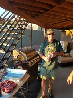 Grillmaster Howie getting ready to do his magic.
Time for a beer. First beer in Arizona for the trip, so I started with one that we had purchased in Flagstaff, the Lost Highway Double Black IPA from Mother Road Brewing which is located in Flagstaff. Go big or go home, right? Well, this one was in a big can, a pint. The surprise was when I pulled the tab to open it, the whole top opened up. Think Mickey's malt liquor in the big mouth bottles, only a can. That will make for an easy drinking beer. The other surprise was that it was very smooth and not real heavy, considering it was a double black IPA. Quite tasty as well. I headed out to the backyard to hang with the guys since the grilling had started by now. Howie was getting burgers, dogs and brats fired up for the Herd and there was action in the kitchen as well as the ladies were getting the side dishes and fixings in order. The house was humming.
The rest of the Herd was starting to arrive. By the time we were ready to eat, there were 20 of us scattered about the property. The cats in our Herd have come from all over the country and even the world for our little meet-up in Page. We had a wonderful time this evening, getting reacquainted and catching up, making plans for the next few days, and eating way too much. There was plenty of food to go around, way more than we needed. OK, we've got leftovers, but this crew will eat them. As for tomorrow, everyone will meet here in the morning and we'll get on the road by 0830 for a 4WD adventure that will take us to the amazing rock formations known as White Pocket. This was Howie's suggestion as he has been there before and he'll be our leader tomorrow. We'll have 20 cats on the excursion, 19 from the group here tonight (everyone except Frankie) plus we'll meet Susan at the north end of the House Rock Valley Road in the morning. This should be great!
The rest of the Herd was starting to arrive. By the time we were ready to eat, there were 20 of us scattered about the property. The cats in our Herd have come from all over the country and even the world for our little meet-up in Page. We had a wonderful time this evening, getting reacquainted and catching up, making plans for the next few days, and eating way too much. There was plenty of food to go around, way more than we needed. OK, we've got leftovers, but this crew will eat them. As for tomorrow, everyone will meet here in the morning and we'll get on the road by 0830 for a 4WD adventure that will take us to the amazing rock formations known as White Pocket. This was Howie's suggestion as he has been there before and he'll be our leader tomorrow. We'll have 20 cats on the excursion, 19 from the group here tonight (everyone except Frankie) plus we'll meet Susan at the north end of the House Rock Valley Road in the morning. This should be great!
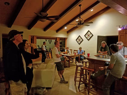 Part of the Herd at the Casa Hick, aka the Hen House.
The party started to break up about 9:00, which is about the typical time for these soirées to end. Which was fine with me as we had been going since oh-dark-thirty this morning and had covered a lot of ground. Lynn and I called it a day, but were looking forward to an adventure tomorrow.
Day 3, Friday, September 29 - White Pocket. We did better than last night and made it to 0400 before rolling out of bed. Lynn got up first and went into our sitting room to read (did I mention this was a huge house and we had a ginormous suite?). I tried to continue napping but gave up and joined her on the couch. We finally went downstairs once we heard some of the other folks rattling around in the kitchen. Lynn was ready for coffee. Eventually the rest of our housemates were all arrayed around the kitchen and dining room, having breakfast, drinking coffee, continuing to chat up and getting ready for the day. Simple breakfast for us, just a bagel, banana and juice.
I spent part of the morning just enjoying the views from our penthouse and the backyard. The morning was glorious, with a cloudless, blue sky spreading westward over Glen Canyon and the desert monuments beyond. There were a few critters out this morning. A desert cotton tail was hiding in the shrubs just outside the back gate and there were a flock of White-crowned Sparrows having breakfast along the fence. They were particularly attracted to the pomegranate tree that was overhanging the wall from our neighbor's yard.
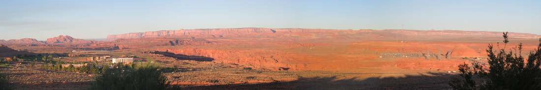
Morning vista from the penthouse.
The rest of the Herd started rolling in a little before 0800. Once the majority where here we started sorting out who was driving with who and how many vehicles were needed. We have 20 cats (once we catch up with Susan) to transport to the trailhead and five vehicles capable of making the journey. The discussion became should we take all five vehicles with four cats each, which would be a bit more comfortable, or four vehicles each carrying five cats, reducing by one the number of trucks that we might break out in the desert? This turned into a considerable debate. Having no opinion one way or the other, I just waited for a decision to be made. Eventually we went with the smaller fleet with more crew per ship, so we all started jockeying for seats in the trucks. Lynn and I split up for the drive, she road in Tommy's brand new Jeep along with Beth, David and Roz and I lucked into shotgun in Bethany's Toyota, with John, Donna and Oscar in the back seat. Howie was on point and Danny brought up the rear of our little off road convoy as we dropped onto route 89 heading west out of Page. Our 0830 departure was closer to 0845 which is actually very good for these cats.
Yep, definitely a wonderful day in the making. Comfortable temperature and a bright blue sky. Should be great for the drive and then walking around on the rocks. We had a nice time cruising along, chatting about everything and nothing. I quipped to Bethany that we'll just have to avoid talking politics as the bumper sticker on her SUV was at odds with my thinking. She laughed and said that she really feels sorry for Alex since he's riding right behind us and will have to stare at that sticker for the next couple of hours. I think I spotted the probable trailhead for Bucktank draw with a couple hikers heading up the wash. I'll file that away for future reference. John pointed out another road that is good for exploring, as long as it is good shape. There was a grader parked there, so it seems that the BLM is trying to keep it passable. I reckon it was about a 30-minute drive, maybe a little longer, to get to the House Rock Valley Road turnoff. We all made the sharp turn onto the dirt road then pulled into the first parking area where Susan was waiting. She said that she had just got there so perfect timing. I guess it was good that we were running just a little behind schedule. What was the other road we went by, John said it was worth exploring if in good shape. Susan climbed into one of the off-road worthy vehicles and our convoy continued on our way.
The rest of the journey was on dirt roads of varying quality. House Rock Valley Road was in great shape, not even a little washboard, so we made good time. But that would soon change when we got onto the roads less traveled, and less maintained. Howie has been out to White Pocket once before, so he has a route in mind along the four-wheel-drive tracks. We paused when we turned off of House Rock Valley Rood for a sanity check and so that Howie could take over from Deb as the driver of their truck (it seems that she does the high-speed driving and Howie handles the lower-gears). Now the fun begins as we are working our away through the crisscrossing, sandy tracks that cover this area. Howie has a map, but I'm thinking there is an element of winging it involved as well. Bethany had a photo of Howie's map on her phone, so we were trying to keep pace with where we thought we were as we bounced our way through the desert. Bethany's job was to keep us on the road, while the rest of us kept an eye on the rest of our group to make sure that we were keeping up with our leader and those behind us were still in view. The convoy did spread out a bit but generally we maintained the needed visual contact between the vehicles to ensure no one was left behind.
Not much in the way of wildlife on the drive, which was a little surprising. The only thing we spotted were a few birds which got us talking about other critter sightings. Bethany described a grey and black bird that she saw tearing apart a pine cone. I suggested that it could have been a Clark's Nutcracker. Shortly later we flushed a bird up from alongside the road. Bethany took a guess at its identity, I forgot what she said, but I thought it was a Flicker based on the white spot on the rump and the way that it flew. John then declared me the bird guy for the Herd. I'm not sure that I need or deserve that title. Of course after that success the game changed to "prove Allen is a moron" which is a much easier title to live up to than "bird guy." I don't recall how the conversation turned to get to this point but we had fun with it for a few minutes as we trundled across the desert. We talked of our travels and other happenings since the last meet-up. Donna and Oscar are planning a big road trip with one-time Herd members, Rhonda and Chris (actually, once in the Herd you are always in the Herd; we're kind of like the Mafia that way). Chris is perhaps the most avid photographer of the group, although there are a couple other semi-pros in the Herd. He is a very precise person with his equipment and setup but so creative with his images. Chris pokes at Oscar regarding camera equipment, asking when Oscar is going to get a camera from this century.
The good news is that the ride from House Rock Valley Road to White Pocket was not that jarring. There were a few rough spots, but we were crawling over those. Bethany was having a ball as she guided her truck over the rough terrain. The deep sandy stretches were actually of more concern than the rocky stuff, but our little herd of trucks just plowed through each one with no issues. The only spot that gave us pause was near the end of the trip out to the trailhead where there was a steep, sandy, curvy, section then went up a small rise then down the other side along a straighter but even steeper grade that was full of sand. We closed ranks a bit since the convoy slowed down for this section. OK, four vehicles, we're good. We made it through this with no real problems, but we all concurred that this could be a problematic section on the return with the steep and very sandy uphill track. But we'll figure that out later. Our destination is in view!
 You're a mean one, Mr. Grinch....
Arrived about 11:45, Arizona time (the time zones in this area are goofy since Arizona does not observe daylight saving time, but the Navajo Nation does as does Utah, so we were always sort of guessing what time it was). As we were driving into the trailhead parking area we noticed a face in the rock formation out in front of us. It had sort of Dr. Seuss look to it and we decided that it reminded us of the Grinch (more of the Jim Carrey version rather than the original, classic cartoon). There were a handful of other vehicles in the lot when we arrived, all sturdy looking trucks, and a few folks milling about. We rolled out of our vehicles, stretched and walked off the bumps from the ride. There were several comments along the lines of "I'm getting too old for this" but we were soon getting geared up and ready to explore the area.
While the Herd was getting ready for the short hike, we also talked to some of the other visitors. There was one group getting ready to hike out who were with a tour guide and were here for photography. One guy just chilling next to his truck, just kicked-back with his feet up and listening to tunes. He was camping nearby and said that he only shoots the formations at dawn and dusk for the best light. I get that, but we do not have that luxury.
Once we all had our packs in order, the Herd gathered for a little logistical briefing from Howie. There is a short, sandy trail that leads out to the rock formations, but once the trail reaches the slickrock there is no additional "formal" trail. Just scattered and explore. Howie suggested looping around toward the left (west) as he remembered the more interesting rocks were in that directions. There was higher ground off in that direction that would provide a good overall view that Howie was thinking of trying to access, but that might take more time that we had (at least according to chilling dude in at the trailhead parking). It was right at noon, so we decided to give ourselves until 2:30 for exploring then meet back here at by the vehicles. And we're off!
As we exited the parking lot and started out along the trail, we could see the tops of some of the brightly hued formations not that far away, just calling to us. I think we were all ready to go play on the rocks after the drive out here, but there was still just time enough to take in the history of the area that was posted on the sign near the beginning of the trail:
Fascinating, Captain. Now let's go exploring!
The sandy trail led us directly toward our goal of the marvelously colored rocks. It was a short walk in the sand, less than a quarter mile, then we were on the hard slickrock, which made the going much easier. The Herd was starting to disperse, but before we scattered across the area we called everyone in for a team phone. Since Gurjinder was carrying a proper tripod, he was elected photographer. We found a nice spot for the cats to congregate with one of the yellow and red formations in the background. We took a couple of shots the resumed our meander on out into the fascinating rocks. The Herd melted into smaller groups, a few singles, a few pairs, and a few other small bunches. We crossed paths with each other for a while but later were basically spread all over the area. Lynn and I kept working sort of east, as each time we walked around one of the fossilized sand dunes we would see something else in that direction that caught our attention. But eventually we looped through the area covered by this collection of intriguing natural sculptures. The area we were exploring was roughly a half mile long and a quarter mile wide, so similar in size to The Wave, maybe a bit bigger.
While the Herd was getting ready for the short hike, we also talked to some of the other visitors. There was one group getting ready to hike out who were with a tour guide and were here for photography. One guy just chilling next to his truck, just kicked-back with his feet up and listening to tunes. He was camping nearby and said that he only shoots the formations at dawn and dusk for the best light. I get that, but we do not have that luxury.
Once we all had our packs in order, the Herd gathered for a little logistical briefing from Howie. There is a short, sandy trail that leads out to the rock formations, but once the trail reaches the slickrock there is no additional "formal" trail. Just scattered and explore. Howie suggested looping around toward the left (west) as he remembered the more interesting rocks were in that directions. There was higher ground off in that direction that would provide a good overall view that Howie was thinking of trying to access, but that might take more time that we had (at least according to chilling dude in at the trailhead parking). It was right at noon, so we decided to give ourselves until 2:30 for exploring then meet back here at by the vehicles. And we're off!
As we exited the parking lot and started out along the trail, we could see the tops of some of the brightly hued formations not that far away, just calling to us. I think we were all ready to go play on the rocks after the drive out here, but there was still just time enough to take in the history of the area that was posted on the sign near the beginning of the trail:
- The White Pocket area is a spectacular exposure of red, pink, and white contorted sedimentary rock layers. The bedrock here consists of the Early Jurassic age Navajo Sandstone. The Navajo Sandstone is composed of frosted well-rounded, fine- to medium-grained quartz cemented by calcium carbonate.
- Approximately 190 million years ago, this area was part of a region covered with deep, shifting sand and complex dunes comparable to the modern day Sahara Desert. The dune field encompassed parts of Arizona, Utah, Nevada, Colorado and Wyoming. The large-scale, high-angle cross beds which can be up to 25 feet wide are characteristic of windblown deposits and are examples of what was once a large dune field.
- At that time, periods of monsoonal moisture supported plant and animal life. Organisms left evidence of their existence in this area in bioturbated beds. Bioturbation in this area is caused by the mixing of sediments by ancient, burrowing insects and spiders.
- The various shades of red, pink, yellow and brown rocks are due to oxidation of the iron-bearing minerals within the sandstone. The red and pink colors are attributed to the presence of the mineral hematite, while the yellow and brown colors are produced by the minerals limonite or goethite.
- The beautifully swirled appearance of the rocks at White Pocket are due to an exceptional exposure of unusually soft sediment deformation and slump sediments. Soft sediment deformation occurs when separated layers of sediments are folded and/or sheared due to gravitational forces, changed in ground water or earthquakes.
- Thick, massive beds at White Pocket have characteristic polygonal cracks produced by tensile stress and exposure by weathering processes. Many theories exist regarding the origin of the polygonal cracks, including thermal contraction, moisture cycles and the drying process of these sediments.
Fascinating, Captain. Now let's go exploring!
The sandy trail led us directly toward our goal of the marvelously colored rocks. It was a short walk in the sand, less than a quarter mile, then we were on the hard slickrock, which made the going much easier. The Herd was starting to disperse, but before we scattered across the area we called everyone in for a team phone. Since Gurjinder was carrying a proper tripod, he was elected photographer. We found a nice spot for the cats to congregate with one of the yellow and red formations in the background. We took a couple of shots the resumed our meander on out into the fascinating rocks. The Herd melted into smaller groups, a few singles, a few pairs, and a few other small bunches. We crossed paths with each other for a while but later were basically spread all over the area. Lynn and I kept working sort of east, as each time we walked around one of the fossilized sand dunes we would see something else in that direction that caught our attention. But eventually we looped through the area covered by this collection of intriguing natural sculptures. The area we were exploring was roughly a half mile long and a quarter mile wide, so similar in size to The Wave, maybe a bit bigger.
The Herd at White Pocket. Seated/kneeling (left to right): Gurjinder, Oscar, Max, Roz, Allen, Donna, Alison, Lynn, Beth, Tommy. Standing (left to right): Alex, Mark, Susan, Howie, Deb, David, John, Danny, Norma and Bethany. Gurjinder gets credit for the photo.
The first feature we encountered was a rolling, white rock surface that was covered in a pattern that reminded me of a scaly, reptilian hide. It seemed as if we were walking on the back of a huge white dragon, or maybe giant turtle shells when it came time to climb the domes in the area to get a better vantage point. I reckon this would be the polygonal cracks that were described on the marker at the start of the trail. Getting on the higher ground did provide a bigger picture view and let me see some of the colorful features that were down over the hill or in the small gullies. Oscar was getting a similar view from one of the adjacent domes. This was also a good spot for getting a panoramic image of the greater area beyond the White Pocket. I called to Lynn to get her to scramble up as well. She needed a hand getting started as her slightly shorter legs would not allow her to make the first steps up onto the dragon's toes, but once she got past the first obstacle she was fine. From up here we could see that the dragon skin extended for some distance and that the area was surrounded by more colorful and formations which were primarily yellow but included swirls of red and were generally topped with a layer of white frosting. There was a handful of other folks arrayed out in that direction, toting tripods and long lenses. Serious photographers. We spotted a truck parked off to the northeast as well, which probably belonged to those folks. We'll meander over that way eventually to see what the real photographers are shooting.
As we were coming down from our dome, we saw Alison coming across the wavy sandstone area below us and up a sluice way right where we were coming down. She was also just on a random route to explore the beautiful rocks. We chatted for a bit, discussing the natural wonders, like White Pocket, that we have been fortunate enough to visit as part of these meet-ups. Shen mentioned the photobooks and what a lovely memento they make for each trip. Like me, she takes them into work to share with her colleagues. She said that one woman at the office seems to continually confuse her and Lynn as every time she sees a photo of Lynn in the book, she thinks it is Alison. OK, we can maybe remedy that, as I took a photo of Lynn and Alison together with the crazy landscape as a backdrop. I'll make sure that goes in the book for this trip to provide a gauge for Alison's confused coworker.
As we were coming down from our dome, we saw Alison coming across the wavy sandstone area below us and up a sluice way right where we were coming down. She was also just on a random route to explore the beautiful rocks. We chatted for a bit, discussing the natural wonders, like White Pocket, that we have been fortunate enough to visit as part of these meet-ups. Shen mentioned the photobooks and what a lovely memento they make for each trip. Like me, she takes them into work to share with her colleagues. She said that one woman at the office seems to continually confuse her and Lynn as every time she sees a photo of Lynn in the book, she thinks it is Alison. OK, we can maybe remedy that, as I took a photo of Lynn and Alison together with the crazy landscape as a backdrop. I'll make sure that goes in the book for this trip to provide a gauge for Alison's confused coworker.
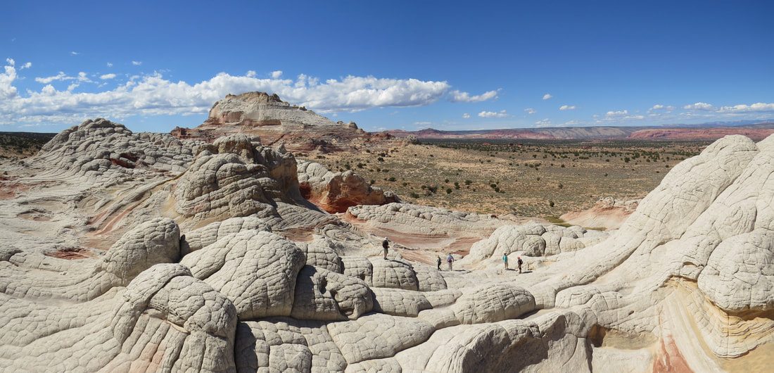
|
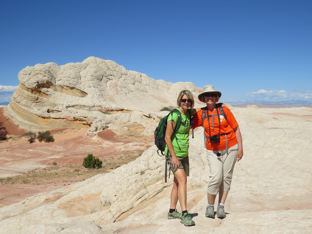
Two cute blondes at White Pocket.
|
Lynn and I continued to climb around on the undulating sandstone floor, generally working our way toward a set of yellow formations, but checking out the details of the rocks as we went. There were lizards scurrying about in the rocks, really the only critters that I saw during our time in White Pocket. The first one we came across was the same color red as the that in the rocks, a perfect camouflage for the area. The little guy stood out on the white strata but blended in completely on the red rocks.
As we came around one formation we could see further to the north and east and the formations continued on in that direction. OK, Howie suggested going the other way, but there sure seems like a lot to see over there, and that is where the guys with the long lenses are, so maybe it is worth checking out. We worked up and over a couple more rolling areas for a better view. Yep, well worth the effort to see these rocks. The serious photographers were working along the ridge coming our direction, but there was still at least one guy with is tripod setup in the distance. As we climbed over another high point we passed the other photogs as we all converged on sort of a narrow stretch but we all got by easy enough. This point also gave us a nice view out over the next set of formations. Very pretty, but not quite as colorful as the area we just passed through, so we figured we would just enjoy the long range view then circle back to the more colorful rocks. Then I noticed that the remaining photographer down at the foot of these formations was working with a model. That's cool, certainly an interesting place to use as a backdrop. OK, wait a second. Looks like we have stumbled into a nude photo shoot. Yeah, we'll stop here to stay out of their space. That's the second time we have come across a glamour shoot out in the desert, the first being at the Mesquite Sand Dunes in Death Valley last spring. There we just spotted the photographer and his model as they were walking out after the session. He was dragging a roller bag of equipment and she was wearing a white robe so it is impossible to say if that was a nude shoot or if she was in a bikini. Here at White Pocket there was no doubt as this model was wearing nothing but a smile. She was posing lying down on the rocks. That just cannot be comfortable due to the rough nature of the sandstone. She was moving gingerly as she struck her poses. But hers were not the natural formations we came to see so we hiked back to the more colorful rocks.
As we came around one formation we could see further to the north and east and the formations continued on in that direction. OK, Howie suggested going the other way, but there sure seems like a lot to see over there, and that is where the guys with the long lenses are, so maybe it is worth checking out. We worked up and over a couple more rolling areas for a better view. Yep, well worth the effort to see these rocks. The serious photographers were working along the ridge coming our direction, but there was still at least one guy with is tripod setup in the distance. As we climbed over another high point we passed the other photogs as we all converged on sort of a narrow stretch but we all got by easy enough. This point also gave us a nice view out over the next set of formations. Very pretty, but not quite as colorful as the area we just passed through, so we figured we would just enjoy the long range view then circle back to the more colorful rocks. Then I noticed that the remaining photographer down at the foot of these formations was working with a model. That's cool, certainly an interesting place to use as a backdrop. OK, wait a second. Looks like we have stumbled into a nude photo shoot. Yeah, we'll stop here to stay out of their space. That's the second time we have come across a glamour shoot out in the desert, the first being at the Mesquite Sand Dunes in Death Valley last spring. There we just spotted the photographer and his model as they were walking out after the session. He was dragging a roller bag of equipment and she was wearing a white robe so it is impossible to say if that was a nude shoot or if she was in a bikini. Here at White Pocket there was no doubt as this model was wearing nothing but a smile. She was posing lying down on the rocks. That just cannot be comfortable due to the rough nature of the sandstone. She was moving gingerly as she struck her poses. But hers were not the natural formations we came to see so we hiked back to the more colorful rocks.
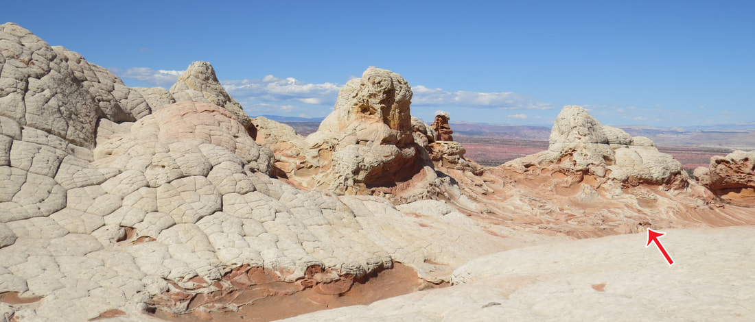
Once we realized there was a nude photo shoot happening, we just admired the rocks from a distance and left the model and photographer in relative privacy. No one else from the Herd stumbled unto the shoot. This was as close as we got. The model is posing in on the red swirly rocks in the lower right of this image (red arrow marks the spot).
We could see some of the Herd milling about in the low area in the midst of all the colorful rocks and others scattered about on the higher edges of the bowl. Everyone was off exploring, snapping pics and just enjoying the day. We had ideal conditions. Granted we were here during the middle of the day, so the light is rather harsh for photos, but we had an azure sky with a few clouds sprinkled in for interest, it was pleasantly warm but certainly not hot. We just meandered about the area, enjoying the vistas as well as the details of the formations.
The colors in the rocks were amazing. There was a lot of white, as much of the floor was the dragon back scales and several of the formations were had the foamy looking caps, but in between were a variety of shades of yellow, orange and red. It's not fair to stop at "yellow, orange and red" as the variety is so much greater than that and the colors changes between the layers incorporate so many subtle hues: saffron, ochre, amber, burnt orange, vermilion, maroon…need I say more. It was spectacular.
The combination of the colors and shapes make this a magical place. There were several amazing formations with a lot of variety in the relatively small area. We had a marvelous time just crawling around on the rocks, lining up photos and in general just taking it all in. I think we found most of the major clumps of rocks in the area. We also came across the remains of a low, block wall, most likely built to capture water in the little basin area in the middle of the formations for the cattle the graze here (we found several of their calling cards scattered about as well). So there's some history here as well as the millions of years of geology. As we walking around the abstract formations, we would try to apply a little science and engineering to how these things formed, but mostly we just wandered and wondered. Much of the strata made such abstract sculptures that we did not even try to see objects in most of the rocks. Sure, we had the dragon hide that we were walking on earlier and there was one small formation that reminded both Lynn and I of the hell hound gargoyle critters from Ghostbusters (the original, 1984 version). Of course there were plenty of formations that looked like waves, in fact I got Lynn to "surf" on one of these wavy stretches. It wasn't until we returned to the trailhead and Howie asked if we saw the "bison's ear" or the "dragon tapestry" that I even knew there were names (official or not) for any of the specific rocks. Shoot, when he asked about the specific formation names I was thinking that I must have missed these spots but I quickly scanned the photos and figured out the formations he was referring to. OK, bison's ear was a bit of a stretch, but I get it. And once I saw the dragon it was very obviously a look-alike for an Asian inspired print. Sometimes it is easier to see these things in the photo than in person (like the eagle head on the ceiling of the Big Hogan in Monument Valley that we saw during the meet-up last year).
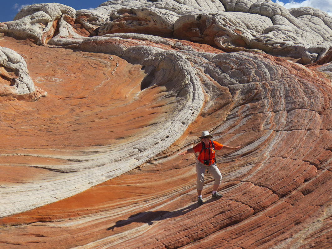
Surfing the rocky waves.
|
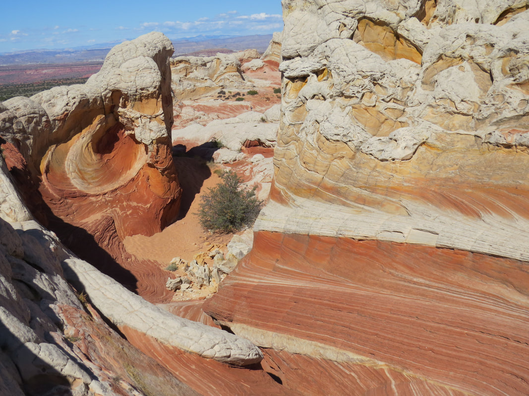
How cool is that!
|
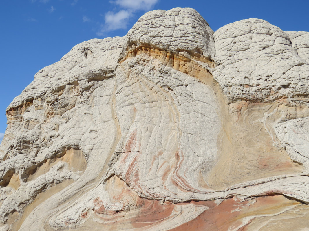
See the dragon?
|
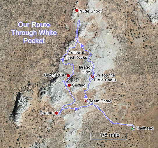
It was 2:00 by the time we made our way around this amazing little area. We could see many of the other cats already heading in the direction of the parking lot. Yes, it is probably time for us to go as well. Not that anyone would, but the last thing you want to happen is get left behind out here. We were back at the trailhead in no time, where we ditched our packs and found a cold beer. Most of the rest of the gang was already back ahead of us. Only Susan and Deb were missing, but they were not late yet and soon enough we spotted them on the trail. All the cats were self-herding this afternoon. My Ramblr track showed that we had made a lollipop route around White Pocket, or at least the part that we explored. Only about 1.5 miles, and basically a flat hike, and it could have been even flatter but we opted to scramble around on the knobby formations in order to get some views.
The consensus from the group was that White Pocket is awesome! No sorry, can't use the term. Much too over used according to David. How about "outstanding?" "Phenomenal?" "Breath-taking?" All of the above! What ever superlatives you wish to apply will work. Here are the photos from our day at White Pocket.
How does it compare to the Wave? Both are beautiful, both have their distinct character. Both areas are true natural wonders. Trying to rank one above the other is really pointless. I've now seen both and both are spectacular. I would certainly visit either of them again. For Lynn and me, a common denominator for seeing both the Wave and White Pocket is these meet-ups. We may have never seen either if not for having these grand gatherings of the folks with the local knowledge and know-how to get us to these glorious locations. Sure we could hire a guide and get to see these places but it is a lot more fun and more special when you get to go exploring with this crazy group of friends.
We hung out at the trail head just a while longer, having a snack and an adult beverage or two, then we loaded up and got the convoy in order. Howie had an alternate route for the return trip based on the review of the map and his discussions with the "locals" here at the trailhead, one that proved to be a bit easier on the vehicles and passengers. While we avoided the steep, sandy hill at the end of our inward trek, there was one section of deep sand that was just a little hairy, but everyone made it through with just a little praying and/or swearing but no towing or pushing involved. The route dumped us back out on House Rock Valley Road further south than when we came in this morning, closer to 89A than 89. So at this point the convoy split up. Danny had to go north to get Susan back to her car, but the rest of us continued south to route 89A. Less dirt road but probably a longer distance overall, so I bet the time will be a wash in terms of who gets back to Page first. But the main advantage to taking 89A was getting to cruise along the Vermilion Cliffs, always a welcome view.
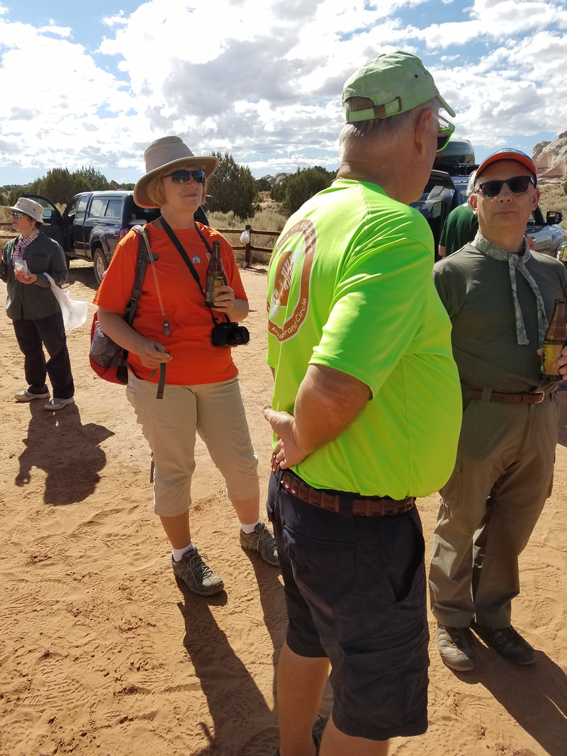
Post-exploration discussion and refreshment...
|
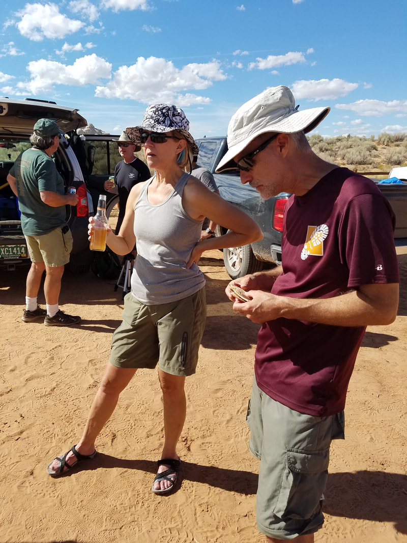
|
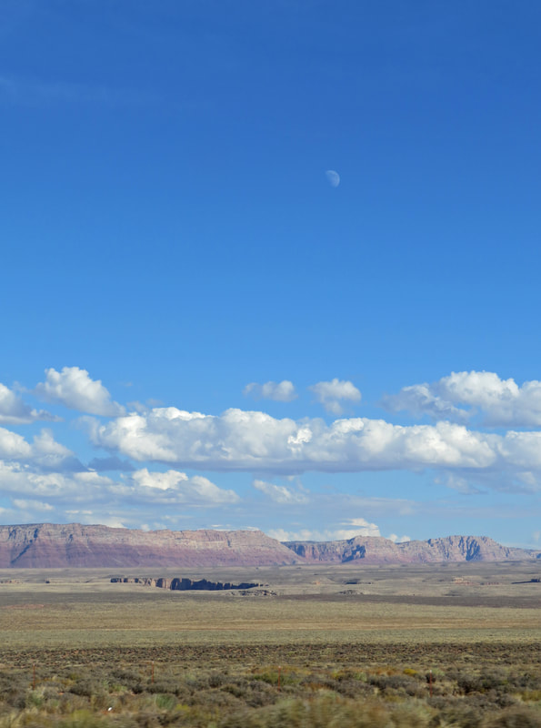
Moonrise over the Vermilion Cliffs.
|
We were home a little before 5:00. Plenty of time for a shower then a beer before the Herd started to arrive for dinner. Tonight is the official kick-off dinner for the meet-up and we'll have a full house again. Twenty-three Herd mates in Page now for the meet-up, since Susan arrived this morning, Dan P. rolled in this afternoon and Anna got in this evening. The gang is all here. Howie is again manning the grill with Alex assisting and there is a flurry of activity in the kitchen. Everyone who can fit into the space is pitching in to fix dinner. Shoot, I cannot even keep up with all the dishes we have. There is salmon and tenderloin on the grill and a number of sides in the buffet line. Way too much food, but we'll work on it for the rest of the meet-up. And all for a cost of eight bucks a head per night. What a deal! Hats off to Alex, Max and Howie for their shopping prowess. These group dinners are one of the things that makes these meet-ups so special and having a big enough rental house so important. Having a place where the Herd can just come and hang-out for the evening is so much nicer than going to a restaurant. Folks can mingle and chat and spread-out throughout the grounds. Throughout the evening there was laughter, conversation, great food and plenty to drink. Alison had again brought her homemade lemoncello, Gurjinder contributed a bottle of Scotch (or some kind of hard spirit) and of course there were many beers from which to choose. In fact, Howie, Oscar and I had a little beer tasting event going this afternoon. I brought down a bottle or two, including the Dirt Wolf Double IPA from Victory out of our mix-and-match stash, Oscar had a 22 oz. bottle of Hop Stoopid by Lagunitas and Howie brought out Amputator IPA from Butcherknife Brewing out of Steamboat Springs. A nice variety of brews.
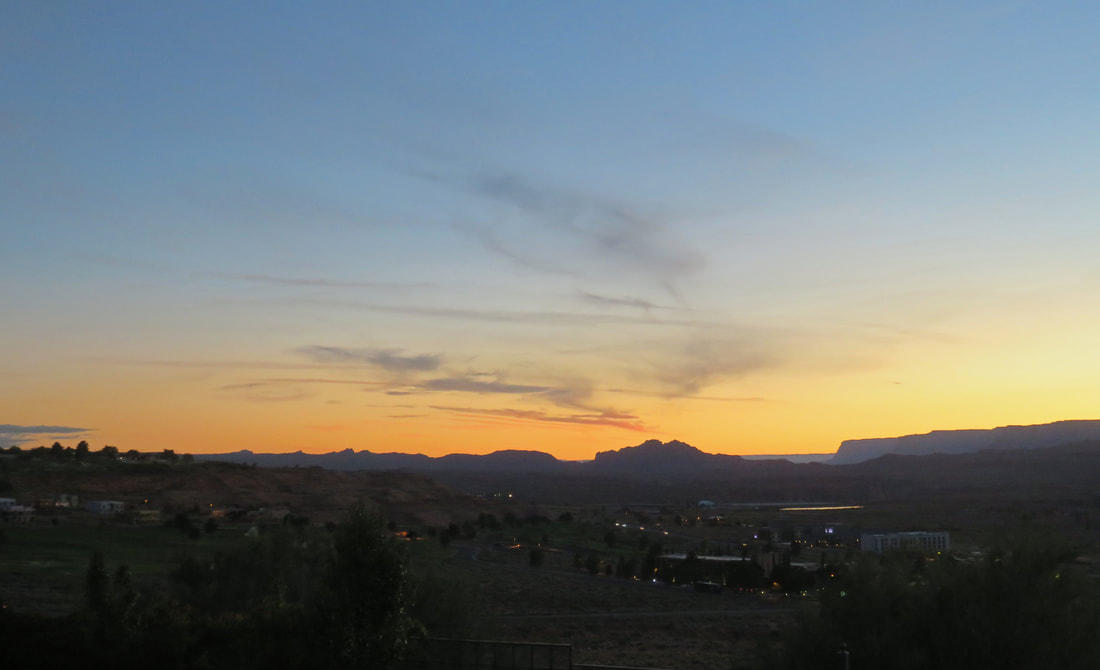
Nice sunset color from the back porch looking out over Page National Golf Course and Glen Canyon to the distant cliffs.
Once everyone had made a trip or two through the buffet line, as had our usual skull session with Alex again acting as the master-of-ceremony. He welcomed the group to our eighth annual fall UTAH meet-up and acknowledged the one newbie for this year, Dan P. As is our tradition, we also recognized one member of the Herd who played a special role in the planning and execution of our event. Yes, this is truly a team effort, particularly when it comes to the food, but there usually is someone who steps up to the plate to make some of the activities happen. This year it was John who flexed his expertise of the area around Page and particularly Lake Powell to set up the boating adventures that will highlight the weekend. For that, he was the recipient of the coveted beer glasses with the UTAH logo.
We worked out the logistics for tomorrow morning. John wants and early departure for the boating crew in order to maximize their time on the lake. The marina opens at 0800, so I think he wanted folks there by 0745. There was less groaning than expected over that schedule. Those of us who chose to stay on dry land will try one of the tourist activities in the morning, a tour of Lower Antelope Canyon. It used to be that this slot canyon was largely ignored as the upper part of the slot got all the attention but now it is just a big of a draw. We'll go early and if the crowds are as bad as reported we will adjust accordingly.
Since everyone had an early start planned for the morning, the party drew to a close around 9:00. The Herd did a nice job of pitching in on the clean-up for the evening and then the house was quiet. A wonderful first day to the Great Page Meet-up has drawn to a close.
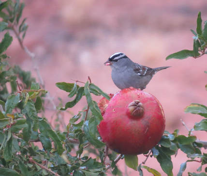 White-crowned Sparrow committing a pomegranate massacre.
Day 4, Saturday, September 30 - Lower Antelope Canyon. I was up early to the dawning of another great looking day in northern Arizona. I worked on my journal for a while, enjoying the morning light and the colors on the Vermillion Cliffs and along the top of Glen Canyon. The White-crowned Sparrows were very active dismantling one of the pomegranates hanging over the wall. A peaceful start to the morning, but that would be changing very shortly.
The Hen House was buzzing early this morning as the boaters were getting ready. Max, Deb, Howie and Alex were heading to the marina today. Some of the Herd was meeting here to caravan over, but others were just going straight to the dock. They were quickly loaded up and on the road for their adventure on the lake, leaving the house rather quiet. Frankie stayed home today with the pups. The rest of the housemates will give Lower Antelope Canyon a go. Beth and Tommy, who were staying just across the street, arrived once the boaters departed and we got our plan in action. We had all heard the stories of how the canyon is now overrun with tourists. Not that long ago, you would have had the canyon nearly to yourself, but those days are seemingly gone. Alex sent us an update on the crowd as they passed by on their drive to Antelope Point Marina. At 7:48 AM there were already an estimated 70 cars and two tour buses in the parking lot. I was not too thrilled with this report, but we decided to give it a shot anyway. If we get there and it was totally packed we can always punt.
We left the house at 0800 to make the short drive to the canyon. Donna and Oscar piled into the Rogue with us and Tommy and Beth followed us in their Jeep. There are two outfitters for tours into Lower Antelope, Dixie Ellis and Ken's Tours. For whatever reason, perhaps someone saw a flyer or something yesterday or one of the Herd members recommended the outfit, we had pre-selected Ken's Tours. In terms of crowds, it did not matter as both places were swarming with cars and buses. But we're here so we'll see how bad the wait is. The line at the walk-up window was short, so that's a good sign and I was talking to the friendly young lady on the other side of the glass by 8:25. I asked when the first available tour with space for six people would be and her reply was somewhat shocking, 9:00 AM. Sold! Shoot, with the number of cars and buses in the lot, I thought it would be a lot longer of a wait. We paid the fees, got our gear and meandered to the staging area.
Wow, there are a lot of tourists packed into the staging area, at least 50. The guides were running just a little behind schedule today, but they were soon getting us organized. They split the big tour into smaller groups of about a fifteen, each with a guide. Our guide was Trinity, a very nice Navajo young lady who proved to be an excellent guide. Unlike the Upper Antelope Canyon tour we took during our first trip to Page in 2008 where you drive from the staging area to the canyon, for Lower Antelope there is just a short walk down a sandy slope to the canyon entrance. I chatted with Trinity as we walked along. She told me that each tour is up to 75 people and that most of the tours are full. The first tour is at 8:20 and they go every 20 minutes all day, ending at 4:30, I think. They have to coordinate with the other tour company to get all these tourists through the slot in a timely manner. That's about 1,800 people per day who could go through the canyon just for Ken's Tours. I think the Navajo Nation has a real money-maker on their hands!
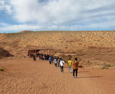 Gettin' ready to get ready....
So a 9 o'clock tour does not mean that you get into the Lower Antelope at 9:00 AM. Nope, that just got us into the queue at the entrance of the canyon. From here we still had about a 30-minute wait until it was our turn to descend the steep, metal ladders that took us down into the slot. But that's OK. The Navajo Nation had erected a nice shelter covering the lined-up tourists so that we had some shade. Plus it gave us some more time to visit with our friends so we chatted about travel and Beth's and Tommy's recent move to Sedona. Trinity helped us get our camera settings in order to take best advantage of the lighting conditions in the slot canyon. She suggested ISO of 400 and to set the white balance for "cloudy." It took us a little while to get Oscar's camera settings in order as we could not figure out the white balance. I reminded him that he probably would not have this problem if he had a camera from this century.
Trinity also went over some safety and logistical points. "No photos while one the ladders." OK, that makes good safety sense. "Try to keep moving through the canyon; pause just long enough to take one picture in an area, then keep moving." I get that one as well, since there are a bazillion tourists in a rather tight area. At 9:45 we were at the top of the first ladder and shortly thereafter were down in the slot with a hundred of our closest friends. I think I unconsciously reset my expectations for the quality of the tour to a lower level based on the number of folks in line, figuring that it will elbow-to-elbow the entire time and next to impossible to get any really nice photos. We'll just go in, see what we can see, take some pictures and hope for the best. Turns out that the whole experience was far better than I could have ever expected. This was in large part due to Trinity and the other guides who kept things moving along as best they could without being pushy while at the same time pointing out the most interesting features and photo ops. This was obviously not their first rodeo.
Two things happened which really made this a great tour. First, many of the really pretty features in the canyon are above the throng of tourists, so you are generally shooting over the heads of the rest of the people. Sure you might get the top of someone's head or cell phone being held up for a photo along the edge of the frame, but those things can easily be cropped out. More importantly however is that the crowd actually thinned out as we went through the canyon. Again, this must be due to the experience of the guides and how they ushered folks through, moving quickly here and then pausing there. The end result was that once through the first couple of turns it felt like Trinity's little band had the canyon to ourselves.
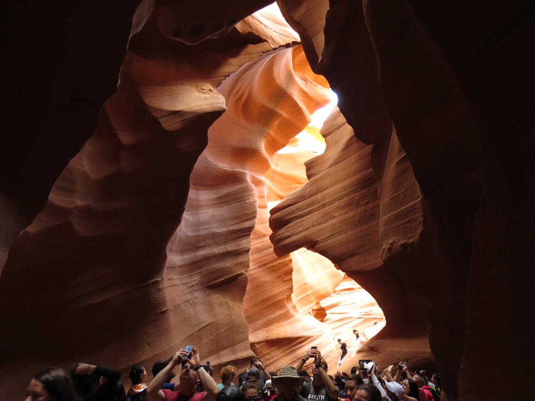
A mass of humanity at the start of the tour below the Lion's Head.
|
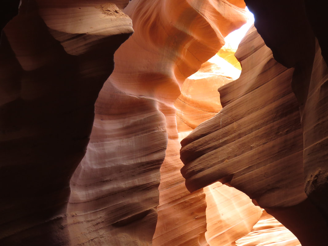
Just aim high and narrow the field of vision and poof! No more tourists.
|
The only real issue we had during our time in the canyon was the young Indian family who took way too many selfies. Not Navajo Indians, but rather Indian subcontinent Indians. A twenty-something mom and dad and their little boy, probably in the 5-year-old range. Sure, everyone wants a photo of the family in the canyon, and there is time for that, but they were taking pictures at every turn and multiple shots to boot. Remember, we were asked to just take one photo and keep moving on. The Indian couple were having a private glamour photo shoot! At least she kept her clothes on! She was posing against the rocks, multiple poses mind you, and he was taking several shots at each point of interest. Dude, really? She's cute but how many freakin' photos do you need of her. Is this a cultural thing? I've witnessed this a few times with the young Indian couples at other parks (the couple in the back of the tour boat at Crater Lake springs to mind). Or generational? A little of both? The only good news was since they were already holding up the parade, we did not feel any remorse for taking an additional photo or two while they were conducting their photo shoot. But we really were not being pushed by the other tours coming after us, so I guess there was really no harm.
Enough of the happenings, let's talk about the rocks! The slot canyon is amazing with so many twists and turns, Escher-esque contours, subtle lighting and color changes. It is no wonder that the guideline was to take one photo and move along as it would be easy to spend hours in the canyon studying the angles of the rocks surfaces and the lighting. The show got better the further into the canyon we went. At the very beginning and the far end there was really too much light to get nice images as the sunbeams through the opening at the top of the slot was rather harsh, but in between there was plenty of light to see the wonderful contortions of the sandstone without any garish glare.
Enough of the happenings, let's talk about the rocks! The slot canyon is amazing with so many twists and turns, Escher-esque contours, subtle lighting and color changes. It is no wonder that the guideline was to take one photo and move along as it would be easy to spend hours in the canyon studying the angles of the rocks surfaces and the lighting. The show got better the further into the canyon we went. At the very beginning and the far end there was really too much light to get nice images as the sunbeams through the opening at the top of the slot was rather harsh, but in between there was plenty of light to see the wonderful contortions of the sandstone without any garish glare.
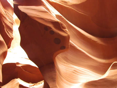 The Lion's Paw.
The first stop that Trinity made was in the first big chamber after we got into the slot where she pointed out a couple features that were related only by the happenstance of what the human eye makes of them. First she pointed out a large section of sandstone that was jutting out from the canyon wall and extending over the entrance of this chamber. This was the first time that she had us engage our imaginations to see to what the ages of water flow had carved into the rock. Yes, I see it, a Lion's Head, albeit a bit on the abstract side. The paired oddity in the strata was the big cat's paw, with well-placed circles of darker sandstone marked the pads. Yep, that sure looks like a paw to me. Trinity also pointed out a crack that is forming in the Lion's Head that will one day cause the snout to break off. Maybe tomorrow, maybe in a few hundred years. Just don't be standing under it when it happens.
We milled about in this first large area for a while longer while other groups moved out and new folks moved in. Then Trinity gathered her charges and had us proceed through the slot. There is only one way to go, forward, and no chance of getting lost. We made a couple turns and viola, we seemed to be alone in the canyon. We knew that we weren't, but the distance that the guides put between the groups and the meandering flow of the canyon let us spread out. We slowly ushered by the amazing formations and highly textured rocks. Trinity had positioned herself at the next point-of-interest, a little sluice way that ran down the canyon wall and emptied at about thigh height (for me, but probably right at eye-level for Donna. Oops, did I type that out loud?). This feature is one that most folks would miss if they did not kneel down and look up the flow path in the rock. Trinity was pointing this out to us all and suggested an easy way to get a good image by placing the camera right at the exit of the sluice and shooting back up the wall. That did produce a nice image. We got our shots of the sluice and kept moving while the rest of the group got their shots. Then Trinity herded us and moved us to the next cool spot, pointing out a few other interesting things along the way like the wall of shooting stars.
We milled about in this first large area for a while longer while other groups moved out and new folks moved in. Then Trinity gathered her charges and had us proceed through the slot. There is only one way to go, forward, and no chance of getting lost. We made a couple turns and viola, we seemed to be alone in the canyon. We knew that we weren't, but the distance that the guides put between the groups and the meandering flow of the canyon let us spread out. We slowly ushered by the amazing formations and highly textured rocks. Trinity had positioned herself at the next point-of-interest, a little sluice way that ran down the canyon wall and emptied at about thigh height (for me, but probably right at eye-level for Donna. Oops, did I type that out loud?). This feature is one that most folks would miss if they did not kneel down and look up the flow path in the rock. Trinity was pointing this out to us all and suggested an easy way to get a good image by placing the camera right at the exit of the sluice and shooting back up the wall. That did produce a nice image. We got our shots of the sluice and kept moving while the rest of the group got their shots. Then Trinity herded us and moved us to the next cool spot, pointing out a few other interesting things along the way like the wall of shooting stars.
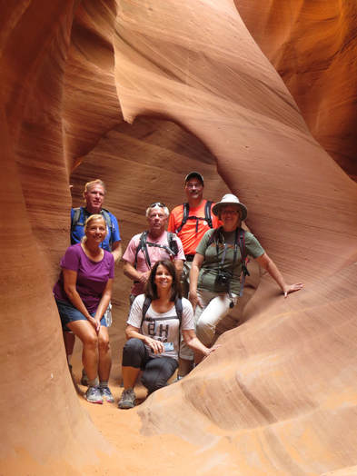 The gang at Elephant Arch.
Trinity next stopped us at an archway that had formed in the middle of the canyon. I guess one of the sandstone walls had just gotten too thin over the millennia until the forces of nature took a shortcut through the rock and eventually widened it out to a sizeable doorway. Seems the arch is now a picture frame as Trinity had us all stop in the arch for a photo op. Lynn and I went first, then called the rest of our cats into the archway for our team photo for the excursion. After everyone go their couples photos and we moved to the downstream side of the formation, Trinity pointed out the view of the arch from this direction. The name of the arch was very evident looking from the angle, Elephant Arch.
Of course there were amazing views throughout the canyon, not just at the spots the guide pointed out. We were "oohing" and "aahing" every step of the way. It is a good practice to look behind you for great images as well. Looking back the way we came gave us very nice views of the little windows that have been carved in the canyon. Amazingly there was rarely anyone from the trailing tours interfering with these looks-back due to the twisting nature of the slot. This was great as it reduced the amount of post-processing of the photos which ended up being a little cropping to remove a head or camera from the edge of the image and just a few times erasing a random tourist who snuck into the background. In fact, cropping was the main tool as I also trimmed out several hot spots from the sunbeam glare.
Trinity pointed out a couple other interesting features as we walked through the narrow canyon. The next was I rock sticking out from the wall well above our heads. She called it the Smiling Shark that is exactly what it resembled, a charactiture of Great White with a wide, open mouthed grin. Hey, what was the name of that old Saturday morning cartoon from Hanna-Barbara cartoon? Jabberjaw! Yeah, I remember that, but was not a favorite. I'm more of a Bugs Bunny guy. Trinity had no idea what we were talking about as it was way before her time. On through the canyon to The Wave, where Trinity again showed us the lower perspective needed to see the seascape formed from the sandstone. And finally the Bison, another big rock protruding from the canyon wall well over our heads and it did look just like the big ol' noggin of our favorite of Yellowstone's bovine residents. Shoot the crusted sand on the lower part of the rock even gave the look of drool running down the bison's chin. One of the last stops was where a nice sunbeam was cutting through the chamber. Not quite the classic sunbeams of Upper Antelope but still pretty cool.
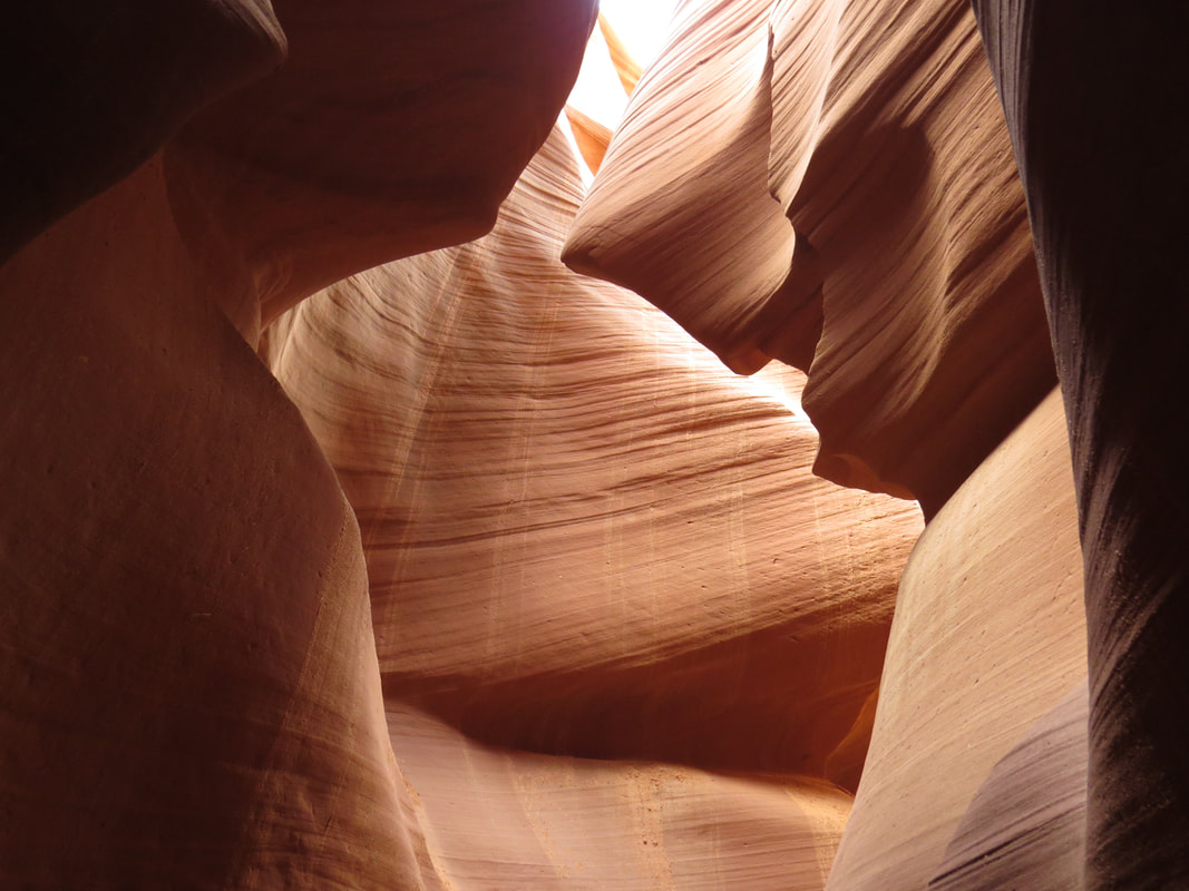
Smiling Shark
|
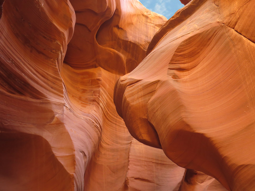
Bison Head
|
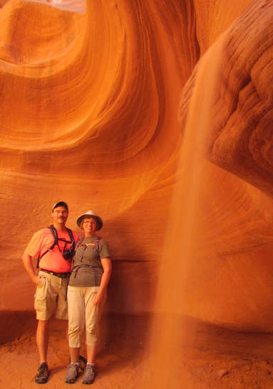
Trinity had three or four other stops where she would take photos of us with the fascinating sandstone backdrops. Lynn and I skipped at least one of these to continue exploring and taking photos of the rocks. We did take advantage of the final photo op offer, this one where Trinity created a little sand "waterfall" in the foreground of the image. It made for a cool composition.
Beautiful, subtle lighting in the main stretch of the slot, once away from the entrance. Just sort of a soft, yellow aura…kinda-sorta. Upper Antelope gives more range of color with purples and deeper reds, but lower may have just as many interesting formations. I think that using the camera settings that Trinity suggested worked for our Canon superzooms, but Tommy and Oscar were not as pleased with their shots. I was concerned that we might not get anything useful since all the pictures were hand-held only, no room or time for a tripod in here. But in the end, I think Lynn and I got some really nice shots. Here's the link to the SmugMug gallery with all our best images.
Trinity had one last point-of-interest for us once out of the slot, a couple dinosaur tracks frozen in time in the sandstone on the path back to the visitor center. I forgot what prehistoric critter made the tracks, maybe it was a velociraptor. We walked on up the hill to the parking lot, pausing while the ladies hit the shops. The Navajo Salt River Power Generating Station is just up the hill from Antelope Canyon. This is a coal-fired electric power plant with three tall smokestacks. The plant must have been working hard today as there was white smoke coming out of each. Just sort of an odd juxtaposition having just existed the natural wonder of Lower Antelope Canyon then to be confronted with this scene of modern-day industry. But I guess Page is sort of surrounded or at least bracketed by these man-made marvels, with the power plant here and the dam and bridge on the west side of town.
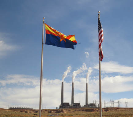 Navajo power plant.
Oscar reported that he tracked us at 1.6 miles for the loop down through the canyon. I did not even attempt a Ramblr track, figuring that there would be no signal, or spotty signal at best, down in the slot canyon. We had spent right at an hour, walking through the canyon from the time we reached the bottom of those first sets of stairs leading down into the slot to viewing the dinosaur track the other end. A great little tour. And it is not yet 11:00 AM, so we still have the rest of the day to explore a bit. Or have a beer. We'll probably do both. But we're all a little hungry now so we headed back to the house for lunch. There are plenty of leftover burgers, brats and dogs, so no reason to go out or go hungry.
Back at the hen House, we fired up the microwave and nuked whatever we wanted then sat around a while checking out photos from Lower Antelope and just chatting in general. Lynn wanted to get back out and enjoy the day, suggesting that we take a walk along the Rim Trail that goes along the edge of the mesa on which Page sits. The trail runs right below the house, so we have direct access. OK, I'm game. We got our packs and headed out the back gate at 1:35, turning right on the trail towards the lake. This is a very exposed trail, not a stitch of shade anywhere. It would be brutal to walk it on a hot day. But we were fine today as it was just pleasantly warm with a slight breeze. The trail was very quiet as we only saw two random mountain bikers during our little outing. Not much in the way of critters either, with just a few ground squirrels, a rabbit, a miscellaneous lizard or two, Ravens and of course the ever present gone birds.
While this was mostly a walk just to stretch the legs and keep the circulation going, there were some nice views out over the canyon and the lake. We also got the bonus of some sort of up-close looks at the other houses along the rim drive, including the two at the end of the row that we had looked into renting (we had also detoured past the front of these houses on the way back from Antelope Canyon just to see what they looked like in person). These were two very nice places. We did not stop and gawk, we just peaked at what we could see from the trail as we walked by, but that was enough. Very pretty and they seemed set up nicely for a party but at the end of the day I think we did pretty darn good with the house that we rented. I think its laid-back nature just fits the Herd better than these upscale places.
Turning our attention back to the big vista off to our left, we could see the bridge across the canyon just downstream of the dam from the trail but the dam itself was just barely visible, only the very top could be seen. We did have nice views from the trail of the lake and Antelope Island and on across to Wahweap Marina and the grey mesas that line the north side of the lake (hey, that would be in Utah, while we're standing in Arizona…not sure why that matters). The trail turned to parallel the south side of the lake where we saw a couple power boats and a flotilla of Skidoos zipping east. The water was a deep, dark blue, contrasting somewhat with the powder blue of the sky. There were some fluffy, white clouds over the horizon to the north and west, but otherwise it was bright and clear. Sandwiched between the layers of blue were rocks that covered the range from white to tan, yellow, orange to dark red, plus a sprinkling of desert shrubs to add a dash of green to the palate. It was a pretty scene, actually quite pretty in fact, but it just could not compare to the wonders we saw yesterday at White Pocket or this morning in Antelope Canyon. Still, it was a lovely to see this mix of colors and contour, rock and water.
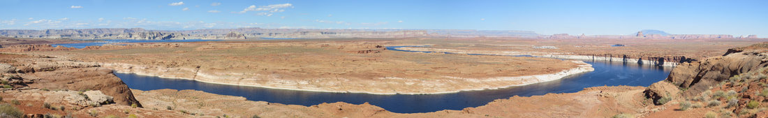
View from the Rim Trail, looking north out over Lake Powell and Antelope Island.
This was a peaceful little trail, at least while we were out. We could hear the boats and other watercraft, but they were far enough away and down in the rock walls surrounding the lake so that the rumble of their motors was mostly muffled. There was a fairly constant parade of airplanes coming and going from the little airport just a little way south east of our location. Mostly single-engine, high-wing light cargo or passenger birds, but I have no idea what they were. But there were a lot of them. I guess these were just commuter runs to some of the large area airports like maybe Flagstaff or Phoenix. Maybe some were just sightseeing tours. Whatever the reason, the sky over Page was busy.
We gave up on our hike after almost two miles, turned around and retraced our steps back to Casa Hick. We were back at 3:10 and had beer in hand by 3:20. First up was an Extrovert IPA from Left Hand Brewing. OK, but nothing special. Again the housemates were just chatting about whatever came up, but mostly concerning travel and exploring the desert southwest. Donna and I somehow got into a discussion on the size of Hoover versus Glen Canyon Dam. She thought the latter was the larger while I recalled Hoover being bigger. Turns out we were both right, or wrong (I'm a glass half-full kind of guy so I'll say we were both correct). A quick review of stats on the Internet showed that Hoover is a little taller (726 feet against 710) and much thicker, but Glenn Canyon dam is considerably wider (1,560 feet to 1,244 for Hoover). I reckon we'll call it a draw.
We gave up on our hike after almost two miles, turned around and retraced our steps back to Casa Hick. We were back at 3:10 and had beer in hand by 3:20. First up was an Extrovert IPA from Left Hand Brewing. OK, but nothing special. Again the housemates were just chatting about whatever came up, but mostly concerning travel and exploring the desert southwest. Donna and I somehow got into a discussion on the size of Hoover versus Glen Canyon Dam. She thought the latter was the larger while I recalled Hoover being bigger. Turns out we were both right, or wrong (I'm a glass half-full kind of guy so I'll say we were both correct). A quick review of stats on the Internet showed that Hoover is a little taller (726 feet against 710) and much thicker, but Glenn Canyon dam is considerably wider (1,560 feet to 1,244 for Hoover). I reckon we'll call it a draw.
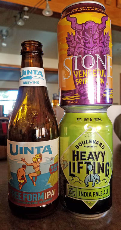 First set of beers to sample this evening.
We resumed the beer tasting this afternoon as well, first Oscar, Lynn and me, then later in the evening Oscar, David, Dan and me. Apricot blonde was an abomination per David but I thought it was drinkable. But there was nothing of great note out of the trials today. Probably the best of the lot was the Gimme Mo IPA from Crux Fermentation Project, but it was still not a great beer. We'll keep looking.
Dinner today was just like lunch, leftovers from the previous two cookouts plus whatever the boaters brought home from their day on the lake. Still plenty of food for everyone to eat more than they should and still have leftovers for later in the weekend. Beth's homemade brownies were a hit as were the cookies from Jacob Lake and Bluff. I stick to the more traditional cookies like chocolate chip or peanut butter but the Herd as a group seems to prefer the zucchini cookies. I mean, I like carrot cake so maybe zucchini cookies would be alright. But I decided to just leave them for those who know they like them.
We did have two action items to complete tonight, our usual planning session to make sure all the cats know what they will be doing tomorrow and the group portrait to commemorate the Great Page Meet-up. Now talk about herding cats! We probably got a bit of a late start on this as the evening was upon us and the light was fading, so we had to act fast, not our strong suit. There were a flurry of ideas on how to arrange the Herd and the vantage point for the cameras, now of which were logistically easy. In the end we arrayed all the cats and two dogs on the back deck with Gurjinder's camera set up on landing to the upstairs suite and Oscar's camera as a back up on the deck. After a couple quick checks we got the shot and the Herd quickly dispersed with calls for more beer and dessert.
Later we completed our second action with the evening skull session. Alex again led the discussion. Poor guy was in a bit of pain this evening after taking a tumble on the speedboat this afternoon when they went a across a wake a high velocity. Looks like the Herd will be scattering all over the place tomorrow as we break into several smaller groups. The main event will be exploring on Lake Powell using a speed boat to get to some interesting side canyons. This will be the second day of boating excursions that John set up, so he'll be the captain with the crew of Max, Anna, Tommy, Beth, Susan, David and Roz. Gurjinder will also be out on the lake, heading to Rainbow Bridge on the tour boat. Danny, Norma and Alex will be on the other side of the dam, floating down Glen Canyon on the half-day raft trip that goes down to Horseshoe Bend then motors back to the dam (unlike the full-day trip that floats all the way to Lee's Ferry, like we did as part of the Kanab meet-up in 2011). Frankie will hold down the fort with the puppies.
We also talked about plans for the 2018 meet-up. The location is set. We'll be in Torrey. The dates are yet to be determined, so we'll probably need a Doodle poll for that. I reckon we'll have to see what, if anything, there is in terms of VRBO options around Capitol Reef. Susan pitched Vernal for 2019. Fine by me as Lynn and I have never been there.
Unfortunately this was the last evening for the meet-up for some of the Herd as Bethany, Dan, Alison and Mark were all leaving tomorrow, although Dan is planning on going out to Horseshoe Bend to see if he can see our rafting crew float by.
So the only folks remaining yet to develop a definitive plan for Sunday were the rest of the Casa Hick crew. We'll be hiking somewhere, we just don't know where. There were several ideas bandied about. Deb suggested an early morning drive to Alstrom Point out to the west end of Lake Powell for the view and then we could drive back and hike Waterpocket on the south side of Page. Dan recollects that Alstrom Point is about 1:30 drive time, so three hours round trip so that will take half the day for sure. I think this plan involves too much driving. Howie suggested exploring along Cottonwood Road. Bucktank Draw was still in play particularly now that we spotted the trailhead. We left the options open and decided to figure it out in the morning.
The party continued well past 9:00, a late night for this crew. We lingered as we said our goodbyes to those Herd members who are heading out tomorrow, something that none of us likes to do. Hey, it's been a year since most of us saw each other last so the few days that we get together at these events is hardly enough time. That said, Donna threw the last of the crew out at 9:30.
The past two days were outstanding. White Pocket and Lower Antelope Canyon are two of the best meet up activities I can remember and there have been many excellent adventures with the Herd. I thought about a top ten list but that quickly filled up as there have been so many great adventures. Still maybe I could create such a list.
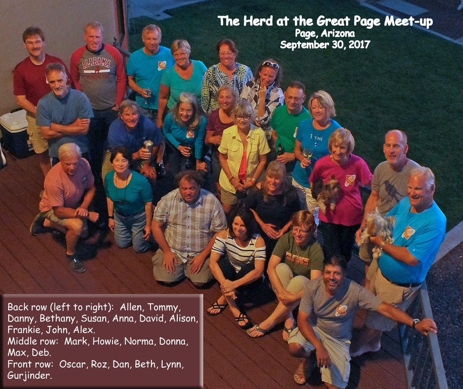
A little team work on this image. Gurjinder was the photographer and I did a little editing in Photoshop Elements to brighten it up. Some of us are looking up at Gurjinder's camera and some are looking at Oscar's, so as usual we are all over the place! But in the end, not a bad capture of the Herd in Page.
Day 5, Sunday, October 1 - Hiking Somewhere. It seems we are falling into a routine as we were again awake at 0500 and got our day rolling. Lynn went downstairs first for her morning caffeine boost. I hung out upstairs for a while, updating the journal and reviewing photos. I think I got some nice shots in Lower Antelope yesterday, but I won't know for sure until I download them to the laptop back home and study the images on the bigger screen. I got ready for the day then wandered down to the main floor at 0600. The open kitchen and dining area has become our congregating area and the housemates were starting to gather.
The view from the big picture window across the crack in the earth that is Glen Canyon and beyond to the cliffs was spectacular again this morning. The day was starting sort of hazy but the forecast is for sunny and 85 F. So it should be a great day for the Herd here in Page as we scatter across the area.
The view from the big picture window across the crack in the earth that is Glen Canyon and beyond to the cliffs was spectacular again this morning. The day was starting sort of hazy but the forecast is for sunny and 85 F. So it should be a great day for the Herd here in Page as we scatter across the area.
Sunrise view from Casa Hick at 6:22 AM.
Same view at 7:09 AM.
Alex and Max were both out the door early, as he was rafting and she was going out on the lake this morning. Since Frankie is staying home with the pups, that just leaves the remainder of the Casa Hick residents to find a trail to hike. We are not yet sure where we are going but an early start for our hike to beat the heat is in order. Howie and I discussed options, looked at the literature and in the end relied on his knowledge of the area. Plan now is the check out the canyon of hoodoos, toadstools and other interesting formations west of Page along route 89. The drive should not be that long and trail into the canyon is reportedly easy. We'll stop at the ranger station first to get the low down on the area before we drive in.
Let me cut to the end of this hike for a second. Two points, OK, three. First, it was a great hike and we saw some truly amazing landscapes and rock formations. Second, we did not see another soul the entire day (there was another truck at the trailhead but we saw no other people). Finally, Howie suggested that we keep this one hike "off the radar" since it seems that the trail is not highly used. So I'm purposely being vague on the exact location. So, we are west of Page and north of route 89, along the southern edge of the Grand Staircase Escalante National Monument but instead of calling the area by the name listed on the map, I'm just going to go with "Howie's Hoodoos."
On the road about 0830, Howie and Deb took their truck and Oscar drove Max's Jeep. Lynn and I piled in with Oscar and Donna. First stop was the Big Water Visitor Center. Nice little information center with some interesting displays on the dinosaur fossils that had been found in the area, including several skulls of long extinct horned beasts. While I was checking out those displays, Howie inquired at the information desk about the hike in which we were interested, but the Rangers there had no personal knowledge of that area and no maps to share (although Howie did have an old version of a map of that area that he had gotten there a while back…curious). OK, so no updated information, but we'll still go with our plan since Howie knows where he's heading.
|
|
The drive to the trailhead was not that difficult, but did require 4WD at a couple of dry wash crossings. Oscar commented that this was the first time this Cherokee had been in 4WD as Max had told him she had not taken it off road. It took a minute to figure out which combination of buttons would actually get the vehicle into four-wheel-low. I don’t know if we ever got it right, but we got through easy enough. Oscar was having problems finding the controls to the sunroof as well, not being familiar with the vehicle. I asked him which controls he was looking for, thinking I could help in the search. When he relied indicating the sunroof, an arm reached up from the backseat, grabbed the handle and slide manually slid the sunroof cover aft. That Lynn, she's pretty clever.
This was not a long drive to the trailhead from the time we exited route 89 and we were soon at our destination. We unloaded and Howie give us a general briefing on where we were heading. Once geared-up, we hit the trail. The hike is easy, really just a stroll up a flat, wide valley. The most difficult part of the hike was the wind. Any hat not snugged down on a noggin was airborne! There is a definite trail, but it is probably used by cattle as much as hikers. There was one dominating feature that we could see for much of the hike, a tall red rock that we could see while in the main canyon. Howie was hoping that we could find a route over to it that would be easy enough for the entire group as there was supposed to be rock art at the base of this big rock. We'll work on that on the return hike. We followed the trail up the middle of the valley for about a mile-and-a-half before Howie detoured us into one of the side canyons. And what a detour. This was just a short, dead-end canyon defined by white and yellow walls but it was full of little white hoodoos, most of them wearing a cap of reddish-brown sandstone. They were scattered all over this little canyon, along the floor and up the slope at the end. Most of them were six-foot tall or less, but there were a couple that towered well over our heads. We spent 25 minutes or so exploring this rather small area, climbing around the hoodoos and toadstools, but staying off of these sandstone balancing acts. This was a nice setting for our team photo so Oscar set up his light tripod. It was a bit breezy today so he was having a little trouble getting a stable base for the camera but he eventually got the equipment to cooperate. After the photo op, Howie walked over into the next little canyon to see what wonders it might contain. He reported back shortly that the next valley was not worthy of our time.
This was not a long drive to the trailhead from the time we exited route 89 and we were soon at our destination. We unloaded and Howie give us a general briefing on where we were heading. Once geared-up, we hit the trail. The hike is easy, really just a stroll up a flat, wide valley. The most difficult part of the hike was the wind. Any hat not snugged down on a noggin was airborne! There is a definite trail, but it is probably used by cattle as much as hikers. There was one dominating feature that we could see for much of the hike, a tall red rock that we could see while in the main canyon. Howie was hoping that we could find a route over to it that would be easy enough for the entire group as there was supposed to be rock art at the base of this big rock. We'll work on that on the return hike. We followed the trail up the middle of the valley for about a mile-and-a-half before Howie detoured us into one of the side canyons. And what a detour. This was just a short, dead-end canyon defined by white and yellow walls but it was full of little white hoodoos, most of them wearing a cap of reddish-brown sandstone. They were scattered all over this little canyon, along the floor and up the slope at the end. Most of them were six-foot tall or less, but there were a couple that towered well over our heads. We spent 25 minutes or so exploring this rather small area, climbing around the hoodoos and toadstools, but staying off of these sandstone balancing acts. This was a nice setting for our team photo so Oscar set up his light tripod. It was a bit breezy today so he was having a little trouble getting a stable base for the camera but he eventually got the equipment to cooperate. After the photo op, Howie walked over into the next little canyon to see what wonders it might contain. He reported back shortly that the next valley was not worthy of our time.
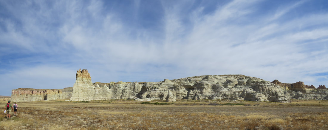
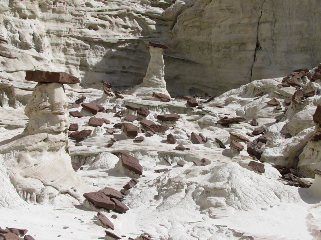
Howie's Hoodoos
|
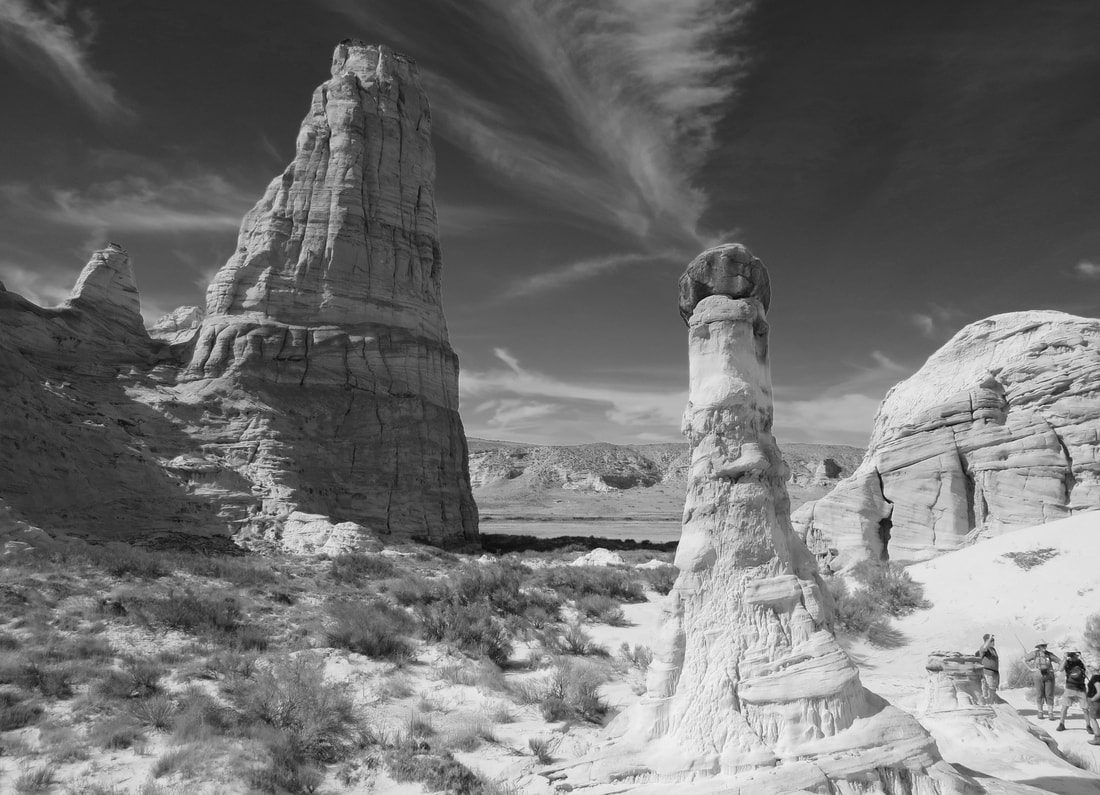
|
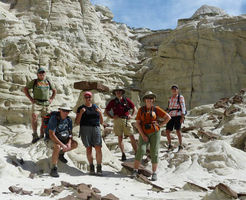 The gang at Howie's Hoodoos: Howie, Oscar, Donna, Allen, Lynn and Deb. Photo credit to Oscar.
Once we were done exploring this first canyon we worked our way around the wall of the main canyon and continued checking out the subsequent side canyons. The first was just a shallow indentation in the canyon wall and while pretty did not afford the interesting formations of Howie's Hoodoos, so we continued on. The next canyon was much larger and longer with the trail running again down the middle of the canyon not unlike our starting hike into the area. We could see some formations off in the distance, so there was hope of something cool. Howie was way out in front, like a hound dog on a scent, and we followed to see what he would find.
From the point where we turned into this longer side canyon to the point where we could see the fascinating formations was about a half mile. This is a wide canyon with rather tall walls at the point where we entered and after a short bit the canyon opened up into a wide, open plain, probably a quarter-mile across. The canyon narrowed as we went deeper but was still always quite wide until the very end. As we approached, it seemed that the canyon made a turn, but what we were really seeing were rock partitions jutting out from the main walls of this canyon, nearly opposite one another and forming sort of an entrance way to the best part of the canyon. This was a huge, grand entrance, about 100 yards wide and provided a frame to the amazing features beyond. There was a very tall spire just beyond the entrance, topped with rock whose patina and patterns looked like a Pinto stallion guarding the gate.
From the point where we turned into this longer side canyon to the point where we could see the fascinating formations was about a half mile. This is a wide canyon with rather tall walls at the point where we entered and after a short bit the canyon opened up into a wide, open plain, probably a quarter-mile across. The canyon narrowed as we went deeper but was still always quite wide until the very end. As we approached, it seemed that the canyon made a turn, but what we were really seeing were rock partitions jutting out from the main walls of this canyon, nearly opposite one another and forming sort of an entrance way to the best part of the canyon. This was a huge, grand entrance, about 100 yards wide and provided a frame to the amazing features beyond. There was a very tall spire just beyond the entrance, topped with rock whose patina and patterns looked like a Pinto stallion guarding the gate.
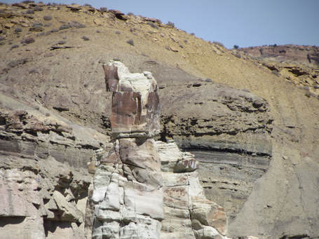 Horse Rock guards the end of the long valley.
As we passed through this natural gateway, we were treated to a very beautiful setting and some very impressive formations. The formation on our right as we walked in had the look of a huge, ornate palace, like something out of ancient Egypt. There was even a rock way up high in this formation that resembled a Pharaoh's head. This formation was next to the canyon wall and there was an area of the slope that was covered with the reddish-brown rock layer that looked like the capstones on the little toadstools back in the first side canyon. It looked like this layer had collapsed as one big piece from the way it was laid out. I wonder if the layers beneath this one had eroded away leaving this one as sort of an awning over that part of the canyon until it lost the battle to time and gravity.
The overall character of this canyon was quite different than the first, which just added to the variety of the hike. Here the canyon floor was a wide, grass-covered field with the stone features arrayed around the periphery. While the first canyon was predominantly composed of white rock, here there were stripes of dark red running through the strata. Not as many toadstools here, but there were a few scattered about at all levels along the canyon walls. My favorite of these was a tall, thin spire wearing its cap at an extreme angle. The red stripes ran through the body of the toadstool allowing it to blend in somewhat with the strata of the canyon wall directly behind. I thought it was sort of cool.
We walked around the edge of the canyon, along the base of the walls, studying the details of the rocks. A collared lizard kept an eye on us as we meandered by. Some of the taller formations had rows of little toadstools higher up on their walls. Other areas were reminiscent of hoodoos in Bryce Canyon, just more muted in terms of color. But there were interesting formations scattered from ground level all the way up to the canyon rim.
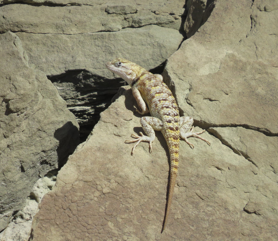
|
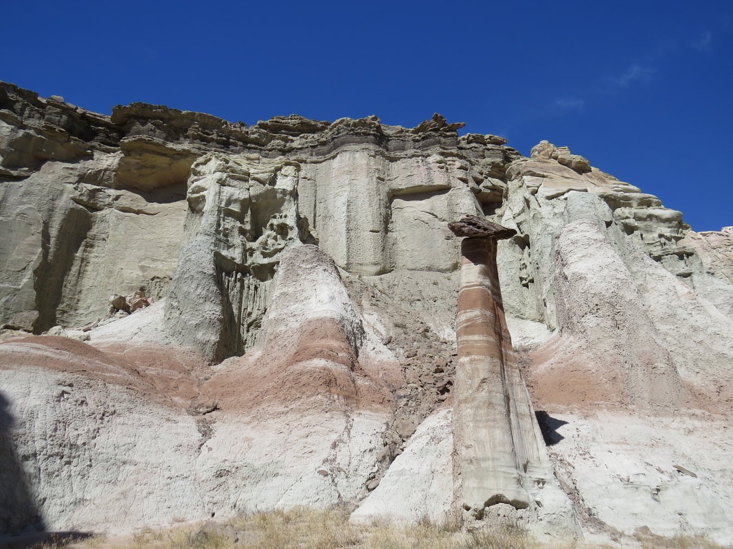
|
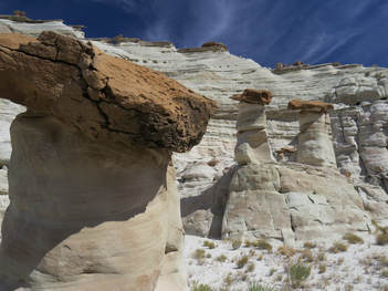 Toadstools in the last side canyon we explored.
After a fairly thorough examination of the fascinating rocks we retraced our path out of this long canyon then into the next shorter side canyon. We were greeted by a nice small cluster of white toadstools, very similar to those in the first side canyon. But beyond this first set, there was not a whole lot to see in this canyon, but we still poked around a bit. Oscar headed up the scree covered hillside to get a better view and to see if he could make it over to the tall red spire. We watched him slowly gain on the rim of the canyon but it was slow going, often two steps forward and a half-dozen back. But he eventually made it. Donna and Lynn watched his exploits for a while, then agree that they were not attempting that route and started back out the way we had come in. Howie tried yelling to Oscar, but the wind was blowing so hard that communication was futile. So with a few waves and a lot of pointing we agreed that the rest of us would look for an easier way to get up to the next level. I went off after Lynn and Donna to give them the plan.
Lynn and Donna were making tracks, but I eventually caught up and detoured them from the trail back over to the canyon wall. We found a simple way to get up the wall, following a pour-off. Nice views from the elevated perch. We could see all around, so we kept an eye out for Howie and Deb coming down the canyon as well as watching for Oscar coming from above. I searched around on the slickrock, just climbing around mostly for fun, but also seeing if there was an easy access route to the top of the canyon wall. I never found one in our immediate vicinity. Howie and Deb had found us and joined in the search as well. Oscar also rejoined our merry band. He said he could have walked right up to the red rock spire but came over looking for us. But from here there was no easy way up to the next level, so we bagged it at this point, went back to the pour-off area and had a snack. Then it was back down to the main trail and back out to the trailhead. Back at the vehicles we had a celebratory beverage before loading up and heading back to Page. That was a fun hike. Easy but with some great views and wonderful formations tucked into the side canyons. We meandered about for a little over four hours and covered about 5.4 miles. The IPA from Upslope Brewing was a great post-hike and a pretty darn good beer. Light but good flavor. Here are the photos from our hike to Howie's Hoodoos.
We were back at the Hen House (or is that Casa Hick?) by around 2:30. Frankie and Dan were watching the Presidents Cup recap. Team USA rolled to victory. Dan had been out to Horseshoe Bend to watch for the rafters. He was also having challenges with the wind. He stopped by to say goodbye before hitting the road.
I headed upstairs for a beer from our mix-and-match stash, but finished with the gang on the main floor. Still plenty of time to get cleaned up before the rest of the Herd starts rolling in for dinner. It was just nice to hang and the housemates for a while in the relative quiet of the house this afternoon. But eventually we all got in gear for the evening gathering. Since we still have plenty of food leftover from the previous cookouts, it just made sense for the Herd to congregate here again for dinner. We are definitely getting our money's worth out of this rental house (and it was a deal to start!). The family started rolling in about 6:00 and we had a nice group again today. Everyone still in town was present (Alex, Frankie, Donna, Oscar, Howie, Deb, Max, Anna, Gurjinder, Beth Tommy, Roz, David, Danny, Norma, John and Susan). And as usual, no one went hungry. I think I was the last one through the chow line, and the indoor seating was pretty much all taken, so I went out on the back patio. No one else was out there, so I enjoyed my dinner and the peace of the evening for a little while.
I think we all had a great evening, swapping stories and sharing pictures. David appreciated my seal of approval on the beers he had brought to share tonight. The conversations traversed a myriad of subjects, of course starting with the day's events but then diverging to some unexpected and rather random, if not eclectic, subjects. Everything from English archers, to defending one's university to chocolate. There was plenty of the latter to share. It seems that we are a bunch of dark chocolate snobs. I asked if anyone had tried the dark chocolate M&Ms yet (a treat we discovered while in Glacier this summer). According to David, M&Ms are not allowed to be advertised as chocolate in Germany as there is not enough cocoa in them. Hmm, you learn something new every day. Best beer of the day was probably the Josh the Guava King from Clown Shoes. Very smooth for a double IPA with a very pleasing aroma.
Of course we again had our skull session to make plans for tomorrow. Alex and Frankie will be hitting the links at Page National. Danny, Norma and Deb will be back out on the lake, paddle boarding into Antelope Canyon. Max is going to explore Lower Antelope Canyon and Anna also has a tour of some slot canyons planned. The big event for the rest of the Herd will be hiking with Howie as he leads us on another adventure off the House Rock Valley Road, this time to the West Clark Bench area to see another collection of otherworldly rock formations known as Edmaier's Secret.
Day 6, Monday, October 2 - West Clark Bench. Today was a bad day in terms of news. I was awake at 5:00 and checked current events on my phone. There was a shooting in Las Vegas at a concert. Appears that the shooter was firing down from a hotel room adjacent to the concert venue. Fifty dead and scores wounded. This obviously put a cloud over the day. We also read that Rock-and-Roll legend Tom Petty had passed away. No, not a good start to the day. The Herd was a little more subdued this morning.
It is a little overcast this morning, but the clouds are already showing signs of moving out with a clear, blue sky taking over. The forecast is for 70 F, sunny but windy. Looking at the hourly breakdown we could have sustained winds of 30 mph with gusts of 35. Well, we'll give it a go and see if we get blown off the trail. We were on the road at 0815. Deb and Howie were in the lead with David and Roz, I drove the Rogue carrying Lynn, Donna and Oscar, and Gurjinder brought up the rear with John. That's a good group.
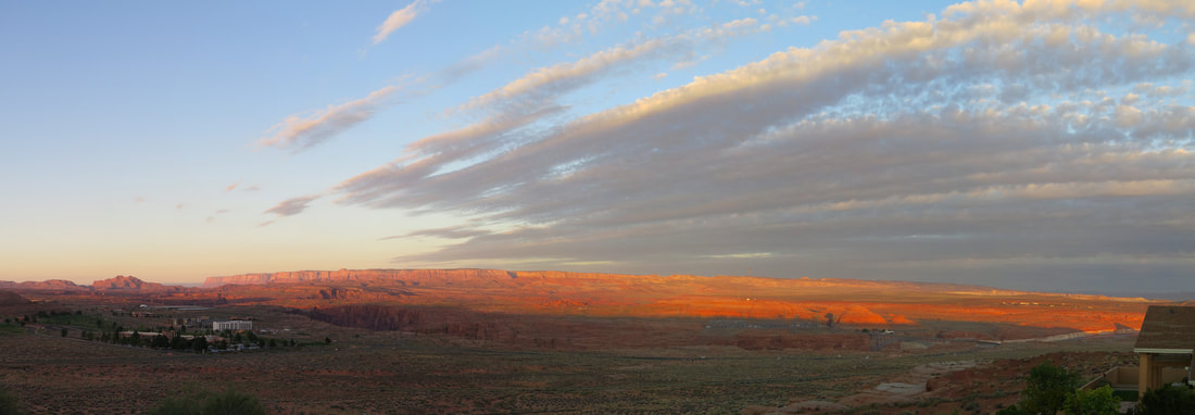
Easy drive west on route 89 to the House Rock Valley Road. Second trip down this dirt highway for the trip, but this was a much shorter and easier journey compared to our jaunt out to White Pocket. Four miles to the Buckskin Gulch Trailhead. No issues at all for the Rogue. The only thing we had to do was keep up with Howie and hopefully not lose Gurjinder. I thought that Deb set a good pace when leading the convoy, but Howie is equally speedy on the dirt roads, particularly when the surface is well graded. He was kicking up quite the dust cloud, so we always knew where he was but also cut down on our visibility. Lynn, riding shotgun, was fanning the air in front of her. Donna commented from the back seat that Lynn was doing a great job keeping the dust down in the Rogue, especially since none of it was actually getting in! We all have our moments!
We pulled in at the trailhead at 9:15. The temperature gage on the dashboard read 57 degrees. The sky was mostly clear, with some fluffy, white clouds arrayed across the azure background. Just enough clouds to provide some photographic interest. Not much action at the trailhead parking lot, maybe one other car there when we arrived. Another car pulled in shortly after us, a couple of kids from Europe somewhere. Howie, being the helpful, fatherly type, gave them some advice on the best hiking in the area. They had a different trail in mind, so Howie sent them to a trailhead that would give them better access. Or they could stay here and hike in and see the cool stuff we were going to see.
So what exactly is that we are going to see? Here's a blurb taken from Americansouthwest.net:
Edmaier's Secret, Paria Canyon-Vermilion Cliffs Wilderness Area: Several smaller locations have been publicized in recent years including Nautilus Rock near the Paria River trailhead and Edmaier's Secret, on the east side of Buckskin Gulch about one mile upstream of the start of its long enclosed slot section. The secret is a group of layered sandstone domes and cones, with a knobby, brain-like texture, crossed by thin fins, often perpendicular to the underlying strata. These 'brain rocks' are one point of interest, but better, photogenically, are the erosive structures formed by the fins, which in some places combine to create larger protruding mounds containing very thin sandstone plates at various angles. The location is named after German landscape photographer Bernard Edmaier, who first identified the formations from the air. The place is also known as Brown Pocket, or West Clark Bench Water Pockets.
Howie had that twinkle in his eye that let us know we were in for a great hike to some really cool formations. We grabbed our gear and started up the trail. The European kids were still discussing their options when we left.
Easy hike and pretty level the entire way, at least to the point where we left the main trail. The only difficult parts were a couple of short stretches of sand. The trail starts across some grassy fields that weave among the red sandstone rocks. There were still some stands of wildflowers adding a pop of color here and there. Parts of the trail also ran in the dry creek bed. Must have been dry here for a while as the bed of the creek is cracked and peeling. The dried mud crunches like dried leaves. I picked up a chunk and Oscar and I studied it briefly. These mud plates were very light weight, maybe a quarter-inch thick. Most were curled along at least one edge, giving them a bowl like appearance. We wondered if seeing dried mud like this is where the original inhabitants got the idea for making pottery.
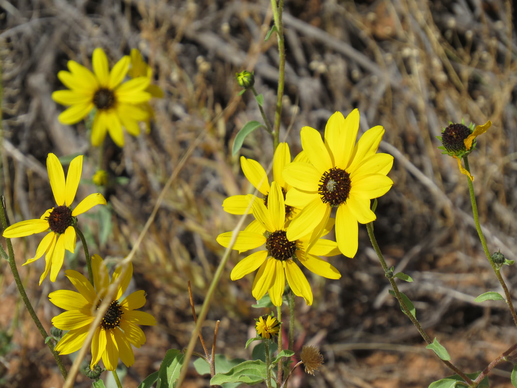
|
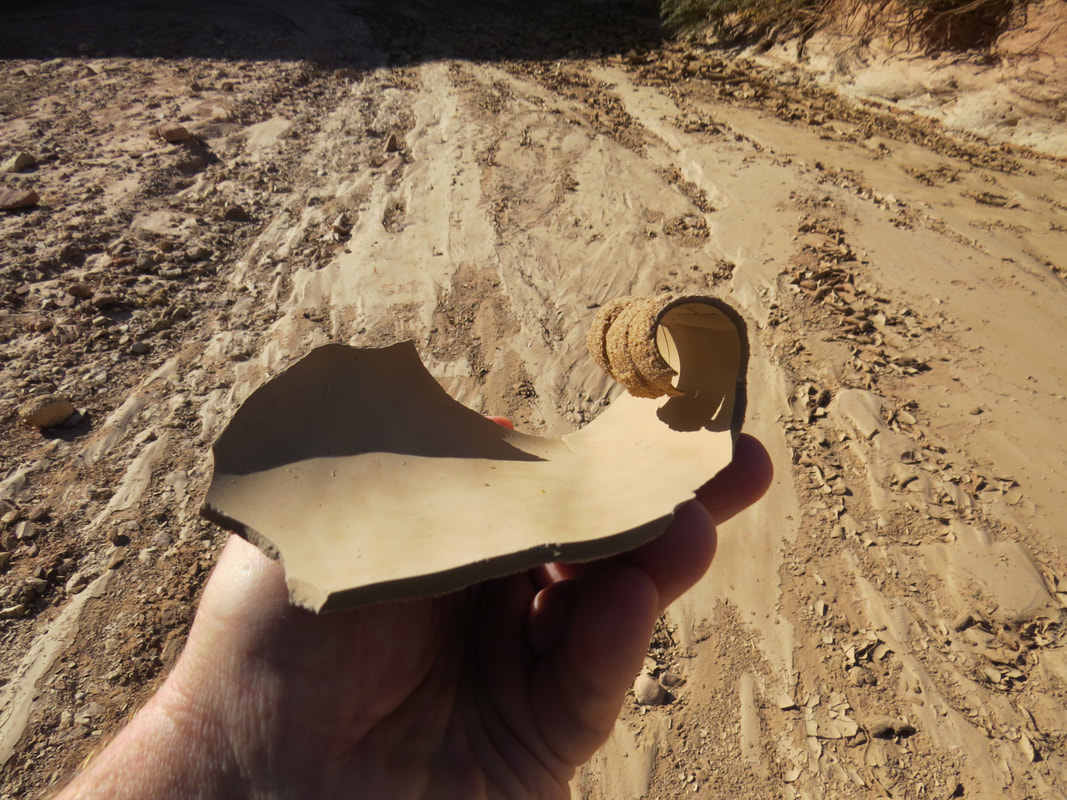
|
The trail continued to weave along or in the creek bed, cutting across the loops in the creek path in places or running parallel to the dry bed in others. This was a pretty hike in itself, with the red sandstone formations lining parts of the trail, then opening up to wider vistas as we went. After about a mile-and-a-half when we reached the point where we left the canyon floor and climbed a bit to our destination. The toughest obstacle was the barbed-wire fence we had to crawl through. Hmmm, I wonder which side the cattle are on. Once through a fence we went cross country through a couple sandy areas and up along a short pour-off. There were a lot of interesting critter tracks in the sand. Everything from beetles to coyotes come through this area at some point of the day. Once on a more solid surface we started to climb toward the really interesting rocks. And there were plenty of those arrayed up the slope before us.
This place is ridiculous! I mean the variety of the formations, the colors in the rocks, the views…it is just crazy. And we had the rest of the day to explore and see all that we wanted to see. There were areas of frail rock fins rocks that formed honeycomb-like structures with the wafer-thin rock panels meeting at all manner of odd angles. Then the "turtle shells" and "dragon hide" as I called them (I prefer these to the "brain rock" used in the description above). We climbed around on these formations for quite a while as they stretched from the edge or the area on up to the higher ground. Most of the troop worked their way up the main pour-off that run up the wide area of dragon's hide, while I worked my way around to the right higher into the piled up turtle shells in order to get a better vantage point. I watched my companions spread out over the checkerboard rock as they continued up the incline and eventually reconnected with them on this vast area of dragon hide. Here we had options as to which we to go. Howie wanted to work around to the right on the turtle shells to show us the view out over the valley then perhaps on around an up to the high ground to the left. Whatever you want, Boss, I've never been here so anything you show me will be new and I'm sure fascinating. Most of us went with Howie. John and Gurjinder left the pack, each striking out on their own going up to the high ground along the left of the area. There was really no worries in splitting up as the area is open so we should be able to keep an eye on each other. We could see the guys making their way up the ridge to our left as we continuing over the dragon hide and open sand heading to another area of turtle shells.
This place is ridiculous! I mean the variety of the formations, the colors in the rocks, the views…it is just crazy. And we had the rest of the day to explore and see all that we wanted to see. There were areas of frail rock fins rocks that formed honeycomb-like structures with the wafer-thin rock panels meeting at all manner of odd angles. Then the "turtle shells" and "dragon hide" as I called them (I prefer these to the "brain rock" used in the description above). We climbed around on these formations for quite a while as they stretched from the edge or the area on up to the higher ground. Most of the troop worked their way up the main pour-off that run up the wide area of dragon's hide, while I worked my way around to the right higher into the piled up turtle shells in order to get a better vantage point. I watched my companions spread out over the checkerboard rock as they continued up the incline and eventually reconnected with them on this vast area of dragon hide. Here we had options as to which we to go. Howie wanted to work around to the right on the turtle shells to show us the view out over the valley then perhaps on around an up to the high ground to the left. Whatever you want, Boss, I've never been here so anything you show me will be new and I'm sure fascinating. Most of us went with Howie. John and Gurjinder left the pack, each striking out on their own going up to the high ground along the left of the area. There was really no worries in splitting up as the area is open so we should be able to keep an eye on each other. We could see the guys making their way up the ridge to our left as we continuing over the dragon hide and open sand heading to another area of turtle shells.
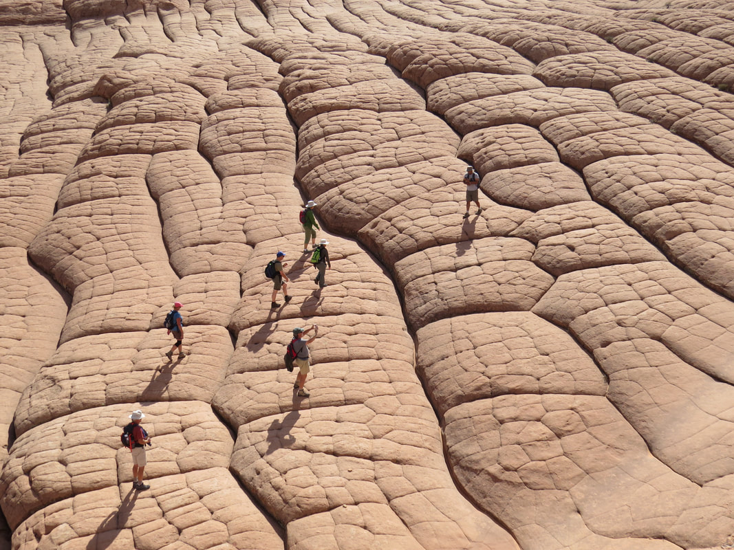
The Herd crossing the dragon hide.
|
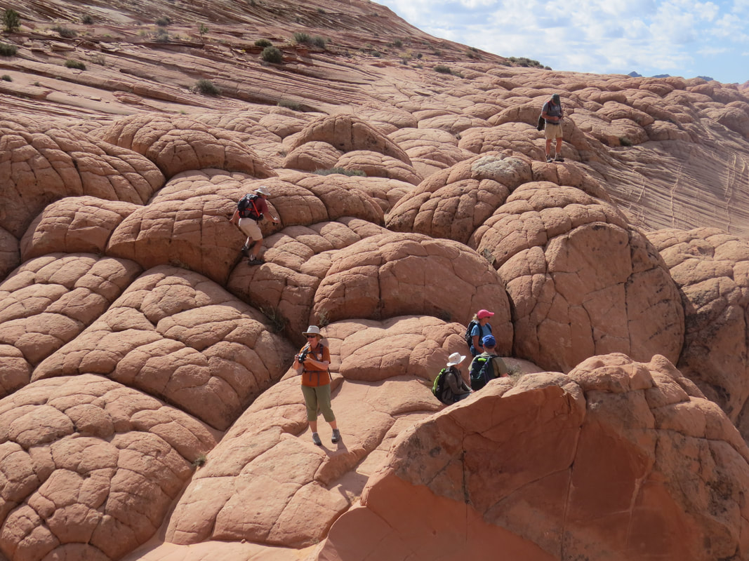
Hanging out on the turtle shells.
|
Walking on the turtle shells and dragon hide was pretty easy, well other than the points with the turtle shells met which could be a bit steep. At these points you had to mind your step. But this was considerably easier than walking around the around with the fragile, thin fin rocks. This you had to stay off of or risk breaking the fine layers of rock. Howie continued to guide us across the turtle shells until we reached the edge of this level of formations. The view that then stretched out in front of us was again otherworldly. From the turtle shells, the formations fell away precipitously, rolling down to the canyon floor below. We worked our way over the knobby, scaly formations, simultaneously admiring nature's handiwork here around us and down on the canyon floor. Howie pointed out where he thought the narrow section of Buckskin Gulch started. That is the longest slot canyon in the United Stated, stretching 16 miles. Rick took Chris and me out there during the Kanab meet-up, after our day at The Wave.
Hey, there's John and Gurjinder coming around the far side of the hill. They were heading down the slope to the canyon floor. Gurjinder seemed more intent on photography and stopped in the slope to get some close-in shots of the variations of the strata. John coasted right down to the bottom. Then found a tree and looked to be settling in for a nap. Well, he certainly deserves one for all his efforts the past couple days leading the Herd on their nautical adventures. We also settled in on the turtle shells, as they made a convenient place to take a break and have a snack. After our break we continued along the rolling section of dragon hide to a section of rock that had the look of the surf crashing on the beach, only frozen in time. Certainly a wave, but a completely different look than The Wave. I think that is a trap that we tend to fall into, comparing all these wonderful places to The Wave. Many in the Herd have been there and everyone is familiar with the photos. The Wave is beautiful, but no more so than any of the other places that Howie has led us into this week. Perhaps it is the extremely long odds of getting a permit for The Wave that sets it apart. Granted it is a wonderful place, magical even, but so are White Pocket, Howie's Hoodoos and Edmaire's Secret.
Hey, there's John and Gurjinder coming around the far side of the hill. They were heading down the slope to the canyon floor. Gurjinder seemed more intent on photography and stopped in the slope to get some close-in shots of the variations of the strata. John coasted right down to the bottom. Then found a tree and looked to be settling in for a nap. Well, he certainly deserves one for all his efforts the past couple days leading the Herd on their nautical adventures. We also settled in on the turtle shells, as they made a convenient place to take a break and have a snack. After our break we continued along the rolling section of dragon hide to a section of rock that had the look of the surf crashing on the beach, only frozen in time. Certainly a wave, but a completely different look than The Wave. I think that is a trap that we tend to fall into, comparing all these wonderful places to The Wave. Many in the Herd have been there and everyone is familiar with the photos. The Wave is beautiful, but no more so than any of the other places that Howie has led us into this week. Perhaps it is the extremely long odds of getting a permit for The Wave that sets it apart. Granted it is a wonderful place, magical even, but so are White Pocket, Howie's Hoodoos and Edmaire's Secret.
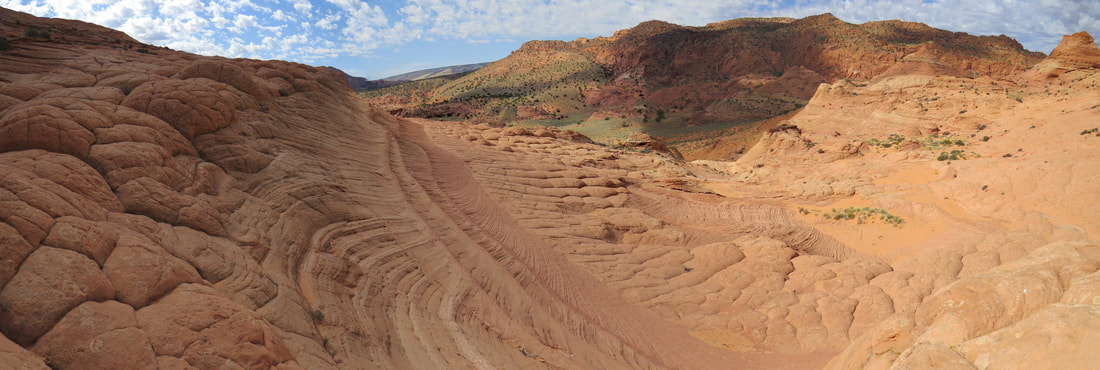
John and Gurjinder have rejoined the party. Howie wanted to head up to the ridge and take a look around up there. Not everyone wanted to take the steep route up the slope to the top so we again divided the column. Howie, Gurjinder, John, Oscar and I went up the ridge and the others continued to explore here on the turtle backs.
OK, this started off as a steep hike and just kept getting steeping. We were alternating from winding our way along the strata by taking sort of a switchback route or just picking a straight path and powering through. I got into a nice rhythm, just got the legs pumping and the arms swinging at a good cadence and made a headlong drive up the slope. That did not last too long before a breather was required. What was it Detective Murtaugh said? Oh, yeah, I remember. Nah, I don't think I'm getting to old for this stuff, well, not yet anyway.
The slope we were climbing was similar to the one we were admiring that led down to the valley floor with the alternating layers of rock, each with different colors and textures and variations in the direction of grain or structure of the rock. Now we were able to have an up close examination, which provided a good excuse for taking a short break on the arduous climb. Once at the top we were rewarded with amazing views in all directions and interesting rocks to inspect at close range. The thin fin rocks spread out before us. We had to study a bit before going too far in order to find a route around these fragile formations. There were areas where there really was no way through, the thin structures were everywhere. In some places there were just rows of these plates. Those reminded me of the defensive plates that lined the back of a Stegosaurus. Then there were the larger box-like structures built from these fins growing together from multiple angles. It was like a mad scientist just had a field day with some sort of crazy erector set. We wandered about the area, just marveling at the amazing sculptures. Yes, definitely worth the effort to get up here.
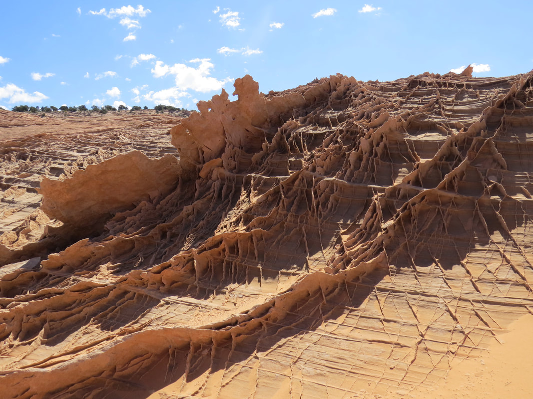
|
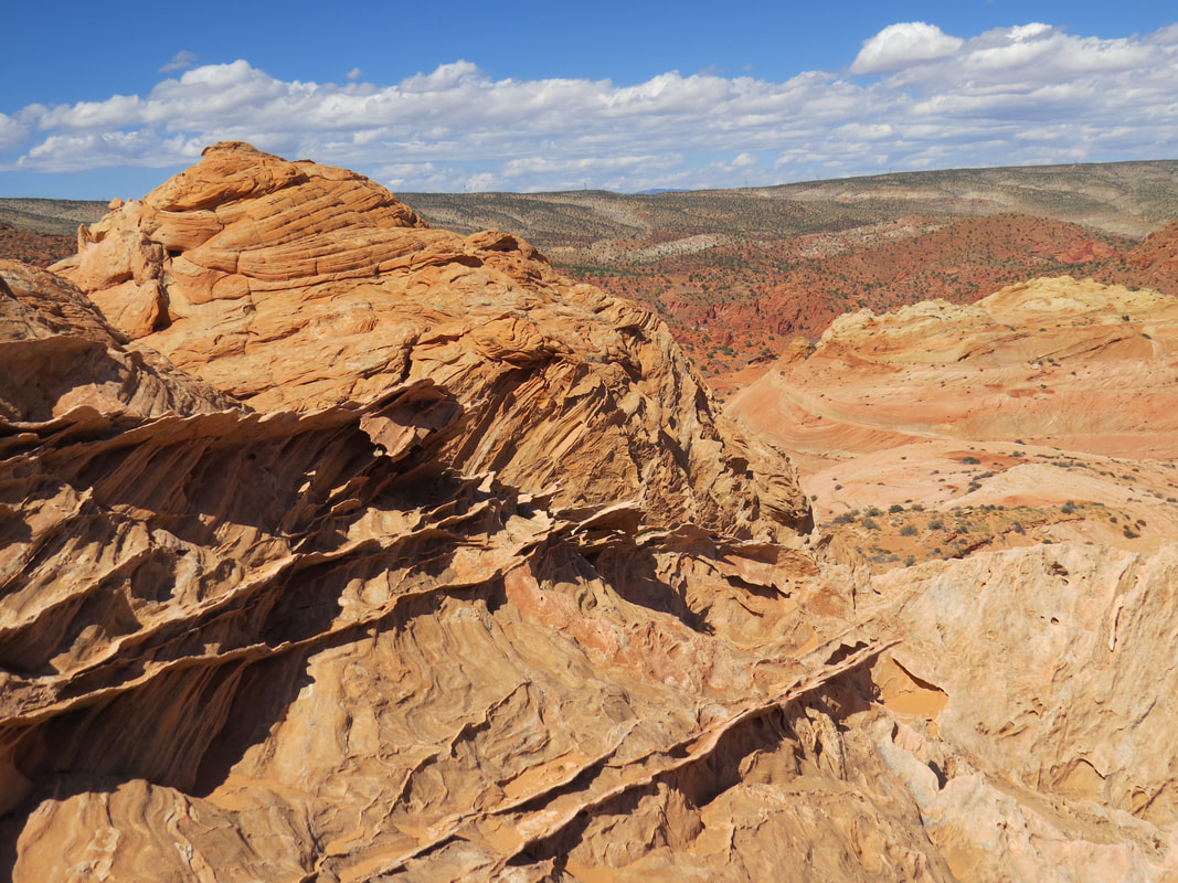
|
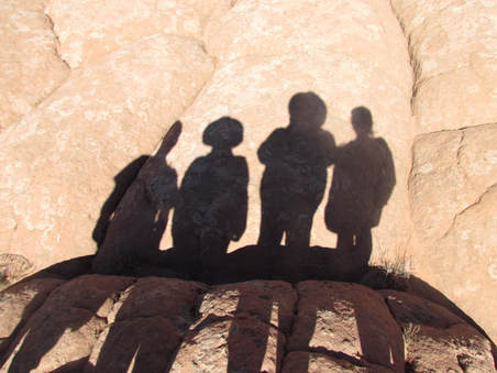 Smile for the camera!
We explored the upper shelf for a while longer but we could see that the rest of the crew had meandered across the dragon's hide to the area we said we would meet, so it was probably time for us to work our way back down the slope. There was one formation on the sloped sandstone that I wanted to check out on the way down, so I vectored that direction. More cool contours and colors so the detour was justified. Back on the more level area Howie pointed out a couple of dry pools. He said these were full of water when he was here last. Today the only water was in a couple of muddy spots. The rest of the gang was lounging nearby. They were taking a break after exploring across the turtle shells and dragon hide. They took and interesting team photo, a shot of their shadows spread out over one of the knobby rocks. Donna told a story on herself, confessing that she was worried she might have ruined the photo because we wasn't smiling!
Now that the gang is reunited it was time to get on the trail and head out of this stunning assortment of rocks. But we still had to get a team photo. We found just the place for that, as there was a row of natural statues made from the thin fins. That should make a nice backdrop for our class photo. We'll see how it turns out once Oscar gets his photos all organized and processed.
Now that the gang is reunited it was time to get on the trail and head out of this stunning assortment of rocks. But we still had to get a team photo. We found just the place for that, as there was a row of natural statues made from the thin fins. That should make a nice backdrop for our class photo. We'll see how it turns out once Oscar gets his photos all organized and processed.
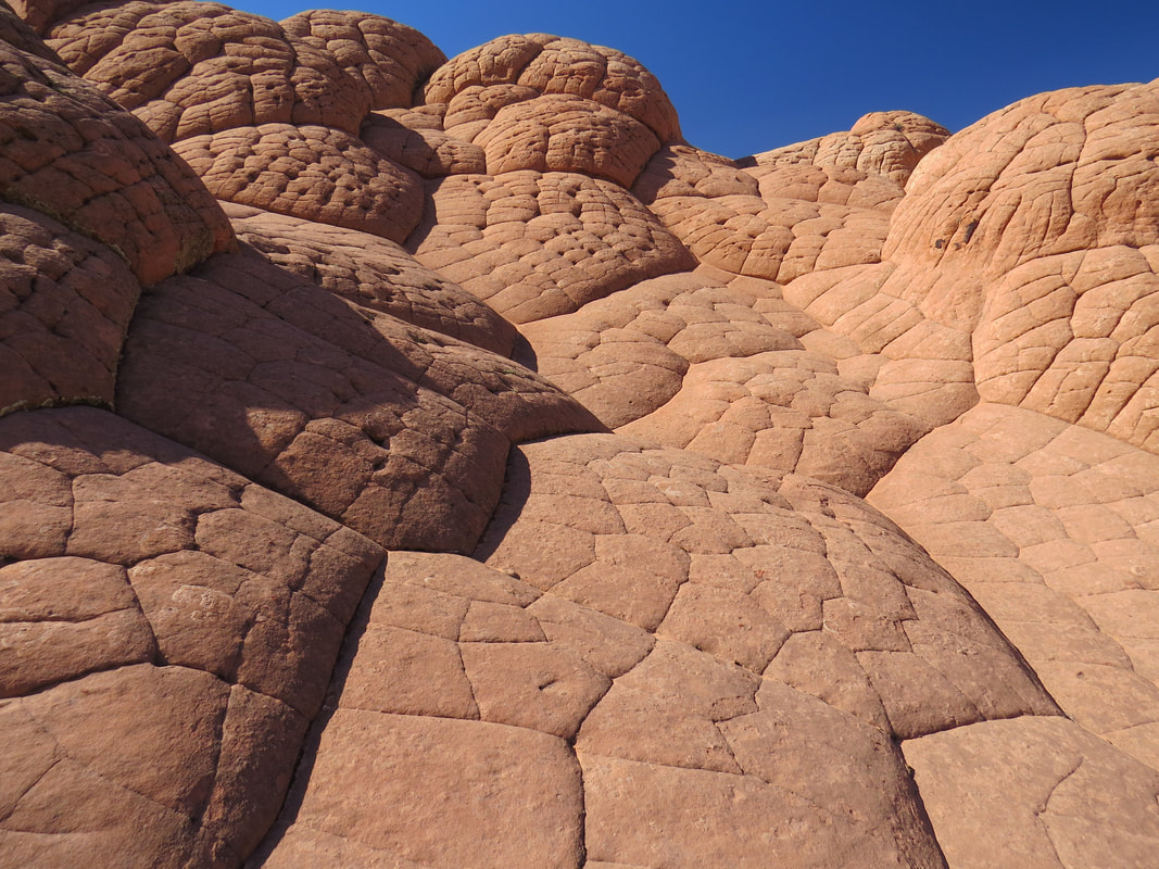
|
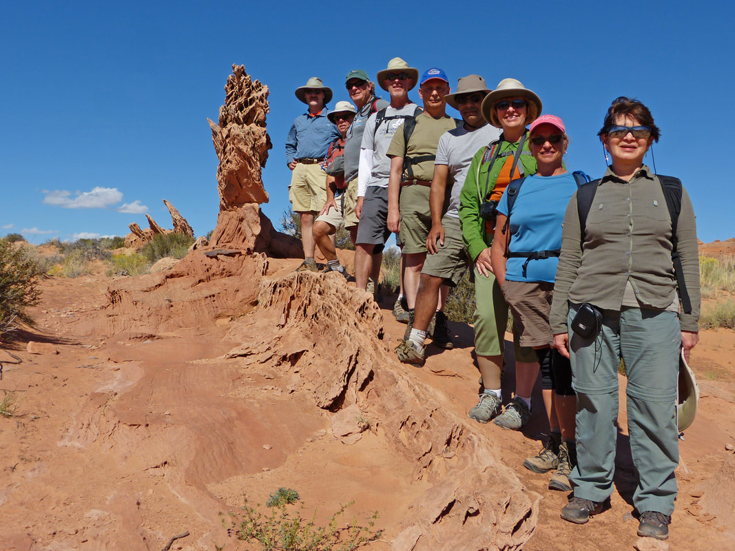
Oscar's nice group photo: Allen, Oscar, Howie, John, David, Gurjinder, Lynn, Donna, and Roz.
|
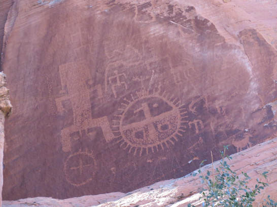
Nothing remarkable on the return hike, other than the stunning scenery, until we were almost at back at the trailhead. As usual, I was near the back of the pack, taking the occasional photo. As we passed by another standard formation of dark red sandstone we were surprised to see a pretty, blonde girl running toward us from behind the rocks, pointing up at the top of the formation and calling to us, asking if we saw the petroglyphs. OK, I was not expecting that at all. And we all completely missed the panel, so I'm glad that she flagged us down. The commotion she caused brought the rest of the Herd back to see what was up. Our new friend quickly asked if any of us were climbers as she was trying to scale the rocks to get a better look at the ancient art work. Nope, no climbers here, just hikers, but we do have cameras so we can bring the images down to us. I can see why she was trying to get up to rock art, as the images were rather high up on the wall. She indicated that she was looking for a way up but could not find a route that she could handle without help or equipment. Oscar and I snapped a few photos of the panel. Very interesting. None of us had seen anything like these. We'll ask Max about them when we get back to Page.
So who was this young lady and what the heck is she doing out here by herself. Through our chat there on the trail (and she did most of talking) we found out that basically, she's one of us, someone who just likes the great outdoors and exploring the wonders of nature. I think she was also looking for Edmaire's Secret but somehow missed it. She gave us her plan for the next few days and received a lot of free advice in terms of other options from John and Howie (we can't help ourselves, it's the Trip Advisor gene and it is a dominant trait in the Herd). She decided to bag the trail for today and hike back out with us. She went to grab her pack while the rest of us started on down the trail. John hung back with her on the hike back. She seems like a nice kid. I hope she is not a serial killer or part of the zombie apocalypse, otherwise we'll be searching for John's body out here and we've got beer to drink at the trailhead.
So who was this young lady and what the heck is she doing out here by herself. Through our chat there on the trail (and she did most of talking) we found out that basically, she's one of us, someone who just likes the great outdoors and exploring the wonders of nature. I think she was also looking for Edmaire's Secret but somehow missed it. She gave us her plan for the next few days and received a lot of free advice in terms of other options from John and Howie (we can't help ourselves, it's the Trip Advisor gene and it is a dominant trait in the Herd). She decided to bag the trail for today and hike back out with us. She went to grab her pack while the rest of us started on down the trail. John hung back with her on the hike back. She seems like a nice kid. I hope she is not a serial killer or part of the zombie apocalypse, otherwise we'll be searching for John's body out here and we've got beer to drink at the trailhead.
We were back at the trailhead right about 3:00 PM. There were a couple other cars in the lot now, but the vehicle the young couple from Europe had driven up in was missing. However they left a note on the Rogue. I reckon the advice that Howie gave them paid off. Funny that we never saw them on the trail or at Edmaire's Secret as I thought we had the place all to ourselves. But it sounds like the kids had a wonderful experience, just like us. The folks in the other vehicles may have gone up into the slot canyon. Interesting that there was apparently a lot more traffic on the trail today but we saw nary a soul, well until our little, blonde friend came charging out from behind the rocks, otherwise we probably would have missed her as well.
Anyway, once back at the trailhead, we quickly stowed our gear and broke into the coolers. Time for a beer. We could hear John and the young lady approaching. OK, she's not a serial killer or a zombie, so we're good. She gladly accepted the beer she was offered and chatted with us a bit longer then she had to move on as she was parked at another trailhead. Sounds like another four miles of hiking for her is just part of a standard day, and she left us with a wave and smile.
OK, John, who was she? Good thing we had a beer in hand, as this was quite the story. John said they had a very nice conversation during the hike out. She just chattered away, sort of like she had been without company for a while. So her name is Rachel, but John indicated that she's not going by that, at least at present. No, her current moniker is Nature Monster (hmmm, I wonder is that's one word or two? Maybe she hyphenates?) She's a nurse, but not working at present. She's from Portland, but has not been there in a while. She had just hiked most of the Pacific Crest Trail, but hit snow and could not complete the trail. She's now just rambling about in her Dad's truck. I agree with John, I wonder if her dad knows she has his truck. And she's heading to Nepal in a couple weeks. Wait, what? OK, interesting girl. Cute as well. She seems to be very confident but still, traveling alone and hiking in the backcountry by herself is not necessarily the best idea. "127 Hours," anyone? Well, I reckon you just never know who you might encounter out on the trail. I'll chalk this one up in the positive column.
|
Well that was an excellent hike with a lot to see in terms of geology and the bonus petroglyphs at the end of the trail. The Pineapple Sculpin I was now sipping was a nice way to end the excursion. Here's a the links to the photo gallery and the map for our hike.
A few minutes later, a white pick-up with a BLM logo on the door pulled into the lot near the outhouse. Probably maintenance personnel here to clean. But the young lady wearing an official cap and shirt (official but still casual) and carrying a clipboard walked over. OK, she's here to check permits. And that was exactly what she was here to do. No worries, as we had paid our fees and had the tags to prove it. Kara was her name and she was very friendly and I think really just came over to chat. She did have some bad news for us (seems like the day for that). Someone had defaced White Pocket sometime since Friday afternoon. Hey, we were there on Friday. While we had not seen anything out of the ordinary, we gave her all the information that we had on the folks we had seen in the area. Maybe it was the folks out there for the nude photo shoot; I sort of doubt it. There was a group of kids who headed into the area when we were leaving. The guy who was camping out there might have seen something as he certainly was not the culprit. While we were chatting with Kara another group of hikers emerged from the trail. They walked around the far side of the vehicles, go into their truck and beat a hasty retreat. I think they must have seen Ranger Kara and her clipboard, deduced that she was checking day use fees, and got on their horse before they could get nabbed for not paying. While we had not seen hardly anything in terms of wildlife on the hike, other than hearing some birds along the trail (they did not even qualify as gone birds as we did not see them), we did spot some ground birds scurrying about in the tall grass adjacent to the parking area. Kara quickly identified them as Chukars. OK, that's a new one for my list. |
Chukar
|
We hit the road back to Page just a little before 4:00 and were back at Casa Hick (or was that the Hen House?) about 4:40. Once inside, we found Mother Hen asleep on the couch in the front room. She obviously had a busy day. We all went about getting ready for dinner, as this was our night out on the town. We had finally eaten enough of the food that we could not feed the entire Herd tonight. Dinner started as a bit of a debacle but worked well in the end. The plan was for us all to go to Big John's BBQ, but when we arrived there was no room for us to even park. OK, plan B. Two carloads of us quickly decided that pizza back at the house was the way to go as we figured the other restaurants in town would be just as packed. We went back to the house and ordered carryout from Stromboli's while the rest of the group led by Alex tried the Dam Bar and Grill. Dam Bar was also packed so they headed back to the house as well. Alex ordered more pizza from Pizza Hut. We now have seven large pies on the way. Once again, we will not go hungry! Oscar and I drove back down to town (the pizza joint was like a mile away, if that). We started on our pizza then Alex and the rest of the crew arrived with more. I'm not usually not a Pizza Hut fan as their pizza is often mon the greasy side, but this was quite good and the pizza from Stromboli's was excellent. Well, it must have been good as the Herd put a hurting on the pile of pizzas and quickly turned it into a stack of empty boxes. There was one full pie remaining, so we stuck that in the refrigerator. Maybe we'll add that to the breakfast menu.
I think going with the carryout pizza was the better option over restaurant dining anyway. That gave us the opportunity for one more relaxed night at the Hen House, that is Casa Hick…you know what I mean. We were able to take advantage of the house and mosey around and chat with everyone there, rather than being stuck at a table in a restaurant. That made for a great finally evening in Page. I chatted with Tommy and Beth about hikes and other stuff to do in Sedona. We looked at the photos of the petroglyphs that Nature Monster had shown us. Max had not seen anything like these images and had no idea what they meant. She texted a photo of the rock art to Rick (she just snapped a picture with her phone from the display on Oscar's camera), but he was not familiar with these figures either. We talked about the crowded conditions at many of the area attractions. The number of tourists at some of these places is getting out of hand. Horseshoe bend is a mess. Both Upper and Lower Antelope Canyon are crowded but at least the Navajo seem to have effective methods for moving the people through. We talked about trying to keep places off the radar, like Howie's Hoodoos. It seems that publicity leads to vandalism, as we learned today from Ranger Kara about White Pocket. But there is really no way to keep these places completely out of the public view. There are just too many ways to share with the internet and social media. We all just need to be cognizant of the impacts that we make when we visit these fragile areas. Maybe more of these places will fall under a permit system like The Wave. The National Parks are already under tremendous strain from the record visitation. I do not know what the solution it, but something will have to be done or we will love these natural wonders to death.
I think going with the carryout pizza was the better option over restaurant dining anyway. That gave us the opportunity for one more relaxed night at the Hen House, that is Casa Hick…you know what I mean. We were able to take advantage of the house and mosey around and chat with everyone there, rather than being stuck at a table in a restaurant. That made for a great finally evening in Page. I chatted with Tommy and Beth about hikes and other stuff to do in Sedona. We looked at the photos of the petroglyphs that Nature Monster had shown us. Max had not seen anything like these images and had no idea what they meant. She texted a photo of the rock art to Rick (she just snapped a picture with her phone from the display on Oscar's camera), but he was not familiar with these figures either. We talked about the crowded conditions at many of the area attractions. The number of tourists at some of these places is getting out of hand. Horseshoe bend is a mess. Both Upper and Lower Antelope Canyon are crowded but at least the Navajo seem to have effective methods for moving the people through. We talked about trying to keep places off the radar, like Howie's Hoodoos. It seems that publicity leads to vandalism, as we learned today from Ranger Kara about White Pocket. But there is really no way to keep these places completely out of the public view. There are just too many ways to share with the internet and social media. We all just need to be cognizant of the impacts that we make when we visit these fragile areas. Maybe more of these places will fall under a permit system like The Wave. The National Parks are already under tremendous strain from the record visitation. I do not know what the solution it, but something will have to be done or we will love these natural wonders to death.
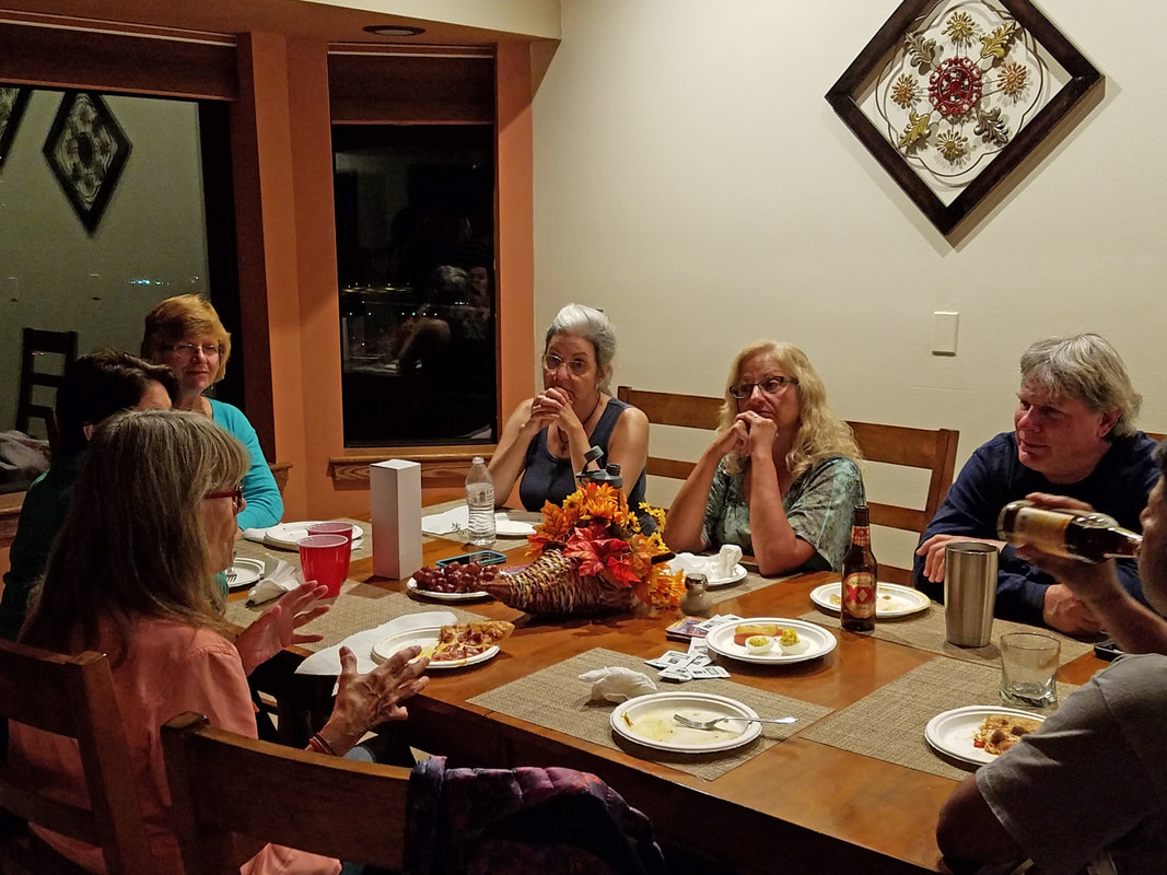
|
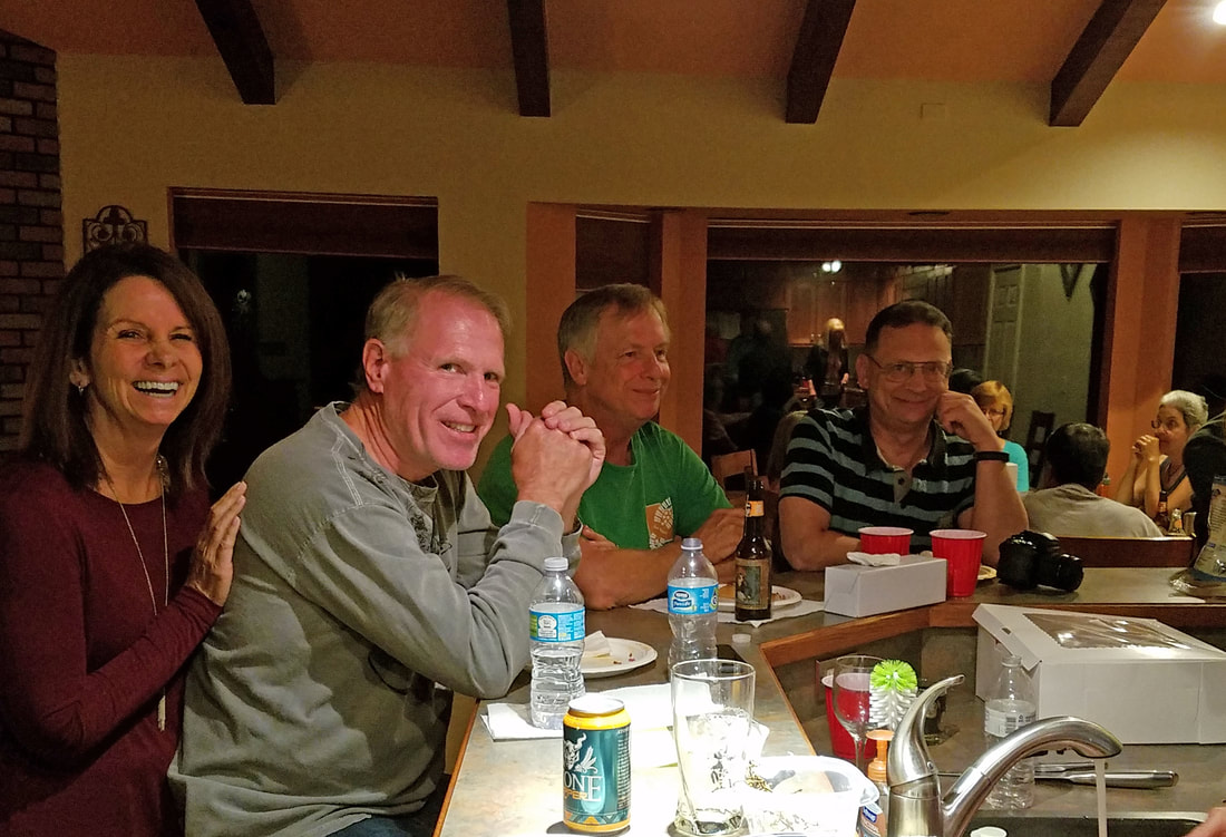
|
There was another common theme to the discussion this evening, focusing on the success of the Great Page Meet-up. Each of these fall gatherings have their own distinctive "personality" based on the location, the excursions and the folks attending. All have been outstanding, but could this one, based here in Page, be the best one to date? Hard to say, but we certainly had a great time here. The house was ideal as a place for the Herd to congregate. Everyone pitched-in and had a ball. We covered a lot of ground, and water, with our excursions. For Lynn and me, we got to visit four very different places over the course of four days and spend a lot of quality time with our friends either on the trail or chillin' at Casa Hick. Yeah, this was a good time!
We said our goodbyes to the rest of the Herd. We'll see many of them tomorrow at breakfast here at Casa Hick. Gurjinder was very appreciative of my efforts in keeping the Herd together through the meet-up planning website and the photobooks. I thanked him for the kind words but let him know that this really is a team effort, everyone plays a part and that's what makes these events so successful and so special.
The house is now nearly quiet. Howie, Deb, Oscar and I are the last of the holdouts, but we gave up at 9:30. I headed upstairs and called it a night. I thought about working on the notes from today, but that thought quickly passed from my mind. Lights out at 9:35.
Day 7, Tuesday, October 3 - Moving on to Chinle. Today wraps-up the Page meet-up. Of the Herd members still in town, only John will be staying another night and he had an early morning excursion planned for today. Gurjinder left out at oh-dark-thirty heading for the next stop on his crazy whirlwind adventures. But most of the remaining Herd members will be swinging by the Hen House (or was it Casa Hick?) for breakfast and/or one last farewell. For Lynn and me, we were in no hurry with only the drive to Chinle on the docket and check-out here not until 11:00. But we were still awake at 0445, however I did not make it downstairs until after 0600 as I had to disposition timecards and address a few emails. Lynn was already working on her second cup of coffee by the time I made it downstairs. Most of the housemates was stirring by then as well. Mother Hen was her normal flurry of activity in the morning, today getting packed and loading her Jeep for an early start back to the Junction. She was on the road at 0715. The departures have begun.
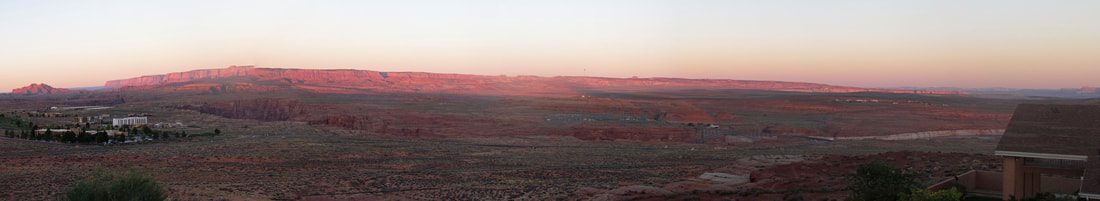
One last sunrise view from Casa Hick.
Danny, Norma, David and Roz all here for breakfast and pitched in with kitchen duty and general house cleaning, not that there was much to do with the latter. The Herd does a nice job of picking up and leaving the house in good order at the end of each day. Mostly we were just cleaning out the fridge and coolers, and trying to find a home for the leftover food and spirits. Howie and Deb ended up with most of the food and a lot of the beer and wine. We probably now have way more beer than we need plus two jugs of water, trail mix, fig bars and at least one big bar of dark chocolate. I think we have sufficient provisions for the rest of the trip.
Chef Howie is hovering over that stove while Norma and Donna did prep work with a few others scurrying through the kitchen to complete miscellaneous tasks. The small area looked like a greasy spoon diner during the breakfast rush. But there were no collisions or other major disasters. And this was all happening in parallel with the cleaning and packing activities.
Chef Howie is hovering over that stove while Norma and Donna did prep work with a few others scurrying through the kitchen to complete miscellaneous tasks. The small area looked like a greasy spoon diner during the breakfast rush. But there were no collisions or other major disasters. And this was all happening in parallel with the cleaning and packing activities.
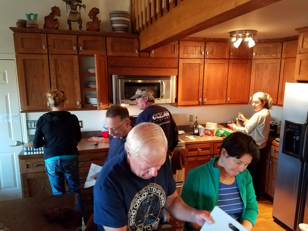
|
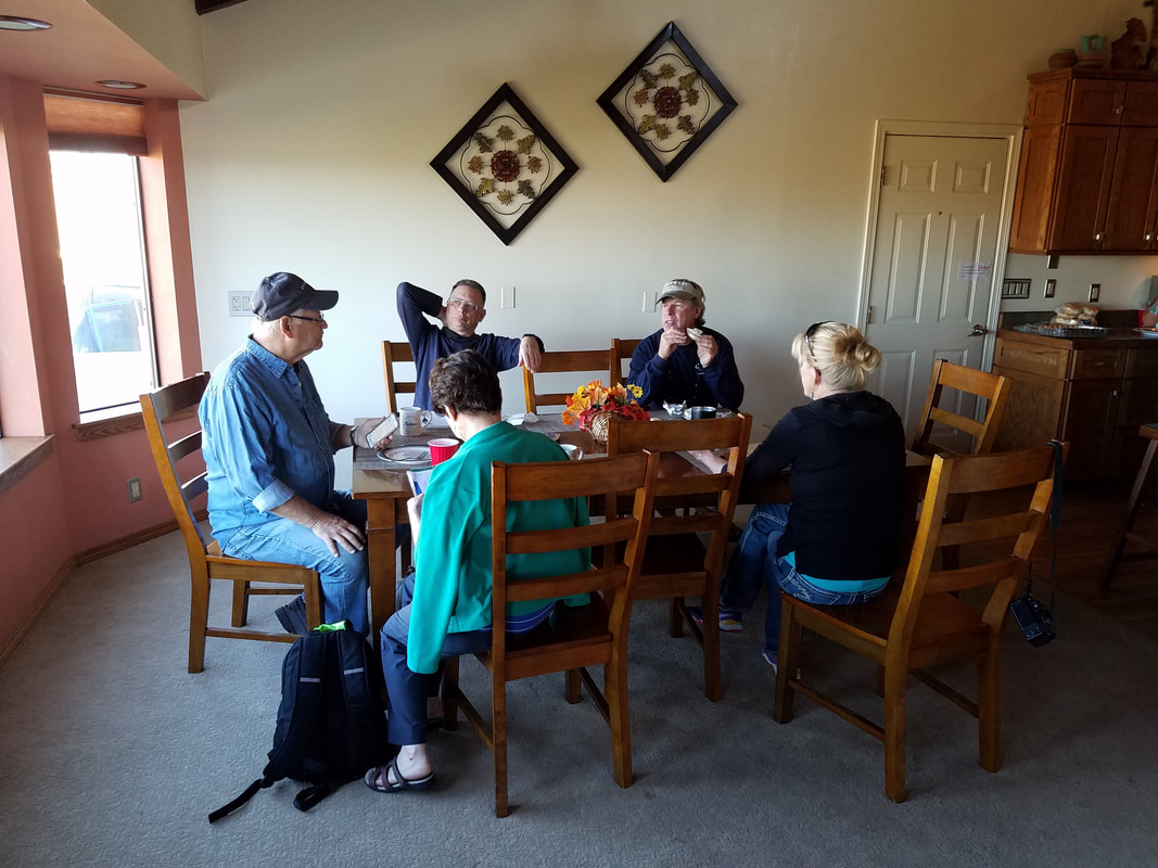
|
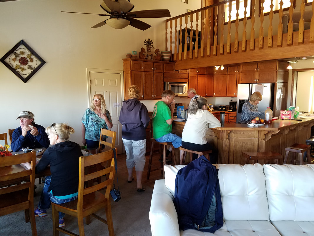
|
Our traditional final day breakfast was again a real treat. Howie whipped up another classic. Basically all the leftovers mixed in the eggs...so a southwest, mixed-up quiche. I rolled mine in a tortilla and added green chilies. Outstanding. Again no one went hungry, but there were no leftovers this time. Howie and I split the one remaining slice of the omelet-quiche delicacy. Hey, whatever you want to call it, it was really good. We ate up, cleaned up, packed up and headed out. Alex and Frankie were starting a loop through Colorado, so taking the very long way home to Sedona. Pretty soon everyone was on the road except for Donna, Oscar, Lynn and me. We were doing the final walk through when I realized…crap, where are the car keys?
OK, this was my bonehead move of the trip. We had 15 minutes of frantic searching and a few desperate phone calls and texts to see if anyone had inadvertently picked-up my keys. Unfortunately, everyone I tried to contact was out of reach. We quickly scoured the house. It was looking bleak until Lynn realized that I was wearing my fleece but now was not. "Are the keys in your jacket pocket?" Boy, I sure hope so! I grabbed the jacket from the top of our pile of gear that was waiting to get loaded into the Rogue. It sure had that feel of something weighing down a pocket. TA-DA! There they are. Right where I left them. Doh! OK, thus it is shown that I am a moron. But at least I have the keys.
The house is in perfect order, cleaner than when we arrived in fact (and it was clean when we got here, well, except for the dirty diapers left in the garbage by the previous occupants. And the grill had had not been cleaned prior to our arrival. I let the owners know about those glitches). Donna and Oscar were on the road at 10:00. Lynn and I completed the final walk-through and were out the door about 10:15. After a quick stop for fuel we on the road out of Page. Lynn and I were on our own and moving on to more adventures in northern Arizona.
Here's the link to the photos from around Page. The details for the second part of our trip are in Part II of the journal…