Trip Journal: Yellowstone and Grand Teton National Parks, Wyoming
Thursday, August 8, through Saturday, August 18, 2018
Part I: Yellowstone
Part II: Grand Teton
Part I: Yellowstone National Park
Thursday, August 8, through Tuesday, August 14, 2018
Planning is part of the adventure. Lynn and I had our third trip to Wyoming Wonderland on the vacation schedule pretty much after we returned from our second excursion to these amazing parks. There is just so much to see and do in Yellowstone and Grand Teton that one or two and probably even three trips does not afford enough time to cover everything. Plus Lynn really wanted to make the hike up to Lake Solitude which we did not complete in 2014 due to the deep snow still on the trail. OK, that's reason enough for me; I'm always up for a National Park Trip.
Over the next couple of years our general plan continued to come into better focus and we finally got our line-up in place such that Yellowstone and Grand Teton fell in the summer of 2018. Our first trip (2011) was at the end of August and early September, the second (2014) was mid-July (for my 50th birthday), so we figured to try a slightly different timeframe with early-mid August, which also happens to fit in well around my summer business travel.
In February 2017 we started to really pull the plan together. Lynn's sister Lisa would again be our travel companion. This would be her first trip to the area, so we decided to include a night or two at Old Faithful so that she can experience the best of the thermal features which is of course a requirement for a first timer in Yellowstone. So our initial plan was two nights at Old Faithful, three at Roosevelt, four in Grand Teton and the final night in Jackson based on rental our car return logistics from the previous two trips.
The lodging reservations are the key and you have to book early to ensure you get what you want if you really have specific desires. I just plan on trying to make reservations as soon as they open for this reason as well as to just check that task off the to-do list. It seems that there are variations in which lodging reservations are handled at each park. For Yellowstone reservations for the summer of 2018 opened on May 1, 2017, so I had that date circled on my calendar. I started getting serious about research lodging options in February. For the Old Faithful area there are several options between the Inn, the Lodge and the Snow Lodge. The cabins at Old Faithful Lodge are simple but should be sufficient. I'm guessing they would be should be similar to the cabins at Roosevelt which we really like. TripAdvisor reviews are middle of the road but generally OK. I'm thinking that a pair of Frontier cabins at Old Faithful Lodge should be fine for two nights.
Our preferred lodging in Grand Teton is Signal Mountain Lodge (we stayed there in 2011 and 2014), but their rates had increased significantly so we decided to look at other options. The other in-park lodges were also either too pricey or not in prime location for the areas we wanted to explore so we widened the scope of our search to include rental properties around the periphery of the park. VRBO came through for us again as we found a really nice cabin just outside the park in the Gros Ventre area. Maybe a little more driving, but the cost will be about half the cost of accommodations for the three of us at Signal Mountain. The location out on Slide Lake looks to be very nice and should make a nice place to relax in the evenings after a day of exploring. I made contact with the owner even though we were well of a year in advance but she went ahead and took the reservation even allowing us the flexibility of adjusting the dates if needed once we got our Yellowstone lodging locked in. Note, the VRBO listing for the cabin is no longer active, but the website for the cabin (they have a five total) is www.jacksonholecabins.com. The owner, Jane, was great to work with throughout the process.
Lynn and I discussed dates (she likes the planning as well). I had looked at the moon phase chart for August 2018 (the Internet is a wonderful thing!) and noted that there is a new moon on August 11. That will certainly help with star gazing, so we kept that in mind and tried to be at Roosevelt or Grand Teton at that time. We settled on the dates for the trip, at least as a starting point, departing Wednesday 8 August, 2018 and returning Saturday 18 August. Now we have a good framework for the trip but nothing really locked-in so there is some flexibility built in in case we need it.
We revisited the plan in April 2017, thinking specifically about the rental car and the final night in Jackson. Staying in Jackson that last night was just to be nearer to the off-airport rental car return locations. But that adds another move to the trip and lodging in Jackson is expensive. While cars are more expensive to rent from the airport, we'll save at least $250 per room in Jackson and get to skip the shuttle ride to and from the off-site rental car locations which would just make things a lot simpler. We mulled it over for a day and decided to rent the car with pick-up and drop-off at the airport terminal and just drop the night in Jackson. We'll use the two nights Old Faithful, three nights Roosevelt and four nights Grand Teton plan.
OK, it is May 1st, and Yellowstone lodging reservations open this morning. Now the fun begins. I was home today taking care of a few chores including the reservations since I will be out of town for a business trip the rest of the week. I thought the phone lines opened at 0900 EDT, but it is not until 10:00 AM (8:00 Mountain). I am on the website and calling at 10:00 AM…busy signals. Not surprising as we are looking for lodging during the Yellowstone high season plus this is opening day for the entire summer. I was almost through with the Roosevelt reservation on-line when the system crashed ("The service is unavailable" message was all that came up after I had input my credit card information….so close and yet so far!). Now the waiting game begins….
I tried again about 1:00 PM and still cannot get through! I have to leave soon for the airport. To kill time I started looking at VRBO options outside the northeast gate. There are a few. The location is not as ideal as Roosevelt, but better accommodations, I'm betting. I did find a few places with 2 bed/2 bath at or below the cost of 2 frontier cabins at Roosevelt. While they look nice, are cost effective and have a lot of amenities, they are still outside the park and will add drive time to each day, so Roosevelt is still the preferred location. We'll keep trying.
I tried again in the evening after dinner both on-line and via phone, but to no avail. Lynn was having similar success. She sent an email at 9:20 PM with a brief update so I called her to discuss options. She got close once and it seems that Friday the 10th of August is sold out. We can adjust, fortunately, but that will have to wait until tomorrow.
On Tuesday, 2 May, 2017, at 0600, as I was getting ready for the day in DC, I figured I would check the website. Lo and behold I got through! OK, the 10th is sold out, but plenty of availability otherwise. I called Lynn to give her the news. She was already on it and had two Frontier cabins booked at Roosevelt and was starting on cabins at Old Faithful Lodge. She's good! She called back at 6:25. We are locked in with two frontier cabins at Old Faithful Lodge, so all of our Yellowstone lodging is in place. We had to shift by one day from the original plan, but that is no big deal. I'll get the Grand Teton VRBO confirmed on Friday once I get home. Looks like the plan is coming together. I guess the lesson learned here is that while the lodging does sell out quickly it is not gone on day one, so as long as there is some flexibility in your plans you really do not need to be on the phone or website immediately when the reservation period opens.
The next period of planning activity was in September when we got the final details for the Grand Teton cabin. Jane called with the information and confirmed that we would be in cabin number 2, which was the one that we saw originally on VRBO. We started looking at airfare. United is off the charts expensive and the itinerary is not that great (2-stops or red-eye for return). Frontier is entering the game as well, and promised lower fares but they seem to stop flying the JAC route in mid-August. Lisa found flights on American for about $500 round-trip. But she was pricing for dates in February since our dates were not available when she looked. I checked again this afternoon and American did have our dates posted and we could get a good itinerary for our dates for $800 per person. About half the cost of United. We'll wait a while. I did get the rental car locked-in through Enterprise, securing a standard SUV for the trip with pick-up and drop-off at the airport.
I checked flights again over Thanksgiving. Airfares are starting to drop but not by a lot. Both United and American are in the $800 range per person; American is about $855 and United is at $750, both with decent itineraries. We've basically decided to go with the early departure from CLE on Thursday 8/9; 0730 departure gets us to JAC at noon. We'll return on an early afternoon flight on Saturday or maybe Sunday (flights are a few bucks cheaper on Sunday, but that would require an additional night stay if we can get the night in the cabin). Lisa seems good with staying until Sunday. We kept an eye on the flights for the next few weeks. Lynn checked again on New Year's Eve and while there was no real movement on cost, United did add a mid-morning departure from JAC back to CLE which made for a better itinerary, and was a few bucks cheaper (the cheapest return flight had a short layover in DIA, and since we got burned by this last summer getting to Glacier we opted to skip that; just not worth the potential hassle to save $200 bucks). We decided to use some of our miles and locked in the flight itinerary.
As we got into summer, I started making a more detailed plan for the trip. Not a minute-by-minute agenda, more of a general outline and a list of things that we might want to do. Again, it is all about flexibility. Nature does not run on a schedule. And the Park Service has to take advantage of the short season for maintenance and repair work. That's why I was not shocked to read of some closures on the trails. Disappointed, yes, but not surprised. In June I found out that the trails leading to the top of Mount Washburn were closed for the summer as there would be construction at the top of the mountain including repairs on the fire lookout and construction of a communications tower at the fire lookout as well as trail maintenance tasks. That was a bummer as we were planning on hiking up Mount Washburn from Dunraven Pass. Well, scratch that idea but there are plenty of other trails to explore. Alternatives hikes listed on the NPS site are Bunsen Peak near Mammoth Hot Springs, Purple Mountain north of Madison Junction and Avalanche Peak along the East Entrance Road.
We almost lost a second hike when I learned that the area around Hidden Falls and Inspiration Point in Grand Teton was closed due to concerns over rock falls. I thought that was going to shut us out from Cascade Canyon, but that trail is still open, we just have to a detour along the horse trail to get around the closure area. We should be good to go for our hike up Cascade Canyon to Lake Solitude.
I kept an eye on the Yellowstone and Grand Teton NPS pages and checked Trip Advisor and some other sites as we got closer to the trip to adjust the plan as needed. I read a few posts on the TA forums talking about the Hootananny at Dornan's on Monday evening. Sounds fun, but we will miss it by a day. Maybe next trip. By July I had as good an itinerary as I was going to need before we left on the trip; the exact order of the hikes and excursions it not set in stone as we'll adjust as needed based on weather, updated information once we get into the parks and what we feel like doing on any given day:
We've got two full days in the area. We'll make daily trips into the Lamar Valley to look for critters and take a hike some where in the area. Bunsen Peak is a prime candidate trail. Slough Creek is also high in the list. We’ll have the final decision on trails when we get to the park.
For our time in Grand Teton we plan to hike each day (trails TBD; list of top prospects below) and also check out the best viewpoints most days (Oxbow Bend, Schwabacher Landing, Mormon Row, etc.). We'll probably also make a trip back into Jackson for a look around the square and supplies.
Part I: Yellowstone
Part II: Grand Teton
Part I: Yellowstone National Park
Thursday, August 8, through Tuesday, August 14, 2018
Planning is part of the adventure. Lynn and I had our third trip to Wyoming Wonderland on the vacation schedule pretty much after we returned from our second excursion to these amazing parks. There is just so much to see and do in Yellowstone and Grand Teton that one or two and probably even three trips does not afford enough time to cover everything. Plus Lynn really wanted to make the hike up to Lake Solitude which we did not complete in 2014 due to the deep snow still on the trail. OK, that's reason enough for me; I'm always up for a National Park Trip.
Over the next couple of years our general plan continued to come into better focus and we finally got our line-up in place such that Yellowstone and Grand Teton fell in the summer of 2018. Our first trip (2011) was at the end of August and early September, the second (2014) was mid-July (for my 50th birthday), so we figured to try a slightly different timeframe with early-mid August, which also happens to fit in well around my summer business travel.
In February 2017 we started to really pull the plan together. Lynn's sister Lisa would again be our travel companion. This would be her first trip to the area, so we decided to include a night or two at Old Faithful so that she can experience the best of the thermal features which is of course a requirement for a first timer in Yellowstone. So our initial plan was two nights at Old Faithful, three at Roosevelt, four in Grand Teton and the final night in Jackson based on rental our car return logistics from the previous two trips.
The lodging reservations are the key and you have to book early to ensure you get what you want if you really have specific desires. I just plan on trying to make reservations as soon as they open for this reason as well as to just check that task off the to-do list. It seems that there are variations in which lodging reservations are handled at each park. For Yellowstone reservations for the summer of 2018 opened on May 1, 2017, so I had that date circled on my calendar. I started getting serious about research lodging options in February. For the Old Faithful area there are several options between the Inn, the Lodge and the Snow Lodge. The cabins at Old Faithful Lodge are simple but should be sufficient. I'm guessing they would be should be similar to the cabins at Roosevelt which we really like. TripAdvisor reviews are middle of the road but generally OK. I'm thinking that a pair of Frontier cabins at Old Faithful Lodge should be fine for two nights.
Our preferred lodging in Grand Teton is Signal Mountain Lodge (we stayed there in 2011 and 2014), but their rates had increased significantly so we decided to look at other options. The other in-park lodges were also either too pricey or not in prime location for the areas we wanted to explore so we widened the scope of our search to include rental properties around the periphery of the park. VRBO came through for us again as we found a really nice cabin just outside the park in the Gros Ventre area. Maybe a little more driving, but the cost will be about half the cost of accommodations for the three of us at Signal Mountain. The location out on Slide Lake looks to be very nice and should make a nice place to relax in the evenings after a day of exploring. I made contact with the owner even though we were well of a year in advance but she went ahead and took the reservation even allowing us the flexibility of adjusting the dates if needed once we got our Yellowstone lodging locked in. Note, the VRBO listing for the cabin is no longer active, but the website for the cabin (they have a five total) is www.jacksonholecabins.com. The owner, Jane, was great to work with throughout the process.
Lynn and I discussed dates (she likes the planning as well). I had looked at the moon phase chart for August 2018 (the Internet is a wonderful thing!) and noted that there is a new moon on August 11. That will certainly help with star gazing, so we kept that in mind and tried to be at Roosevelt or Grand Teton at that time. We settled on the dates for the trip, at least as a starting point, departing Wednesday 8 August, 2018 and returning Saturday 18 August. Now we have a good framework for the trip but nothing really locked-in so there is some flexibility built in in case we need it.
We revisited the plan in April 2017, thinking specifically about the rental car and the final night in Jackson. Staying in Jackson that last night was just to be nearer to the off-airport rental car return locations. But that adds another move to the trip and lodging in Jackson is expensive. While cars are more expensive to rent from the airport, we'll save at least $250 per room in Jackson and get to skip the shuttle ride to and from the off-site rental car locations which would just make things a lot simpler. We mulled it over for a day and decided to rent the car with pick-up and drop-off at the airport terminal and just drop the night in Jackson. We'll use the two nights Old Faithful, three nights Roosevelt and four nights Grand Teton plan.
OK, it is May 1st, and Yellowstone lodging reservations open this morning. Now the fun begins. I was home today taking care of a few chores including the reservations since I will be out of town for a business trip the rest of the week. I thought the phone lines opened at 0900 EDT, but it is not until 10:00 AM (8:00 Mountain). I am on the website and calling at 10:00 AM…busy signals. Not surprising as we are looking for lodging during the Yellowstone high season plus this is opening day for the entire summer. I was almost through with the Roosevelt reservation on-line when the system crashed ("The service is unavailable" message was all that came up after I had input my credit card information….so close and yet so far!). Now the waiting game begins….
I tried again about 1:00 PM and still cannot get through! I have to leave soon for the airport. To kill time I started looking at VRBO options outside the northeast gate. There are a few. The location is not as ideal as Roosevelt, but better accommodations, I'm betting. I did find a few places with 2 bed/2 bath at or below the cost of 2 frontier cabins at Roosevelt. While they look nice, are cost effective and have a lot of amenities, they are still outside the park and will add drive time to each day, so Roosevelt is still the preferred location. We'll keep trying.
I tried again in the evening after dinner both on-line and via phone, but to no avail. Lynn was having similar success. She sent an email at 9:20 PM with a brief update so I called her to discuss options. She got close once and it seems that Friday the 10th of August is sold out. We can adjust, fortunately, but that will have to wait until tomorrow.
On Tuesday, 2 May, 2017, at 0600, as I was getting ready for the day in DC, I figured I would check the website. Lo and behold I got through! OK, the 10th is sold out, but plenty of availability otherwise. I called Lynn to give her the news. She was already on it and had two Frontier cabins booked at Roosevelt and was starting on cabins at Old Faithful Lodge. She's good! She called back at 6:25. We are locked in with two frontier cabins at Old Faithful Lodge, so all of our Yellowstone lodging is in place. We had to shift by one day from the original plan, but that is no big deal. I'll get the Grand Teton VRBO confirmed on Friday once I get home. Looks like the plan is coming together. I guess the lesson learned here is that while the lodging does sell out quickly it is not gone on day one, so as long as there is some flexibility in your plans you really do not need to be on the phone or website immediately when the reservation period opens.
The next period of planning activity was in September when we got the final details for the Grand Teton cabin. Jane called with the information and confirmed that we would be in cabin number 2, which was the one that we saw originally on VRBO. We started looking at airfare. United is off the charts expensive and the itinerary is not that great (2-stops or red-eye for return). Frontier is entering the game as well, and promised lower fares but they seem to stop flying the JAC route in mid-August. Lisa found flights on American for about $500 round-trip. But she was pricing for dates in February since our dates were not available when she looked. I checked again this afternoon and American did have our dates posted and we could get a good itinerary for our dates for $800 per person. About half the cost of United. We'll wait a while. I did get the rental car locked-in through Enterprise, securing a standard SUV for the trip with pick-up and drop-off at the airport.
I checked flights again over Thanksgiving. Airfares are starting to drop but not by a lot. Both United and American are in the $800 range per person; American is about $855 and United is at $750, both with decent itineraries. We've basically decided to go with the early departure from CLE on Thursday 8/9; 0730 departure gets us to JAC at noon. We'll return on an early afternoon flight on Saturday or maybe Sunday (flights are a few bucks cheaper on Sunday, but that would require an additional night stay if we can get the night in the cabin). Lisa seems good with staying until Sunday. We kept an eye on the flights for the next few weeks. Lynn checked again on New Year's Eve and while there was no real movement on cost, United did add a mid-morning departure from JAC back to CLE which made for a better itinerary, and was a few bucks cheaper (the cheapest return flight had a short layover in DIA, and since we got burned by this last summer getting to Glacier we opted to skip that; just not worth the potential hassle to save $200 bucks). We decided to use some of our miles and locked in the flight itinerary.
As we got into summer, I started making a more detailed plan for the trip. Not a minute-by-minute agenda, more of a general outline and a list of things that we might want to do. Again, it is all about flexibility. Nature does not run on a schedule. And the Park Service has to take advantage of the short season for maintenance and repair work. That's why I was not shocked to read of some closures on the trails. Disappointed, yes, but not surprised. In June I found out that the trails leading to the top of Mount Washburn were closed for the summer as there would be construction at the top of the mountain including repairs on the fire lookout and construction of a communications tower at the fire lookout as well as trail maintenance tasks. That was a bummer as we were planning on hiking up Mount Washburn from Dunraven Pass. Well, scratch that idea but there are plenty of other trails to explore. Alternatives hikes listed on the NPS site are Bunsen Peak near Mammoth Hot Springs, Purple Mountain north of Madison Junction and Avalanche Peak along the East Entrance Road.
We almost lost a second hike when I learned that the area around Hidden Falls and Inspiration Point in Grand Teton was closed due to concerns over rock falls. I thought that was going to shut us out from Cascade Canyon, but that trail is still open, we just have to a detour along the horse trail to get around the closure area. We should be good to go for our hike up Cascade Canyon to Lake Solitude.
I kept an eye on the Yellowstone and Grand Teton NPS pages and checked Trip Advisor and some other sites as we got closer to the trip to adjust the plan as needed. I read a few posts on the TA forums talking about the Hootananny at Dornan's on Monday evening. Sounds fun, but we will miss it by a day. Maybe next trip. By July I had as good an itinerary as I was going to need before we left on the trip; the exact order of the hikes and excursions it not set in stone as we'll adjust as needed based on weather, updated information once we get into the parks and what we feel like doing on any given day:
- Day 1 - Thursday, 8/9/2018: Travel Day - Arrive Jackson just after noon (our flight arrives at JAC at about 12:10). Collect the luggage and our car then head to Jackson for lunch at the Merry Piglets and shopping for supplies (bear spray and trail food). Then we head north to Yellowstone with some stops along the way through Grand Teton. Once checked into or cabins, we can explore around Old Faithful. Lodging: Old Faithful Lodge Cabins.
- Day 2 - Friday, 8/10: Upper Geyser Basin - Check out the thermal areas around Old Faithful and walk the trail up to Biscuit Basin. Depending on the timing, maybe sneak in Grand Prismatic this afternoon. Night at Old Faithful Lodge Cabins.
- Day 3 - Saturday, 8/11: Transfer to Roosevelt - Places to hit on the drive: Grand Prismatic (if we did not cover this on Day 2), Norris Geyser Basin, Mammoth Hot Springs, drive the Blacktail Plateau. Night 1 of 3 at Roosevelt (Frontier Cabins).
We've got two full days in the area. We'll make daily trips into the Lamar Valley to look for critters and take a hike some where in the area. Bunsen Peak is a prime candidate trail. Slough Creek is also high in the list. We’ll have the final decision on trails when we get to the park.
- Day 4 - Sunday, 8/12: Morning and/or evening trips into the Lamar Valley and a hike. Night 2 of 3 at Roosevelt.
- Day 5 - Monday, 8/13: Searching for critters in the Lamar Valley and hiking. Night 3 of 3 at Roosevelt.
- Day 6 - Tuesday, 8/14: Transfer to Grand Teton. Potential stops at Canyon, Lake, Hayden Valley... wherever the spirit takes us. Night 1 of 4 at VRBO cabin.
For our time in Grand Teton we plan to hike each day (trails TBD; list of top prospects below) and also check out the best viewpoints most days (Oxbow Bend, Schwabacher Landing, Mormon Row, etc.). We'll probably also make a trip back into Jackson for a look around the square and supplies.
- Day 7 - Wednesday, 8/15: Hike somewhere then chill at the cabin. Night 2 of 4 at VRBO Cabin.
- Day 8 - Thursday, 8/16: Hike somewhere then chill at the cabin. Night 3 of 4 at VRBO Cabin.
- Day 9 - Friday, 8/17: Hike somewhere then chill at the cabin. Night 4 of 4 at VRBO Cabin.
- Day 10 - Saturday, 8/18: Travel back home. Our flight departs @ 10:12 AM; Lisa departs @ 1:20 PM.
|
Top Grand Teton hiking options (but there are plenty of other trails):
|
Dinner options while in Grand Teton.
|
By the middle of July all the boxes had been checked. All that remains is the packing and we started getting stuff staged and ready to go about over two weeks ahead of departure. I hate waiting until the last minute to pack; that rushed feeling just puts me into a bad frame of mind. Getting this early of a start means that we won't be in a mad rush the night before the trip.
In the week or so before we left I was also looking at the weather reports for the parks. Looks good overall, but too early for final determination. Smoke might be an issue based on the horrendous fires in California as well as elsewhere in Oregon, Idaho and Montana. What a mess out there but particularly in northern California. Seems like the entire state is burning. The area we toured in 2016 is really be hit hard, particularly around Redding. Yosemite is also impacted with several areas of the park closed or with evacuation notices. Funny thing is that a few folks at work have asked us if we are rethinking our trip due to the fires in Yellowstone; no, it is that other big park that starts with a "Y" that is currently having the fire issues. I just hope that they get those fires under control and that folks are safe. Already too much death and destruction out there this season. We, on the other hand, have dealt with smoke from west coast fires during previous visits to Yellowstone and the Tetons; not a problem for us and we'll adapt as required.
Looking at the weather just a couple days ahead of trip shows very hot and dry conditions for the first couple of days, then moderating back to the upper 70s with lows overnight in the mid-40s. That just means we have to get up early to beat the heat, which means we'll also be out ahead of 95% of the other visitors in the park. Nothing new on the TA forums relative to haze in the parks; hit or miss. It will be worse with the heat, I'm guessing. That's just part of the deal. One of the replies on the haze in the parks thread really hit the mark. This was a reply posted by "dudegal" to the "Haze in Grand Teton" thread on 5 August:
There is absolutely no way to predict what will happen with fires and visibility over a period of weeks in high summer. Lightning causes many fires, and that is quite unpredictable. Also the wind patterns affect where and when the smoke travels. Haze from distant fires is a fact of life here. Enjoy the relatively cool weather and hope for the best, while praying for those farther west whose homes and savings are at risk and the brave firefighters in harm’s way working so tirelessly and skillfully (and selflessly) on their behalf.
Well said, dudegal.
Day 1, Thursday, August 9 - Wagons Yo! I am a morning person but 0400 is early even for me. The good news is that there is not much to do other than shower, toss the luggage into the Edge and drive to Hopkins, so a very abbreviated version of our normal morning routine. Yesterday, however, was the normal routine with the full list of chores before our last day of work prior to the trip. In fact, I was working through my Wednesday task list, cleaning the kitty litter, when Lynn called down saying she would have forgotten her hiking hat if I had not gotten it out for her. "No chance," I replied, "that's why we have a checklist."
Wednesday was supposed to be an easy day at work with nothing on the calendar, but my free time evaporated with a succession of ad hoc meetings. So much for clearing out my email inbox. But I got through the critical items even if I still had a couple actions to clear in the evening. We were out the door at 3:00; vacation has begun!
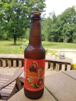 Always a good idea to start vacation with an IPA!
We talked about our impending trip as we drove home from work. I suggested that just for fun we should note the time to seeing our first bison in the park. Lynn figured that would be worth recording. Once back home, Lynn had a brilliant idea, a beer on the patio to toast the start of our vacation, then we can complete our final travel prep tasks and usual evening chores. Beer in hand at 4:00, great start to vacation. While reclining on the patio, enjoying the beautiful day, I received a reply from Roadhouse Brewing; I had pinged them via Facebook last week. Their new pub on the square in Jackson is not yet open. OK, we'll stick to the Merry Piglets (Lynn has already stated that we should eat there at least a couple times), but there is still the Roadhouse taproom to try a few new beers. And of course Snake River Brewing. We should have no shortage of good food and drink on this trip.
Our chores and packing were done at 9:00, including a few final emails, one of which was to confirm that our final rental payment for the VRBO cabin had been received. It had, so we are good to go. We watched night four of "Yellowstone Live" on Nat Geo. Sort of lame. The folks on the Trip Advisor Yellowstone forum were not impressed either. The owl release last night was a bit melodramatic due to the lady reporter, Jenna Wolfe. Still it was a nice primer for our trip, seeing the bison and pronghorn and the beautiful vistas. The views are looking fairly clear, at least what they are broadcasting, so perhaps the smoke is not having too much of an impact. I reckon we'll find out when we get there.
That was yesterday but now it is time to get this trip going. We were on the road at 5:30 AM, just as planned. Still dark but plenty of time, so we took it easy on the drive north. While we are looking forward to seeing a lot of wildlife in Wyoming I'm hoping to see none on the drive to the airport. We arrived at Hopkins just a few minutes after 6:00. Score! Orange lot parking. Not many open slots but all we need is one. Price went up to $15 per day, but I'll pay the little extra for the convenience. Lynn spotted a cottontail in the parking lot. There's are first critter sighting of the trip and still six hours until we'll be in Wyoming.
We were through security at 6:35 so just over an hour since leaving the ranch. That's pretty darn expedient. We made our usual first stop in the bookstore so Lynn could stock up on reading material. She found a couple books she wanted to read but also found a long line at the checkout counter and decided to skip the purchase for now and try again during our layover in Chicago. Lynn grabbed a breakfast sandwich but I opted to wait until we got to O'Hare to eat. We just relaxed at the gate until time to get on the bus. On time boarding, more or less. Flying United and we are in boarding mob 2. It is sort of foggy this morning but there were apparently no flight delays. Well none that are weather related but it was taking a while to herd everyone into the bus. Seems to me that assigning overhead space to a seat number and loading the plane from the back would be quicker. But what do I know.
Uneventful first leg of the trip. We found the gate for our second flight adjacent to our arrival gate at O'Hare, so that was convenient. No Lisa yet, but she had an earlier flight and Lynn suspected that she might be hanging out in the United lounge. As I always tend to do when traveling, there was people watching to keep me entertained. The cuteness award today goes to the little red-headed girl (no, not Charlie Brown's love interest). Reckon she was maybe four years old and reminded me of Merida from "Brave" with her curly, red locks dancing as she skipped along with her parents. How can that not put a smile on your face.
Lynn went off in search of the book she wanted but unfortunately the pickings were slim in this terminal so no luck. I made a tour through the terminal to find breakfast; again the choices were mediocre. The line at McDonalds was 30 people deep so I'll skip on my usual bacon, egg and cheese biscuit. I eventually found a bagel and OJ at a deli in the food court. The good news was that Nuts on Clark was open so I bought a bag of dark chocolate covered almonds. That will make a good snack for the plane ride. We finally connected with Lisa. She and Lynn started their book exchange process. Turns out that Lisa had the book that Lynn was searching for, so all the trouble Lynn had in attempting to buy the book actually worked out in her favor. I guess Murphy must have missed his flight.
We just chilled at the gate until boarding. Many of the folks here looked like they were ready to get off the plane in Jackson Hole and go directly to the trails. Lots of hiking boots, backpacks, trekking poles and related equipment. Makes sense as Jackson Hole airport is more of a final destination rather than a connection point. Boarding seemed to go a lot smoother for this flight. I guess folks are just anxious to get to the parks.
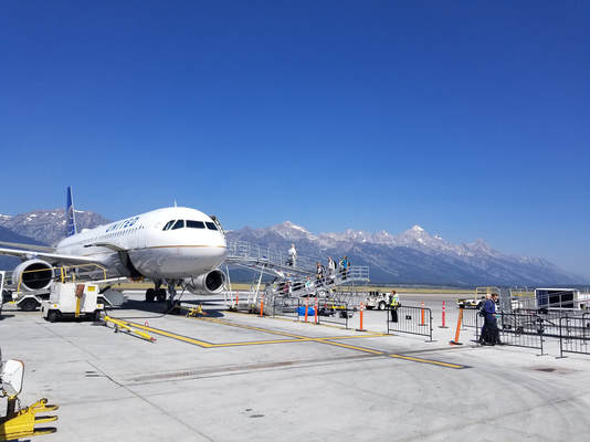 The view from the tarmac at Jackson Hole airport.
"Rhapsody in Blue" from my favorites playlist was sounding in my earbuds as we were taxiing from the gate. Appropriate for United. Uneventful flight, the best kind, and we were on the ground at Jackson Hole airport ahead of schedule. I was on the left side of the bus plus in an aisle seat so no view of the Tetons until we deplaned. As feared, the view was muted due to haze and smoke but it was still a beautiful sight to behold the mountain range as we walked down the ramp.
We went for divide-and-conquer at this point as Lynn and Lisa went to baggage claim and I headed to Enterprise to get our wheels. No line so bonus. The young lady gave me the choice of a Toyota something-or-other or a Ford Explorer. I'm a Ford guy from way back so that was a no brainer. The girls were still waiting back at baggage claim but it was not long before the belt creaked to life and spit out our bags. Then it was outside to find our chariot, which was waiting right where the agent said it would be. Grey Explorer with Utah plates. Up goes the rear hatch, down goes the third row seats and in goes our gear. Easy and with room to spare. A quick chat with the attendant in the lot and we are off. Pulling away from the airport at 12:20; vacation is now really underway!
"Look for bison!" That's our mantra for our trips to these amazing Wyoming parks. Ok, our first big critter sighting was a black-tail deer that Lynn spotted along the creek not long after we turned south on route 89 heading for Jackson. Only took about two minutes after leaving the airport for our first mega fauna checkmark.
First item on the agenda is lunch. The location was predetermined, the Merry Piglets just off the square in Jackson, a southwest restaurant that we discovered during our first trip to Wyoming. It is one of our favorites and a very popular place. The only issue was the crowded conditions and therefore lack of parking. We made a drive by but there was no place to store the Explorer. After a lap around the square, I dropped the girls at the restaurant to secure a table then I looked further afield for an unoccupied parking slot. I did not find one anywhere close and ended up driving back out route 191 and parking along the road. Not really that far away, I just was not sure this was legit parking. But there were plenty of other tourists who had already parked here so either it is meant for parking or the town of Jackson is about to rack up a tidy sum in parking fines.
I was back at the Merry Piglets right about 1:00. Since it took more than a few minutes to find a parking spot, Lynn had called to see what had happened to me; just the multitude of tourists. She reported that they already had a table in the back room on the right side by the door so that I could find them. OK, that worked out well. In just a very few minutes I had found them right where Lynn said they would be and was happily munching on chips and salsa. The girls were already working on margaritas. Good choice, but I'm really looking forward to a beer. The local IPA on tap today is the Wilson from Roadhouse. Sharp but very good.
|
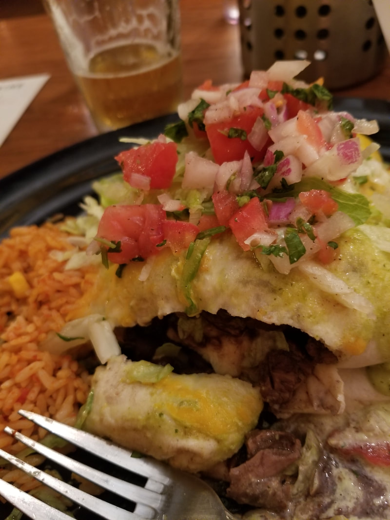
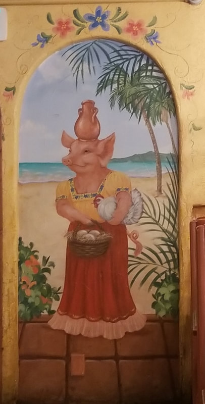
The Merry Piglets is such a fun place with the pig-themed murals covering the dining room walls. These little piggies are an active bunch, as they are cooking, driving, flying a biplane, chillin' on the beach gpomg shopping and so much more. And while the décor is great to look at the food is even better. Southwest cuisine may be my favorite, and Merry Piglets does a wonderful job. That's why we keep coming back each time we travel to this area. Lynn and Lisa both had tacos, I think Lynn opted for shrimp. I went big with the carne asada burrito. I asked our server for his recommendation for the salsa, specifically which had the most heat. The green was his recommendation. That is usually the case and it was quite good, albeit not overly hot (restaurant salsa is never hot enough it seems, but the flavor was still excellent). Since the girls had a head start on me with the drinks, they decided to get another round of margs, but I soon caught up and was working on a second Wilson to accompany the remainder of my burrito. That was excellent!
|
|
|
Time to waddle back to the car so that we can continue with our errands before turning north toward the parks. Off to Alberton's for supplies. Two stops really. First the grocery store for some simple breakfast food and trail snacks plus bear spray. Score! They still have the Second Nature trail mix and the bonus is there is a dark chocolate and nut mix that looks extra good. Luna bars, Pop-Tarts, nut bars, trail mix, M&M's, apples, bananas…that should cover us for a few days. Plus our bear spray….don't hit the trail without it!
I took our supplies out to the truck while the girls got a head start at the at the adjacent beverage store, named appropriately enough The Liquor Store of Jackson Hole. I had found a shady spot along the edge of the parking lot for the Explorer when we arrived so our goodies should be safe from the heat for a few minutes. By the time I returned to the beverage store, Lynn and Lisa had selected several bottles of wine so now it was time to pick out some beer. There was a nice selection of craft beers including those from several local breweries. They also sell beer as singles or build your own six-pack. I assembled a mix-and-match-6 of IPAs and pale ales that I had not previously tried, plus a couple Pinners and a six-pack of Melvin IPA. That should hold me for a day or two! Once back at the Explorer, I extracted the collapsible cooler from my luggage and iced down some of the beer and wine for later this evening.
It was blistering hot in Jackson this afternoon so we did not hold out a lot of hope for critter sightings on the drive into Grand Teton, but we decided to take a chance on the Moose-Wilson Road anyway. The only catch is intersection coming out of Albertson's is right-turn only, so I had to find a place to double-back to get on route 22. Not a big deal, except for the heavy traffic at this time of day, but we were quickly headed in the right direction. Out along route 22 for a ways then north on 390, the Moose-Wilson Road. A large, lighted sign gave a warning to all drivers by stating that five moose had been hit in this area recently, although I did not catch if it indicated over what period of time. Slow down and enjoy the drive, folks, but still you have to pay attention to the road.
As we figured, there was not much in the way of wildlife out this afternoon. Another deer, a Magpie and a few Mallards. We did make a stop at the pond near the north end of the road more so to show Lisa but who knows there might be something big and furry lurking in the shade. Well, not that we could see so we continued on. We opted to take route 191 north rather than drive the park road through Grand Teton; we'll have time for that later in the trip. Besides, with the hazy conditions there is just not much to see in terms of the mountain vistas regardless of the road travelled. The Teton Range is just a dark grey mass against a flat, blue-grey sky. Hard to see the mountains really so we just gazed from the road and made no stops as we cruised north. But we did get our first bison sighting as we drove by the big fields near the Triangle X Ranch. Huge herd of the big beasties to the west of the road. That did not take too long, probably right at four hours, give or take a little, since we got off the plane until we saw our first North American bison, Bison bison, the official mammal of the United States, for our 2018 visit. So cool to see.
We just kept rolling, wanting to get to the Old Faithful area before it got too late. We pointed out the highlights to Lisa as we drove by, like Oxbow Bend, but the conditions today just washed out the view. We did spot a couple swans at Oxbow then some American White Pelicans later on Jackson Lake but cruised north until we were almost out of the park. That's when we spotted another familiar sight, a cluster of cars lining both sides of the road, the animal jam. Slowed down to a crawl as there were people everywhere and they are now focused on whatever critter is nearby and not paying a lick of attention to the traffic. The good news was that the vehicles were pulled completely off the road, so traffic could keep flowing, so as jams go this one was currently small and the tourists were not swarming in the road. As we eased through the jam, Lynn rolled her window down and asked what was in the area. "Grizzly!" was the answer. OK, that is worth a quick stop as you don't get a lot of opportunities to see them. Plus there was plenty of space to get off the road. We pulled in at the end of the row of cars and walked back to get a look.
To the west of the road where the folks were looking the land falls away from and below the level of the road then works up a gently sloping hillside. The area is covered with tall grass and dotted by trees. I was expecting to see the bear on the hillside at some respectable distance from the road. That was not the case. The big bruin was down in the low ground, rooting around in the grass but only maybe 35 yards or so from the road. That is way too close! Several of the tourists were out on the edge of the higher ground overlooking the lower area where the bear of foraging, so even closer. The girls and I stayed back, keeping the cars between us and the bear. Fortunately the bear was happy rummaging through the grassy area and really never seemed to pay any attention to all us tourists. Even though the bear was close, the tall grass and trees obscured it for the most part, but we snapped a few photos then retreated to the car. The jam had grown rapidly and there were now cars and a school bus stopped in the road to see what was happening. The kids on the bus got a good look from their higher vantage point plus they were safe inside the bus. We did see our first stupid person trick of the trip (well, not counting those tourists who were way too close to the bear). A young guy stopped his car in the road, grabbed his camera, jumped out and ran over to get a picture, leaving the driver-side door open and the car running, just sitting in the middle of the highway blocking traffic (with the door open, he effectively blocked both lanes). This is a prime example of what NOT to do in a critter jam. We loaded back into the Explorer and crept away.
Continuing through along the Rockefeller Parkway to the south entrance of Yellowstone, just enjoying the scenery. We got a team photo at the Yellowstone sign, exchanging photographer duties with another family who also wanted the standard memento. Funny thing was that there was no one at the sign when we arrived, but as soon as we pulled in three or four other cars pulled into the lot as well. But that worked out for us all as took turn taking each other's photos (surprisingly there was no camera stand here at the entrance sign like I have seen at other parks).
Continuing through along the Rockefeller Parkway to the south entrance of Yellowstone, just enjoying the scenery. We got a team photo at the Yellowstone sign, exchanging photographer duties with another family who also wanted the standard memento. Funny thing was that there was no one at the sign when we arrived, but as soon as we pulled in three or four other cars pulled into the lot as well. But that worked out for us all as took turn taking each other's photos (surprisingly there was no camera stand here at the entrance sign like I have seen at other parks).
Amazing views as we drove north along the steep canyon containing the Lewis River. There was still a decent crowd of folks at Lewis Falls as we drove by. Lovely views across Lewis Lake. We pointed out to Lisa that she was now inside the caldera of a huge, ancient volcano, same idea as Crater Lake from our 2016 trip, just on a much bigger scale. We made a quick stop at Grant Village for a rest break then turned westward along the park road toward Old Faithful.
We arrived at Old Faithful Village about 6:30. There was still a lot of activity even for this time of the day. As usual, the Park Service did a nice job with the signage which directed us right to the Old Faithful Lodge where we had a quick and easy check-in to our cabins. We took number 409 and Lisa was in 408. Our cabins were located on the far edge of the lodge area just across the road from the Firehole River.
The Frontier Cabins at Old Faithful Lodge are considerably smaller than those at Roosevelt. The units we are in are also set up as quads where the all the cabins at Roosevelt are "single family" dwellings. As it turned out, Lisa was in the next quad, her unit being diagonally across from us. We investigated our dwelling for the next two nights and figured out the best arrangement for us and our stuff. Yes, small, but we'll make it work. Besides, we will really only be in here to sleep.
I noted the question posted on the green/environmental reminder tags hanging in the bathroom: "Is Yellowstone National Park home to more bison or more guest towels?" That one is easy. Towels of course. And I was correct! The answer stated that the lodges stock 24,237 guest towels and that about 4,900 bison live in the park. But at least they don’t have to wash the bison!
Once we were situated in the cabins, we walked back up to see Old Faithful. We just missed the predicted 7:09 eruption of famous geyser so we looked around in the Inn then the Lodge while waiting for the next show which was listed for 8:33.
Very warm here today, from being almost miserably hot in Jackson and it is still toasty in Old Faithful Village even as the sun is going down. Now of course some of that heat here in the Upper Geyser Basin is due to the thermal features; I mean it is generally warm to hot out in around the basin. But this is just plain old hot weather. Shoot, when we were checking out at the liquor store we were chatting with the clear and she was lamenting the heat wave, stating that the locals are just not used to the temperatures they have experienced the past couple of days. Those 90 degree F conditions are predicted to hang around for a day or two before moderating back into the low 80s and upper 70s, so we will have to plan accordingly. Of course, I've already got a couple options in mind.
We spotted a few birds around Old Faithful. The Ravens seemed to be in charge of the area but there were also a few of their smaller cousins, American Crows, hopping about as well. We also saw several birds swooping about overhead with longish, slender wings that sported white bars. Common Nighthawks. Fun to watch as they zipped about over the geyser in search of their dinner.
|
We grabbed water from the deli in the Lodge before finding a seat on the boardwalk in time for the next show. Almost exactly as predicted, more steam started to billow from the geyser then the scalding water began to boil over, building slowly to a tall tower shooting up out of the ground. It was a beautiful sight watching Old Faithful erupt with the sunset as the backdrop. We were sitting looking more or less west into the setting sun which made for a nice view as the day drew to a close.
We were all tired following a long day of travel, not to mention the early start this morning so we decided to call it a day. Between the heat and the big lunch none of us were interested in dinner. As we walked back to the cabins, we discussed the plan for tomorrow. The idea is to start at Old Faithful and walk the boardwalk through the Upper Geyser Basin as far as we wanted but my idea was to go all the way to the Biscuit Basin like Lynn and I had done during our 2011 visit. Maybe we'll make it to Mystic Falls this year (as I recall in 2011, that part of the trail was marked with bear activity signs). We'll try to be on the trail about 0700. We also reviewed our critter sightings for the day. We actually did pretty well with our critter list on this travel day:
|
Sunset eruption of Old Faithful.
|
We were settled in the cabin by 9:00. I started the book I bought at the Inn, "Death in Yellowstone." I read the similar book focused on Glacier National Park during our stay there last summer, so I'll continue the theme this year. The book starts with the sad story from 2012 of a man who dove into a hot spring to save his friend's dog. There was no happy ending for the man or the dog. Lights out before 10:00 after reading of several more grim demises in the thermal features of Yellowstone. The moral to these stories is simple: stay on the trails and boardwalks!
Photo gallery from our travel day (day 1).
Day 2, Friday, August 10 - Upper Geyser Basin. I slept well last night and awoke feeling rested and ready for some exploring. The local time is 0530 on a rather brisk morning. Sometime last night, Lynn found an extra blanket which we were both snuggled up under this morning. Apparently it does get chilly in the cabins but we did have the windows open as it was warm when we went to bed. We took a lap around the lodge area with the primary intent being the search for coffee for Lynn and a bag of ice. We heard a turkey calling in the distance as we made our way to the main building. We were also chastised by an angry squirrel (something that we'll get a lot of during our stay). The ravens were out in force this morning, scouring the area for tidbits left by yesterday's tourists. The lodge building does not open until 6:30 so we are a half hour early. But it was worth the trip to see the geyser basin empty of tourists with the steam from each feature rising into the cool morning air. We did find the ice machine, so batting .500. Back to the cabin with our bag of frozen water cubes to keep our beer and wine properly conditioned. I also opted for another layer so I put my Trip Advisor fleece on over my NPS Centennial sweatshirt. That's when I found the remainder of the chocolate covered almonds I had purchased during our layover in Chicago. Some had escaped into the pocket of my jacket, although most were still in the bag. The loose ones had become a bit of a melted and reformed mess but those still in the wrapper had become a dark chocolate and almond candy bar. I'll save that for later! The good news was that most of the loose debris was easily removed and a good washing after the trip will take care of the rest.
Once the cooler was full, it was time to retrace our route to the lodge building for Lynn's morning caffeine fix. I also remembered to stop by the registration desk to get hair dryers for the girls as this hardware is not kept in the cabins. Plus I got new door tags for the green initiative as I must have I misplaced them last night. These tags simply let the house cleaning crew know that no new towels are required for the day.
Lynn and I made a couple of observations as we were walking about. First, the "tiny house" experiment is a failure! And it was just us two in the little cabin. Imagine adding all the cats. While I do not need a lot of space, we agreed that we need more than the cabin it live in for an extended period of time. The cabin is fine for a couple days to be sure, but long term, no way. I don't know the square footage of these cabins but it was less than two horse stalls back in our barn.
The other item we noted was how quiet it is in the morning around Old Faithful Village. The parking lots are empty, except for the lots for folks staying at the Inn, and there is next to no one out on the boardwalks. That will change shortly as the tourists all converge here to see thermal features including one of the most iconic attractions in the park.
Lisa was ready to roll at 7:00, but Lynn and I still had to get our packs in order, being delayed by the coffee addiction. But we were off about 7:25. I started tracking our route from the cabin but we did have one detour to make before we really started our walking tour. We stopped at Old Faithful Inn to make a reservation for dinner. Surprisingly the earliest availability then had for a party of three was 9:30. Yikes! I'll be asleep by then. But they host did suggest just coming back about 5:00 to see if there had been any cancelations and to sign up for the waiting list for an earlier time. He figured that we should have no problem getting in earlier. We'll figure it out later. I figure it I it is time to get walking.
We left the Inn and circled back along the boardwalk to Old Faithful where there was not much happening, across the Firehole River and up a slight rise to Geyser Hill. I had grabbed a trail guide for the area when we passed by earlier. Lots of good information so well worth a buck.
No big critters out this morning unlike our first visit when we saw bison roaming through the area. Also not a lot of folks on the boardwalk yet; I reckon we are ahead of the crowd with our relatively early start.
This is a great walk and so very easy as there is very little elevation change along the boardwalk and just a few little ups-and-downs along the way. In fact, the trail runs just slightly downhill from Old Faithful out to Biscuit Basin as it follows along with the flow of the Firehole River (of course it is slightly uphill on the return).
The downside to an early start is that there is more steam around the thermal features due to the cooler morning air. Also, the angle of the morning sun is more swallow and therefore not getting the best light down into the pools. So we're giving up a bit on photos in order to beat the heat (we had ideal conditions for photography during our 2011 walk through the Upper Geyser Basin, so I'm not too worried about that). So I spent more time looking and less taking photos as we walked this morning, and that sort of became my mode of operation for the entire trip.
There is so much to see along the boardwalk with the numerous geysers, hot springs and fumaroles. There is good signage along the path to identify each feature and to explain the geology of the area. Plus of course several signs imploring the visitors to be safe and stay on the boardwalk. Between the signage and the trail guide this became quite the educational tour. Here's some of the items we learned today (or maybe relearned):
|
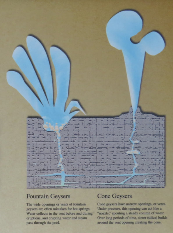
|
The collection of features on geyser hill is quite amazing and provides something for all the senses. Maybe the first thing you notice is the smell, the rotten egg odor from the sulfuric acid. Then there are the variety of sounds emanating from the features, the gurgling and bubbling of the water in the pools and the hissing or even roaring of the geysers as they erupt. You will feel the heat from the features as you walk by and through the steam and of course will get the spray from the geysers. But the best is seeing the amazing colors in the hot springs and the pools of the fountain geysers. There are the deep blues of the water in the pools contrasting with the orange, red, yellow, green and brown of the organisms that grow in the mats in the hot runoff water from the thermal features. And it is all so dynamic. It is quite the show.
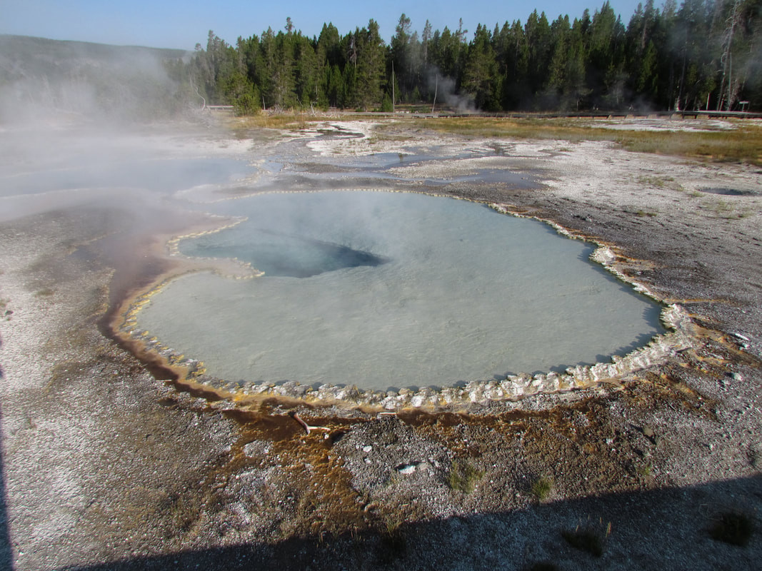
|
|
But there are other sights along the boardwalk. A few clumps of wildflowers were still blooming. We saw a chipmunk collecting seeds, probably already planning for winter. There was a raptor of some sort soaring north along the Firehole from Geyser Hill. We watched it as it passed by, easily identifying it as an Osprey from the markings and wing shape. In one of the open areas between the thermal features there were several Mountain Bluebirds flitting about in the few trees and on the open ground in search of seeds and bugs. I remember seeing them here from our previous walk through the area. There were a several Canada Geese and few Mergansers in the in river, the latter where the trail crosses the river not far from Morning Glory Pool.
We continued north along the boardwalk, admiring the scenery and the thermal features on the chilly yet steamy morning. But it is quickly warming up, in part due to the resident heat here in the Upper Geyser Basin. The names of some of the features have interesting stories, most tied to physical properties. Lion Geyser was named for the roaring sound that often proceeds and eruption. Some are named for their color, like Aurum Geyser which is named for the color of the iron oxide deposits liming the vent's rim (arurum is Latin for "gold"). Past the wonderful colors of Chromatic Pool. An interesting tidbit that I picked up from "Death in Yellowstone" was that Belgian Pool got its name following the 1929 death of the editor of a newspaper located in Antwerp, Belgium, who fell into the pool while running to see the eruption of Castle geyser.
Some of the smaller features were very active, but our timing just was not right for the bigger geysers. For example, Giant Geyser was spewing a fair amount of steam, but would not be erupting until later today, but its little neighbor, Bijou Geyser was spurting hot water a few feet into the air. But our luck changed when we reached Riverside. It was spouting a lot of steam and water high into the air on the opposite bank of the river. The sign predicted the next eruption to occur between 2:45 and 3:45 this afternoon, but the details on the eruption cycle indicated every 5.5 to 7.5 hours which would mean right about now. OK, how's that for timing. We stopped to enjoy the show for a few minutes. The signage at the viewing area had this to say about Riverside Geyer:
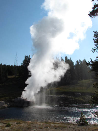 Riverside Geyser
Across the Firehole River is Riverside Geyser, one of the most predictable and consistent geysers in Yellowstone. Beginning an hour or two before an eruption, water pours over the cone's edge, and splashing and bubbling become more visible. Then water and steam arch over the river to heights of 75 feet. The eruption will last about 22 minutes. As the water diminishes during the eruption, steam continues to billow out, and, when the light is right, rainbows often form in the misty air.
Riverside Geyser is a cone-type geyser.
Eruptions are very predictable, taking place every 5.5 to 7.5 hours.
Why is Riverside Geyser so predictable? Unlike many other geysers and hot springs in the Upper Geyser Basin, Riverside may not be connected to nearby features and, thus, has a relatively constant source of heat and water. It is also uniquely unaffected by other forces such as earthquakes, which can shake up underground plumbing systems by closing old channels, creating new ones, and changing previous patterns of water circulation.
Unfortunately for us, the light was not quite right for the rainbow effect in the geyser's spray, but it was still quite impressive to see the eruption.
The last thermal feature along the boardwalk where the path turns to a dirt trail is Morning Glory Pool, a beautiful natural phenomenon that sadly been adversely impacted by thoughtless tourists over the years. The National Park Service sign tells the story:
Morning Glory Pool - Fading Glory: Morning Glory Pool is losing its brilliant cooler. Through ignorance and vandalism, people have tossed objects into the hot spring, clogging its vent and lowering the temperature. Brown, orange and yellow algae-like bacteria thrive in the cooler water, gradually turning the vivid aqua-blue to a murkier greenish-brown. All thermal features are at risk. Hot springs and geysers have fragile, complex plumbing that takes centuries to develop. Morning Glory's future is uncertain; you can help by immediately reporting any vandalism.
The sign went on to say that every year, park personal remove hundreds of rocks, coins and other objects from Morning Glory Pool. Just another day on the job for these dedicated folks. But even with the sad message and the fact the pool has cooled and is now more green than blue it is still a wonderful sight. In fact, it was one of my top ten images to capture during our first visit.

Morning Glory Pool
Continuing north, the character of the trail changes. We are now on a wide, dirt track that undulates through meadows and over a low hill, still roughly parallel to the Firehole River. The trail runs along the edge of the forest, so sometimes we were in the trees and sometimes out in the open. There are some nice views along this section, looking to the east out over the meadows along the river. We spotted a couple more critters in the sections were the trail was in the trees. We had a couple quick sightings of a long, lean varmint dashing across the trail in front of us and disappearing into the woods. Too big for the local squirrels. Lynn figured we were seeing a Pine Marten which seems to fit based on a little post-trip research. Pretty cool as that would be a new sighting for our critter list. We also happened upon a pinecone massacre in progress right in the middle of the trail, being perpetrated by a Red Squirrel. It ran off at our approach. You better be careful little squirrel, I'm thinking that Pine Marten might want to invite you to lunch!
There are not a lot of thermal features along the section of trail between Morning Glory Pool and Biscuit Basin, but the ones that are easily accessible are amazing. The first one we came to was Artemisia Geyser which lies on a wide shelf below the trail but above the open meadows and the river to the west. There was a small geyser spouting off beyond and to the right of the main pool. Is that Artemisia Geyser? Cool to see whatever it is.
There are not a lot of thermal features along the section of trail between Morning Glory Pool and Biscuit Basin, but the ones that are easily accessible are amazing. The first one we came to was Artemisia Geyser which lies on a wide shelf below the trail but above the open meadows and the river to the west. There was a small geyser spouting off beyond and to the right of the main pool. Is that Artemisia Geyser? Cool to see whatever it is.
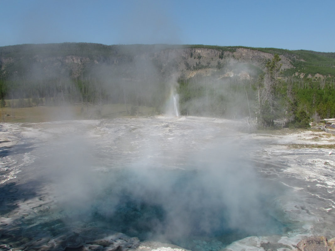
While we were enjoying the view over Artemisia Geyser we spotted something red out in the field below the thermal feature. I zoomed in and confirmed that it was a guy out walking around off trail. He must have come off the bike trail. Going to have to list him under "stupid people tricks" for being off the trail in a thermal area. Maybe he's just out in a meadow, but with all the thermal features it is just too risky to get off the trail. Hopefully he won't be a footnote in the book that I'm reading.
We admired Gem pool the Mirror Pool as we continued on toward Biscuit Basin. There was a bit of a kerfuffle at the entrance to the parking area; construction in the parking lot so one of the workers was metering the cars entering the area which was causing a bit of a backup onto the main road accompanied by some impatience on the part of at least one driver. Relax, folks, you are on vacation. This is just one of the things that you have to expect in Yellowstone, stuff breaks and it has to be fixed. We crossed the road and asked if the area was open. The construction guy waved us through stating there were no issues in the thermal area, just working on the parking lot. Good deal. Onward.
Over the foot bridge crossing the Firehole River, where there was a different regulatory sign posted: Remote controlled aircraft prohibited. Works for me. I get that these things are fun to fly and make a great platform for photography, but they are rather annoying to hear and can be problematic (remember the tourist who crashed his UAV into Grand Prismatic at couple years ago?).
Hey, look whose here, it's Red-shirt Guy who we saw off trail a few minutes ago. At least we know he did not fall into a thermal feature, at least not yet. He must not be a Star Trek fan, otherwise he would know better than to wear a red shirt in an area with this many hazards.
Once across the bridge, the first thermal feature is the somewhat opaque Black Opal Pool which sits just above the river. Then there is a section of the boardwalk that provides great access to the colorful microbial mats that grow in the harsh environment of the thermal areas. Here the mats ranged from rusty to bright orange with some green thrown in from one of the run-off streams. We continued along the boardwalk through Biscuit Basin spending a few minutes admiring the beautiful Sapphire Pool. According to our trail guide, this area was named for the biscuit-like deposits that used to surround Sapphire Pool. However these deposits were blown away when Sapphire Pool erupted following the 1959 Hebgen Lake Earthquake. Sapphire Pool has not erupted since 1991.
Another fun little added attraction to this area are the dragonflies. I remember these cool bugs from our hike through Biscuit Basin in 2011 but there seemed to be more of them sortied today. Their bright colors are particularly fascinating. Most of them are a bright orange that matches the color of some of the microbial mats around the hot springs. There were also several bluish ones hovering around the area. The nice thing is that these guys will sit still just long enough to get a photo or two.
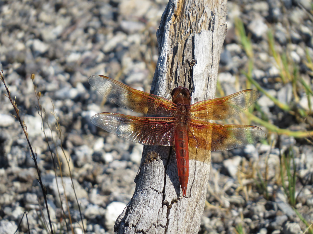
|
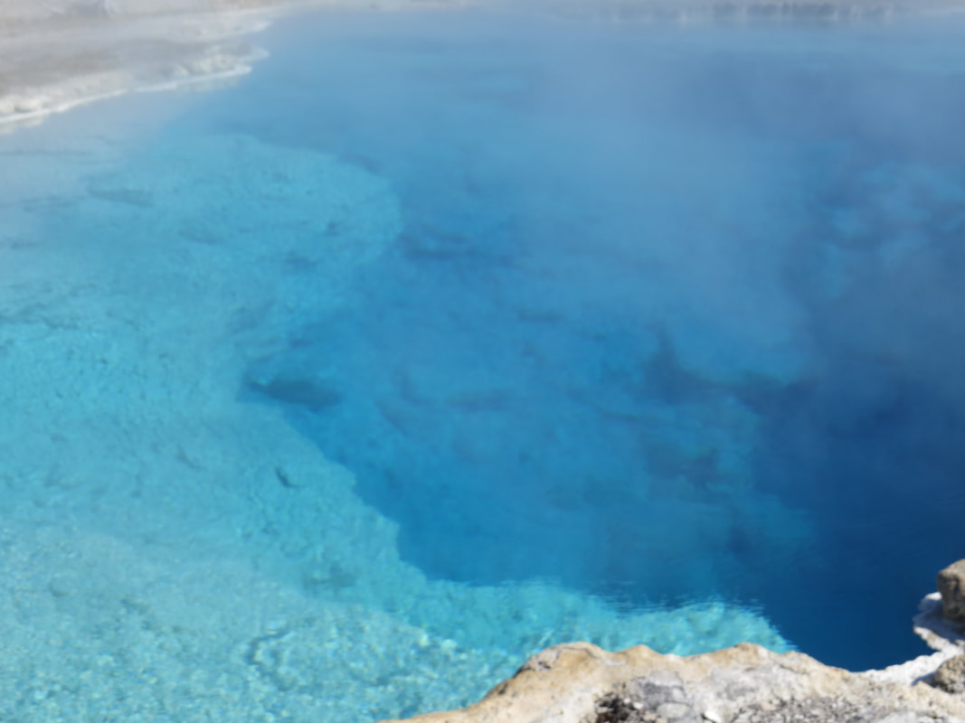
Sapphire Pool
|
We looped around the boardwalk to see Mustard Spring and the several other smaller features that were gurgling, bubbling and spouting in the area. An interesting collection of pools, springs and fumaroles in a rather concentrated little area. We took a short break for a snack along this section of the boardwalk before heading out to Mystic Falls. It was about 10:15, so we had been walking almost three hours by this point. I pulled a lemon Luna bar from my pack. The inspiring message on the wrapper stated that "this day leads to awesome!" So far, so good.
Lynn had a plan in mind for the rest of the hike. First we'll hike the trail out to Mystic Falls then we'll return to the Old Faithful area via the bike trail rather and retrace our route. This will give us an opportunity to cover some new territory. This was all based on the map in our Upper Basin trail guide, which did not include the entire trail to Mystic Falls (here's the link to a map that is essentially the same as the one we were using). So we were not aware that there was a loop along this part of the trail until we came to a sign at the junction of the trail (I had not consulted my Hike734 map of Yellowstone, which did include the loop in the description of the Mystic Falls trail). So a decision point, do the out and back to the falls, or make the loop? We opted for the loop and started by going to the overlook. Note that the out-and-back to the falls was 1.4 miles while the loop is 2.4 miles with the yet to be determined elevation change to the overlook. What the heck, let's check it out.
Lynn had a plan in mind for the rest of the hike. First we'll hike the trail out to Mystic Falls then we'll return to the Old Faithful area via the bike trail rather and retrace our route. This will give us an opportunity to cover some new territory. This was all based on the map in our Upper Basin trail guide, which did not include the entire trail to Mystic Falls (here's the link to a map that is essentially the same as the one we were using). So we were not aware that there was a loop along this part of the trail until we came to a sign at the junction of the trail (I had not consulted my Hike734 map of Yellowstone, which did include the loop in the description of the Mystic Falls trail). So a decision point, do the out and back to the falls, or make the loop? We opted for the loop and started by going to the overlook. Note that the out-and-back to the falls was 1.4 miles while the loop is 2.4 miles with the yet to be determined elevation change to the overlook. What the heck, let's check it out.
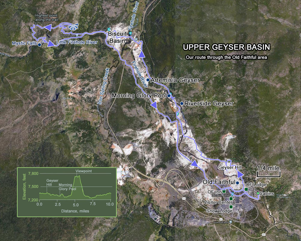
From this point, the trail starts to climb and continues to climb at a fairly constant slope. And climb. And climb. The initial part of the trail works through a wooded area which has its pros and cons. On the plus side, it is shaded which was nice as the temperature was also starting to climb. The down side is that we could not see the trail ahead of us to tell exactly where we were going. But it was a well-defined trail with no sidings or spurs, so we were not concerned about getting off track. We finally broke out of the trees but continued upward. The trail first follows the contours of the mountainside then later a couple of long switchbacks to get to the top of the ridge. It took us a little over 30 minutes to get to the top, less than a mile from the trail junction but with an elevation gain of 400 feet. Now when we started up this part of the trail, we were thinking that the overlook was going to give us a view of the falls. Guess we misinterpreted the sign as the vista is out over the Biscuit Basin and on to the south. But we did get a nice view, even if the distant views are a bit hazy. We walked along the ridge looking for an indication of the true observation point, which we shortly found with a fence along the edge of the trail and a survey marker. We did not see an elevation on the marker but I reckon it is in the neighborhood of 7,700 feet. We could see the steam rising from the Upper Geyser Basin features further to the south.
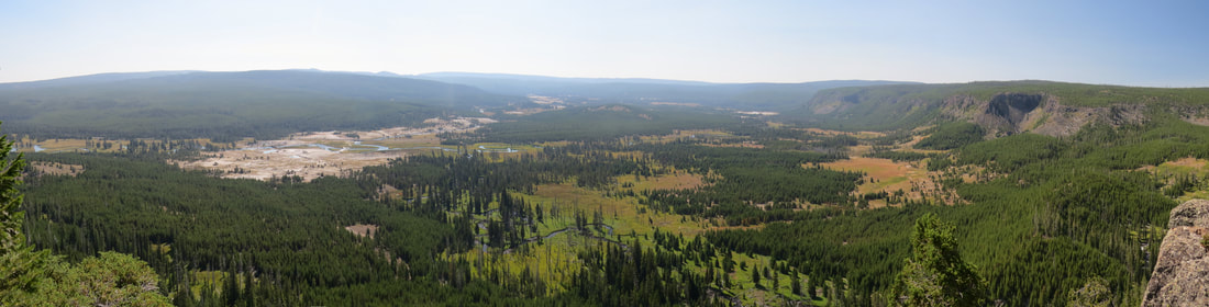
There was not much traffic on this part of the trail. When we got near the top of the climb we spotted three guys out ahead of us (seemingly prepared for an afternoon stroll, not a hike up a steep hill), then we met a 50-something couple at the overlook. They had come up the opposite direction, from the waterfall and could not find the path back down from the observation point, so we pointed them in the correct direction. They chuckled once they were on track as the trail was obvious, well, once they saw it anyway.
From the observation point we followed the trail away from the edge and across a relatively flat (sort of rolling) area. Most of this was in the open with a few stands of trees. There were a few spots with wildflowers and we saw a couple gone birds but otherwise it was quiet. Well, except for the clicking bugs, it had warmed up enough for them to become active. I know, these are just grasshoppers, but I wonder why these western bugs make so much noise when the jump while ours are quiet back home. After about a half-mile we came to an intersection and a sign. Half mile down the hill to Mystic Falls or 9.2 miles to Fairy Falls. We opted to stick with Mystic Falls.
I think we passed one other pair of hikers as we descended toward the falls, but as we got closer to the river we could see a lot of folks on the trail leading to the falls. Obviously a popular trail, at least the easy part. But as we came down the trail, the falls finally came into view. The best view that we found is at the bend of the second switchback above the river level (so the second switch up the hill from the river). This point is about a tenth of a mile from the point where the trail accesses the river below the falls and maybe a 50 foot elevation gain along the trail, so easy to get to. From this point we could see the entire series of falls that make-up the 70-foot drop in the Little Firehole River. The water was really gushing. Quite the impressive sight.
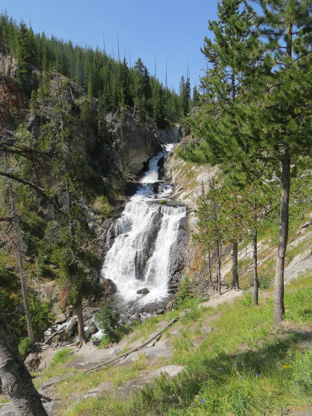 Mystic Falls from the elevation view point.
A Golden-mantled Ground Squirrel was basking on the open rocks at this point. He was not concerned a bit about us being here. In fact, he was probably a little too civilized probably having received hand-outs from previous hikers along this trail.
Down at river level, we took the short access trail to the view point near the water. There were several folks here taking in the view or taking a break. Of course a few folks had to try and get closer to the falls and were climbing on the rocks lining the river. Not the best place to be. Let's see, that brings falling and drowning into play, based on the chapters in the book. Looks like there are no end to the stupid people tricks. Regardless of the misguided antics of others, this is still a great spot, another of the amazing natural wonders in a park that is overflowing with amazing natural wonders.
From the falls we followed the trail along the river back to the junction point. There was a steady flow of hikers heading to the falls. We completed the loop back to the junction point where we started this little detour. Good spot for some trail mix. As we were enjoying our Second Nature dark chocolate mix we scanned the ridge line where we had been earlier. Ah-Ha! There's the observation point, we could easily see the split-rail fence that defined the viewing area.
On the walk back toward the Biscuit Basin, Lynn spotted an interesting rock formation that we missed on the outbound hike. Basically a low wall of lumpy, grey columns. Probably remnants of the volcanic history of the area. Well above the well, we spotted a big raptor circling the area. It was too high to get a good look and too far away to view it with my camera but we watched it for a while trying to get a glimpse of color that might give us a clue to its identity. We both got flashes of white off its tail, but there were also glints of red. Just nothing definitive. My best guess is a big hawk, probably a Red-tail, but we can’t rule out a Bald Eagle. It soared higher and out of sight, so I guess we'll just have to go with a raptor of some kind and leave it at that.
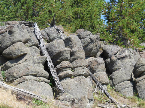
We turned right on to the bike path just short of returning to Biscuit Basin and took that route back to Old Faithful. No traffic on the trail until we got across the main road where we met a few cyclists, including one Aussie lady pulling her kid in a covered cart behind her bike. She asked if she could make it to the Biscuit Basin from the bike trail. She could not as the bike trail ends at the road and the section between the road and the basin is not bikeable (and the signage states no bikes), so here options are to walk or take the main road. She said she would try riding but she obviously did not make it too far as she passed us going the other direction just a few minutes later.
Taking the bike trail was the more direct route and a bit flatter, both good things. We also could see the area where Red-shirt Guy was meandering about this morning. It looks safe enough but you just cannot trust the ground in the thermal areas when off the trail. Nothing much in terms of critters along the bike path, just some dragonflies back closer to Biscuit Basin and some butterflies flitting in the wildflowers as we neared the paved portion of the path. The dirt trail connects with the paved trail near Daisy Geyser, but we've had plenty of walking today so no additional exploring or detours, we'll just take in what we can see from the main trail.
We did make a stop at the general store for a Gatorade. It was now very hot and we had been sucking down a lot of water so a little something extra is probably in order. We found a shaded bench in front of the Inn and paused here to finish our drinks. It was interesting to note the difference in the area in terms of activity and the number of folks from the time we left this morning to early afternoon. It was basically deserted around the Lodge and the Inn when we hit the trail but now it is quite the bustling place. We arrived at the Inn just as Old Faithful was erupting and we watched the gallery evaporate with a steady stream of tourists walking this way. We guessed that 95% of these folks entered the Inn. What they did once inside is a mystery as the lines in the ice cream shop or the bar must have been a mile long. It was also interesting to note that while there were cars parked at each cabin when we left this morning, it seemed that out grey Explorer was the only vehicle there at present. I reckon everyone is out touring the park. Also, based on posts I've read on the Yellowstone forum on Trip Advisor, many folks plan their trips with just one-night stays at the various locations in the park just sort of continuously working their way around the park. You certainly have to move around to effectively explore a park this big, but I prefer a little more relaxed pace. Changing lodging every night might be too hectic.
We were back at our cabins at 1:30, almost exactly six hours from the start of our hike. We covered 10.4 miles within a little bit of elevation change to get up to the Biscuit Basin overlook. That's not to shabby for the opening hike of the trip, so we have earned an adult beverage or three. We ditched our gear, grabbed the cooler and walked over to the creek to enjoy the afternoon. The girls had wine. I tried the Epic Tart-n-Tasty Sour IPA. Very tart with a little hint of citrus. I liked it. And a lower ABV, so a good session-type summer beer.
The spot we found was in a shady location but there was nowhere to sit except on the ground. But that's alright, it is shady and right along the river and overlooks the meadow on the other side of the Firehole. Lisa and I later spotted a log bench just around the corner from where we were sitting but Lynn said she saw it as well and it was in full sun when we were out so would not have worked for us.
This ended up being a good spot for critters as well. Not too long after we got settled, a little herd of Elk, three cows and tow calves. They worked their way across the meadow and down into the river then disappeared around the corner but we had then in view for several minutes. We also had a Great Blue Heron flyby along the river. Another bird of some sort also flew upstream and later back down the river, but it was too fast to get a good look. Well, this was a good time to review the critter sightings from today.
|
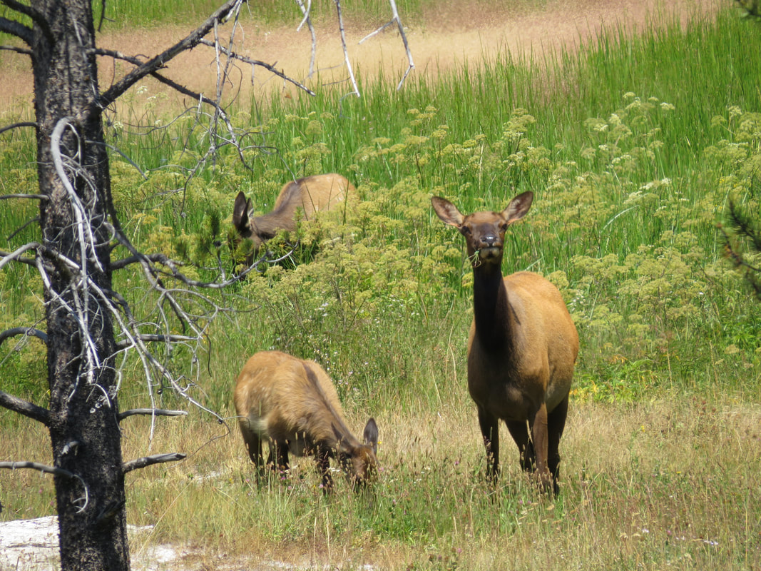
Elk along the Firehole River.
|
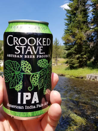
Second beer was Crooked Stave AIPA. Pretty darn good, bit of a bite, but still a drinkable, almost seasonable summertime ale. While we enjoyed our drinks and the peace we discussed options for tomorrow. We're all beat at present, so checking out Grand Prismatic Spring this afternoon became a non-starter. We'll try that first think tomorrow, although the steam early in the morning could be a problem. After that we'll come back to the Lodge, get packed up and check out then meander to Roosevelt with random stops along the way (basically whatever looks interesting and is not jam packed with tourists!).
While the girls got cleaned up, I walked up to the Inn at 3:20 to work on dinner reservations. The waitlist is the only option according to the lady at the desk, so we'll have to swing back about 5:00 to get on the list for a 6:00-ish table. Well, I've got some time to kill so I grabbed a Bent Nail from the bar, the only IPA available, and went out on the second floor observation deck to enjoy the view. My timing was not right for Old Faithful, so I just enjoyed my beer then went back to the cabin to remove the trail dust.
At around 5:00, Lisa and I went back to the Inn to get on the dinner waitlist. Lynn said she would meet us out on the observation deck shortly. Looks like an hour wait for dinner, so should be eating by 6:15 or so. Plenty of time for another Bent Nail on the upper deck. Lisa tried a huckleberry margarita. We had good seats for the 5:45 eruption of Old Faithful. Lynn joined us shortly after, but saw the show from the boardwalk on the way over. I had noted some factoids on Old Faithful in the Upper Geyser Basin trail guide:
- Members of the 1870 Washburn Expedition named the geyser for its consistently timed eruptions.
- Average interval between eruptions is 90 minutes, varying from 50 to 127 minutes, although the period has increased over time.
- Eruptions last 1.5 to 5 minutes.
- The geyser expels 3,700 to 8,400 gallons of boiling water.
- The height of the eruption varies from 106 to 184 feet.
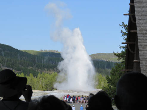 View of Old Faithful erupting from the observation deck at Old Faithful Inn.
I got a margarita for Lynn and we all had time to finish our drinks before the buzzer sounded for our reservation. The dining room in the Inn is good size and it really was not that packed. I guess they just have to manage the crowd based on the number of servers and kitchen staff they have available. We were seated by a window with a view of a lawn area. The service was sort of average, but the food was good. We all started with a salad, as we were feeling the need for some greens after eating trail mix and nut bars all day. Might as well try the huckleberry vinaigrette dressing. For dinner, I had the mac and cheese with jalapeno bison brat. Lynn had the NY strip which was overcooked, but it was still tasty she said. Lisa went with the meatballs. We were done by about 7:00, so way before our original 9:30 reservation.
We hit all the gift stores after dinner. All the gift stores; at the Inn, the General Store and over at the Snow Lodge. At least I found a nice polo with a Yellowstone logo. Then it was back to the cabins. Lisa and I made a quick check of the meadow across the creek. Nothing stirring. We were done and in the cabin about 820. Exhausted. But a good day in the park. Lynn passed out soon thereafter. I completed the chapter on tragic ends in the thermal areas. Not a pretty way to go and these deaths were all preventable if folks would have just paid attention to their surroundings. Lights out just before 10:00.
As I was winding down I was thinking about the usual "National Park relaxation wave" that I normally get sometime early in these trips. It is usually a noticeable, Zen feeling that I get. But this trip it seems that I arrived in a pretty relaxed mood, probably due to the lack of travel hiccups and the nice opening day meal at Merry Piglets. I just settled right into vacation mode. That's just as good as the Zen-wave!
Here's the gallery of photos from our second day in Yellowstone.
Day 3, Saturday, August 11 - Transfer to Roosevelt. Awake before 0600, then up and out the door to get Lynn's morning caffeine at the lodge building. Yeah, I know, not until 0630 for coffee. That's OK, we just looked around the area a bit, marveling again at the steaming thermal features. Once the little bakery place in the lodge opened, Lynn got her go-juice and a pastry. I had an apple nut muffin. We sat at the huge picture window looking out over the geyser basin. The window could use a good cleaning based on the myriad of smudges from tiny hands and noses. Speaking of cleaning, there were a couple noticeable issues around the Lodge that were sort of unusual for the National Park Service and its concessionaires. The first point was that the garbage and recycling bins in front of the Lodge just could not keep up with the throngs of tourists. The cans were full to overflowing by mid-afternoon on Friday. Also noticed around the lodge were trays and stacks of dishes from the cafeteria that were left around the outside seating areas. I noted these last evening and they were still there this morning. First point is that the patrons should have returned this stuff to the café and properly disposed of the scraps. Even if that did not happen, you would think that someone from the Lodge staff would have been assigned to police the area. This seems odd as remaining French fries and burger buns would attract wildlife. I would think at least raccoons or ravens would be all over this and it could also attract bears. Maybe the Yellowstone wildlife has better sense than to eat fast food. Fortunately, scenes like these were confined to the immediate area around the main lodge building; everywhere else in the Upper Geyser Basin seemed to be spic and span.
While the forecast is again for hot conditions in the afternoon, this morning is rather brisk at 43 F. This was helping to create a lot of steam over the thermal features of the Upper Geyser Basin. That does not bode well for our view of Grand Prismatic Spring, however. But it looks like a clear blue sky and it should be little cooler today than yesterday. The weather is what it is and we'll work with what we get.
We were back at the cabin a little after 7:00 and Lisa was ready to roll. It took us a few minutes to get ready and now at 7:25 she has disappeared. Lynn went to check our creek location. There she was, looking for critters. We loaded up and hit the road. From the looks of things as we drove through the cabin area, it was a full house here last night as there are vehicles again parked at each cabin.
Our plan is to investigate the new overlook for Grand Prismatic Spring then walk the boardwalk that runs through the basin, as long as we can find a parking spot. The Midway Geyser Basin is just a short drive north from the Old Faithful area. From the Lodge to the Fairy Falls Trailhead parking is only about seven miles along the park road so 10-ish minutes. Some significant changes have been made to the area since we last visited, including the larger parking area near the Fairy Falls trailhead and the side trail and observation platform off the Fairy Falls trail to provide the coveted elevated views over the Midway Geyser Basin. Adding the view point for Grand Prismatic Spring was probably overdue, but it takes time and resources to get things like this built. We did the scramble up the hillside in 2011 and 2014, which was more than a little hazardous. In fact there was a tourist killed making that climb in 2016, I think, when one of the dead trees fell and stuck him. But this new trail will eliminate those issues and allow for better conservation efforts by the Park Service while still providing us tourists with one of the best views in all the National Parks.
We pulled into the new, larger parking lot about 7:40. There were only three or four other cars in the lot at this time, but it will certainly be jammed later this morning. In fact, we could have parked in the original, paved lot but the little bit of extra walking to the trailhead from the new lot is a non-issue. Besides, this is an easy trail, a walk not a hike, to get to the observation point. But I'm worried about what we'll be able to see when we get there as I spotted a giant plume of steam out over the Midway Geyser Basin as soon as we started on the trail. That could only be from Grand Prismatic. Not a good sign. But it is a lovely morning and we're here, so let's see what we can see.
From where we parked it was maybe a tenth of a mile to the trailhead where we crossed the Firehole River, then a flat walk on the Fairy Falls Trail for a little over a half mile to the new trail up the hillside to the observation point. Once on the new trail, it is about a quarter mile to the observation deck along a wide, dirt trail that follows the contours of the hill. The observation deck is about 150 feet above the Fairy Falls trail, and does provide a good, unobstructed view over the Midway Geyser Basin. Nice job by the Park Service on the trail and observation deck, great addition. Provides the view that the visitors are looking for but in a safe and controlled environment. However, as I feared, there was steam just pouring from Grand Prismatic this morning. The hot spring was completely obscured at present. That's unfortunate for Lisa as she has not seen the spectacular thermal feature from the hillside other than in pictures. That just confirms the advice from Photographing Yellowstone, a book I referred to prior to our first visit. The hot springs are best viewed and shot around midday for two reasons. First, the warmer conditions should mean less steam so a clear view of the pool. Second the light from the sun will be down into the pool which is optimal for getting nice images. We following that thinking in 2011 and 2014 and got some nice shots, but today we are more schedule driven so we rolled the dice and lost. But it is still a nice walk and we saw some other interesting hot springs and thermal features along the way, plus some cliff swallows near the river. While there was some traffic on the trail when we made the hike out, there was a great influx of folks heading to the observation deck when we were walking back. This is truly one of the park's best treasures, so folks want to enjoy the view. Families with kids and grandparents, people with all manner of accents, Millennials to Boomers, quite the hodgepodge. One couple did stop to ask about the view as they had also spied the steam. I broke the bad news. They beat us back to the trailhead.
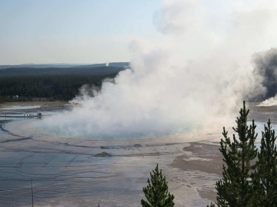
August 12, 2018, at 8:12 AM
|
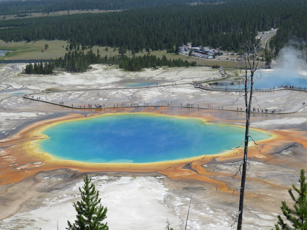
July 14, 2014, at 11:46 AM
|
We are back at the Fairy Falls trailhead parking lot at about 8:35. There is still plenty of room in the lot but there are considerably more cars here than when we arrived. We didn't waste any time getting loaded up so that we could get over to the Midway Geyser Basin before it got too crowded. Just a mile or so north on the park road to the parking area. Yep, there are already a lot of folks here. A bit chaotic in the parking lot as there are several tour buses already here and the rest of the lot is full. But folks are also leaving which makes room for the new arrivals like us. We made one lap around the lot then spotted some folks loading into a pick-up. They were pretty expedient pulling out and I quickly slipped in. That's the Yellowstone dosado.
This is just a short walk through the basin so we just got our cameras and headed to the boardwalk. Across the Firehole then up the ramps to the thermal area. There are four primary features here with Grand Prismatic being the star of the show. I think it is a great combination to get to see this beautiful hot spring from both the elevated "big picture" perspective as well as the "up close and personal" views here along the boardwalk. But Grand Prismatic is not the first stop on the looping boardwalk route. The first feature is the crater of Excelsior Geyser. This one always puts out a lot of steam, attesting to the high temperatures, I reckon. This morning it was tough to see into the crater due to the steam, but we did spot two or three wayward hats that had been blown into the crater. The signage provided a little history of this feature:
The next stop was Grand Prismatic Spring. It is beautiful from ground level, but very difficult to get the full perspective on the overall size of this magnificent pool. One of the coolest aspects of seeing Grand Prismatic from the boardwalk is the rainbow of colors in the steam, reflected from the blue pool and spectrum of hues in the microbial mats. Again, we were not here at the optimal time of day for lighting so the views of the mats were not as vibrant as later in the morning under the more direct sunlight, but it is still an impressive sight to behold.
This is just a short walk through the basin so we just got our cameras and headed to the boardwalk. Across the Firehole then up the ramps to the thermal area. There are four primary features here with Grand Prismatic being the star of the show. I think it is a great combination to get to see this beautiful hot spring from both the elevated "big picture" perspective as well as the "up close and personal" views here along the boardwalk. But Grand Prismatic is not the first stop on the looping boardwalk route. The first feature is the crater of Excelsior Geyser. This one always puts out a lot of steam, attesting to the high temperatures, I reckon. This morning it was tough to see into the crater due to the steam, but we did spot two or three wayward hats that had been blown into the crater. The signage provided a little history of this feature:
- In the 1880s, Excelsior Geyser erupted in bursts 50 to 300 feet high. The thermal violence formed the jagged crater and apparently rupture the geyser's underground system, causing eruptions to cease after 1890.
- On September 14, 1985, Excelsior roared back to life with forty-seven hours of major eruptions. It is impossible to predict when this dormant but powerful geyser's next eruption will occur.
- Through its eruptions have been erratic, the geyser's outflow is nearly constant, pumping more than 4,000 gallons of boiling water per minute over the crater rim into the Firehole River.
The next stop was Grand Prismatic Spring. It is beautiful from ground level, but very difficult to get the full perspective on the overall size of this magnificent pool. One of the coolest aspects of seeing Grand Prismatic from the boardwalk is the rainbow of colors in the steam, reflected from the blue pool and spectrum of hues in the microbial mats. Again, we were not here at the optimal time of day for lighting so the views of the mats were not as vibrant as later in the morning under the more direct sunlight, but it is still an impressive sight to behold.
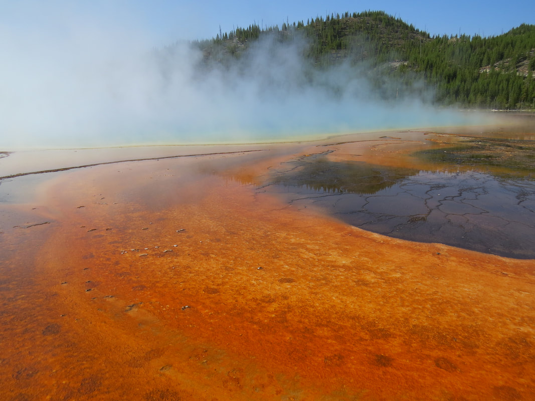 Grand Prismatic Spring from the boardwalk through the Midway Geyser Basin.
The signage along the boardwalk provided insight into what is happening in the unique ecosystem created by the thermal features and how this relates to the start of life on Earth and potentially elsewhere in the Universe:
Pretty interesting stuff. Certainly does make one wonder. But there are other wonders yet to investigate, both here and elsewhere in the park.
On around the boardwalk loop we admired Opal and Turquoise Pools. There were a fair number of folks on the boardwalk, so the pace was slow and you had to wait your turn for the view as folks took selfies with the pools in the background. But this provided some opportunity to chit-chat with your fellow tourist. I ended up next to an older couple who had driven to Yellowstone from one of the Grand Plains states and he mentioned the beauty of the park as well as the hazard of wildlife encounters. True, but I pointed out that there are serious hazards all around the park including right here along this boardwalk. He gave me a confused look and asked what I meant. I just pointed at Opal Pool and said "don't fall in."
There was a little bird sitting on the boardwalk railing as we were making the turn to the exit. She did not seem concerned about the tourists passing by and was more than willing to pose for a portrait. Looks like some sort of finch, but I'll have to post the photo to BirdForum.com to get an identification.
- Life on the Edge - The billions of colorful microorganism lining Grand Prismatic's runoff channels are called "extremophiles" because they live in conditions that were once thought to be too extreme to host life. Extremophiles that live in hot springs are called "thermophiles - heat-lovers.
- Miniature Forests - Within the rainbow of orange, brown and red colors, some microorganisms live in communities of the thick mats. Like miniature forest, these mats have a vertical structure and stratified functions. Microbes that live on or near the top of the mat (similar to a forest canopy) use sunlight to perform photosynthesis, which fuels the mat community. Organisms living deeper in the mat (similar to a forest understory) derive energy from chemicals produced by the surface microbes. They perform other vital functions such as decomposition and recycling nutrients to the mat's "canopy" just like their counterparts in a forest. All of these organisms create an ecosystem in the expanse of a few inches.
- Yellowstone National Park is one of the most accessible places to study extreme environments and the organisms that inhabit them. Understanding lifeforms here provides clues for scientists searching for life elsewhere in the universe. Because conditions on other planets in our solar system are harsh, if life exists elsewhere in is probably as some form of microscopic extremophile.
- For thousands of years, microbes have grown in the runoff channels extending from Grand Prismatic Spring. These vast communities were buried alive as the flowing hot water deposited a crust of silica minerals. The resulting deposit, called sinter, preserved the shape of the microbial mat it entombed. As new mats grew, more layers developed. Today's formation is the result of this interplay between its living and nonliving components.
- Yellowstone's hydrothermal features provide a glimpse into the distant past when intense volcanism was widespread on the young Earth. The lifeforms found here help scientists understand the type of life that likely arose and diversified billions of years ago on our planet.
- Life Beyond Earth? Formations that entomb microbes in Yellowstone's geysers and hot springs may offer clues in the search for life on other worlds. Volcanic hot springs are believed to have existed on other planets in our solar system. If similar formations are found, they may contain evidence that life existed elsewhere in the universe.
Pretty interesting stuff. Certainly does make one wonder. But there are other wonders yet to investigate, both here and elsewhere in the park.
On around the boardwalk loop we admired Opal and Turquoise Pools. There were a fair number of folks on the boardwalk, so the pace was slow and you had to wait your turn for the view as folks took selfies with the pools in the background. But this provided some opportunity to chit-chat with your fellow tourist. I ended up next to an older couple who had driven to Yellowstone from one of the Grand Plains states and he mentioned the beauty of the park as well as the hazard of wildlife encounters. True, but I pointed out that there are serious hazards all around the park including right here along this boardwalk. He gave me a confused look and asked what I meant. I just pointed at Opal Pool and said "don't fall in."
There was a little bird sitting on the boardwalk railing as we were making the turn to the exit. She did not seem concerned about the tourists passing by and was more than willing to pose for a portrait. Looks like some sort of finch, but I'll have to post the photo to BirdForum.com to get an identification.
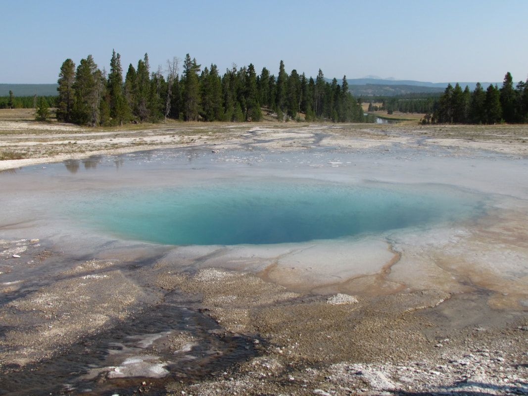
Opal Pool
|
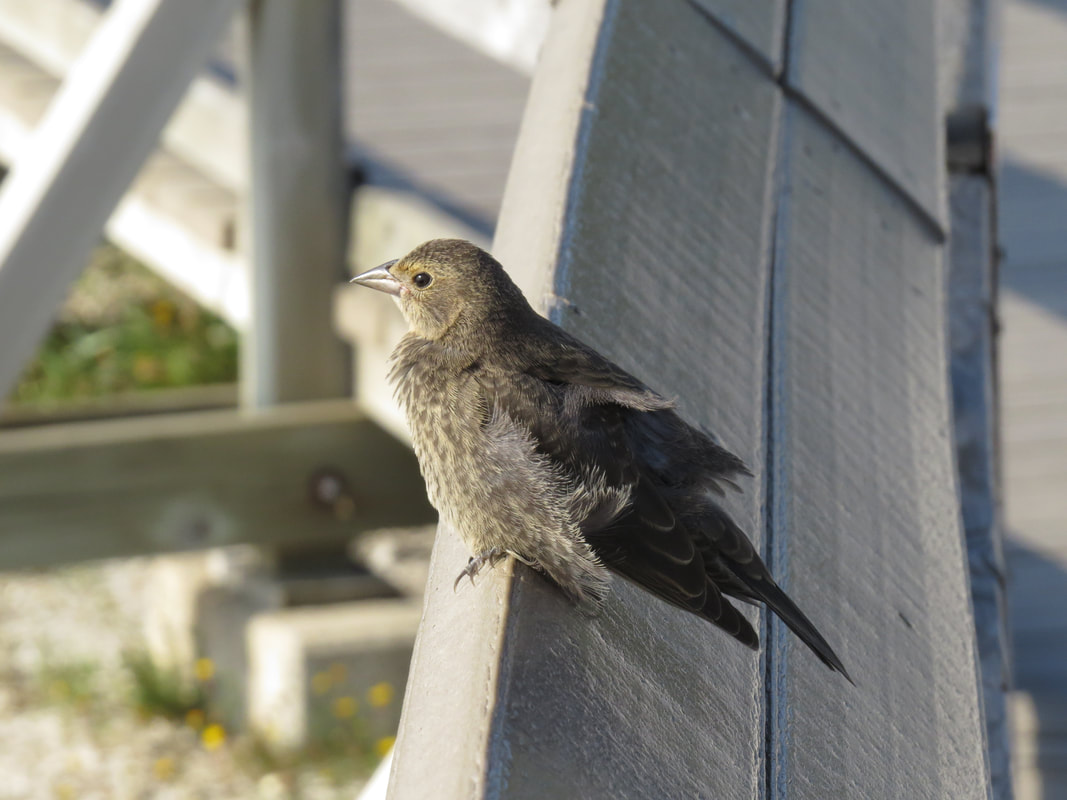
Brown-headed Cowbird
|
We were back at the Explorer about 9:15. There was a line of cars extending back out the driveway as far as we could see, so we quickly loaded up to make room for the next visitors. While the drivers of the small vehicles seemed to have a clue as to how to navigate around the parking lot and worked to the unwritten rules of decorum and common sense, the herds of tourists pouring on an off the tour buses just made the area chaotic. The little old Asian ladies are the worst as they just meandered seemingly aimlessly through the lot with no regard for the traffic. That really adds to the delays and poor traffic conditions in the popular areas. I'm sure the bus drivers and tour guides provide safety advice to the tourists but I think that most of it is ignored.
 Hydaspe Fritillary
We were back at the lodge about 9:30. Many if not most of cabins around us were now deserted. Ours will be shortly, as quick as we can load up our gear. That only took a few minutes. I snapped a few photos of a butterfly flitting about on the sparse flowers by our cabins while the girls were getting in the car. Maybe a Zerene fritillary? Actually it was a Hydaspe Fritillary (Speyeria hydaspe), according to the experts on ButterfliesandMoths.org. A quick stop at the registration desk in the main building to check-out and we were off to explore.
From this point we were just lollygagging along the park road, continuing around the outside of the figure-eight drive between Old Faithful and Roosevelt. There was no set agenda, schedule or list of places to stop and see. We were just going to see what whatever we wanted to try and see. Here's the rundown of our stops, attempted stops and observations along our drive.
From this point we were just lollygagging along the park road, continuing around the outside of the figure-eight drive between Old Faithful and Roosevelt. There was no set agenda, schedule or list of places to stop and see. We were just going to see what whatever we wanted to try and see. Here's the rundown of our stops, attempted stops and observations along our drive.
- Unfortunately, the drive started with a stupid people trick involving a guy driving down the road and a GoPro. There was a bit of a traffic issue as I was attempting to get on the main road from the Old Faithful entrance ramp; there were two cars driving side-by-side at this junction, so I had to slow to almost a stop to let those folks pass before I could enter. That's not a big deal, just driving, but then I saw what was going on. The big SUV in the inside lane was being driven a bit erratically, causing the other driver to pass in the outside lane just to get away from this moving hazard. Once I was on the road and behind the SUV I could see the reason it was maneuvering oddly. The driver had a camera mounted to the doorframe so he could take video of where he was going. The issue was that he was dismounting the camera and panning around the area as he was driving. He did this a couple times while we were behind him. Obviously this would qualify as distracted driving. The good news for us was that he pulled off at the Biscuit Basin so we did not have to deal with this accident-waiting-to-happen driver for very long.
- The parking lot at the Fairy Falls trailhead was completely swamped when we drove back by, which was not surprising. Similarly, at the Midway Geyser Basin boardwalk, the cars were parked along the road for a considerable distance.
- Our first excursion from the main road was at the Firehole Lake Drive with a couple quick stops to see the thermal features, however the girls opted out of the walk to the lake.
- Back at the main road, we tried to get into the Fountain Paint Pot area, the entrance to which is directly across the road from the exit of the Firehole Lake drive. But it was only after I pulled into the entrance to the parking area that I could see it was packed with a long line of cars already queued up and waiting for parking. Fortunately I had enough room to whip the Explorer around in the driveway and escape back onto main road.
- Our next detour was along the Firehole Canyon Drive with a stop at Firehole Falls. The river was running swiftly and there was plenty of water flowing over the 40-foot high falls. The best view that I could find was from the edge of the road directly across from the falls. The area that seemed to be an observation point also provided a nice view but the angle was not as good and it was a bit obstructed by the pines. The informational sign in the little parking area talked of the volcanic activity in the area and how this whole plateau was at one time covered in lava. The waterfall is actually a clue to the existence of the lava field: "where the river reaches the edge of a hard lave flow, it erodes softer rock downstream, quarrying a steeper and steeper fall." On around the road, there was a lot of activity at the river access area with plenty of folks taking a dip in the river.
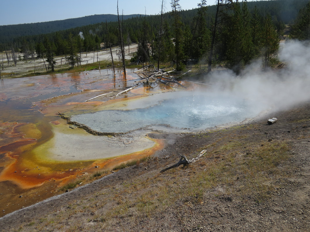
Firehole Spring was the first stop along our Firehole Lake Drive.
|
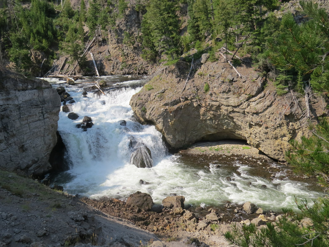
Firehole Falls
|
- Continuing northward, we just did a drive-by of Beryl Springs and Gibbon Falls, then tried our luck at Artist Paintpots. Lynn and I had been thwarted here in the past due to crowded conditions in 2011 and I think the area was closed in 2014. Today looked much more promising when we turned onto the access road and cruised right to the entrance of the parking lot. "Uh-Oh!" Lisa and I said in unison when we hit the line of cars at the lot waiting for a parking space. But the wait ended up being very short as there were several folks leaving when we arrived so we sort of lucked into a parking spot. I'm glad we did as this turned out to be a nice little thermal area, particularly the bubbling mud pots. We grabbed our cameras and hit the short trail to the thermal area. The rather exposed dirt trail worked through some sparse stands of pines for about 0.3 miles to the thermal area, then there is a half-mile loop around the features that works up the hillside a bit along a boardwalk to provide access to the mud pots and provides a great view over the little basin area. We turned left at the junction and traveled clockwise around the area. The first feature we encountered was named Blood Geyser, but it was not named for some gruesome event, but rather for the color of the surrounding rocks which are stained a rich red by the high concentration of iron oxide that precipitates out of the water. This little geyser has been busily erupting since it was first recorded in 1882. The eruptions can be up to 6-feet high and the geyser discharges 150 gallons of water per minute. The most interesting features in the thermal area were along the backside of the loop, the mud pots. These were a little higher up on the hill side (about 100 foot rise to the back of the loop). I had some fun with the camera, trying to capture the bigger bubbles bursting. I reckon I zipped through well over a hundred images taking bursts of photos. The signs here explained what was happening: From Soup to Stew: The hydrothermal system at Artists' Paintpots operates somewhat like a double-boiler in your kitchen. Just as the bottom pot of the double-boiler holds boiling water, underneath the ground here is a hot water system with hot acidic steam. This super-heated acidic steam heats the ground above it causing the rocks to dissolve into clay. The hot clay receives water from rainwater and snowmelt. This causes mudpot consistency and activity to vary with the season and amount of precipitation. Even though mudpots are extremely hot, the bubbles are caused by steam and carbon dioxide gases, not heat. The sign was right, one pot was thicker like a stew so the bubbles formed and popped more slowly compared to the pot with the thinner, soupier mud. The thinner mud was much more active with the bubble forming and popping with the speed of boiling water. I'm guessing this was the hotter of the two pots.
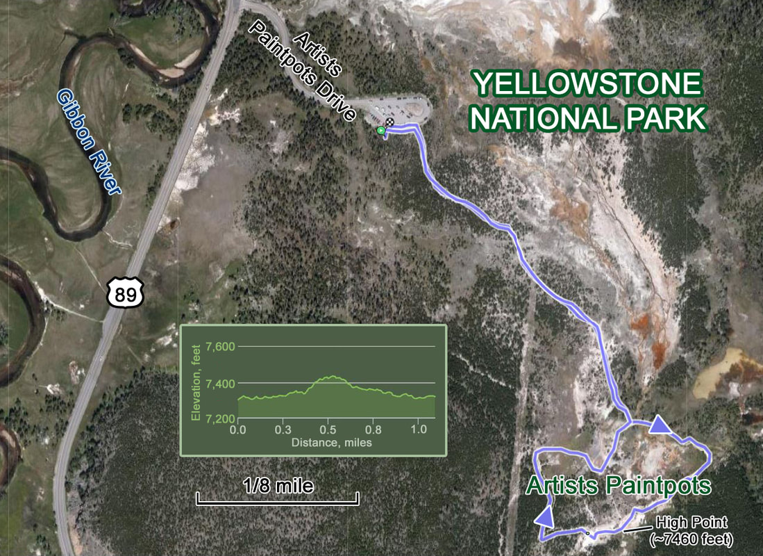
Our walk to Artists Paintpots. Ramblr came up with an odd scale for this map.
|
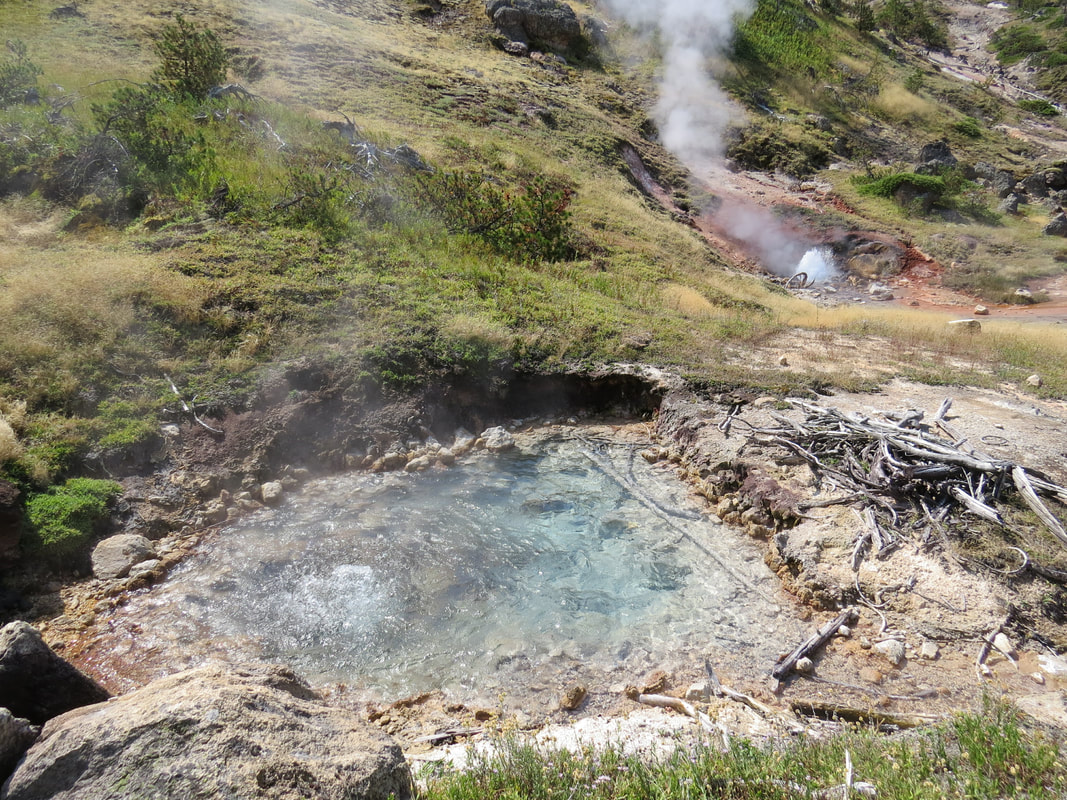
|
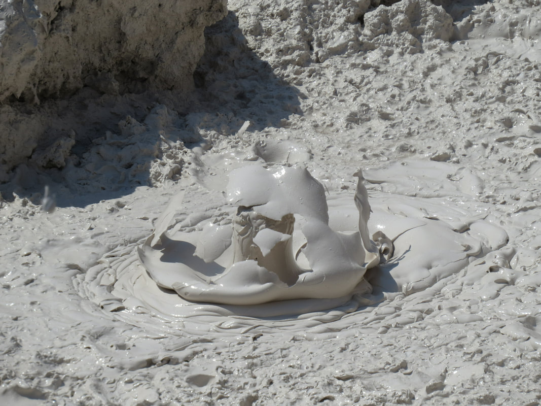
|
|
- We tried to get in at Norris Geyser Basin but the parking lot was jammed and there was a long line of cars circling in search of an opening. We made two laps (the second while Lynn made a rest stop) and decided to move along.
- No issues with road construction today, only one very minimal delay. I reckon part of this was because this was Saturday, so there was no major activity just water trucks running to keep the dust down.
- We spotted the trailhead for Bunsen Peak as we exited Swan Lake Flats and started toward the Golden Gate. Good to know this location; very helpful for when we return for the hike.
- Our next stop was at the Mammoth Hot Springs Terraces. We skipped the drive at the upper level as there was a backup at the entrance that included a couple of big RVs. Instead I lucked into a parking spot further down by the main terraces and we walked through the main and lower terraces, just meandering along the boardwalks. The terraces here are generally barren and grey, seemingly mostly dormant, with a few areas of active springs. The dead trees scattered around the terraces add an element of the macabre. The trees are sparsely spaced around the area, grey and stunted. They got this way when the area was flooded with water from the springs which was absorbed by the trees. The calcium carbonate in the water hardened the “veins” of the trees blocking their ability to absorb nutrients and water. These trees are now “rock solid” according to the signage and can stand for decades. There are several springs contained within the Mammoth terraces and each goes through a sort of life cycle. Jupiter Spring is a good example that was highlighted on a sign. Jupiter Spring first bubbled up in a landscape of scattered trees and travertine – travertine created by older springs. As Jupiter Terrace grew, hot mineral water streamed downhill, burying the grass and trees growing there. A photograph from 1872 showed that the tress were engulfed by travertine. Descriptions and drawings from 1923 indicated that Jupiter Spring flowed abundantly and that colorful pools adorned its terraces. However by 1998 Jupiter Spring had been dormant for several years. If it remains inactive, soil will eventually form on Jupiter’s crumbling travertine and become home to trees and flowers again. And while there are several areas that are dormant and crumbling, there are still some active springs, one of the prettiest that we saw being Canary Springs (Palette Springs is also amazing but we did not venture down there this trip). The terraces at Carney Springs are bright white with water pouring down and forming pools that have an opaque blue color. The brown and orange stains streaking the terraces provide quite the contrast. Well worth braving the heat to see this amazing spring again.
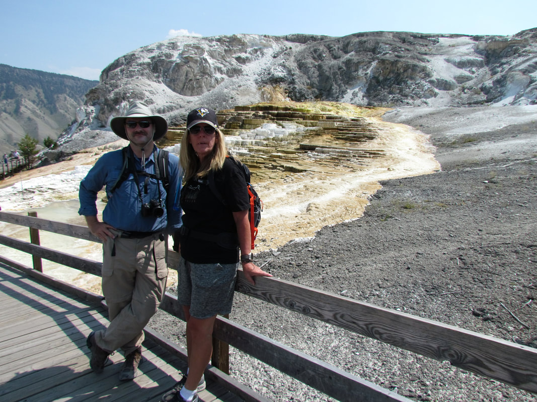
Me and Lisa on the boardwalk at Mammoth Hot Springs Terraces.
|
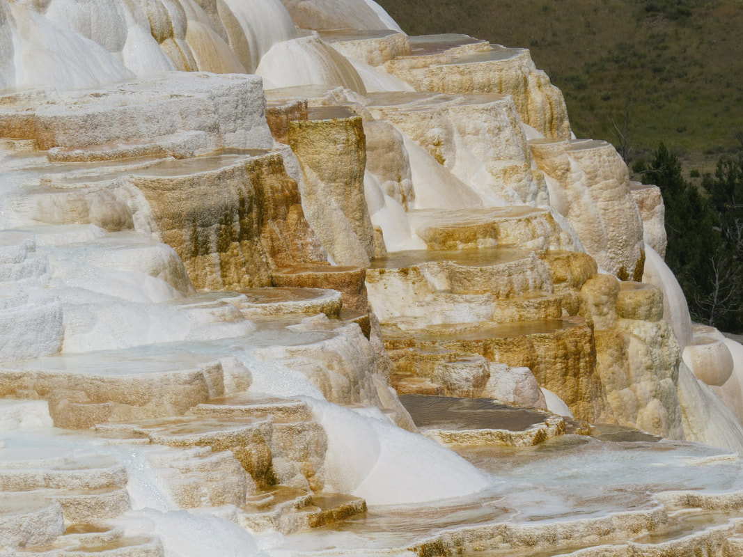
Canary Springs
|
- Other signage along the boardwalk described the “micro-wildlife” living in the hot springs: Travertine Occupants: You are looking at a world of heat-loving microorganism called “thermophiles.” Billions of them live, die, and are buried at Mammoth Hot Springs. Thread-like filamentous bacteria link together, creating chains that can spread into aprons. They live on hydrogen sulfide gas rising through vents. Like flowering plants, colorful cyanobacteria use light for energy, or photosynthesize. If other microorganisms did not consume hydrogen sulfide gas near the vents these sun-loving microbes would be poisoned. That sign also talked about the Perished Communities: Heated deep underground, water rises through buried limestone, then deposits the mineral calcite above ground. The calcite hardens, becoming travertine. As hot springs water flows, trees, grasses, thermophiles, and even the boardwalk are entombed! Smothered by a coat of travertine, a fossil-like impression of thermophiles is cast in stone. These travertine impressions are evidence of former thermophile communities. The final paragraph on this sign tied back to the information we had read at Midway Geyser Basin about extraterrestrial life: Yellowstone’s hot springs are among Earth’s most extreme environments. Yet life survives and thrives in conditions that would be lethal to humans. Scientists studying hot spring habitats are learning about life’s limits on Earth. What they learn here may also aid the search for life on other planets. I noted that the sign was made possible through a grant from the NASA Astrobiology Institute and Lockheed Martin Space Operations.
- There were a lot of folks out on the boardwalks at the Mammoth Terraces, which provided some opportunity for people watching. I happened to hear one comical exchange between a father and his rather unhappy crew of kids who were apparently displeased with the day’s activities. Dad’s sarcastic direction to the kids noted his disdain for their desire for connectivity: “Let's go, there’s WiFi at the top.”
- Lynn offered to buy ice cream at the general store in Mammoth but alas there was no place to park so we just rolled on through town.
- The drive from Mammoth to Roosevelt is a favorite from our past two trips. We have had good luck with wildlife sightings along this stretch of road, but our expectations were low today due to the heat here in the early afternoon. Good thing that we had aimed low as the only activity we saw were kids playing in the water at the Lava Creek Picnic Area (I think that was the name; very near the Wraith Falls trailhead) and a few road construction workers.
- Our final excursion from the main road was the drive across the Blacktail Plateau Road. We had driven this dirt road during our previous visits with very little luck in terms of animal sightings, but I have talked to folks and read about all manner of great sightings. As I recall, the only big critter we have seen was a single pronghorn in 2014. But that was the also the year of the amazing wildflower bloom when the hillsides and meadows here were just blanketed in color. That was truly a beautiful drive. We'll keep trying this road; eventually we will get lucky. Again, the lack of animals is not really surprising given the high temperatures today. If I were a critter I would certainly be hiding in the shade (come to think of it, I am a critter and I am sort of hiding in the air conditioning). The best we did today was a bison skeleton lying very near the road. We figured it was a bison due to the bone structure along back where the big hump is located. Obviously the muscles here need something to connect to.
We pulled into Roosevelt Lodge a little after 3:00. Check-in time is 4:00, so I figured we would not be able to get into our cabins yet. I was right. But the clerk did take care of all the paperwork so all we had to do was pick up keys later. Since we have time to kill (and the bar at Roosevelt was not yet open) we decided to continue our driving tour of Yellowstone and cruise into the Lamar Valley. Our luck was about to change.
Where we had minimal sightings along the Blacktail Plateau Road, we have seen all manner of varmints in the Lamar Valley during our past two visits. Still, today we are not driving through at primetime and the conditions are less than perfect, so we kept our expectations in check. We should not have been concerned.
We were just a couple miles beyond Tower Junction when we saw our first bison of the day, a lone bull sauntering along in the westbound lane of the road. He had several cars in tow behind him, and the east bound traffic had also slowed accordingly. He eventually stopped and turned sideways in the road seeming to ponder what to do next. The cars in front of me also stopped to give the big, furry brute room to change course. He finally crossed the east bound lane and wandered off in search of a snack or something. Traffic was still slow since the big guy was so near to the road so we got to watch him walk over to a nearby wallow and flomp his big carcass down into the swallow depression. OK, he must have had a busy morning and needed a nap.
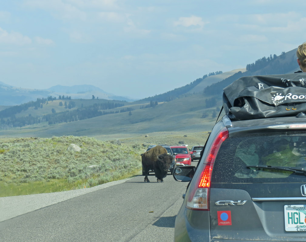
|
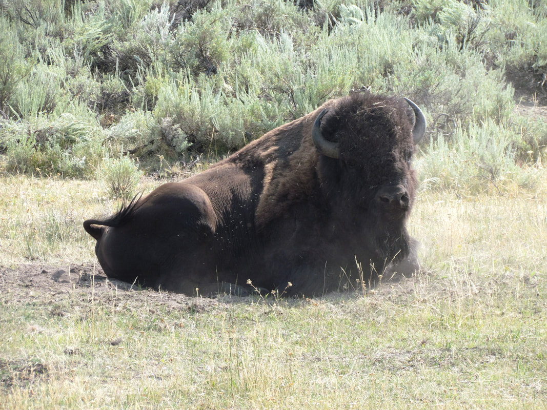
|
The Lamar Valley is one of, if not my number one favorite place in the park. This is critter central. Plus there are wonderful views of the meandering river and the rolling hills that define the valley. Sure, there are lots of tourists out and about as well, but this is a big valley, so folks are spread out over its length. The big animal jams can cause some traffic issues, sometimes due to the animals on the road, sometimes due to the tourists not paying attention, but for the most part this is a peaceful and relaxing cruise. Of course, as soon as someone stops to look at something the rest of us will follow just to see what there is to see. That's why we are all here.
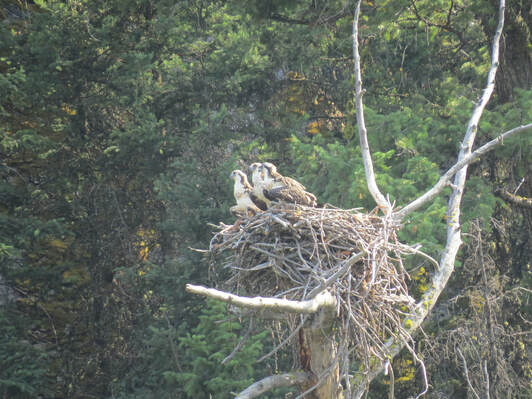 Osprey
Continuing east through the valley we were treated to seeing vast herds of bison arrayed across the floor and all along the river. There were a few pronghorn mixed in, just a few individuals scattered about. We turned around at the horse trailer parking, just shy of Soda Butte. Right in this area is where the Lamar River and Soda Butte Creek converge near to the road. Fly fishermen dotted the creek, sharing the area with a few Bison and several Canada Geese. We saw a couple Sandhill Cranes at one of the little ponds on the return trip. We stopped at a pull out above the Lamar River (a little east and up the hill from the Slough Creek access road) where we had spotted an Osprey nest in 2014. No other tourists were here were we arrived, so we had a little quiet time to find the nest and see if there were any birds living here this season. Sure enough, we found a nest and there were three Osprey hanging out there. If these were this year's chicks it looks like they have their adult plumage but they are just chillin' on the nest. Maybe they have not finished flight school. Once we were peering through the cameras and binoculars three or four other cars quickly pulled into the turnout, their occupants spilling out to see whatever it was that we were seeing. One older couple were obviously serious birders as they quietly and efficiently set up their spotting scope and set about their business of studying the scene. Two of the other cars were carrying families traveling together as they were yelling back-and-forth to each other to grab the camera, watch the kids, find out what we are looking at, hurry up and all manner of other instructions. If that didn't spook the birds from the nest, nothing will. Well, at least we had a few minutes of peace. We loaded up and rolled back toward Tower Junction.
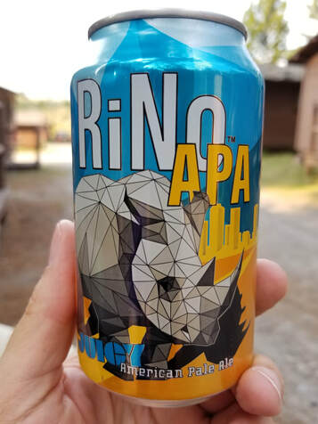
Back at Roosevelt, we grabbed our keys from the front desk and were in our cabins by 5:00. Beer in hand shortly thereafter. While Lynn and I were unloading our stuff and getting the cabin organized, Lisa went scouting for a suitable place for an afternoon drink. Basically she was trying to find a picnic table in the shade (there was no table by our cabins and if there was one it would have been out in the blazing sun). She was successful as there were a couple tables just up the hill from our cabins very near the creek. That will work. I started with a Rogue Cold Brew IPA, but it was not a hit. Coffee flavor is OK in a stout, but I'm not digging it in an IPA. Lynn tried it and suggested just dumping it; that bad. Not every beer is a winner. However, the Rino APA from Epic was really good. Nice flavor, fairly light. Yes, quite tasty! I gave this one a 4.25 on Untappd (the Cold Brew got a 2.25 but probably should have been lower).
We chatted with a group of folks visiting from South Carolina, two couples just a bit older than us. They had driven out and were touring through the parks. They thought we were brilliant for having a cooler of beer and wine out here for an afternoon break; but then they also had adult beverages with them as well. We exchanged some ideas on things to see and do in the park. Turns out that Bunsen peak was high on their list of hikes. They had also hiked Slough Creek just today, so they gave us a general description of the hike; steep to start then levels out. They went a little past where the trail first contacts the creek, out to around the Ranger station, then turned back for a 4-mile round-trip. They thought it was a great little hike. OK, that sounds like a winner. They eventually wandered off to one of the other picnic tables, probably to work out their plans for tomorrow. We continued to refine our plans for the next couple of days and reviewed our critter sightings for today; not a bad list:
We chatted with a group of folks visiting from South Carolina, two couples just a bit older than us. They had driven out and were touring through the parks. They thought we were brilliant for having a cooler of beer and wine out here for an afternoon break; but then they also had adult beverages with them as well. We exchanged some ideas on things to see and do in the park. Turns out that Bunsen peak was high on their list of hikes. They had also hiked Slough Creek just today, so they gave us a general description of the hike; steep to start then levels out. They went a little past where the trail first contacts the creek, out to around the Ranger station, then turned back for a 4-mile round-trip. They thought it was a great little hike. OK, that sounds like a winner. They eventually wandered off to one of the other picnic tables, probably to work out their plans for tomorrow. We continued to refine our plans for the next couple of days and reviewed our critter sightings for today; not a bad list:
|
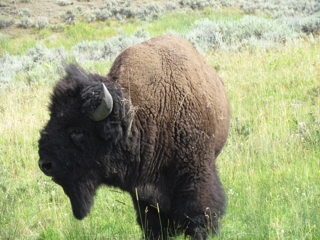
|
We headed up to the lodge building for dinner at about 6:00. A bit of a crowd tonight so we were told there was a 40 minute wait. Not a problem as the bar is open and there was rockers available on the front porch. The bad news is that the beer selection was pretty poor. No IPAs tonight; they were out of Bent Nail. I went with the Grand Teton Old Faithful ale, a pale golden ale. A pretty beer, but too malty and sweet for me. Golden and a bit hazy. Probably one and done on this brew. But you have to try 'em before you know for sure. Our buzzer sounded at 6:30, so our wait was a little shorter than predicted, thus a bit of a bonus. I had the BBQ chicken sandwich the girls had taco salad. The food was good, but not great, and the server was very friendly. This is about what I remembered of dining at Roosevelt.
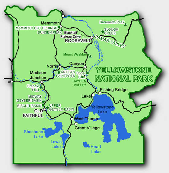 Points-of-interest that we hit during our 2018 visit to Yellowstone.
Photos from day 3 of our Wyoming adventure.
After dinner we enjoyed the evening from the porch and watched the clouds start to roll in. Well, that's not good for a starry night sky. Well, we still have a couple more nights here in Roosevelt.
Day 4, Sunday, August 12 - Slough Creek. I was up at 0550. Lynn was starting to stir. We walked to the lodge building a little before 0700 but we were slightly ahead of opening so we headed up to the road to see what we might see. First was a lone Sandhill Crane flyover. He was loudly calling all the while he cruised across. They have such a ratchety call; very distinctive so you always know who is flying by. Catty-corner across the road was a small herd of bison just where I spotted them during one of my morning excursions in 2014. The big bull was bellowing and checking out the ladies, also very reminiscent of previous trip. It is so cool to get to see these big critters up close, but still from a very safe distance. They talk a lot with all the snorting and grunting. I didn't understand the vocabulary, but certainly got what he was saying.
Back at the lodge a yellow bus was picking up tourists for a wildlife tour. Sadly for those tourists they were in a new bus, not one of the classic buses built by White and refurbished by Ford. The lodge building was now open so Lynn got her coffee; all is right with the world. While she was doing that, I went back to the cabin for a nut bar and Pop-Tarts. We converged on the porch. We watched the bison through a gap in the trees until they again moved out of sight. Plus a hawk flew over while we were there. Not sure what kind, except not a red-tail. The only thing marring this peaceful moment was the annoying family hashing out their issues there on the porch. Fortunately they came to some resolution and walked away smiling. I was smiling that they walked away. Back to peace.
The original thought for today was the hike up Bunsen Peak (actually, the original original-plan was Mount Washburn but as mentioned earlier that trail is currently closed), but the forecast is for hot and hazy again, although not as bad as yesterday. Tomorrow is supposed to be cooler, so we will defer Bunsen Peak by a day and try Slough Creek this morning. We were loaded into to the Explorer and cruising toward the Lamar Valley around 7:30.
I had read that Slough Creek is a popular trail so I was anxious to get to the trailhead in order to beat the crowd. We were there a little after 8:00, so not far off my preferred schedule and there were still plenty of parking spots available. While not crowded by any stretch of the imagination, there were a few folks getting their gear in order for a hike or backpack adventure. One group looked like they are gearing up for a few days of fishing. Oops, we forgot our trekking poles. Hopefully we won't regret that. But we're not going back for them, that's for sure. We quickly donned our packs and walked to the trailhead, stepping off ahead of the rest of the folks here this morning. I'm guessing that we will see all these folks again when they pass us along the trail (hey, almost everyone passes us on the trail).
Slough Creek is an out and back hike, so go as far as you want and turn around whenever and where ever you like. We'll see what the trail is like and figure it out as we go. Pretty sure we will get in at least a nice stretch of the legs. The sign at the trailhead indicated that McBride Lake is three miles out, so perhaps that is the place to turn around. Our South Carolina friends said that they went to the first lake (actually a meander in the river) then just a little further and had about a 4-mile round-trip hike. We'll figure it out as we go.
Just a little ways beyond the trailhead sign we came to a gate that hikers could easily get around but horses not so much and certainly not wagons. The gate was locked, so obviously you had to be in the know to get by here other than on foot. We assumed that horses also used this trail since it was wide and fairly smooth, and we soon had confirmation with rather fresh manure piles. Yep, watch your step. The initial section of the trail is an uphill and pretty steep, as it works through an old burnt section of forest. We saw a few birds including a woodpecker of some sort but no portraits this morning. I'm glad we're doing this uphill section early as it was generally exposed and pretty darn steep. We made pretty good progress, with just a couple brief stops to catch our breath and enjoy the views. Along this section of the trail the view is looking southwest, I guess, along the side valley we drove through to get to the trailhead. We played leapfrog with a lone lady hiker all dressed in purple. She would pass us when we took a break and vice versa. She joked that she was slow and that we would eventually leave her behind, but in fact it was just the opposite as she made it to the top of the steep section ahead of us and that was the last we saw of her.
Once we crested the initial uphill section we worked downhill and into some trees down to the creek. Just where the trail flattened out we were accosted by a ferocious but tiny denizen of the forest. We thought it was a squirrel or chipmunk charging at us, it was hard to tell in the deep shade. But as it got closer it appeared to have a black face. That's not a squirrel. It paused it the trail, sized us up, and then dove into the tall grass along the trail. What the heck was that? It had a longish body but was thin, like a furry brown hot dog. Its tail was not that long nor bushy, but it had a distinctive black tip. Some sort of weasel? I manage to get a couple very blurry photos as the little varmint scurried along a log just off the trail as a bypass around us. "Hey, that's an ermine!" Lynn was channeling Jack Hanna, I reckon, and came up with the identification. Ok, that will work. We can Google that later to see if she got it correct.
Once the ermine disappeared we turned our attention to the lovely view off to our left, so north of the trail. Here we had a nice big oxbow bend in the creek. The rolling hills were refracted in the still water providing a very tranquil scene. Lisa and I found a narrow social trail that provided access to the water's edge, so we went out for a better view while Lynn stayed in the shade along the trail. Great reflection shots from this point, with the very clear and nearly mirror like surface of the water. Just a pretty scene with the pines and hills reflected in the meander of the river. But we did not delay too long and rejoined Lynn on the trail to continue our exploration.
The trail continued along the edge of the woods and in general proximity to the river for a ways, mostly level just slightly rolling around to the Ranger station. We noted several social trails branching off from the well-defined main trail, all heading off toward the river. These would be the access for the fishermen to get to the water. The trail was a bit damp along this stretch but otherwise it was dry and firm, save for a couple random mud holes that we had to skirt around. Nothing significant and we never got our feet wet.
Beyond the Ranger Station, the trail turns away from the river and climbs rather steeply. Like the opening stretch of the hike, trekking poles would have been a plus here but certainly not required. But overall the poles were not needed on this trail. What was needed right in the area was bug spray. We hit several patches along this section of the hike that alternated between mosquitoes, dragonflies and butterflies. The latter two were fun to watch, but the former were little terrors. We picked up the pace through the swarms. After surviving two or three areas like that Lisa mentioned that she had a little bug repellent left. Hey, don’t keep information like that to yourself! We emptied that small bottle and kept moving. I find that spraying my hat is particularly effective and since my arms and legs were covered already I just had to defend my face and neck from the little bastards.
While the bugs were annoying and the climb up the slope got us breathing hard, the views out over the river and on up the valley were worth the effort. We could see for quite a ways even with the slightly hazy conditions. Best we could tell, we almost had the trail to ourselves at present. There was a group of three young women coming up behind us, one well ahead of her two companions. That one would soon catch us but she was holding back a bit waiting on the slower hikers. I wonder whatever happened to the lady in purple. Remember her? We played leapfrog with her along the initial uphill section of the trail until she passed us for good. Never saw her again. She was not geared up for more than a day hike, but maybe it was an all day hike. From here we could see a lot of the trail but she was nowhere in sight. Maybe she had left the main trail and went down along the river. That reminded me, where is McBride Lake? We never noted a sign marking a branch trail to the lake. Is the spur further up the Slough Creek trail? Did the lady in purple go there? We kept going. Maybe we will find the answers to these questions on down the trail.
From the high point, the trail drops gradually down through the valley with very nice views. This is a wide valley and the trail at this point is well above the creek on the south wall. There are pine trees dotting the area around the trail although we did walk through a couple more dense stands of trees. There were some nice patches of wildflowers. Past their prime for the most part, but still some nice color. The Indian paintbrush was sparse but the individual flowers were a brilliant crimson. Plenty of little lavender pom-pom flowers that were really attracting the butterflies. I got a few decent photos that will probably be good enough to make identifications after the trip. There were three types, a checkerspot of some sort, a little grey one with big white eye-spots on its wings, and dozens of little skippers.
While we were enjoying the views and the flora, the three young lady hikers (early twenties) caught us as expected. We exchanged a friendly "good morning" and "enjoy your hike" with them. From their accents I would think they were from maybe Eastern Europe somewhere. The one girl was definitely an uber hiker with a strong stride and was sort of dragging the other two along in her wake. The group of fishermen, including one fisherlady, who we saw gearing up at the trailhead also caught us. Two grizzled veterans leading the way and two youngsters bringing up the rear. Guessing this was a family outing. We chatted with them briefly. They are going in for a few days in search of cutthroat. The leader of the expedition was walking and talking with Lisa but the next guy stopped to talk with Lynn and me. Lisa later told us that the leader was a bit exasperated by this as he now has to work to get them moving again. I get it, it is tough to be the cat herder and on a mission. They asked if we had seen any wildlife along the trail; Lisa mentioned that we saw an Ewok. Uh, no, that's the little fuzzy critters from Star Wars; you mean Ermine. But for the rest of the trip it was an Ewok. The fishermen did give us some info on Lake McBride. Seems it is off to the north side of the valley across the river but there is not a marked trail to get there. Well, that explains why we did not see a trail sign.
We went just a little further on, to a point where the trail starts to drop down from the rolling hills into the wide valley. We could see the European girls taking a break under a lone pine next to the trail, right where a side trail splits off toward the river. The map indicated that there is a campsite off in that direction. The fishing group made it past the girls as we were admiring the view and having a quick snack. Another Luna bar (lemon again), another saying: "It's a brilliant day to believe in you." I think I have read this one before, probably in Glacier last year. Seems they need some new material. This looked like as good a place as any to turn around. The Ramblr track showed 4.4 miles to this point and we've been hiking for about two hours (time is approaching 11:00). Yeah, let's get back before it gets crazy hot.
We again had the trail to ourselves for a while. We kept an eye open for critters. The good news was that we were not seeing any more mosquitoes but the bad news was we were not seeing much else, other than the butterflies. We did hear a chorus of frogs at one point near one of the wetter areas along the trail; peepers I reckon. And there was an interesting worm or caterpillar crawling across the trail. Sort of struggling as it would go a few inches then sort of roll on its side then back up right for a few more inches; lather, rinse, repeat. It was a segmented critter, sort of pale red or peach colored with white spots on each segment. I was able to identify this one from a quick Google search once we got home. Turns out it was a Bedstraw Hawkmoth Caterpillar. We did see one lone bison on the far side of the valley, across the creek. Apparently he was king of all he surveyed.


We only saw eight other hikers on the way in but probably 40 on the return plus two groups on horses. I think the first hikers we saw during our return trek were a couple younger guys at about the top of the steep section beyond the Ranger station. Then there was a young mom and two little kiddos back down near the river. She was trying to take a selfie with her phone while the 6 year-old boy was playing with mom's expensive DSLR. Needless to say mom was spread a bit too thin. By the time we were heading back up the hill from the river the flow of hikers coming the opposite direction was pretty steady.
The first equestrian sighting was a group of three on a day trip; we passed them shortly after we saw Selfie Mom. The second troop was six or so riders going in for at least an overnight excursion as they had four or five pack mules with a lot of gear and supplies. I quipped to the wrangler leading the pack that it is always nice to see the cavalry. The girls were a little ways ahead of me and we all stepped off the trail to give the horses the right of way. The lead wrangler and a couple of the dudes were a little ways in front of the rest of the group and just as the rest group was walking by, one of the horses decided it was time for a snack and grabbed a mouthful of the head-high grass. The greenhorn rider pulled on the reins, breaking one right where it attached to the bit. I called up to the leader that there was an equipment failure, then grabbed the horse's halter (these horses were in western tack and decked out the way we did it in the cavalry, with headstalls over halters). One of the other riders dismounted and was able to tie the rein back to the bit while I held on to the horse. I thought the rider helping was a wrangler by the hat, but he was just a dude (one wrangler was stuck at the front of the line and the other had the mule train to deal with, so a hiker and a dude saved the day). All's well that ends well.
We continued to pass hikers as we descended to the trailhead. I'd have to give this trail a pretty high friendliness rating as everyone we passed was smiling and tossing hello, howdy and even a g'day or two around. We found a great trail and had a wonderful hike. We ended up covering 8.9 miles, according to the Ramblr track with 4:22 on the trail. A bit of a roller coaster trail with a couple of long hills to traverse. We started at about 6,200 feet at the trailhead and got to right around 6,700 feet at the peak elevation, so not extreme in term of the absolute elevation but still a bit of a workout with the ups-and-downs along the trail. Yep, this one is a keeper.
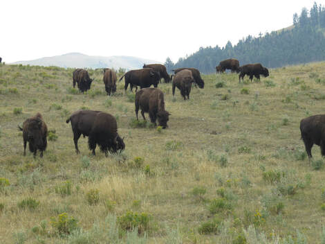
The scene back at the trailhead parking lot was quite different than when we hit the trail this morning. While not full to capacity at present, there were only a couple spaces remaining so we figured we should not lollygag and give someone else our spot. Bison were lining the dirt road all the way back to the main road. Several were right along the road, so we had to watch both the furry traffic and the oncoming tourists.
We enjoyed the scenery through the Lamar Valley. Lynn captured a few bison photos as we drove through. After we ditched the car and our gear at Roosevelt cabins (I pulled my hiking poles out of the luggage to ensure they would be remembered tomorrow), we walked to the general store for ice cream and bug spray (thus checking off the second action item from the Slough Creek hike, the poles being the first). I had a Fudgesicle (when was the last time that happened) and the girls went with huckleberry ice cream on the deck of the general store, followed by a Teton Range IPA on the front porch of the lodge. We then moved to the shady picnic table out by the creek. The girls started a bottle of pinot griego. I went with the Your IPA from Melvin. Great aroma. I gave it a 4.25 rating on untappd. As usual, we tallied the critter sightings for the day:
We enjoyed the scenery through the Lamar Valley. Lynn captured a few bison photos as we drove through. After we ditched the car and our gear at Roosevelt cabins (I pulled my hiking poles out of the luggage to ensure they would be remembered tomorrow), we walked to the general store for ice cream and bug spray (thus checking off the second action item from the Slough Creek hike, the poles being the first). I had a Fudgesicle (when was the last time that happened) and the girls went with huckleberry ice cream on the deck of the general store, followed by a Teton Range IPA on the front porch of the lodge. We then moved to the shady picnic table out by the creek. The girls started a bottle of pinot griego. I went with the Your IPA from Melvin. Great aroma. I gave it a 4.25 rating on untappd. As usual, we tallied the critter sightings for the day:
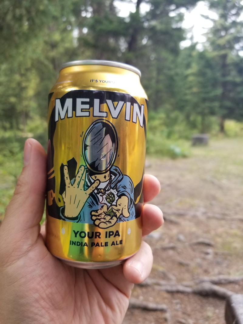
|
|
|
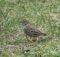
Chipping Sparrow
|
We all got cleaned up for dinner. That shower sure felt good! Lots of trail dust today. We were headed to the lodge building at 5:20, so early enough that there was no wait. We all went simple today with burgers, the girls had beef burgers, but I had the bison burger. The bison was great. Unfortunately the side dishes did not hold up their end of the deal. The baked beans were as lackluster as the fries from last night. But it was still a very good meal.
We were all done for the day after dinner. Overcast had set in so stars and the Perseids were a non-starter. I read for a while to keep from crashing at 7:15. Death by wildlife was the topic tonight. As was the case with the deaths in the thermal areas, those eaten were generally at fault and could have prevented their demise had they listened to the Rangers. I finally did turn off the lights at about 9:00. Lynn said I was snoring before the room was dark. Here's the link to the photos from Slough Creek and around the area.
Day 5, Monday, August 13 - Bunsen Peak. I was up about 0530 and worked on trip notes while waiting for Lynn to start moving. We walked down to the lodge building at about 0630, knowing it was not yet open, but I do not argue with a woman in search of coffee. Pretty sunrise though, so that was worth the early walk. Back to the cabin to get the gear in order and have a Pop-Tart. Lynn reported that as luck would have it she had two left-handed trekking poles in her suitcase and would be willing to trade for one of the right-handed poles she surmised that I had in my luggage. She's so smart. Glad we got that sorted out. Otherwise, we were ready to roll at 0700. Well except for the freaking coffee. Lisa and I relaxed on the front porch of the lodge building while Lynn got her caffeine boost. Pretty quiet this morning both in terms of tourists and critters. We spotted two bison through the trees in the open area across the road. They were just grazing their way across the field.
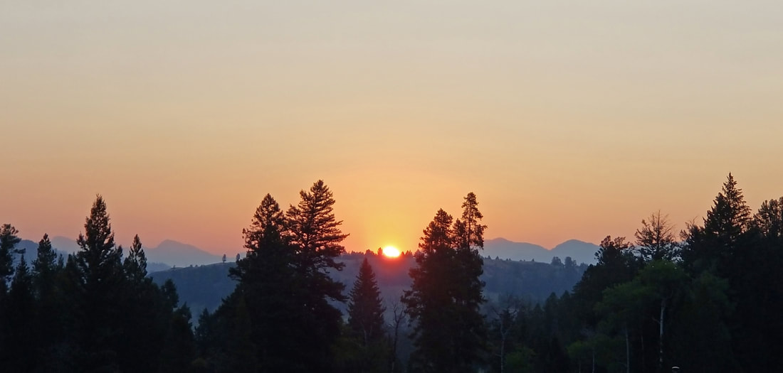
Once Lynn got her coffee, we walked back to the cabin to gear-up for the day. I went for ice and got the opportunity to say farewell to our South Carolina friends. They are heading to Grand Teton today. I said that we would be following tomorrow. In the short time that I was gone, Lynn and Lisa had a close encounter with a doe and fawn between our cabins. The deer were just browsing for breakfast but moved through the area fairly quickly.
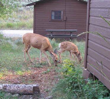
We were loaded and rolling away from our cabins at 0729. This should be early enough to secure a parking spot at our trailhead de jour. The plan for today is the hike to the top of Bunsen Peak, but Lynn has already nixed adding Osprey Falls due to the steep elevation change advertised along that section of trail. The girls did note that a stop at Mammoth would be needed, particularly for Lynn after two cups of coffee. Yeah, no surprise there. I made some comment about bear butts and bare butts out on the trail and the conversation spiraled wildly out of control from there for a few minutes but when soon regained some semblance of dignity and settled into our usual mode of critter searching. Not much out this morning that we saw, just another pair of deer at the Blacktail Plateau sign. We were in Mammoth for the quick pit stop right at 0800.
We rolled into the trailhead parking at 8:15. There were three or four cars there already but still plenty of room for our grey Explorer. The temperature gauge read 47 F, same as when we left Roosevelt, although it was 58 F as we rolled through Mammoth. We got our gear in order as another group was doing the same, a dad and two young sons. We did not see anyone else on the trail so they were either already going up to the peak or around to the falls. We looked at the Hike734 map as we were getting ready. Going to Bunsen Peak and back is a 4.4 mile out-and-back. That will work. But we could make a loop out of it by continuing down the backside of the peak and connecting with the Osprey Falls trail, which is an old dirt road so that part should be easy and relatively flat. Lynn did not balk at that as long as we did not add the significant elevation change down to Osprey Falls. That's reasonable. OK, there is hope for a longer hike. I reckon it will all depend on how hard the hike is up to the peak. By the way, for you chemistry geeks, yes, Bunsen Peak is named after that Bunsen. For those who are not making a connection, I'm talking about Robert Bunsen, the guy who developed the Bunsen burner use in chemistry labs all over the place.
We rolled into the trailhead parking at 8:15. There were three or four cars there already but still plenty of room for our grey Explorer. The temperature gauge read 47 F, same as when we left Roosevelt, although it was 58 F as we rolled through Mammoth. We got our gear in order as another group was doing the same, a dad and two young sons. We did not see anyone else on the trail so they were either already going up to the peak or around to the falls. We looked at the Hike734 map as we were getting ready. Going to Bunsen Peak and back is a 4.4 mile out-and-back. That will work. But we could make a loop out of it by continuing down the backside of the peak and connecting with the Osprey Falls trail, which is an old dirt road so that part should be easy and relatively flat. Lynn did not balk at that as long as we did not add the significant elevation change down to Osprey Falls. That's reasonable. OK, there is hope for a longer hike. I reckon it will all depend on how hard the hike is up to the peak. By the way, for you chemistry geeks, yes, Bunsen Peak is named after that Bunsen. For those who are not making a connection, I'm talking about Robert Bunsen, the guy who developed the Bunsen burner use in chemistry labs all over the place.
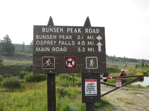
We walked to the end of the parking area to the trailhead. The sign here listed the distances to the main points-of-interest: Bunsen Peak is 2.1 miles, 4.6 miles to Osprey Falls or 5.2 to loop all the way around and back to the main road. We paused briefly to watch the waterfowl in the pond adjacent to the trail. Are those coots? They seem grey instead of black. Perhaps they were this year's babies. I took a picture and will figure it out later. The trail starts along the old road which would eventually wrap around the base of the peak and reconnect with the main road over toward Mammoth somewhere. We quickly came to our first point of interest, the trail marker at the split in the trail. Someone had scratched arrows into the paint of the sign, the vector for our route to the peak being sharply upward and to the left. Alrighty then, here we go!
Once on the trail, we could see one group ahead of us, slowly making their way up the open section of the trail. Dad and the kids took a little longer to get on the trail but were quickly gaining on us just as we were closing the gap with the five folks ahead of us. An athletic pair of twenty-somethings zoomed passed us. Where did they come from? While he was much taller and looked like he could cover ground quickly, she evened the playing field by making him carry their pack. Whatever works. They were quickly out of sight.
As we started up into the first section of pine forest, we saw our third set of mom and baby deer for the morning. These two were mule deer. They were working down the slope above the trail, browsing as they went. They were so intent on eating that they barely paid us any notice to the point that they barely picked their heads up to look at us (so no good photos of this pair). The fawn eventually decided that we were close enough so he bounced across the trail and down the slope. Mom seemed completely unconcerned and did not give chase. Perhaps she was ready for junior to be more independent. Or maybe she just had not had her coffee yet.
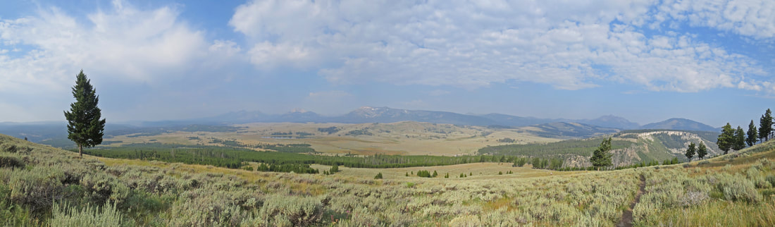
We were gaining elevation steadily, even though the trail is not steep so even on this lower section the views over Swan Lake Flats were very nice and just got better as the switchbacks took us up the slope. The smoky haze was not nearly as bad looking out in this direction and afforded as fairly long distance views of the surrounding peaks of the Gallatin Range arrayed of to the south and west. These were all mountains that were in the 10,000 foot tall range. The best I can figure from the map is that we were seeing from south to north (or left to right in our field of vision) Mount Holmes, Dome Mountain, Antler Peak, Bannock Peak, Quadrant Mountain and Little Quadrant Mountain along the hazy horizon. We saw a ground squirrel sitting on a log above the trail probably getting his daily dose of people watching. Working higher, the trail again enters pines as it takes us around the side of the mountain. From here we got nice views of the Golden Gate, the rock slide area, the Hoodoos and Mammoth.
This section of the trail was also where all the passing of the hiking groups occurred. Of course, the 20-something couple who zoomed passed us earlier was long gone. Dad and the kids caught us as we just started into the pines. Just below the hoodoos, we caught the group that we had spotted earlier. Three Japanese ladies and a local guide. They were taking their time and a lot of photos as the guide provided some narration to their hike. They were taking close-ups of the local vegetation when we passed. A couple guys in our age range passed us at the viewpoint above the hoodoos. Jovial fellows with who we exchanged pleasantries before as they cruised up the hill. They were the last of the hikers that we saw on the trail before reaching the summit. That makes only eleven other hikers on the trail this morning that we saw besides us.
The next few switchbacks continued along west face, providing a very nice vista over the Golden Gate but it was much more muted looking north toward Mammoth due to the smoke and haze. The hoodoos are in shadow at this time of day so it was tough to get a decent photo but the spires are still cool to see. We also got a nice critter sighting here as a Dusky Grouse flinched and drew attention to itself. I guess we startled it. We would have missed completely if it had not moved as it blended in so well with the brush. We stopped and watched it work its way up the slope along a log then through some brush then finally across the trail above us and back into the brush and out of sight.
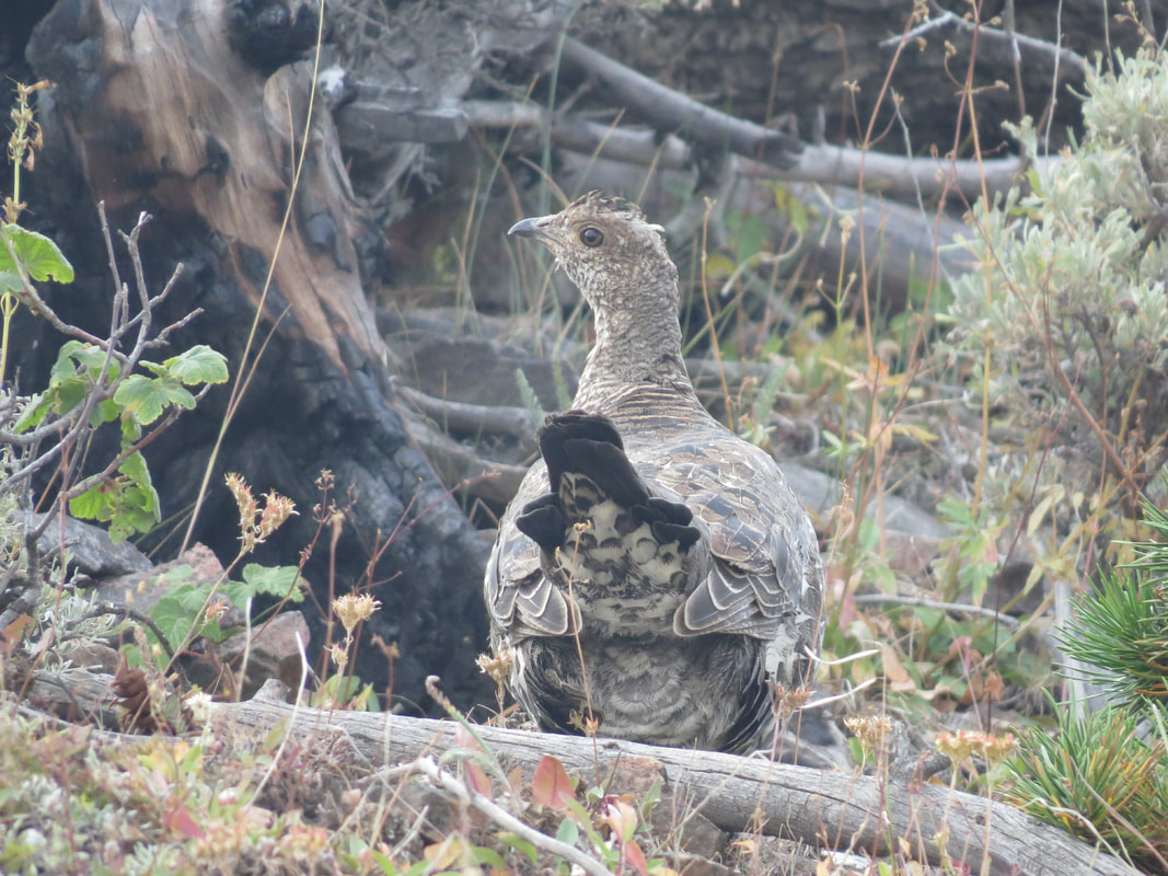
The trail made a couple more switchbacks on the west side of the slope then wrapped around to the north slope. Exposed here, out under bright sunlight, but still comfortable. We are now getting into the rocky, scree- and talus-covered part of the mountain. One description of the trail that I had seen indicated that the trail could be difficult to follow through the loose scree but I did not think that to be the case. We found the main trail to be very discernible and easy to follow, although there were also several other social trails visible but those were narrow and generally very steep, so certainly not the route to take. We just took our time and watched our step to ensure that we stayed on the main trail and kept our footing. I figured that this is what walking on a pile of broken pottery might sound like as we continued up through the scree.
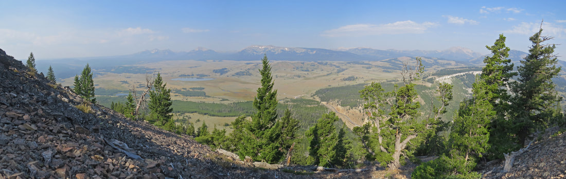
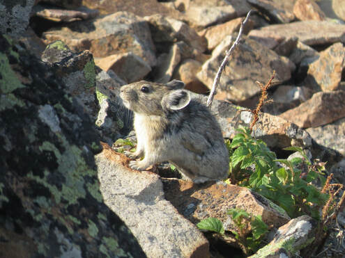
Now that we were firmly in the rocks and at higher elevation, we wondered if we might see a pika. No sooner had we made that speculation than we heard a squeak. Pika! We spotted one at the next switchback, busily gathering grass. It blended in so well with its rocky habitat that both Lynn and I were having trouble locating it in our viewfinders, but we eventually got its portrait. These are such industrious little varmints. And cute. We stood and watched him scurry about the rocks gathering his treasures.
As we neared the top, we passed dad and the boys as they were making their return hike, but the other hikers were either still hanging out at the top or had continued down the other side. That got us talking again about our route. I think Lynn is now game for the loop route as the hike up to Bunsen Peak has turned out to be rather easy and quite enjoyable. Might as well cover a bit more new ground.
As we neared the top, we passed dad and the boys as they were making their return hike, but the other hikers were either still hanging out at the top or had continued down the other side. That got us talking again about our route. I think Lynn is now game for the loop route as the hike up to Bunsen Peak has turned out to be rather easy and quite enjoyable. Might as well cover a bit more new ground.
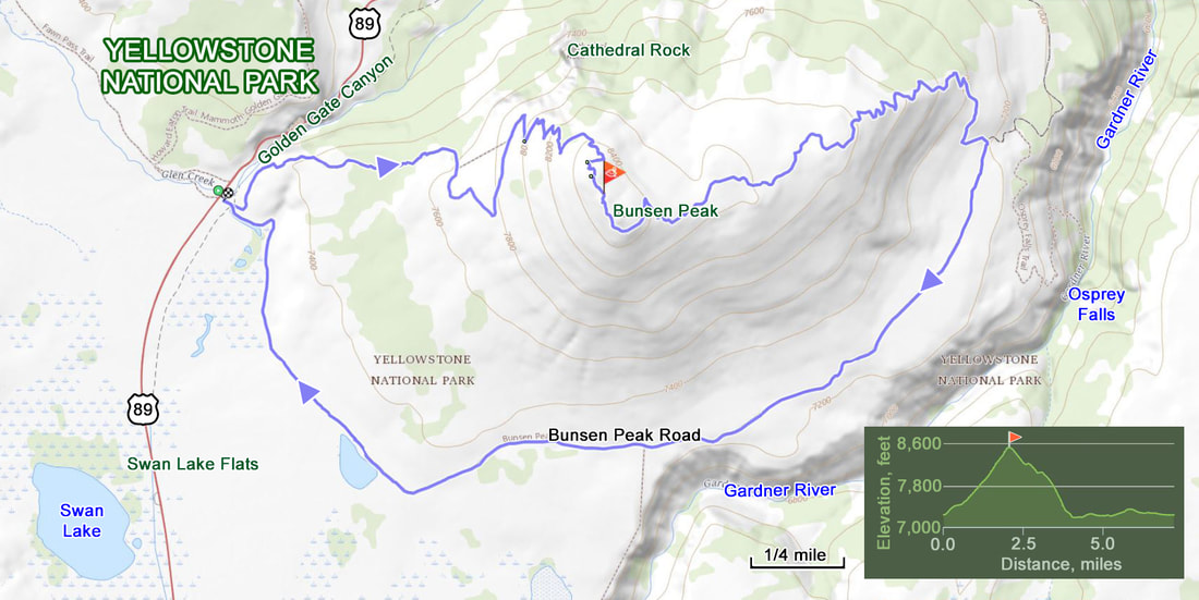
By now we are almost at the top. Perhaps as we were traipsing through the final switchback in the scree I noticed some exposed electrical lines, maybe grounding lines. My NASA safety training automatically kicked in as I noted this as a trip hazard, after having walked about a mile over loose, broken rocks. I guess those are natural occurrences so I did not flag them like I did the man-made hazard.
The top of Bunsen Peak is rocky and dotted with pines and an antennae or two, plus a little log structure. The sign on the log building let us know we had arrived at Bunsen Peak, with an elevation of 8,564 feet above sea level. I signed the hiker's log that was mounted on the front of the little building then followed the girls around to the other side to enjoy the wide open vista looking out over Swan Lake Flats. We had the summit to ourselves for the moment, so the other hikers did continue around the loop. A nice bonus to have a little quiet time here at the top.
This seemed like a nice place for a team photo, so I improvised a platform for my camera (I have a light weight tripod, I just never seem to put it in my daypack). Well, that looks pretty level, but if not I can fix any tilt with Photoshop when we get home. Not a bad shot with Swan Lake Flats as a backdrop. Certainly the best views today were to south and west over the flats.
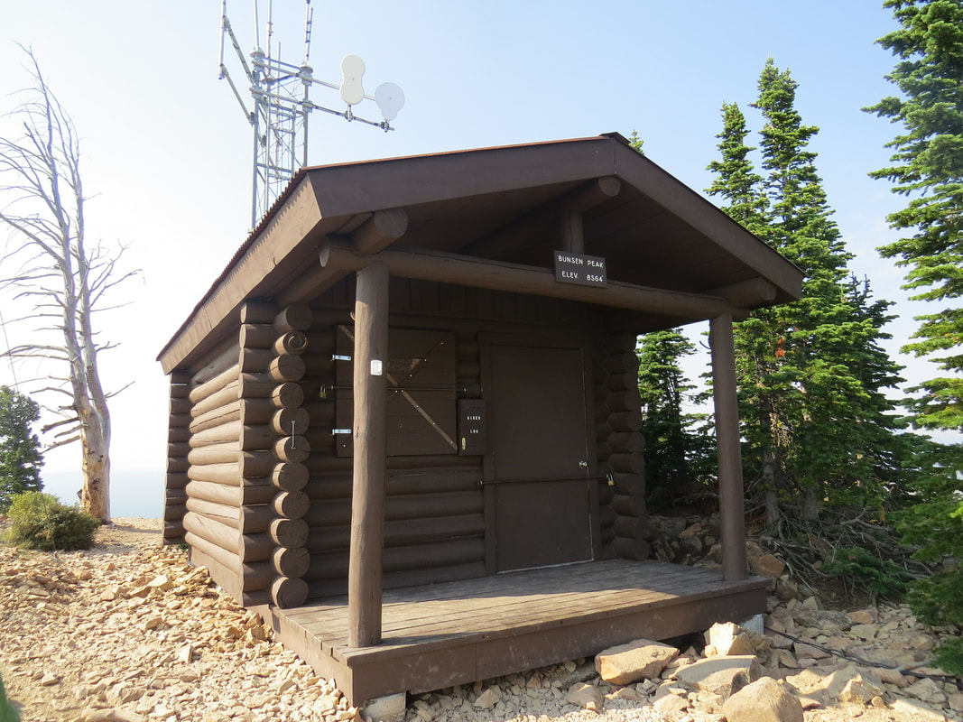
|
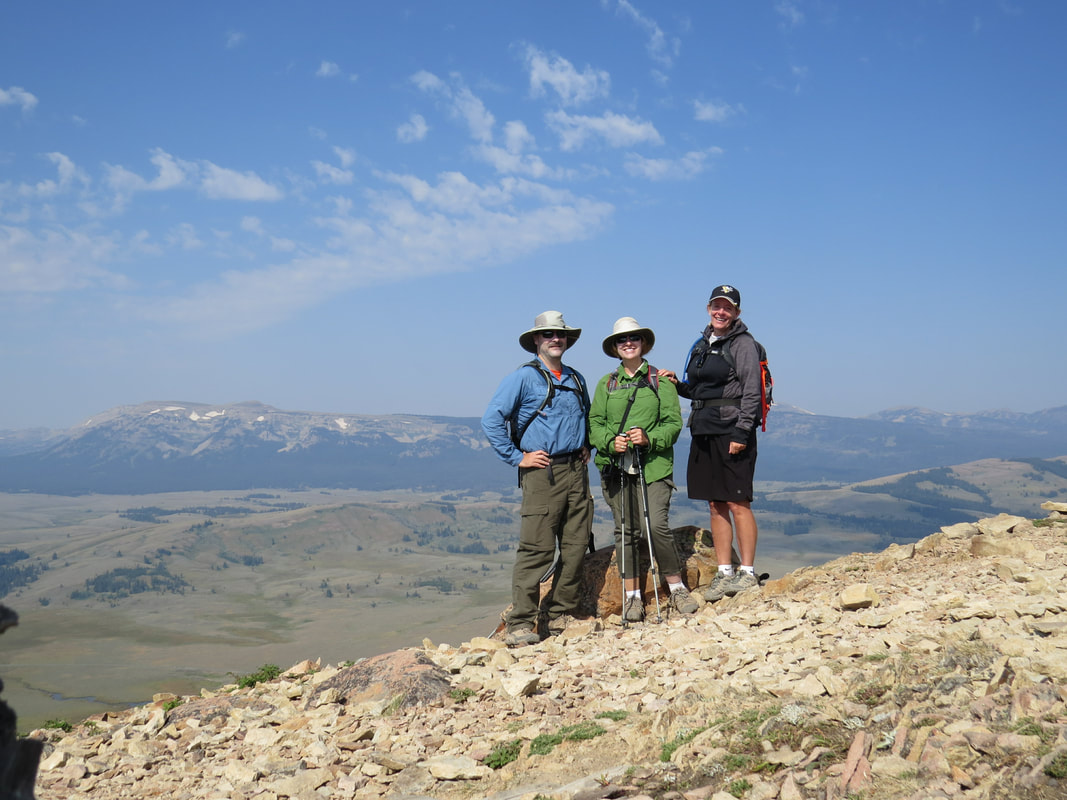
|
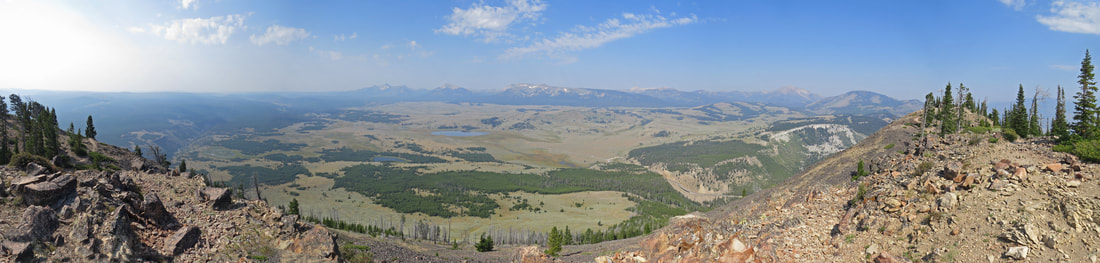
View looking south from the top of Bunsen Peak.
After a few minutes, the Asian ladies and their guide made it to the top. We gave them a wave and congratulated them on reaching the summit, and then decided to start our descent down the backside of the mountain. Lisa and Lynn found the trail and off we went. We walked by concrete foundations for old equipment, probably communication systems of some sort as there were other antenna and related stuff nearby.
The initial part of the trail down the backside of Bunsen Peak is pretty easy and works through burnt out trees. The bleached-out, silver and grey trunks are a stark reminder of what used to be. Those dead hulks that remain standing make for interesting images. Tommy would like this. But even though the big trees are dead there is plenty of life here. Stands a wildflowers attract the butterflies. Scattered bird sightings, most listed as gone birds but I got a few photos for identifying these guys. One was a Yellow-rumped Warbler. We also spotted another grouse as we were transitioning from the old burnt area back into the pine forest.
The initial part of the trail down the backside of Bunsen Peak is pretty easy and works through burnt out trees. The bleached-out, silver and grey trunks are a stark reminder of what used to be. Those dead hulks that remain standing make for interesting images. Tommy would like this. But even though the big trees are dead there is plenty of life here. Stands a wildflowers attract the butterflies. Scattered bird sightings, most listed as gone birds but I got a few photos for identifying these guys. One was a Yellow-rumped Warbler. We also spotted another grouse as we were transitioning from the old burnt area back into the pine forest.
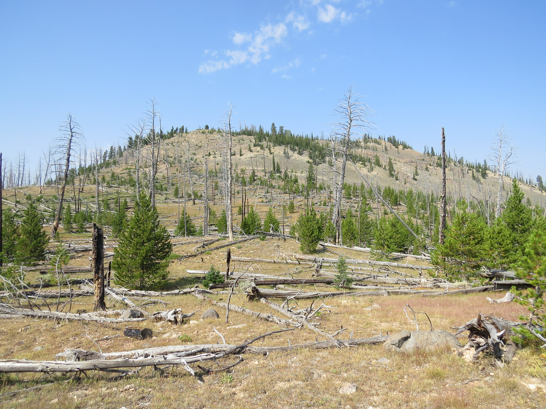
Looking back up at Bunsen Peak through the burnt out forest during the hike down.
|
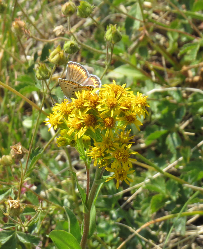
Mellissa Blue butterfly
|
As we exited the burnt forest and got back into the living pines, the character of the trail became much difficult, just as the Hike734 map indicated. Steeper with some downed trees to negotiate. There were one or two minor scrambles other the downed logs and along short but very steep sections of the trail. Hands were needed in a couple spots to safely make it down. Fortunately this was not an exceptionally long stretch and we were soon out in the open slope along the base of the mountain. Our next goal, the old dirt road was now in sight below us. Once out of that steep section there were a couple of long, gradual switchbacks that brought to the intersection with the old road above Osprey Falls.
The walk along the dirt road was basically just an easy stroll. We were out in the open as the road is completely exposed, and while we were walking under a clear blue sky the conditions at present were quite pleasant. This section of the road was wide and level. Lisa was in front and Lynn and I were following, waking side-by-side. We were just enjoying the scenery and looking for animals. Just after getting on the road, Lynn spotted a small furry varmint along the edge of the woods in a jumble of logs. She speculated that it was a Pine Martin. Maybe there was but all I could find with the longer zoom of the SX50 was a squirrel. Perhaps her critter radar was not exactly calibrated on that sighting, but she soon had another view that was cause for excitement. Lynn spotted a good-sized, brown furry creature scurrying along the road maybe 50 yards ahead of us. Too far to tell what it was so I again used the camera to try and at least get an image that we could use for an identification. First thought was a marmot, but seemed larger and had longer legs, and it was pretty fast. Could it be? We watched until it was out of sight. I had taken several photos, all long-range so not great and the critter was small in the frame, but upon closer inspection it seemed that we had seen our first badger. How's that for a great sighting. Sure, it was from a distance and mostly a butt shot, nor did we get any wall-worthy photos, but we saw one. Very cool.
The walk along the dirt road was basically just an easy stroll. We were out in the open as the road is completely exposed, and while we were walking under a clear blue sky the conditions at present were quite pleasant. This section of the road was wide and level. Lisa was in front and Lynn and I were following, waking side-by-side. We were just enjoying the scenery and looking for animals. Just after getting on the road, Lynn spotted a small furry varmint along the edge of the woods in a jumble of logs. She speculated that it was a Pine Martin. Maybe there was but all I could find with the longer zoom of the SX50 was a squirrel. Perhaps her critter radar was not exactly calibrated on that sighting, but she soon had another view that was cause for excitement. Lynn spotted a good-sized, brown furry creature scurrying along the road maybe 50 yards ahead of us. Too far to tell what it was so I again used the camera to try and at least get an image that we could use for an identification. First thought was a marmot, but seemed larger and had longer legs, and it was pretty fast. Could it be? We watched until it was out of sight. I had taken several photos, all long-range so not great and the critter was small in the frame, but upon closer inspection it seemed that we had seen our first badger. How's that for a great sighting. Sure, it was from a distance and mostly a butt shot, nor did we get any wall-worthy photos, but we saw one. Very cool.
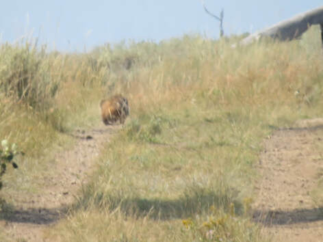 Badger butt running away from us on the road back to the trailhead.
As the road arched around back toward the trailhead we got a nice view into the Gardner River gorge. The river was about 400 feet below us as we peered down from the trail. We paused here for a few minutes to take in this very pretty view. There were a couple hawks circling slowly above the river. Too high for a good photo but I took a shot any way so that I might try to identify it later. Several bands on its tail and sort of a broad wing platform. Best I could figure was a Swainson's Hawk, but that is just a guess.
As we continued on around the road, there were plenty of chartreuse butterflies on the flowering shrubs along the trail, none of which would light long enough to get a good look at much less a portrait. I'd pause each time I saw one, just to see if I could get a lucky shot, but it just never worked out. Lynn called me Fluffi as I was chasing the butterflies, a reference back to our first trip to Utah in 2007 when one of little barn cats went missing right before the trip, but I found her the on our travel day, out chasing butterflies in the yard by the barn.
As we continued on around the road, there were plenty of chartreuse butterflies on the flowering shrubs along the trail, none of which would light long enough to get a good look at much less a portrait. I'd pause each time I saw one, just to see if I could get a lucky shot, but it just never worked out. Lynn called me Fluffi as I was chasing the butterflies, a reference back to our first trip to Utah in 2007 when one of little barn cats went missing right before the trip, but I found her the on our travel day, out chasing butterflies in the yard by the barn.
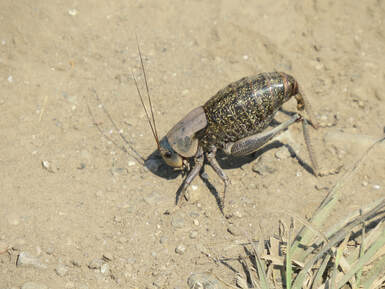 Mormon Cricket
While the butterflies were not cooperative, there was another insect that did not mind posing for a picture. We just were not sure what the heck it was. Other than freaking grande! Lynn described it as a huge cricket with a stinger and opted to give it a wide berth. Well, it was not moving very fast, in fact, not much at all, so I studied it a bit more. Yeah, big cricket or grasshopper or locust. I guess this is our trip for odd bugs on dirt roads with this guy and the hawkmoth caterpillar yesterday at Slough Creek. I did finally figure out what the big bug was; a quick Google search once I found some connectivity showed that it was a Mormon cricket.
There was a lot less traffic on the trail than I anticipated. Only the eleven folks on the trail as we were going up to the top of Bunsen Peak and after leaving the peak we had the trail to ourselves until nearly back to the trailhead. We might have met another dozen or so on the road going to Osprey falls but most of those were very near the trailhead, so they were just getting started with their hikes. First was mom and kid on bike; she was really struggling and did seemed to be rethinking her choice of making this ride. But she kept after it. Only one pair of uber hikers, probably heading for Osprey Falls then a couple larger family units in meander mode just getting on the trail. The little parking lot was pretty full by the time we returned.
There was a lot less traffic on the trail than I anticipated. Only the eleven folks on the trail as we were going up to the top of Bunsen Peak and after leaving the peak we had the trail to ourselves until nearly back to the trailhead. We might have met another dozen or so on the road going to Osprey falls but most of those were very near the trailhead, so they were just getting started with their hikes. First was mom and kid on bike; she was really struggling and did seemed to be rethinking her choice of making this ride. But she kept after it. Only one pair of uber hikers, probably heading for Osprey Falls then a couple larger family units in meander mode just getting on the trail. The little parking lot was pretty full by the time we returned.
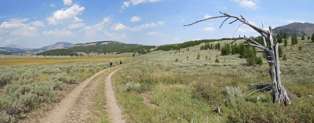
The temperature had risen to 82 F by the time we were back at the truck. Dry, dusty and very warm. Time to crank the A/C once I got the car started. Alas, Mammoth was again swarming with tourists, so no place to park for ice cream, so we just cruised on through. We also opted out of a return drive along Blacktail Plateau. Instead we just continued back to Roosevelt, enjoying the scenery and looking for critters along the main road. Our conversation meandered from a recap of the hike and counting the critter sightings to sort of a stream of consciousness dialog of miscellaneous topics. For example, did the old folks in the family drive? Seems that most of the men did but many of the women did not. How about who learned to drive on a standard transmission? I did, Ford F-100 "three on the tree." Lynn did not but figured it out later when she got her first car. Now all she wants is a manual transmission. Lisa never did it seems, she stick with automatics. This is the nonsense we need to discuss on the trail just to make noise. The only other item of interest that gave us something to talk about on the drive back to Roosevelt was the jackass who passed us along the road east of Mammoth. C'mon dude, this ain't a race, I'm going the speed limit and while the visibility along that section of road was good enough to see the oncoming traffic any higher speeds are just asking for trouble due to the potential for wildlife darting out into harm's way. And the wildlife here is big, so colliding with a bison or elk would be a bad scene for all involved. Karma was in play today as he did not get anywhere once he got around me as there were more and slower traffic ahead. Me? I'm on vacation and in no hurry at all.
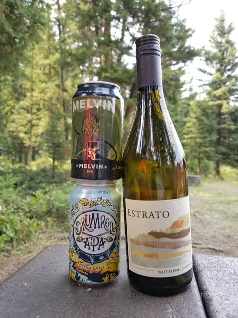
|
Anyway, we were back at Roosevelt at 2:15. Beer in hand by 2:35, out in the shade by the creek. I started with a Drumroll APA from O'Dell. Decent beer, sort of dry. Give it 3.75. I followed with a Melvin IPA, now a "go-to" beer when out west. The girls had a chardonnay of some sort. Quiet here today, so a good time to unwind from our hike. Of course we tallied the critter sightings. In additional to several gone birds and butterflies that would not hold still, we complied a pretty good list:
|
A sidebar on our critter sightings was what kind of deer are we seeing? Some are mule deer, recognizable by their long ears, like a mule's, thus the name. But we were going back and forth on white-tail or black-tail deer. I think I finally figured this out once I got back home with internet service. The answer is white-tailed deer. Seems that Black-tailed deer are only found along the Pacific Coast from Oregon into Alaska. Also, the species list that I found on the NPS website only lists white-tailed and mule deer as present in Yellowstone.
We reviewed the Yellowstone and Grand Teton maps to get our plan in order for the next day or two. Tomorrow we will get on the road to Lamar Valley early, but just after 0700....as soon as Lynn gets her coffee. Breakfast at Roosevelt afterward then pack-up and head to the VRBO cabin followed by dinner and a supply run in Jackson. Obviously a great opportunity for a return to the Merry Piglets. Priority for Grand Teton hiking is Cascade Canyon. We will figure out trails for the other days as we go, but top options are Amphitheater Lake, Death Canyon and Phelps Lake.
The girls left to clean up while I finished my beer. I watched an aspiring Steven Spielberg creating a video of the family vacation. Grandpa was his primary subject. I'm betting this was some sort of school project. But he had a script and was doing multiple takes to get the shot he wanted. Plus they seemed to be having fun. Hey, it's all about making memories.
I finished my beer and headed back to cabin about 4:30. Once we were all spiffy and clean it was time for dinner. I was counting on a little porch time first but there was no one in the dining room so we were seated immediately. Ok, that will work. We can always relax on the porch after dinner. I had to laugh at the idiot kids at the next table; actually I was shaking my head in disbelief. Seems they did not like the New York Strip they ordered because it was not the same as what they had yesterday at another restaurant in the park. Really? We'll give them an honorable mention for stupid people tricks for not reading the menu.
Our dinner was again good, but not great. Sort of typical for national park fare. I believe we all had the carnitas (maybe Lisa had a burger as she is not the adventurous diner). While this was supposed to be a southwest-themed dish, it was unfortunately a bit bland and a kind of dry. I need a jar of Mrs. Renfro's habanero salsa.
After dinner we sat on the porch for a short spell while Lisa browsed the gift shop. How about a drive out through the Lamar Valley? Lynn was too tired. We will just wait for the morning. We opted to call it a night, but it is only 6:30. I grabbed my book from the cabin and returned to the porch. The chapter on death from exposure and avalanches ended on a particularly tragic note. I feel I need a plaid shirt.
You know, Death in Yellowstone should be required reading for all park visitors, along with some basic tips on common sense and good manners.
At 7:30 there was an abrupt shift in the weather. The temperature dropped noticeably and quickly and the wind picked up. Feels like a storm brewing. Black clouds were rolling in from the west. Time to get back to the cabin. Foiled again on the starry night sky it seems. Lynn was already asleep when I walked in. I went ahead and got ready for bed as well. 7:48 and the first roll of thunder rumbled through.
Another great day in Yellowstone; here are the photographic highlights.
Day 6, Tuesday, Augusts 14 - Transition to the Tetons. I was up by 0600 and the girls were not far behind. We were loaded up and driving out at 0655, making a quick stop for coffee then on to the Lamar Valley. We had a little rain last night but were now are under clear skies with pleasant conditions this morning, albeit a bit chilly at 45 F.

There was tons of activity almost from the moment we passed through Tower Junction, both natural and tourist. Our first critter sighting was a lone bison bull ambling across the Yellowstone River Bridge. He was heading toward Tower Junction in the west bound lane, holding up a car or two. The critters have certainly figured out that the paved roads are the way to get around the park. He seemed to be staggering a bit; maybe he had a rough night. I paused before driving onto the bridge to let the big guy pass in peace.
As we approached the access road to Slough Creek, we could see cars stacked up along both sides of the road and a horde of folks spread out all around the area. As we slowed and carefully approached the area it was apparent there was a major critter event in progress as this was an extremely chaotic animal jam. There were dozens of cars parked along the road and in the rest area parking area at the Slough Creek campground access road intersection. Several of the cars parked along either side of the road were partially in the road reducing the width of both lanes, which was both annoying and very hazardous. There were a lot of spotting scopes set up in several locations on both sides of the road plus more out further in the field to the south. All the optics were looking in the same direction, off to some point to the south. There were eyes glued to each scope plus another half dozen folks standing around each one waiting to glimpse whatever is happening. There were tourists meandering in the road, creating a bad safety situation. I was crawling along the road as folks darted out in front, looking for a better view but not watching where they were going. We were down to one-way traffic due to the haphazard manner in which the vehicles were stacked along the road, so I was force to take my half in the middle. Fortunately there was no on-coming traffic just at the moment. I was concentrating on navigating the jam, but Lynn took advantage of the opportunity, rolled down her window and asked one of the bystanders what was in view. Turns out there were bears and wolves feeding on a bison carcass. Well that is certainly deserving of all the excitement. But with the number of cars and people already lining the road, we figured it was best just to roll on through even if there was a place to park, which there wasn't. No sense in adding to the mayhem. Once through the jam, I found a deserted wide spot a couple hundred yards down the road. We actually had higher ground, but we could not see the critters. Probably behind a hill from this angle. Oh, well, it was worth a shot. We continued eastward.
So I wonder what happened since we were here two days ago. What brought the bison down and when did it happen? There was a vast herd in the area when we were out here for the Slough Creek hike but otherwise all was quiet and serene. Did a bull get gored while sparing with a rival? Maybe one got hit on the road. Perhaps a wolf pack took down a weaker member of the herd. Hard to say. It is interesting how quickly conditions change.
We cruised east through the valley just enjoying the scenery and watching for wildlife. Plenty of other tourists out doing the same thing. The speed limit through Lamar Valley was reduced to 35 MPH. The signage was all official but looked temporary, sort of heavy cardboard signs taped over the metal, permanent signs. Slower is better through this corridor in my opinion. Too many critters and people scurrying about to go any faster. Of course not everyone concurs with that position. One jackass in a pickup zipped around me. No idea why he was in such a hurry, as we saw him pulled into one of the overlooks less than a mile down the road. Just a few seconds after he passed, a coyote ran out in the road in front of us. Since I was watching and going the speed limit there was no danger of hitting him, but it just shows that you have to pay attention.
There were bison scattered throughout the valley below the road as well as on the gentle slope above us. They stretched nearly to Soda Butte. We spotted a few pronghorn scattered about among the bison as well. There were a few folks with spotting scopes at most of the viewpoints but no one seemed to be gazing intently at anything so we guessed there were no really extraordinary sightings. That seems odd as the bison herd stretching as far as I could see is a pretty extraordinary vision. In addition to the critter viewers like us, there were several fishermen casting for trout in the Yellowstone. They were again sharing the river with the bison, but both man and beast seemed content to leave the other in peace.
Lynn wanted to go at least to Baronette Peak to see if we could spot mountain goats. We had seen a few here when we took our Yellow Bus tour in 2011. Pretty quiet here today, just one outfitter tour van loading up when we pulled in. We got out to take a look, Lynn scanning with the binoculars and me with the camera. She saw several little white spots on the mountain side and I zoomed in with the SX50. We were just too far away to state definitely what we were seeing, but we were leaning toward just snow patches. However, after studying the images on my laptop post-trip at least one of the white spots was indeed a Mountain Goat. Duly added to the daily critter count.
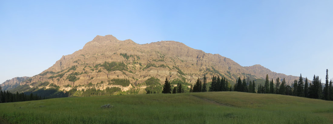
Baronette Peak
We turned around at Baronette Peak and retraced our route through the valley, again just taking it all in as we cruised through. Bison all over, from the solitary bulls lounging in their wallows to the herds of 100s. The animal jam at the Slough Creek intersection was not as frenetic but it was still packed. Maybe the activity around the carcass had subsided as several of the scopes were now pointing in other directions and most of the scopes were not in use when we crept through. Still too crowded to stop and we just did not want to add to the chaos. Lisa in particular did not want to deal with the crowd.
We only made one stop on the return drive, at a little pond and marshy area west of the Slough Creek jam. This was just sort of a pretty view and there were a few birds out on the pond. Besides, I had taken relatively few photos and wanted to get a shot of the "bison rocks," those big chunks of stone that are scattered across the valley and at a quick glance sort of look like the members of the bison herd. Of course it was not too long before a real bison herd ambled into view which is always a bonus. I think the birds we spotted in the pond were coots, but there was also a flock of black songbirds with bright yellow markings. They were in the reedy grass at the west end of the pond, so very tough to see much less to photograph. They were flitting about but when they lit back on the tall grass they sank out of sight so all I could manage were a few long-range, blurry shots. But those were enough to identify these little guys as Yellow-headed Blackbirds. That's a new one for our list.
We only made one stop on the return drive, at a little pond and marshy area west of the Slough Creek jam. This was just sort of a pretty view and there were a few birds out on the pond. Besides, I had taken relatively few photos and wanted to get a shot of the "bison rocks," those big chunks of stone that are scattered across the valley and at a quick glance sort of look like the members of the bison herd. Of course it was not too long before a real bison herd ambled into view which is always a bonus. I think the birds we spotted in the pond were coots, but there was also a flock of black songbirds with bright yellow markings. They were in the reedy grass at the west end of the pond, so very tough to see much less to photograph. They were flitting about but when they lit back on the tall grass they sank out of sight so all I could manage were a few long-range, blurry shots. But those were enough to identify these little guys as Yellow-headed Blackbirds. That's a new one for our list.
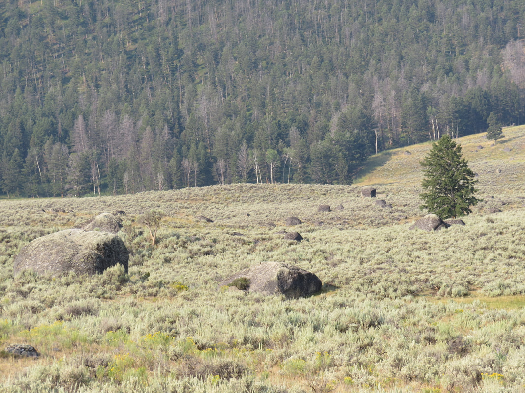
|
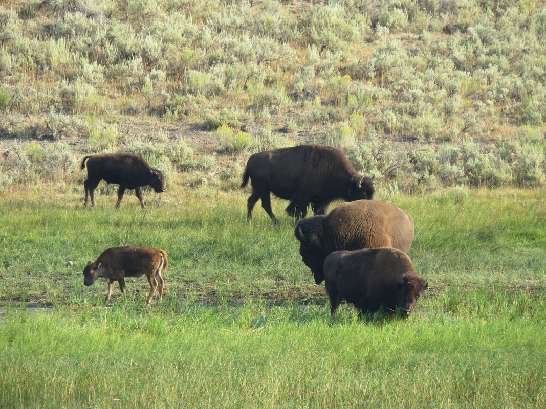
|
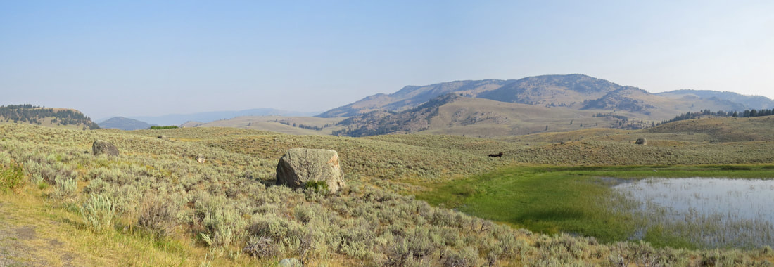
That was a pretty quick trip into the Lamar Valley and we were back at Roosevelt at 9:05. The Bison were now out here, just across the main road from the horse stable. We ditched the Explorer and our gear at the cabins then it was off to breakfast. I reckon a lot of other folks had the same idea as we had just a short wait on the porch. The warm rays from old Sol feel good on my legs but I was grateful for the extra layer as my upper body was in the shade. Ah, yes, shorts and sweatshirt weather, my favorite. We had gained only a few degrees on the thermometer by the time we returned (52 F) and unfortunately the haze was again becoming apparent.
Once settled in at our table by the front window we made a quick study of the menu. My mind was already made up as Lynn had been talking about pancakes. I'll go with a tall stack of pecan cakes. Holy socks, I should have brought a couple more friends to breakfast. That was a monster stack! I should have asked the server about the size, but heck, this is vacation and we still have many miles to hike. Plus it was very tasty. While I could not finish it, I did make a considerable dent in the stack.
Once settled in at our table by the front window we made a quick study of the menu. My mind was already made up as Lynn had been talking about pancakes. I'll go with a tall stack of pecan cakes. Holy socks, I should have brought a couple more friends to breakfast. That was a monster stack! I should have asked the server about the size, but heck, this is vacation and we still have many miles to hike. Plus it was very tasty. While I could not finish it, I did make a considerable dent in the stack.
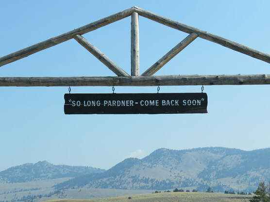 Another great stay at Roosevelt Lodge has come to an end.
We waddled back to the cabins to pack. No rush as we are not hiking today, just making the drive to Grand Teton. We were loaded up, checked-out and on the road by about 11:00. We continued clockwise around the park loop with no definitive plan. We ended up mostly just enjoying the drive with not many stops and just a few detours. Here are the highlights:
- The winding drive leading up to Dunraven Pass was pretty, but without the vast blanket of wildflowers that lined the road during our 2014 visit. The views off to the west were nice but muted due to the haze.
- Lynn and I figured that we should risk the crowd and show Lisa the view from Artist Point along the South Rim of the Grand Canyon of the Yellowstone. The Uncle Tom's area is closed, not that we were going there. Looks like this entire area is being rebuilt. It was indeed packed at Artist's Point but we found a parking spot after a short wait. We parked at the far end of the lot from Artist Point so we had a bit of a walk, but the stretch of the legs was very much appreciated. As we walked along the lot we saw vehicles of all types sporting license plates from all over. Lots of big coaches and tour buses. And plenty of people. This is a favorite area but too many tourists today. Lots of selfie-taking Asians, but if that's what they want to remember the trip that is fine by me. Just take the pic and let someone else have a turn. I reckon the Lower Falls does make an impressive backdrop for a self-portrait. We took in the view, and managed to snap a photo or two without someone else's arm or hat in the frame. This really is a beautiful view. The colors in the canyon walls are lovely. And even without the rainbow at the base of the falls it is a magnificent sight.
- Continuing south, our next detour was a drive across Fishing Bridge. This was another construction area, so we just looped through the visitor center parking lot and headed back to the main road.
- We made a quick tour of Lake Hotel which provides a significant contrast with most of the classic National Park lodges with its bright yellow siding and white trim. Of course we stopped in the gift shop where I bought a tee-shirt made from recycled plastic bottles. There were 6.5 bottles used to make each shirt. Surprisingly soft material.
|
From Lake Hotel we just cruised south through the park, along the east side of Yellowstone Lake and on out through the south exit. That completes our adventures in Yellowstone for 2018, but we still have plenty to see and do in Grand Teton National Park. And that’s where we are heading next. Part two of the journal has all the details.
|
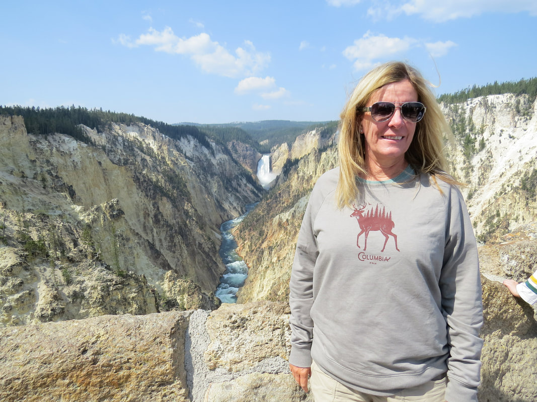
Lisa at Artist Point
|