Trip Journal: UTAH Meet-up 2018 - Torrey, Utah
Wednesday, October 3rd - Saturday, October 13th, 2018
Part 1: The UTAH Meet-up in Torrey (October 3 through 7).
Part 2: Lynn and me exploring Capitol Reef (October 8 through 13)
Introduction. Sometimes deciding the location for the annual meet-up takes a little effort; a bit of discussion, a few Doodle polls maybe some compromise. Nothing major, just the standard herding of the cats. Not so for setting the 2018 UTAH meet-up site. We decided on the location while we were still in Page for the 2017 gathering. We will converge on Torrey, Utah, in 2018. Some of the Herd had met in Torrey over the Fourth of July in 2011, sort of a mini-meet-up following our initial group event in Bluff the previous fall. Since most of the current gang was not at the summer meet-up in Torrey (Lynn and I were not) and a lot of us had not explored Torrey and Capitol Reef National Park in great detail, this was an easy sell. OK, destination set. We did hold off on determining the dates. In early December, Danny called and we chatted about options, whittling the choices down to either the first or second week of October, then I set up a Doodle poll to get input from everyone. Lynn and I discussed options over dinner at Lagerheads. Since we are locked in on San Diego at the end of October for our 30th anniversary trip, the first weekend of October would be better for us for the meet-up and I voted accordingly. The good news for us was that the rest of the Herd concurred on the first weekend; it was basically unanimous. The primary points for the 2018 meet-up are locked in, Torrey during the first weekend in October, Friday the 5th through Monday the 8th. Now that the dates are in place, Danny can issue the official invitation on Trip Advisor and the detailed planning for our ninth annual fall meet-up can begin.
So who is this Herd and what is UTAH? Good questions. We are a group of friends who came together through Trip Advisor over our mutual love for the desert southwest. A diverse group but with that common theme that has brought us together each year since 2010. We pick some place interesting within the Grand Circle and convene there for a weekend of exploring, learning, laughing, eating and drinking (we like to eat and drink as much as we like to hike!). We are called the Herd because organizing this group is sometimes like herding cats! But this is a great group of folks and everyone pitches to help with the planning and execution of each meet-up. UTAH is our "official" name, the Utah Trip Advisor Herd. DannyS on Trip Advisor gets the credit for bringing the group together as he came up with the idea for the first meet-up and continues to be the instigator for planning these annual events. Following each meet-up, I have created a photobook that contains memories collected from those who attended and as part of the 2014 Green River book I included short history of the Herd and the meet-ups, which I have linked here in case you want to know more about the group. The Herd has grown over the years and we have all become great friends. There are now over 70 names on the Herd roster; some are regulars for the annual meeting and some have only attended once, but all are always welcome.
Let the Planning Begin! Back at Lagerheads, Lynn and I also discussed travel option for getting to Torrey. We figured there were two viable entry points for Torrey, either Grand Junction or Salt Lake City. Drive time for both to Torrey is about 3:15. Neither had direct flights from CLE. At that time (and it was still way early to make flight reservations) airfare was running at $640 to Grand Junction versus $545 to SLC. We boiled the general plan options down to these two:
By mid-January our travel plans for Torrey were coming together. We had been looking at rental house options over the past couple of weeks but there was really nothing that would make a good base for the group. Plus, Lynn and I had decided that we'll just do our post-meet-up add-on in Torrey since we have not explored that area in detail, so a small rental would be perfect for us for the entire time. Since there were no big houses suitable for sharing, we locked our rental house on January 16th. We were also studying the flight options, adding Las Vegas as a possible entry point along with Salt Lake City and Grand Junction. Looking for the option that optimizes flight cost, schedule, rental car cost and drive time. I included Las Vegas as it was the only nearby airport with direct flights from Cleveland, but the additional drive time was a definite negative (about two hours longer one-way compared to either SLC or Grand Junction). The rental car component could make a big swing. The cost for renting from the airport locations in Salt Lake City were outrageous, so I looked offsite. The lowest rate for a mid-size SUV at the airport was $750, but we could get the same vehicle off-site through Hertz for $370. Deal! Even adding in $30 for an Uber to the rental car pick-up we still come out way ahead. OK, I am on a roll, so I checked the airfare options again an found an ideal itinerary on United for well under $400 per person. Sold! I'm a bird-in-the-hand type of guy, and that flight schedule and price fit our requirements so why wait. We'll have a night in Salt Lake City at the beginning and end of the trip based on the flight schedule. I held off on making the SLC hotel reservations until closer to the trip since there were plenty of options (finally securing those rooms in late August). I opted for the Holiday Inn Express in downtown on arrival night to be close to a couple of the brew pubs (options, it is good to have options). I had thought about staying closer to our rental car pick-up location in West Valley City but there were no hotels within walking distance so an Uber ride will be needed anyway; might as well stay near the better restaurants in downtown. For our last night I booked a simple Microtel right by the airport since we have an early return flight.
With all the logistical details in place, the long list of possible activities from Danny's invitation plus some additional ideas on activities from the Herd, we now had a good plan to work to:
Getting ready to get ready. Just a few days to go before we leave for the meet-up. Now that my business travel is over (September was a blur, but the trips were quite successful), it is time to get started on packing for Torrey. Lynn and I reviewed the travel plans over an early dinner at Lagerheads Friday afternoon. Looks like all the details are in place (air, car, lodging and cat sitter). Lynn started getting her gear in order earlier in the week while I was in Tennessee. I got rolling with that task Saturday morning. We also looked at the weather in Torrey while at dinner. Wow! It is going to be cool for the most part. Highs in the 60s (varies from low 60s to near 70) and lows around freezing some nights. Alrighty then, that will take a little rethink on the packing list.
Monday evening we were back at Lagerheads for dinner after the final yardwork chores were completed prior to the trip. The weather looks chilly and perhaps wet in Torrey. Could be the worst weather since Green River. Generally early October is a great time to visit the Grand Circle. In all the trips we have made to the desert southwest over the years we have not had a completely lost day due to weather. A very few days were we had to scramble a bit and rearrange plans but there was always a way to work around whatever Mother Nature threw at us (and that includes 17 years of springtime golf trips to Arizona where we never missed a round of golf, although there was just one day that we had to drive from Phoenix to Tucson to get out of the rain). We did lose a couple folks over the last week; most were on the fence about the meet-up anyway for other reasons so the weather may have been a deciding factor for some. Looks like we will have around 14 cats to herd in Torrey. The fun fact for this evening was while we are just about to leave on one trip we are working details for the next big excursion. I booked the flights for the Alaska cruise set for next summer. That's exciting!
The weather became the wildcard for this trip as the forecast continued to deteriorate as we got closer to the trip. Cold and wet with heavy rains at time and the potential for flash floods. That could make a mess of the trail and certainly limit our options. On Tuesday morning, Danny posted a question on the meet-up Facebook site about possibly canceling the meet-up or moving to a new location. All responses were to stick it out and see what happens. It is raining now (remnants of Typhoon Rosa) and could rain some more over the weekend, and will be cooler for sure. But this group is adaptable. We're going to Torrey. I worked on packing before work on Tuesday, adjusting for the potentially cold and wet weather. My suitcase is stuffed due to bulky clothes. Warm weather packing is generally lighter.
The good news for me was that I finally had an easy last day at work prior to vacation. It seems that often there is a flurry of last minute chaos when I am trying to depart for a trip. But today I simply churned through my task list, had no surprises pop-up and we were heading home on time at 4:00 PM. We thought about pizza and beer at Fatheads but figured we should get home and get on the errands and chores and just finish up some leftovers for dinner. Ended up with a BLT. We finished up the chores and as much of the trip prep as we could. We were chilling with a beer by 8:00, a little late for a porch beer besides it is a bit drizzly. NCIS on the TV and working on the notes from the Yellowstone trip proved to be a nice evening to ease into vacation.
Part 1: The UTAH Meet-up in Torrey (October 3 through 7).
Part 2: Lynn and me exploring Capitol Reef (October 8 through 13)
Introduction. Sometimes deciding the location for the annual meet-up takes a little effort; a bit of discussion, a few Doodle polls maybe some compromise. Nothing major, just the standard herding of the cats. Not so for setting the 2018 UTAH meet-up site. We decided on the location while we were still in Page for the 2017 gathering. We will converge on Torrey, Utah, in 2018. Some of the Herd had met in Torrey over the Fourth of July in 2011, sort of a mini-meet-up following our initial group event in Bluff the previous fall. Since most of the current gang was not at the summer meet-up in Torrey (Lynn and I were not) and a lot of us had not explored Torrey and Capitol Reef National Park in great detail, this was an easy sell. OK, destination set. We did hold off on determining the dates. In early December, Danny called and we chatted about options, whittling the choices down to either the first or second week of October, then I set up a Doodle poll to get input from everyone. Lynn and I discussed options over dinner at Lagerheads. Since we are locked in on San Diego at the end of October for our 30th anniversary trip, the first weekend of October would be better for us for the meet-up and I voted accordingly. The good news for us was that the rest of the Herd concurred on the first weekend; it was basically unanimous. The primary points for the 2018 meet-up are locked in, Torrey during the first weekend in October, Friday the 5th through Monday the 8th. Now that the dates are in place, Danny can issue the official invitation on Trip Advisor and the detailed planning for our ninth annual fall meet-up can begin.
So who is this Herd and what is UTAH? Good questions. We are a group of friends who came together through Trip Advisor over our mutual love for the desert southwest. A diverse group but with that common theme that has brought us together each year since 2010. We pick some place interesting within the Grand Circle and convene there for a weekend of exploring, learning, laughing, eating and drinking (we like to eat and drink as much as we like to hike!). We are called the Herd because organizing this group is sometimes like herding cats! But this is a great group of folks and everyone pitches to help with the planning and execution of each meet-up. UTAH is our "official" name, the Utah Trip Advisor Herd. DannyS on Trip Advisor gets the credit for bringing the group together as he came up with the idea for the first meet-up and continues to be the instigator for planning these annual events. Following each meet-up, I have created a photobook that contains memories collected from those who attended and as part of the 2014 Green River book I included short history of the Herd and the meet-ups, which I have linked here in case you want to know more about the group. The Herd has grown over the years and we have all become great friends. There are now over 70 names on the Herd roster; some are regulars for the annual meeting and some have only attended once, but all are always welcome.
Let the Planning Begin! Back at Lagerheads, Lynn and I also discussed travel option for getting to Torrey. We figured there were two viable entry points for Torrey, either Grand Junction or Salt Lake City. Drive time for both to Torrey is about 3:15. Neither had direct flights from CLE. At that time (and it was still way early to make flight reservations) airfare was running at $640 to Grand Junction versus $545 to SLC. We boiled the general plan options down to these two:
- Fly into Grand Junction, stay a night there, head to Torrey for the meet-up, followed by a few days in Moab and back out of GJT.
- Fly into SLC, stay the first night there (depending on arrival time), then drive down to Torrey for the meet-up and add on a few days in Torrey since we have not explored around there that much. Thinking is that we'll probably have our meet-up activities outside the park, but we can explore the park during the extra time. With a late morning or early afternoon departure out of SLC we can just drive directly from Torrey, otherwise we might have to spend a night near the airport at the end of the trip.
By mid-January our travel plans for Torrey were coming together. We had been looking at rental house options over the past couple of weeks but there was really nothing that would make a good base for the group. Plus, Lynn and I had decided that we'll just do our post-meet-up add-on in Torrey since we have not explored that area in detail, so a small rental would be perfect for us for the entire time. Since there were no big houses suitable for sharing, we locked our rental house on January 16th. We were also studying the flight options, adding Las Vegas as a possible entry point along with Salt Lake City and Grand Junction. Looking for the option that optimizes flight cost, schedule, rental car cost and drive time. I included Las Vegas as it was the only nearby airport with direct flights from Cleveland, but the additional drive time was a definite negative (about two hours longer one-way compared to either SLC or Grand Junction). The rental car component could make a big swing. The cost for renting from the airport locations in Salt Lake City were outrageous, so I looked offsite. The lowest rate for a mid-size SUV at the airport was $750, but we could get the same vehicle off-site through Hertz for $370. Deal! Even adding in $30 for an Uber to the rental car pick-up we still come out way ahead. OK, I am on a roll, so I checked the airfare options again an found an ideal itinerary on United for well under $400 per person. Sold! I'm a bird-in-the-hand type of guy, and that flight schedule and price fit our requirements so why wait. We'll have a night in Salt Lake City at the beginning and end of the trip based on the flight schedule. I held off on making the SLC hotel reservations until closer to the trip since there were plenty of options (finally securing those rooms in late August). I opted for the Holiday Inn Express in downtown on arrival night to be close to a couple of the brew pubs (options, it is good to have options). I had thought about staying closer to our rental car pick-up location in West Valley City but there were no hotels within walking distance so an Uber ride will be needed anyway; might as well stay near the better restaurants in downtown. For our last night I booked a simple Microtel right by the airport since we have an early return flight.
With all the logistical details in place, the long list of possible activities from Danny's invitation plus some additional ideas on activities from the Herd, we now had a good plan to work to:
- Day 1, Wednesday, 3 October - Travel Day. Lynn and I get into SLC about 5:00 PM. We’ll get an Uber to our hotel downtown then walk to dinner (the Holiday Inn Express Downtown is a block from Red Rock Brewing and Squatters Pub).
- Day 2, Thursday, 4 October - Moving to Torrey. I'll Uber over to the Hertz offsite location to get the car at 0800. We'll just pack up and go with some touring along the way. Check in at the Torrey house is at 3:00, so no rush. Dinner with the Herd.
- Day 3, Friday, 5 October - The Meet-up Begins. Danny is planning for a driving tour along the Notom Road and Burr Trail with a couple short hikes mixed in (Strike Valley Overlook for example). This might be a good night for a cook-out if we can work out the logistics.
- Day 4, Saturday, 6 October - Sulphur Creek Hike. This was a big hit with the Herd during the July, 2011 mini-meet-up so the rest of us would like to try it.
- Day 5, Sunday, 7 October - Hiking with the Herd. Plenty of great hiking options in Capitol Reef. We'll see what is of the most interest to the group.
- Day 6, Monday, 8 October - Last day with the Herd. Perhaps breakfast with the gang before folks leave Torrey, maybe a morning hike as well. We'll figure it out.
- Days 7 through 9, Tuesday, 9 October - Thursday, 11 October - Lynn and me in Torrey. Lynn and I have the next three days to explore Capitol Reef National Park. We'll figure out which trails to hike as we go.
- Day 10, Friday, 12 October - Torrey then back to SLC. Maybe we'll spend the morning in Torrey, or we could get an early start on the drive north so that we can explore SLC a bit. Drop rental car at airport tonight. Hotel near airport (Microtel by Wyndham).
- Day 11, Saturday, 13 October - Going Home. Early flight out of SLC for mid-afternoon arrival in CLE.
Getting ready to get ready. Just a few days to go before we leave for the meet-up. Now that my business travel is over (September was a blur, but the trips were quite successful), it is time to get started on packing for Torrey. Lynn and I reviewed the travel plans over an early dinner at Lagerheads Friday afternoon. Looks like all the details are in place (air, car, lodging and cat sitter). Lynn started getting her gear in order earlier in the week while I was in Tennessee. I got rolling with that task Saturday morning. We also looked at the weather in Torrey while at dinner. Wow! It is going to be cool for the most part. Highs in the 60s (varies from low 60s to near 70) and lows around freezing some nights. Alrighty then, that will take a little rethink on the packing list.
Monday evening we were back at Lagerheads for dinner after the final yardwork chores were completed prior to the trip. The weather looks chilly and perhaps wet in Torrey. Could be the worst weather since Green River. Generally early October is a great time to visit the Grand Circle. In all the trips we have made to the desert southwest over the years we have not had a completely lost day due to weather. A very few days were we had to scramble a bit and rearrange plans but there was always a way to work around whatever Mother Nature threw at us (and that includes 17 years of springtime golf trips to Arizona where we never missed a round of golf, although there was just one day that we had to drive from Phoenix to Tucson to get out of the rain). We did lose a couple folks over the last week; most were on the fence about the meet-up anyway for other reasons so the weather may have been a deciding factor for some. Looks like we will have around 14 cats to herd in Torrey. The fun fact for this evening was while we are just about to leave on one trip we are working details for the next big excursion. I booked the flights for the Alaska cruise set for next summer. That's exciting!
The weather became the wildcard for this trip as the forecast continued to deteriorate as we got closer to the trip. Cold and wet with heavy rains at time and the potential for flash floods. That could make a mess of the trail and certainly limit our options. On Tuesday morning, Danny posted a question on the meet-up Facebook site about possibly canceling the meet-up or moving to a new location. All responses were to stick it out and see what happens. It is raining now (remnants of Typhoon Rosa) and could rain some more over the weekend, and will be cooler for sure. But this group is adaptable. We're going to Torrey. I worked on packing before work on Tuesday, adjusting for the potentially cold and wet weather. My suitcase is stuffed due to bulky clothes. Warm weather packing is generally lighter.
The good news for me was that I finally had an easy last day at work prior to vacation. It seems that often there is a flurry of last minute chaos when I am trying to depart for a trip. But today I simply churned through my task list, had no surprises pop-up and we were heading home on time at 4:00 PM. We thought about pizza and beer at Fatheads but figured we should get home and get on the errands and chores and just finish up some leftovers for dinner. Ended up with a BLT. We finished up the chores and as much of the trip prep as we could. We were chilling with a beer by 8:00, a little late for a porch beer besides it is a bit drizzly. NCIS on the TV and working on the notes from the Yellowstone trip proved to be a nice evening to ease into vacation.
Day 1, Wednesday, October 3, 2018 - Head west, young man. The relaxed theme continues since our flight does not depart until 10:45 this morning, so plenty of time to get ready, take care of the critters and finish the trip prep. Lovely sunrise as I was walking to the barn to tend to Logan, Blue and 'Zona. I know the old adage is red skies at morning, sailors take warning, but I'm the optimistic type and will take the beauty of the morning sky as a good sign. All is well and we were on the road ahead of schedule, rolling down the driveway at 0800 (0830 was the plan). 57 F as we left the ranch. Early is good as we will be parking on Snow Road this morning. The airport has updated their website and now provides the status of the various onsite parking lots. Bummer that our preferred orange lot is full, but that does take the guess work out of the equation. So straight to Park Place. Not having to drive to around the airport to figure out the parking situation does save us a few minutes and the offsite parking is a little less expensive. Plus it is customer appreciation week so we received a free granola bar. Bonus! Smooth transition through check-in and security. TSA Pre Check had a very short line, so we were walking into the book store at 0905, so very expedient.
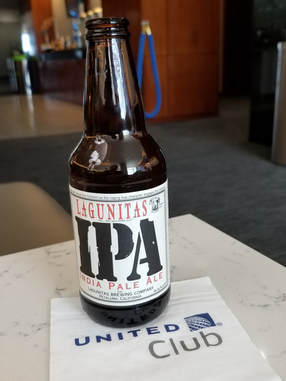
We just hung out at the gate and ate our granola bars. On time departure and no issues with the flight. Why is it I have more leg room on this commuter jet (Canadair CRJ-700) than on a United 737? Early arrival into Denver so even more time to kill. We could not find a restaurant that spoke to us, so we went straight to the United Club (we have free passes that will expire soon so better use them). Turns out that there was plenty of stuff here for a light meal. The green chili and pork soup was very good. Nothing good in the free beer, and the best option for premium was Lagunitas IPA. Only five bucks so not outrageous. But it is the first official vacation beer for this trip. A tap of glasses with Lynn's house Pino Grieco to toast the occasion.
We just hung out at the gate and ate our granola bars. On time departure and no issues with the flight. Why is it I have more leg room on this commuter jet (Canadair CRJ-700) than on a United 737? Early arrival into Denver so even more time to kill. We could not find a restaurant that spoke to us, so we went straight to the United Club (we have free passes that will expire soon so better use them). Turns out that there was plenty of stuff here for a light meal. The green chili and pork soup was very good. Nothing good in the free beer, and the best option for premium was Lagunitas IPA. Only five bucks so not outrageous. But it is the first official vacation beer for this trip. A tap of glasses with Lynn's house Pino Grieco to toast the occasion.
We had about three hours to relax in the lounge, so this was an opportune time to use our passes. Lynn read, I reviewed hiking options in Capitol Reef and we chatted a bit about miscellaneous stuff, like my Denver Random Destination trip idea. The layout of Denver International Airport with its very long terminals sometimes means a long walk between gates. But this also provides an opportunity to see where other folks are flying to. I've made the walk through the terminal many times and usually find a destination or two that sounds interesting and probably more fun than where I am heading. So why not just fly to Denver then pick a random destination that sounds interesting and go to that place? I told Lynn that we should try that some time. Just fly into Denver then scout the options of places to go and grab a flight. Random. Spontaneous. Probably would never work since most flights are packed and last minute flights are expensive, and I like to have some sort of plan, but what the hell, it might work out.
We stayed in the lounge until the last possible minute before heading to our gate. Worked out to nearly perfect timing to the gate as the boarding announcements and pre boarding were underway. We queued up with the boarding group 2 mob then made the long walk to the plane at gate B71. This must be a seasoned group of travelers as we were on the plane in short order and on our way. For some reason I was thinking this was a longer flight, but it is just a short hop to SLC at 400 miles and 1:10 flight time. A bit bumpy as we passed through some weather. Light rain in SLC when we landed, just a sprinkle really. My bag was first off the carousel and Lynn's was not far behind so we were on our way very quickly. I dialed up an Uber and we were off. We chatted with our driver, Ahmed, while he drove us to the Holiday Inn Express downtown. Turns out he's a truck driver full time and just does Uber and Lyft on the side. As a driver, he prefers Uber as it gets him more fares but he thinks Lyft is probably less expensive for the rider. He talked about traveling with his dogs, well one dog goes with him in the truck and the other stays home. Nice guy. And he had us downtown in no time even with having to work around the traffic.
At the HIE just a little after 5:00. Right across the road from the convention center. After ditching our bags in the room, which was very nice, we were off in search of dinner. There were several options scattered about the area, from chains to brew pubs to mom-and-pop places. I had already zeroed in on Squatters Pub or Red Rock Brewing Company, opting for the former based on the variety on both the beer and food menus. With the odd rules in Utah, I always lower my expectations on beer offerings in restaurants. Plus I noted jambalaya as a dinner option, a personal favorite. We'll see what the Utah spin is on the dish. I'm glad we went early as the joint was jumping; maybe we were catching the after work crowd. But we were seated right away and our server was right with us for drink orders. There was nothing on tap that was of interest but they did offer Hop Rising Tropical double IPA in a can; pretty good with a hint of mango. Lynn had the Ghost Rider white IPA. The jambalaya was excellent. It came with a big blackened catfish filet on top. Not the presentation I was expecting but it really worked! Lynn had a wrap. As expected, the food was much better than the beer. Not that the beer was bad, in fact the beer was very good. The food was just better. Makes me miss the Cleveland beer scene. After dinner we walked the rest of the way around the block. Nice area, lots of interesting eateries. If the Salt Palace convention venue is big enough, this would be a great location for an AIAA event.
We were back in the room at 6:30. After a long day of travel we were done. We did a little prep work and planning for tomorrow knowing that we are not in a rush. Looks like we should have a good day for driving tomorrow the decent weather Friday and maybe Saturday in Torrey, then all bets are off. We'll figure it out. We crashed early as it was a long day of travel.
Day 2, Thursday, October 4 - On to Torrey. Early to bed, early to rise. Up at 0430. I moved over to the couch and worked on trip notes and email while waiting on Lynn to stir. Plenty of time to get ready for the day so no need to wake her. Once she was up, we wandering downstairs for breakfast. Decent spread on the breakfast bar, including rolls from Cinnabon. OK, I'm declaring vacation rules and splurging. Fortunately these were small size cinnamon rolls so no sugar overload, just enough to enjoy as a treat.
I got ready for the day and was off to get our rental car. I had found a Hertz location away from the airport that was well under the cost of renting at the airport. This has become the standard mode of operation for us, when it fits the overall schedule. I made the reservation several months ago but checked it recently (late July or early August) along with all the other reservations just to make sure there were no glitches. I should have checked again.
I called up an Uber at 0745. Kent collected me in front of the HIE a few minutes later. He's an outdoor guy and familiar with the parks in southern Utah, so we chatted about our favorite hiking trails. He did not have any specific recommendations for trails in Capitol Reef but did suggest a website, climb-Utah, as a source for ideas. He quickly got me over to the Hertz location in West Valley, just a few minutes after 8:00 so right on time to get my ride. I had picked this location as it gave me the lowest rate on a small SUV and was not too long of a drive from our downtown lodging (I could not find suitable lodging and dining within walking distance of the rental car place). Plus this Hertz was located near a couple car dealers and repair shops so it seemed like it would get a lot of insurance business, even though it looked sort of run down. As Kent approached the place, I could see a lot of activity around the building but also noted that the letters spelling Hertz had been removed, leaving only the faded outlines on the façade. They are either getting ready to paint the building, or I have a problem. As it happens, the guys milling about there were looking at building work including painting. I asked one of the guys if he was here to pick up a car and he informed me that the Hertz site had closed a month or so ago. Hmmm. Bummer. Seems that I was right on both points, the paining and the problem. It would have been nice if someone from Hertz had informed me of that little detail. Well, no sense in getting mad. I have a phone and all the info I need. After a short search I found the contact info for Hertz, fought my way through the automated menus and finally found a person to talk with (that was the hardest and most time consuming part of the process; it is like these companies do NOT want the customer to talk to a real person). The customer service representative was sympathetic to my plight and quickly found my reservation. He said the pick-up location was at the downtown facility. I asked why I was not informed of the change in location. His reply was that the pick-up location change had been requested by the client. Nope, I'm the client and made no such request. Again, no sense in arguing about it. I got the address and phone of the downtown location then called to confirm they had my ride. They did. Next, another Uber. Then I mapped the location of the downtown Hertz facility. Yeah, it was walking distance from our hotel. Well, a bit of a wild goose chase, but I eventually got my vehicle. The agent at the downtown location was very fast and friendly. Once he got the paperwork (actually it was all electronic, done on a tablet) in order, he dashed out to get the car and came back with a freshly washed, white Chevy Equinox. We did the typical damage scan of car; looks to be in excellent shape, just a handful of little dings and scratches around the lower edges. He even pointed out that the satellite radio was engaged, so a little bonus to offset the additional running around this morning. I commented that the car would not be coming home this clean, most likely covered with red dirt and mud. He just chuckled and said that was the usual state of a returned rental car. I did ask him about driving on dirt roads as it is so often stated on Trip Advisor that driving on any dirt road is not allowed by rental car companies. He said that this is NOT the case; no problem driving on maintained dirt roads, just don't go off-road or 4-wheeling in a vehicle not made for that kind of abuse. That’s the same information I have received from other rental car agents I have asked.
Now that the great rental car adventure was complete, I made the short drive back to the hotel. The Holiday Inn Express parking garage is right behind the hotel. They gave me a free parking pass since I would only be there a short time. Turns out it was a very short time. Lynn was ready to go when I got back, so we just grabbed our bags, checked-out, loaded the Equinox and we were on the road going south out of town by 9:40. Shoot, that's earlier than I was expecting but there was no reason to hang out in the hotel room.
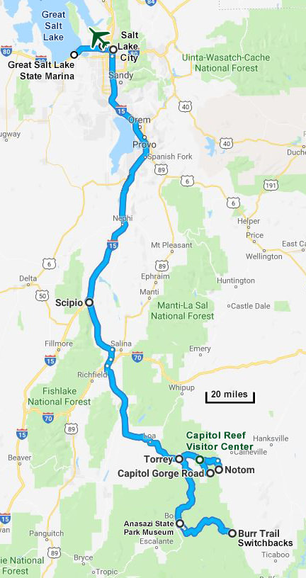
The drive to Torrey is about three hours, but we have about five hours to get there since we can't check in to the house until 3:00. We do have a couple stops to make along the way, so that will help. And there was a time consideration on one of those stops since the state liquor stores do not open until 11:00 AM. I had already done a little searching on the web and found a grocery store and a state store at the far southern end of the urban sprawl. These would be the last of these stores before we left civilization and were about an hour drive away so just perfect for our schedule. Plus the unorthodox driving habits of the folks heading south on I-15 ate up some time as well. There was a fair amount of traffic but not enough to cause any major slow-downs. The annoying thing was that there were so many cars driving in the inside lane but traveling 5 to 10 MPH under the speed limit. Ohio drivers seem to have a bad reputation for this habit but the folks in Salt Lake City are clearly the champions at this maneuver. But that was really the only downside to the drive. Weather was cool and overcast but no rain, which made for easy driving conditions. We just enjoyed the scenery, particularly the mountains that surrounded the area. There was snow along the crests that we could see but for the most part the peak and ridgelines were obscured as the clouds were draped across the mountain tops. I noted a few software related companies along the drive, including a very interesting looking structure that houses Adobe. It took us a while to actually get out of the urban sprawl, which lead us to speculate that the Salt Lake City area might be bigger than Cleveland, but I think that is a bit misleading as the map indicates that most of the size of the SLC area is south of downtown, the direction we are traveling. As it happens, a quick Google search produced a list of the largest urban areas in the US; the Cleveland-Akron-Canton area was 26th, just over 2 million people, while Salt Lake City (including Provo and Oren) was 48th at 1.2 million folks, according to the 2010 census.
We stopped at the Smith's in Springvale for groceries about 10:30 or so. This is a big place so it had just about everything we were looking for, but it took us a while to find it all. That's the problem with a foreign grocery store; you are used to how your hometown store is organized so shopping in a different store is just sort of a huge game of hide-and-seek and never seems to make sense compared to what you are used to. But we eventually found everything we wanted, although we deferred buying milk and juice until we were closer to Torrey as those items would take up too much space in our small cooler. Smith's did have a decent selection of beer, much better than I would have expected, but it was all 4% ABV or lowered. OK, time to find the state store for some good beer. Our timing was perfect as it was now right at 11:00 AM. I topped off the fuel in the Equinox then we backtracked one exit to the state store. So it does add one more stop to the trip having to buy beer and wine at the liquor store, but I guess I'm just used to Ohio where we can buy the high octane brews at the grocery store. And while the bigger stores back home do offer single beer purchase and build your own six-packs, we are at the mercy of the stores to stock the shelves with the single cans and bottles. The Utah state liquor stores just let you break up the six-packs at your own discretion so you can buy what you want in whatever quantity you want. That is perfect for folks who like to try a variety of beers. While Lynn went in search of a bottle of wine, I went into "kid in the candy shop" mode. I reckon I bought the equivalent of a case including a six-pack of Pinner but the rest were all by ones and twos. That should be enough to get us started and share with the rest of the Herd. I had already found that there is a small state store not far from Torrey in Bicknell, in case we needed to restock before the end of the trip.
We were done with our shopping and back on the road at 11:35. I think we spent more time in the state store than the grocery store. That's not really surprising. From this point south the surroundings went from urban to rural with cows and hay fields being the primary scenery. I explained Laura's "those cows are mine" driving game to Lynn, including the Amish version (thine cows art mine), but Lynn did not like that the sighting of a cemetery meant that you could kill all of the other player's cows. OK, we won't play that game. Instead we just watched for wildlife, which is our usual driving pastime. Unfortunately there was not much to see along the Interstate. We took a break when we exited I-15 at route 50, having a snack (we bought some deli sandwiches at Smith's) and feeding the Equinox as well. We pulled into the first place we came to, a Dairy Queen-convenience store-gas station adjacent to a petting zoo. Sort of one-stop shopping for the average tourist. A busy place but room enough for us to find a parking spot and have our sandwiches. While there, I bought a couple candy bars for dessert. While I was inside, Lynn spotted an orange tabby cat. Fortunately it was under an immobilized truck and out of harm’s way so there was no worry of Lynn adopting it. This was quite the bustling crossroads as the gas pumps were packed with all manner of vehicles. The first place we stopped at was such a madhouse around the pumps that I drove to the Texaco for gas since it had a lot more room to maneuver and fewer cars to deal with. Once we fueled up and exited the little berg of Scipio the traffic dropped to near zero as we continued south along route 50.
Our path was route 50 to 260 and finally 24. We went through a series of small to tiny towns, at least a couple of which seemed to have more horses than people living within their city limits. We had left the mountains behind and were now driving through wide valleys that seemed to be made for ranching based on the number of cattle and amount of hay. Looks like beef operations as most of the cattle are Angus, although there were herds of those "Oreo cows" as well. We figured the Angus must just be double chocolate Oreo cows.
While we saw a lot of farm critters once off the Interstate there still was not much in the way of wildlife. Back where we stopped for lunch there were plenty of House Sparrows and a few Ravens but since then there have been a few Magpies and a couple hawks, one with long narrow wings and a short tail and the other with a long tail.
We knew we were getting close when we reached Loa. There's the grocery store for future reference, but we only need milk and juice so a convenience store will do. We did not see one in Loa. Or Bicknell. Saw the state store, again good for future reference, but that does not help us with milk. I guess we should have stopped in Loa.
We rolled into Torrey just before 3:00 and made a quick stop at Austin's Chuck Wagon general store for milk and juice. Now we're good on groceries. We were at the rental house at 3:01. I love it when a plan comes together. Well, except that the entry code for the front door did not work. But there is signal for the cell phone so I called the owners. Martin answered and gave me the back-up code. Success! Unpacked and semi-organized, we were out on the back porch, beer in hand at 3:20. Ahhhhh…. A little time to chill before the meet-up begins. Nice view from the back porch. Lynn spotted one of the local citizens sunning himself next to the house, a fat little lizard. Sunny but brisk and a bit windy. Perfectly acceptable.
|
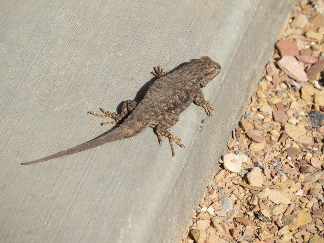
One of our neighbors.
|
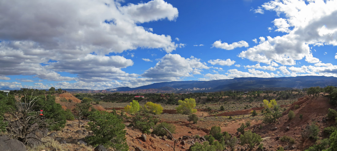
View from the back porch of our rental house.
Danny called about 3:30. I invited him and Norma over for a pre-happy-hour drink. Turns out that they found Rob staying at the same hotel (Austin's Chuck Wagon), so they brought him along. Nice time out on the back porch just chatting and working out the details for the weekend. There will be weather issues to work around as it is predicted to be cold and probably wet. It is cold right now, but we can deal with that; hopefully the wet part will not be severe. The plan for tonight is happy hour at Panorama Point in the park followed by dinner at the Capitol Reef Inn and Café, a personal favorite of Danny's. Texts from the Herd started popping up. Looks like Beth and Tommy are delayed due to a big sinkhole that opened up on route 89 between Cameron Trading post and Page so they have to detour the through the Reservation. Alison and Mark needed a ride since they were RVing this week so all they had was the camper and their mountain bikes; we volunteered to be the Uber for the evening.
After Danny and the gang left, we got ready for happy hour. Step one was getting some beer on ice in the TA cooler. Now this is not the high octane beer crowd so I went with Pinners and a couple sours. That should work. Now that we have cold beer, step two is to make sure we keep warm. Extra jacket, gloves and my Fat Heads toboggan. Lynn was similarly dressed except even more layers, as she is a real freeze baby.
About 5:30 we left for happy hour with our first stop being the RV park at the west edge of town to collect Alison and Mark. They were easy to find as their rolling cabin had bicycles growing from its rear bumper. They have named their RV "Zena" after the warrior princess, I suppose. Nice machine. Looks like a good size for two, as long as you really like each other. Hugs, handshakes and hellos, then they tossed their stuff in the back of the Equinox. Alison must have brought all of her clothes just to be ready to fight the evening chill. Obviously another freeze baby.
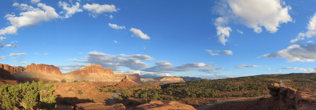
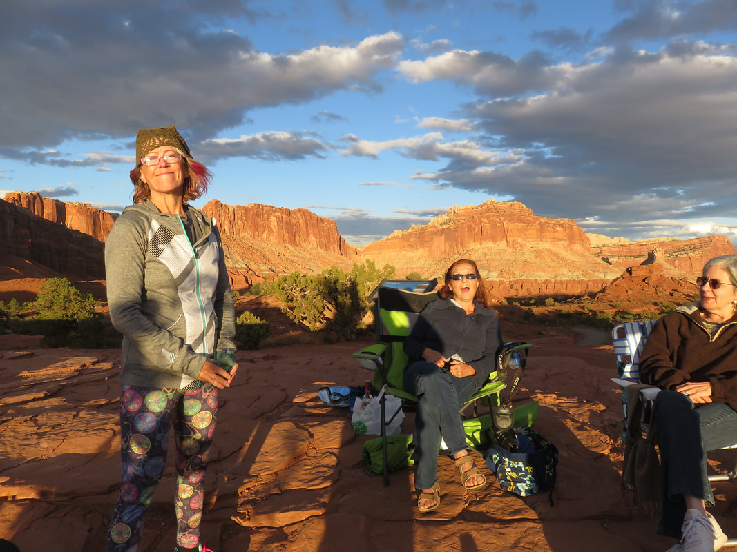
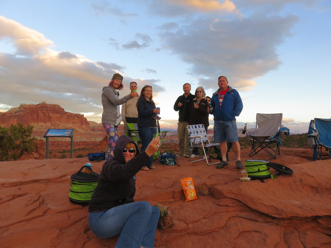
We rolled into the parking area for Panorama Point right about 6:00. There's Danny's Jeep, so at least part of the Herd us here. We gathered our cooler and Alison's wardrobe then made the short climb to the viewpoint. Yep, the gang is all here, well the ones who have made it to town thus far. Pixie had arrived this afternoon, so we had eight for happy hour tonight. We all had a nice time catching up and making plans for the next few days. There were two or three Trip Adivsor travel coolers full of beer, wine and other assorted adult beverages. Alison broke out a bottle of her homemade lemoncello. Or was it some-other-fruit-flavor-cello? I'm not sure, but being a one-trick pony, I did not try it whatever flavor it was. I just had a nice, crisp, light Pinner (one of the best session IPAs I have ever had). We were all bundled up this evening. While it was a pretty evening with the blue sky and the bright sun, it was brisk with a chilly breeze. Everyone was holding their cold drinks with gloved hands. But we had a wonderful view. The early evening light was making the sandstone formations glow. Unfortunately, the sunset was not spectacular as there were no clouds for Old Sol to paint on before dipping behind the horizon.
After Danny and the gang left, we got ready for happy hour. Step one was getting some beer on ice in the TA cooler. Now this is not the high octane beer crowd so I went with Pinners and a couple sours. That should work. Now that we have cold beer, step two is to make sure we keep warm. Extra jacket, gloves and my Fat Heads toboggan. Lynn was similarly dressed except even more layers, as she is a real freeze baby.
About 5:30 we left for happy hour with our first stop being the RV park at the west edge of town to collect Alison and Mark. They were easy to find as their rolling cabin had bicycles growing from its rear bumper. They have named their RV "Zena" after the warrior princess, I suppose. Nice machine. Looks like a good size for two, as long as you really like each other. Hugs, handshakes and hellos, then they tossed their stuff in the back of the Equinox. Alison must have brought all of her clothes just to be ready to fight the evening chill. Obviously another freeze baby.
We rolled into the parking area for Panorama Point right about 6:00. There's Danny's Jeep, so at least part of the Herd us here. We gathered our cooler and Alison's wardrobe then made the short climb to the viewpoint. Yep, the gang is all here, well the ones who have made it to town thus far. Pixie had arrived this afternoon, so we had eight for happy hour tonight. We all had a nice time catching up and making plans for the next few days. There were two or three Trip Adivsor travel coolers full of beer, wine and other assorted adult beverages. Alison broke out a bottle of her homemade lemoncello. Or was it some-other-fruit-flavor-cello? I'm not sure, but being a one-trick pony, I did not try it whatever flavor it was. I just had a nice, crisp, light Pinner (one of the best session IPAs I have ever had). We were all bundled up this evening. While it was a pretty evening with the blue sky and the bright sun, it was brisk with a chilly breeze. Everyone was holding their cold drinks with gloved hands. But we had a wonderful view. The early evening light was making the sandstone formations glow. Unfortunately, the sunset was not spectacular as there were no clouds for Old Sol to paint on before dipping behind the horizon.
|
|
Once the sun was down we gathered our gear and heading off to dinner. I think that we were all happy to retreat to the warmth of the vehicles after being out in the chilly evening air. Danny had selected the Capitol Reef Inn for our first group dinner of the meet-up. We settled in at our long table and started checking in with the folks still on the road. Beth and Tommy were getting close to Torrey after making a long detour to get by the sink hole in route 89. They made it in time for dinner. We also got texts from Gurjinder and John. Both were beat and will catch up with us tomorrow. Understandable. While waiting for our meals to arrive we refined our plan for tomorrow. The weather looks good so the Burr Trail is still on tap, but we'll have to check the conditions on the Notom Road since it has been raining this week. We'll convene at the Wayne County visitor center at the intersection of routes 12 and 24 at 9:00 AM to sort out the remainder of the details.
Dinner was pretty good. While the service was fast, the delivery of our food was rather haphazard. A few meals came out quickly...then a few more...then another... and finally mine. What's up with that? Of course by this time I was so hungry I chowed right through my burger in very short order. Still a good evening with the Herd. We closed the joint, but in a small town like Torrey, the sidewalks roll up early, so it was only 9:00 PM when we departed.
We dropped Alison and Mark back at the RV park then returned to our little rental house. Not that Torrey is a hopping place but it was nice being well removed from the main road and up on the hill at our rental house. We had already seen a few birds and a lizard at the house, so we might get lucky with some additional sightings along the road. We were tonight, with three sightings in the headlights in quick succession and in order of increasing size as we drove back to the house; first a mouse of some sort, just a little guy scurrying across the road, then a rabbit, probably a desert cottontail and finally a jack rabbit, easily recognizable from the long ears. We'll see what else presents itself as the week goes by.
Back at the rental house we paused for a moment getting inside to be dazzled by the dark night sky. The stars were amazing. But the temperature was continuing to drop so we did not stay out too long. Once back inside we had one last beer, a grapefruit Hop Nosh. Well, that gets us our Uinta badge from Untappd. A good end to a great first evening in Torrey. Here are a few more photos from our travels to Torrey and the happy hour in the park.
Looks like there will be 13 of us in Torrey, maybe 14 if Anna makes it in for a day as her plans seem very fluid. This will be the smallest group for a fall meet-up so far. But that's ok. We still a great bunch of cats and we will find fun things to do regardless of what the weather throws at us.
Day 3, Friday, October 5, 2018 - Burr Trail. I was up at 0520 and went out to the couch to read and work on trip notes (I'm still working on the Wyoming trip notes as well as getting the details in order from Torrey). We picked away a preparations for the day but had plenty of time as we were not meeting the rest of the gang until 9:00. At the appointed time we were all collecting at the Wayne County Travel Information Center (at the intersection of routes 12 and 14 on the east side of Torrey). A grey morning with a light drizzle falling. Most of the Herd was there already and we did not have long to wait for the remaining stragglers. We have 13 cats today, John, Gurjinder and his eldest son Harvin, the new member of the Herd, were all ready to go. This was to be our driving tour day, making a big loop driving through the park on route 12, then down the Notom Road to the Burr Trail and back on route 12 (or maybe Danny was thinking we would start with route 12, either direction works for me). But Danny had already done some reconnaissance work by checking with the Rangers the Capitol Reef Visitor Center (he and Rob were out early this morning) and found that the Notom-Bullfrog Road was probably not worth risking today as it was likely a muddy mess due to the heavy rains they had recently. No sense in getting stuck in the mud. As mentioned, the Herd is adaptable, so rather than drive the big loop, we'll make this an out and back drive, taking Scenic Byway 12 south across Boulder Mountain to the Burr Trail at least to the switchbacks. The main roads that we would be traversing should be easily passable by any vehicle. Danny has a list of places that we can stop and see along the drive, one of which is a short hike to the Strike Valley Overlook but we'll need the off-road capable vehicles for the side road to get to that trailhead. That detour will be dependent on how the road looks when we get there. Gurjinder was on one of his standard insane road trips, seeing a hundred places in no time. He and Harvin had a breakdown in their rental car early in their travels and were now driving a replacement vehicle, a nice, new Nissan pick-up which he was itching to drive on this little excursion. That truck should be quite capable of making the rough-road portion of the trip if we end up doing that. We were heading south on route 12 by about 9:30 in our little four-car caravan; Danny's Cherokee, Gurjinder's pickup, John's Honda Element and Tommy's Jeep. Lynn and I rode with Tommy and Beth. Danny took the lead. We brought up the rear. The rain stopped by the time we were on the road and the skies were clearing as we climbed up the mountain along route 12. 47 F as we crossed over the mountain. Starting to look like a nice day.
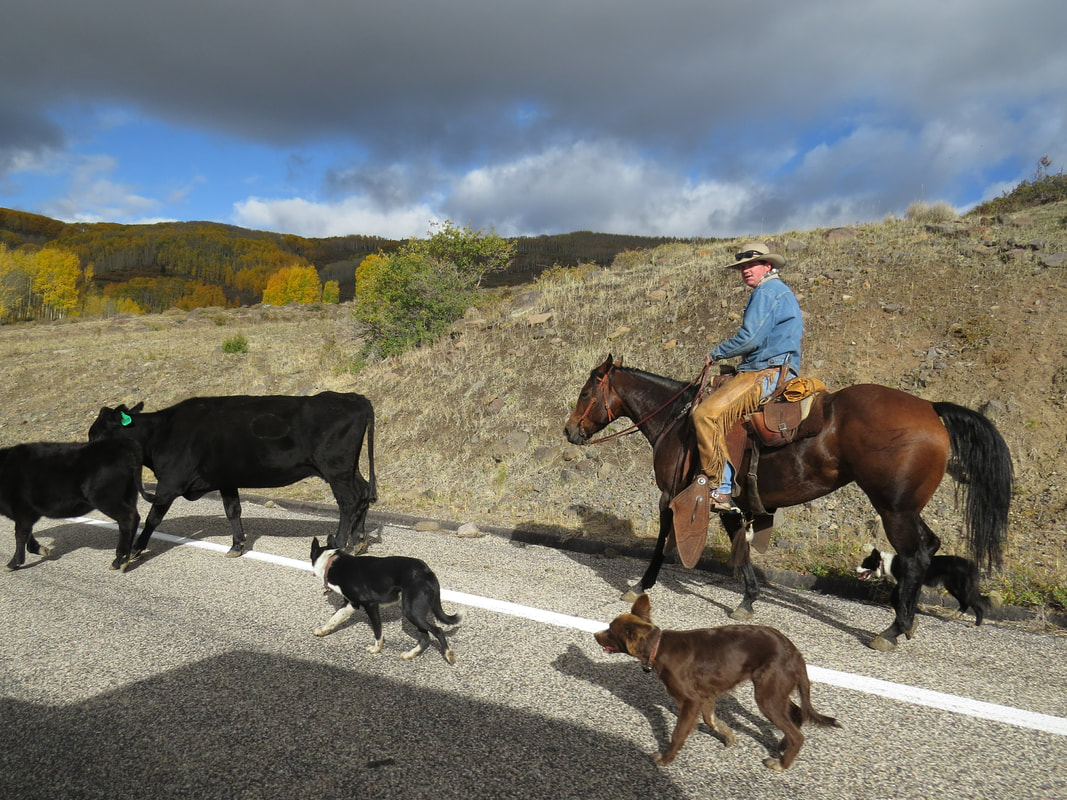
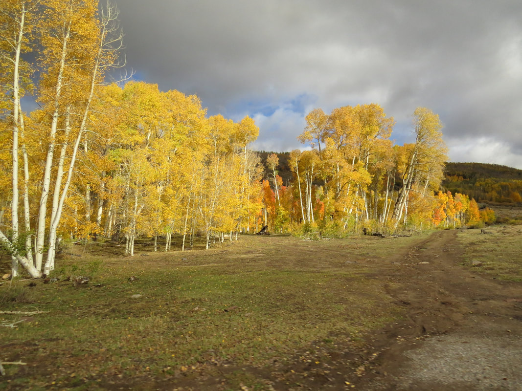
The drive over Boulder Mountain was beautiful The aspens were modeling their bright golden fall wardrobe We saw a few critters, including some deer in the woods below the road The most interesting sighting was the cattle drive complete with a real cowboy and a few herding dogs. The herd (the cattle, no us) were working their way down the mountain and were crossing the road in front of us. We just stopped and watched the parade. The cowboy and his canine helpers quickly had the bovines out of the road and heading down the hill. Our only other stop along route 12 was at the Anasazi State Park Museum for a quick rest break. Looks like an interesting little historical site, but since we only had a few minutes here we opted not to pay the entrance fee for the museum or grounds. Maybe next trip.
Looks like there will be 13 of us in Torrey, maybe 14 if Anna makes it in for a day as her plans seem very fluid. This will be the smallest group for a fall meet-up so far. But that's ok. We still a great bunch of cats and we will find fun things to do regardless of what the weather throws at us.
Day 3, Friday, October 5, 2018 - Burr Trail. I was up at 0520 and went out to the couch to read and work on trip notes (I'm still working on the Wyoming trip notes as well as getting the details in order from Torrey). We picked away a preparations for the day but had plenty of time as we were not meeting the rest of the gang until 9:00. At the appointed time we were all collecting at the Wayne County Travel Information Center (at the intersection of routes 12 and 14 on the east side of Torrey). A grey morning with a light drizzle falling. Most of the Herd was there already and we did not have long to wait for the remaining stragglers. We have 13 cats today, John, Gurjinder and his eldest son Harvin, the new member of the Herd, were all ready to go. This was to be our driving tour day, making a big loop driving through the park on route 12, then down the Notom Road to the Burr Trail and back on route 12 (or maybe Danny was thinking we would start with route 12, either direction works for me). But Danny had already done some reconnaissance work by checking with the Rangers the Capitol Reef Visitor Center (he and Rob were out early this morning) and found that the Notom-Bullfrog Road was probably not worth risking today as it was likely a muddy mess due to the heavy rains they had recently. No sense in getting stuck in the mud. As mentioned, the Herd is adaptable, so rather than drive the big loop, we'll make this an out and back drive, taking Scenic Byway 12 south across Boulder Mountain to the Burr Trail at least to the switchbacks. The main roads that we would be traversing should be easily passable by any vehicle. Danny has a list of places that we can stop and see along the drive, one of which is a short hike to the Strike Valley Overlook but we'll need the off-road capable vehicles for the side road to get to that trailhead. That detour will be dependent on how the road looks when we get there. Gurjinder was on one of his standard insane road trips, seeing a hundred places in no time. He and Harvin had a breakdown in their rental car early in their travels and were now driving a replacement vehicle, a nice, new Nissan pick-up which he was itching to drive on this little excursion. That truck should be quite capable of making the rough-road portion of the trip if we end up doing that. We were heading south on route 12 by about 9:30 in our little four-car caravan; Danny's Cherokee, Gurjinder's pickup, John's Honda Element and Tommy's Jeep. Lynn and I rode with Tommy and Beth. Danny took the lead. We brought up the rear. The rain stopped by the time we were on the road and the skies were clearing as we climbed up the mountain along route 12. 47 F as we crossed over the mountain. Starting to look like a nice day.
The drive over Boulder Mountain was beautiful The aspens were modeling their bright golden fall wardrobe We saw a few critters, including some deer in the woods below the road The most interesting sighting was the cattle drive complete with a real cowboy and a few herding dogs. The herd (the cattle, no us) were working their way down the mountain and were crossing the road in front of us. We just stopped and watched the parade. The cowboy and his canine helpers quickly had the bovines out of the road and heading down the hill. Our only other stop along route 12 was at the Anasazi State Park Museum for a quick rest break. Looks like an interesting little historical site, but since we only had a few minutes here we opted not to pay the entrance fee for the museum or grounds. Maybe next trip.
|
|
We passed Hell's Backbone Grill, which is supposed have fantastic food but Lynn and I have not eaten there yet. We were thinking that maybe this trip after the meet-up is over, but we never made it back across Boulder Mountain. The turn-off for the Burr Trail Road is just south of Hell's Backbone Grill. OK, new territory for Lynn and me, as this is our first excursion along this road. The weather was continuing to improve; the sky was blue with some big, puffy white clouds and the temperature was approaching 60 F. Looking very good.
Danny continued to lead our little string of Jeeps, trucks and whatever and Element is considered. Since he has explored along the Burr Trail Road before, he had a list of places that he wanted to show the group. Here are some of the highlights and points-of-interest from our drive:
Danny continued to lead our little string of Jeeps, trucks and whatever and Element is considered. Since he has explored along the Burr Trail Road before, he had a list of places that he wanted to show the group. Here are some of the highlights and points-of-interest from our drive:
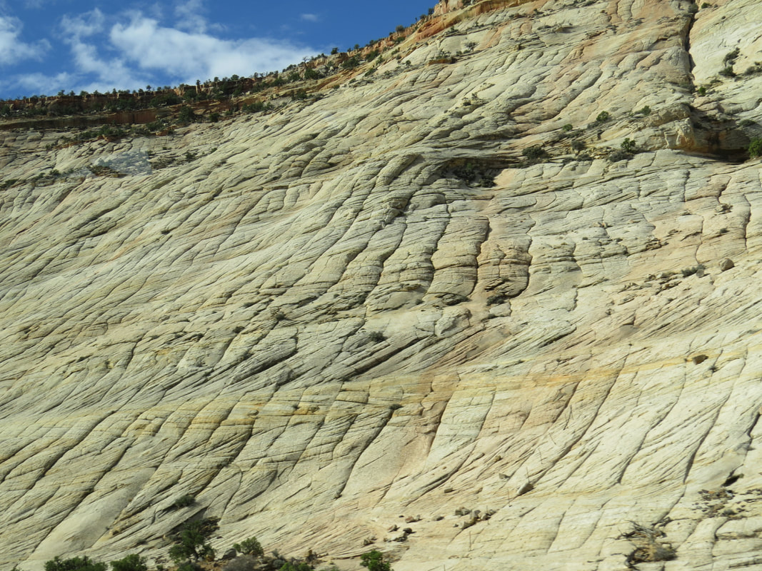
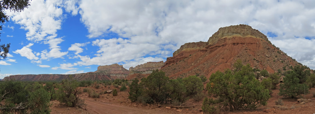
- Some of the first formations we passed along the Burr Trail Road reminded me of Checkboard Mesa outside of Zion National Park.
- Our first stop was at Long Canyon. A pretty little spot along a creek with interesting rock strata. We spent a few minutes admiring the scene then continued the driving tour.
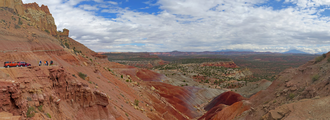
- A little further down the road we pulled over at an amazing view point, the Long Valley Overlook. Flanking the road were the yellow and red sandstone formations that we had been driving by but out in front of us as we looked east was a vista that covered a huge expanse and a variety of terrain and geologic features. This was just a big view! Directly below us were mounds of dark red dirt sitting on top of purple, blue and grey strata which provided a very colorful foreground to our vista. Further away, the yellow and red desert floor was interrupted by the results of erosion, sometimes creating gullies an valleys and other times resulting in ridges and ochre cliffs. On the horizon we could see the outline of mountain peaks, I'm guessing the Henrys. All of this was under a clearing sky, as the cloud deck was starting to break up to reveal a deep blue background. A lovely view, but a picture is certainly better than any typed description, regardless of the number of words (I am nowhere near a thousand).
- Then we made a stop sort of in the middle of nowhere. Actually at the intersection with a dirt road, the Wolverine Loop Road, that leads to Horse Canyon, Wolverine Canyon and Little Death Hollow. Danny said there was really nothing much to see here so no need for cameras, but Tommy and I did not listen. And for good reason. There is always something of interest or beauty at just about any point in the desert southwest. Danny also gave us some options for future exploration down the Wolverine Loop Road. Wolverine Canyon is full of petrified logs. And Little Death Hollow is a slot canyon that can make for a full-day adventure.
|
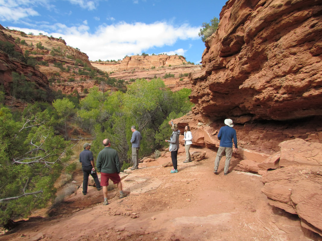
The Herd enjoying the view at Long Canyon.
|
The first big vista point.
Even though this was no place special out in the middle of nowhere, there was still a pretty view.
- The Burr Trail Road is paved for most of the distance we drove. Interestingly, the pavement ends where the road enters into the National Park. While now a dirt road, it is well maintained, smooth and wide as we continued into the park.
- After 70 miles of driving we have reached the point that was perhaps the primary destination, or at least one of the key points-of-interest, the top end of the Burr Trail Switchbacks. Like the Moki Dugway, this set of hairpin turns were built to provide a route from the top of the mesa down into the wide valley below, in this case dropping down into the Waterpocket Fold. We paused at the top of the switchbacks to take in the view out across the valley then headed on along the road to reach the valley floor. We dropped rather precipitously, about 600 feet through the series of a half dozen or so sharp turns that were carved into the sheer face of the cliff. But the road through the switchbacks was in great condition; I think any street vehicle could have made the drive.
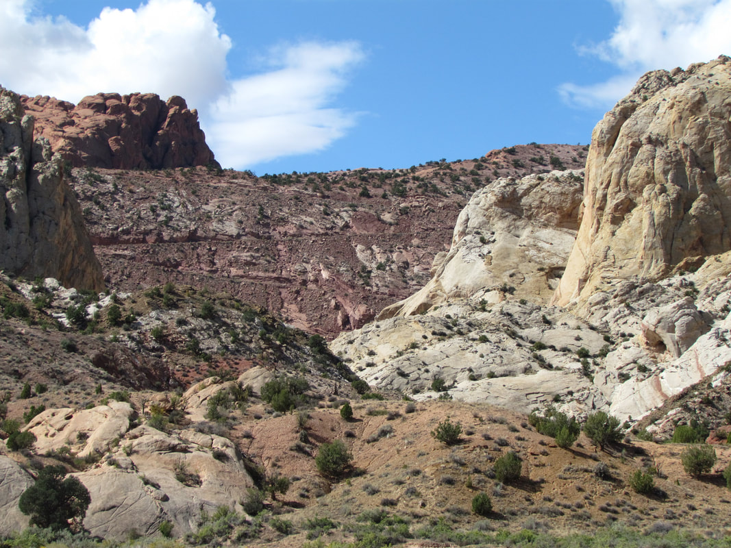
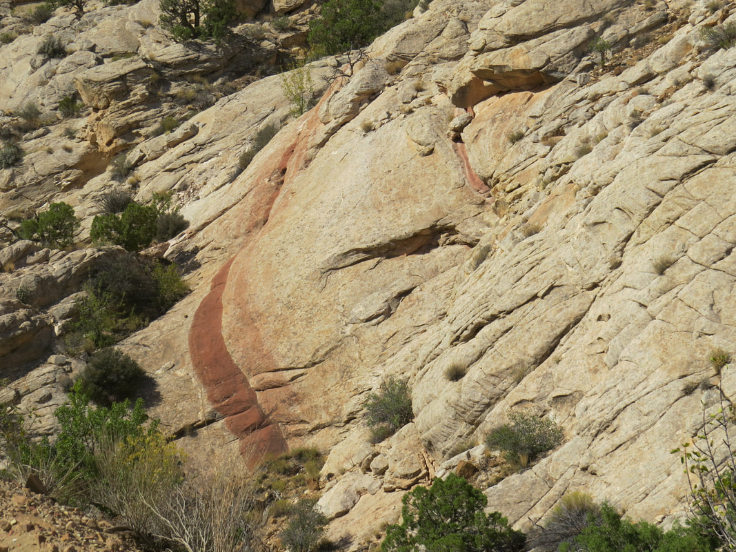
- Once down in the valley below the switchbacks we drove out to nearly the intersection with the Notom-Bullfrog Road before stopping to take in the views. The original idea was to make this a loop drive that included the Notom-Bullfrog Road back to Torrey (34 miles to route 24 and 48 to the Park Visitor Center). I'm not sure if Danny was thinking that we would start on the Notom Road and come up the switchbacks or come the direction we did this morning and just continue along the Notom Road, but as mentioned there was concern that the Notom Road might not be passable due to the recent heavy rains. Where we were standing, all looked fine. We paused here at the far end of our drive today and admired the rugged beauty of the landscape as we stood in the middle of the Waterpocket Fold. Looking back up the road we could clearly see the scars of the switchbacks that provided the means to get from the top of the mesa down to this point. As we studied the formations lining the valley, we spotted a window carved in the rock above on the mesa a little north of the switchbacks. There are so many details to see when taking in these desert views. As we were driving back up the switchbacks one such detail caught my eye, a deep red band weaving through the otherwise yellow sandstone. It was uniform and seemed also deliberate, as if it applied by a paint roller.
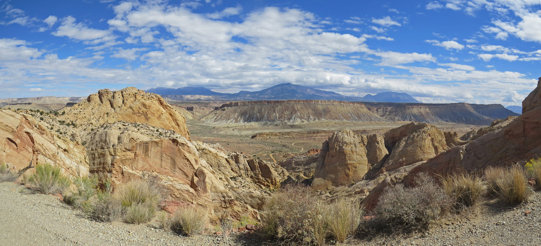
View looking east fro the top of the Burr Trail Switchbacks.
View from the floor of the valley looking back toward the switchbacks.
The Burr Trail Switchbacks are carved into the side of the mesa.
|
|
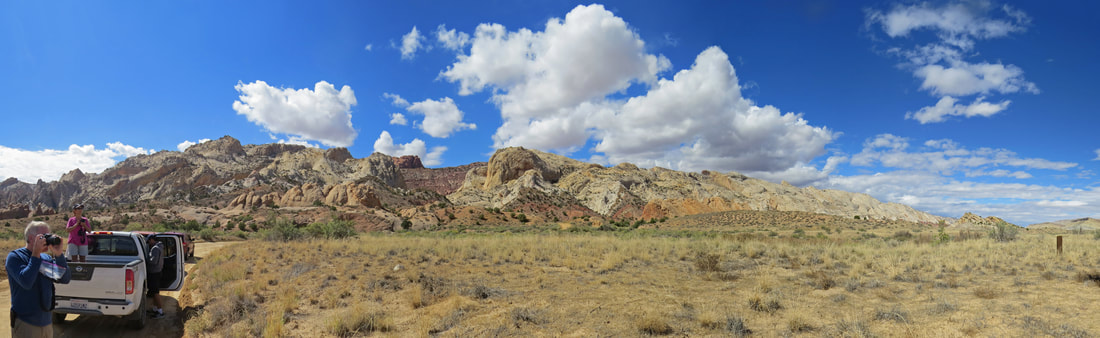
- We were again the caboose of our little train, and Tommy stopped the Jeep when we reached the top of the switchbacks so that we could get some additional photos. This is certainly a grand view. Looking out from the edge of the mesa, across the fold an on to the mountains in the distance. Interestingly, there was no great view of the switchbacks below us, just the first couple were in view as the slope of the cliff at this point is so steep. Vertical is the word that comes to mind.
- Once we were back in the Jeep, we figured we would catch up with the rest of the caravan in short order, but they were no were to be seen. We could not even discern the cloud of dust that they should have been kicking up. Then we spotted Danny waving to us from a little side road. Seems he had a place in mind for a lunch break, complete with a picnic table. Who would have thought that there would have been a picnic table out here in an unmarked pull-out at the top of the Burr Trail Switchbacks, but there is was. Danny said that he had stopped here on previous trips and had marked the spot as a great place to stop for a snack. Good planning! Nice place for a lunch break.
- After lunch we continued west back along the Burr Trail Road. We got a good view of the opposite side of the natural window that we had spied while down in the valley.
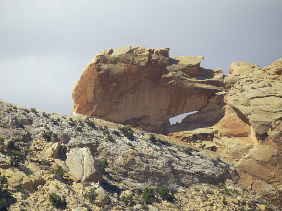
View of the window from the valley below...
|
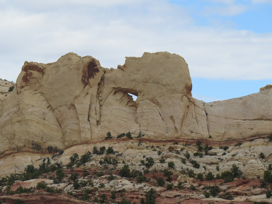
...and from the Burr Trail Road near the intersection of the Muley Twist Road.
|
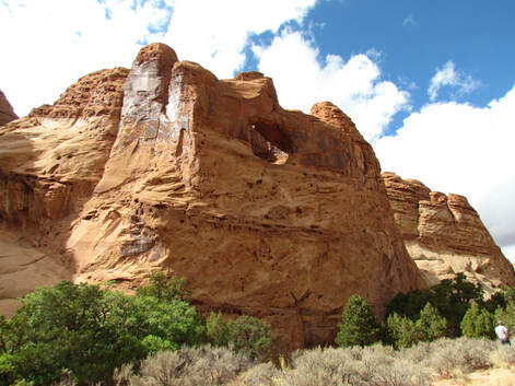
- Next we made the big side trip for the day, turning north along a rough road that led to the Strike Valley Overlook and Upper Muley Twist. This was a high-clearance vehicle road, so John's little rolling box was not going to make it, so he and Rob climbed into Gurjinder's truck for this part of the drive. Harvin was relegated to the bed of the pickup. I guess seniority does count for something, but the youngster did not seem to mind. We had about a four mile ride along this rough road to get to the Strike Valley Overlook trail. Along the way we made a stop to gawk at another natural window in the sandstone wall in the ridge well above the road.
- Once we arrived at the little parking lot at the trailhead, we looked about the area, admired the views and got ready for our little hike. Upper Muley Twist meandered off toward the northwest (Danny recommended this as a great hike for another day), but we were heading to the Strike Valley Overlook, which was off to the northeast. An obvious trail at the start but shortly became sort of convoluted mess of looping trails but all basically leading toward our destination. The short trail was not well marked and the cairns were not necessarily the most helpful in terms of marking the trail. We ended up split into smaller groups as we hiked along the various trails, our subgroups changing in make-up as we crisscross the desert. Ultimately Alison, Lynn and I ended up together, hiking away from the rest of the herd. In short order we found the edge of the mesa and the amazing view looking out over the valley and the Waterpocket Fold. Just a truly wonderful vista. There was still a fair amount of cloud cover but the blue sky was continuing to poke through and the combination was creating a series of shadows playing across the landscape. We spotted the rest of the Herd on the higher ground off to our right so we worked our way along the edge of the mesa to join the gang. Eventually everyone ended up in the same spot where were gawked some more at the amazing views, looking out over the valley floor stretched out about 700 feet below us. This looked like a good place for a team photo, which was as usual an exercise in cat herding. But we got the shot with the valley as our backdrop. Well, that was certainly worth the walk! After a few minutes more of admiring the view, we ambled back to the trailhead where we paused for a few minutes, just chatting about nothing particularly before loading up and returning to the Burr Trail Road.
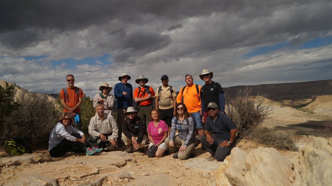
Tommy took this photo of the Herd at the Strike Valley Overlook. Front row (left to right): Alison, Danny, Lynn, Pixie, Beth, Gurjinder. Back row: Mark, Norma, Tommy, Allen, Harvin, Rob, John.
|
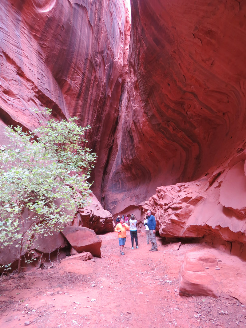
|
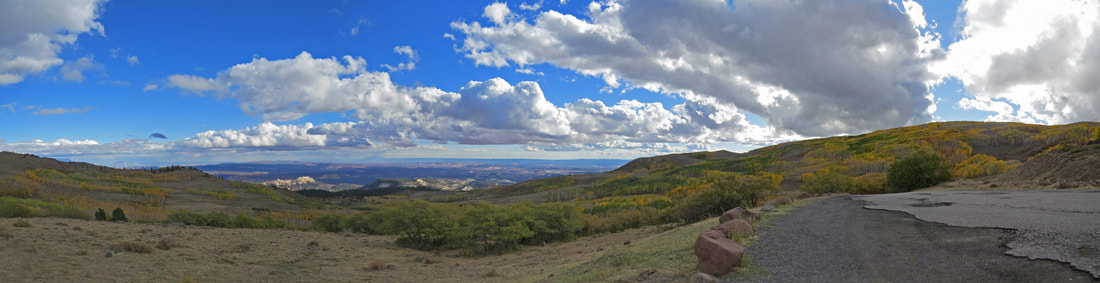
Vista along route 12 as we climbed up Boulder Mountain on the drive home.
We pulled in to the parking area for the overlook right about 6:00. It was a bit crowded but our timing was good and we grabbed a spot that was being vacated just as we pulled in. Most of the rest of the Herd was already up at the overlook, having staked out prime spots along the edge of the canyon. More amazing views, right on the edge of the gorge above Sulphur Creek. The evening light again provided a wonderful glow on the red rocks around us. Unfortunately the sunset itself was again a nonevent; just not the right combination of sun and clouds. But it was another nice time with the Herd, albeit a bit chilly. Again gloves were needed to hold our beers. The big news was that Rob and Harvin saw a cougar on the drive back from the Burr Trail Road along route 12 at one of the ranches. He guys, don't keep that stuff to yourselves! We used the time to get our plans in order for tomorrow. Since the weather is becoming a wildcard at the moment, we decided to convene at the National Park visitor center and review hiking options as it might be a bit on the cold side for our going in plan of hiking Sulphur Creek.
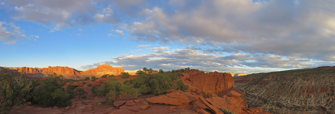
Early evening light at Goosenecks Overlook.
After Happy Hour broke up we headed to our dinner reservation at Café Diablo. There were twelve of us there for dinner, just Pixie was missing as she had to get her camp in order for the night before the weather rolled in. We ended up squeezing all of us in around a table that was set for ten. Hey, we're all friends here so we can be cozy.
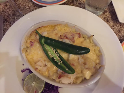 Beth also had the green chili lobster mac and cheese. I'm glad she got a photo of the dish as I was too busy devouring mine to take a picture!
This is a great restaurant, one of my all-time favorites and certainly a gem out here in what amounts to the middle of nowhere. The servers are friendly, very helpful and quite expedient. But the star is the food. The menu here is on the eclectic side. Their website says "innovative southwest fusion." That basically covers it. We ate here last in October 2009 and I've been itching to get back ever since. It was that good. The concern of course is that after nine years things might have changed or the reality of the food might not live up to my memory. That was not the case. Dinner was just as good as I hoped it would be and just like I remembered. The southwest bread was great, a nice start to the meal. Lynn ordered the pumpkin ravioli which she said was excellent. I went with the green chili lobster mac and cheese; this seemed to be the most popular entrée around the table as three or four other folks also got it. One word: OUTSTANDING. No room for dessert after a dish like that. The only downside to the meal was the lack of a quality beer (but that is typical of the restaurants in Utah and was definitely a common theme for all the places we ate while in Torrey. I had the Ghost Rider White IPA from Wasatch Brewing; a solid IPA but a Hop JuJu would have been so much better. I also tried a taste of John's Jalapeno Cream Ale, also from Wasatch. Creamy, maybe a hint of pepper. After dinner we said goodbye to Alison and Mark as they are leaving in the morning. The first departures from the meet-up.
Back at the rental house we were treated to the best dark night stars we have seen in a long time. The Milky Way was glowing against the deep black backdrop with billions of brilliant pin points. Too bad the neighbor across the street is a jackass and had floodlights glowing, actually aimed at our rental house. Very distracting and quite unfortunate. But in the grand scheme of things, a the floodlights just could not compete against the glorious lights in the heavens.
Here's the link to the gallery of images from our drive along the Burr Trail, the Strike Valley Overlook and Happy Hour at Goosenecks Overlook.
Day 4, Saturday, October 6, 2018 - Bridges of Capitol Reef. I was up about 5:20 this morning. No real rush today as we were not meeting the rest of the Herd until 8:30 at the National Park Visitor Center. Bagels for breakfast again, but they are really drying out. But I guess that is to be expected in this low humidity climate. While we were not in a hurry this morning, Lynn ended up being a bit too lackadaisical so we were a bit behind schedule and did not get on the road until 8:25. We'll be late. We rolled into the visitor center parking lot at 8:45, but the rest of the gang was just walking from the lot, so I reckon we are not that tardy. Once inside we checked out the maps (including the overall Capitol Reef National Park map), trail conditions and weather. The going in plan was the Sulphur Creek hike, which is actually in part through the creek. That did not sound very appealing this morning at 45 degrees F under a heavy overcast. We talked over options and got our plan in order. The weather did force us to adapt to the conditions. John, Rob, Gurjinder and Harvin are sticking with the Sulfur Creek hike. The rest of us decided that hiking through a creek on an overcast, chilly and sort of misty morning was not the best way to explore. We opted to try a couple other trails, starting at Capitol Gorge.
We were on the road at 9:15, heading along the scenic drive through the Fruita Historic District. The mule deer were out grazing and lounging in the orchards, a sight that we would get to enjoy several times during our time in Capitol Reef. Our first stop at Gifford House area for the famous homemade pie. There was a good size flock of Wild Turkey wandering through the picnic ground and parking lot across from the old house. Most of the group bought a pie or two with the thought that these would be good for our lunch time break. Lynn and I picked two, apple and pumpkin. These are little pies, sort of a shareable size for two people although I'm sure that I could polish one off by myself. The aroma inside was somewhere between a small town bakery and Sunday morning at Grandma's house. There was a good crowd around, not packed but plenty of folks were here buying pies and breads. As we were heading back to the vehicles, Danny noted the sign out in front of the house advertising the Ranger-led hike for tomorrow morning. He suggested that this might be a good activity for us, depending on how the weather plays out, plus it would give an opportunity to get pie for breakfast. The hike is at 8:30, so we could meet here at 8:00. Sounds like a plan.
As there was plenty of room in the large lot across from the Gifford House, we figured we should reduce the number of vehicles we took down the scenic drive as the parking might be tight at the trailhead. Pixie jumped in Danny's Jeep and Beth and Tommy rode in our Equinox. We continued south along the scenic drive to the end of the paved road where we made a quick rest stop (this group never passes up a perfectly good outhouse), then up the dirt road leading into Capitol Gorge. The roads were in great shape so the Parks Service maintenance folks are obviously on the ball. As expected, there was already a good number of cars in the trailhead lot so creative parking required. Good thing we consolidated vehicles back at the Gifford House as we were lucky just to squeeze in the two we had. Our cars ended up near the start of the Golden Throne Trail, which works up the canyon wall to a viewpoint. That is an option for later today or another day this week.
Once we have the vehicles out of the way, we got our packs and cameras, then hit the trail. Lynn and I had walked this route when we visited back in 2009. The trail through Capitol Gorge is pretty easy and mostly flat as it winds through the little canyon. We alternated between walking on the trail and just ambling through the wash, although the latter sometimes was more difficult due to loose stones and random debris. With the grey overcast and generally bland sky, it was just as well to be in the confines of the canyon to enjoy the more intimate views. While not a particularly pretty canyon there are some fascinating historical points as well as more interesting geology further into the hike. The first item of interest is a petroglyph panel on the north wall of the canyon about a quarter mile from the trailhead. These etchings and engravings in the sandstone were left by the Fremont Indians. There is a variety of images and symbols but they are rather difficult to make out as they are faded due to the passage of time. I reckon the poor lighting did not help either. Still it is fascinating to look on these ancient drawings and try to understand what message the artists and authors were trying to convey. The more time I spend out here in the Grand Circle the more intrigued I become by the rock art. I think I'll have a hobby to occupy my time when I finally retire. The bizarre humanoid figures with the odd appendages emanating from their noggins are of course the most interesting. What do these represent? I have no idea. But they are sort of cool. Further into the canyon was another panel of old engravings by the local residents, but this set of etchings were made in the much less distant past (late 19th and early 20th century, to about 1930). This collection of signatures is called the "pioneer register." Some of the names were printed some were in cursive. Sections of the register were covered with pockmarks; were these drilled somehow into the rock or perhaps made by bullets? Some of the marks seemed to make letters but we could not make out full names, dates or any other message. It looked like a strange game of connect-the-dots. Again, pretty cool.
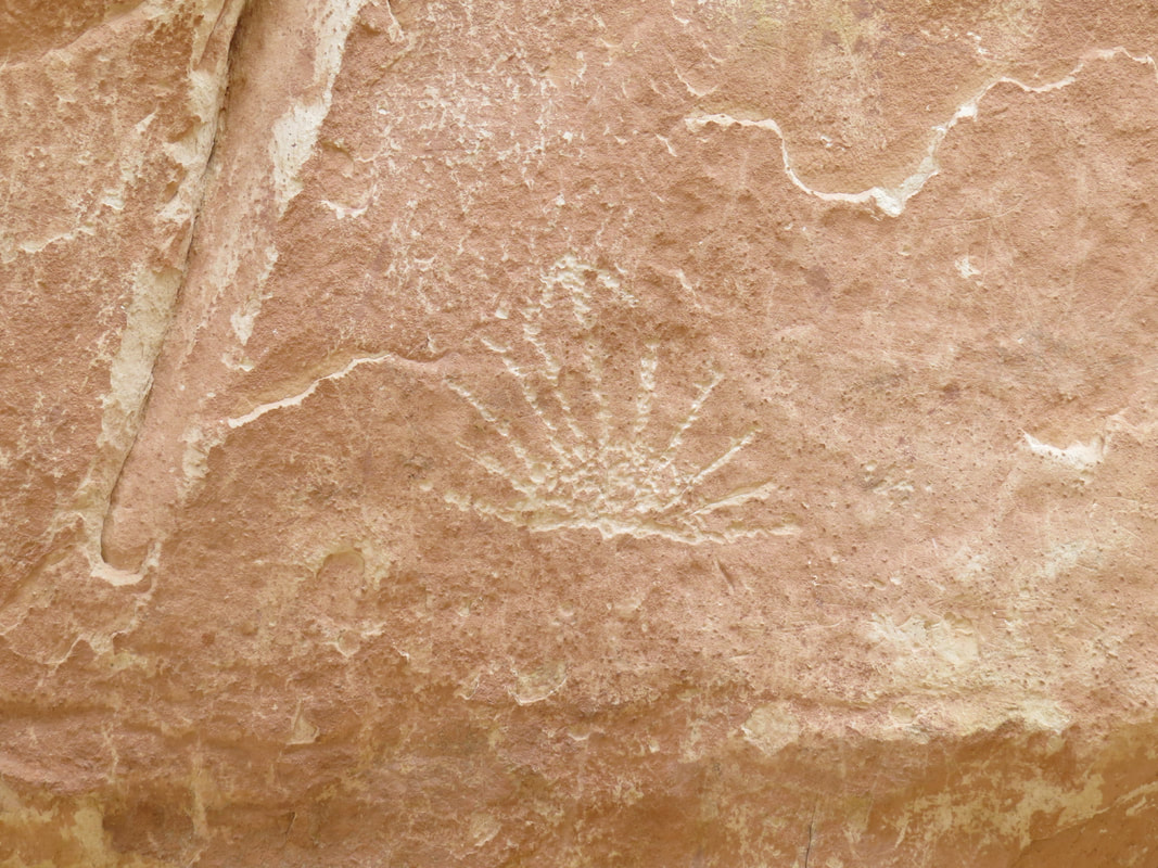
Sunrise/sunset petroglyph.
|
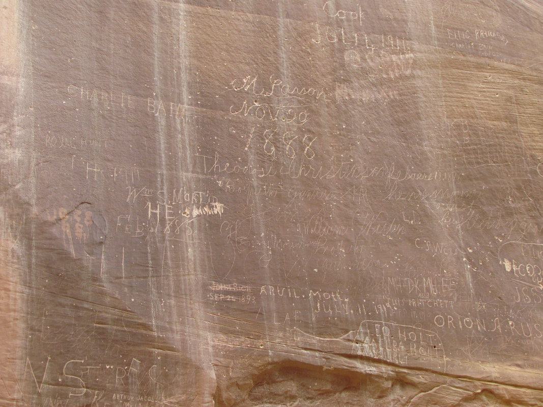
A section of the Pioneer Register.
|
The entire canyon is really an artifact of the more recent history of the area as the main road used to run through Capitol Gorge from Notom to points west. Well, this is certainly wide enough to hold a road, although I did not notice any remnants of a highway, dirt road or otherwise. There were a couple of the old posts that used to carry power or telephone (or maybe telegraph) line. These were sticking out of the sandstone walls of the canyon, reminders of the technology of old.
We walked about a mile into Capitol Gorge, then at the point where the canyon widened out we took the side trail going north out of the canyon to check out the tanks in the area (the Ramblr app was a bit confused due to the high walls of the canyon, so it was not possible to get a very good track of our route except for the portion around the tanks when we were up out of the canyon). This was the only tough part of the hike, not that it was really that difficult. There is a short but significantly uphill section to get off the canyon floor but once up to the level of the tanks the trail is fairly level. It just meanders about a bit and it not as clear as it should be. Probably too many cairns in some spots and not enough in others (hint, leave the trail marking to the Rangers). The tanks are potholes that can be filled with water, as they were today. Not surprising with the rain that fell in the area recently. We walked around the area checking out the views; still a grey, overcast sky, but now we have an elevated position to check out the surrounding formations. Interesting sandstone domes surround the area, mostly off-white to tan with some darker red highlights. The tanks were all full but there were no tracks around them (last time we were here I think we saw some big cat tracks in the sand around the tanks). We all just wandered about, studying whatever details caught our attention. Pixie and I walked down to the stop of the steep fall heading down to the canyon floor to check out the tanks below us. I spotted something that looked sort of odd in the rock structure, but could not figure out what I was seeing. Sort of an optical delusion. Yes, it is a little natural arch or bridge, but from this angle it blends in so nicely with the surroundings. The full tanks on above and below the bridge make it seem like the bridge is actually the rim of another tank. I called Pixie over to show her, in part still to make sure that I was not seeing things that were not there. Yep, it is a bridge. No easy way to get down to it. Maybe with a rope, but that's more effort and risk than I'm interested in just for a photo. Hmmm, I wonder if this little natural bridge as a name?
We walked about a mile into Capitol Gorge, then at the point where the canyon widened out we took the side trail going north out of the canyon to check out the tanks in the area (the Ramblr app was a bit confused due to the high walls of the canyon, so it was not possible to get a very good track of our route except for the portion around the tanks when we were up out of the canyon). This was the only tough part of the hike, not that it was really that difficult. There is a short but significantly uphill section to get off the canyon floor but once up to the level of the tanks the trail is fairly level. It just meanders about a bit and it not as clear as it should be. Probably too many cairns in some spots and not enough in others (hint, leave the trail marking to the Rangers). The tanks are potholes that can be filled with water, as they were today. Not surprising with the rain that fell in the area recently. We walked around the area checking out the views; still a grey, overcast sky, but now we have an elevated position to check out the surrounding formations. Interesting sandstone domes surround the area, mostly off-white to tan with some darker red highlights. The tanks were all full but there were no tracks around them (last time we were here I think we saw some big cat tracks in the sand around the tanks). We all just wandered about, studying whatever details caught our attention. Pixie and I walked down to the stop of the steep fall heading down to the canyon floor to check out the tanks below us. I spotted something that looked sort of odd in the rock structure, but could not figure out what I was seeing. Sort of an optical delusion. Yes, it is a little natural arch or bridge, but from this angle it blends in so nicely with the surroundings. The full tanks on above and below the bridge make it seem like the bridge is actually the rim of another tank. I called Pixie over to show her, in part still to make sure that I was not seeing things that were not there. Yep, it is a bridge. No easy way to get down to it. Maybe with a rope, but that's more effort and risk than I'm interested in just for a photo. Hmmm, I wonder if this little natural bridge as a name?
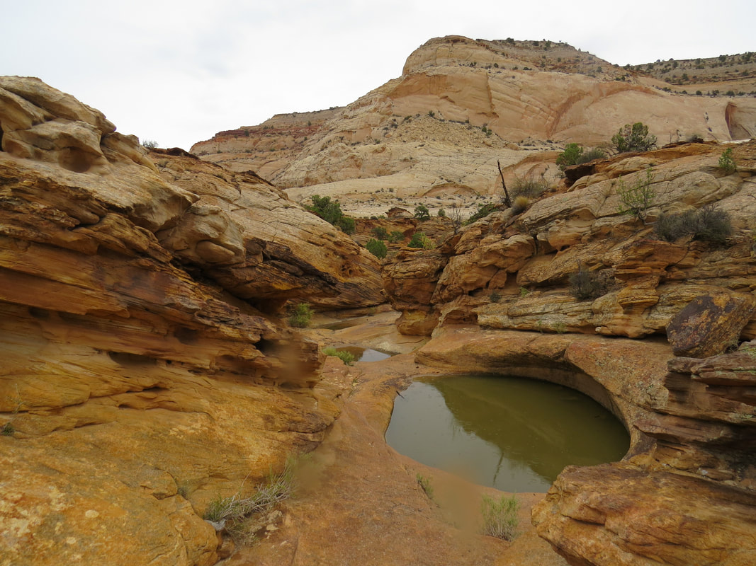
|
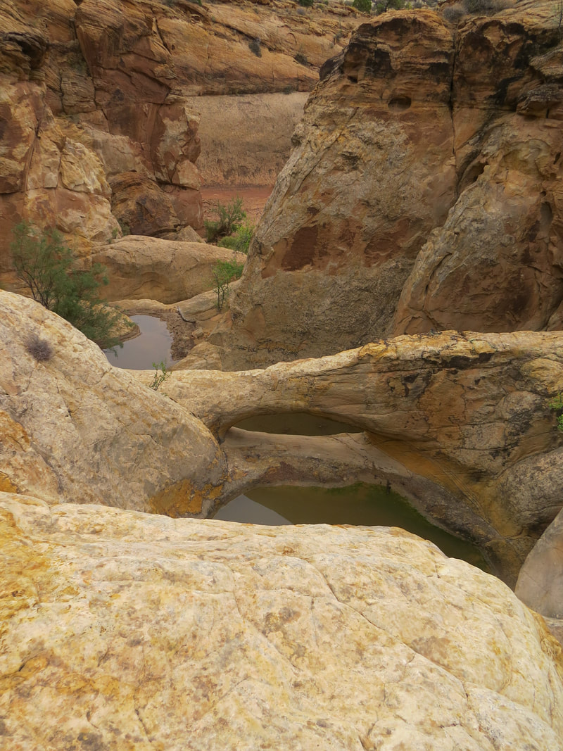
Little natural bridge spanning the tanks.
|
Once we were done looking around the tanks, we worked our way back down to the wash and retraced our route to the trailhead, pausing at the pioneer register and petroglyph panel on the return trip. Since we were in the canyon and did not always get a clear signal, the track I recorded was not accurate. My best estimate was that we hiked about 2.3 miles to the tanks and back (the app said 3.1 miles, but that just seems too long). The wash flows from west to east, so we were walking slightly downhill on the way in and uphill on the way out. Interesting how the mind works as the slight downhill was hardy noticeable, but I could perceive the small but steady climb in the return hike. We were back at the trailhead right at noon, so perfect timing for lunch. We took advantage of the picnic pavilion located at the trailhead, a nice covered location. Lynn and I split our apple pie. We don't eat desserts that often, but we are making up for our lack of pie this week. We offset the pie with a couple of Beth's homemade brownies. Now that is a balanced meal!
Here's the gallery with a few more photos from our walk through Capitol Gorge.
Here's the gallery with a few more photos from our walk through Capitol Gorge.
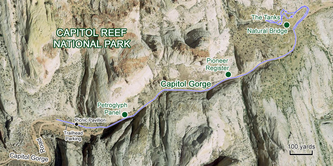
The weather was cooperating and it was still early in the day, so we figured that we had time for another short hike. The consensus was to take the trail to Hickman Bridge based on Danny's suggestion. We finished our lunch, loaded into the vehicles and headed off to our next adventure, continuing with the carpooling as we figured the parking at the Hickman Bridge trailhead would be tight. Turned out to be a good call to leave the extra vehicles parked in Fruita parking and carpool over, as the parking at Hickman Bridge was indeed packed. Danny was in the lead and was able to snag the only open parking space. We were next in the queue. Fortunately a pair of older ladies were walking to their car that was parked right in front of us. They did eventually load up and pull out, but it seemed to take them a while. Tommy and I were sitting in the Equinox "encouraging" the ladies to move along, not that they could hear us. Boys being boys. Lynn and Beth concurred the Tommy and I are too much alike. The ladies finally pulled away and we pulled in. OK, that was not so bad. We grabbed our gear and walked across the lot to join our friends at the start of the trail.
Danny picked a nice hike for the afternoon, and quite complementary to the one we had completed before lunch. While the walk through Capitol Gorge is down in the canyon for the most part and generally flat and easy, the trail to Hickman Bridge, while shorter, is tougher as it is uphill most all the way, steep at times and generally out in the open providing big vista views for much of the hike. From the trailhead, we walked along a path carved into the sandstone rock face just above the Fremont River. This little section along the river is less than a quarter mile, then the trail makes a hard left turn and starts to gain elevation through a few switchbacks. Once we gained a little height the big views came into play. The day was grey and chilly, but the views were lovely nonetheless. The while sandstone domes stretched out in front of us, including the namesake Capitol Dome.
Danny picked a nice hike for the afternoon, and quite complementary to the one we had completed before lunch. While the walk through Capitol Gorge is down in the canyon for the most part and generally flat and easy, the trail to Hickman Bridge, while shorter, is tougher as it is uphill most all the way, steep at times and generally out in the open providing big vista views for much of the hike. From the trailhead, we walked along a path carved into the sandstone rock face just above the Fremont River. This little section along the river is less than a quarter mile, then the trail makes a hard left turn and starts to gain elevation through a few switchbacks. Once we gained a little height the big views came into play. The day was grey and chilly, but the views were lovely nonetheless. The while sandstone domes stretched out in front of us, including the namesake Capitol Dome.
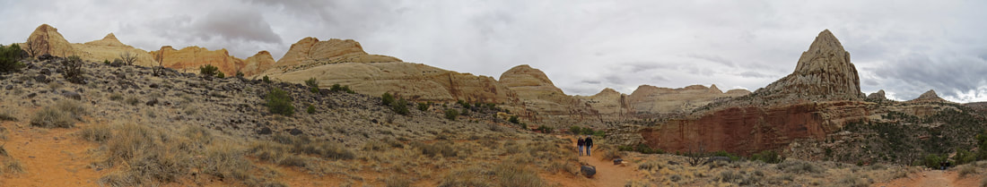
Big vista along the Hickman Bridge Trail with Danny and Norma are walking up the trail. Capitol Dome is in the distance behind them. I believe that the tall feature to the right is Pectols Pyramid.
We noticed several numbered markers along the trail, obviously placed to highlight specific points-of-interest. Unfortunately I did not see the trail guide when we started the hike, but picked one up later so that I could learn a few things about the area. Here are a few of the items of interest from the guide that we noticed along the trail:
Like our little natural bridge at the tanks above Capitol Gorge, Hickman Bridge also was playing optical tricks on me. The big sandstone span blended into the sandstone walls making it difficult to spot. Sort of reminded me of the stone bridge that Indiana Jones had to cross in The Last Crusade; it was there but camouflaged by its surroundings. Once I got it in my sights it was surely a wonder to behold. The trail right under the bridge so that we got to see it from several perspectives. It is an impressive sight and quite the bulky span, thick and massive.
- As we started to climb from the river level, one of the formations that dominated the views was Capitol Dome, so named as it resembles the dome of the U.S. Capitol Building. The other part of Capitol Reef's name is derived from a regionally common use of a nautical term "reef" to identify steep ridges that are barriers to transportation.
- The area is strewn with boulders of black rock. These boulders are made of andesite lava that caps the flat-topped peaks to the west of the park. The boulders were transported here, and rounded in the process, bu large debris flows from the flanks of the peaks. The debris flows were associated with the melting of high elevation glaciers in very recent geologic time.
- The small natural bridge that we spotted along the trail provided evidence of the erosive power of water. Floodwaters, laden with sand and pebbles actin as grit, do most of the work. Erosion widened the canyons that have been deepened by flowing water. The small bumps in the trail are erosion resistant accumulation of iron.
- One of the rock walls in the canyon area is dotted with numerous holes called solution cavities, which formed as slightly acidic groundwater dissolved the calcite that cemented the sandstone grains together.
- The white Navajo Sandstone to the north of the trail was deposited as sand dunes about 180 million years ago. Remnants of the vast dune field, or erg, are prominently exposed here, at Zion National Park and in Glen Canyon National Recreation Area.
- Hickman Natural Bridge is 133 feet long and 125 feet high. The bridge was named after Joseph Hickman, a local school administrator and Utah legislator. Hickman was an early advocate for this are, which he called "Wayne Wonderland." Wayne Wonderland was proposed as both a state park and a National Park.
- So how was this massive natural bridge formed? The Keyenta Formation consists of hard beds alternating with much softer layers. The bridge is firm sandstone, while next to the trail is friable red shale with crumbles easily. During wetter time, water coursed down behind the fin into with the bridge was cut and eroded the soft shale until it broke through. Subsequent erosion enlarged the span.
- From the vantage point on the far end of the loop beyond Hickman Bridge it is easy to see how the rock layers tilt (dip) down to the east. The strata were tilted during a mountain-building event that began 65 million years ago. The monocline that results is named the Waterpocket Fold in recognition of small depressions in the rock which fill with water during storms. Erosion has exposed 200 million years of rock formation in and just east of Capitol Reef along Highway 24 for a distance of 15 miles.
Like our little natural bridge at the tanks above Capitol Gorge, Hickman Bridge also was playing optical tricks on me. The big sandstone span blended into the sandstone walls making it difficult to spot. Sort of reminded me of the stone bridge that Indiana Jones had to cross in The Last Crusade; it was there but camouflaged by its surroundings. Once I got it in my sights it was surely a wonder to behold. The trail right under the bridge so that we got to see it from several perspectives. It is an impressive sight and quite the bulky span, thick and massive.
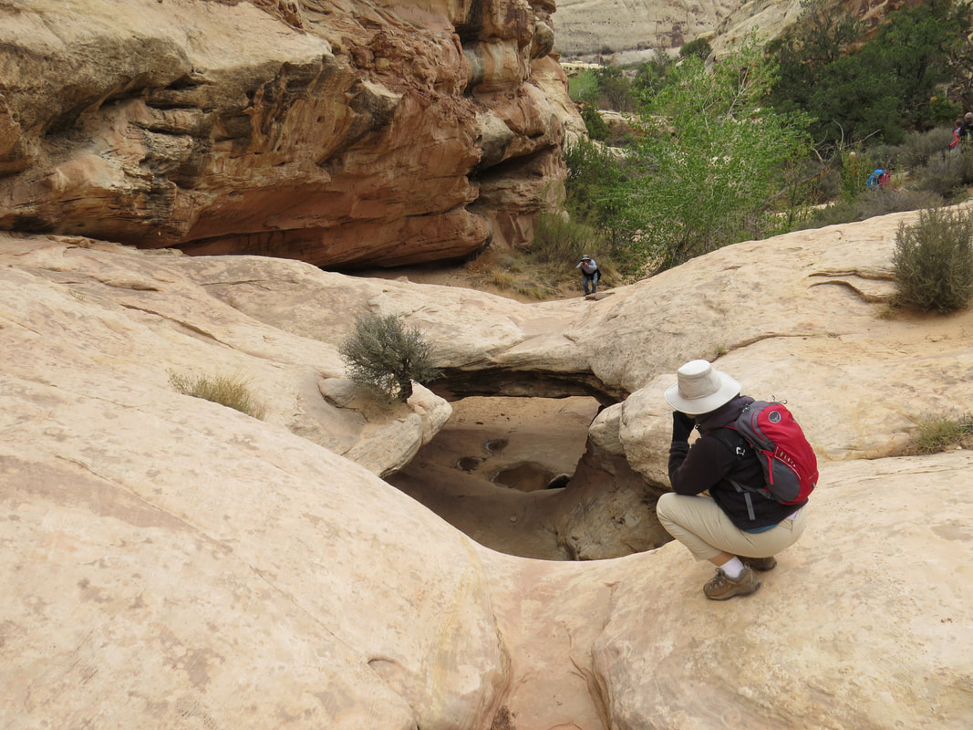
Lynn studying the little arch along the Hickman Bridge Trail.
|
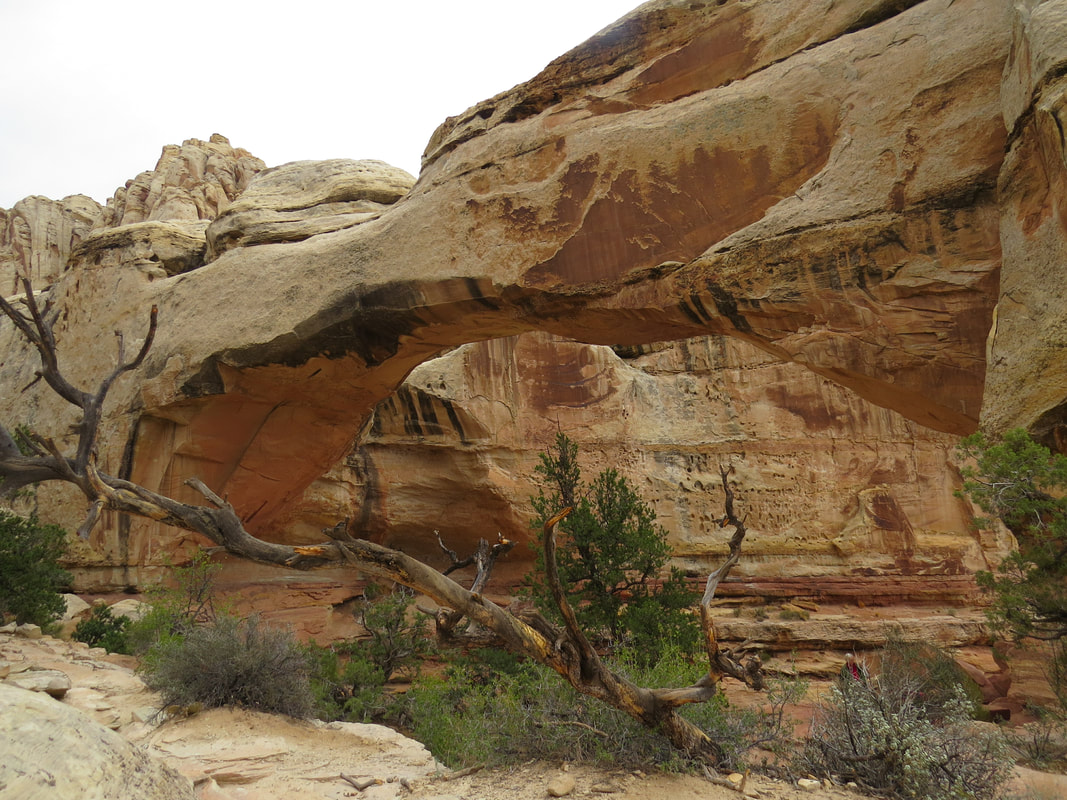
Hickman Bridge
|
We were milling about under the bridge taking pictures and enjoying the view. The next thing I knew, I was talking to Gurjinder. Wait a minute, you guys were off splashing through Sulphur Creek. Like us, they finished their morning hike and decided to check out Hickman Bridge, so the Herd was back together here under the big stone span. We all chatted about our adventures this morning. The guys who went to Sulphur Creek said they had a great hike. OK, we'll keep that one on the list for a future trip as the weather for the remainder of our stay in the area this time will just not be conducive to a wet hike. We all meandered back down the trail at our own pace, eventually congregating back at the trailhead. Here's the Hickman Bridge hike gallery.
So I got several numbers for the distance of our hike to Hickmann Bridge. The Ramblr app track said we hiked 1.8 miles roundtrip (from where we parked at the far end of the lot up to the natural bridge then back to the trailhead), the Hickman Bridge Trail Guide lists this as a 2.2 mile round-trip hike, the Fruita Area Map and Guide states that this is a 0.9 mile hike, one-way, and another guide listed 2.4 miles as the distance. I'll just go with the track distance; close enough for government work.
So I got several numbers for the distance of our hike to Hickmann Bridge. The Ramblr app track said we hiked 1.8 miles roundtrip (from where we parked at the far end of the lot up to the natural bridge then back to the trailhead), the Hickman Bridge Trail Guide lists this as a 2.2 mile round-trip hike, the Fruita Area Map and Guide states that this is a 0.9 mile hike, one-way, and another guide listed 2.4 miles as the distance. I'll just go with the track distance; close enough for government work.
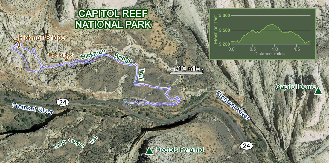
So today ended up being a good for hiking in terms of the weather, although a less overcast day would have been better from a photogenic perspective. The temperature was 45 F when we left this morning and hovered in the 55 to 60 degree range for most of the time we were on the trails and was 55 F when we dropped Beth and Tommy back at their Jeep in the parking lot across from the Gifford House. The deer did not seem to mind the weather at all as there were several scattered in the orchards as we drove through. But the conditions were quickly changing. The rain rolled in by the time we pulled back out onto route 24 and the temperature dropped to 45 F as we cruised back to Torrey.
We were home at 4:00, unloaded our gear, grabbed a beer (Manta Ray Double IPA from Ballast Point) and settled in for a little break. I worked on trip notes for a bit, including our meager critter list for today: Mule deer (lots of those), a couple random chipmunks, Wild turkey (also lots of those), the ever present Ravens, a few Grackles and an assortment of gone birds.
We were home at 4:00, unloaded our gear, grabbed a beer (Manta Ray Double IPA from Ballast Point) and settled in for a little break. I worked on trip notes for a bit, including our meager critter list for today: Mule deer (lots of those), a couple random chipmunks, Wild turkey (also lots of those), the ever present Ravens, a few Grackles and an assortment of gone birds.
 Artwork from the men's restroom, "Nose to Toes." The horse does not look impressed.
Tommy and Beth came over to the rental house before dinner. Unfortunately it was just too cold and wet to enjoy the porch this afternoon. In fact it started to pour as the sun went down. That could make the trails a bit of a mess tomorrow. We visited until it was time to leave for our 7:30 dinner reservation at the Broken Spur toward the east end of town. Anna was able to join us for dinner, bringing to 14 the total number of cats for the meet-up. It was great to see her. The restaurant on the other hand was a bit of a disappointment. First, they ignored our reservation and we were not seated until after 8:00. That gave us a little time to look at through the little gift shop and study the artwork and other artifacts scattered about the place. Words of wisdom, or maybe not so much, on the tee-shirts, like “So far this is the OLDEST I have been.” While the service was outstanding once we were seated, the food was mediocre at best. I had a bowl of chili which was just too sweet and potato skins, which were tiny; not at all what I was hoping for. But it passed as sustenance, so I reckon that will have to do.
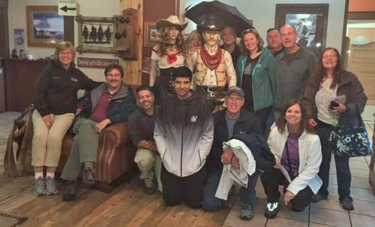 The Herd after dinner at Broken Spur. Front row, left to right: Lynn, Allen, Gurjinder, Harvin, Tommy, Beth; back row: "Alison", Norma, "Mark", Danny, Anna, Rob, John and Pixie.
Danny pitched Hanksville for next year. The group thinks that could work, although logistically it might be a challenge as Hanksville is limited on infrastructure in terms of lodging and dining options but there is probably enough to make it work. Danny did have a nice list of activities so we will be able to stay busy for a few days. Since we have a low turn out here in Torrey we will have some additional discussion to get input from the rest of the Herd.
We also reviewed the plan for tomorrow. We're going to go with the idea we came up with earlier today and start at the Gifford House at 0800 with pie for breakfast then go on the Ranger-led hike at 0830. Of course the weather could still be a factor and serious rain cancels all!
Rob, John and Anna are leaving in the morning so we said our goodbyes after dinner. Pixie is heading out tomorrow as well but she will be around for the hike, if the weather cooperates. We decided to get another group photo after dinner as we had another Herd member for the evening. We even managed to have stand-ins for Alison and Mark, so at least this portrait had 14 faces to represent all 14 cats at the Torrey meet-up.
After the photo op, Lynn and I braved the pouring rain and scurried to the car. We were home at 10:20. A bit of a late night for this group. It was still raining steadily and the temperature had dropped to 39 F. This does not bode well for tomorrow, but we will wait and see what the morning brings. Obviously no star gazing tonight.
Day 5, Sunday, October 7, 2018 - Ranger Hike. 0545, so up and at 'em. Grey day. Just socked in. But there might be a window to do something this morning as the hourly forecast indicates that the rain will hold off until about 11:00 AM. The temperature is currently 39 F and will at best be 45 F today. But Lynn and I decided to stick with the plan that was agreed upon last night at dinner. At the very least we'll get pie for breakfast. Let's see if anyone else shows for the Ranger hike. Might as well give it a whirl this morning as the rest of the day looks like a wash-out.
We were on the road at 7:40 and arrived at the Gifford house just after 8:00. Hey, there's Danny and Norma. I reckon they were also drawn in by the allure of breakfast pie. Lynn and I spilt a cherry pie and bought an apple for later. We sat at one of picnic tables under the covered area adjacent to the house (turns out this structure was a car port that was added to the historic building later in its life). Very good pie. The small cherry pie was just a little tart...hmmm, is that a pun? Whatever.
We had a very good turnout for the guided hike considering the less than ideal weather conditions. Gurjinder, Harvin and Pixie also decided to brave the elements, along with a half dozen or so other folks. We were all gathered in front of the Gifford House with our guide, Ranger Deena Lucas. This was her first year as a Ranger although she was an intern here last season. She is a very energetic and enthusiastic young lady and proved to be a great guide.
The plan for this morning was to start here from the Gifford House and walk along Fremont River Trail. The initial part through the orchard area is basically a flat nature trail that runs along the river, then the trail starts to climb when we entered the canyon containing the river. Ranger Deena indicated that she would take us as far as the first overlook point but that we could continue out to the second viewpoint if we wanted. That would only add a little over a half mile to the hike. Along the way we made several stops for interpretive discussions and to take in the views. Here are a few of the items that Ranger Deena shared (augmented by information I found on the NPS.gov website), in no particular order:
- Since we started our hike at the Gifford House, let's start with some history of the house and the Fruita area. The area around Capitol Reef was not explored until the early 1870s. Mormon settlers moved and established small agricultural communities west of Capitol Reef in the late 1870s. Then they began moving east along the Fremont River. The first resident of the area that is now Fruita probably came here in 1879, followed shortly by the first landholder, Nels Johnson. As others moved into the area a community called Junction, as it was at the junction of the Fremont River and Sulphur Creek, was formed.
- There was already a town in Utah called Junction, so the Postal Service required a new name so in 1902 the name of the community was changed to Fruita.
- Regarding the Gifford Homestead, the original home was built in 1908 by polygamist Calvin Pendleton. He and his family occupied it for eight years. The original house had a combined front room/kitchen and two small bedrooms. An outside ladder accessed two upstairs bedrooms. Pendleton also constructed the barn and smokehouse, as well as the rock walls near the house and on the mesa slopes above it. The second residents of the home were the Jorgen Jorgenson family who resided here from 1916 to 1928. Jorgenson sold the homestead to his son-in-law, Dewey Gifford, in 1928. The Gifford family occupied the home for 41 years (1928-1969). Gifford added a kitchen in 1946 and the bathroom, utility room, and carport in 1954. The Giffords sold the property to the National Park Service in 1969.
- The human history of the area stretches back much further than the Mormon settlers. The area of Capitol Reef has been a homeland to people for thousands of years. Archaic hunters and gatherers migrated through the canyons as early as 7,000 BCE (Before Common Era). Fremont Culture solidified around 500 CE (Common Era), from food foraging groups, to farmers of corn, beans and squash. Petroglyphs etched in rock walls and painted pictographs remain as sacred remnants of the ancient Indians' saga.
- The Fremont people developed farming techniques and replied on three key crops: corn, beans and squash.
- The Mormon settlers continued the agricultural ways and a variety of fruit orchards (apples, peaches and pears). The water of the Fremont River was crucial and irrigation was required for the farming efforts to flourish. When the Mormon settlers were asked about the specifics of the irrigation system they used they stated that the ditches that brought the water from the river to the fields and orchards were already in place when they arrived. The Fremont people had built the irrigation system and the Mormons knew a good thing when they saw it.
- There was a major flood in the early 1900s that destroyed the much of the orchards and washed trees from Fruita downstream to the next community of Cainesville, about 20 miles downriver.
- Ranger Deena also talked about the flora and fauna of the area. She pointed out an example of the milkweed plant growing along the trail near the river. The "milk" that flows through the plant is toxic so it is not eaten by most insects, is poisonous to most insects. However, the Milkweed Beetle has figured out how to tie the vines of the plant together to stop of the flow of the poisonous "milk" so that it can eat the plants leaves.
- She also gave us a little etymology in the realm of entomology. The milkweed beetle is a bug. Generally, the common name can be a clue to determine if an insect is a bug (I think she was referring to "true bugs"). One word names generally do describe the insect correctly and are not bug. Examples, dragonfly (not a fly) and ladybug, but a stink bug (two words) is a bug.
- While we have not seen a great variety of critters in the park, Ranger Deena indicated that there are a lot of animals in the Fruita area. She told of about a territorial raccoon that had claimed part of an orchard for its own. It would drive off the deer. There was also a beaver in the area, and the raccoon did not want it around either. The raccoon climbed a fruit tree and shook the limbs until the fruit dropped and struck the beaver on the noggin.
- She talked some about the geology of the area. There are more exposed geologic layers here in Capitol Reef that anywhere in Utah, I believe 20 layers. Ranger Deena had a nice, color graphic that showed the strata exposed here and at other parks in southern Utah that but I did not have an opportunity to get a photo. This stuff interests me, so I did my best to come up with my own graphic.
After 0.6 miles, the trail starts to climb, rising steadily above the river and providing nice views into the canyon. We were now off of the hard packed, nature trail surface and on the more typical dirt and rock trail. Fortunately, the trail was in good shape. We were concerned it might be really muddy after all that rain last night, but it was quite dry and easily passable. But it was uphill and a little steep in spots. Norma and a couple other folks turned back early along this section of the trail. As we walked along the trail well above the river we had a nice view down into the valley. I spotted a little wide spot on the far side of the river, next to the service road in the canyon, complete with three picnic tables. I pointed those out to Danny, suggesting that he add these to his list of obscure places to have a snack, right after the lone table at the top of the Burr Trail switchbacks.
We made a couple stops along the trail before reaching the viewpoint. Ranger Deena had a few more interesting tidbits for us on geology and history, but mostly she was just trying to keep the group together. There were a couple of interesting rocks along the way, including an example of a conglomerate rock. Just one chunk of this seemingly out of place boulder, a round mosaic of little pebbles and gravel all cemented together in a purple composite. Much more like something that would come from the bed of a creek of the bottom of a sea. Which is probably exactly from where it originated. In fact, Ranger Deena told us to be on the lookout for other rocks that had an aquatic pedigree. There are slabs of sandstone scattered about the trail with a wavy texture formed from the ripples of sand on the ancient sea that used to cover this area (OK, I might not have that detail exactly correct, but it sounds pretty good). I spotted a hollow rock and asked Ranger Deena if she had any clues about that one. Turns out that she had not noticed it before. She now has a homework assignment.
We reached the first view point right around 10:00 AM. Even with the grey, low overcast, this is still a pretty view as we looked generally westward, up the canyon holding the Fremont River and beyond to the red sandstone formations to the north of route 24. This is the point where the guided portion of the hike ended. Ranger Deena pointed us in the direction of the next view point, which was not that much further. Gurjinder and Harvin were quickly on the trail to see the next vista. Lynn and I followed a few minutes later. The rest of the folks went back with Ranger Deena. The trail to the second viewpoint runs parallel to one of the feeder creeks for the Fremont River. Just the creek bed is a few hundred feet below us. And we were still climbing steadily to the end of the trail which was at an exposed little knob that provides views in all directions. Looking west is basically into the canyon we've walked next to on the hike here. I think the better views from here are to the east, toward the scenic drive and the sandstone formations stretching as far as we could see. Red, orange and yellow striped cliffs and mesas nearest then the caps of the white sandstone domes. The green patch of Fruita, where we started this morning, stood out against the desert rocks. We chatted with Gurjinder and Harvin at the viewpoint before they took off back down the trail. That left us as the last of the group to hike back. Fine by me, we'll just take our time and enjoy the views and some solitude.
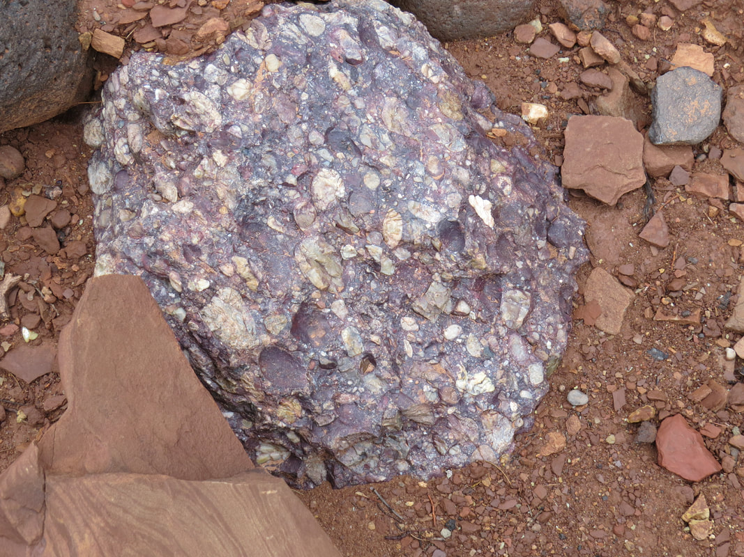
Conglomerate Rock
|
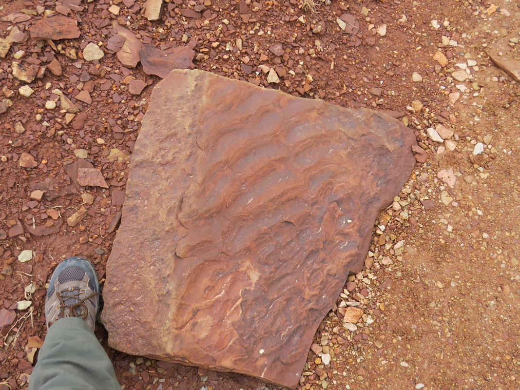
|
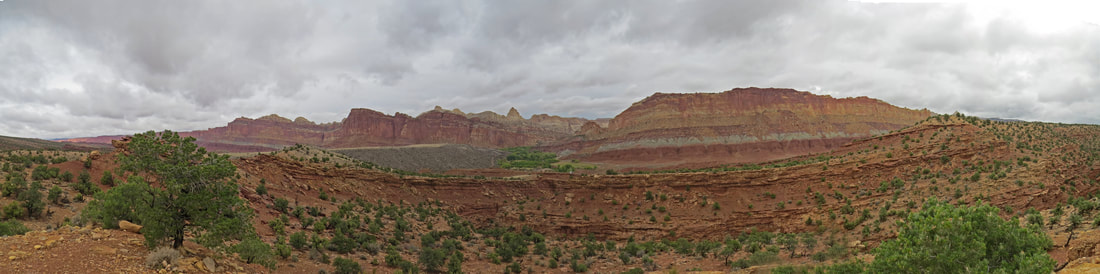
Vista looking east fro the end of the Fremont River Trail.
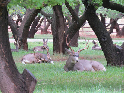
We left the far viewpoint about 10:30 and we made really good time getting back down to the orchards, about 20 minutes. Well it was downhill all the way. We met Norma, Beth and Tommy on the trail near the orchards, looking at the deer lounging about under the fruit trees. Norma reported seeing a coyote here earlier as well. She was doing better than us as our animal sightings for this morning were meager. Again lots of mule deer in the orchards (at least 11 including five bucks) and a flock of Wild Turkeys. Other than that, just a few scattered birds: Common Flicker, White-crowned Sparrows, American Goldfinch and the smattering of gone birds.
Pixie hit the road after the Fremont River Trail hike. We said our good-byes; great seeing her as she had missed two of the last three meet-ups. Then she climbed into Pepe (her name for her Jeep) and started for home. Rob, John and Anna also all hit the road early this morning. We are now down to just eight cats. Those of us who were left decided to have lunch under the car port at the Gifford house, so we all gathered our grub and congregated around the picnic tables. Lynn and I split an apple pie. I have had more pie this week than my total for the last three years. Not complaining. Good thing that we were under the awning as it was getting a bit misty. That does not bode well for any more hiking today, but we'll see what the trails look like. We talked over options and decided to try the Chimney Rock Trail. We'll see what it looks like but the mist is becoming more persistent.
Pixie hit the road after the Fremont River Trail hike. We said our good-byes; great seeing her as she had missed two of the last three meet-ups. Then she climbed into Pepe (her name for her Jeep) and started for home. Rob, John and Anna also all hit the road early this morning. We are now down to just eight cats. Those of us who were left decided to have lunch under the car port at the Gifford house, so we all gathered our grub and congregated around the picnic tables. Lynn and I split an apple pie. I have had more pie this week than my total for the last three years. Not complaining. Good thing that we were under the awning as it was getting a bit misty. That does not bode well for any more hiking today, but we'll see what the trails look like. We talked over options and decided to try the Chimney Rock Trail. We'll see what it looks like but the mist is becoming more persistent.
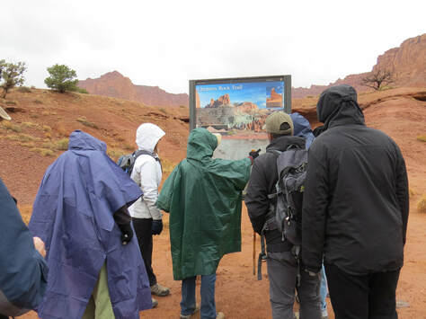 Geared up and getting directions for a chilly, rainy hike....maybe.
We finished lunch and headed over to the Chimney Rock Trailhead, arriving a little before 1:00. There were a number of cars parked around the little loop, which we took as a good sign, but also some huge puddles, so we knew it would be wet. But we are here so we're going to give it a go. Daypacks and rain gear as the misty conditions were turning into more of a drizzle. The initial portion of the trail was not bad at all, so we had high hopes. However when we reached the first steep, uphill section, the trail became a quagmire of grey, boot-sucking muck. We only went a little way along this piece of the trail before our hiking shoes had tripled in size and weight. Harvin volunteered to scout up to the top of this section (or maybe Gurjinder volunteered him, I'm not sure). Yep, it is a mess all the way up. We met a couple hikers coming down the trail; they said that their trial was no bad when they hiked out but had degraded significantly on the return trip. OK, that's enough data. We decided it was not worth the risk and gave up a bit before 1:00. Back at the trailhead we took advantage of the puddles to try and get some of the mud off of our boots. Light rain is falling. I think we are all done with hiking for the day. Gurjinder and Harvin took a drive out along route 12. Beth and Tommy went to the Capitol Reef Visitor Center. Lynn and I just went back to the house to get warm and relax for the afternoon.
Back at the house, quickly took off our mud-encrusted hiking shoes and found a plastic bag to set this one in order to contain the mess. There was a ton of mud on our shoes. But otherwise we were clean and mostly dry. While it had been 50 degrees F while we were hiking, the temperature had dropped to 42 F here on the hill above Torrey. And the rain was really coming down. We were now in an all-day soaker and it was really pouring at times. Time for beer, cheese and chocolate.
We decided that we should have the remaining Herd members over for a pre-dinner drink. A flurry of texts alerted everyone to the invitation. There was plenty of room for the eight of us to sit around the little living room. Just too bad we could not hang out in the outdoor areas but it is raining and cold this afternoon. But it was a nice time and we had a pleasant little visit just talking about travels and meet-ups past and future.
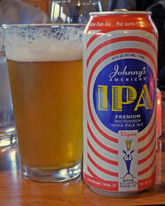
For dinner this evening we went to Rim Rock Inn and Restaurant out on the east edge of Torrey. First time that Lynn and I had been here. Nice place. I would rate it second behind Café Diablo. Sort of a western theme with a comfort food menu. The service was excellent, the food was very good and the beer, well, this is a small town in Utah, so the beer selection was just OK (and that is being generous). I had the Johnny's American IPA from Moab Brewing, a decent IPA but certainly nothing special. But it went well with my burger and that's all that mattered. Dinner this evening is really the final official event of the Torrey meet-up. Everyone else will be heading out in the morning. Only Danny and Norma may stick around. The weather will not be great on Monday, so no reason for folks to hang around. Lynn and I are committed to Torrey for a few more days. We'll figure it out as we go.
After dinner we said our farewells to the rest of the Herd then headed back to our little rental house. We were getting settled in for a quiet evening by about 8:15. Done for the night. We lounged in the living room for a while and finally turned in about 10:00. The end of another great UTAH meet-up. But tomorrow starts our solo adventures in Torrey, so we'll see what we can find to do.
Here is the link to our photos from today.
Our adventures in Torrey and Capitol Reef continue in PART 2 of this journal.