Trip Journal - Hocking Hills, Ohio
Logan, Ohio
Friday, July 9 - Wednesday, July 14, 2021
Introduction. It only took us 33 years to make the short trek to Hocking Hills. We had heard about the beauty of the area since we moved to Ohio. In fact, folks were surprised to learn that we had not visited previously as it is known for its great hiking trails and hiking is what we like to do. We finally fixed that omission by making the short drive south in July 2021.
We probably have the pandemic to thank for this trip, as odd as that sounds. Usually, mid-summer is the time for one of our big excursions out west for the National Parks. However, with COVID still a significant issue as we flipped the calendar to 2021, we decided to defer the longer, multi-destination adventure for at least another year, and looked for a closer-to-home road-trip option. Hocking Hills was the perfect fit. The nice thing about a nearby destination is that the only reservation I have to deal with is lodging, and I have VRBO to work with for that. We invited Lisa along, since she has been a part of our summer trips the past couple of years. She’s in. VRBO did come through with several nice options and I locked-in a cabin near the state park by the end of February. Now I have the rest of the winter and spring time to figure out the hiking options.
I think my only concern with Hocking Hills was my perception that this would just be hiking in the woods. Hey, I enjoy hikes in the forest, but a week of that might get a little stale. I like the wide open spaces that we get on the trails out west. The big vistas. Well, I found out that there was no need to worry about the quality of the trails in the Hocking Hills area. Yes, the trails are through the trees, but this is really about the rocks and water that live in the forest. We hiked seven trails in the state parks and nature preserves (plus a few walks along the road where our cabin was located) and found wonderful views, interesting geologic formations, plenty of wildlife and other interesting natural wonders in the details along the trail. Plus, we were usually able to avoid the crowds simply by starting early (well, sort of early) and arranging our itinerary to avoid prime time on the popular trails.
By the end of the trip, I had to ask myself what took us so long to visit this amazing area.
Summary & Highlights. Let me start with a few highlights and summary items, mostly focused on the trails, then I’ll go through the day-by-day journal of the trip. I’ll pull the common themes, like hiking, dining, and trip logistics forward in case someone might find these useful in planning a trip.
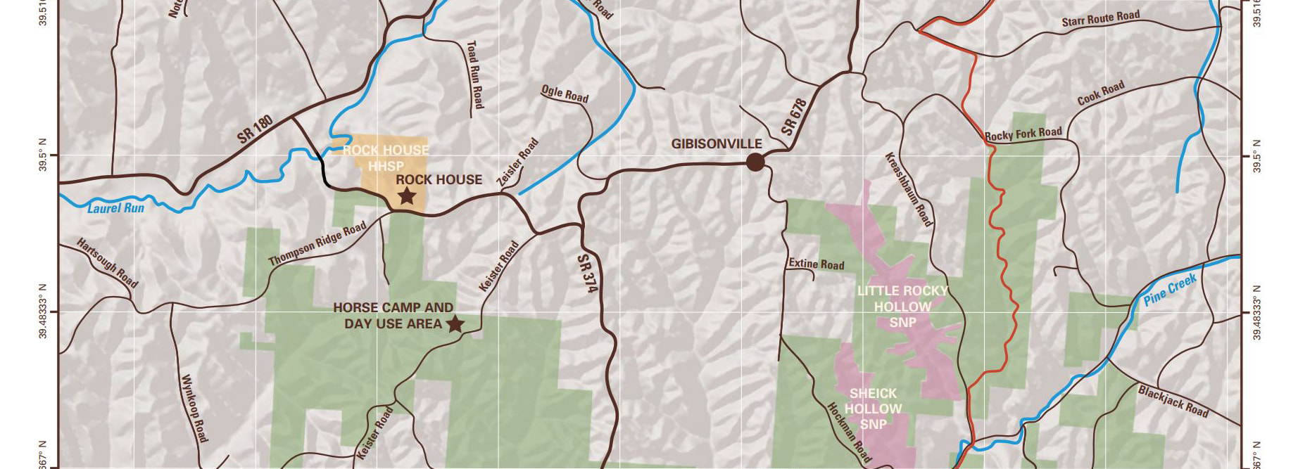
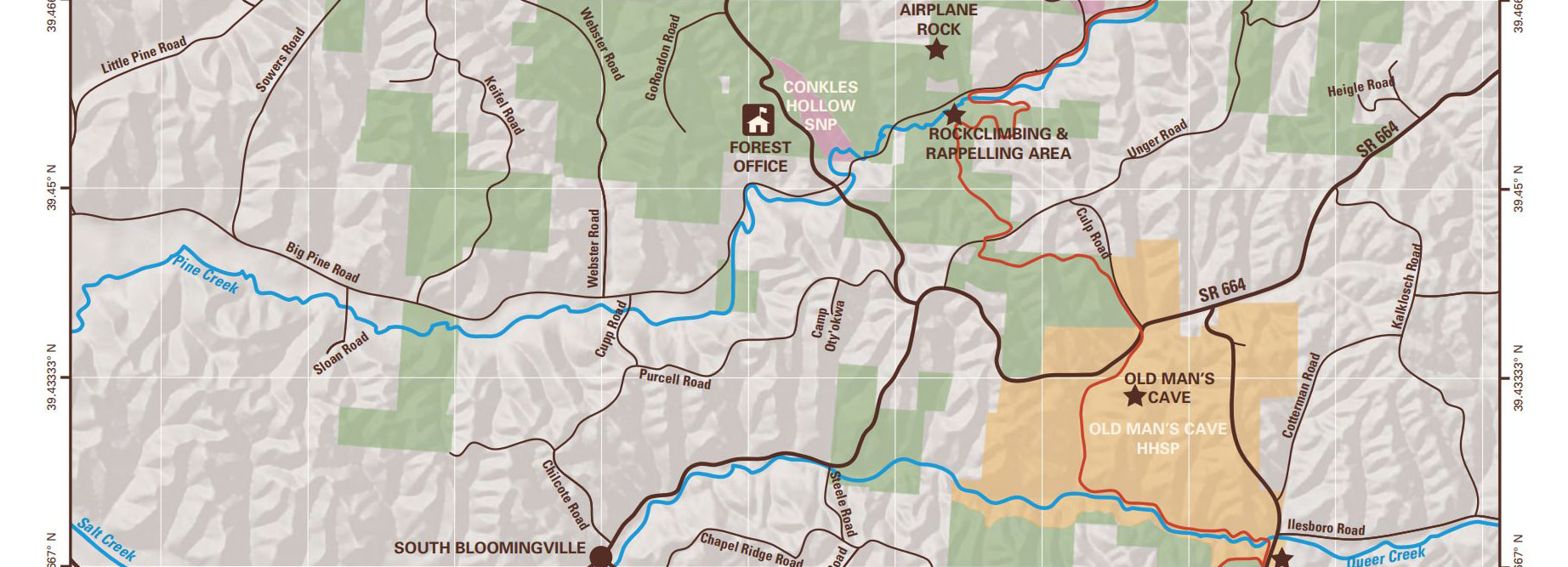
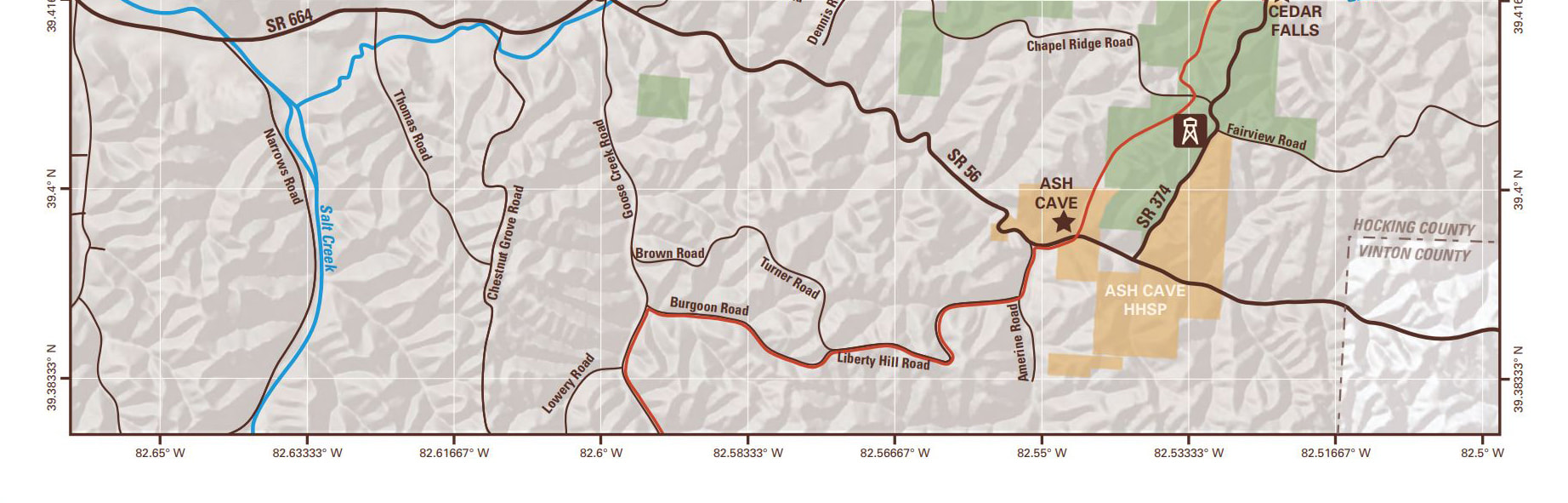
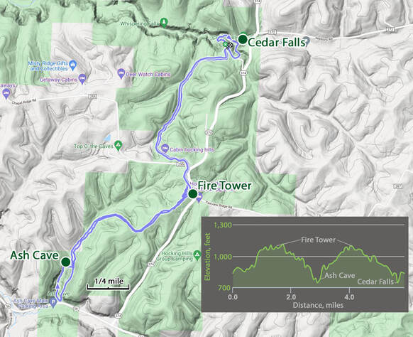
The Hocking Hills Region. As I said, we’ve heard about Hocking Hills for years. I would hear references to the area as Hocking Hills and Hocking Hills State Park. I never paid this much attention as I’m used to the National Parks just being referred to by their name, that is Yellowstone not always Yellowstone National Park. However, in this case, just saying Hocking Hills is the way to go. The natural wonders of the area are protected by a discontinuous collection of parcels made up of the Hocking State Forest, Hocking Hills State Park and several State Nature Preserves. The state park is not even one chunk of land but separate areas that encompass specific geologic features. It all starts to make sense when seen on a map, albeit it took me a little time to find the right map. The one below was downloaded from the Ohio Department of Natural Resources (ODNR) website and shows the various sections administered by the state along with some of the key highlights.
Logan, Ohio
Friday, July 9 - Wednesday, July 14, 2021
Introduction. It only took us 33 years to make the short trek to Hocking Hills. We had heard about the beauty of the area since we moved to Ohio. In fact, folks were surprised to learn that we had not visited previously as it is known for its great hiking trails and hiking is what we like to do. We finally fixed that omission by making the short drive south in July 2021.
We probably have the pandemic to thank for this trip, as odd as that sounds. Usually, mid-summer is the time for one of our big excursions out west for the National Parks. However, with COVID still a significant issue as we flipped the calendar to 2021, we decided to defer the longer, multi-destination adventure for at least another year, and looked for a closer-to-home road-trip option. Hocking Hills was the perfect fit. The nice thing about a nearby destination is that the only reservation I have to deal with is lodging, and I have VRBO to work with for that. We invited Lisa along, since she has been a part of our summer trips the past couple of years. She’s in. VRBO did come through with several nice options and I locked-in a cabin near the state park by the end of February. Now I have the rest of the winter and spring time to figure out the hiking options.
I think my only concern with Hocking Hills was my perception that this would just be hiking in the woods. Hey, I enjoy hikes in the forest, but a week of that might get a little stale. I like the wide open spaces that we get on the trails out west. The big vistas. Well, I found out that there was no need to worry about the quality of the trails in the Hocking Hills area. Yes, the trails are through the trees, but this is really about the rocks and water that live in the forest. We hiked seven trails in the state parks and nature preserves (plus a few walks along the road where our cabin was located) and found wonderful views, interesting geologic formations, plenty of wildlife and other interesting natural wonders in the details along the trail. Plus, we were usually able to avoid the crowds simply by starting early (well, sort of early) and arranging our itinerary to avoid prime time on the popular trails.
By the end of the trip, I had to ask myself what took us so long to visit this amazing area.
Summary & Highlights. Let me start with a few highlights and summary items, mostly focused on the trails, then I’ll go through the day-by-day journal of the trip. I’ll pull the common themes, like hiking, dining, and trip logistics forward in case someone might find these useful in planning a trip.
The Hocking Hills Region. As I said, we’ve heard about Hocking Hills for years. I would hear references to the area as Hocking Hills and Hocking Hills State Park. I never paid this much attention as I’m used to the National Parks just being referred to by their name, that is Yellowstone not always Yellowstone National Park. However, in this case, just saying Hocking Hills is the way to go. The natural wonders of the area are protected by a discontinuous collection of parcels made up of the Hocking State Forest, Hocking Hills State Park and several State Nature Preserves. The state park is not even one chunk of land but separate areas that encompass specific geologic features. It all starts to make sense when seen on a map, albeit it took me a little time to find the right map. The one below was downloaded from the Ohio Department of Natural Resources (ODNR) website and shows the various sections administered by the state along with some of the key highlights.
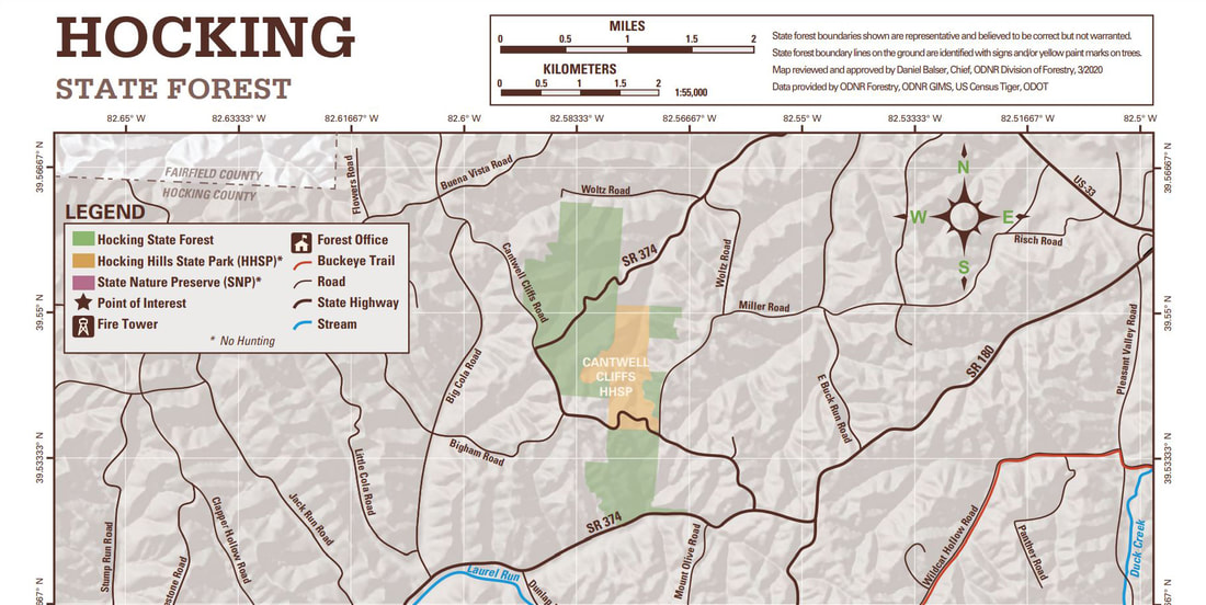
Note that our rental cabin is located just off the east edge of the map along SR 664.
The Trails. I followed my usual process used for researching the hiking options. There were plenty of online references found by simply doing a search of Hocking Hills hiking, plus I gleaned a little from TripAdvisor. I purchased a book, Hocking Hills Day Hikes by Mary Reed. And I even got a little local knowledge, which is always helpful.
One of the first websites that I found highlighted seven featured areas in Hocking Hills and talked about combining some of these into longer hikes (a bonus for me).
The local knowledge came from a discussion with one of my young engineers, Evan. During the spring we were chatting over Teams (we’re all teleworking due to the pandemic, but we have the tools to stay productive while away from the base). While the point of the conversation was his annual performance review, we spent more time talking about travel plans for the summer (we’re not letting the pandemic stop us completely). Evan and his wife have hiked in Hocking Hills and he highly recommended the trail to Airplane Rock. He said they had the trail to themselves and that the rock formation and the view at the end of the hike were excellent. This was their favorite hike of the trip. OK, I added Airplane Rock to the list.
Based on all this input, it looks like we can cover the seven featured areas plus Airplane Rock in the four days that we have. Here are the combinations by day (the days can be in any order and we will adjust based on weather and expected crowds):
Day 1: Old Man’s Cave & Whispering Cave (merged into one hike)
Day 2: Ash Cave & Cedar Falls (merged into one hike)
Day 3: Conkle’s Hollow (1-mile lower trail and 2-mile upper trail) & Airplane Rock (3.4 miles)
Day 4: Rock House (1 mile) and Cantwell Cliffs (two separate hikes).
I guess this was sort of the going in priority order based on the reading that I had done. But we knew that Hocking Hills was a popular area and some of these trails would be crowded particularly on the weekend. So, for example, I figured we would hike Old Man’s Cave Monday or Tuesday to hopefully reduce the number of tourists on the trail.
The pandemic did force some changes on the trails. The ODNR had implemented a one-way route on the loop trails in order to keep folks moving in the same direction and thereby reduce crowding and hikers passing as frequently on the trails, all with the idea of reducing the chances of spreading the virus. I guess that sounds like a reasonable approach. I guess everything we can do will help. The ODNR did provide very nice, color-coded maps of all the major trails showing the one-way routing. They did a pretty good job with the routes to allow good access to the entirety of the trails, although a few looked a bit convoluted. However, once we got on the trails, the routes worked out well. In fact, the one-way trails are actually not a bad idea, particularly on the more crowded trails since the traffic kept moving in the same direction which appeared to help the overall flow and reduced the congestion.
One note was that my hiking book was published pre-pandemic so it did not incorporate these recently adopted one-way routes. That limited the usefulness of the book a bit, as some of the suggested routes in the book were not possible with the COVID-induced restrictions (well, not if you wanted to follow the rules, and I guess I’m a rule-follower).
That’s a long preamble to get to a summary of our hiking experience in Hocking Hills. The really short answer is that the hiking was fantastic! Yes, hiking in the woods, but the wooded trails were gorgeous and in excellent condition (well, all but one) and the highlighted natural wonders one each trail were spectacular. We did hit some crowds on the trail, but our usually early start each day helped to mitigate that issue. Plus we had great weather for hiking (a little hot and muggy at times, but the trails were well shaded; I guess that’s the advantage to hiking in a forest!).
During our final evening on the back porch of the cabin, I asked Lynn and Lisa for their rankings of the hikes, mostly just for fun, but I was also interested to see how closely our likes and dislikes for the trails were. For me, I’m going to go with the more challenging and less crowded hikes, but the aesthetic nature of the trail is also a very important factor.
The table shows the order of the hikes and the day we did each, so how we combined the various trails and areas. Seven hikes total, so the rules to the rating game were pretty simple, just rank the trails from your favorite (1) to least (7). I did not impose any additional grading criteria, but items like views, trail condition, and crowds all played into the ratings. Interestingly, our individual rankings were pretty darn close, with Lynn’s and Lisa’s being nearly identical. My ratings were a little off from the girl’s just because I put Airplane Rock higher on the list, but still the alignment was close.
The Trails. I followed my usual process used for researching the hiking options. There were plenty of online references found by simply doing a search of Hocking Hills hiking, plus I gleaned a little from TripAdvisor. I purchased a book, Hocking Hills Day Hikes by Mary Reed. And I even got a little local knowledge, which is always helpful.
One of the first websites that I found highlighted seven featured areas in Hocking Hills and talked about combining some of these into longer hikes (a bonus for me).
- Old Man’s Cave
- Whispering Cave
- Ash Cave
- Cedar Falls
- Conkle’s Hollow
- Rock House
- Cantwell Cliffs
The local knowledge came from a discussion with one of my young engineers, Evan. During the spring we were chatting over Teams (we’re all teleworking due to the pandemic, but we have the tools to stay productive while away from the base). While the point of the conversation was his annual performance review, we spent more time talking about travel plans for the summer (we’re not letting the pandemic stop us completely). Evan and his wife have hiked in Hocking Hills and he highly recommended the trail to Airplane Rock. He said they had the trail to themselves and that the rock formation and the view at the end of the hike were excellent. This was their favorite hike of the trip. OK, I added Airplane Rock to the list.
Based on all this input, it looks like we can cover the seven featured areas plus Airplane Rock in the four days that we have. Here are the combinations by day (the days can be in any order and we will adjust based on weather and expected crowds):
Day 1: Old Man’s Cave & Whispering Cave (merged into one hike)
Day 2: Ash Cave & Cedar Falls (merged into one hike)
Day 3: Conkle’s Hollow (1-mile lower trail and 2-mile upper trail) & Airplane Rock (3.4 miles)
Day 4: Rock House (1 mile) and Cantwell Cliffs (two separate hikes).
I guess this was sort of the going in priority order based on the reading that I had done. But we knew that Hocking Hills was a popular area and some of these trails would be crowded particularly on the weekend. So, for example, I figured we would hike Old Man’s Cave Monday or Tuesday to hopefully reduce the number of tourists on the trail.
The pandemic did force some changes on the trails. The ODNR had implemented a one-way route on the loop trails in order to keep folks moving in the same direction and thereby reduce crowding and hikers passing as frequently on the trails, all with the idea of reducing the chances of spreading the virus. I guess that sounds like a reasonable approach. I guess everything we can do will help. The ODNR did provide very nice, color-coded maps of all the major trails showing the one-way routing. They did a pretty good job with the routes to allow good access to the entirety of the trails, although a few looked a bit convoluted. However, once we got on the trails, the routes worked out well. In fact, the one-way trails are actually not a bad idea, particularly on the more crowded trails since the traffic kept moving in the same direction which appeared to help the overall flow and reduced the congestion.
One note was that my hiking book was published pre-pandemic so it did not incorporate these recently adopted one-way routes. That limited the usefulness of the book a bit, as some of the suggested routes in the book were not possible with the COVID-induced restrictions (well, not if you wanted to follow the rules, and I guess I’m a rule-follower).
That’s a long preamble to get to a summary of our hiking experience in Hocking Hills. The really short answer is that the hiking was fantastic! Yes, hiking in the woods, but the wooded trails were gorgeous and in excellent condition (well, all but one) and the highlighted natural wonders one each trail were spectacular. We did hit some crowds on the trail, but our usually early start each day helped to mitigate that issue. Plus we had great weather for hiking (a little hot and muggy at times, but the trails were well shaded; I guess that’s the advantage to hiking in a forest!).
During our final evening on the back porch of the cabin, I asked Lynn and Lisa for their rankings of the hikes, mostly just for fun, but I was also interested to see how closely our likes and dislikes for the trails were. For me, I’m going to go with the more challenging and less crowded hikes, but the aesthetic nature of the trail is also a very important factor.
The table shows the order of the hikes and the day we did each, so how we combined the various trails and areas. Seven hikes total, so the rules to the rating game were pretty simple, just rank the trails from your favorite (1) to least (7). I did not impose any additional grading criteria, but items like views, trail condition, and crowds all played into the ratings. Interestingly, our individual rankings were pretty darn close, with Lynn’s and Lisa’s being nearly identical. My ratings were a little off from the girl’s just because I put Airplane Rock higher on the list, but still the alignment was close.

This is sort of like ranking your favorite pet or National Park, as they are all special. We did enjoy all the trails we hiked and would do all of them again. So, I do recommend each of these trails, but based on the numbers, Old Man’s Cave/Whispering Cave loop, Conkle’s Hollows and Airplane Rock get the gold, silver and bronze medals, respectively. I added a few general notes on each trail below:
- Old Man’s Cave and Whispering Cave - I guess this is the signature hike for Hocking Hills, especially Old Man’s Cave. The key is to start early and avoid the crowd. That worked well for us. There is a LOT to see on this loop between the waterfalls, Old Man’s Cave, Devil’s Bathtub and Whispering Cave. Plus the trail itself, particularly the bridges, is a work of art in places.
- Conkle’s Hollow - We only got to do the gorge trail before we got rained out (we thought about returning for the rim trail on Tuesday, but Lynn’s bee sting put an end to that plan). Short hike but gorgeous. So green. Like a rain forest. Easy, paved trail for the most part, but we did walk the dirt and rock section back to the end of the gorge.
- Airplane Rock - The trail here is an old dirt road, so wide and easy to follow. We had the trail to ourselves which is a huge bonus in my book. Nice view from Airplane Rock. I bet that this is a beautiful vista during peak fall colors. The woods here were pretty but not the rainforest green of Conkle’s Hollow or Old Man’s Cave, however there were plenty of interesting details along the trail, you just have to keep your eyes open.
- Rock House - Another short loop hike, but a bit of a work out with the elevation change (hey, this is Ohio, so there are no extreme elevation changes to deal with, but this one did have us huffing just a little). Very cool cave, the only real cave in Hocking HIlls State Park. Well worth seeing.
- Rockbridge State Nature Preserve - I added this one at the last minute since it looked like we would have time for an extra hike on Tuesday. The hiking book came through. I did not know there were any natural bridges in Ohio but these formations are favorites of mine, so once I read about it, the trail was on the list. We could have skipped the Rock Shelter trail, as there was not much to see there, but Rock Bridge was quite impressive. Glad we got to see that natural wonder.
- Cedar Falls and Ash Cave - I was surprised that this one ended up near the end of all of our rankings, but that really highlights how good some of the other trails are. I think that the crowded conditions, particularly at Cedar Falls, was the biggest issue with the hike. But both Ask Cave and Cedar Falls are lovely and the hike along the Buckeye Trail was great. The trail was in excellent shape.
- Cantwell Cliffs - We all ranked this one as our least favorite hike. It may have suffered from being one of the last hikes. While the scenery was pretty and the geology interesting (there were some nice cliffs, hollows and other features scattered along the trail), the trail was not in great shape and was really in need of some maintenance. Plus one of the trails in this area listed in the book was closed (not sure if this was due to COVID or that the trail was not in good shape.
Lodging. We stayed at Red Pine Cabin on Collison Road just a few miles east of the Old Man’s Cave area of Hocking HIlls. I think all of the cabins along that sort section of Collison were rentals managed by a couple different outfits. While we rented through VRBO, the management company was Buffalo Lodging and Cabins. No issues working with them at all. This was a very convenient location to all of the hiking areas and back into Logan for dining. Also a fairly quiet area and nicely secluded, with a nice looking back porch where we could enjoy a beer in the afternoon. The roads around the cabin were very low traffic and the area was scenic so we ended up getting in some extra miles just walking around the area each day. Overall, the cabin fit our needs but did have some quirks. I included the review I posted on VRBO to provide some additional details.
VRBO Review - Red Pine Cabin, Buffalo Lodging and Cabins: Convenient Location for Exploring Hocking Hills
Red Pine Cabin is a very nice lodging option in the Hocking Hills area, but with some oddities so I could not rate it as “5 stars.” But it was close. Staying for our 5-day visit were my wife and I, and my sister-in-law, (late 50s to early 60s). Our goal for lodging was simply to provide a base for exploring Hocking Hills and to have a nice place to relax in the afternoon. In these respects the cabin fit our needs well.
The positive points for the cabin were the location (about 10 minutes back into Logan for restaurants and only 10-15 minutes to the trailheads we hiked from each day). Plus it was on a quiet, dead-end road that connected with another quiet country road, which was very conducive for an early morning or evening walk (no traffic on these roads, scenic and plenty of wildlife to see). The highlight of the cabin for us was the back porch that overlooked the wooded area behind the house. Great place to relax with a beer or glass of wine after hiking. We had dinner on the back porch three nights (carry-out from the local restaurants) which worked out very nicely. The main area of the cabin was very comfortable. The main bedroom on the first floor (my wife and I had this room) also had plenty of space (however it would have been nice to have had some additional counter space in the bedroom). Note that this cabin does have two full and one half bathrooms, which is a bonus.
There were a few negative points and while most of these are minor they do add up. The downstairs bathroom was on the small side. The upstairs is probably meant more for kids as it was lacking a little headroom in the bathroom and bedroom (my SIL was concerned about hitting her head on the ceiling fan). The towels provided were “thin” but got the job done. We nicknamed the cabin “Squeaky” as it made a lot of noise (creaky floors and the dishwasher door). The doors from the living room to the back porch were also hard to open at times (the door from the main bedroom to the back porch was very easy to use). It also seemed that some of the doors opened the wrong way, like the front door to the cabin. When it was open, it blocked access to the hall leading to the laundry area and main bedroom. Not a big deal, but a bit annoying when entering with luggage or backpacks.
Overall, we found the cabin to be a nice place to stay and made a nice base for exploring the Hocking Hills area.
Dining. We don’t cook on vacation, just not our thing. We keep breakfast very simply, eat lunch on the trail or just a snack on the porch, and usually eat out or carry out for dinner. That was definitely our modus operandi for this trip.
Based on my pre-trip research, I did not get the impression that Logan is the culinary capital of Ohio, but it had its share of reasonable restaurants, once I waded through all the pizza places, sub shops and Mexican joints (there were a surprising number of those). But all of those categories were in play since dining on the back porch of the cabin is a preferred venue for this trip. But I did expect that we might go to a restaurant once or twice during the trip, probably on arrival night at least, just to keep things simple.
A couple places caught my eye from the TripAdvisor reviews and forum posts for places to dine at in Logan. Again, trimming out the pizza joints and the family diners that don’t offer a meaningful beer or drink menu, there were two places of interest:
The Short Story. Those were all of the pieces and parts that went into the trip. Below is how all those parts flowed into the trip and how we spent our time in Hocking Hills:
That covers the general plan, logistics and hiking overview. Next is the day-by-day journal with all the details of the trip.
Day 1 - Friday, July 9 - Travel Day. A pretty relaxed day for the start of vacation, although Lynn and I still had a couple work tasks and meetings to clear off our to-do lists before we could officially start our time-off. Plus, we had the final packing details and a trip to the grocery store before we hit the road, but there was plenty of time for all of that. Overall, a quiet morning.
By noon the work stuff was long since completed and we were just finishing up the packing details. That’s another nice thing about a road trip, the packing is easier. We don’t have to cram everything into a suitcase like we would when flying, and we can bring along extra items, the stuff that we may or may not need but, what the heck, we have plenty of room to bring it along.
At 12:54 I was packed, had my gear and the coolers loaded in the Edge and was just waiting on Lynn. She was still tracking down some missing items, like the rubber gloves she takes for house cleaning in case the rental property is not up to snuff. We just had those for the Kentucky trip last month and since we’re taking the same things to Hocking Hills, the gloves should be on the big green tote we use for storing such travel supplies, right there in the packing zone. But she said she looked there and has expanded the search. OK, I better help or we’ll never get on the road. There’s the green tote box, lift up her backpack and there are two bright yellow raincoats for your hands. I grabbed the gloves and walked to the kitchen, asking my standard sarcastic question that I pose whenever I have located what she has lost, “can you describe the missing rubber gloves.” I got “the look.” But she is happy now and we are one step closer to departure.
Lynn got squirreled a couple more times for what reasons I don’t know, but we were finally loaded up, had the directions queued up on Baby and were starting down the driveway at 1:21. OK, that’s not too bad and should get us to the rental cabin right on time for check-in time at 4:00 PM.
Uneventful drive, and very easy given the pleasant conditions. Much better than the downpour we endured for the drive to Kentucky last month. The drive time from the ranch to the cabin was 2:40 per Baby. I-71 south to Columbus then east on route 33 to Logan then south on route 664 to our cabin. Pretty easy. And only one stop to fuel up the Edge once we reached Logan. Lynn and I passed the time chatting about the plans for our time in Hocking Hills. The only wildcard is the weather, which looks pretty good but does include some chances for rain. But we’re flexible and will adjust as needed.
The positive points for the cabin were the location (about 10 minutes back into Logan for restaurants and only 10-15 minutes to the trailheads we hiked from each day). Plus it was on a quiet, dead-end road that connected with another quiet country road, which was very conducive for an early morning or evening walk (no traffic on these roads, scenic and plenty of wildlife to see). The highlight of the cabin for us was the back porch that overlooked the wooded area behind the house. Great place to relax with a beer or glass of wine after hiking. We had dinner on the back porch three nights (carry-out from the local restaurants) which worked out very nicely. The main area of the cabin was very comfortable. The main bedroom on the first floor (my wife and I had this room) also had plenty of space (however it would have been nice to have had some additional counter space in the bedroom). Note that this cabin does have two full and one half bathrooms, which is a bonus.
There were a few negative points and while most of these are minor they do add up. The downstairs bathroom was on the small side. The upstairs is probably meant more for kids as it was lacking a little headroom in the bathroom and bedroom (my SIL was concerned about hitting her head on the ceiling fan). The towels provided were “thin” but got the job done. We nicknamed the cabin “Squeaky” as it made a lot of noise (creaky floors and the dishwasher door). The doors from the living room to the back porch were also hard to open at times (the door from the main bedroom to the back porch was very easy to use). It also seemed that some of the doors opened the wrong way, like the front door to the cabin. When it was open, it blocked access to the hall leading to the laundry area and main bedroom. Not a big deal, but a bit annoying when entering with luggage or backpacks.
Overall, we found the cabin to be a nice place to stay and made a nice base for exploring the Hocking Hills area.
Dining. We don’t cook on vacation, just not our thing. We keep breakfast very simply, eat lunch on the trail or just a snack on the porch, and usually eat out or carry out for dinner. That was definitely our modus operandi for this trip.
Based on my pre-trip research, I did not get the impression that Logan is the culinary capital of Ohio, but it had its share of reasonable restaurants, once I waded through all the pizza places, sub shops and Mexican joints (there were a surprising number of those). But all of those categories were in play since dining on the back porch of the cabin is a preferred venue for this trip. But I did expect that we might go to a restaurant once or twice during the trip, probably on arrival night at least, just to keep things simple.
A couple places caught my eye from the TripAdvisor reviews and forum posts for places to dine at in Logan. Again, trimming out the pizza joints and the family diners that don’t offer a meaningful beer or drink menu, there were two places of interest:
- Inn and Spa at Cedar Falls - https://innatcedarfalls.com/restaurant/dinner-menu: Non Logan but very near to the state park, around Cedar Falls (as you might guess from the name). Interesting dishes on the menu, sort of an eclectic mix but still with an American theme. Plus the venue itself looked interesting. I also liked the idea of not having to drive into town for dinner, so more time in the wilderness. And there was a nice selection of craft beers. Based on the website recommendation, I locked in a reservation for Saturday night at 6:30 (I made the reservation about a week in advance and there were plenty of open times available). Turned out to be a great choice as the service, food, beer, and atmosphere were all great. Not crowded at all, so we had a very relaxed and enjoyable evening.
- Urban Grille - https://hockinghillsgolfclub.com/urbangrille/: This is the restaurant at the local golf club. Nice place with good food and really good service. The outside looks a little beat, but the inside is nice. Not much in terms of the golf course view (we should have asked about outside seating as we did not see there were tables on the patio until we were seated, although I did not ask if they actually served dinner on the patio). Again nice not being in town, so a more relaxed atmosphere. Again reservations were recommended, but it was not that crowded, particularly considering it was Friday evening (we had a 6:30 reservation).
The Short Story. Those were all of the pieces and parts that went into the trip. Below is how all those parts flowed into the trip and how we spent our time in Hocking Hills:
- Day 1: Friday, July 9 - Travel Day. No rush for us since we only have less than three hours of drive time to the cabin. We arrived right at 4:00 PM and Lisa was just a few minutes behind us. It did not take us long to unload our gear and get settled, and in short order we were relaxing on the back porch with a beer or glass of wine. Dinner tonight was at the Urban Grill (6:30 PM reservation). After dinner we reconvened on the back porch at the cabin and worked out our hiking plans for the next couple of days.
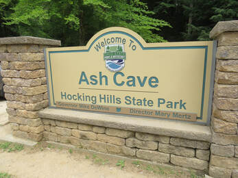
- Day 2: Saturday, July 10 - Cedar Falls and Ash Cave. Lisa and I took a walk along the quiet country roads around the cabin, finally ending at a little, local cemetery. Then we were off to our first hike in the park, combining Cedar Falls and Ash Cave. We parked at Cedar Falls then hiked the Buckeye Trail to Ash Cave, then back along the Buckeye Trail to checkout Cedar Falls. Very nice hike, but a lot of traffic at both Ash Cave and Cedar Falls and a fairly good flow of hikers on the Buckeye Trail. Great day for a longer hike. We hit the trail at 10:30, a little later than hoped but still beat most of the crowd, and we were back at the car around 1:20. We did drive over to the state park visitor center but it was a zoo. We’ll try that again later in the trip. The afternoon was spent relaxing on the back porch, right up to the time for dinner at the Inn and Spa at Cedar Falls.
- Day 3: Sunday, July 11 - Airplane Rock and Conkle’s Hollow. Forecast is for afternoon rain, so we opted for a couple of shorter hikes this morning. Started with Airplane Rock which we had all to ourselves (did not see another soul for the entire hike). Lovely view out on the rock. Nice weather so far so we next tried the gorge trail at Conkle’s Hollow. Quite the Jurassic Park feel. We were nearly at the end of the trail when the rain rolled in, so we finished the trail and got soaked on the hike back to the car. We spent the afternoon on the back porch, enjoying the rain from a dry vantage point. Carry-out pizza from Pizza Crossing for dinner tonight. Since the rain had moved out of the area, Lisa and I took another walk through the rural neighborhood around the cabin.
- Day 4: Monday, July 12 – Old Man’s Cave and Whispering Cave. This was the big event for the trip, the visit to Old Man’s Cave and Whispering Cave. We were not disappointed. Amazing geology and beautiful waterfalls. Really a lot packed into a short distance through the spectacular gorge. The bonus was that our plan of getting there early and beating the bulk of the crowd worked out nicely. We mane the loop starting at the Upper Falls, then through the gorge passed the Devil’s Bathtub, Old Man’s Cave and the Lower Falls, then on around to see Whispering Cave. We were done before noon so we just chilled at the cabin for the afternoon. Lynn joined Lisa and me fo the early evening stroll out along Collison Road to the church and back. Good night for birding. We had carry-out from Millstone BBQ for dinner; quite tasty.
- Day 5: Tuesday, July13 – A Collection of Short Hikes. We did well dodging the rain today as we skipped around the area to hike a series of shorter trails. We started at Rock House, which turned out to be a fascinating cave (a true cave, not a recess in the sandstone). Next was Cantwell Cliffs; nice but he trail was in rough shape. Our final hike for the day was a Rockbridge State Nature Preserve, home of Ohio’s largest known natural rock bridge. Pretty impressive structure plus a few bird sightings. Rain rolled back in during the afternoon, so we again relaxed at the cabin. One final dinner on the back porch, Mexican night with Carry out from La Cascada since it had the highest ratings on Trip Advisor.
- Day 6: Wednesday, July 14 – Heading Home. Lovely morning, so Lisa and I took one last walk along Collison Road, today detouring along the Krinn Unger Keck Road then up Pleasant Valley Road just for a change of pace. No rush getting out the road, but also no reason to hang out at the cabin. Nice day for the drive back to Medina.
That covers the general plan, logistics and hiking overview. Next is the day-by-day journal with all the details of the trip.
Day 1 - Friday, July 9 - Travel Day. A pretty relaxed day for the start of vacation, although Lynn and I still had a couple work tasks and meetings to clear off our to-do lists before we could officially start our time-off. Plus, we had the final packing details and a trip to the grocery store before we hit the road, but there was plenty of time for all of that. Overall, a quiet morning.
By noon the work stuff was long since completed and we were just finishing up the packing details. That’s another nice thing about a road trip, the packing is easier. We don’t have to cram everything into a suitcase like we would when flying, and we can bring along extra items, the stuff that we may or may not need but, what the heck, we have plenty of room to bring it along.
At 12:54 I was packed, had my gear and the coolers loaded in the Edge and was just waiting on Lynn. She was still tracking down some missing items, like the rubber gloves she takes for house cleaning in case the rental property is not up to snuff. We just had those for the Kentucky trip last month and since we’re taking the same things to Hocking Hills, the gloves should be on the big green tote we use for storing such travel supplies, right there in the packing zone. But she said she looked there and has expanded the search. OK, I better help or we’ll never get on the road. There’s the green tote box, lift up her backpack and there are two bright yellow raincoats for your hands. I grabbed the gloves and walked to the kitchen, asking my standard sarcastic question that I pose whenever I have located what she has lost, “can you describe the missing rubber gloves.” I got “the look.” But she is happy now and we are one step closer to departure.
Lynn got squirreled a couple more times for what reasons I don’t know, but we were finally loaded up, had the directions queued up on Baby and were starting down the driveway at 1:21. OK, that’s not too bad and should get us to the rental cabin right on time for check-in time at 4:00 PM.
Uneventful drive, and very easy given the pleasant conditions. Much better than the downpour we endured for the drive to Kentucky last month. The drive time from the ranch to the cabin was 2:40 per Baby. I-71 south to Columbus then east on route 33 to Logan then south on route 664 to our cabin. Pretty easy. And only one stop to fuel up the Edge once we reached Logan. Lynn and I passed the time chatting about the plans for our time in Hocking Hills. The only wildcard is the weather, which looks pretty good but does include some chances for rain. But we’re flexible and will adjust as needed.
 First beer of the trip.
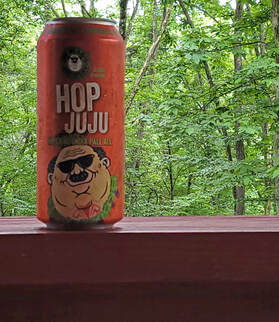
We arrived at the cabin just a few minutes past 4:00 PM, so right at check-in time. No sign of Lisa but she can’t be too far behind us. We were unloaded and unpacked in a few minutes. Would have been quicker if the front door opened toward the kitchen and not into the hallway thus blocking the route to our bedroom. There’s Lisa, just 10 minutes behind our arrival. Good timing as we had just finished unloading the Edge so now we can help with her stuff. Once her gear was in the cabin, I was very quickly out on the back porch with a Hop Juju. The girls grabbed a bottle of wine and joined me in short order.
We hung out on the back porch, just enjoying the peace of the woods behind the cabin, until a little after 6:00 PM. Then we were off to dinner at Urban Grille, which is the restaurant at the Hocking Hills Golf Club. Not knowing how crowded the dining options would be on a Friday night, I had made reservations about a week in advance. Probably not really necessary as there were a few open tables, but we are still dealing with the pandemic so perhaps that reduced the crowd a bit. We rolled in, right on time and were seated immediately. We even got a table with a view of the golf course. The outside seating looks to be full, so I guess this is as close as we can get (and maybe the outdoor tables are for the golfers). Oh, and there’s one of those oversized adirondack chairs that I saw on HockingHIlls.com while doing my pre-trip research. Part of their tourist shtick, I guess. I explained to Lynn and Lisa that apparently there are six of these big chairs scattered around the area and the game is to take photos of all six to receive a free tee-shirt or some such prize. The consensus around the table was that we don’t need a tee-shirt so probably no need to look for the other five chairs. Not that we would probably see any others, unless the chairs are placed at the trailheads in the park.
We hung out on the back porch, just enjoying the peace of the woods behind the cabin, until a little after 6:00 PM. Then we were off to dinner at Urban Grille, which is the restaurant at the Hocking Hills Golf Club. Not knowing how crowded the dining options would be on a Friday night, I had made reservations about a week in advance. Probably not really necessary as there were a few open tables, but we are still dealing with the pandemic so perhaps that reduced the crowd a bit. We rolled in, right on time and were seated immediately. We even got a table with a view of the golf course. The outside seating looks to be full, so I guess this is as close as we can get (and maybe the outdoor tables are for the golfers). Oh, and there’s one of those oversized adirondack chairs that I saw on HockingHIlls.com while doing my pre-trip research. Part of their tourist shtick, I guess. I explained to Lynn and Lisa that apparently there are six of these big chairs scattered around the area and the game is to take photos of all six to receive a free tee-shirt or some such prize. The consensus around the table was that we don’t need a tee-shirt so probably no need to look for the other five chairs. Not that we would probably see any others, unless the chairs are placed at the trailheads in the park.

Randi took great care of us and provided a nice overview of the menu and specials. Plenty of good sounding options. No surprises here, as Lynn had the crab cakes and Lisa a burger (she’s not the most adventurous when it comes to dining), accompanied with margaritas. For me? Salmon with root veggies and mashed potatoes. That made for a great meal. My beer pairing for this evening was Scott’s American Pale Ale from Brewery 33, the local craft beer option. Pretty good beer. Very fruity; not so much citrusy but berry-mango-something. Good beer. I gave it a 4.0 out of 5.0 on Untappd.
We discussed the plans for our time in Hocking Hills. I had the trails selected and a general order for each day, looking to alternate longer hikes and shorter hikes as well as keeping the most popular trails off the weekend, at least in part. Then there was the chance of rain that we’ll have to work around, but the predictions for precipitation had dropped, with only Sunday showing a significant chance of rain. The starting plan that I layed out was:
Overall, a very good and relaxed meal, good service, excellent food, decent beer and nice atmosphere. Since there was no one waiting to be seated we took our time with our drinks. With the short drive back to the cabin we were back and out on the back porch by about 8:00. Nice way to spend the evening. We finally called it a day at about 10:00.
Day 2 - Saturday, July 10 - Cedar Falls and Ash Cave. Sort of a restless night. The temperature in the cabin seemed to fluctuate from too hot to too cold, like something from Goldilocks and the Three Bears. Except we never seemed to find a temperature that was “just right.” Then Lynn’s alarm went off at 0500. Please turn that thing off. She did. Right back to sleep until 6:30. So nice to sleep in!
Once we were finally up, we went about our morning between getting breakfast and preparing for some hiking. As is typical when traveling, breakfast was simple, just a bagel with peanut butter for me. I enjoyed my morning meal out on the back deck. A bit cool this morning at 61 degrees F at 0700 and a little cloudy, but the prediction is for a lovely day but still a chance for rain later. But we should be off the trail by then.
While getting our hiking packs in order, I also helped Lynn load the Ramblr app that I like for tracking our hikes onto her new phone. She finally took the plunge and moved to a smart phone after years of resistance and clinging to her trusty flip phone. She’ll like the upgrade once she finally embraces the change, but she’s an engineer so change is never easy. We got her new device connected to the wifi and I walked her through the process for downloading the app. For now she will need some adult supervision when it comes to getting apps on her phone!
One thing that Lynn is always hoping for when we travel is finding the starry night sky. That is one of the draws of our travels out west (although we have been thwarted on that point the past few trips due to smoke from the fires that always seem to be burning out there). Maybe we’ll get lucky in this rural area of Ohio, even though Columbus is not that far away. The trick will be finding an opening in the trees somewhere near the cabin to get a good view of the sky. Lisa suggested that we take a quick walk along the road in front of the cabin just to see if there is a place nearby. Sure, a little warm-up before our first hike is not a bad idea. Lynn opted out, preferring to finish her coffee and read this morning.
OK, a short walk to check out the area. We started at about 8:45. Since I figured we were just walking down to the cul de sac I did not change out of my water Crocs nor did I track our walk. Well, the cul de sac is just 100 yards or so beyond the cabin. There is an opening in the trees so that could work for stargazing if the conditions are right. But then Lisa suggested walking past the cabin a bit to get the lay of the land. Sure, we’ll go up to the intersection, that’s not too far. Looks like all of the cabins along the road are rented for the weekend and most have multiple cars, except maybe one place. And we just kept going…..
Beyond the intersection with Bishop Road, the houses transitioned to a mix of rental cabins and full time residents. The rentals still had the rustic cabin vibe while the full-time places were generally just basic ranch homes. But it was much more open along this stretch of the road, and we were more or less walking along near the top of the ridge line so out here would be nice for stargazing, if the conditions were right. Therefore, mission accomplished. And we just kept going….
OK, I’m game for a little longer walk to make up for driving yesterday. Not a lot of animals out this morning. There was the “posing chipmunk” sitting on a stump right along the road in a shady stretch just downstream of the intersection with Bishop Road. He seemed to be asking for his picture to be taken. Shoot, even the lighting was even ideal. But all I had was my phone and while it takes great landscapes, I’ve not mastered wildlife portraits with that device. The rabbits and birds were not as accommodating, so no definite identifications on the feathered critters. And one white cat sitting in the shade in the yard of one house, dutifully ignoring us as we walked by. And we just kept going...
The road is paved for the most part, which is nice since I was not wearing hiking shoes, but the Crocs are good for a short walk. We were still walking along the ridgeline more or less and it was very open at this point. OK, mission still accomplished as this area would be even better for stargazing, should the nighttime conditions cooperate. The houses out here were residential but there were still a few vacation cabins mixed in, including one big A-frame place sitting well back off the road that had a dozen or so cars parked in front. Family reunion, perhaps? Looked like a nice place, at least what we could see from a distance. Plenty of land around it as well, including a pond with a deck down in the little valley between the house and the road. No one was there this morning. Too bad, it looks like a nice place to sit and enjoy a little peace. And we just kept going….
OK, we need to get back. I spotted a stop sign in the distance. Let’s make that our turn around point. Lisa agreed. But as we approached the sign, she saw a cemetery just beyond the intersection and decided we should investigate. And we just kept going….
We discussed the plans for our time in Hocking Hills. I had the trails selected and a general order for each day, looking to alternate longer hikes and shorter hikes as well as keeping the most popular trails off the weekend, at least in part. Then there was the chance of rain that we’ll have to work around, but the predictions for precipitation had dropped, with only Sunday showing a significant chance of rain. The starting plan that I layed out was:
- Saturday, we’ll roll the dice on the crowds and hike from Cedar Falls to Ash Cave and back. Looks like a nice day, so we can knock out this longer hike.
- Sunday has some chance of rain, so we’ll go with a couple shorter hikes to give us some flexibility. First we check out Airplane Rock then over to nearby Conkle’s Hollow.
- Monday will be the day for Old Man’s Cave, hoping for smaller crowds. But we’ll shoot for an early start to get out ahead of most folks. I’m suggesting that we make this a big loop by including Whispering Cave as well.
- Tuesday will be the make-up day for anything we may have missed due to weather or crowds but we’ll also try to get in the shorter hikes at Cantwell Cliffs and Rock House.
Overall, a very good and relaxed meal, good service, excellent food, decent beer and nice atmosphere. Since there was no one waiting to be seated we took our time with our drinks. With the short drive back to the cabin we were back and out on the back porch by about 8:00. Nice way to spend the evening. We finally called it a day at about 10:00.
Day 2 - Saturday, July 10 - Cedar Falls and Ash Cave. Sort of a restless night. The temperature in the cabin seemed to fluctuate from too hot to too cold, like something from Goldilocks and the Three Bears. Except we never seemed to find a temperature that was “just right.” Then Lynn’s alarm went off at 0500. Please turn that thing off. She did. Right back to sleep until 6:30. So nice to sleep in!
Once we were finally up, we went about our morning between getting breakfast and preparing for some hiking. As is typical when traveling, breakfast was simple, just a bagel with peanut butter for me. I enjoyed my morning meal out on the back deck. A bit cool this morning at 61 degrees F at 0700 and a little cloudy, but the prediction is for a lovely day but still a chance for rain later. But we should be off the trail by then.
While getting our hiking packs in order, I also helped Lynn load the Ramblr app that I like for tracking our hikes onto her new phone. She finally took the plunge and moved to a smart phone after years of resistance and clinging to her trusty flip phone. She’ll like the upgrade once she finally embraces the change, but she’s an engineer so change is never easy. We got her new device connected to the wifi and I walked her through the process for downloading the app. For now she will need some adult supervision when it comes to getting apps on her phone!
One thing that Lynn is always hoping for when we travel is finding the starry night sky. That is one of the draws of our travels out west (although we have been thwarted on that point the past few trips due to smoke from the fires that always seem to be burning out there). Maybe we’ll get lucky in this rural area of Ohio, even though Columbus is not that far away. The trick will be finding an opening in the trees somewhere near the cabin to get a good view of the sky. Lisa suggested that we take a quick walk along the road in front of the cabin just to see if there is a place nearby. Sure, a little warm-up before our first hike is not a bad idea. Lynn opted out, preferring to finish her coffee and read this morning.
OK, a short walk to check out the area. We started at about 8:45. Since I figured we were just walking down to the cul de sac I did not change out of my water Crocs nor did I track our walk. Well, the cul de sac is just 100 yards or so beyond the cabin. There is an opening in the trees so that could work for stargazing if the conditions are right. But then Lisa suggested walking past the cabin a bit to get the lay of the land. Sure, we’ll go up to the intersection, that’s not too far. Looks like all of the cabins along the road are rented for the weekend and most have multiple cars, except maybe one place. And we just kept going…..
Beyond the intersection with Bishop Road, the houses transitioned to a mix of rental cabins and full time residents. The rentals still had the rustic cabin vibe while the full-time places were generally just basic ranch homes. But it was much more open along this stretch of the road, and we were more or less walking along near the top of the ridge line so out here would be nice for stargazing, if the conditions were right. Therefore, mission accomplished. And we just kept going….
OK, I’m game for a little longer walk to make up for driving yesterday. Not a lot of animals out this morning. There was the “posing chipmunk” sitting on a stump right along the road in a shady stretch just downstream of the intersection with Bishop Road. He seemed to be asking for his picture to be taken. Shoot, even the lighting was even ideal. But all I had was my phone and while it takes great landscapes, I’ve not mastered wildlife portraits with that device. The rabbits and birds were not as accommodating, so no definite identifications on the feathered critters. And one white cat sitting in the shade in the yard of one house, dutifully ignoring us as we walked by. And we just kept going...
The road is paved for the most part, which is nice since I was not wearing hiking shoes, but the Crocs are good for a short walk. We were still walking along the ridgeline more or less and it was very open at this point. OK, mission still accomplished as this area would be even better for stargazing, should the nighttime conditions cooperate. The houses out here were residential but there were still a few vacation cabins mixed in, including one big A-frame place sitting well back off the road that had a dozen or so cars parked in front. Family reunion, perhaps? Looked like a nice place, at least what we could see from a distance. Plenty of land around it as well, including a pond with a deck down in the little valley between the house and the road. No one was there this morning. Too bad, it looks like a nice place to sit and enjoy a little peace. And we just kept going….
OK, we need to get back. I spotted a stop sign in the distance. Let’s make that our turn around point. Lisa agreed. But as we approached the sign, she saw a cemetery just beyond the intersection and decided we should investigate. And we just kept going….
 Halloween tombstone on the cemetery fence.
I did not catch the name of the cemetery, but it was just a small lot at the intersection. Still in use as there are several recent headstones, but it has been in service for a while. The earliest date we could read on a headstone was 1841. A few were marked as being veterans of the Grand Army of the Republic, so Civil War vintage. Many were weathered to the point of being illegible. Sadly, many of the early graves were those of children. It was also interesting that quite a few of the early graves listed the lifespan of the interred in years, months and days. And now we went back….
Since we walked much further than I was expecting, I started a Ramblr track when we left the cemetery, just to get a gage on how far we went. Might as well count the mileage. Very quiet this morning, even though it is not that early. No cars which was great given the narrowness of the road and limited sight distance. We did see a couple guys out running during our return trip. Probably from the big rental cabin. The only local that we saw was that white cat.
As we were nearing our cabin, we spotted something in the middle of the road ahead of us. Looks like a rug or towel? That certainly was not there when we walked by earlier. Sadly, as we approached it became obvious that this was a kitten that had been hit and left in the road. How could that happen? A pretty little calico. Poor girl. First, why is there a kitten (probably a few months old but well under a year) out here in the first place. Feral, I reckon. But more importantly, how could anyone possibly be driving on this road in such a way that they would hit the kitten. Sure, I guess it could have just darted out in front of a car, but c’mon, folks should be driving really slowly on this short, “residential” cul de sac. I moved the poor thing off the road and into the tall weeds beyond the ditch. Not much else that I could do, but no sense in leaving her there where she would have just become more mangled. A sad end to our walk.
We were back at the cabin about 9:30. Nice little warm up hike (except for the poor little calico). Just under three miles round-trip. Lynn said that she was just getting ready to come and find us as she thought we had gotten lost. Not lost, just did not turn around in a timely fashion. But we’re back now and it is time to get ready for a real hike in the park.
We were finally loaded up and pulling away from the cabin at 9:53. A little later than planned, so hopefully we will still beat the worst of the Saturday crowd. We had the route queued up in Baby. A quick scan looks like she knows where she is going. Always best to check. We’ll be going right by a couple of restaurants, including our dining opting for tonight, as we head into Hocking Hills State Park, so we can get a couple data points on drive time for future reference. Five minutes to Captain Ron’s Pirate Pizza; that might work for carryout one night. The funny thing is that Captain Ron’s is about three miles from the cabin via the roads, but as the crow flies it was just half a mile. Now if there was only a trail to get there. Continuing we found that it was right at 15 minutes to the Inn and Spa at Cedar Falls, so just a short drive there this evening for dinner.
Just a couple more minutes past the Inn we came to the parking area for Cedar Falls. The dashboard clock read 10:10 when we pulled in but still plenty of parking in the large lots near the main road. Due to the one-way routing of the driveway we had to go through the smaller lot right by the trailhead. Lo and behold, there was one remaining parking spot. The last melon! No reason to pass up a primo spot, so I inserted the Edge and we got geared-up for our hike. This is not too bad in terms of crowd. Sure, plenty of folks were heading down to the falls, but the parking lot was not jammed. Maybe the reports of really high traffic areas were overstated.
It was 10:17 by the time we got our packs and cameras untangled and our gear properly strapped over our shoulders and we started our Ramblr tracks (Lynn was also tracking our route today). We walked over to the Cedar Falls trailhead to check out the signage. Seemed like everyone else in the area was heading the same direction and heading down the hill along that trail. We decided to try the less traveled option and start with the hike to Ash Cave. The start of that trail was not obvious from our current location but the map indicated that it was across the parking area from Cedar Falls, so we just walked the driveway around the loop knowing that we would have to walk right by the trail at some point. That approach worked. We found the trail. Basically a dirt road, with a gate blocking the way to discourage all but hikers, so a nice wide trail.
The route is really an out-and-back trail with two short loops at either end for access to the key features, Ash Cave and Cedar Falls. Sure, we could have just driven between the two points of interest and saved five miles of walking, but where’s the fun in that? Just a short distance up the hill from the start of the trail we passed a sign that explained we were on the Buckeye Trail…. That’s sort of cool as the Buckeye Trail also runs very near to our house along the Lester Rail Trail.
Following the Blue Blazes of the Buckeye Trail.
Follow the Blue Blazes. Founded in 1959, Ohio’s Buckeye Trail (BT) is the only long distance hiking trail entirely within Ohio. More than 1,400 miles loop through wooded footpaths, abandoned railroads, historic towpaths, back roads, rivers and lake shores, within both rural and community settings. The BT provides an intimate way to experience Ohio’s wonderful scenic and historic diversity.
The Buckeye Trail is marked along its length by blue paint blazes. The trail is open to all hikers, made possible by Buckeye Trail Associate volunteers and the partnership of federal, state, and local agencies, as well as many private landowners. The BY is also the proud host of two other long-distance trails, the North Country National Scenic Trails, from New York to North Dakota and the coast-to-coast American Discovery Trail.
The Buckeye Trail is marked along its length by blue paint blazes. The trail is open to all hikers, made possible by Buckeye Trail Associate volunteers and the partnership of federal, state, and local agencies, as well as many private landowners. The BY is also the proud host of two other long-distance trails, the North Country National Scenic Trails, from New York to North Dakota and the coast-to-coast American Discovery Trail.
This section of the Buckeye Trail provided us with a pretty hike in the Hocking State Forest. Not particularly difficult, just sort of rolling over the hilly terrain, so ups and downs but nothing overly steep and no edges or drop-off to deal with. The trail was in good shape and surprisingly dry considering the wet weather we have had so far this spring and summer. Crossed a couple creeks and topped over a ridge or two. Certainly a nice hike but really just a walk in the woods.
There was a fair amount of traffic on the trail this morning. While not crowded there was a steady stream of hikers going between Cedar Falls and Ash Cave. Most of our fellow hikers seemed prepared for a longer hike. No flip-flops were seen and everyone appeared to have water with them. There were a few dogs on the trail and all but one was leashed. And best of all, everyone seemed to be in a good mood. A few folks asked us for distance to destinations but most it was just hello, good morning, a wave or a smile. I’d have to give the trail a high friendliness rating. And it was quite a diverse group of hikers out on the trail today, which is nice to see. The parks, whether National or State, are here for all to enjoy.
There were a couple of things that I did not see during our hike. The first was masks. I’d say less than ten people were wearing any sort of face covering. We were not. We were outdoors and spread out, and had our shots, so no need for the face covering on the trail. The second was litter. Maybe just a couple small scraps of paper along the trail, but no bottles, cans or other debris. Well, done to my fellow tourists!
Between the well-marked trail with all the blue blazes, and the number of folks out hiking one would think that it would be easy to stay on track. And it was, except for one minor detour. That occurred when we reached the fire tower which is roughly halfway between Cedar Falls and Ash Cave. Fire tower sounds interesting, let’s check it out. But we could see from the main trail that there were a LOT of folks there at present and a line of people climbing up the tower. OK, good news is that you can go up in the tower and check out the view; the bad news is it is packed at present. OK, we’ll hit that on the return hike. So, we did not go up the trail leading to the tower, thinking that was just a short access trail that dead-ended at the tower, and instead went around the trail to the right of the tower. We walked about a hundred yard or so down this trail and did not pass any other hikers, but 20 yards to our left were lots of hikers on another trail. Did we get off track? Obviously the trail that went up to the fire tower was also a through trail. I bet these two trails join back up in short order. Lynn and Lisa were not so sure, as we had seen some other old looking trails leading off in the forest a mile or so back, and there were no blue blazes right here. OK, it’s not like we’ve gone miles out of our way, just a football field, give or take. So back we went, and up the little hill past the fire tower. Still packed, so we kept going toward Ash Cave. As we continued along beyond the tower we did come to the point where the trails intersected. I checked our track on Ramblr. We were almost there when we turned around. Silly us. After we got home and had uploaded the track to the website I was able to estimate the distance. Maybe 30 yards or so was all that we had to go. But, in all fairness, when hiking in the woods it is better to be sure of where you are going. That really is true regardless of the terrain. But our sight distance was reduced due to the trees. We’ll know for the return hike. And hope that we get lucky with the crowd at the fire tower.
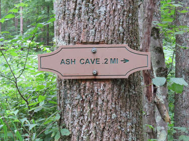
Since I had the phone out, Lisa asked how much further to Ash Cave. Looks like we’ve hiked almost two miles, so we should be about a half mile from our destination. Getting close. Lisa got a little ahead of Lynn and I at this point, as we were watching a bird rustling around in the underbrush (Eastern Towhee, I think). We caught up with Lisa, who had paused at a trail marker. She stated that the sign said “Ash Cave two miles.” Wait, what? Can’t be that far. But from our vantage point still a few yards away that is sure what it looked like. Lisa snickered, just kidding, the sign says point-two miles. OK, that makes more sense. And Lisa is happy that she got us. But, as an engineer, I must protest the lack of a leading zero in the number. It is the simple things that when missed cause the biggest issues. At least the units were clearly displayed.
From this point we were going slightly downhill and walking along a creek. We crossed a little bridge and that little creek headed toward the edge. Hey, I think we’re here. The trail worked over to the edge of the gorge and the little creek poured over into the gorge. We were greeted at this point by a lone pigeon that was wading in the creek. Seems like an odd place for a pigeon but it seems to be enjoying its bath.
The trail comes in above Ash Cave. OK, that makes sense per the map. Next, we should join up with the loop trail that goes around and into the cave area. One of COVID-19 precautions that the Ohio Department of Natural Resources implemented was one-way traffic on the more crowded trails, like here at Ash Cave. Since the access trail to the cave is a loop, it was simple just to make everyone go clockwise around the loop. I guess the thinking was if everyone is going the same direction along the trail there will be less opportunity for contact and therefore transmission of the virus. Seems reasonable. What we did find out is that on the more crowded trails the traffic flow was much better, so we’ve got that going for us. I would hate to try and be that fish trying to swim upstream through this mass of humanity.
From where we entered the loop trail, we were going downhill, or rather downstairs. Caution here as it was a bit damp and these were wooden steps, so likely to be slick at times. We made it safely down to the ground level where the trail was flat and paved leading into the hollow containing Ash Cave. Lots of folks were walking in from the parking area, so it was getting a bit more congested than along the Buckeye Trail. I made a quick detour out toward the main road to see if there was a state park sign. There was, but it was specific to Ash Cave. That will do. Then I caught up with the girls and we joined the throng heading up the trail that leads through the gorge to Ash Cave.
This was our first experience walking into the deep green lushness of one of the gorges in the Hocking Hills area. Sure, we had just walked through the Hocking State Forest along the Buckeye trail to get to this point, and that hike was through a healthy and very green wooded area, but this was different. Being in the gorge changed the characteristics of the trail and the hike. Perhaps this was part due to the change in lighting being in the gorge. It was also more damp here, seemingly misty and a bit more humid. Whatever the reason, the foliage was thicker, more verdant from the ground up, from the moss and ferns up into the broad-leafed trees. There was a bit of a rainforest feel. Besides the flourishing plant life, there were also interesting details in the rock walls that defined the gorge. Many little alcoves and recesses in the wall of the gorge which were setting the stage for our introduction to Ash Cave.
An additional introduction was provided but the interpretive signage along the trail that gave a good overview of the geology of the cave and the human history related to this natural wonder:
Ash Cave, Ohio’s largest stone recess, stretches 700 feet across and rises 90 feet high.
The rock shelter was created when ground water percolating through the sandstone eroded away the formation’s weaker middle layer, undercutting the resistant top layer which forms the ceiling of the “cave.” The water dissolves away the cement which holds individual grains of sand together. Seasonal freezing and thawing causes expansion and contraction which further loosen the particles and on rare occasion, blocks of stone, until they break off. The falls also contribute to the slow erosive process.
Archeological excavation of the site in 1877 yielded sticks, arrows, stalks of coarse grasses, flint artifacts, pottery fragments, corn cobs, and the bones of a variety of animals. From subsequent excavation, we know the native habitants once hunted elk and black bear in addition to deer, turkey squirrel, rabbit, and duck. Once the home of the Wyandots, by the 1790’s, settlers were moving into the area and began clearing the land for farming. Area streams powered grist mills and saltpeter used in the manufacture of gunpowder was mined by early settlers. By 1900, the last remaining relics of virgin forest existed only in the secret hollows and steepest cliffs where they were safe from the woodsman’s axe and the farmer’s plow.
The cool, damp gorges also preserved a trove of treasure fore Ohio’s geologic past, mimicking the climate that existed here thousands of years ago when glaciers imported the eastern hemlock, Canada yew, mountain laurel and other flora and fauna of more northern climes into the region.
Recognized for its excellent acoustics, including a “whispering gallery”, Ash Cave became the site for a variety of public meetings and gatherings in the 1800s. As late as 1886, the floor of the shelter was still covered with ashes, causing speculation that early settlers manufactured gunpowder here. Excavated artifacts suggest that the ashes were the accumulated remains of countless campfires used by the Native Americans who inhabited the shelter for untold centuries. Regardless of the actual cause, or causes, this striking geologic feature, Ash Cave, took its name from those ashes, the certain source of which will likely forever remain a mystery.
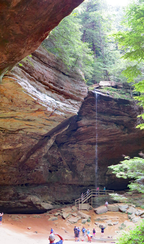
We did not linger at Ash Cave since we still had a few miles of hiking ahead of us. Instead, we just worked our way through the enormous recess, checking out some of the details of the cave, enjoying the waterfall and watching our fellow tourists as they did their own exploring.
|
OK, Ash Cave is not a cave, but we knew that going in. But it is a HUGE recess in the rock face. Pretty cool. Actually, it was cool. And a little damp. Plus, it was a bit crowded. There were a fair number of folks milling about in the “cave” but since this is a big space, we were not packed elbow-to-elbow, so we were able to look around the space without bumping into our fellow tourists (I guess there were 50 or more folks scattered throughout the area, so not too bad). But between the number of people and the less-than-ideal lighting it was difficult to get a decent photo in Ash Cave. Still, it is an interesting place to see. The color of the sandstone walls and the orange-red sand that carpeted the floor of the recess complemented the lush green of the surrounding forest. The trickle of a waterfall from the upper edge of the cave added a nice, tranquil element as the water poured into a small pool. I later learned that this little trickle can be a much more impressive cascade that plunges 84 feet from the top lip of the recess into the pool below. Everyone was just taking it all in. Even with the number of other visitors, it was a relaxed and fairly quiet spot, all things considered. The only major activity was from the pigeons that must be nesting in the little alcoves in the back wall of Ash Cave. They did not seem bothered by us tourists as they were higher up on the wall and I’m sure they were used to people anyway. But they were flitting in and out of the cave. The sound of their wings and the occasional call echoing from the wall of the recess made for an eerie soundtrack to the setting.
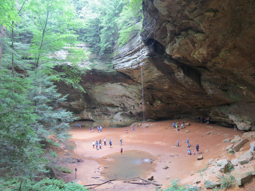
|
A little more traffic on the trail from the return trip at least for a while then it thinned out again. Sort of odd. Perhaps some folks just wanted to walk along the creek a bit then turned around and a few probably went as far as the fire tower then returned to the Ash Cave trailhead. But there were a few folks from Ash Cave who I spotted on the trail. I chatted briefly with one such couple, kids just out of college it turned out. Athletic looking pair. He was sporting a NASA meatball, which I used as a conversation starter. His name was Jeremy, recent grad from Ohio State (wait, I forgot “The”). Engineering student looking for that first job in aerospace. Tough time to break in, with the pandemic and all, but hiring seems to be picking up. He was just out at JPL on an interview, so hopefully that works out for him. I would have given him my card, but I did not have any with me and besides we are on hold for hiring at present so it would not have done him any good. We reached the split in the trail for the fire tower, so I wished him luck and we parted ways.
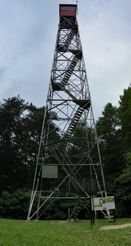
Lynn was waiting patiently on a bench near the tower. Once we were back on terra firma, we paused by the informational signage about the fire tower and forest fires in Ohio. Lynn had read it and provided some of the highlights, the main points being that the tower was built in 1934 and is 80 feet tall. I snapped a couple photos so that I could read the details later. That info is included on a separate page.
As we left the fire tower and continued north along the Buckeye Trail, I told Lynn that I got her something from the gift shop at the top of the fire tower and handed her the little, purple charm. |
Visiting the fire tower on the return trip worked out as there were very few folks here now, certainly a lot less than earlier. There were a couple women who just came off the tower and three or four guys up at the top but no one else was waiting, so our timing was perfect. Lisa and I decided to give it a go. We passed the guys at about the midpoint as they were descending. Sort of a tight squeeze as these were rather burley lads. Once they were by, it was clear sailing to the top. As we neared the top, I noticed something shiny laying on the platform just outside the protective fencing. Looked like some sort of piece of jewelry, but of the cheap variety. Whatever it was, it did not belong there and could fall off at some point. Not that it would probably hurt anyone but why risk it. I was able to drag it back under the fence. Looks like a child's trinket, some sort of Disney character charm bracelet. A little purple guy with big ears. I’ve seen this critter before but can’t recall the name. We’ll figure that out later. I put it in my pocket for proper disposal. Upward.
Not much further to the top. The hatch into the lookout perch was locked so we could not get the full effect of the tower, but we were close. As you might expect from a fire tower there was a clear view for miles, just overlooking a sea of green trees. Not overly remarkable today as the sky was overcast and featureless. However, I bet this could be lovely at the peak of the fall foliage, particularly with a nice blue sky to contrast the autumn hues. OK, we came, we saw, now we’ll climb back down. 
|
I don't think I got "the look" but I certainly got a look, both for stating there was a gift shop at the top of the fire tower and for the dubious gift. But it was all in fun. As far as the pendant/charm gizmo goes, she recognized it as a movie character and even vaguely recalled the movie, but could not come up with the name of the film or the character. I reckon we'll Google it when we get back to the cabin.
The small parking lot adjacent to the fire tower was now overflowing. As we cautiously walked through, two big pickups pulled hoping to get lucky with an open spot. There would be no joy for them plus now they will have to back out to the road. Good luck with that. The second truck did not pull all the way into the lot, so he did not have a huge struggle, but the first driver had his work cut out for him. We just got out of the way, crossed the road and reentered the woods on the other side.
I would not say that the Buckeye Trail was crowded but there was a steady stream of folks approaching from the direction of Cedar Falls. Familiar faces and tee-shirts along the return when we saw the folks we passed this morning. Integrity, was that the word on the one lady’s shirt?
Cedar Falls parking was crazy packed by the time we returned. There were cars everywhere. The lots were full and every conceivable open spot along the driveway and in the median was covered. Considerably different from this morning but more of what I was expecting in terms of the crowd in the park.
Back at the parking area, we paused for a snack by the car and Lisa adjusted her water pack as it had started to leak. Seemed like the typical problem with the water bladders; if you don’t have the cap on exactly perfect there will be water everywhere. But we got her all situated and headed on for the final little segment of our hike, the loop down by Cedar Falls.
Brief pause at the start of the loop for the signage which provided insight on the fragility of the area, the geology, natural wonders and how to protect both nature and yourself while on the trail:
A Rock Solid but Fragile System
As hikers stroll through the scenic gorges and rock walls that make up the Hocking Hills it is easy to see the many towering Hemlock trees and old growth forest and cliffs walls that have existed here for eons. The ecosystem seems immense and powerful but looking closer could reveal a whole new side of the gorge trails that many hikers never realize is all around them. S delicate side that is every bit as vital as the giant tress and massive rock formations. These smaller, yet no less vital, organisms make up the intricate interconnected ecosystem web and create this natural wonderland in Southeastern Ohio.
Starting with the rock itself hikers can take a closer look at what makes the Hocking Hills so special. Unique to the Hocking region of Ohio is a type of sandstone known as “Blackhand” sandstone. It is characterized by a loose conglomeration of sand, rock, quartz, iron ore, and even coal. As such, this loose mixture allows for the beautiful carvings and rock formations but also is very susceptible to damage by unknowing climbers, carvers and even hands rubbing along the stones. So please STAY OFF THE WALLS to avoid inevitable damage by climbing, carving, or handling of the rock walls. However, make sure to take a close look at the many small plants and animals that call the cracks and holes home. Some of the small delicate plants hikers see on the cliff wall play a key role in the adhesion of the loose rock. But one stroke of a poorly place hand or foot can take decades to grow back and restore.
The slow and steady work of the water as it cascades through the gorge is extremely vital throughout the entire park and would be the next step through the ecosystem of Hocking that needs your protection. All the beautiful rock formations and gorges hikers see are a direct result of the slow and steady work of our clear, clean streams eroding the soft sandstone. Clean undisturbed water system in the park are vital to the health of the park and the continuation of this process. DO NOT SWIM OR WADE in the park streams to avoid damaging the process and harming the many organisms that call this water home. The plants and animal tat call our steams and waterfall pool home, nest, raise their young or feed are easily damaged by trampling or constant muddied water by swimmers. Even the body oils, soaps, and insecticides we leave in the water from our bodies can seriously change the water chemistry and kill delicate organisms and small fishes that next and balance these ecosystems. Every hiker stepping into a stream is causing damage or stepping on a species home. Wading or jumping into waterfalls is also dangerous for hikers and results in multiple injuries every year in the park. As well as being very disturbing and unsightly to visitor trying to enjoy the scenic beauty.
STAY OFF THE WALLS - DO NOT SWIM OR WADE
To keep all of the Hocking Hills pristine and beautiful for many generations and for safety, hikers must STAY ON MARKED TRAILS AT ALL TIMES staying out of the water, off the rocks and plants and taking only pictures and their trash home with them.
Words to live by when hiking, that’s for certain. Unfortunately, most visitors won’t stop to read the sign, and others would just figure that the rules don’t apply to them anyway. We see it all too often in the parks, whether National Park, State Parks, or the local County Parks.
Words to live by when hiking, that’s for certain. Unfortunately, most visitors won’t stop to read the sign, and others would just figure that the rules don’t apply to them anyway. We see it all too often in the parks, whether National Park, State Parks, or the local County Parks.
The Nature of Cedar Falls
The trail leading to Cedar Falls passes through some of the most austere areas in the Hocking Hills. This remote, primitive gorge is laden with hemlock trees and bound by steep rock walls and their accompanying small cases and waterfalls.
The stream that flows over the cliff at Cedar Falls was named Queer Creek because of the unique northern backward flow of the stream. The force of water flowing from this creek creates a waterfall with the greatest water volume in the Hocking Hills region.
The trail to the falls was used by the Shawnee, Wyandot and Delaware tribes. Early visitors to the region would find painted black handprints on the cliff walls marking this heavily-used route. The unique rock in the park was eventually named Black Hand Sandstone.
The early settlers to the area appreciated the location’s picturesque scenery. However, those same early settlers made the mistake of misidentifying the hemlock trees as cedar trees. Although the area is named Cedar Falls, there is not a single cedar tree location in the area.
Along with the unique plants and trees, a diversity of wildlife calls Cedar Falls home. Look and listen closely in the trees above for the tiny golden-crowned kinglet. Cedar Falls and the Hocking Hills area play host to a number of overwintering birds due to the unique microclimate habitats. Birds like the golden-crowned kinglet make conifers, such as the eastern hemlocks, their homes. Check out the pool below the falls for the lazily drifting common snapping turtle.
Eastern Hemlock - Most of the large evergreen trees in the gorge around Cedar Falls are eastern hemlock, frequently referred to as Canada hemlock. This ice age transplant remains green and vibrant all year, even when the native hardwoods drop their foliage in the fall.
The Geology of Cedar Falls
- Slump Block - Large blocks of rocks found on valley floors that have broken or slid from their original position in the harder upper layers of the sandstone can be found all around the Hocking Hills area.
- Cross Bedding - Layers of sediment deposits can be easily seen on cliff faces throughout the park. Most layering occurred horizontally, but when stream directions changed, diagonal layers of deposits occurred during formation.
- Honeycomb Weathering - Water seeping directly through the porous sandstone weathers small loose pockets of sand and gravel from the cliff faces, leaving behind rings that resemble a bee’s honeycomb.
- Recess Caves - A large hollowed opening carved by water in the softer middle layers of the sandstone cliff walls are commonly known as recess caves. Like Old Man’s Cave, these recesses can sometimes be massive.
While shale, limestone, coal, clay and conglomerate rock are all present in the Hocking Hills, the most outstanding rock formation in the park in Black Hand Sandstone This sandstone was formed during the fluctuation of the shallow sea that once covered much of Ohio. Deposits of eroded sand, silt and other materials eventually accumulated, consolidated and compacted to form this unique sandstone.
The scenic features of the park were carved into the sandstone by natural erosion and weathering. In most areas, the sandstone is more than 150 feet thick and has three distinct horizontal layers or zones. The upper zone is firmly cemented and resistant to weathering, forming the roof of rock shelters and overhangs. The many rock shelters, caves and recesses were formed in the softer middle zone by freezing, thawing and movement of water. The lower zone, like the upper zone, is resistant to weathering and forms a strong base for these formations.
The rugged beauty of the area is enhanced by the stately old growth stands of hemlock and vast stretches of tulip poplar, American beech and several varieties of oaks. The cool gorges are home to many ice age remnant species including yellow and black birch, Canada yew bushes and eastern hemlock. The dusky and red-backed salamanders also enjoy the park’s cool recesses. Observant hikers will not subtle changes in species as they hike up and down the slopes and hills of the Hocking region.
|
This was another one-way loop trail, but there were a few folks who bucked the signs and were coming back up the trail against traffic. Fortunately, the trail down to the falls was not crowded and fairly wide, so it was easy enough to pass those wrong-way hikers.
Once we had worked our way down into the gorge, the trail paralleled the creek as we walked upstream toward the waterfall. This was a very pretty section and was actually very quiet, perhaps sedate even. This little stretch was one of the nicest we hiked today. There were a couple of interpretive signs along the Cedar Falls trail. The first one I noticed talked about a massive flood that ripped through the gorge in January 1998; a “100-year flood” based on the amount of damage it had done. Apparently tore out all of the manmade structures that the park service had built while also continuing the never-ending process of carving the sandstone that forms the gorge. The signage provided a little detail on the sculpting of the rock in the park: Most of the exciting geology that occurs throughout the park are direct results of water and wind carving away the sandstone cliff faces. Here in the park, our sandstone has a much softer middle layer, which is often carved out first leaving behind a hard top and bottom. The possess is called sapping and often leaves behind hollowed out areas known as recess caves. Look for the many large or small slump blocks that litter the floor of the gorge. These large boulders are direct evidence of geology in action.
|
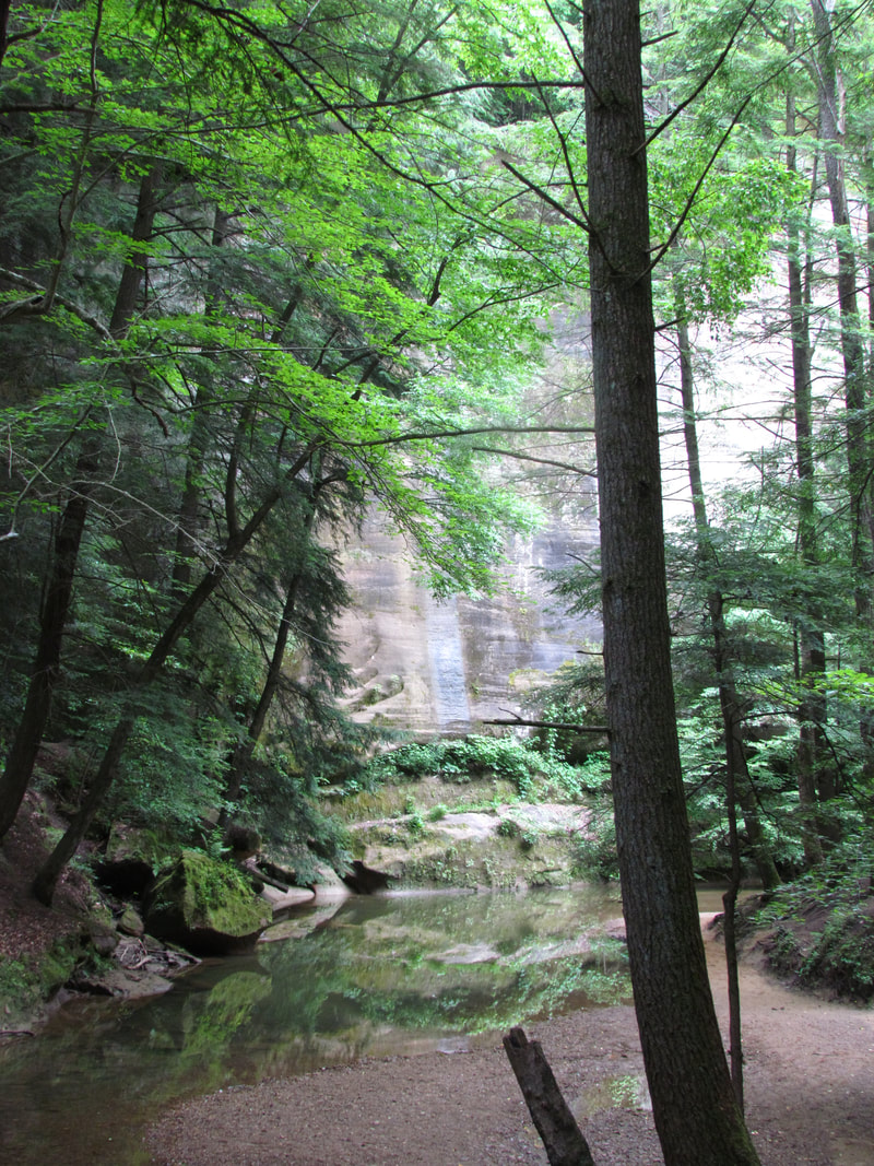
|
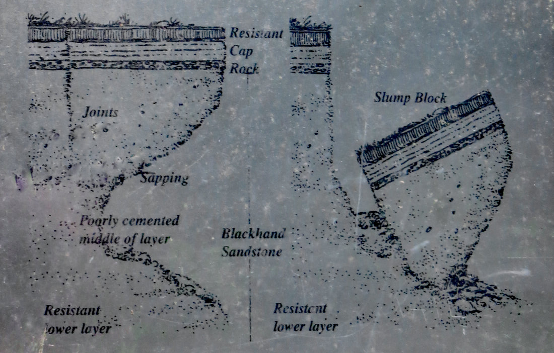
|
The second sign was about where the trail emptied in the amphitheater end of the gorge containing Cedar Falls. It was a metal plaque that cited a few historical and natural details of the falls, most of which had been mentioned on the signs at the trailhead. But there were a couple of new tidbits:
|
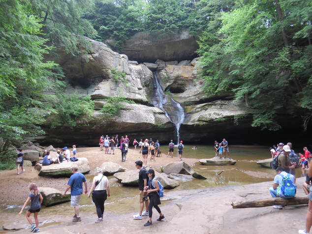
While the trail leading up to the falls was serene and without a lot of traffic, at least when we traversed it, the area right around Cedar Falls was packed. Zoo? Circus? Parade? All of the above? Whatever the term, there were a lot of people, on the order of 70, perhaps more. It was another scene that was impossible to capture without people in the picture, but that’s OK. We still had a lovely view of the falls. We did not enter the fray to get any closer views of the falls in order to stay away from the mass of humanity. In a normal year I probably would have wandered up to the edge of the pool below the falls, but during a pandemic I'll just stick with the longer distance and socially distant vista.
Of course, when there are that many tourists you have to expect a few stupid people tricks. Granted, we had spotted a couple of unleashed dogs on the Buckeye Trail, but those canines were well behaved and sticking with their people (the people are at fault, not the dogs). Here along the Cedar Falls Trail there were other infractions, again all due to adults not following the rules. There were a few hikers going against traffic. The kids wading in the pool below the falls was disconcerting. Granted the rules were not posted in huge red letters, but there was signage at the trailhead and near the falls stating not to wade in the pool or the creek along with the reason why being in the water was bad for the environment. I guess big red letters are needed.
All that said, this is a lovely setting. Sort of a bowl at the end of the gorge. Even with the number of folks here it was rather peaceful. I imagine it would be spectacular and very relaxing to be here early when no one else is around. The falls were following nicely, but nowhere near peak capacity based on photos of the springtime flow. The water runs down the face of the rock for the initial part of the falls, before free falling into the large pool. Overall, a drop of 50 feet for this horsetail type falls, according to the waterfall database (www.worldwaterfalldatabase.com) I found online after the trip.
We enjoyed the view of the falls for a few minutes then continued on around the loop, slowly climbing along a little ravine and through a little section of boulders back to the trailhead. Back in the parking lot, there were still plenty of cars looking for an open spot and many more hikers approaching the start of the trailhead. We quickly loaded up and moved along to make room for the next tourist.
Not a bad first hike for our time in Hocking Hills. Granted there were a lot of other tourists around the key features of Ash Cave and Cedar Falls, but we still had an enjoyable time on the trail. We were back at the Edge at 1:23, so we were out just over three hours and covered 6.1 miles. A pretty easy hike, all things considered, but that is probably enough trail time for today. Here's the photo gallery from the hike.
Since we had plenty of time yet this afternoon, we decided to check out the State Park visitor center. That was a mistake! The place was a madhouse! We could see from the road that the parking lot was packed, but we did not see the sign stating that the lot was full until we had already turned into the driveway. OK, that sign would have served its purpose better if it was out on the road. The recommendation posted on the sign was to return in a few hours. OK, sounds like good advice, we'll try this another day. So, we looped through the very large parking area that was indeed packed to capacity. We did find a couple of empty spots as we completed our lap around the sea of cars but contending with all those people did not seem like a lot of fun so it was back to the cabin for us. An afternoon porch beer sounds like a much better idea!
We were back at the cabin at 1:55. By 2:05, I was comfortably seated on the back porch with a Pompeii IPA from Toppling Goliath. Life is good!
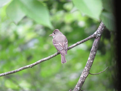 Eastern Wood Peewee in the backyard of the cabin.
During the course of the afternoon, we just lounged on the back porch and enjoyed a little quiet time, plus we each got cleaned-up. I jotted a few notes, and we reviewed the wildlife sightings. Not many critters out on the trail. Lisa and I saw the posing chipmunk and a few skittish cotton tails this morning. Only a couple birds that we could identify along the Buckeye trail: American Robin, Pigeons and an Eastern Towhee. Lisa did see a deer along the road this morning as we were driving to the trailhead. We saw a second deer as we were driving back to the cabin. While out here on the back porch we spotted a Northern Cardinal, an eastern Wood Pewee and a Fox Squirrel. A short list, but a start.
At 6:00 we left for dinner. Probably earlier than necessary given that we knew the drive time was only 15 minutes, but we did not know the parking situation. Better to have a few extra minutes than to rush. Turns out that there was plenty of room in the lot across the road from the inn and no wait once we were inside, so we were seated a few minutes early. Good as we are all hungry.
Interesting place. Obviously an older building based on the layout as the dining area ranged through three or four rooms of various sizes. However there have been plenty of updates and a good bit of remodeling. The interior ended up as a mix of rustic and Country with elements of industrial thrown in. We were seated in a newer looking area that was bright and roomy. Given the setup, we speculated that this space was used for larger gatherings and maybe for buffets. Perhaps the Inn offers a breakfast buffet as part of a stay.
Ashley was our server this evening and she took very good care of us, but then we are a pretty easy little group. She went over the dinner specials and asked to take our drink orders. All I needed was a little more detail about the craft beer on tap this evening so I could build a flight. She let me take a picture of the hand-written list so I did some quick research on Untappd. She went off to get us some water and bring the girls their lemon drop martinis while I got my ducks in a row. It was a short list of options (only six beers on tap), but some quality choices, so it did not take long to get the flight line arranged.
Once the decision on beer had been made, I turned my attention to the dinner menu. We all had our selections in mind by the time Ashley was back with my flight. Lisa went light with a flatbread, while Lynn was in full vacation mode and selected the filet mignon. I was tempted by that as well but opted for the scallops and I had the scallops. Now that we have that settled, we can sit back and enjoy our drinks in the eclectic mixed décor of the dining hall.
Returning to my collection of beer tasters. Quite the variety, given the very short list of options. No IPAs this evening, but I did anchor the flight with an old favorite pale ale from Masthead Brewing in Cleveland, so I knew I would be getting at least one good beer. Actually two, as I had also tried the Kentucky Bourbon Barrel Ale previously but included it as it seemed to fit the roster. I rounded out the flight with two beers from a local brewery, Devil’s Kettle Brewing in Athens. Turned out to be a very nice flight!

- Spider Silk, Blonde Ale, Devil’s Kettle Brewing (7.0% ABV, 15 IBU) - Lots of banana notes in the taste and a bit in the nose. Pretty good beer. (3.75 out of 5.0).
- Bockasaurus, Bock, Devil’s Kettle Brewing (6.5% ABV) - Wow, that has some caramel. Not bad. (3.75).
- Kentucky Bourbon Barrel Ale, Lexington Brewing & Distilling Company (8.2% ABV, 19 IBU) - (4.0).
- Tire Swing, New England Pale Ale, Masthead Brewing (5.5% ABV) - (4.0).
Considering the relaxed pace of dinner, we were done early at about 7:30. The girls looked at the gift shop adjacent to the restaurant. I waited outside as the potpourri was overpowering. But it was a short wait as they found nothing of interest this evening. We next made a quick stop at the State Park Visitor Center as we thought it was open later. That was obviously not the case as the huge parking lot was empty and the doors were locked. But we got the lay of the land and checked the posted trail maps for future reference. Our final observation on the drive back to the cabin was that Captain Ron's had a modest crowd this evening. That's a positive sign that the pizza is good. Plus, it is very close to home for a carry-out meal. That’s settled then, we'll go with the Captain for dinner tomorrow.
Back at the cabin, we sat on the porch for a while then one-by-one wandered inside for the night. I was the last to give up on the pleasant night air. Lynn had fired up the TV, so we wasted some time watching American Pickers. By 9:45 we had called it a day and headed off to bed.
Day 3 - Sunday, July 11 - Airplane Rock and Conkle’s Hollow. I slept in until after 0600 and finally had feet on the floor at about 0630ish. Lynn was still snoozing, so I went out to the living room to plan the day. Looks like the weather will cooperate as the significant rain chance holds off until around 1:00 PM . That gives us time for a hike or two depending on what the girls want to do. We’ll figure that out once they are up. I reviewed the maps and hiking guide and confirmed my thinking for today:
- We'll start with the hike to Airplane Rock. This trail came highly recommended from Evan McKee. Sounds like a nice hike but not highly trafficked. This is a shorter hike at 3.5 miles, so we should be able to add a second short hike before the rain rolls in.
- The obvious choice for a second hike is Conkle’s Hollow due to its close proximity to Airplane Rock trailhead (less than three miles, or about a 6-minute drive).
- We can watch the weather and if conditions look iffy we can defer Conkle’s to another day.
- We'll defer Old Man’s Cave to Monday or Tuesday and hope for lighter crowds and less chance of rain.

Once the girls were up and Lynn was well into her coffee (no sense going over the plan with Lynn until the caffeine kicked in), we talked about options for the day. They were on board with my suggestion and starting to get in gear. I was packing and ready to roll at 0820. Lynn is working on it but still has coffee to drink. We also solved the mystery from yesterday, the identity of the Disney critter charm found at the Ash Cave fire tower. Between Google and IMDB we determined that this was Stich from “Lilo and Stich.” Hey, if it had been a Jedi or Sith I would have known, but this one was not in my wheelhouse.
The conditions outside were warm, humid, and very overcast. There was a very brief light sprinkle just as we loaded into the car. Not a good sign, but it was over almost before it started. We were pulling away from the cabin at 0841.
We took the long way, by two minutes per Baby, to show Lynn where Lisa and I walked yesterday morning. If I had thought about it a moment, I would not have driven that route as the road is just too narrow for opposing traffic to pass. You know, when I first saw the address for the cabin, I thought the road name was Collision, not Collison. It was not until Baby told us on arrival day to turn left on Collison Road that I realized my error. However, after walking the road yesterday and more so from driving it today, I think that “collision'' is the correct moniker. This is a narrow, one-lane road with no shoulder and very limited opportunities for vehicles to pass each other when coming the opposite direction. Plus there are a few blind spots due to the hills. Yes, I would say a collision or two is definitely possible. Fortunately there was no traffic opposing us this morning and we made it over to Blackjack Road unscathed. But we did add to our wildlife sightings for the trip, with a flock of turkeys along the edge of a hay field not too far from the road.
At the little cemetery, Collison Road intersects with Krinn Unger Keck Road, but continues with the same driving challenges. Still not a lot of houses along the road and a mix of residential and vacation cabins. Also, more of a drive in the woods. We finally emerged onto Blackjack Road right next to an old church. Well, at least we know where the road goes beyond the cemetery in case we want to extend our local walking path.
Blackjack took us to the main road, Big Pine, and we continued west for a mile or so. We passed three or four horse trailers along the way plus a couple parked at a trailhead with the horses out getting ready to get tacked-up. These were larger, multi-horse trailers, so outfitters most likely getting ready for a guide horseback trail ride. Good morning for it, as long as the rain holds off.
One last turn onto Hocking Road, a wide and well-maintained dirt road that steadily climbed up the hill side toward the trailhead. The phone said, “your destination will be on your left” and there it was. Baby got us to the trailhead with no issues or misdirection. Sometimes out in the country Google maps has sent us astray, but of late the directions have been solid, but I do try to remember to confirm the route and not just blindly trust the technology.
We rolled into the decent size trailhead parking area for Airplane Rock, which was deserted when we arrived. Still, I parked the Edge in the corner of the lot to leave plenty of room for other hikers, should there be any. The conditions were improving as the sky was getting lighter but was still generally grey and overcast. The good news was that the sprinkle we had at the cabin did not follow us to the trail. Looks like we should get this hike in with no problem.
We quickly got our packs, cameras and hats and set off toward the gate at the far in of the parking area. Looks like another hike on a dirt road just like the guidebook said. That's a bonus as we can walk three abreast as long as there are no hikers approaching. Spoiler alert: we stayed spread across the trail for the entire hike as we never saw another soul.
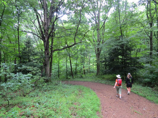
The hike to Airplane Rock was very similar to our trek yesterday along the Buckeye Trail, dirt road through mostly wooded areas and over undulating terrain. The trail was in great shape, there was only one muddy spot at an intersection with another maintenance road that we had to contend with but easy to get by. Other than that, there were just a few random, scattered puddles along the way. We were in shade most of the way, with only a couple of open stretches but none were that long. That made for a very pleasant morning walk. Mostly shaded other than a couple short stretches.
Lots of evidence of horses on the trail. I guess that “evidence” were the only other items on the trail that we had to avoid beside the random, scattered puddles. But no equestrians were out on the trail today. With all the trailers we saw this morning I was surprised that we saw no riders here this morning.
This was a trail to focus on the small details along the way through the woods. Not much in the way of critters, but some interesting mushrooms and wildflowers, plus the lush green of the trees and ferns. I sort of figured that would be the case based on the description in the hiking guide, a walk in the woods that leads to a vista point. But we did find one bonus viewpoint, at a gas line right of way that crossed the trail along the ridgeline. That gave us a nice view in either direction. An interesting point was the fog that was wafting through the right of way, the breeze carrying the mist from east to west across the trail. Sort of a cool phenomenon.
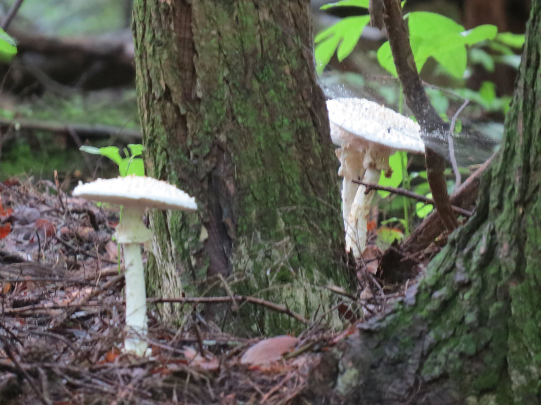
|
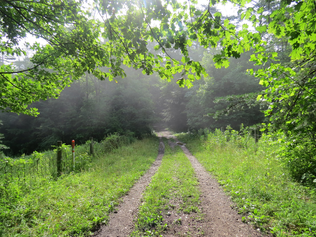
|
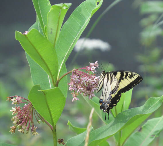 Eastern Tiger Swallowtail along the trail to Airplane Rock.
The other bonus provided by this right of way was a stand of wildflowers that had attracted a variety of butterflies. I got a couple photos of an Eastern Tiger Swallowtail and a Red-spotted Purple, but for the most part these fellows were just too wiggly and not willing to sit for portraits. I’ll try my luck again on the return trip.
From the right of way cut it was a short distance along a wooded stretch on the road to the little trail leading to the namesake formation. Up the hill to our left were the picket lines for the horses, but still no mounts or riders or other hikers. We followed the little trail through the fence and down the hill to our final destination for the hike. We had Airplane Rock all to ourselves. That is truly a bonus.
The short access trail to Airplane Rock works downhill through a short section of trees then opens onto a flat expanse of grey rock that overlooks the adjacent valley. We had a clear view out over the sea of green treetops looking west and south from the vista point. A pretty scene, but not spectacular or overly dramatic. I bet this might be an ideal place at the peak of the fall foliage.
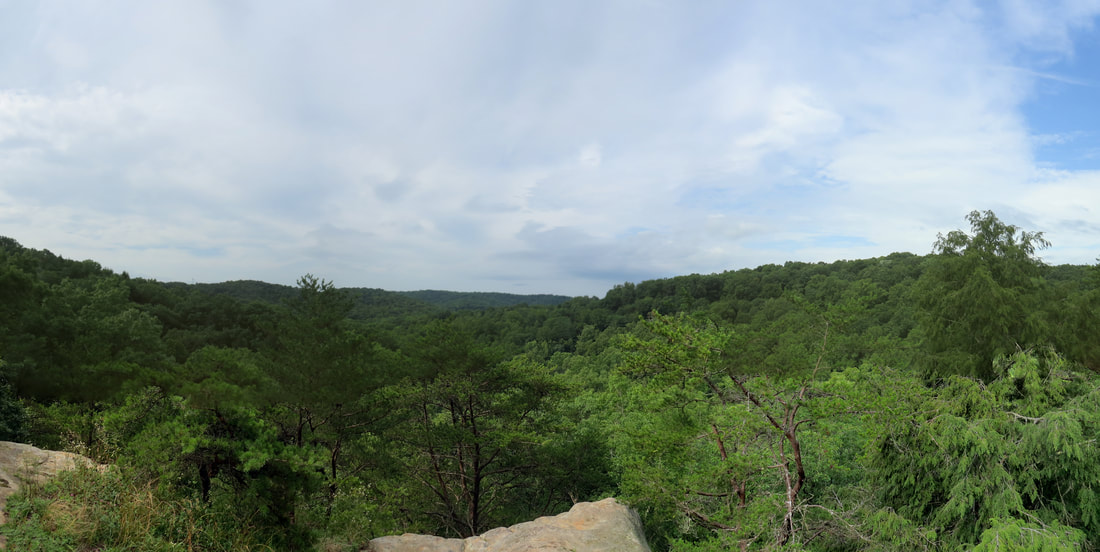
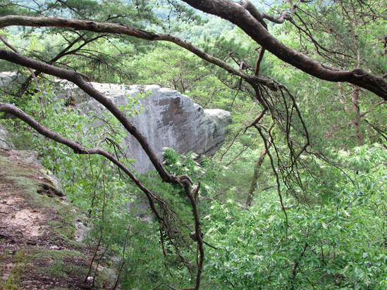
While the view was very pretty, we also wanted to see the rock and judge for ourselves if it was properly named. Hey, I’m an aerospace engineer, so I know what an airplane looks like, but I also like finding patterns and shapes in the clouds and the desert varnish, so I’m not totally without some abstract vision.
We walked along the canyon rim, on what would be the right wing of the airplane. I reckon we walked 20 or 30 paces to get to a position where we could get a clear view of the nose of Airplane Rock. OK, from this vantage point, I can see the resemblance to a general aviation aircraft. High wing, single engine, sandstone airplane. However, Lynn and I agreed that the rock outcropping looked more like a dog’s head, sort of a pointy-nosed hound. The map does also list the name of the rock as Bear Head Rock. Not really seeing a bear, but at least there was a reference to a big critter’s noggin.
We walked along the canyon rim, on what would be the right wing of the airplane. I reckon we walked 20 or 30 paces to get to a position where we could get a clear view of the nose of Airplane Rock. OK, from this vantage point, I can see the resemblance to a general aviation aircraft. High wing, single engine, sandstone airplane. However, Lynn and I agreed that the rock outcropping looked more like a dog’s head, sort of a pointy-nosed hound. The map does also list the name of the rock as Bear Head Rock. Not really seeing a bear, but at least there was a reference to a big critter’s noggin.
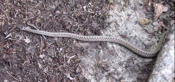 Dekay’s (Northern) brown snake
As we were walking back toward Airplane Rock, I was still studying the shape of the formation when Lynn spotted a snake. That’s sort of exciting as we have not seen much in terms of wildlife in Hocking Hills and hardly ever see snakes. Just a little brown dude. Not a garter snake. And it was not that worried about us, so we were able to get a decent photo. That will help with identification. I later was able to determine that this was a Dekay’s (Northern) brown snake, after Googling “snakes in Ohio.” The Ohio Department of Natural Resources has a nice guide on reptile in the state.
We stopped out on Airplane Rock for one last look before starting the return hike. Good time to get a photo of the sisters. As expected, they were not completely cooperative. Lynn decided this was a good time for a little goofiness. Sure, no issues with getting the girls to get together and pose for the camera, but Lynn gave Lisa bunny ears. Took Lisa a bit to figure out what was going on and we all got a nice chuckle out of the shenanigans. And I did finally get a good shot of the Jones girls for posterity.
We stopped out on Airplane Rock for one last look before starting the return hike. Good time to get a photo of the sisters. As expected, they were not completely cooperative. Lynn decided this was a good time for a little goofiness. Sure, no issues with getting the girls to get together and pose for the camera, but Lynn gave Lisa bunny ears. Took Lisa a bit to figure out what was going on and we all got a nice chuckle out of the shenanigans. And I did finally get a good shot of the Jones girls for posterity.
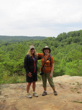
Once I had the portrait shoot take care of, we started the hike back. Plenty interesting details to see along the trail, the first one right along the road adjacent to the picket line area. There was a swarm of bees on a tree. Not hundreds but certainly a couple dozen or more. Then seemed to be attracted to the sap oozing out of the tree and running down the truck. There was a lot of activity with the little varmints buzzing about. I don’t think we could have missed this when we walked by the first time so they may have moved in in the time we were down at Airplane Rock. They were agitated, so we opted to give them a wide berth and scurried on down the trail out of range.
Back at the gas line right of way, I was in luck. There were more butterflies and some other critters flitting about in the wildflowers. A few were willing to pose for a portrait. There was even a hummingbird moth in the mix, which really interested Lisa. She thought it was a hummingbird at first glance, which is perfectly understandable. A fascinating insect to be sure. In additional to the butterflies and moths in the area, I also spotted a bright red beetle on one of the flowers, later identified as a Red Milkweed Beetle. Actually, there were two of them and they were quite interested in each other, if you know what I mean by “interested.” Anyway, I ended up with a couple insect porn images.
I could have stayed here for a while longer, just watching the bugs flying around, but the girls were ready to move along. They’re right, we have more to see and do today. Still, we came up with a nice little list of sightings from this one spot:
|
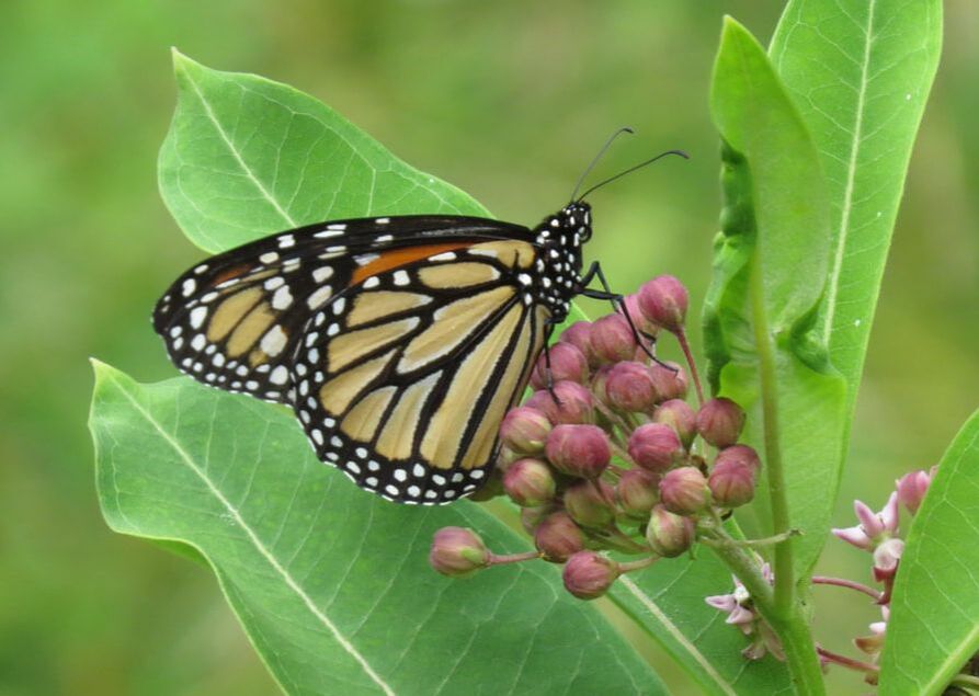
Monarch
|
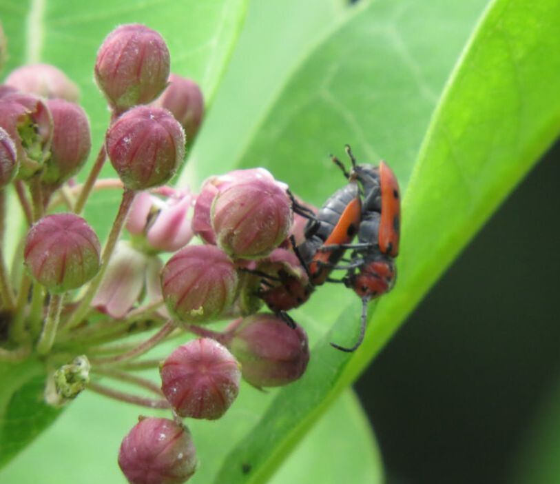
Red Milkweed Beetles
|
- Sometimes what you see is not what you get along the trail. As we came around a slight bend in the road, we spotted a dark shape on the right edge of the road maybe 30 yards in front of us. Looked like a ground bird of some sort, perhaps a grouse. We stopped and looked for a moment, but it was too far away to tell and it did not move. Was it just stilling still to avoid detection? Well, I’ve got plenty of reach with the SX50’s zoom, so I zeroed in on the object in question. Yep, sure enough, it was a Southern Ohio Log Grouse. Well, it looked convincing from a distance but through the camera it was just forest debris. Onward.
- There were some interesting flowers along the trail, one of the most striking was the tall and slender Black Cohosh, as identified by Seek (a handy app, when it can find a match).
- The next interesting flower were the bright red American Trumpet Vines that were growing high up the trunk of a tree right along side the road. Lynn speculated these vines may indicate the location of an old homestead here or nearby. There was a clearing of sorts just off the road but no ruins or other indication of an structures that we could see. But the vines and flowers were lovely.
- Not far from the trumpet vines, I spotted some interesting rocks in the road. They stood out due to the color and shape. Looks like chunks of flint. There were some sharp edges on the specimen we were studying. Certainly understandable how rocks like this were used for tools and weapons.
- One list little critter sighting for the hike, a small, tan moth with gray markings. Nothing really remarkable about it, but it did standout against the dark, wet dirt along the road where it had landed. Tough to get a good photo of it even though it was sitting still. Seek said it was a Speckled Renia Moth. That seems to match the images on the Butterflies and Moths of North America website that I checked later.
- One detail that you don’t won’t to see along the trail is trash and unfortunately, we did spot some. Not much, just an old beer can and a water bottle. Lynn scooped them and we’ll deposit them in the recycling back at the cabin. The can was a tall boy of Natural Lite strawberry lemonade. I guess if you put enough extra flavor in the can even this swill might taste OK, but I doubt it. I’ll stick with my good craft IPAs, thanks.
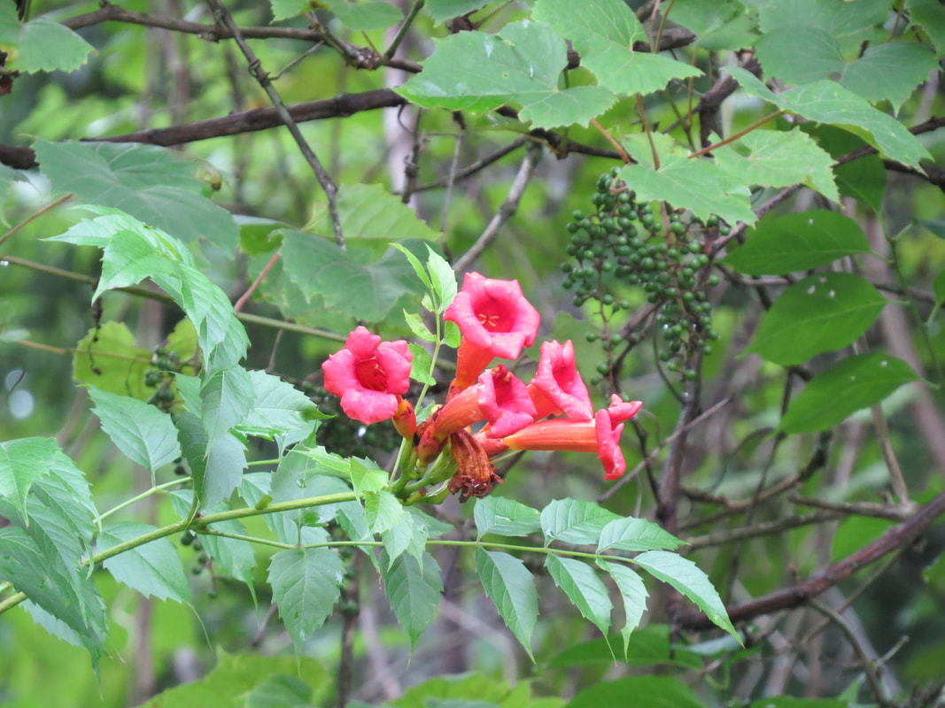
|
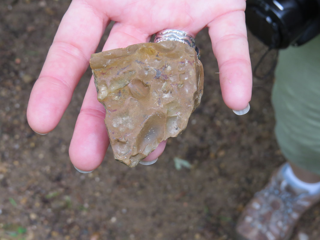
|
We were back at the trailhead at 10:50 AM. The Edge was still the only vehicle in the lot. That makes sense as we did not see another hiker anywhere along the trail. Here's the link to the photo gallery for the Airplane Rock hike.
Seems that we have time to explore Conkle’s Hollow before the rain arrives, at least based on the data from weather.com. The girls are willing to give it a go, so we tossed our pack in the back of the car and headed off for our next adventure.
Seems that we have time to explore Conkle’s Hollow before the rain arrives, at least based on the data from weather.com. The girls are willing to give it a go, so we tossed our pack in the back of the car and headed off for our next adventure.
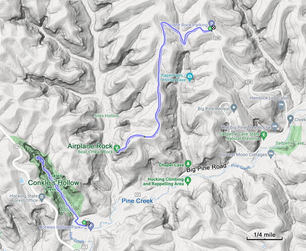
Only a five-minute drive from the Airplane Rock trailhead to the parking lot for Conkle’s Hollow State Nature Preserve. The patches of blue sky that we had early in the return hike from Airplane Rock have been replaced with a uniform, grey overcast, but the rain was predicted to hold off for a while yet, still looking at 1:00 PM for any significant chance of precipitation. That will give us time to hike at least one of the trails here at Conkle’s Hollow. We grabbed our gear and hit the trail, starting the Ramblr track at 11:05 AM, so only 15 minutes between the end of one track and the start of the next. Even though the hiking areas looked dispersed on the map, they are actually in fairly close proximity to each other. In fact, as the crow flies the distance from Airplane Rock to the Conkle’s Hollow trailhead is right at a half mile.
As usual, I parked away from the collection of cars nearest to the start of the trail, so we had a short walk to get on to the trailhead. Hey, just a little extra mileage for the day. Once on the trail, the initial section ran along a boardwalk through a sort of wetlands area. Signage along the trail provided a description of what we were seeing:
The valley of Pine Creek is an excellent example of a river birch community. Found primarily in southeastern Ohio and the southern United States, the river birch (Betula nigra) is found mainly along smaller streams that are prone to frequent flooding. Such floodplains are home to many species of trees and wildflowers. Striking flowers, such as Virginia bluebells, trout lily, cardinal flower and wingstem, provide a colorful contrast to the muted bark of the sycamore and musclewood trees.
Once through the boardwalk, we reached the entrance to the hollow where we had a choice to make in terms of which trail to take. Doubtful that we’ll have time to complete both the gorge trail and the rim trail before the rain rolls in. Lynn jumped right on this and selected the gorge trail. OK, I like a woman who knows what she wants. The gorge trail it is. And a great choice that turned out to be.
This is a really easy trail, paved and flat. The trail follows the creek, so maybe it is a touch uphill heading into the gorge since we are going upstream, but any elevation change in miniscule. But it is a well named trail as we were walking right along the bottom of the gorge, with the rocky walls towering 200 feet or more above us. Not a tight, narrow gorge, at least at the start. Actually plenty wide so that you can see the big picture of the structure, about 600 feet, give or take from wall to wall at the start of the hike into the gorge, but the gorge did neck-down as we went further in.
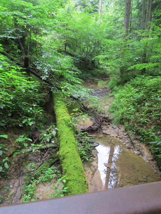 View looking upstream along Pine Creek from one of the bridges along the Gorge Trail in Conkle's Hollow
What really made this place special was how green it was. The trees and ferns of course brought their green foliage but even the lichens and mosses on the rocks added to the verdant overload. The overcast conditions meant no harsh light entering the gorge which really accentuated the green, made it fuller, darker…greener. Even the air seemed green. Just like our hike last month along Auxier Branch in the Red River Gorge Geologic Area of Kentucky, the short hike into Conkle’s Hollow made me thing of the rain forests in Jurassic Park or the magical Fangorn Forest of Middle Earth. But no Ents or velociraptors today, which is probably a good thing.
I guess this is a bit of a nature trail as well, since there were interpretive sign along the trail pointing some of the highlights of the trail as well as making other points regarding the natural world:
I guess this is a bit of a nature trail as well, since there were interpretive sign along the trail pointing some of the highlights of the trail as well as making other points regarding the natural world:
- The stately evergreen hemlocks of Conkle’s Hollow gorge are relicts of a time when massive ice sheets halted their approach just miles from the preserve. In the Hocking Hills region, the eastern hemlock (Tsuga canadensis) grows primarily in the cool, moist hollows. Easily identified by the two white stripes on the bottom of each needle, the hemlock creates an atmosphere similar to the boreal forests of Canada. Although capable of living 900 years, most old growth hemlocks in this area were harvested soon after settlement. The bark, high in tannic acid, was used for tanning leather, and the needles, which are high in vitamin C, helped prevent scurvy among settlers.
- The Monarch butterfly is a milkweed butterfly and are easily recognized by the black, orange and white patterns on their wings. These butterflies are native to North America and fly south to Mexico during the colder months some traveling over 3,000 miles during their migration. Monarch butterflies are being considered for the Endangered Species List because the population of the species has declined 90 percent over the last 20 years, from about 1 billion to 35 million butterflies. Bringing back milkweed will bring back the Monarchs and many other butterflies.
- The definition of a grotto is a small cave with attractive features.
- The massive blocks of sandstone, which litter the valley floor of Conkle’s Hollow, are called “slump blocks.” At one time, these blocks were firmly attached to the bedrocks walls of the hollow, but gradual erosion and the hand of time have cause the blocks to fall from their original lofty positions. Because these blocks slide imperceptibly down the hillside on which they lie, they are also known as “float blocks.”
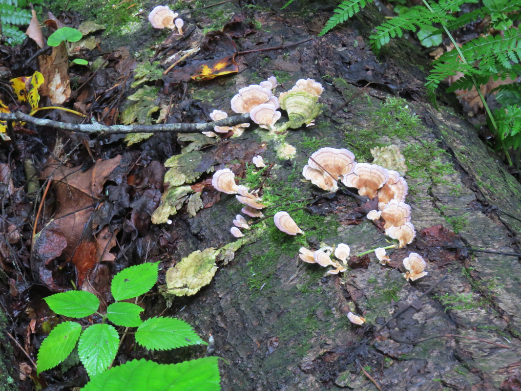
|
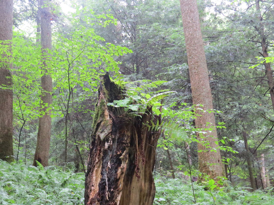
|
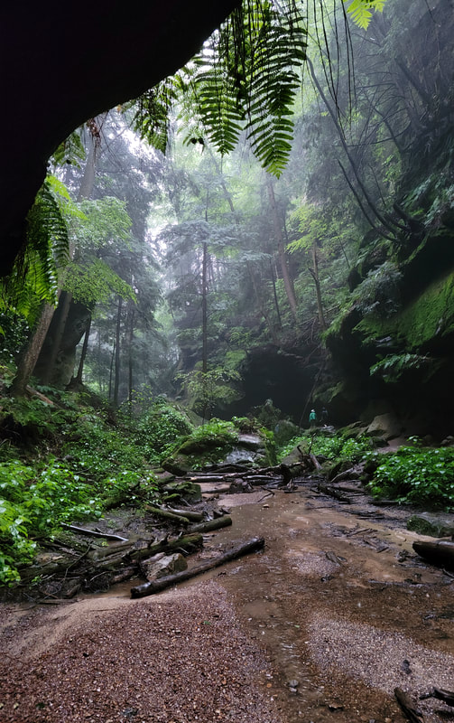
About a half mile into the gorge trail, we hit the end of the pavement, but continued along the dirt path. From this point the gorge became tighter and had a more primitive feel to it. The trail now was working right along the edge of the sandstone wall and we had to pick our way over and around the rocks. Eventually, the trail just fed into the trickle of Conkle’s Creek, which we easily walked across. We went as far as we could then the trail appeared to peter out. Now we really are in Fangorn Forest. The rain had started, but just a drizzle at present, so we stood under the rock overhang and studied the scene for a few minutes….
Then we heard the rumble of thunder, and we are done. Time to hike back to the car. We can get the rim trail another day.
The serious rain started about the time we reached the end of the concrete trail. Time to store the cameras and phones in their ziplock bags. We walked back through the gorge in a deluge. Again, very reminiscent of our hikes in Red River Gorge in June. The dense foliage did not provide much protection from the heavy downpour. Glad we were not hiking out west as these conditions would have caused serious flash flooding. While we had raingear and plastic bags to protect the cameras and phones, we once again had soaked our boots. But it’s warm so being a little wet is no big deal.
Back out in the open of the parking lot, we were now in a steady shower. Nothing to do but just march to the car. He good news was that I parked under the overhang of a large tree, so we were sheltered a bit as we stored our gear in the back of the Edge. As we were pulling out of our parking place, we had a flyby of a Great Blue Heron. I reckon the big bird is used to the rain. Conkle's Hollow photo gallery.
We spotted a few soaked horses and riders at one trailhead on the way home. The ponies did not seem to care. Neither did the riders, for that matter. Just part of trail riding.
We were home in ten minutes. That’s another data point for a theme that went on all week, that the return trip always seems much shorter than the outbound journey. Once back at the cabin we quickly unloaded and got our stuff spread out to dry. I jumped in the shower just to warm-up a bit.

Lynn set us up with cheese, crackers, veggies and fruit and we had a little picnic on the back porch. Sounds like a good time for an IBUsive from Fat Head’s. Rained off and on for the rest of the afternoon. It was just nice to listen to the rain on the metal roof over the porch. There was some critter activity in the backyard as well: a white-tailed deer mamma and her twins and a couple fat fox squirrels. A few birds as well. Lots of singing, but only fly-by sightings. Somewhere in there I got a second beer.
At 4:20 and the skies opened! The rain pounding on the metal roof was deafening. But still enjoyable sitting here watching the downpour from the back porch where we were dry and warm. The downpour was short lived, but the rain continued just at a much slower pace. At 5:00, the sun came out, but the rain was still falling. There has to be a rainbow somewhere, but we’ll not find in here in the forest.
The break in the weather was timely as that gave us the opportunity to discuss dinner. We’ll stick with the plan for pizza from Captain Ron’s. Only one problem. Turns out that the Captain closed for the day. The message on their phone said that they had to shutdown due to “lack of product.” I bet they ran out of dough. OK, regroup. I referred to my planning research and found that Pizza Crossing was the number one rated pizza place in Logan. OK, let's go with that. Ordering a pizza continued to be problematic as the number for Pizza Crossing was busy. Well, I’ll just drive to Logan and order the pizza. I have to drive there anyway to get the pizza, so no big deal. Worst case is that Pizza Crossing is closed and I'll have to make an executive decision on the next option for dinner. The girls were happy on the porch with their bottle of wine so I was off on a solo excursion.
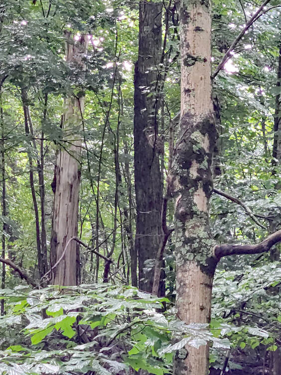 Not a great photo but there's a Barred Owl in there!
Not far after pulling out onto Big Pine Road, I spotted a big bird swoop out of a tree and cruise across the road. Raptor of some sort. I saw where it landed in a tree off to my left. Good news as there was no traffic behind me, so I slowed to a stop and zeroed in on the spot where I had seen it heading. Fortunately, the foliage was not thick and I quickly found the bird. Barred Owl! How cool is that? We hear them all the time at home and in Buckeye Woods. Their 'who-cooks-for-you' call is unmistakable. So great to see one from relatively close range, 30 yards or less. Alas all I had was the phone for a camera, but it was enough for a confirmed identification. Note to self, get back in the habit of carrying the SX710 for just such opportunities.
Short drive back into Logan. First time back into town since arriving on Friday. Baby took me straight to Pizza Crossing and it is definitely open by all the cars in the lot. I had to take a lap around the block to find parking. Once inside, I placed order for a large pizza loaded with veggies and a side of banana peppers (since the girls won’t eat ‘em), then went to wait in the bar. Sadly, the beer selection at Pizza Crossing was pitiful. Nothing of interest on tap. All macro brew crap, seltzers, etc. There was only one IPA available from the can and bottle list, and I've never heard of it. Oh, Sure (6.4% ABV, 37 IBU), from Land-Grant Brewing out of Columbus, so a sort of local beer. Very fruity. Not a bad IPA and certainly than Bud or Miller Lite, but it can’t compete with the IBUsive or Pompeii that I had earlier today. But it provided a nice diversion while waiting for dinner. I rated it 3.75 out of 5.0 on Untappd.
Short drive back into Logan. First time back into town since arriving on Friday. Baby took me straight to Pizza Crossing and it is definitely open by all the cars in the lot. I had to take a lap around the block to find parking. Once inside, I placed order for a large pizza loaded with veggies and a side of banana peppers (since the girls won’t eat ‘em), then went to wait in the bar. Sadly, the beer selection at Pizza Crossing was pitiful. Nothing of interest on tap. All macro brew crap, seltzers, etc. There was only one IPA available from the can and bottle list, and I've never heard of it. Oh, Sure (6.4% ABV, 37 IBU), from Land-Grant Brewing out of Columbus, so a sort of local beer. Very fruity. Not a bad IPA and certainly than Bud or Miller Lite, but it can’t compete with the IBUsive or Pompeii that I had earlier today. But it provided a nice diversion while waiting for dinner. I rated it 3.75 out of 5.0 on Untappd.
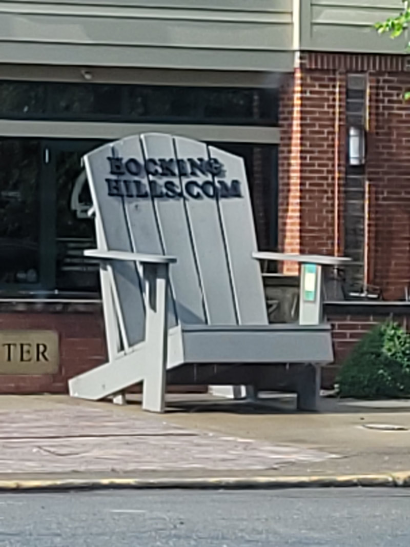
I spotted one of the huge Adirondack chairs in Logan on my way to the Pizza Crossing. That's two we found.
|
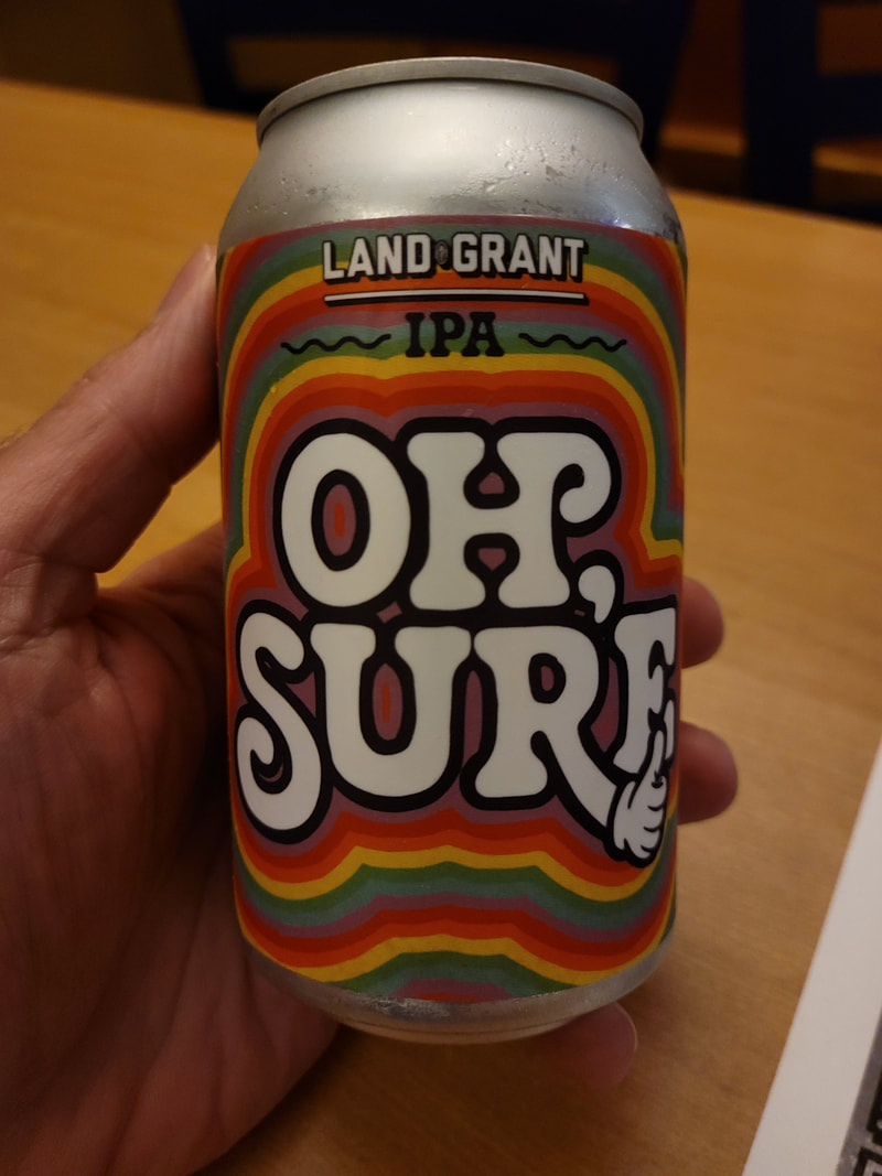
Well, better than no IPA, I reckon.
|
The timing on the pizza was almost perfect, as I was just about finished with by beer when I was alerted that dinner was ready. So, I quickly polished off the Oh, Sure and walked to the front counter. There sat a box sized for a large pizza and a HUGE container of banana peppers. Perfect!
The trip home again seemed shorter than the ride to get the pizza, even with the aroma of dinner trapped in the car with me. Lynn, Lisa and I were soon arrayed around the table on the back porch, ready to open the box and dig in. Wow, that is a really pretty pizza. I wish I had taken a picture. I guess I’m not a true foodie. Cut in squares like Donato’s used to do it. And this was more than just another “pretty face” as it was quite tasty as well. I reckon it must have been good as there were no leftovers. Veggie pizza with plenty of banana peppers paired very nicely with a Hop JuJu from Fat Head’s, one of my all-time favorite double IPAs. |
After dinner, Lisa suggested that we take a walk. Sounds like a winner. Lynn opted out as she was happy with her book. We started out about 7:15, heading west along Collison Road. I’m ready for a walk this evening as I have on sturdy shoes instead of my Crocs, so we can go as far as Lisa is willing to go. Very pleasant evening. The rain has moved on for now and the sky is blue, at least what we can see through the fluffy, white clouds. Just up the road at one of the other rental cabins I spotted a Wood Thrush hopping around in the gravel driveway. It was not interesting in getting is picture taken so all I got were a couple brown and white blurs, but they were good enough to confirm the identification. We also saw the white cat again. He ignored us, again.
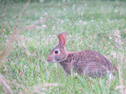
We did pretty well with critter sightings this evening, particularly along the open ridge approaching the cemetery. In addition to the Wood Thrush we saw at the start of the walk as saw Tree Swallows, a couple Cedar Waxwings, Chipping Sparrows, Eastern Phoebe and a few Eastern Cottontails. The rabbits were near the road in one of the lush lawns enjoying the green grass for dinner.
Today we continued passed the cemetery and went all the way to Blackjack Road. Basically, the same mix of rental cabins and local houses, plus a couple of business operations. The last section was downhill and wooded. This section was also crossed by a couple utility rights-of-way which make for good places to watch for wildlife. Sort of a steep descent to the intersection with Blackjack Road. At the intersection was an old church or maybe one-room school building. Not sure what it is used for at present. Looked to be in decent shape. We crossed the road to look over the edge of the bridge. Blackjack Branch was flowing nicely following the rain, pouring over a series of small waterfalls as it approached our vantage point.
Today we continued passed the cemetery and went all the way to Blackjack Road. Basically, the same mix of rental cabins and local houses, plus a couple of business operations. The last section was downhill and wooded. This section was also crossed by a couple utility rights-of-way which make for good places to watch for wildlife. Sort of a steep descent to the intersection with Blackjack Road. At the intersection was an old church or maybe one-room school building. Not sure what it is used for at present. Looked to be in decent shape. We crossed the road to look over the edge of the bridge. Blackjack Branch was flowing nicely following the rain, pouring over a series of small waterfalls as it approached our vantage point.
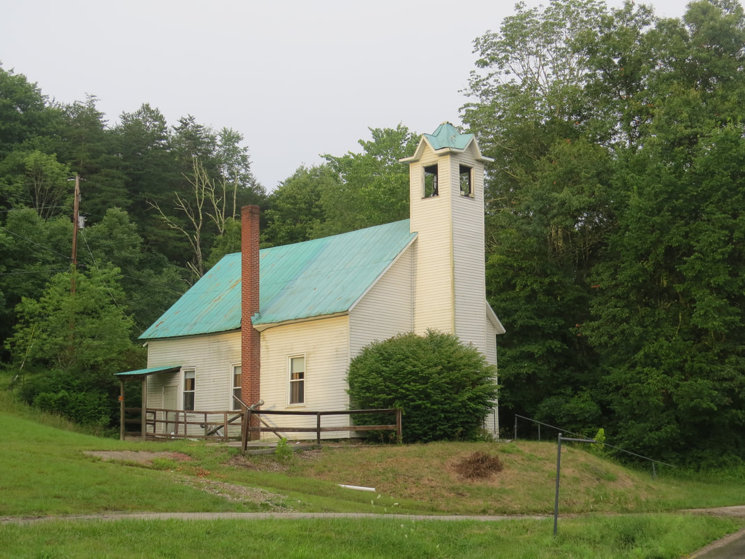
Lisa and I were back at the cabin at 8:35. Lynn was happily reading on the couch. We spent the rest of the evening just relaxing. I looked at the hiking options and reviewed the weather forecast. Looks like we should be good to go for tomorrow, at least through early afternoon. I’m thinking we’ll try Old Man’s Cave and the surrounding area. Perhaps the crowd won’t be so bad on a Monday. We’ll see. The girls had crashed before 10 pm. I stayed up reading and working on trip notes until 11 but that was a far as I could make it.
|
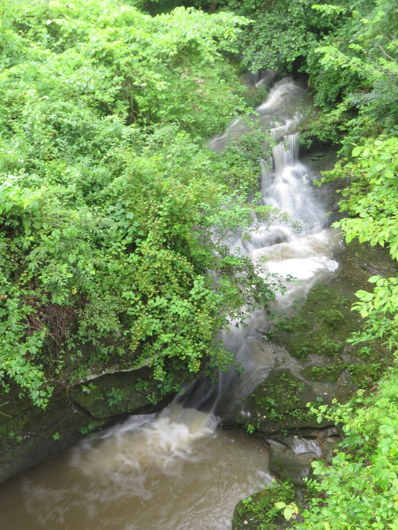
|
Day 4 - Monday, July 12 – Old Man’s Cave. I rolled out of bed at 0615. Feeling pretty good but the varying temperature in the house woke me up once or twice last night. This cabin is very nice but not a 5-star lodging option from VRBO. Location is great. Living area and back porch are also just what we want. Kitchen works for us but is a bit beat. We nicknamed the cabin "Squeaky" as there are several spots in the floor and a few doors that are noisy. The doors from the living room to the back porch stick. Quality of the towels is dubious. Biggest issue is the lack of headroom in the upstairs sleeping area and bathroom. But for a few days we can make it work.
Weather is overcast again, but the rain should hold off until after noon. That should give us time for Old Man's Cave this morning, if I can get the girls moving. Not that much of an effort as they were also wanting to get on the trail before the mass of tourists arrive. I reckon it was just a little past 8:30 AM when we hit the road for the 15-minute drive to the Old Man’s Cave Visitor Center, where we’ll start our exploration for today. This will count as a day of hiking in Hocking Hills State Park.
What a difference the time of arrival makes! Saturday late afternoon when we tried to get into the Visitor Center parking lot it was packed to overflowing, however this morning a little before 0900 the lot was maybe ten percent full. Now, by the time we were back from our hike today, just before noon, the lot was filled to 90% capacity or more. The moral of the story is get out early!
The really short story is that this is an excellent hike with many fascinating natural features to see all along the trail, but the hike was not as long as I expected. But for a loop hike that measures less than four miles, it sure packs in a lot to experience along the trail!
The temperature reading on the Edge indicated 72 degrees F, so nice conditions to start the day. I parked along the far side of the lot, along the paved trail and nearer to the trailhead above the first set of falls. We were quickly unloaded, checked our packs, cameras and hats, and we were off. I started our track at 8:59 AM. I love it when a plan comes together.
We did not have to wait long at all for our first sighting of note for the hike. Not really a sighting, more of a smelling. There is definitely a black and white pussy cat in the area, as that odor is unmistakable. The good news is that we’re out in the open for this stretch of the trail, and there aren’t many cars nearby where a skunk might hide under. I reckon the odiferous critter was just passing through and we never caught another whiff of it.
At the start of the trail, there were a series of interpretative signs providing guidance on the use of the area as well as information on the natural wonders that are waiting for us. The first sign was a plea to the tourists to “STAY ON THE TRAIL.” The same “A Rock Solid but Fragile System” message that we read at Cedar Falls. This should be repeated at every trailhead, so I was glad to see it. Perhaps with enough repetition the message will start to sink in.
The other signs focused on the natural wonders that can be seen in the area. There were a series that highlighted the seasons in Hocking Hills and showed the interconnected nature of the elements that make up the various ecosystems found here. The sign that I found most interesting described how this unique area came to be and how it was shaped over the course of hundreds of millions of years.
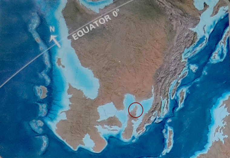

|
GEOLOGIC HISTORY
The story of the Hocking Hills region began during the Devonian Period (420-360 million years ago), when much of the state was covered by shallow seas. As this paleogeographic map shows, Ohio was south of the equator, while the east, ancestral Appalachian (or Acadian) Mountains were eroding. Ancient rivers carried the eroded sand and silt to form deposits similar to the modern Mississippi River deltas and coastal bayous. By the Mississippian Period (360-320 million years ago), these deltas extended further to the west and covered much of present-day eastern Ohio, including the Hocking Hills region.
These deltas were fed by steams that carried coarse sand and milky-white, quartzite pebbles. The areas between the stream channels were covered with thick, silty mud, which eventually formed shale. During the time, sea levels fluctuated, possibly caused by glaciation in the southern hemisphere. As sea levels fluctuated up and down, the deltas and feeder channels west through multiple, alternating phases of erosion and infilling. Eventually, these thick sequences of sandy, channel-filled deposits accumulated to form the Blackhand Sandstone. Later during the Permian Period (300-265 million years ago), the seas retreated from the interior of the continent, and the shale form the delta plains eroded. The coarser sandstone deposits remined because they were more resistant to erosion. These sandstones, which were once within topographical lows, now form the ridges and cliffs that are visible throughout the Hocking Hills region today. This “topographic inversion” accounts for the spectacular geological features visible in the park. Geologic Features – Unique sandstone features found in the park:
|
Next was information on the more recent history of the region:
THE HISTORY OF THE HOCKING HILLS REGION
Hocking State Forest - Hocking State Forest was established in 1924 as one of he state forest parks administered by the Ohio Department of Forestry. Hocking State Forest incorporated Cantwell Cliffs, Rock House, Ash Cave. Conkle’s Hollow, Crane Hollow, Cedar Falls and Old Man’s Cave – each initially designated as its own state forest park. As surrounding land was added, most of which was barren due to early subsistence farming, reforestation began. The first tree planting was done in 1925, and continued for the next several decades until 1985. Ohio’s early foresters protected the hemlocks in the gorges because of their unique ecological and recreational value.
In the 1930s, the Great Depression-era Civilian Conservation Corps (CCC) planted many of the fields. The young men of he Hocking CCC improved access to the rock formations by making roads and trails by carving steps out of the rock at Old Man’s Cave.
The trees the Hocking CCC and the Department of Forestry planted were from Ohio as well as other state seed sources. The seeds ere started at the state seedling nurseries, which provided millions of trees for reforestation and windbreak planting on private and public lands. Most of the trees planted on the old farmlands in Hocking State Forest were shite and red pines, but also included Scotch, shortleaf, loblolly, and Austrian pines, Norway spruce and yellow poplar. Many acres were planted in pure stand of a single species, while some areas were mixed rows of red and white pine, red and Scotch pine, and other combinations.
While most visitors to the Hocking Region venture out to enjoy the unique geological features, many do not realize the relatively recent success of forest management that surround these geologic jewels. Reforestation and forest stewardship practices in Hocking State Forest provide a broader scenic area while enhancing and stabilizing soils, purifying air and water, enabling more diverse habitat, expanding recreational opportunity and furnishing wood products.
Trees were planted in roughly 850 acres of today’s 9,588-acre Hocking State Forest and 2,356-acre Hocking Hills State Park, including 490 acres of white pine. The majority of these state-held lands, as well as surrounding privately owned woods, are of self-regenerating native hardwood composition.
During the 1950s, prisoners from the Hocking Honor Camp worked on tree planting, cleaning plantations and pruning more established plantations, as well as making telephone poles and clearing fire lanes. The prisoners earned five cents per hour for their labor if they had dependents, otherwise they earned half a cent per hour for their hard work.
Today, nurtured mature trees can be harvested from these early plantings and well-managed hardwoods.
Old Mans Cave - The hollows and caves of the Hocking Hills State Park have long attracted people. Evidence of the ancient Adena culture illustrates that man first inhabited the recesses more than 7,000 years ago.
In the mid 1700’s several Indian tribes traveled through or lived here including the Wyandot, Delaware and Shawnee. The area around the park began to develop in 1835 when a powder mill was built near Rock House and a grist mill was constructed at Cedar Falls.
The case areas were well-known as scenic attractions by 1870. In 1924, the state purchased the first parcel of 146 acres, including Old Man’s Cave, to preserve the scenic features.
Today the land surrounding Old Man’s Cave continues as a conservation and Forest management legacy to Ohio.
THE HEMLOCKS OF THE HOCKING HILLS REGION
Hemlock Wooly Adelgid (HWA) (adelges tsugae), is an invasive pest native to Asia that is threatening Eastern and Carolina hemlocks. This small aphid-like insect sucks sap from young twig, resulting in discoloration and loss of needles, eventually killing the tree. This small insect has devasted thousands of acres of hemlock throughout its Appalachian range. The Ohio Department of Natural Resources (ODNR) Division of Forestry is working diligently and collaboratively to protect and preserve the remaining hemlock stand in Ohio.
The first HWA white wool mass was discovered in the Hocking Hills area in February 2013. Surveys found that approximately 55 trees in an acre of hemlocks were lightly to moderately infested with HWA at Cantwell Cliffs in Hocking Hills State Park. Since then, treatments of more than 500 infested and buffer zone trees, as well as additional surveys for new populations, have been completed. HWA has been found in native stand of hemlock in Meiggs, Washington, Lawrence and Vinton counties, as of January 2015.
This pest is best detected from November through May, when it forms a protective, white, “wooly” covering. During other times of the year, the insect is very small (less than 1/16 inch long).
All HWA adults are female and produce 50-300 eggs in a lifetime. After hatching, early adelgid nymphs are in a crawler state (the only time in their development that they are able to move around). During this stage, they are most easily spread to new areas, primarily by birds, wind and people.
Saving Hocking’s Hemlocks - Due to HWA, the natural beauty that is seen in hemlock groves is in danger. Without action, these unique forest ecosystems in Ohio could become extinct.
Once passed the signs, we started down the trail along the creek. This section of the trail from the trailhead all the way to Whispering Cave but particularly the section from the Upper Falls to the Lower Falls was just a constant barrage of fascinating geologic formations, waterfalls, and plant life. Plus, a couple interesting man-made items as well. Here’s the listing of the highlights:
- Right as the trail turned south, we were greeted by a small waterfall, sort of a appetizer for the bigger items we would be seeing very shortly. The trail crossed the creek via a stone arch bridge just below these little falls and provided a peek upstream through the trees at the series of little cascades as well as down into the pool below the larger Upper Falls. A sign near the bridge provided a little perspective on the scene:
- Once across a stone bridge, we got our first view of the Upper Falls first from the trail looking down on the waterfall and the pool below the falls. Not a gushing cascade here in the middle of summer, but still a sufficient flow to make a lovely waterfall.
- A cool detail as we headed down the section of the trail the took us to the floor of the gorge was a large, dew-covered spider’s web suspended from the trees and rocks on the far side of the gorge. While the bridge and trail show man’s building expertise, the spider that wove this web is quite the engineer as well.
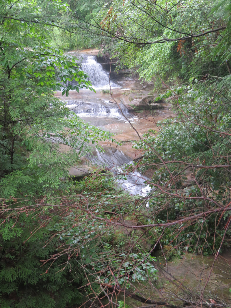
The little cascade leading to the Upper Falls.
|
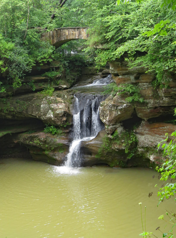
Upper Falls
|
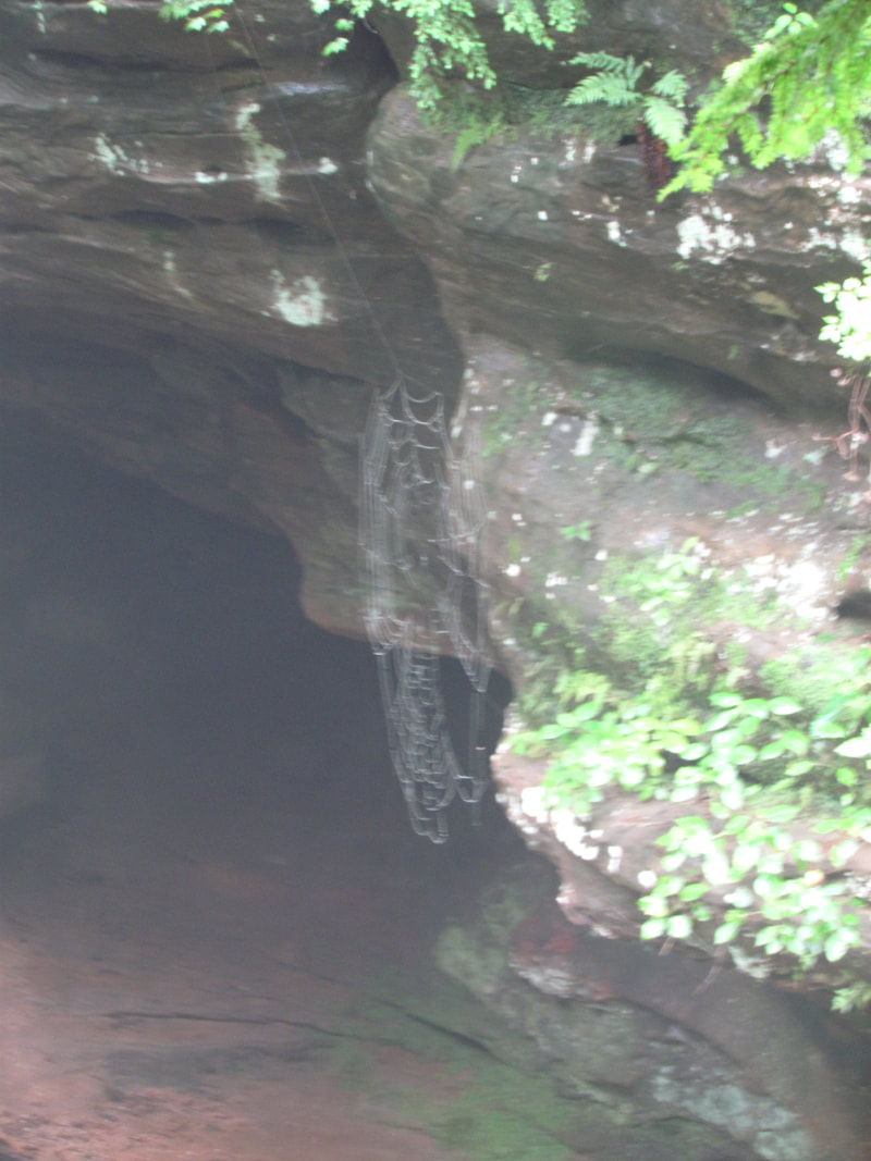
|
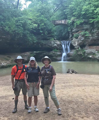
- Then down the hill to the edge of the pool for a different perspective of the Upper Falls. I thought this was the view we would be getting when I crossed the bridge; I have seen the photos of the falls with the bridge spanning the creek in the background, so it just seemed familiar. There were a couple other hikers there when we arrived, but they were just leaving, so we had the area to ourselves for a couple minutes. A very nice change from the scene at Cedar Falls on Saturday. We enjoyed the view and took our photos with no other tourists in the frame. No Photoshop adjustments will be needed on these images, other than maybe a little cropping. A family with young kids arrived a few minutes later, about the time we were gearing up to leave. Good timing as this gave us the opportunity to act as photographer for their little group and they reciprocated for us. Hey, now we all have a nice photo to capture the memory.
- After we left the Upper Falls, we were now hiking along the creek through the bottom of the gorge. The vertical sandstone of the initial section of the gorge were adorned in the green ferns and mosses that we’ve been seeing over the past couple of days. The rock walls were not that tall here, but then it is just the beginning of the gorge. The trees added quite a bit of the feeling of depth in this section. The creek was flowing nicely but was a muddy brown ribbon through the center of the gorge.
- The next named feature in the gorge was an oddity of geology and water erosion in the middle of the stream channel, the Devil’s Bathtub. This was a corkscrewing sluice through the sandstone. Seems that it is considered a waterfall of sorts, at least it is listed in the waterfall database. I can certainly see how it gets its name and the first hollow in the rock does resemble an old bathtub. A little bridge crosses the stream right over the Devil’s Bathtub, so we all got a good look at the hydrodynamics at play through this narrow section of the creek. A sign near the bridge provided more science as well as the lore of the Devil’s Bathtub as well as a warning for those considering a swim:
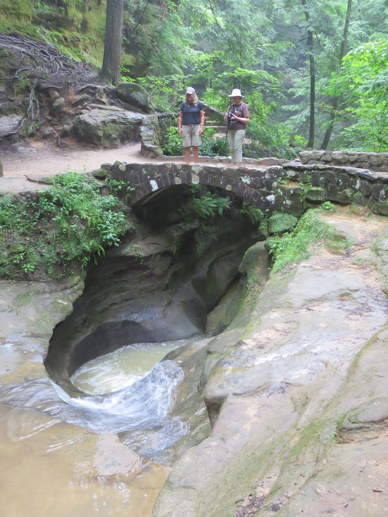
Lisa and Lynn studying the Devil's Bathtub.
|
DEVIL'S BATHTUB
As the water works its way down through Old Man’s Cave gorge, one of the first unusual areas that it encounters is here at Devil’s Bathtub. This is an area in the sandstone that has been cemented together more tightly than the other nearby rock layers. Because of this constriction of the stream, it has forced the water to carve in the only direction it can – straight down. Over time, the swirling action has carved out the “bathtub” shape in the rock.
Legend says the swirling drain goes all the way to Hades itself. The reality is that the tub is several feet deep, and comes out downstream under the bridge and towards Old Mans’ Cave. The tub can be very dangerous and climbing out is virtually impossible. Please remember that swimming or wading in the stream is dangerous, prohibited, and may cause damage to wildlife. Always stay on the constructed trails while enjoying the scenery here at the park.
|
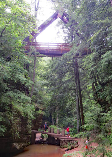
- The bridges were of particular interest as they varied in style, size and construction. There were several stone arch bridges, like the one above the Upper Falls, along the way. Between the Devil’s Bathtub and Old Man’s Cave there were two very cool bridges, one at our level for us to get across the creek and a second overhead for the rim trail that spanned the gorge. Sort of a Frank Llyod Wright feel to the structures. Certainly not the typical park construction which is more utilitarian in nature. The higher bridge was an A-frame construction, very angular. Our bridge was a series of concrete pylons with platforms arrayed in an arc over the creek. The structure was both bridge and artwork. It had its own presence in the gorge due to its unique design, but also seemed to blend into the natural contours of the gorge.
- Old Man’s Cave was the next major feature in the gorge. We did not explore this area as much due to the one-way nature of the trails. We did buck route a little, since there was no traffic at this time and walked up onto the stone bridge leading into the large recess that is Old Man’s Cave, which gave us enough of a view. Actually, a very pretty scene with the creek flowing and forming a little falls, the large recess higher up on the very colorful cliff face and all of this framed in the ever present green of the forest.
- I found the tree roots fascinating the way they extended from the base of the trunk and spread out over the rock surface looking for a way to reach down into the dirt. At some point, the seeds that created these large trees had found a tiny gap in the sandstone, just enough to connect to nutrients in the dirt, then over time the roots had to expand and search for more connections to support the growing tree. These often extension root systems just added to the overall surreal nature of the surroundings here in the gorge.
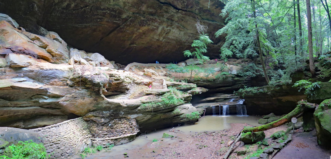
|
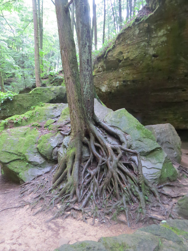
|
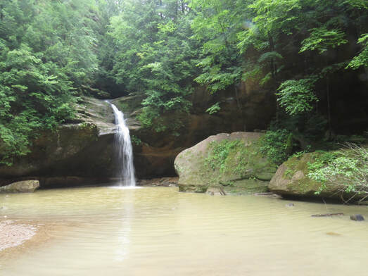
- Not far beyond Old Man’s Cave we reached the Lower Falls. Another great stone arch bridge crossed the creek to provide us access to the sandy beach area below the falls where we got a better view. We had the area around the Lower Falls almost to ourselves, only a couple other hikers there, so easy to get phots of both the natural beauty and the lines of the stone bridge.
- I tried to find out some information on these waterfalls, but there was not much data available. Shoot, I could not even determine the name of the creek that runs through the gorge. The creek is not shown on all the maps that I looked at and the ones that did show it as intermittent or seasonal. One of the interpretive signs further along the trail did refer to the creek as Old Man’s Creek. That works for me. In the World Waterfall Database, the Lower Falls is called Old Man’s Cave Falls. It is classified as a plunge type waterfall with a single drop of 45 feet.
- Below the Lower Falls, the gorge transitioned from a narrow passage with vertical, well defined rock walls, to a wider valley a more sloping, but still steep, grade to the walls. The trees here were tall and straight, again providing the illusion of a tight passage through a deep gorge. Large boulders and slump rocks were scattered on the slope above us and all the way down into the creek. Shades of green dominated the scene, from the olive tints in the creek, to the mossy hues on the rocks, and the bright green of the ferns and other foliage. We continued down the trail along the creek, still studying the interesting tree roots, ferns, fungi on downed logs and the moss-covered rocks. Some of the bigger boulders had little forests of their own growing on top. A sign along the trail spoke to this very point, citing that many of the rocks “are covered with miniature life. Growing along the tiny cracks and moist crevices are a wide variety of tiny plants. Plants such as Sphagnum Moss, lichens and several types of fungus find all they need to survive in the moist barren places in the park. Up to 15 types of ferns, such as Christmas or Wood Fern, can be found in Old Man’s Cave alone! There small and delicate life forms are one of the many reasons we ask you to stay on the trail at all time while in the park.”
- Now I understand why Hocking Hills is so popular. While we’ve seen some beautiful scenery over the weekend in other parts of the region, the stretch of trail from Upper Falls to beyond the Lower Falls is truly spectacular. Glad we got here early to enjoy these sites sans people. There were still plenty of folks there, most having taken the direct trail to Old Man's Cave and then exiting.
- The crowds dropped to nearly zero beyond the Lower Falls. Just one or two faster pairs of hikers passed us before we got on the loop to Whispering Cave.
- Near the intersection with the trail leading to Whispering Cave, we found a little clearing along the trail with a couple benches. This would have made a nice place to take a break and have a snack but we were not ready for either. I did comment to Lynn that this is where Dad would have stopped and that within five minutes there would be another old railroader there talking about trains.
- One final interesting bridge to cross before heading up the trail to Whispering Cave, this on a cable construction swinging bridge with a wood plank deck. This last crossing was just upstream of where the Old Man’s Creek emptied into Queer Creek. We decided to cross one at a time since we did not know how much to moved, but it turned out to be a stable platform. Once across the Old Man’s Creek, the trail ran parallel to Queer Creek, so this water has recently poured over Cedar Falls.
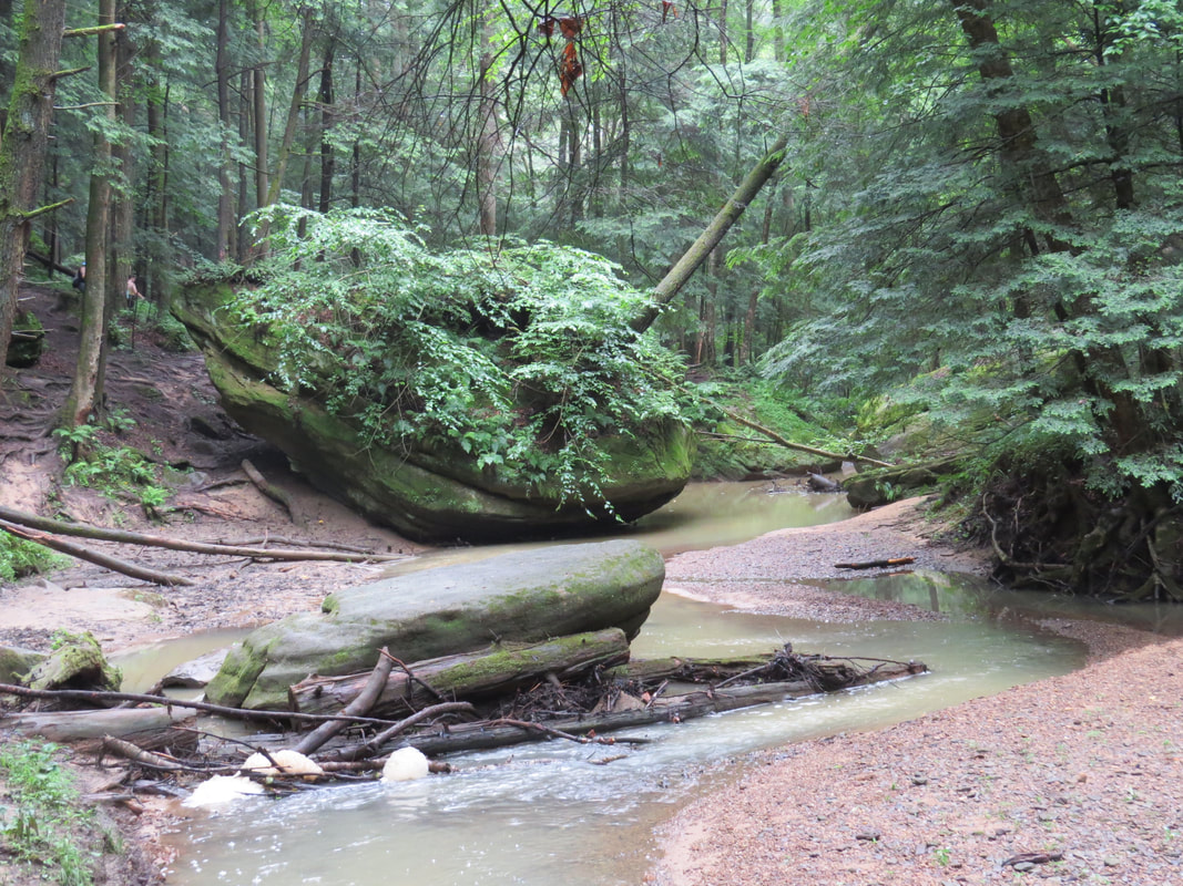
Scene along Old Man's Cave Creek.
|
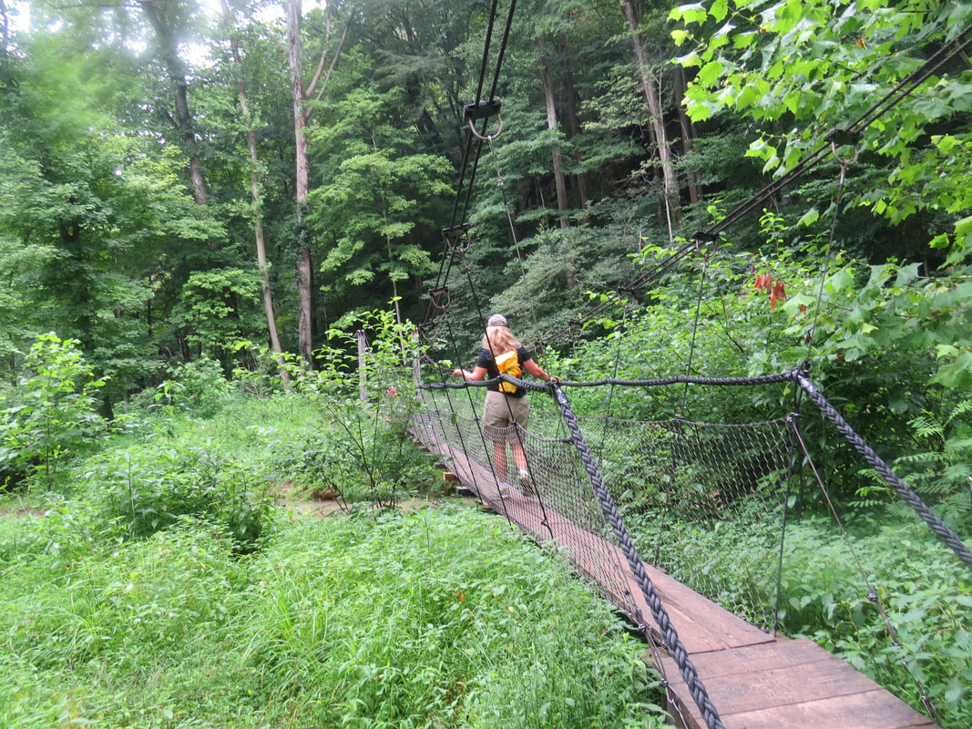
Cable bridge at the mouth of Old Man's Cave Creek.
|
- Just across the bridge was an interpretive sign focused on the “Creatures of the Gorge” and listed a variety of animals that live here, including grey fox, river otters, Wood Ducks, Belted Kingfishers, frogs, toads and snakes. As usual, we’ve been looking for critters, but oddly have seen nothing along the trail. Not even tracks in mud along the creek. Well, what we’re missing in terms of wildlife sightings today we are certainly making up for with the magnificent geology and beautiful scenery here in the gorge.
- After a short distance along Queer Creek, the trail turned uphill. This was a steep section but not overly long and certainly worth the effort, as the trail led to some fascinating and beautiful formations. From one vantage point at the top of the trail there were several wonderous natural phenomena. First the sandstone wall in front of us was an example of honeycomb weathering. To the right of the wall was a section of rounded sandstone exhibiting nearly the spectrum of the rainbow between the orange, yellow and red of the rocks with the greens of the mosses. Then there was the tree growing just above this colorful rock. While all the other neighboring trees were growing straight and tall, this on, had taken an odd detour as it reached for the sky. The trunk had a spiraling nature, making a loop parallel to the ground. We had no explanation for this one unless it was growing on top of a Sedona vortex. The final little oddity was found in the recess along the base of the wall, a collection of little spider webs that had collected moisture, very similar to the ones that Oscar and I saw near Hidden Arch in the Red River Gorge.
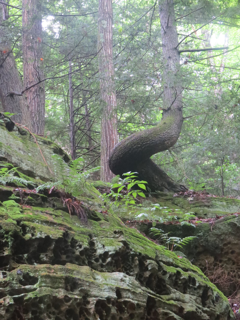
|
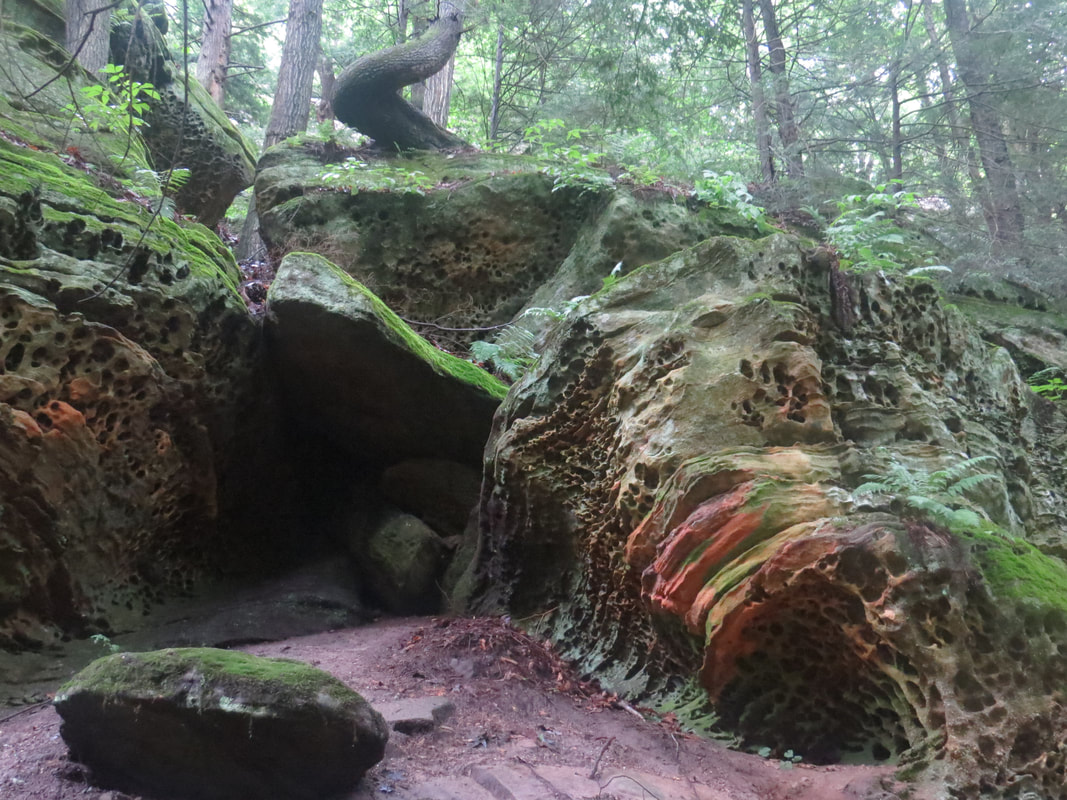
|
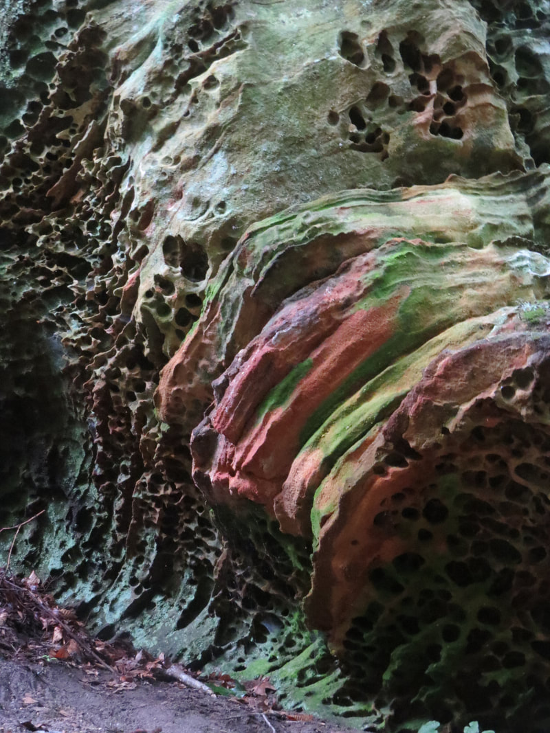
|
- A side trail took us around to the left of the rock wall to the recess that is Whispering Cave. This was a very large recess, on the order of Ash Cave, but hanging on the side of the cliff with a sloping hillside below it, unlike Ash Cave which was situated on the floor of its little gorge. We could see that there were several other hikers hanging out in the cave, mostly kicked-back and taking a break in the cool confines of the big recess. Given that the trail was not crowded, there were more people at Whispering Cave than I expected, but still only about a dozen or so. Maybe they came in from the opposite direction, though I thought it was a one-way loop.
- We made our way into the cave and looked around the area a bit. Signage there provided an overview of the recess caves in the Hocking Hills region.
WHISPERING CAVE
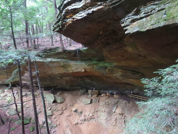
Here is where hikers can witness the power of water in the Hocking Hills. Looking out from within this cave with its very steep walls and loose boulders, the actual formation of a young sandstone gorge is taking place as the water slowly digs and widens in the tight rocky gap below. This slow relentless process can take millions of years to develop into a full sized rocky gorge. The massive recess formed in the side of the Blackhand sandstone cliff wall is another example of the power of water in the Hocking Hills. Caves like this are not true caves. Instead, they are massive overhangs carved in the cliff walls through the power of water erosion digging out the bedrock. Like its nearby neighbors of Old Man’s Cave or the massive Ash Cave, Whispering Cave and its 105-foot waterfall are great examples of how water can carve out the softer layers of the sandstone. As an added bonus feature, under the right moonlight, the quartz crystals in the exposed bedrock make the cliff appear to have twinkling lights.
This cave’s depth and size also contributes to a cooling effect that has allowed several ice age era species of plants to thrive in the deep gorge environment. Looking out from the case, people can see what looks like a primitive forest with short-needled Eastern hemlock and the waxy looking leaves of the rhododendron bushes covering the slopes and creek bank below. This is the same natural beauty that inspired the local native tribes to use these recess caves as temporary shelters. Evidence of the earliest people dates back to the end of the last ice age in Ohio and continue right up through the historical tribes of the Shawnee, Delaware and Wyandot. The wild abundance of natural resources to farm, hunt and gather along with the milder climate made the gorges ideal location for these early inhabitants to camp.
This cave’s depth and size also contributes to a cooling effect that has allowed several ice age era species of plants to thrive in the deep gorge environment. Looking out from the case, people can see what looks like a primitive forest with short-needled Eastern hemlock and the waxy looking leaves of the rhododendron bushes covering the slopes and creek bank below. This is the same natural beauty that inspired the local native tribes to use these recess caves as temporary shelters. Evidence of the earliest people dates back to the end of the last ice age in Ohio and continue right up through the historical tribes of the Shawnee, Delaware and Wyandot. The wild abundance of natural resources to farm, hunt and gather along with the milder climate made the gorges ideal location for these early inhabitants to camp.
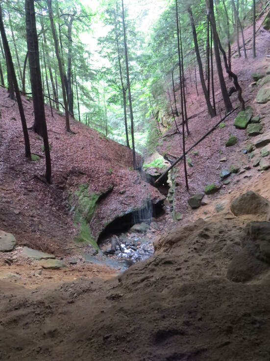 The trickle of water falling from the upper edge of Whispering Cave.
- The waterfall from the top edge of the recess was a mere trickle today. I wonder what it was like during the downpour we had yesterday afternoon. Whether running fast or slow, it was apparently relentless as the water had drilled a very definite channel in the slope below the cave, starting with a larger, fairly deep depression and extending downhill as a sort of slot canyon. A perfect example of nature’s version of rock-paper-scissors, but instead the game is rock-water-wind. Sure, it takes a long time, but water will beat rock eventually.
- We retraced our steps from Whispering Cave to the main loop trail and continued around the loop. There was still a bit of an uphill section but not it was not long before the trail leveled out. There was one overlook along this stretch, but there was not much to see as the view was just peering out over the tops of the trees that fill the gorge below. A pretty sea of green to be sure, but nothing extraordinary.
- There were a couple interpretive signs near the overlook. One discussed the sandstone in Hocking Hills but most of the information was covered in the other signs we’ve seen around the park. There was one interesting nugget on the honeycomb weathering we had seen back along the trail: “The water permeating through the porous sandstone erodes loose sand grains and leaves small pits formed from the inside of the bedrock. The firm edges of the small pits are made from resistant iron and silica, leaving small cups.”
- A second sign mentioned that over 260 species of birds can be found in the Hocking Hills region, in part due to the wide variety of habitats available.
- This sign also gave me the name of the creek flowing through the gorge containing Old Man’s Cave, the appropriately names Old Man’s Creek. That solves that mystery. The sign also described an oddity of the flow path of another creek: “Old Man’s Creek flows through the gorge in s southern route and is joined by the “backwards” flowing Queer Creek moving to the northwest. The strange backward flow of Queer Cree, which gave the stream its unique name, is due to the layout of the surrounding steep hills, giving the water no choice but to turn a short distance north before moving int eh more normal path to the south. After the two combine, they continue an expected route along the Slat Creek to the southwest and eventually meet the Scioto River.”
- The rest of the hike was a walk in the woods and generally near the park roads. There were still details to see along the trail, and I noted a couple interesting things growing up through the dense mat of leaves on the ground, one plant and one fungus, according to Seek. First was a set of white stems, about six inches tall, with a little hook on the end. I figured this was a fugus of some sort but Seek identified it as Ghost Pipes (Monotropa uniflora, also called ghost plant, Indian pipe or corpse plant). The information on Seek indicated that the species is widespread but rare in occurrence. The other sighting was smaller, only two or three inches tall, but bright orange. A fungus identified as Clavulinopsis aurantiocinnabarina or Spindle Shaped Orange Coral. Neither of those names really roll off the tongue.
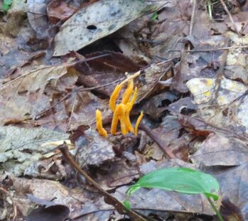 Clavulinopsis aurantiocinnabarina or Spindle Shaped Orange Coral
The trail exited the woods where we crossed the road one final time and completed our trek along a paved path that led back to the Old Man’s Cave Visitor Center. We made a quick look through the Visitor Center. Our primary mission was to check out the gift store, but it was closed today. Perhaps due to lack of staff? The sign outside the shop state to check at the camp store. OK, we’ll do that. There were a lot of people in the Visitor Center so we did not hang around inside long. No sense in challenging the pandemic.
We completed our loop hike back in the parking lot where we started this morning. We were back at the Edge right at 11:30. Shorter hike than I thought it would be as Ramblr had us at 3.7 miles. But I guess that’s alright as we were off the trail well before the rain rolled in. Of course, at present the weather looks great, warm temperature and blue sky. We tossed our gear in the car and quickly got on the road. The parking lot was filling up quickly. I’d say it was 90 percent full if not more. I’m sure someone will be wanting our spot. Photo gallery from the hike.
We made a quick stop at the camp store, which is just at the next driveway from the Visitor Center. Quick stop, not that much of interest but we did get our souvenir pin for Hocking Hills State Park. So that action item has been completed.
We were home at 11:55. Since I was expecting a longer hike, I was sort of surprised we were home so early. We could have easily fit in another hike somewhere. But then again, this is vacation, and vacations are at least in part about relaxation and kicking back with a beer in the afternoon is a key part of relaxing. Time for a picnic on the back porch. And that is where we spent the rest of the afternoon.
During the course of the afternoon, we read, surfed on the phones, watched for birds in the back yard and did a little planning for tomorrow. Lisa checked the weather and stated that the chance for rain today has diminished to zero. At some point later in the day I glanced over and noticed that both Lynn and Lisa had nodded off. Hey, that’s part of vacation as well.
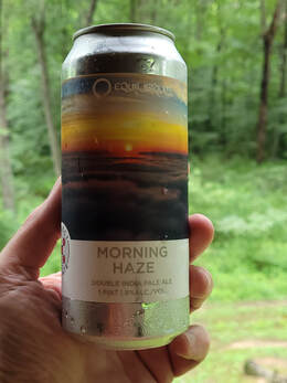
I tried a couple of the oddball beers that I had in the cooler. I think that these came from Oscar as part of our beer swap at the end of the Kentucky meet-up back in June. First up was Morning Haze, a double IPA (8% ABV) from Equilibrium Brewing. Not bad. Nice full feel to this beer. Very hazy, basically opaque. Not much in terms of aroma. Light flavor but pleasant. I gave it a 3.75 rating on Untappd. The second was Rocky Mountain Kolsch (5.1%, 27 IBU) from Upslope Brewing. Not a style of beer I drink often, but this one is pretty good. Light. Sort of sweet due to the honey, I guess. Overall balanced. Good for a change of pace. Also rated at 3.75.
We had a pretty good set of critter sightings from the back porch this afternoon. The most conspicuous was a squirrel that was quite agitated and animated, "agimatated" is the term we’ve coined for critters in such a state. He was chittering loudly, and his tail was flicking wildly. He’s definitely not happy about something. Also, several birds in the trees. A couple landed on the stump in the yard so that we were able to get a better look at them. A lady Cardinal started the show but would not quite sit still enough for a nice photo. I had better luck with an Eastern Towhee. There were others that just passed through but provided enough clues to determine what they were. There were a few butterflies as well. A black one that I could not identify (too far and flitting about too much for a photo). I did not need a photo to tell the Tiger Swallowtail when it fluttered by. We also saw several little silky threads floating through airspace above the yard, transporting tiny little spiders most likely.
We had a pretty good set of critter sightings from the back porch this afternoon. The most conspicuous was a squirrel that was quite agitated and animated, "agimatated" is the term we’ve coined for critters in such a state. He was chittering loudly, and his tail was flicking wildly. He’s definitely not happy about something. Also, several birds in the trees. A couple landed on the stump in the yard so that we were able to get a better look at them. A lady Cardinal started the show but would not quite sit still enough for a nice photo. I had better luck with an Eastern Towhee. There were others that just passed through but provided enough clues to determine what they were. There were a few butterflies as well. A black one that I could not identify (too far and flitting about too much for a photo). I did not need a photo to tell the Tiger Swallowtail when it fluttered by. We also saw several little silky threads floating through airspace above the yard, transporting tiny little spiders most likely.
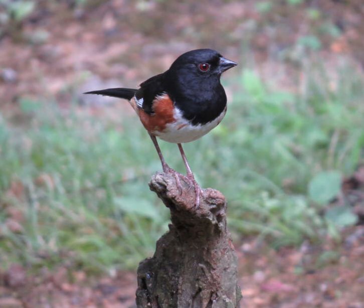
|
|
|
|
I did a little more trail research, looking for additional options for tomorrow. Ended up adding trail number seven from the hiking book. This was the trail at Rockbridge State Nature Preserve, the home of Ohio’s longest natural bridge. That’s just too interesting to miss, especially since I enjoy viewing the arches and bridges out west and we just saw some in Kentucky last month in Red River Gorge.
The sun was out for most of the afternoon, just like the revised forecast stated. However, rain rolled back in around 4:00 PM. Another miss by the meteorologists of Central Ohio. The rain did not last long, and the sun was still shining, so there must have been a rainbow somewhere, just not visible from the back porch. |
|
At 5:45, Lynn, Lisa, and I walked to the church and back, detouring through the cemetery on the return trip. The creek across from the little church was not flowing as high as our previous visit. We spotted a few birds and butterflies along the way. We paused to study the area along the gas line rights-of way, looking for critters of course. No deer, but there was a flurry of activity along the edge one of the clearings. Looked like a flock of ground birds that got flushed and flew into the tree line. Too far away to tell what they were, and they were quickly out of sight; probably grouse or maybe turkey but we were just a guessing.
|
Red Admiral
|
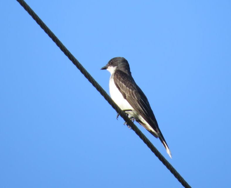
Eastern Kingbird
|
We were a little later than usual for dinner. Carry-out was the mode of dining, but what type of grub. I offered up either Mexican or BBQ with the thinking that we would have one tonight and the other tomorrow. After a quick review of the menus, we decided on Millstone BBQ for our take-out meal tonight. Works for me. I placed the order which will be ready at 8:00 PM. That’ll work. I kicked back and finished my beer as I had some time to kill.
A bonus for going to Millstone BBQ was the location, right on the edge of town, so very easy to access from our cabin. And I noticed that the Mexican restaurant on my list is right in the same little area, so that will work out for tomorrow. On the drive in I spotted a few more deer plus Canada Geese by the lake and House Sparrows scavenging in the restaurant parking lot, a couple additional sightings for the trip list. Just a short wait while the order of completed and I was back on the road to the cabin. Again, the return trip seemed to go very quick.
Out on the back porch I passed out the Styrofoam containers with our dinners. A very elegant affair to be sure! Lynn had the beef brisket sandwich, Lisa the “big bad wolf” which is also a beef brisket sandwich but with peppers and onions, and I went with the Cuban. We all had fries for our side. Hey, its vacation! The bonus was the order of little cornbread muffins that came with the dinners. Quite tasty! We’re doing very well with the dining options here in the Hocking Hills area.
After dinner, once it was dark, we went out to check the view of the sky, but there was no joy on stars yet again. We lounged in the living room for the rest of the evening. I caught up on email. Some good news was that John has rented a house for the AIAA Fellows dinner outing in D.C. OK. It is time to look at flights for that trip. But that can wait until we get home. We called it a day at 10:15.
Day 5 - Tuesday, July 13 – Several Short Trails. I opened my eyes to see my phone quietly stating that the time was 6:29 AM. Time to get the day rolling. Once out of bed, I check the conditions through the window and door to the back porch. Looks like a nice day albeit a bit breezy based on the motion of the trees around the cabin.
I was out on the back porch at 0700. Lynn is making her coffee. I get my caffeine by listening to the sounds of the morning. The birds have resumed their chorus, although we have a different set of players than last evening. Also, there are the sounds of humans from a neighboring cabin. Plus, a car heading down Collison Road. That was an unusual sound for this trip.
The plan for today is a series of shorter trails.
Lynn requested that we start at Rock House, which is part of the Hocking Hill State Park, as that was one that she was really interested in seeing after reading the description in the hiking book. So, the order listed seems to be the best way to string these together, both from a priority order and logistically from a driving perspective. If we do all these, we'll cover about eight miles total, but I'm betting that at best we'll get in the first three. I reckon we'll figure it out as we go. Lynn and Lisa each checked the weather forecast for the day and declared that it will be sunny and dry. Based on previous results, I was a bit skeptical, but at present we do have a nice looking day for hiking.
We were saddled up and on the way at 8:45. Short drive to Rock House, perhaps 15 minutes. There were only a couple cars in the main lot when we arrived, but we drove on to the upper lot since that was where the trailhead was located for the start of the one-way loop through the little park. No cars in the upper lot when we arrived. We got our gear in order and walked toward the signs marking the trailhead. The Ramblr track start at 9:08 AM.
Interpretive and warning signs met us at the trailhead. The warning sign was a duplicate of the one we read at the Old Man’s Cave trailhead listing the ways to take care of the natural wonders, primarily by staying on the trail and showing due respect for the treasures along the trail. The other two signs here focused on history, both from a geologic timeframe and the more recent timeline.
A bonus for going to Millstone BBQ was the location, right on the edge of town, so very easy to access from our cabin. And I noticed that the Mexican restaurant on my list is right in the same little area, so that will work out for tomorrow. On the drive in I spotted a few more deer plus Canada Geese by the lake and House Sparrows scavenging in the restaurant parking lot, a couple additional sightings for the trip list. Just a short wait while the order of completed and I was back on the road to the cabin. Again, the return trip seemed to go very quick.
Out on the back porch I passed out the Styrofoam containers with our dinners. A very elegant affair to be sure! Lynn had the beef brisket sandwich, Lisa the “big bad wolf” which is also a beef brisket sandwich but with peppers and onions, and I went with the Cuban. We all had fries for our side. Hey, its vacation! The bonus was the order of little cornbread muffins that came with the dinners. Quite tasty! We’re doing very well with the dining options here in the Hocking Hills area.
After dinner, once it was dark, we went out to check the view of the sky, but there was no joy on stars yet again. We lounged in the living room for the rest of the evening. I caught up on email. Some good news was that John has rented a house for the AIAA Fellows dinner outing in D.C. OK. It is time to look at flights for that trip. But that can wait until we get home. We called it a day at 10:15.
Day 5 - Tuesday, July 13 – Several Short Trails. I opened my eyes to see my phone quietly stating that the time was 6:29 AM. Time to get the day rolling. Once out of bed, I check the conditions through the window and door to the back porch. Looks like a nice day albeit a bit breezy based on the motion of the trees around the cabin.
I was out on the back porch at 0700. Lynn is making her coffee. I get my caffeine by listening to the sounds of the morning. The birds have resumed their chorus, although we have a different set of players than last evening. Also, there are the sounds of humans from a neighboring cabin. Plus, a car heading down Collison Road. That was an unusual sound for this trip.
The plan for today is a series of shorter trails.
- Rock House
- Cantwell Cliffs
- Rockbridge State Nature Preserve
- Conkle’s Hollow Rim Trail (since we got rained out on Sunday)
Lynn requested that we start at Rock House, which is part of the Hocking Hill State Park, as that was one that she was really interested in seeing after reading the description in the hiking book. So, the order listed seems to be the best way to string these together, both from a priority order and logistically from a driving perspective. If we do all these, we'll cover about eight miles total, but I'm betting that at best we'll get in the first three. I reckon we'll figure it out as we go. Lynn and Lisa each checked the weather forecast for the day and declared that it will be sunny and dry. Based on previous results, I was a bit skeptical, but at present we do have a nice looking day for hiking.
We were saddled up and on the way at 8:45. Short drive to Rock House, perhaps 15 minutes. There were only a couple cars in the main lot when we arrived, but we drove on to the upper lot since that was where the trailhead was located for the start of the one-way loop through the little park. No cars in the upper lot when we arrived. We got our gear in order and walked toward the signs marking the trailhead. The Ramblr track start at 9:08 AM.
Interpretive and warning signs met us at the trailhead. The warning sign was a duplicate of the one we read at the Old Man’s Cave trailhead listing the ways to take care of the natural wonders, primarily by staying on the trail and showing due respect for the treasures along the trail. The other two signs here focused on history, both from a geologic timeframe and the more recent timeline.
HISTORY OF ROCK HOUSE
Rock House is the only true cave in Hocking Hills State Park. Over time, water slowly eroded away the Black Hand Sandstone, creating a cave. This cave has been home, hideout and destination for many throughout history.
The cave at Rock House is approximately 25 feet high, 200 feet long and 20 to 30 feet wide. There are seven different window-like openings allowing sunlight into the cave, and several sandstone columns support the roof.
Not only does the cave at Rock House resemble a house, with its rook, support pillars and windows, various groups have inhabited the cave over thousands of years. Archaeological evidence shows Native Americans took shelter here, constructing small ovens in the rock walls to cook meals. The man-made troughs in the cave’s floor collected water and provided cave-dwellers with a protected water supply. It is alleged that in the 1800s , robbers and bandits used the Rock House as a hideaway, which led to its nickname as the “Robber’s Roost.”
Rock House was a popular tourist attraction nearly a century before the State of Ohio established Hocking Hills State Park in 1924. In 1835, F.F. Remple, a businessman from Logan, Ohio, built a 16-room hotel a short distance away from the Rock House cave. Located where the current picnic shelter is, the hotel included a ballroom, stables and even a post office.
ICE AGE REMNANTS OF ROCK HOUSE
The profound effects of time, weather and the historic ice age have made the Hocking Hills region a unique and diverse place.
Many plants found in the deep gorges surrounding the Rock House are northern species pushed south when glaciers moved across the continent. Although glaciers did not reach the Hocking Hills region, the seeds, rocks, soil and vegetation pushed ahead of the glaciers, called till, was present at the foot of the glaciers.
Once the glaciers started to recede, runoff carried till into the regions ravines. Certain plants thrived as they originated from the same type of cool, wet environment. Over time these plants took root and established in the southwest region of Ohio. Once a plant community was established, animals soon followed. The White-winged Crossbill, the golden-crowned Kinglet and Northern Red-backed Vole are all species that traveled with the glaciers and made Hocking Hills their home.
These unique species are usually only found within the confines of the deep gorges and ravines where the eastern hemlock grow in abundance. When several unique species are located in a specific habitat, it is called a microclimate.
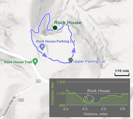
Once passed the trailhead signage, it did not take long for the trail to start its descent into the little gorge that holds Rock House. Downhill all the way, but not really that steep, and only about 100 feet in elevation change to the namesake formation. There were some steps carved into the rocks but these were in great shape and fairly well spaced. As we walked down the trail, the sandstone wall was on our left and the gorge to our right. Only took about 15 minutes to reach the cave from the time we left the car.
When we reached Rock House, we were greeted by strange noises through one of the windows in the sandstone wall. Sounded really weird, in part due to the acoustics of the cave, I’m guessing. But what could it be? Bear? Not likely. Frogs? Sort of sounded like frogs, but a cave does seem like the right habitat. I paused and tried to record the sounds. Nope not a bear or frogs or even people, it was pigeons, rock doves. Go figure. After listening to the clip of the sounds, it was obvious that this was the cooing of pigeons (hey, it’s always easier when you know the answer). OK, back to the geology.
When we reached Rock House, we were greeted by strange noises through one of the windows in the sandstone wall. Sounded really weird, in part due to the acoustics of the cave, I’m guessing. But what could it be? Bear? Not likely. Frogs? Sort of sounded like frogs, but a cave does seem like the right habitat. I paused and tried to record the sounds. Nope not a bear or frogs or even people, it was pigeons, rock doves. Go figure. After listening to the clip of the sounds, it was obvious that this was the cooing of pigeons (hey, it’s always easier when you know the answer). OK, back to the geology.
|
|
We found the path leading into the cave and went in to check it out. The interior was fairly well lit due to the numerous openings in the rock wall. These windows also provided nice views from the cave out over the gorge. The shapes of the windows were rather abstract and allowed us to us our imagination as to what each shape looked like. One was quite obviously the profile of a gorilla. The rest of them were a bit more of a stretch to find a defined shape. But if you held your head at the right angle and squinted a bit, that one might be a witch…or maybe Gandolf the Grey. There was s running shoe in the mix as well.
|
The sandstone both inside and outside the cave was very colorful between the oxidized minerals in the conglomerate rock, the various shades of green lichens growing on the surface of the sandstone and the plants that had taken root in the cracks in the rock wall. We spend several minutes exploring the cave, taking in the views and trying to get interesting photos in the low light conditions. The pigeons did not seem to mind us being there. Reckon they are used to people.
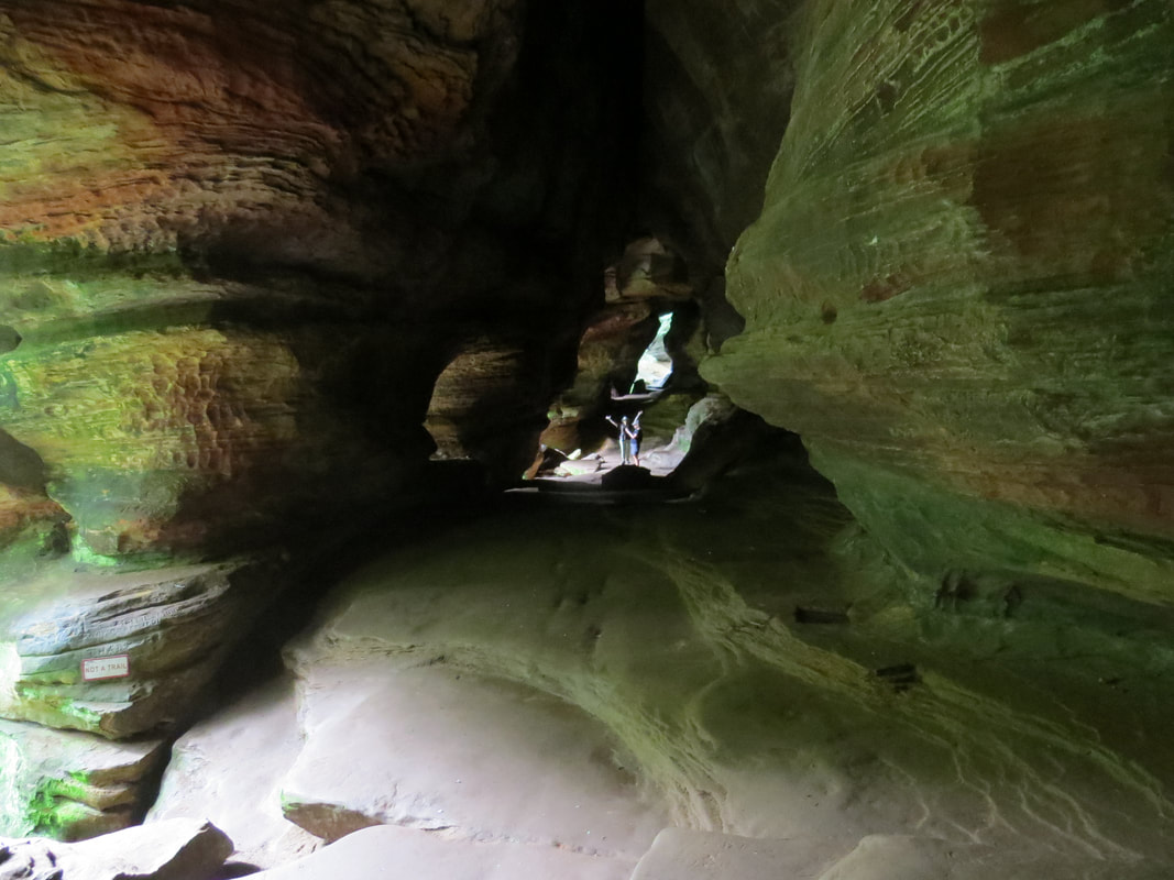
|
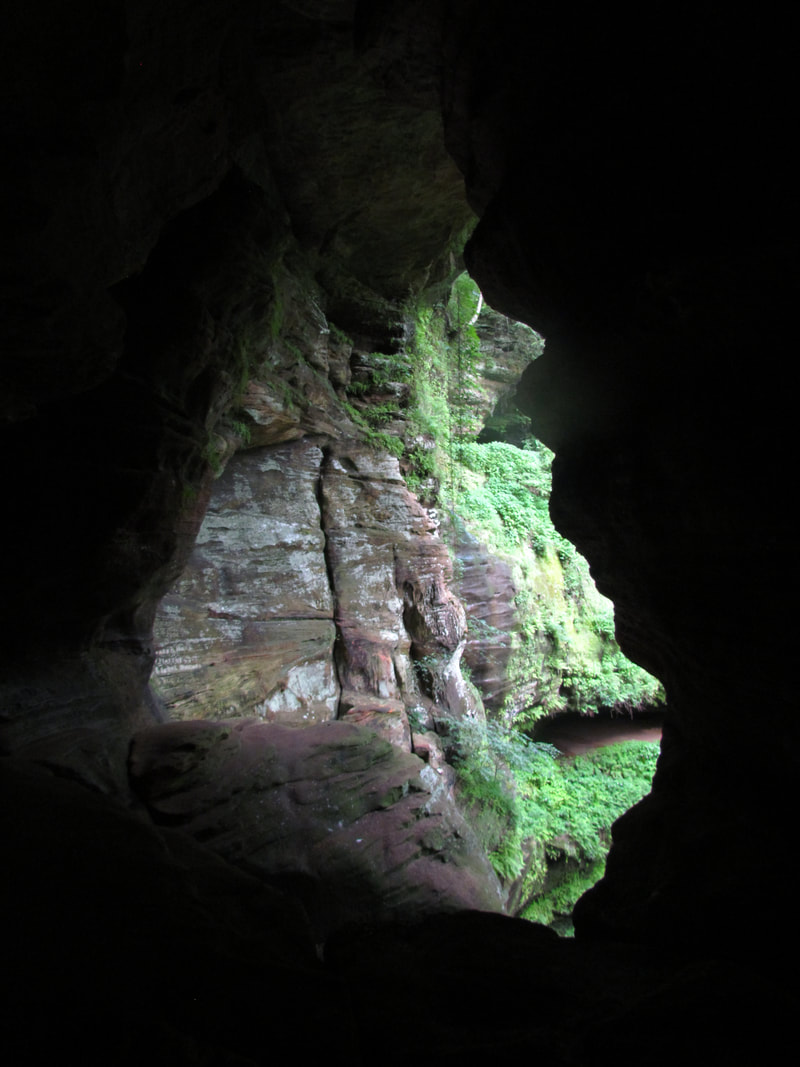
|
From the cave the trail worked down into the bottom of the gorge and across a bridge spanning. This was a lush and very green area. The rock walls of the little gorge were covered in plants, basically a continuous hanging garden. The bridge was there to span across the wet area where the water draining from the end of the gorge funnels through. Once across the bridge we climbed back up through a couple long switchbacks to the main parking area. We skirted the main parking lot and followed the signs to the upper lot and our waiting vehicle. There were a few other cars there now and some other hikers getting ready to check out Rock House. Rock House photo gallery.
That was a nice little hike. A short loop trail, just under a mile, and only took us 45 minutes to complete, so we have plenty of time for the next short hike or two. We had the trail to ourselves. I don’t recall seeing another hiker while we were on the trail, but that is an advantage of the one-way trails as everyone is going the same way around the loop, so even if there are other hikers on the trail you may never see them. Rock House was well worth the visit, but now it is time to move on. Next stop, Cantwell Cliffs.
Drive time from Rock House to Cantwell Cliffs as only ten minutes or so (seven miles). More folks here as the little parking lot was over half full. Still, plenty of open spaces for the Edge. The sunny sky we had earlier have given way to overcast. What was that I heard about no chance of rain today? No worries, it’s not raining at present, so off we went. Ramblr was tracking our route starting at 10:13.
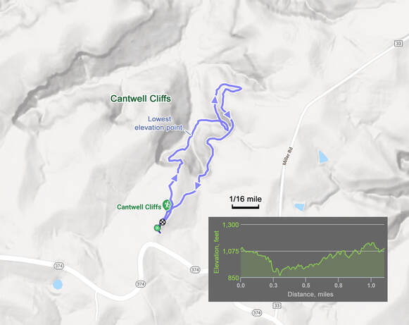
Pretty scenery but not as interesting as Conkle’s Hollow or the area around Old Man’s Cave. A major detractor to hiking in Cantwell Cliffs was the condition of the trails, as they were in serious need of maintenance. Maybe part of the conditions was weather related as there were many wet and muddy spots along the trail, but these could also point to the need for improved drainage. Also, the Gorge Loop that was highlighted in the hiking book was closed. Not sure if this was due to COVID or poor conditions. While we did have to spend more time watching for trip hazards and steep drops along this trail, it was still a pretty walk. From the parking lot we looped clockwise around the gorge. The initial section dropped us down to the floor of the valley, then we spent the rest of the hike slowly regaining the elevation to get back to our starting point. That first section was one of the more interesting as the trail was routed through a wide gap between the huge blocks of rock. We walked by a couple smaller recesses in the rock walls, along some little run-off creeks and generally just had a nice walk in the woods. Pleasant, but nothing truly spectacular. We did not see many other hikers on the trail, considering the number of cars in the lot. Probably due to the one-way routing. The only wildlife we saw was a crane fly of some sort lounging on a fern. While we where down in the lower section of the gorge, I did spot a stone bridge on the ridge above us and wondered if that was the upper level of the trail. Just a matter of time to find out and eventually we did cross that section of the trail. Not really a bridge, more of a retaining wall with a drainage running through it. But that did provide an interesting view down into the gorge where we had been not long before.
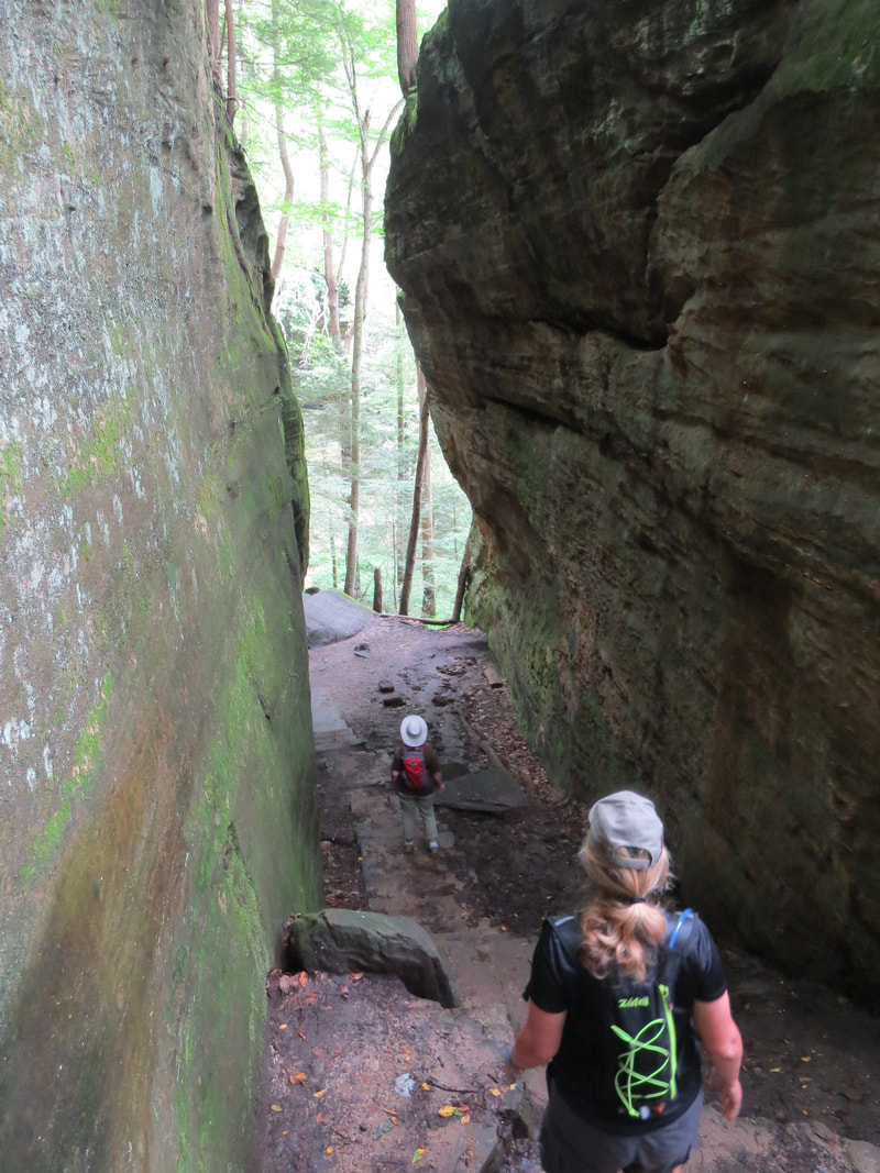
|
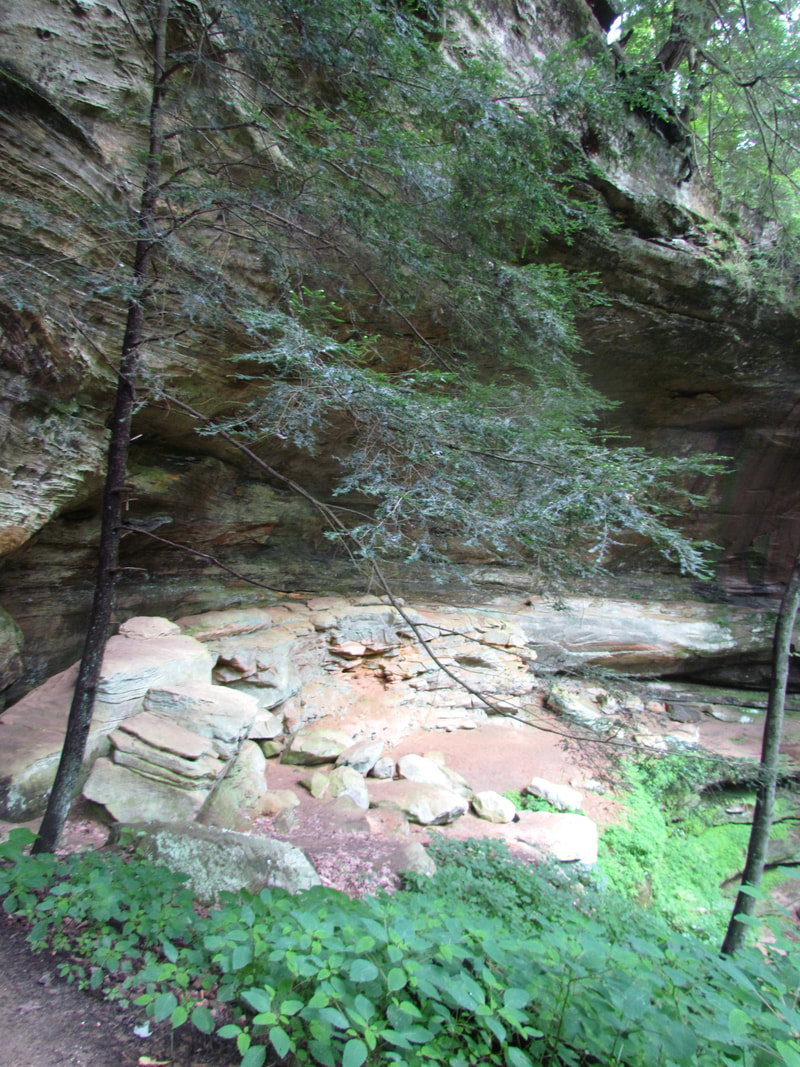
|
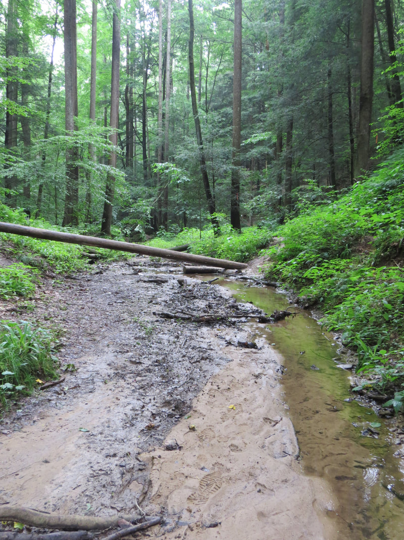
|
As we were nearing the end of the trail the overcast turned into rain clouds. And after Lisa and Lynn declared no chance of rain today. Not a soaker, just enough to be annoying. But the forest and our hats kept us dry as we made our way back across the parking lot to the car. We talked briefly with a pair of twenty-year-old girls who were looking for one last hike before they went home today. We gave them our assessment of Cantwell Cliffs, basically a nice hike but watch your step. We saw them walking to the trailhead as we were storing our gear in the back of the car. Another short loop hike in the books for today; 1.1 miles and less than an hour. The rain had subsided again, so we loaded up and made our way to Rockbridge State Nature Preserve. A small gallery of photos from the Cantwell Cliffs trail.
It took us maybe 15 minutes to cover the 7.5 miles from Cantwell Cliffs to Rockbridge. Very convenient that the various hiking areas within the general Hocking Hills region are in relatively close proximity to each other, which makes stringing several of these short trails together in a day pretty simple to do. Hike for an hour, drive for 15 minutes, hike for an hour… lather, rinse, repeat.
Rockbridge State Nature Preserve is west of Logan and a short distance north of route 33, just off the Hocking Hills region map that I had found when planning the trip. But it was still just a short drive to get there. The parking area was a small, grassy field, right at the trailhead. Baby took us right there. There were a few cars there but still only about half full, so we did not expect much traffic on the trail.
Once we got our gear in order and started walking toward the trailhead sign, we stopped to chat with one of the local who lives by the trailhead. He gave us a few pointers for the hike. He suggested checking out the collapsed rock shelter first, then the bridge, which was already my plan but nice to get the confirmation. He also mentioned hiking passed the bridge and on down to the river saying that you can usually get the rafters to share their beer. I’m thinking I’ll pass on that as I know I have good beer at the cabin and folks out on river float trips typically bring the cheap stuff. In parting he said to watch for Daryl. As we walked away, Lisa asked who Daryl is. "Bigfoot," I replied.
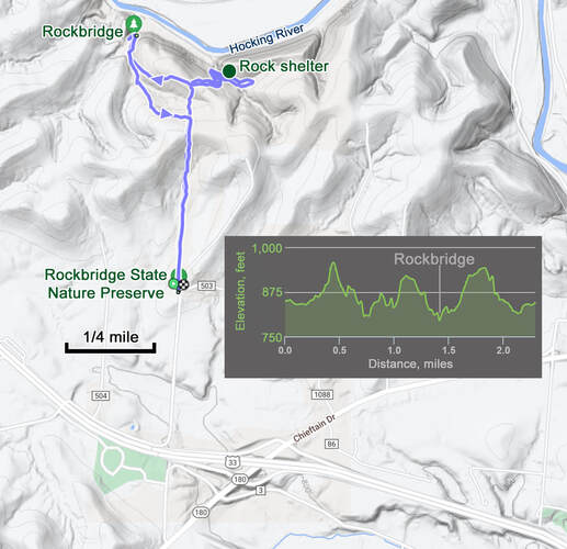
OK, time for a hike. The first part of the trail is along the edge of an open field. Good habitat for birds and we saw a few: several Red-winged Blackbirds, some Song Sparrows, and a Red-tailed Hawk gliding by. Once in the woods, we soon came to the intersection point. Right to the Rock Shelter or left for Rockbridge. We’ll start with the Rock Shelter, thus saving the best for last on this hike. As we were making our way through the woods to the Rock Shelter, there were three times that tree branches came crashing to the ground in the woods adjacent to the trail. Not near the trail at all, so no worries there, but still a bit concerning that the trees are dropping branches like that. Perhaps the rain that passed through the area over the last few days also brought some local wind that damages the trees. Or maybe Daryl is messing with us.
The trail worked down a couple long switchbacks to get into the gorge where the old rock shelter is located. We found it easy enough. OK, I see it, but it is really just a jumble of boulders and slabs of rock down in the bottom of the ravine below is. Interesting, but not really. We continued on the trail passed the rock shelter for a short distance then hit a rather wet, muddy section. Since this seemed to be a simple walk in the woods by this point, we opted to reverse course and head for the main attraction.
The trail worked down a couple long switchbacks to get into the gorge where the old rock shelter is located. We found it easy enough. OK, I see it, but it is really just a jumble of boulders and slabs of rock down in the bottom of the ravine below is. Interesting, but not really. We continued on the trail passed the rock shelter for a short distance then hit a rather wet, muddy section. Since this seemed to be a simple walk in the woods by this point, we opted to reverse course and head for the main attraction.
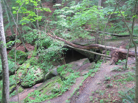 Rock Shelter
Back up the hill to the trail intersection where we met a large group of folks going to the rock bridge. Looked like a family and a large one at that, Mom and Dad, all their kids and all their kids’ kids, all the way down to babes in arms. They were strung out along the trail for some distance, but we managed to get around them when we had the opportunity. We figured they were a Mennonite family. I dubbed them “the Swiss Family Robinson.”
Once past the large family we had a downhill walk to reach the bridge. The bridge sort of sneaks up on you, as it blends is with the surrounds and it is at ground level. Out west, these natural structures tend to be above the trail and are out in the open. Here, the trail runs right into the end of the bridge. In fact, the trail goes right across the bridge.
This is a beefy natural bridge, thick and wide. Looks to me that the bridge was at one time the leading edge of the overhang of a recess cave, but that at some point the middle portion of the recess overhang collapsed leaving this section standing as a natural bridge. Mere speculation on my part, but it seems to fit the evidence. There were no interpretive signs in the area, but I did find some details about Rockbridge on the ODNR website:
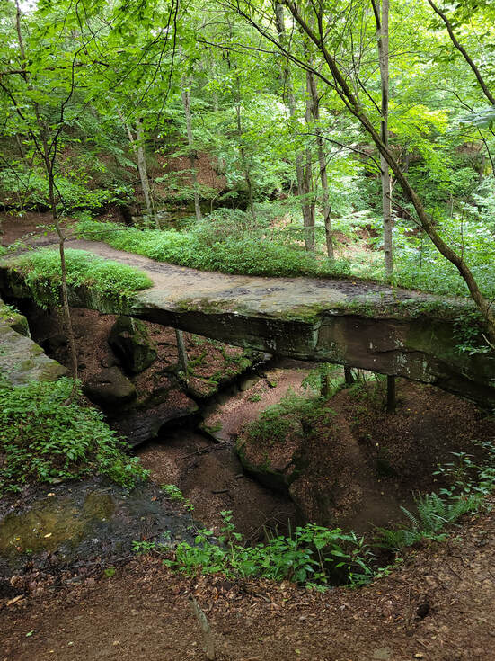
Rockbridge's natural arch or bridge is more than 100 feet long and 10 to 20 feet wide, and gracefully arches 50 feet across a ravine. It is considered the largest natural bridge in Ohio. Ohio is a land of diverse geological features. Among the most unusual and spectacular formations are its natural rock bridges. Ohio has at least 12 such bridges. These bridges (or stone arches) have been found primarily in the area characterized by massive sandstone outcroppings in south central and eastern Ohio. Very few have been discovered in the limestone region of southwest Ohio although natural bridges are often associated with such weathered limestone topography.
Rockbridge Natural Bridge originated millions of years ago when Ohio lay under a warm inland sea. Rivers flowed into the vast body of water, carrying both fine and coarse grained sands which settled to the sea bottom. Over the centuries, the accumulating sand thickened, compressed and formed the hard sedimentary rock known as Black Hand sandstone. Eventually, great pressure from beneath the earth's surface caused the land in eastern North America to rise, forming the Appalachian Mountains. The inland sea soon drained away, exposing the newly uncovered rock layers to steady erosional processes. The natural bridge soon began emerging in all its grandeur. Wind, rain and percolating groundwater worked together for centuries, carving a deep cave-like recess in the softer midportion of the Mississippian Black Hand sandstone. Gradually, erosional forces also worked along a natural joint plane some distance behind the brink of the cliff. Over the centuries, this ongoing process has widened the crevice, and all that remains of the overhanging ledge is the narrow rock arch.
We looked around the area a bit. I walked across the bridge to get the perspective from all angles. The trail also went below the bridge however, the area directly under the bridge and in the recess behind the bridge was roped off, presumable to keep folks safe from falling rocks. The Swiss Family Robinson finally arrived. After they had the entire clan assembled, they got set up for a family portrait. The family was gathered on the edge of the recess cave overhang and Mom was on the bridge taking the photo. I walked out and volunteered to take the picture so that she could be in the frame with everyone else. She was very happy to take me up on my offer.
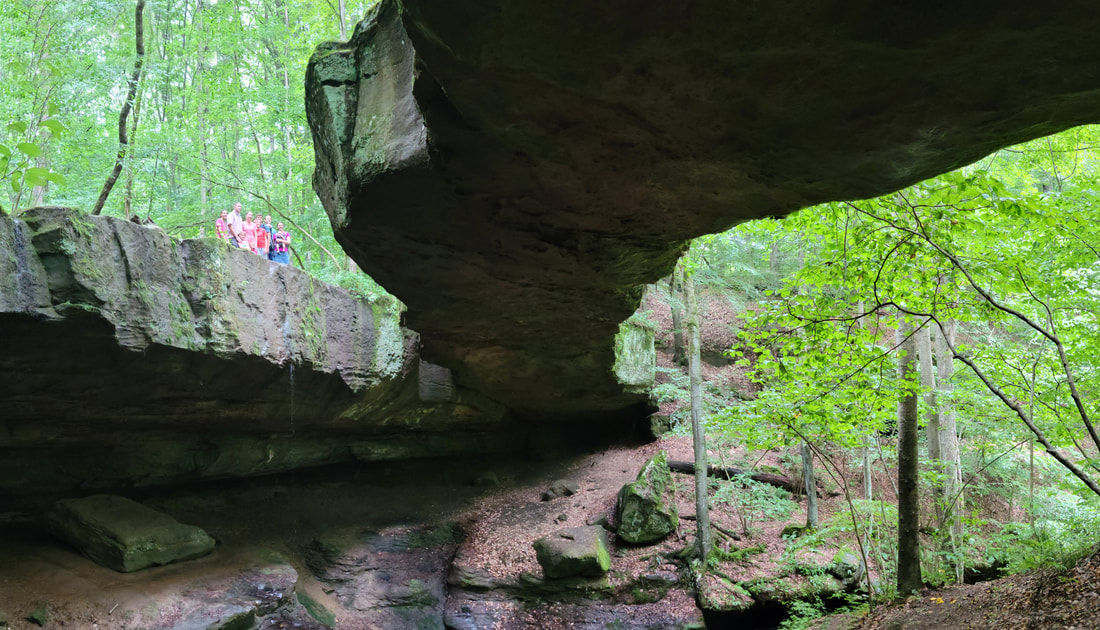
View from under Rockbridge. The "Swiss" family Robison" is starting to gather along the edge of the recess.
Once we had explored around the bridge, we started the hike back to the trailhead. We opted not to walk down to the river, in favor of getting on the trail ahead of the big family who also seemed to be getting ready to depart now that they have their family picture. We took the alternate path back, which just cuts the diagonal to the main trail. That trail runs along a little creek then cuts steeply up the slope to the main trail. The only real excitement for the return hike was that Lynn got stung by some random hornet or wasper. She did not see it be it zapped her good.
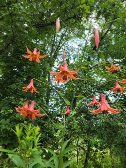 Canada Lilies
We spotted some pretty red flowers on the return hike along the fields. Seek said these were Canada Lilies. Not sure how we missed them on the hike out, but we did. Maybe they were not yet open when we first walked by. Not many photos from this hike, but here's the link to the gallery.
We were back at the trailhead about 1:00. Ramblr indicated that we had covered 2.3 miles in about 90 minutes. Several more cars in the lot compared to when we arrived including a couple vans. I reckon the vans are how the Swiss Family Robinson reached the trailhead. We decided to skip the return trip to Conkle’s Hollow and instead headed home to ice Lynn's hand. Good thing as it poured as we were driving back to the cabin. What was that about no chance of rain? The forecasters for this area are as bad as the precipitation prognosticators around Cleveland.
Our little loop through the Hocking Hills region to connect these three trails was just under 60 miles. We were back at the cabin around 1:15. If the weather would have stayed dry and the hornet had not attacked Lynn, we could have added a fourth short hike. But we're good with the three that we did complete and now it is time for another picnic on the back porch for lunch. I started the beer sampling with a Hop JuJu then worked through a couple of the oddball cans that I had. Based on the radar on Weather.com, it appears that another line of storms will be coming through between 3:00 and 5:00. Right on cue at 3:00 the wind picked up and temperature dropped. However, nothing else really materialized. There was a little shower around 4:30, but nothing significant. The odd occurrence for today was that the grounds maintenance crew showed up around 4:00, with their mowers and string trimmers fired up and ready for action. Not sure what they were mowing as there is really not much yard around the cabin and what there is was very sparse and was certainly had no long grass. Probably a regular service and they just do their thing by contract whether they need to or not.
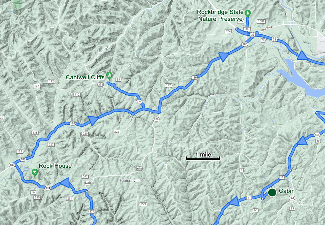
 I was working on this beer when the phone rang....
My phone rang at about 4:15. Work beckons. Turned out to be nothing serious, just upper management trying to make mountains out of molehills. It took a few phone calls to sort it all out but eventually everyone was happy, and I could get back to vacation.
Once that ordeal was settled and I had gotten cleaned-up, it was time for dinner. We’ll do carry-out again, as eating here on the back porch is better than sitting in a restaurant. We ordered from La Cascada, and I did my Uber Eats impersonation again. Typical Mexican fare, but tasty, nonetheless. The girls ordered margaritas, which were HUGE but a bit light on tequila.
We were enjoying our quite evening on the back porch. Someone had a fire going at one of the nearby cabins as we could smell the smoke. Then we started hearing fireworks. A bit annoying as that spoiled the Zen of the evening. The firecrackers and other noise from our neighbors also subdued the birds, so we missed part of our evening serenade. The noise finally died down and the birds resumed singing about 8:45. They continued their chorus until 9:21, when again the birds fell silent for the evening following lovely recital. A Wood Thrush closed the show for the evening. With the end of the serenade, we decided that it was now time to go in for the night.
Day 6 - Wednesday, July 14 - Heading Home. Up early with a beautiful, sunny sky awaiting me. Started working on packing for the trip home, but that won’t take too long. Lisa suggested a walk. She wanted to check out Pleasant Valley Road which we have passed by a couple times while driving along Big Pine Road. Fine by me. I started the Ramblr track when we left the cabin at 6:57 AM. The route today was west along Collison then just before reaching the cemetery, turn right on the Krinn Unger Keck Road, cross Big Pine Road then go up Pleasant Valley Road as far we like then retrace our steps back to the cabin. I’m not really sure what piqued Lisa’s curiosity with Pleasant Valley Road, but what the heck, something new to checkout.
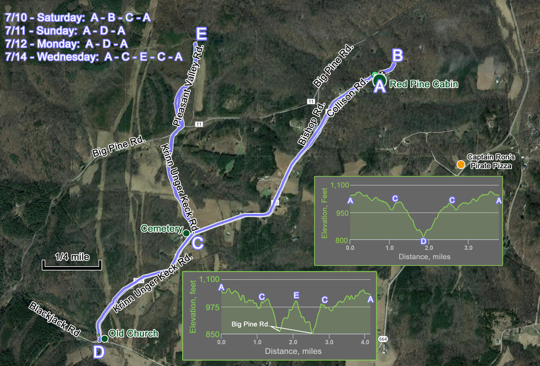
Summary map of our walks starting and ending at the cabin.
Not much going on along Collison Road. The white cat was not around and there was no wildlife to speak of. Once we turned on to the Krinn Unger Keck Road, things did not really pick up, although I did spot a Goldfinch and there was a road repair crew getting set up for the day. One of the crew had just unloaded their little backhoe and left it idling while he found a better spot to park the truck and trailer. Lisa joked that we could take the backhoe for a joy ride. Yeah, no. It’s not like that would be a great getaway vehicle. From the construction site, the road ran downhill to the Pine Valley Road. There was an interesting old house at the base of the hill. It looked mostly abandoned but there was at least one light bulb shining inside.
We walked along Big Pine Road for a short distance to get to Pleasant Valley Road which was just a dirt road running through the woods. The woods and fields on either side of the road were posted, not that I was planning on randomly walking through someone’s private property. The road was uphill, so we got a bit of a workout, but there was really nothing of great interest. We walked about a half mile up the road when I called time to turn around. No argument from Lisa. I guess her adventurer’s curiosity had been satisfied.
We walked along Big Pine Road for a short distance to get to Pleasant Valley Road which was just a dirt road running through the woods. The woods and fields on either side of the road were posted, not that I was planning on randomly walking through someone’s private property. The road was uphill, so we got a bit of a workout, but there was really nothing of great interest. We walked about a half mile up the road when I called time to turn around. No argument from Lisa. I guess her adventurer’s curiosity had been satisfied.
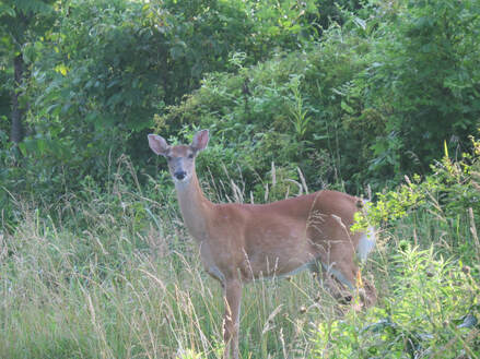
We retraced our route back to the cabin. Waved at the road crew as we went by. We did spot a doe in the road back near the cabin, so that was our megafauna sighting for the morning. We were back at the cabin at 8:15. Still plenty of time to get cleaned-up, packed-up and out of here before check-out time. Shoot, none of that took much time at all and we were saying our goodbyes to Lisa in short order and on the road for home about 9:15.
This gallery has the highlights from our walks along Collison Road during our stay as well as a few critters spotted in the backyard of the cabin.
An uneventful drive home and more importantly, a pretty short drive. That’s a bonus. Just a little over three hours, including getting Baby on the right track after she tried sending us down a questionable dirt road as a short cut (so much for technology and for me confirming the route ahead of time). The only other stops were in Lancaster to get fuel for the Edge and breakfast at Panera (at least I think that was in Lancaster). After that, we just cruised back to Medina. We were back at home at 12:30 and had everything unloaded, mostly unpacked and a check of the cats completed by 1:15. All is well on the ranch. That’s the best way to end a wonderful trip.
By the Numbers – Tallies and Lists.
- Hiking Miles:
- 33.7 total for 11 hikes, including our local walks along Collison Road.
- Miles in the parks: 19.2 miles for seven hikes.
- Cedar Falls to Ash Cave along the Buckeye Trail – 6.1 miles
- Airplane Rock – 3.6 miles
- Conkle’s Hollow, Gorge Trail – 1.5 miles
- Old Man’s Cave and Whispering Cave Loop – 3.7 miles
- Rock House (loop) – 0.9 miles
- Cantwell Cliffs (yellow-red trails) – 1.1 miles
- Rockbridge including spur to cave – 2.3 miles
- Parks Visited: While we were in the Hocking Hills region for the entire trip, we spent time is several state parks and preserves:
- Hocking Hills State Park
- Hocking Hills State Forest
- Conkle’s Hollow State Nature Preserve
- Rockbridge State Nature Preserve
- Wildlife List: 43 species total that we could identify, including 28 birds. No life-list bird sightings but a couple first-of-the-year additions.
|
Mammals:
|
Reptiles:
|
|
Beers: Tried eight new beers during the trip, plus many old favorites! All those covered at least nine different styles of beer, but as usual the focus was on variations of IPAs. All from ten different breweries.

- Edge miles: I forgot to capture this data exactly from the odometer but racking up the trip on Google maps puts us right at 500 driving miles (497 was the exact stack-up, but there is a margin for error).
- Journal Pages: 52
- Photo Count: 828 after all the editing, creating and culling.
That’s a Wrap. That was a fun trip. Low stress, not a lot of planning involved, simple logistics and an amazing area to explore. I’m glad that we finally made it to Hocking Hills. I now understand the attraction. I reckon we should look at other things to see and do in Ohio and the surrounding states and consider more of these driving trips. Red River Gorge and Hocking Hills were both a lot of fun, just like the trips we made to Gettysburg and the West Virginia State Parks in recent years. We’ve got a few other ideas, Like Mammoth Cave National Park and the Finger Lakes. We’ll see when we can get those into the schedule. Perhaps a driving trip next summer will be in order, as I don’t see us getting completely out of pandemic mode any time soon.
That said, next up for Lynn and me is our fall trip to the desert southwest featuring a long stay in Sedona, Arizona, and a weekend getaway with The Herd in Cortez, Colorado. To paraphrase Paladin, “Have vaccine - Will travel.”