Trip Report: Moab and the Green River Meet-Up....continued....
Part II: The Great Green River Meet-up (Wednesday, September 24 through Monday, September 29)
This is the continuation of my trip journal for our fall 2014 excursion to Utah. We started with four nights in Moab and had a wonderful time exploring Arches, Canyonlands and the surrounding sandstone landscapes. “We” for this trip was Lynn, Lisa and me and “we” had a ball. Lots of hiking but still time to chill. But now we are heading to our second destination for the trip to meet-up with our outdoor adventure crew for the 5th annual Utah meet-up. That’s where we’ll pick up the story, on day 5 of the trip….
Day 5 – Wednesday, September 24: Heading to Green River (continued). So we are on our way to Green River and the 5th annual Utah Trip Advisor Herd Meet-up. We had a great time in Moab the past few days, but now we are heading west on I-70 to the next phase of our adventure. But it is still early afternoon and we have a couple of hours available before we can check into our hotel. Fortunately, I have a plan (but then, don’t I usually have a plan).
Since we had taken scenic route 128 out of Moab so that the girls could check out the winery, we are now in a position to check out the rock art panels in Sego Canyon, as it is now more or less on the way to Green River. So we took exit 187 toward the sprawling metropolis of Thompson Springs (hey, compared to Cisco, this really is a sprawling metropolis!) and took the dirt road up Sego Canyon. We were once again following the directions provided by Laurent Martres in his book “Photographing the Southwest, Volume 1 – Southern Utah”. In fact, I used this book quite a bit in planning this trip. He included an entire chapter on the San Rafael Swell which described slot canyons and several rock art panels in the area, tips on photography (of course) and directions on how to get to each location. Quite a useful guide. I’ve had similar experience with using landscape photography books as guides for exploring an area, most notably using “Photographing Yellowstone” by Verderber. That book makes a great guide for seeing some of the best sites in the park, even if you care nothing about photography. Again, I digress.
Back to the dirt road, which was in great shape; obviously well maintained. We easily found the parking area for the panels. The lot was easy to spot because it was full of cars. Holy overflow parking, Batman, where the heck did all these folks come from? I think there were fewer people in Canyonlands this morning. Hey, you pay your money and you take your chances, as the man said. We did not even try to drive into the parking area as there were cars lining the driveway all the way out to the main road. So I just found a wide spot in which to wedge the Explorer, and we walked up to where a crowd was gathered. As we got closer to the gathering, it seemed to be an archaeology class of some sort out on a field trip. Well that’s cool. So much better than looking at pictures in a textbook or artifacts in a museum. They were apparently breaking up into study groups just as we got there, so we were able to view the panels while the students were getting their gear in order.
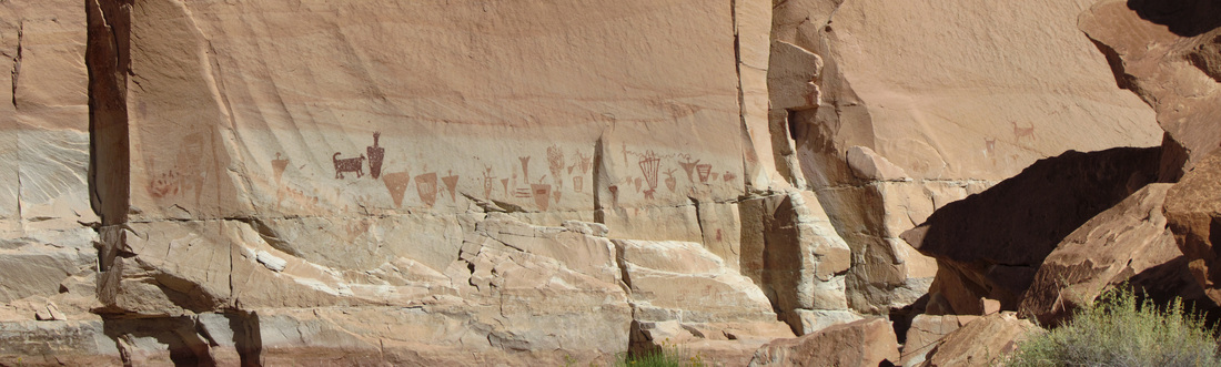
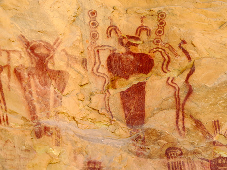 Barrier Canyon style pictographs from Sego Canyon.
I had seen the photos in Martres’ book of the Barrier Canyon panel, so that is the one that I really wanted to see. But there were other panels near to the parking area, from Fremont and Ute peoples. These panels had unfortunately been added to by recent tourists but the ancient etchings were still very visible and beautiful. Lynn soon found the trail that led to the additional panels. We walked the short distance along the sandstone face and around the corner and there it was. Wow! As is usually the case, the photos didn't do it justice (but that does not stop me from taking several shots!). The panel is well above the level of the trail, but still easily visible. And the artwork is, well, let’s see…
First of all, it is really cool to see rock art this old and seemingly so well preserved. And this Barrier Canyon style of artwork is in some sense just bizarre. These are pictographs of larger than life size anthropomorphic figures, so human-like but not exactly humans with the unusual eyes, antennae, and other appendages. Are they representations of the spirit world? Maybe aliens? Who knows, but it is really awesome to see these panels.
First of all, it is really cool to see rock art this old and seemingly so well preserved. And this Barrier Canyon style of artwork is in some sense just bizarre. These are pictographs of larger than life size anthropomorphic figures, so human-like but not exactly humans with the unusual eyes, antennae, and other appendages. Are they representations of the spirit world? Maybe aliens? Who knows, but it is really awesome to see these panels.
 So did Sego have a Pizza Hut?
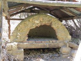
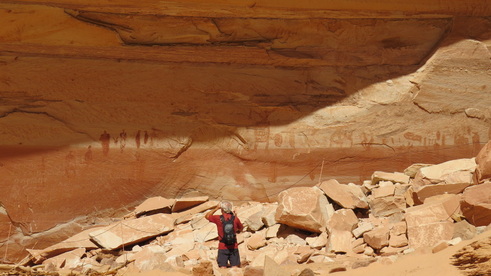
The other awesome sight at this stop occurred when we got back to the truck. Lynn and Lisa were talking to some folks. Hey, wait, I know them! David, Roz and Max! The meet-up has started early! Hugs, handshakes, hellos and we’re off and running, just chatting away and catching up. Max mentioned that they were heading on up the canyon to the ghost town, so we decided tag along. We did pass a couple of long abandoned structures and finally stopped at a dilapidated old stone house. Max thought we had driven further than we should have to reach the “town” so perhaps it was up a different canyon. OK, no worries, not every expedition will be successful. So we looked around a few minutes at the old structures (yes, Roz, that does look like a pizza oven), then decided just to head on to Green River. The only problem was that Max had locked her keys in her vehicle. The good news was that this was Rick’s Jeep and he had planned for such a scenario by hiding a spare door key on the vehicle. Whew, disaster avoided. Onward to Green River.
Just a relaxed drive from this point and not too much further to Green River. We arrived at the River Terrace hotel around 3:00 so good timing for check-in (we had already dropped Lisa across the road at her hotel; the River Terrace was sold-out by the time she decided to make the trip). The reunion continued as I saw Howie in the parking lot and we talked for a little bit. We also saw T arrive and helped her to unload her car. Seems that the gang is rolling into town.
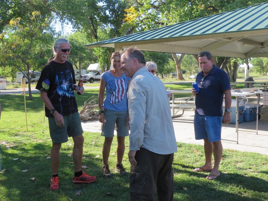
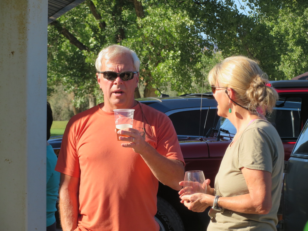
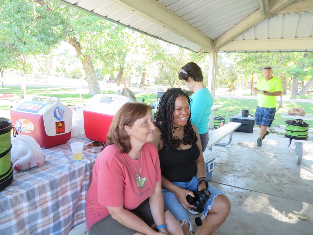
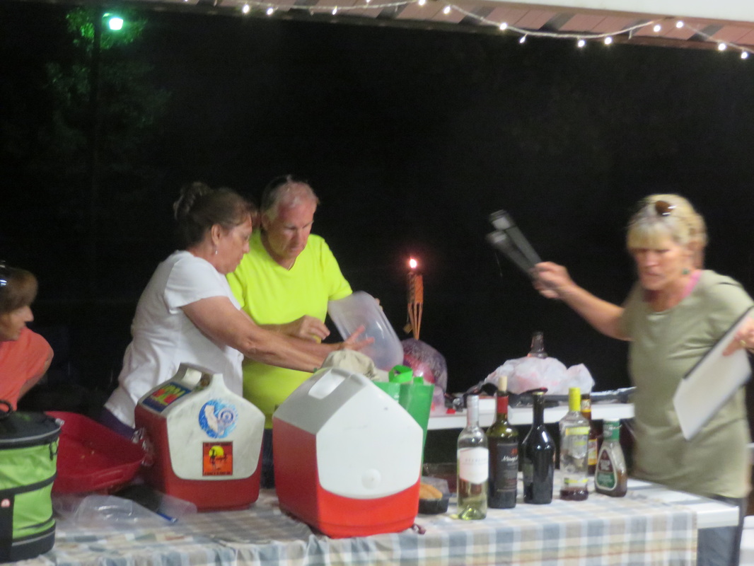
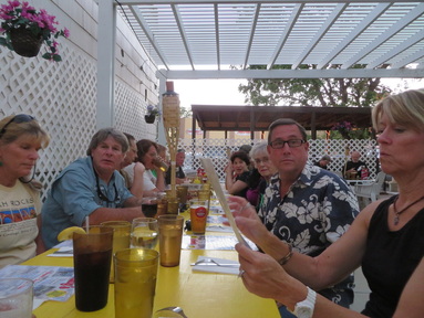
The opening event for the meet-up is the traditional first day cook-out (well, it is becoming a tradition as we started the having the opening-day cook-out at the Moab meet-up). Since we could not find a rental house to act as the focal point for this meet-up, we had to improvise. Pixie was camping in the state park which is basically in town and secured one of the pavilions for our use. It turned out to be ideal with plenty of space for our herd to spread out as well as lots of room for the cooks to do their thing.
We arrived a little after 4:00 and the party was already in full swing! For now it is just “happy hour” as the serious cook-out won’t get rolling for an hour or so. But still folks are getting a few things prepped as well as getting the appetizers out for all to enjoy. Alex and I made an ice run early on; one can never have enough ice at a picnic! So into the urban jungle of Green River…don’t blink, you might miss it!
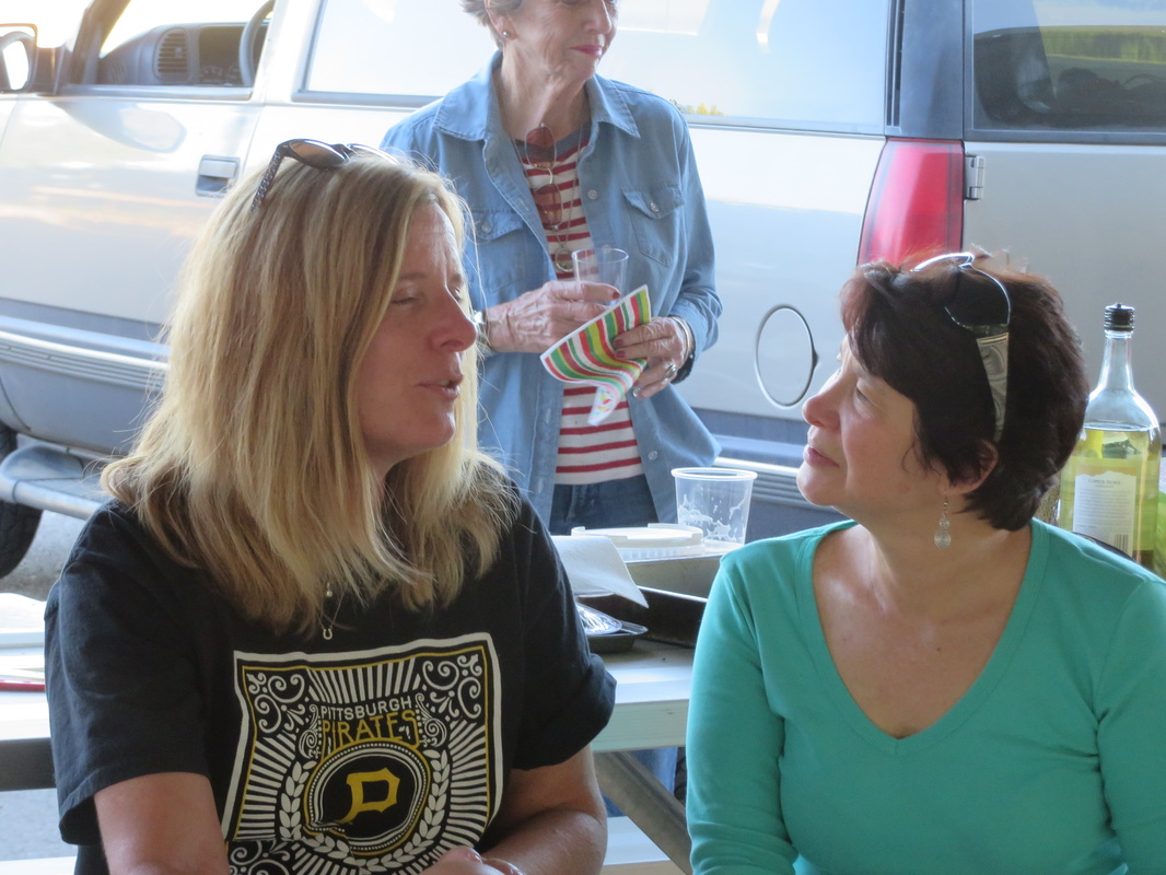
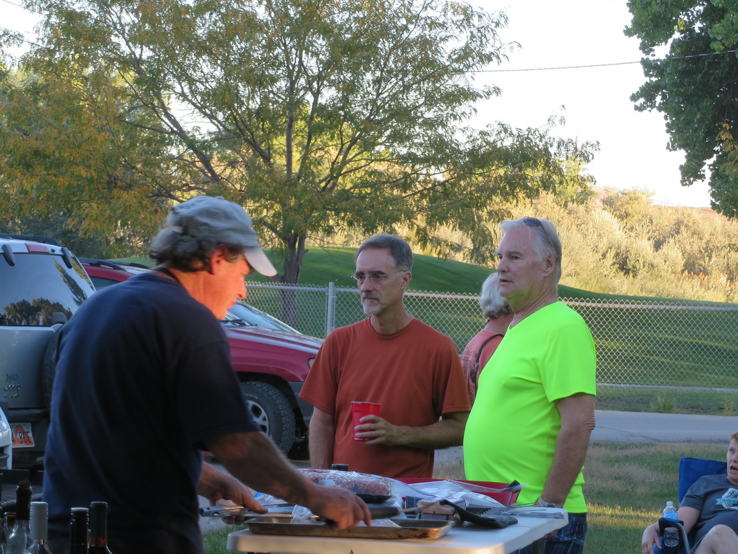
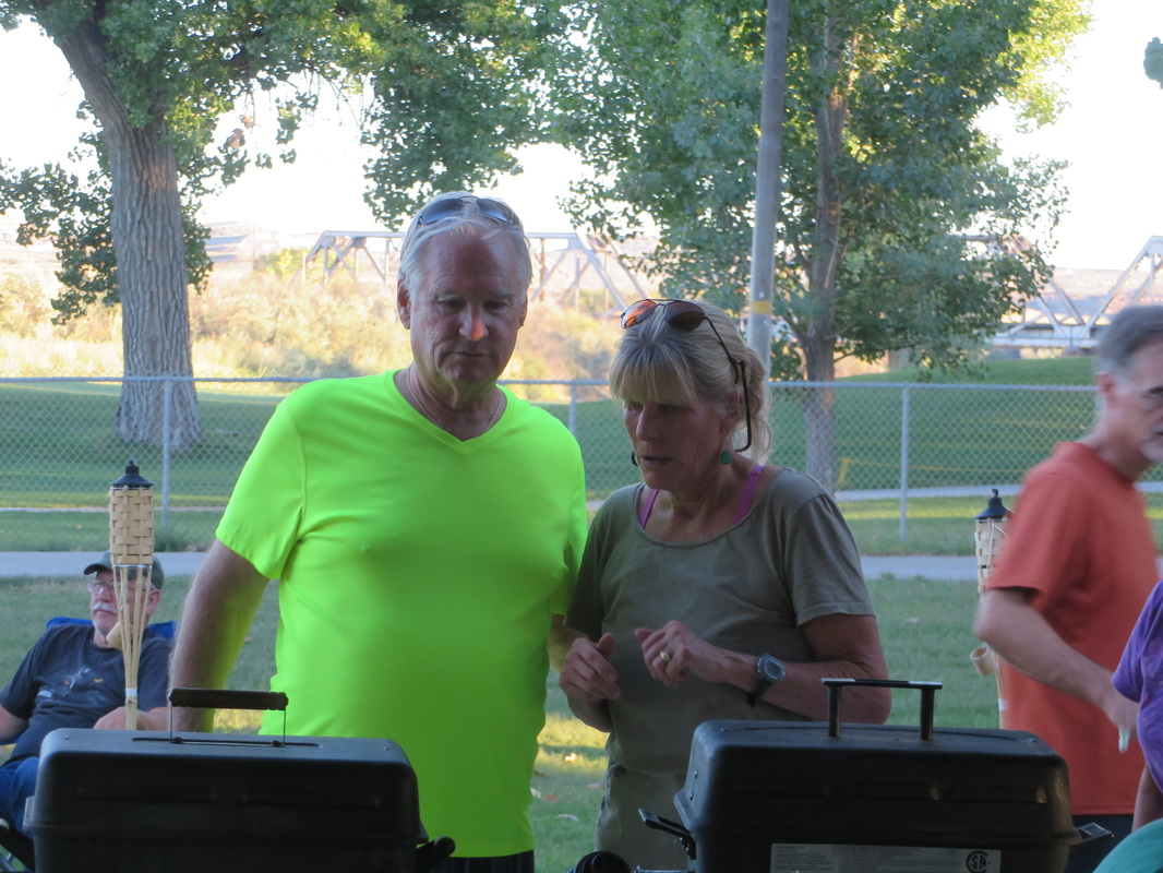
We had a great turn-out for the cook-out. I think there were 23 members of the herd attending, including five first-timers, so our list of participants in these events just keeps growing. And it was a lot of fun. The cook-out allows folks just to meander about and catch up with everyone, rather than being stuck at a table in a restaurant which sort of limits the socialization aspects. Howie was manning the grill and Alex was the sous chef; I was talking beer with Oscar and Rob….some things never change! The ladies were all working on getting the side dishes prepared and organized. We’re like a little colony of ants! But it is fun and fun to watch.
The picnic also provides an opportunity to herd the cats a bit, so Alex called the group together for a few announcements and to get a plan in place for Thursday. First of all, we had another tradition to take care of, the presentation of the walking stick, something that started our second year when in Kanab. Alex presents the stick to the person who took on a bigger part of the planning for the event. This year for securing the state park pavilion and providing a lot of ideas for activities in the area, the walking stick went to Pixie, so I reckon it is a “Pixie stick”!
The opening event for the meet-up is the traditional first day cook-out (well, it is becoming a tradition as we started the having the opening-day cook-out at the Moab meet-up). Since we could not find a rental house to act as the focal point for this meet-up, we had to improvise. Pixie was camping in the state park which is basically in town and secured one of the pavilions for our use. It turned out to be ideal with plenty of space for our herd to spread out as well as lots of room for the cooks to do their thing.
We arrived a little after 4:00 and the party was already in full swing! For now it is just “happy hour” as the serious cook-out won’t get rolling for an hour or so. But still folks are getting a few things prepped as well as getting the appetizers out for all to enjoy. Alex and I made an ice run early on; one can never have enough ice at a picnic! So into the urban jungle of Green River…don’t blink, you might miss it!
We had a great turn-out for the cook-out. I think there were 23 members of the herd attending, including five first-timers, so our list of participants in these events just keeps growing. And it was a lot of fun. The cook-out allows folks just to meander about and catch up with everyone, rather than being stuck at a table in a restaurant which sort of limits the socialization aspects. Howie was manning the grill and Alex was the sous chef; I was talking beer with Oscar and Rob….some things never change! The ladies were all working on getting the side dishes prepared and organized. We’re like a little colony of ants! But it is fun and fun to watch.
The picnic also provides an opportunity to herd the cats a bit, so Alex called the group together for a few announcements and to get a plan in place for Thursday. First of all, we had another tradition to take care of, the presentation of the walking stick, something that started our second year when in Kanab. Alex presents the stick to the person who took on a bigger part of the planning for the event. This year for securing the state park pavilion and providing a lot of ideas for activities in the area, the walking stick went to Pixie, so I reckon it is a “Pixie stick”!

We also used this little pow-wow time to make sure that everyone got their “UTAH” shirts. The group had kicked around ideas for a logo and name for our merry band. We finally settled on the “Utah Trip Advisor Herd”, so UTAH, and I had some shirts made up using the logo (I used CustomInk.com and they provided excellent customer service and an outstanding product). Now we’ll have a “uniform” to tell us apart from the ordinary hikers. Well, not that we’ll be very uniform as the shirts came in all colors of the rainbow.
As for Thursday plans, the main event will be the float trip on the Green River for a dozen of the herd. Most of the rest of us will be hiking in the Horseshoe Canyon Unit of Canyonlands National Park in search of rock art panels, including the great gallery. Howie mentioned that they when they hiked there they would have missed some of the panels (there are four sites) if not for the being with a Ranger. Danny also emphasized the difficultly of the hike, particularly the “800 feet straight down” the trail into the canyon. Both were useful pieces of information, as we’ll see tomorrow.
As usual, Howie and the rest of the crew outdid themselves as the food was excellent! Burgers, brats, ribs, chicken, portabella mushrooms and many side dishes. I think we had enough to feed everyone in town! And even after dinner we kept eating. Somehow s’mores had become an obsession for this trip, so out came the Hershey bars, graham crackers and marshmallows and around the campfire we congregated. Roz had a British alternative of peanut butter and chocolate for the herd to try as well. I went British as I’m not a marshmallow fan.
A good time was certainly had by all, but all good things must come to an end, so the clean up was under way probably around 9:00 and we left the party about 9:30…hey, it has been a long day for me with my sunrise excursion to Mesa Arch. That seems like it happened days ago! Here's the link to the photos from today. But tomorrow is a big day. The weather report looks dry but hot, so we should have a good day for the much anticipated hike to the Great Gallery.
Day 6 – Thursday, September 25: Horseshoe Canyon. Early start today as we will be heading out for our big hike at 0700, so we went down to breakfast right 0600 just as it opened. Good thing we did as we just got in ahead of the bus tour group who was staying at the River Terrace. We passed the tour guide on the way into breakfast and she even commented on our fortuitous timing.
Just a word on the breakfast set-up at River Terrace. It has to be the best complimentary breakfast that I have had in a motel in a very long time. Most places have reduced their breakfast offering to the point that it is hardly worth the effort, but River Terrace offered made to order omelets, pancakes, French toast and they have a great variety on the menu. Plus they have cereal, bagels, toast, coffee, juice and other assorted goodies on the buffet. If we would have gone to a restaurant to get this kind of food we would have easily paid twenty bucks for the two of us, so it was a good deal. The French toast I tried this morning was very good and it was served up in very short order. So far the River Terrace is proving to be an outstanding lodging option.
After breakfast we finished getting ready for the hike and I swung over to Lisa’s hotel to collect her. We met Donna, Oscar, Al and Sueann in the River Terrace parking lot at 0700, as per plan. Alison and Mark will also be doing the hike, but they plan on sleeping in and will catch us on the trail (which is quite likely as they are very fast hikers).
We had a little bit of a drive to get to the trailhead this morning (see the overall trip map in Part I of the journal) but once again Martres’ book was again dead on with the directions to the trailhead. It is about a 70 mile drive from Green River, the first 40 of which is on the main roads (a short stretch on I-70 west then south on route 24 toward Goblin Valley). Just past the access road to Goblin Valley State Park, we turned on to road 1010 and trundled the next 30 miles over a well maintained gravel road. I was in the lead and set a 30 mph pace that I only had to break a few times. Sort of took me back to my days exploring the back roads in WV, where the goal was to make the ride as smooth as possible by picking the best line to avoid the potholes and washboard. There were a couple of sandy washes that we slowed down for as well as a couple of blind hills that required caution to ensure that there were no free range cattle loitering on the road just over the crest. And we did see several cattle along the drive. The only other big critter that we saw was a lone pronghorn that ran along with us for a few hundred yards. Otherwise the trip was uneventful, which was great. I was a little worried about a repeat of the breakdown of Oscar’s truck while cruising the Hole-in-the-Rock Road near Escalante last fall. But all was well this year and we made it to the trailhead just before 9:30 AM, so a little less than two-and-a-half hours from Green River (a little better than the 2:40 drive time estimate provided by Google maps).
There were only two or three other vehicles at the trailhead when we arrived, so we should have the trail pretty much to ourselves which is always a plus. We all needed a little stretch after the drive. The pit toilet was also a welcome sight. We got our packs, poles and cameras in order and were on the trail a little after 9:30. Right now it is pleasant, with bright blue skies and nary a cloud to be seen. Perfect hiking weather, but we knew it would be hot on the return trip.
I had done some reading about this hike and found a couple of good websites in addition to Martres book. A couple of the websites had maps that marked the location of the panels and other points of interest. Since the Parks Service was not offering the Ranger-led hikes this fall due to budget constraints, the map would have to be our guide (I called the Hans Flats Ranger Station just a week ago to see if there was any reprieve on the Ranger-led hike, but no dice I also called there yesterday for a check on the road condition, just to make sure). Lynn took on the role of Sacagawea and led us along the trail. She easily found all the cool stuff, but I think we might have missed a few highlights without the map. Here's the link to one of the websites I found during my research; it is the one that had the map that we made such good use of.
This turned out to be a classic hike in the desert as there were beautiful landscapes and other things of interest all along the trail. While it was no cake walk, the hike was actually a lot easier than I expected. Sure, the hike along the trail from the parking area down into the canyon was tough; certainly the hardest part of the trail, but it was not that bad. I think the fact that it was a “smooth” trial, that is very few uneven steps along the downhill section, really reduced the difficulty. But there were nice views down into the canyon almost from the start of the hike. Plus, we started seeing things of interest almost right away. Not far into the hike, Lynn spotted a Jack rabbit. Then we stumbled over the dinosaur track. It is right in the middle of the trail and had a ring of rocks around it so it is hard to miss. Next we came across the old water trough and piping that had been set up decades ago to pump water up from the canyon. And that was all before we even got to the steep part of the trail. Again, the downhill part of the trail is the hardest, but not nearly as hard as Danny made it out to be. He made it sound like the Trail of Tears or the Bataan Death March. But maybe Danny’s warnings were a good thing, as I was prepared for much worse than we actually got.
|
Once down in the canyon, we just walked along the sandy wash and looked for cairns and other markers as well as the cues from Lynn and the map. The trail is mostly out in the open, so we took advantage of every opportunity to walk in the shade of the canyon walls. Not a lot in the way of wildlife down in the canyon, just a few lizards and a nice size toad. We did stumble across the odd bone every once in a while. From the size, we guessed cattle or horse.
But the draw for this hike were the four rock art panels, and we found them all. Each one is a little more impressive than last, but they are all fascinating. These panels are the namesakes for this style of artwork, that being Barrier Canyon as they are named for Barrier Creek which flows through Horseshoe Canyon (as I learned from one of the educational signs back in Sego Canyon). Each panel is a collection of anthropomorphic figures along with representations of animals. All of the panels are beautiful The first is called the High Panel, as it sits well above ground level on the south wall of the canyon. It could be easily missed as it was in shadow and sort of blends in with the cracks in the sandstone as well as the desert varnish that paints the canyon walls. While this is the smallest of the panels, if does have some interesting features, in particular a winged figure that is above a figure that seems to be falling over backward. Does that suggest that the winged figure has some power over the other figure? Shoot, I reckon you could sit in front of these panels all day and try to figure out the stories they are trying to convey. I think a beer would help. But there was a lot more to see, so on to the next panel. Next is Horseshoe Panel and it is more or less across the canyon from High Panel so on the north wall. It has a slightly different flavor than the High panel in a few aspects. First the colors; the painting in the high panel were more red while the images on the Horseshoe Panel were mostly tan with some dark brown thrown in. The figures were a little more triangular in shape on this second panel, but still had the same general feel of the anthropomorphic beings. Plus there were a few more animals shown on this panel than the previous one. The artists chose well with the placement of their drawings as the images spanned along a lighter colored seam in the sandstone. The artwork then stood out on the lighter colored rock as well as being highlighted by the darker bands above and below. |
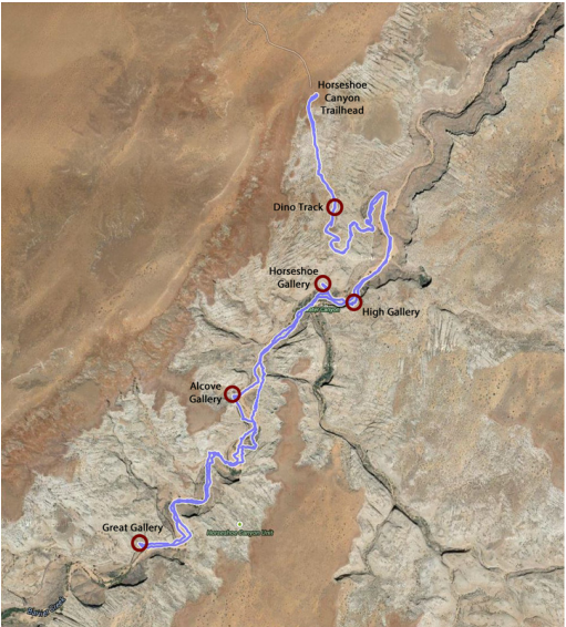
Our track and the primary points-of-interest for our hike into Horseshoe Canyon.
Part of the High Panel; the little winged figure is in the center of this image.
|
Lynn got this nice panoramic view of the entire Horseshoe panel.
We had a bit of a walk to get to the next panel, the appropriately names Alcove Panel. But we enjoyed the views as we traipsed through the narrowing canyon. The desert varnish was particularly pretty as it draped over the sandstone walls of the canyon. Sueann asked me what exactly is desert varnish. Darn it, I used to know this one. I remember that the formation had to do with certain minerals in the rocks and the process was caused by bacteria, but I could not remember the specifics. So, for you inquiring minds, here’s a more detailed description of desert varnish from the National Parks Service. Hmmm, Manganese; that’s interesting. Again, digressing.
 Oscar checking out Alcove Panel.
As the names suggestions, Alcove Panel was painted on the back wall of a large alcove in the bend of the canyon. There were red and tan images painted here, the red ones more closely resembled those from High Panel and the tan ones looked to me to be more closely related to Horseshoe Panel, although some of the figures had a character all their own. It was a little more difficult to get a decent image of this panel due to the lighting in the alcove and the boulders in front of the panel. Part of the area around the panel was also roped off. But we did what we could do, and even if the photos were not great, we still got to see these amazing images from an ancient people.
Here’s the thing that none of us could figure out. How have these painted images survived out here in the desert of hundreds or even thousands of years. The petroglyphs are etched into the rock or varnish so they would seem to have more staying power. But these pictographs are painted images, and this ain’t Sherwin Williams paint we’re talking about; this stuff was made from berries or other natural ingredients. It just seems that the paintings would have faded to nearly nothing over the centuries, but there they still are. A lasting tribute to a long forgotten people.
Here’s the thing that none of us could figure out. How have these painted images survived out here in the desert of hundreds or even thousands of years. The petroglyphs are etched into the rock or varnish so they would seem to have more staying power. But these pictographs are painted images, and this ain’t Sherwin Williams paint we’re talking about; this stuff was made from berries or other natural ingredients. It just seems that the paintings would have faded to nearly nothing over the centuries, but there they still are. A lasting tribute to a long forgotten people.
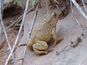 Desert Toad of some sort, maybe a Woodhouse's Toad.
Pressing on we found the zoo portion of the trail. Lynn spotted a lizard as we were leaving the alcove. A little later Al, Oscar and I were marveling a red beetle with very long antennae. finally we spotted a toad making its way along a shady stretch of the sandy dry creek bed. There’s plenty of wildlife out here in the desert, you just have to watch for it.
After we saw the red beetle, Al, Oscar and I were at the back of the pack, just moseying along and enjoying the canyon views. At one point we were in a turn in the creek bed sort of under an overhang of the sandstone wall when we heard a loud CRACK! Holy heart attack, Batman, did that come from the rocks! It sounds like whatever process of erosion was working in that area had won a round in its battle against the stoic rock wall. Fortunately, it was a minor skirmish and nothing fell. Al quipped that if that big slab above us had let loose they would have just had to etch our names in the stone as there would be no reason to try and dig us out. “Besides,” he reasoned, “the women would be too busy spending the insurance money!” OK, note to self, try not to get crushed by ginormous slabs of sandstone.
After we saw the red beetle, Al, Oscar and I were at the back of the pack, just moseying along and enjoying the canyon views. At one point we were in a turn in the creek bed sort of under an overhang of the sandstone wall when we heard a loud CRACK! Holy heart attack, Batman, did that come from the rocks! It sounds like whatever process of erosion was working in that area had won a round in its battle against the stoic rock wall. Fortunately, it was a minor skirmish and nothing fell. Al quipped that if that big slab above us had let loose they would have just had to etch our names in the stone as there would be no reason to try and dig us out. “Besides,” he reasoned, “the women would be too busy spending the insurance money!” OK, note to self, try not to get crushed by ginormous slabs of sandstone.
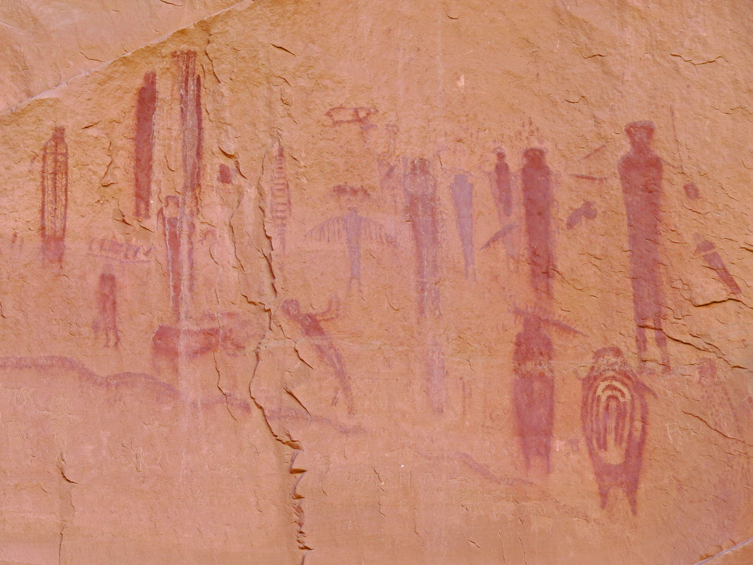
After we saw the toad, I was again at the tail of the troop, which my normal location so I can take more photos. We came around a slight bend and into a wider section of the canyon and there off on the far wall I could see our final goal, the Great Gallery. Even from well over a hundred yards away the pictographs were impressive. What I had first noticed were the figures that make up “the Holy Ghost” panel. Wow. Just...Wow. We completed our hike to the foot of the huge panel and enjoyed the spectacle for a few minutes. This was worth every step of the hike. The overall panel is huge (over 300 feet long and 15 feet tall) and has about 80 figures including many that are life-sized or larger images. Some of the figures are over 7 feet tall and the Holy Ghost is nearly 8 feet high. I did a little digging on the internet and found age ranges for these panels going back as far as 7500 BC, so this artwork could be 9500 years old. That’s just staggering!
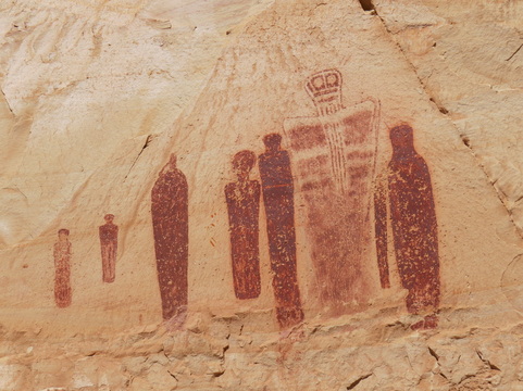 The Holy Ghost panel of the Great Gallery.
It seemed that the more we looked at the panel, the more we saw; the details just kept coming out. Many of the anthropomorphic figures were just simple, featureless red shapes, but many others had ornate decorations, maybe representing robes or shields. There were also several animals on the panel, most probably herd animals, but one over to the far right near the foot of the tall anthropomorph could have been a dog. A few of the smaller figures had arms and legs and appeared to be doing some sort of tasks (hunting or herding the animals perhaps).
One thing that I found interesting is that it seemed to me that the Holy Ghost part of the panel may have been added later as it was in a slight alcove where the rock face had fallen so that part of the panel was on a different surface than most of the rest of the panel. There was also one figure to the left of the Holy Ghost that is incomplete as part of it must have been painted on the rocks that fell to form the alcove in which the Holy Ghost panel was painted. I have no idea what that means, if anything, I’m just making an observation. Whatever the timeline, this ancient rock art is simply beautiful.
We found a shady spot to rest and have a snack where we could sit and admire the Great Gallery. We had the place to ourselves (there were a couple guys just leaving when we arrived, so good timing). Well, almost to ourselves anyway, as there were a couple little furry residents who were looking for handouts. They are bold little varmints as they tried their best to either charm or steal our lunch. Forget it, guys, we don’t feed the wildlife. That’s just bad juju.
We hung around the Great Gallery for over half an hour, just taking it all in. After our break we started getting ready for the return hike and snapped a few more photos. Just as we were turning to go we saw a couple folks coming down the trail. Hey, I recognize that goofy hat! Even with our huge head start, Alison and Mark have caught up with us. We chatted with them a while but they said for us just to go on as they’ll catch us again down the trail. OK, no worries, off we go. Oscar and I are again bringing up the rear, having chatted a little longer with Alison and Mark. Then there was the chatty Park Service volunteer who arrived just as we set off, but that was fine. It is good to meet and talk to folks who have a real passion for these natural wonders.
While we only saw a couple of other hikers on our way in, the crowd was starting to pick-up as we hiked out, but still I bet we saw fewer than a dozen people on the trail. And one bat. A batcrap crazy bat at that. Here’s the deal. So again, Oscar and I are trailing the rest of the herd, probably talking about beer. As we came around a bend I saw the rest of the gang a couple hundred yards ahead of us; OK, we’re not too far behind. Then I saw this bird flying right at us. I figured it was a cliff swallow or something, just swooping about catching bugs. But it was bigger than a swallow. And it kept flying straight for us and only at the last second did it break left and loop around. In that last second before it turned I saw that it was a bat. Holy malfunctioning alarm clock, Batman, what the heck is that thing doing out at this time of day. I mean it is practically high noon! That can’t be good. Rabid bat? By now it is lined up for another strafing run and this time it is show no signs of diverging from its path right at our heads. I swung my trekking poles over my head and that got it to pull up and fly on past. At the point Oscar had a grand idea: RUN! So we sprinted our way to the next bend in the canyon. Fortunately the bat opted not to follow. That was certainly unusual behavior for a bat.
The remainder of the return hike was pretty calm. The only downside was that the temperature was climbing and the shade was receding. But we made good time back to where the trail starts the climb out of the canyon. Then we all just went at our own pace as the heat and the hill were getting to some folks. Those of us who were making good time would stop and keep an eye out for the stragglers. Mark and Alison caught up with the herd, as expected. But we all made it under our own power, so a good day on the trail. Mark figured it was about 85 F by the time we reached the trailhead; hot but not oppressive. My GPS showed that the hike took a couple minutes less than four hours, including all the time that we spent examining the rock art. However, by the time the herd was reassembled at the trailhead it was after 2:00. Here's the review for the hike and the Ramblr track.
We were on the road in pretty short order and had an uneventful ride back to Green River. Actually made a little better time on the return trip (ran the dirt road a little quicker just for the fun of it). We were back at the River Terrance at 4:40 and had a beer in hand shortly thereafter. Plenty of time to relax and get cleaned up for dinner (ohhhh that shower felt soooo good!). I got a call from the folks at Ray’s Tavern to confirm our reservation. Turns out they have a second large group coming tonight as well but gave us the choice of indoor or outdoor seating. I picked the patio. We headed to Ray’s at 6:45 for our 7:00 reservation.
 Dinner at Ray's Tavern.
Well, the patio was the right choice. Plenty of room for the gang to mingle and socialize prior to dinner. I think most of the herd was already at Rays’ by the time we arrived; in the end we again at 23 cats at dinner. Great service and the beer and wine was flowing like water…we’ll it was 3.2 beer so it was pretty much water. But the food was excellent and the company was even better (review).
We took a few minutes to go over the plans for Friday. The main event was the canyoneering for eight of the group. The rest of us will be splitting up to tackle two different slot canyons in the Swell near Goblin Valley. The hard-core folks are heading to Ding and Dang slots, while the more relaxed hikers will take in one of the classic hikes in the Swell, Little Wild Horse slot canyon. The weather for Friday is looking good, so we should be able to get these activities in. However, Saturday might be a different story. We’ll just have to wait and see. But today was a good day to be part of the this herd and tonight was fun time hanging with the cats. Here's the link to the photos from today's events.
We took a few minutes to go over the plans for Friday. The main event was the canyoneering for eight of the group. The rest of us will be splitting up to tackle two different slot canyons in the Swell near Goblin Valley. The hard-core folks are heading to Ding and Dang slots, while the more relaxed hikers will take in one of the classic hikes in the Swell, Little Wild Horse slot canyon. The weather for Friday is looking good, so we should be able to get these activities in. However, Saturday might be a different story. We’ll just have to wait and see. But today was a good day to be part of the this herd and tonight was fun time hanging with the cats. Here's the link to the photos from today's events.
Day 7 – Friday, September 26: Little Wild Horse. The canyoneering crew had an early 0700 meeting time with the outfitters and still had the long haul to Hanksville. The rest of us chose the more relaxed starting time of 8:30 to convene in the River Terrace parking lot. There were two groups getting ready to move out. Howie, Deb, Danny, Esty, Walt, Mark and Alison were going to take on the technically challenging Ding and Dang canyon, which is just a little ways further up the road beyond Little Wild Horse canyon. Alex, Susan, Rob, Sue, Lisa, Lynn and I were going to give this less strenuous but visually pleasing slot canyon a go. However, Susan was running late (shock!) and texted Alex that we should not wait for her; she would catch up when she could. So by 8:40, we had our six hikers loaded into the Explorer and we were on our way. It was nice having a smaller group so that we only needed one vehicle; just makes the logistics so much easier. Of course, we’ll probably never connect with Susan today, but we’ll see how that goes.
The drive to Little Wild Horse is easy from Green River; I-70 west for a few miles then jump on route 24 south for about 24 miles, take the road to Goblin Valley and they just follow the signs to Little Wild Horse. Paved roads all the way, so you can get there in just about any type of car. Just watch the weather as there are a couple of fords in the access road to the trailhead that could be full of water during a storm. We were at the trailhead at 9:30, got our gear in order and headed to the slot. We walked a few minutes, then I could not remember if I locked the truck. Darn it, I hate when that happens, so I backtracked and made sure the Explorer was in fact locked then retraced my steps to catch up with the group (so a little extra exercise…maybe I need to exercise my brain a bit more).
The drive to Little Wild Horse is easy from Green River; I-70 west for a few miles then jump on route 24 south for about 24 miles, take the road to Goblin Valley and they just follow the signs to Little Wild Horse. Paved roads all the way, so you can get there in just about any type of car. Just watch the weather as there are a couple of fords in the access road to the trailhead that could be full of water during a storm. We were at the trailhead at 9:30, got our gear in order and headed to the slot. We walked a few minutes, then I could not remember if I locked the truck. Darn it, I hate when that happens, so I backtracked and made sure the Explorer was in fact locked then retraced my steps to catch up with the group (so a little extra exercise…maybe I need to exercise my brain a bit more).
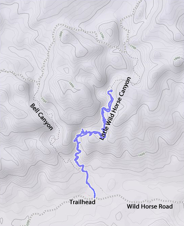 Our track through Little Wild Horse slot canyon. The contours are in meters (1800 m = 5905 ft.)
When we reached the first narrow section of the canyon, we hit a snag. There was a large rock wedged in the slot so the trail was blocked. There were alternative routes available, but both required a little scrambling so we checked our options to see which, if any would allow the entire group to go on. Rob and Sue decided that there was no way that Sue could get around the choke point, but she said that we should go on and that she would find a shady spot and work her crossword puzzles. I gave her the keys to the truck in case she needed to chill in the AC. So onward we went.
Alex and I were both thinking that we would just do an out and back along Little Wild Horse, rather than the loop including Bell Canyon. This should also keep the hike a little shorter so that Sue is not waiting around by herself too long. We also expected some water in the slot, so that could impede our forward progress as well. Hey, we’ll see how far we can go.
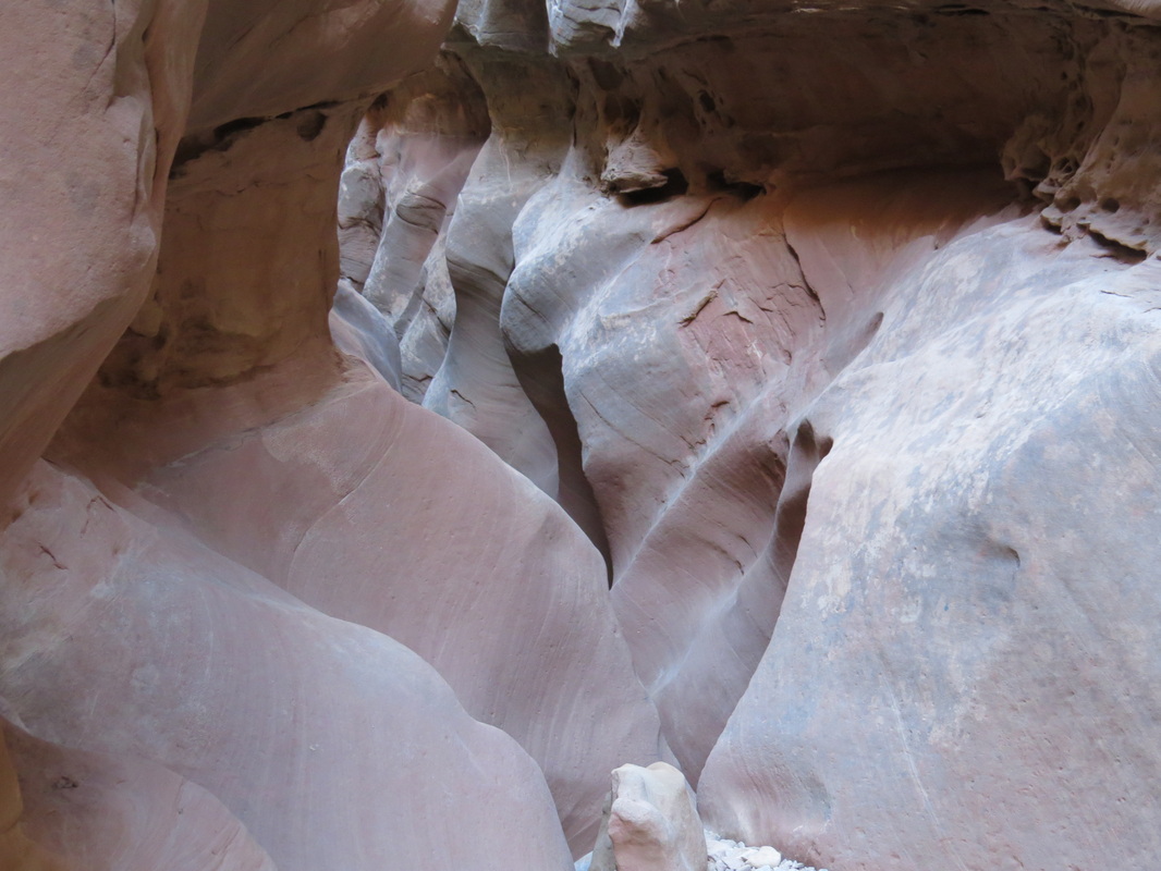
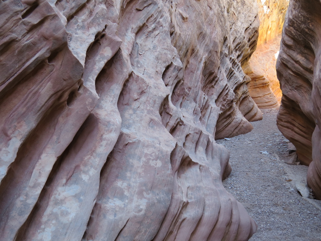
The short story is that this is a GREAT HIKE. The slots in Little Wild Horse are extremely photogenic and there is a lot of variety in terms of terrain, geology and views. There were also a few small critters like lizards and toads in the slots. So something for everyone along this trail. Once we got past that first choke point there were no serious obstacles, just s few small scrambles over or under boulders and a pour-off or two to negotiate. But as per the norm, we all pitched in and helped each other as needed.
Alex and I were both thinking that we would just do an out and back along Little Wild Horse, rather than the loop including Bell Canyon. This should also keep the hike a little shorter so that Sue is not waiting around by herself too long. We also expected some water in the slot, so that could impede our forward progress as well. Hey, we’ll see how far we can go.
The short story is that this is a GREAT HIKE. The slots in Little Wild Horse are extremely photogenic and there is a lot of variety in terms of terrain, geology and views. There were also a few small critters like lizards and toads in the slots. So something for everyone along this trail. Once we got past that first choke point there were no serious obstacles, just s few small scrambles over or under boulders and a pour-off or two to negotiate. But as per the norm, we all pitched in and helped each other as needed.
|
For the most part the hike was dry. There was not anyplace that we had to get our feet wet and just a few small puddles to step across…well, until we reached the end of our hike, but I’m getting ahead of myself. Of course the puddles are of great interest from a photographic point-of-view and we did try to take advantage of those opportunities. But the real fun was just walking through the narrow parts of the canyon and enjoying the twisting and turning contours of the strata. I was in my usual position at the back of the line so I could get shots of the slots, both with and without my hiking partners. Plus there were not a lot of folks on the trail, so we could enjoy the views and stop and take some photos without getting over run by other hikers. I mean we passed a few groups, but it was not a steady stream of folks and everyone was friendly, courteous and willing to share the trail.
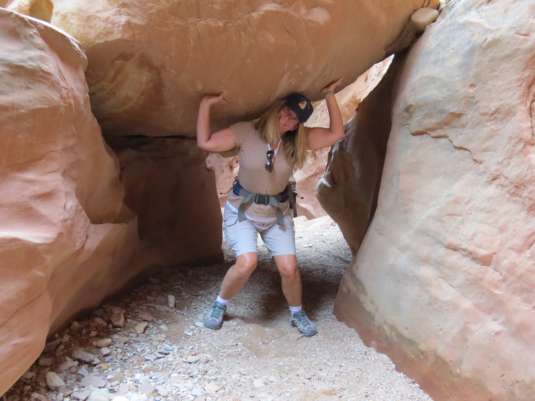
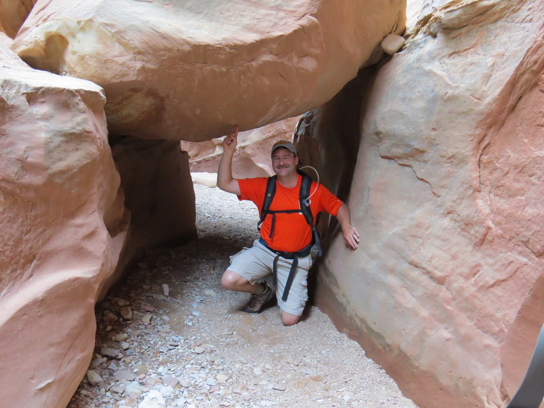
We were keeping an eye on the clock as we did not want to leave Sue sitting alone for too long, but at the same time we wanted to see as much as possible of this cool slot canyon. We finally came to a deep pool in the middle of a particularly narrow area of the slot. We knew there was a way around it as we saw the cairns marking the detour, but we figured that this was probably near the end of Little Wild Horse and would make a good point to reverse course. We took the time to take a team photo here and also marveled at the forces of nature that carved the narrow canyon. We could see the narrow opening at the far side of the pool; it was the narrowest slot we had seen so far. Not some place that I would want to be in a flash flood! As we retraced our steps we passed a few more hikers. A couple of the groups let us know that a woman was looking for us and from their description it was Susan. Hey, she made it after all! The other hikers said that she was just 10-15 minutes behind, but we never caught up with her. Alex supposed that she must have turned back and that we’ll find her sitting at along the trail with Sue. Onward and outward. It was a good plan to just return back down Little Wild Horse rather than make the loop through Bell Canyon. We had all heard that Bell was not as pretty as Little Wild Horse, plus retracing our steps let us see the canyon from a different perspective as well as slightly different lighting. We also caught a few photos that we might have missed on the inward trip, including some more “photo fun with Lisa.” In one of the slots there is a large boulder wedged between the canyon walls just high enough above the floor that it is easy to duck under. We got shots of Rob and Lisa playing Hercules and Xena, respectively, as they “lifted” the huge boulder. I told them they were doing it all wrong, and “balanced” the massive rock on one finger. See, fun with photos! We made our way around the final obstacle and were back out in the wide entrance to the canyon. As Alex predicted, there sat Susan with Sue. We told Susan that she must have come close to catching us, from the reports from the other hikers, but she said that she was not sure if we were doing the loop or not, so she turned back rather than risk missing us altogether and just hung-out with Sue until we arrived. |
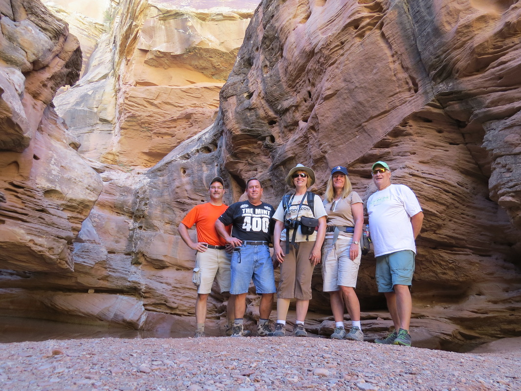
Team photo in Little Wild Horse slot canyon.
|
So our hike into Little Wild Horse took 4 hours almost on the nose. The Ramblr app on my phone indicated that we hiked a total of seven miles, but I’m thinking that is a bit on the high side; maybe the GPS signal got a little confused down in those deep slots. Still it was a great hike, with excellent companions through some beautiful rock formations. Here's the TA reivew of the hike and the track on Ramblr.
On the walk back to the trailhead, Susan suggested heading to Hanksville to grab a snack at Stan’s Burgers. She had me at “milkshake”! Even though we would be backtracking a bit, we decided to go to Hanksville first, and then come back for a quick peek at Goblin Valley (it’s not that far out of the way). Pretty drive to Hanksville, but don’t blink or you will miss “the city.” We were following Susan and she led us right to Stan’s, which is a simple roadside restaurant, gift store and gas station…one stop shopping at its finest. The place was practically deserted this afternoon, so we just bellied-up to the bar and placed our orders. Milkshakes all around. Problem was that these were not really milkshakes, but rather frozen custard with cookies or candy added, like a DQ Blizzard. Good yes, but I all geared up for a honest to goodness milkshake, as I just figured this would be the out-of-the-way kind of place that would make a stellar shake. Oh well, still the cold treat was a welcome relief from the heat of the day. It was nice and shady in the slot canyon, but now that we’re out in the open, it is getting toasty!
After our snack and a little break, we retraced our steps northward to Goblin Valley. We got there a little before 4:00 and just took in the views from the overlook. It is a fascinating place with the hundreds of little sandstone sculptures clustered around the valley. It was too hot to do any hiking, plus we had a dinner date to make back in Green River.
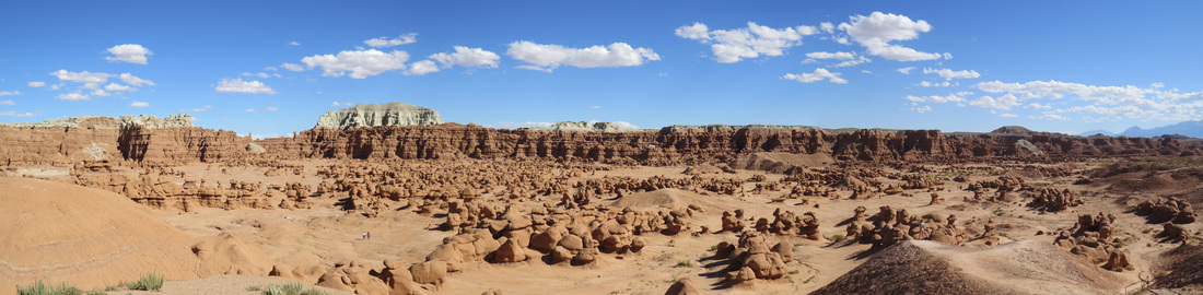
Vista from the overlook at Goblin Valley State Park.
We were back in Green River about 4:50. Time for a beer and a shower…both were refreshing after our day at Little Wild Horse. We have plenty of Unita Brewing Company's Hop Nosh, one of our favorite IPAs. It is a Utah beer (the brewery is located in Salt Lake City). We discovered it during the 2012 meet-up in Moab and it is certainly better than the 3.2-percent Utah beers that are served in the restaurants.
The plan for the evening was to get our group photo then head to dinner at Tamerisk (review), which is right next door to the River Terrace. Dinner reservation is for 7:00, so we set 6:30 for the group photo. I started scouting for a location for the photo around the hotel around 6:00. This might be more difficult than I thought as there really are no picturesque spots nearby. We had thought about trying to convene the group at the sculpture called “The Ratio” or maybe at the local park, but the cats would be hard to herd after a long day on the trail.
Once the herd started to converge, I got the reports from the group who went to Ding and Dang slots; that was a very challenging hike and everyone had some dings to show for it (and I bet they all said “dang” or worse more than a few times). They mentioned that there was a bad accident in the slot as a college girl in another hiking group had fallen and busted up her leg (compound fracture it appeared) and reportedly it took hours to get her out over the rough terrain. That just illustrates once again the unforgiving nature of the desert southwest.
So the herd was congregating at 6:30 for the photo. The best location I could find was the green space between the hotel and the pool area. Good enough. Hans and Antoinette had arrived and Susan stuck around (she’s leaving shortly), so I thought that we would have the entire gang in the shot. Problem is that the canyoneers were missing. We figured that they would be here by now, but this was sort of the newbie group and they were all the way down by Hanksville, so they are probably just running late. Of course the news that the Ding and Dang hikers brought back about the college girl who broke her leg in that slot did not ease our worry for our friends. But there was nothing that we could do now except wait, so we took the photo with the group that we had, then headed next door for dinner. Apparently there was another old friend lurking about as well, as Gary of Forest Gump fame was arriving tonight as well. He had posted on the Trip Advisor thread and Hans had given him the details for this evening’s plan, but somehow we never connected; hopefully we will tomorrow.
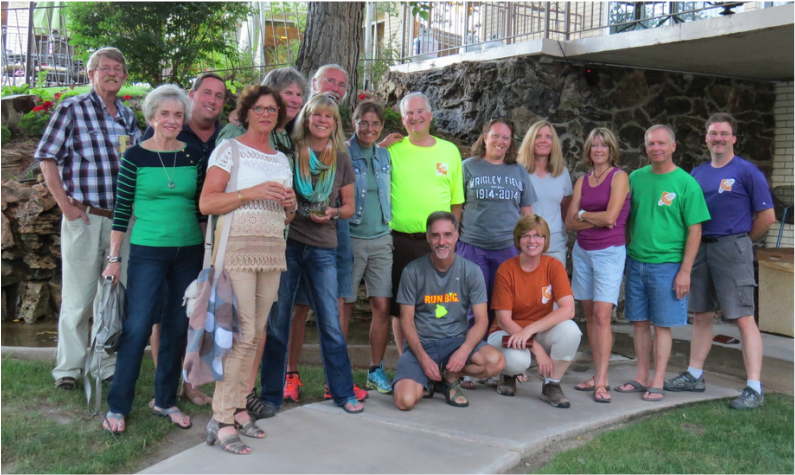
Most of the 2014 Green River Meet-up Herd.
We spent dinner wondering about our canyoneering crew. We all tried to call and text but to no avail as there was probably no signal where they were. Danny and I were looking for phone numbers for the county sheriff or other search and rescue, but we would not even know where to direct them as we did not know exactly where they were hiking. The outfitters voice mail was full, so no help there. We finished dinner and headed over the pool area at River Terrace to wait for word from the canyoneers. We did not have long to wait as texts started coming in at 9:00. They were just getting off the trail and heading to Hanksville for dinner. Seems the issue was “slow hikers” but that did not matter now, as we knew the gang was safe. I’m sure there will be plenty of stories to share on Saturday.
Now on to planning the rest of the weekend. The issue we now have is weather as there are big storms rolling in from the west and the region is under a flash flood warning through Sunday morning. The Saturday canyoneering trip is most likely going to be canceled and hiking in general is doubtful. So we adjourned for the evening and agreed to reconvene tomorrow morning in the parking lot of the River Terrace as it is the most centrally located. We’ll just wait and see what the morning holds. Here's the link to see what today held in photos.
Day 8 – Saturday, September 27: Nine Mile Canyon. Yep, rain is coming. The forecast is iffy at best for this morning but looks to be a wash out for the afternoon. There is already thunder and light rain in Green River as we went to breakfast at 7:00. We saw Howie there and he informed us that the canyoneering event was canceled for today. No idea on a plan for the day. We’ll congregate later in the hotel lobby to get our act together.
After breakfast, Lynn and I headed to the Green River Coffee Shop to see what Alex and company were up to. Esty and Walt were also there. Alex is sticking with his initial plan of spending the day with Hans and Antoinette and driving into Moab for a look around the area. They’ll start with the Crystal Geyser, as long as it is not raining, then head south. Esty and Walt were going to follow that same general scheme.
Back at the River Terrace, the herd had gathered in the hotel lobby, and I mean the whole herd, including Gary who had caught up with us. Twenty-plus cats make a lot of noise, so we adjourned to the parking lot so the folks working the front desk could hear what they were doing. Folks were just sort of heading in several directions in smaller groups; Moab and Goblin Valley were destinations for many of the herd. I had a driving route planned that would take us to some of the arches out in The Swell, but as most of it was along dirt roads it was probably not the best choice with the impending wet weather. Pixie suggested a drive up Nine Mile Canyon, which is all paved, to check out the hundreds of rock art panels. I had seen this listed in Martres book as well, and it sounded like a good alternative. Plus Pixie was very familiar with the area, so she would be able to act as the guide. T also wanted to explore there, but she still needed to eat breakfast, so she would catch up with us later.
OK, ready…BREAK! And the players trot to the line of scrimmage then scatter in all directions from Green River.
We were finally on the road at 10:40. New territory for us today, as we head north toward on route 191 toward Wellington. This is right at 50 miles from the River Terrace to the turnoff onto Soldier Creek Road just before reaching Wellington. I reckon we then drove another 45 miles (at least according to Google Maps) up the canyon to cover Nine Mile Canyon and reach the Hunting Panel just into Cottonwood Canyon. But it was a simply gorgeous drive. But again, I’m getting ahead of myself.
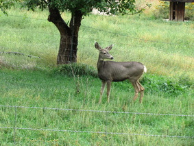 Mule deer in the apple orchard.
The drive up Nine Mile Canyon was beautiful. We were obviously going up in elevation as we were seeing aspens along the hillsides and they were in various stages of their fall colors. There were a few areas where the trees were in their full golden glory. There was also a fair amount of animal activity, including lots of Magpies along the road as well as Flickers. We also saw a few mule deer; in fact three darted across the road in front of us as they headed to lunch in an apple orchard (we may never know about the chicken, but now we know why the mule deer crossed the road).
We made a couple of stops on the way in. Pixie was very excited to show us everything in the canyon, and there was a LOT to see. But we had limited time and I definitely wanted to see the Hunting Panel which was at the far end of the route. So after stopping at the picnic ground to take advantage of the outhouse and see the old homestead site, we decided to drive to the end of the line and check out the Hunting Panel, then work our way back toward the beginning, stopping at as many of the highlights as possible. We set 3:00 as our departure time from the canyon (which was conservative, so I knew we had some wiggle room on that point).
We made a couple of stops on the way in. Pixie was very excited to show us everything in the canyon, and there was a LOT to see. But we had limited time and I definitely wanted to see the Hunting Panel which was at the far end of the route. So after stopping at the picnic ground to take advantage of the outhouse and see the old homestead site, we decided to drive to the end of the line and check out the Hunting Panel, then work our way back toward the beginning, stopping at as many of the highlights as possible. We set 3:00 as our departure time from the canyon (which was conservative, so I knew we had some wiggle room on that point).
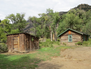 Old log cabin homestead at the Nine Mile Canyon picnic grounds.
The good news was that the weather improved as we went into the canyon. It was sprinkling a bit for our first couple of stops, but by the time we reached the picnic area, the rain had moved out and we were under mostly sunny skies for the reminder of the tour. And the road was in excellent shape. Newly paved for the majority of the drive, so easy going. Plus there was not a lot of traffic out today, just a few tourists also checking out the rock art. Pixie had driven herself but jumped into the Explorer at the picnic ground so that she could act as tour guide. She provided a lot of details on the panels and surrounding area. As for the great condition of the road, that was all done by the mining outfit working in the area; part of the deal for them mining (or drilling, I forget what resources they were after…might have been natural gas, at least according to a quick Google search) was to upgrade the road. Even on a Saturday there were a couple of big rigs from the mining operation cruising the road. An interesting feature of the road was the number of fords used to handle run-off from the storms (rather than using culverts). There were dozens of these. At first I would slow down considerably, but after a while I could tell that most could be taken at nearly the speed limit. At many of the fords, there were also cattle guards made of grating across the road, which produced a little rumbling noise when crossed. So we paraphrased Bill Haley and had “Dip, Rumble and Roll” as we drove through each of these features.
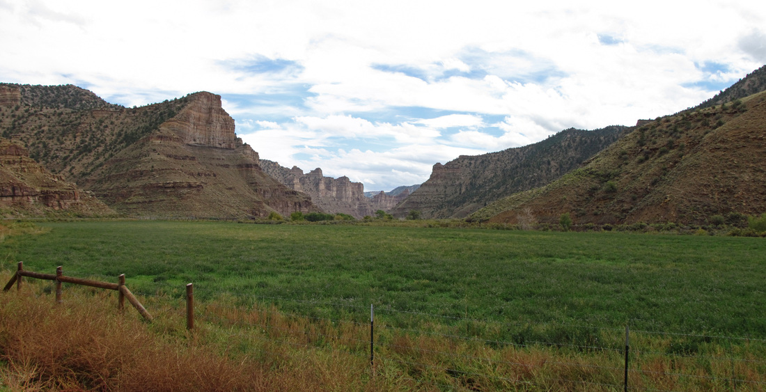
Lynn got this view looking up Nine Mile Canyon.
It was a lovely drive up Nine Mile Canyon. Pixie was pointing out the highlights and making suggestions for places to stop on the return drive. She was a great guide for this excursion and has put in a lot of time and effort into studying the panels along the canyon. The weather continued to improve as we went up the canyon as well. Lynn snapped a few drive-by shots of the vistas as we rolled through. At the very end of our drive we turned into Cottonwood Canyon to see the Hunting Panel, arriving there right about 1:30.
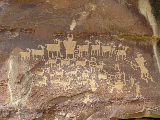 Hunting or Great Hunt Panel.
Unlike the other panel sites that we visited in Nine Mile Canyon, there was a paved parking area with information markers and a nice, fenced walkway to the panel. Pixie said that this was quite the safety upgrade as folks used to to have to walk right along the road with the big trucks whizzing past. The current setup made it easy to see the Hunting Panel (or Great Hunt Panel, as the signage called it) and surrounding engravings and the fence helped to protect the delicate artwork. There is a large rock in the center of the viewing area that made a great perch for getting a better view of the panel. The informational signage indicated that the panel is probably a depiction of a real-life event that would have happened in the fall with the big horn sheep would gather for mating season. The artwork is of the Fremont style which dates the panel to a period of AD 950 to 1200. Just too cool! We stood and studied the main panel for a while then looked at some of the adjacent panels while Pixie scurried about looking for new details to add to her files on these amazing pieces of history.
We knew we did not have a lot of time for exploring the rest of the canyon. According to Pixie, there are hundreds of panels scattered along the canyon, so we asked her to show us her favorites, as we were still targeting 3:00 for our departure time. She had three in particular that she wanted to share with us: Bison and Pregnant Bison, Rasmusson Cave and the Balloon Man at Pig Head Rock. OK, we have a plan. Now we just need to keep an eye out for T.
We knew we did not have a lot of time for exploring the rest of the canyon. According to Pixie, there are hundreds of panels scattered along the canyon, so we asked her to show us her favorites, as we were still targeting 3:00 for our departure time. She had three in particular that she wanted to share with us: Bison and Pregnant Bison, Rasmusson Cave and the Balloon Man at Pig Head Rock. OK, we have a plan. Now we just need to keep an eye out for T.
|
We did not have to go too far to our next stop, probably a half mile or less from the Hunting Panel back to the pullout for Bison and Pregnant Bison (OK, I think Pixie referred to these and Buffalo and Pregnant Buffalo, but I’m just stuck on calling these big critters “bison”. After all, their scientific name is Bison bison). From where we parked, we had to walk back up the road maybe 50 yards to the trail, then down the embankment and across the dry creek bed to the rock face where the panels are located. There was a lot to see along this stretch of sandstone. Right where the trail meets the rock face is a panel and the artwork continues around to the left for quite a ways. The images were a mix of bison, sheep, humans and shapes. There is a large bison on this first panel, and I think that is where it derives its name. The set of concentric circles also caught my eye. As we worked our way slowly along the rock we encountered more animal images. We also noted a section of the sandstone wall that had fallen from some point higher up. This rock was also covered with artwork, but we could not figure out exactly where it fit on the cliff. Pixie said that she had not noticed this before, so even she is seeing new sights today.
|
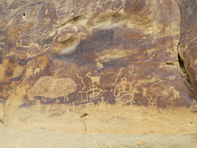
Bison panel.
|
The trail around the base of the sandstone cliff is fairly obvious, so it is easy to follow and it leads right to the other namesake image, that of a little bison with in a larger bison, thus “pregnant bison.” Hey, makes sense to me. One of the most striking panels was located directly above the pregnant bison; a colorful pictograph in red, yellow and white featuring a Fremont style human, some sheep and a geometric object that could represent the sun. There was also a more contemporary engraving from the 1867. Quite a bit going on within this relatively small section of sandstone.
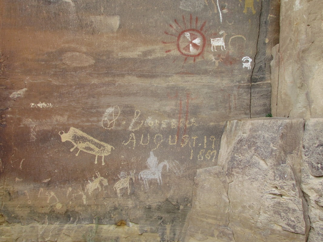
Pregnant Bison panel.
|
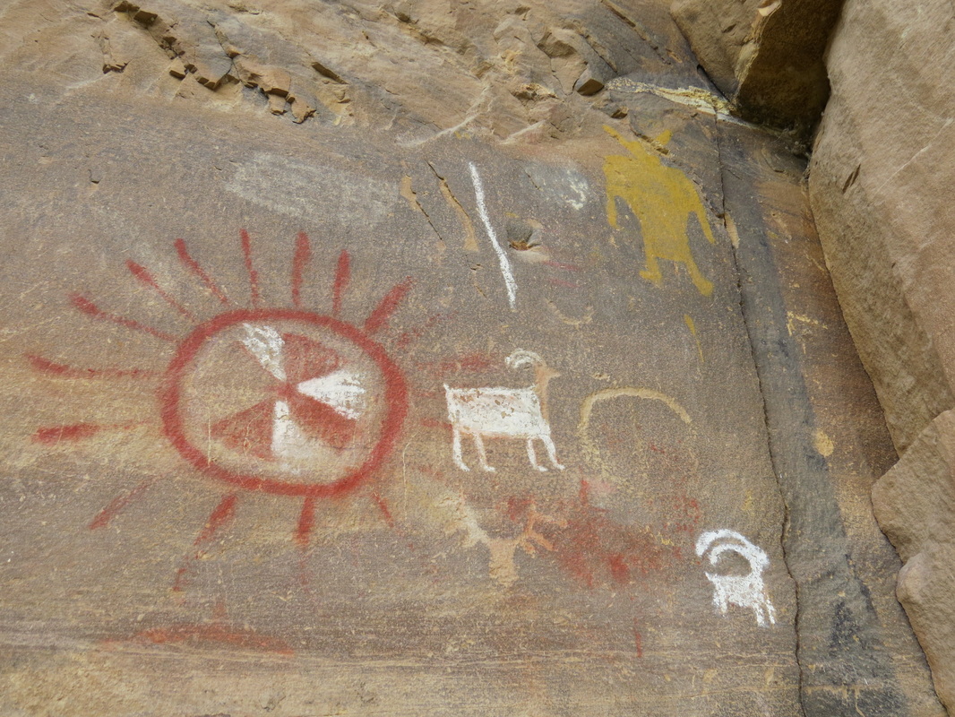
Colorful Fremont pictographs.
|
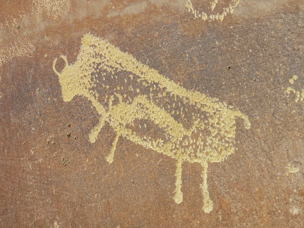
Pregnant Bison.
|
|
On the return hike, Lisa noticed a faint image well above the trail, it sort of looked like a clock face. Pixie had never seen it before; again something new for her to research. We stood there a few minutes and scoured the cliff face for other rock art and sure enough I spied another panel just below and to the left of the clock face image (I reckon these images were about 30 feet above ground level). Another new panel for Pixie. I can see how these panels could be missed. The clock face was on a sandstone surface that was sort of perpendicular to the main cliff face and it was also light and kind of blended with the surroundings. The adjacent panel was on the primary cliff face, but one a section that looked slightly upward, so it was not as obvious from ground level.
Our next stop was Rasmussen Cave. There were several interesting panels on the rocks adjacent to the parking area. Pixie indicated that there were additional panels further up the trail, but we opted not to wander too far due to lack of time. But there was plenty to see near where we parked as well as in around the corral built next to the rocks. |
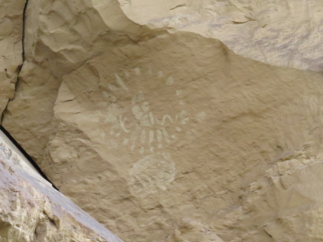
I have no idea what this is supposed to represent. but it kind of resembles a clock face.
|
The more interesting petroglyphs were over by the cave. Lots of animal images, a few hunters and some interesting geometric figures as well. Inside the case were several pictographs of deer, mostly in red. One of the prettiest had been painted over by a no trespassing sign, complete with spelling errors. I reckon that says it all.
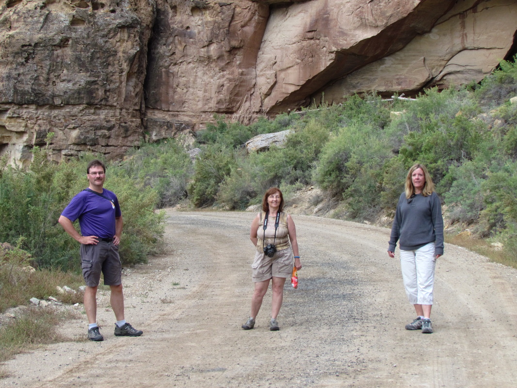
Me, Pixie and Lisa heading over to view Rasmussen Cave.
|
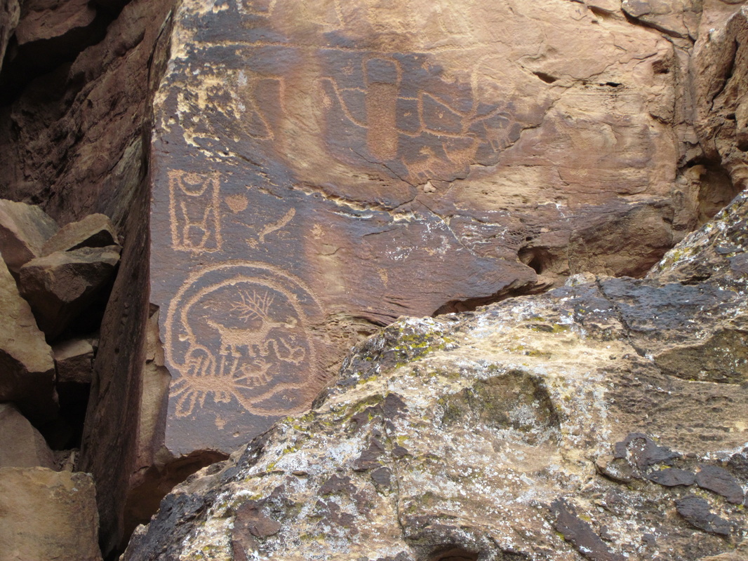
|
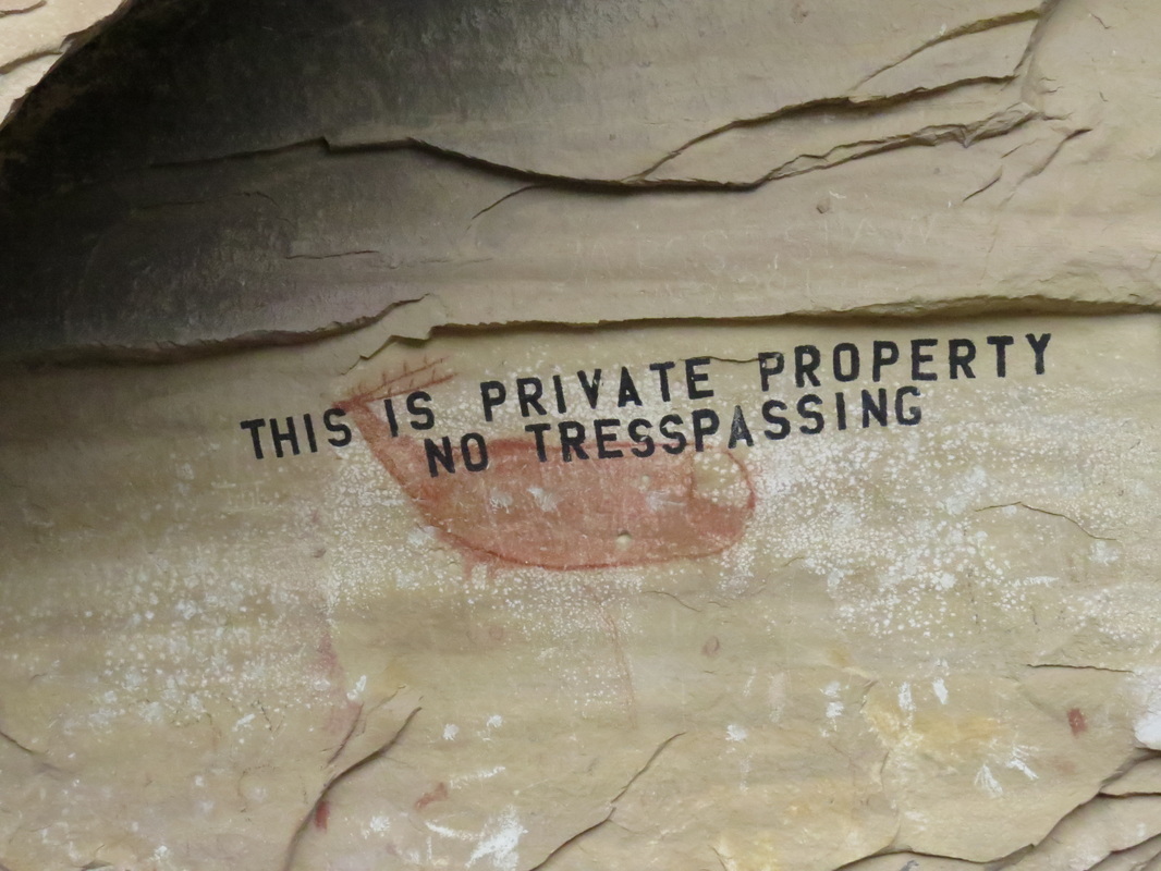
|
While we were looking around the cave, T pulled into the lot. Glad that she could join us. But it was also getting close to our appointed departure time, as it was about 2:45 by now, and Pixie still had a couple more panels to show us. Pixie rode with T for the rest of the tour. We made a couple quick stops at some panels that were easily viewed from on or near the road. First was a panel called sheep-snake (or something like that), basically a critter with the front end of a sheep or goat and a very long body, which sort of resembles a snake.
We were now in full search of pig head rock to see the Balloon Man panel. Since we were running out of time, we went ahead of T and Pixie. It is interesting how many rocks tend to look like the head of a pig when you are looking for one specific rock. Lynn spotted another roadside panel with some red, Fremont looking pictographs, so we stopped for a quick photo then headed on down the canyon. Pixie and T had caught up with us and took the lead so that Pixie could show us the location of the Balloon Man panel. We found pig head rock easy enough, but Pixie was having trouble finding the panel. There were a couple other interesting panels in the area, but no Balloon Man. As time was running out, we gave up the search and headed back to the Explorer, when Pixie yelled that she had located the panel. OK, what’s a few more minutes. Balloon Man has been waiting on us for hundreds of years, so we better go pay our respects. I’m glad we did, as it was an interesting panel; a very unique figure.
We were now in full search of pig head rock to see the Balloon Man panel. Since we were running out of time, we went ahead of T and Pixie. It is interesting how many rocks tend to look like the head of a pig when you are looking for one specific rock. Lynn spotted another roadside panel with some red, Fremont looking pictographs, so we stopped for a quick photo then headed on down the canyon. Pixie and T had caught up with us and took the lead so that Pixie could show us the location of the Balloon Man panel. We found pig head rock easy enough, but Pixie was having trouble finding the panel. There were a couple other interesting panels in the area, but no Balloon Man. As time was running out, we gave up the search and headed back to the Explorer, when Pixie yelled that she had located the panel. OK, what’s a few more minutes. Balloon Man has been waiting on us for hundreds of years, so we better go pay our respects. I’m glad we did, as it was an interesting panel; a very unique figure.
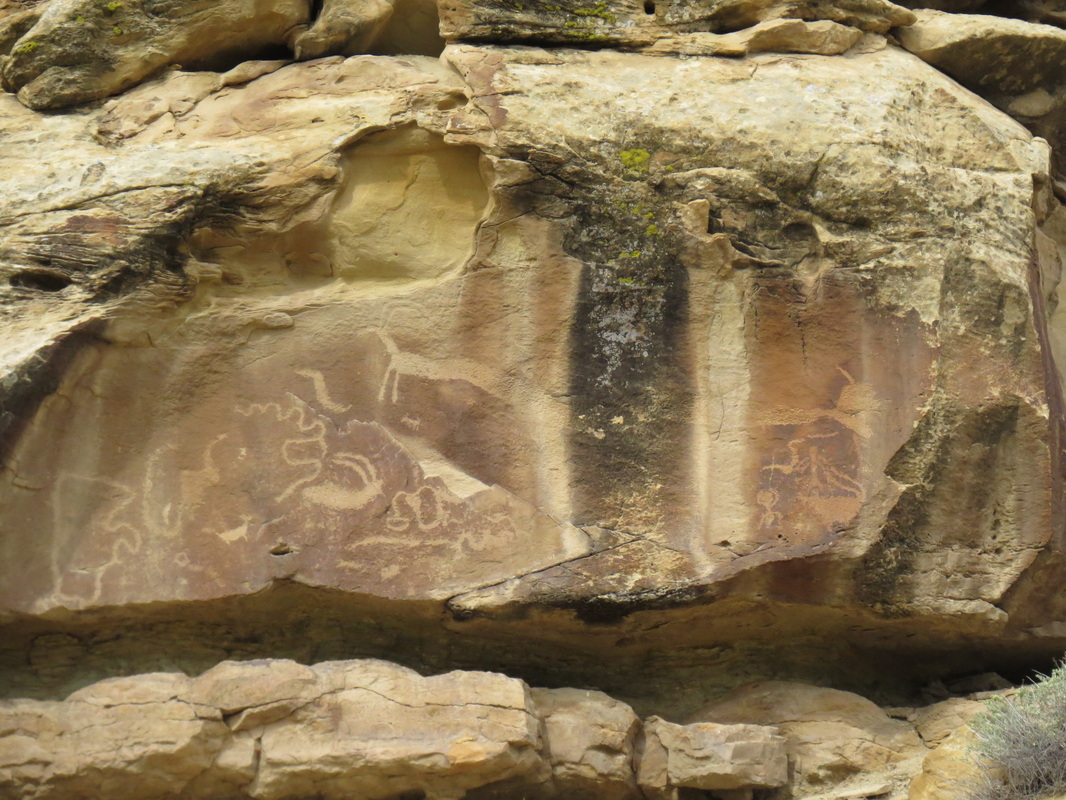
"Sheep-snake"
|
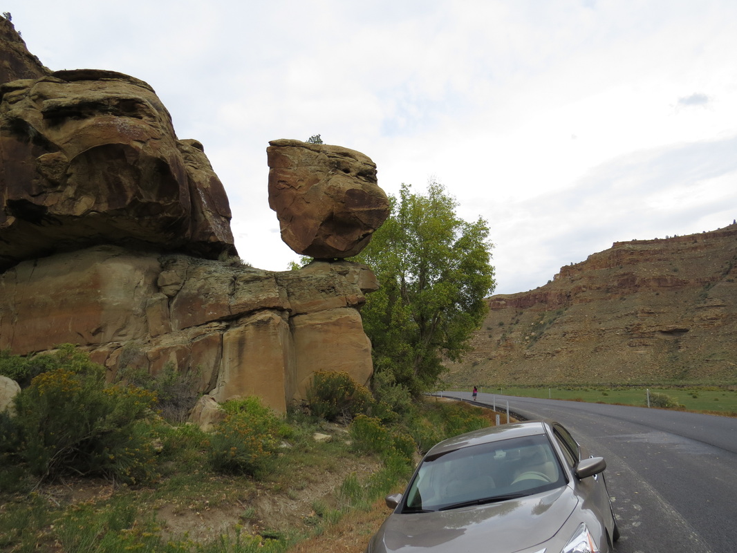
Pig head rock.
|
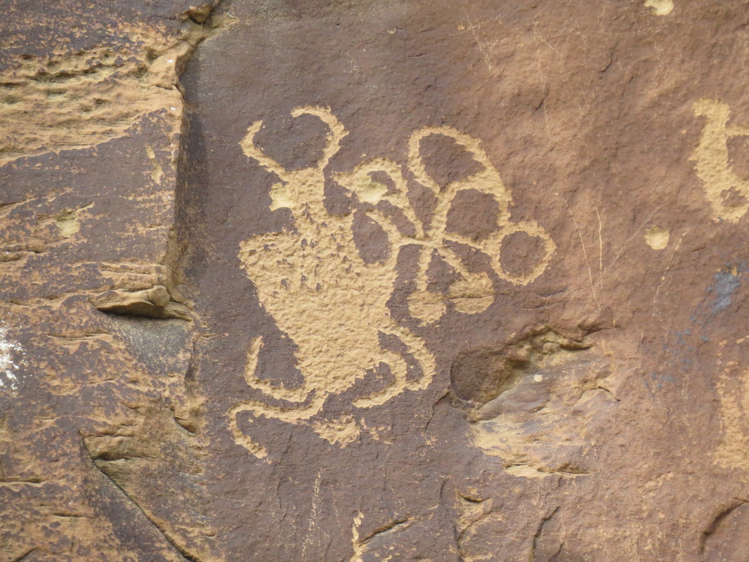
Balloon Man.
|
We had a little less than four hours of exploration time in this fascinating canyon. We barely scratched the surface of all there is to see….hey, Foghorn Leghorn would say that I made a funny; scratched the surface…petroglyphs…get it? “I say, I keep pitchin’ ‘em and you keep missin’ ‘em.” Digressing again. Anyway, I reckon you could spend days poking around in Nine Mile Canyon and still have more to see. But that’s part of the beauty of southern Utah and what keeps drawing us back to the region. Here are some more photographs from our drive through Nine Mile Canyon.
Well that was a fun little excursion, but now it is past time to start our return back to Green River. While the weather had cooperated with us so far, the skies started to turn as we got closer to Wellington. There was a huge storm to the north toward Price and more weather coming in from the southwest. We could see the downpours in the distance and marveled at the show the lightening presented. Nature in all her awesome fury. There were also pockets of rain to the east in the direction of Green River, so it seemed that the pizza party on the terrace was a wash out. We were weaving our way south on 191 and dodging the storms for most of the drive, but about two-thirds of the way back to I-70 our luck ran out and we hit a major deluge complete with a sandstorm. Visibility went down to about 20 yards. Fortunately there was very little traffic on the highway. I was concentrating on the white line on the right edge of the road while Lisa who was riding shotgun was working the defroster and emergency lights. The storm was going north while we were heading south, so we punched through after just a few minutes and the rest of the drive was under grey, but dry skies.
We got home around 5:30 to a flurry of texts and calls to reschedule dinner. Everyone else had also come to the same conclusion that carry out pizza on the terrace at River Terrace was not going to be a good idea. I had asked about using the breakfast area at the River Terrace as a backup in case the weather turned sour, but that was not an option. Danny made reservations for 7:00 at the West Wind Restaurant over at the truck stop so our dinner plans were now set. We ran into Howie and had a beer with him and swapped stories of our adventures from the past couple of days. He provided some additional details from the hike through Ding and Dang Canyon. Tough slot canyon. I think I’m glad we went to Little Wild Horse.
We had again had 23 folks at dinner this evening at West Wind (review); that seems to be our magic number for this trip. We were spread across three tables, but that worked out pretty well as folks could move about an socialize as then wanted. The service was on the slow side as we only had one server for the group, and I bet a big group like this probably overloaded their kitchen at this time of evening. But the slower pace just give us more time together and this was the last night that many of the herd will be in Green River. We also got another group shot, so now we had everyone who made the meet-up immortalized in one of the two team photos. Gary had brought a few specialty pumpkin ales to share for the pizza party, but due to the rain out he distributed them to the beer drinkers in the group. I reckon I'll save mine for tomorrow evening or it might even make the trip back to Ohio.
As the dinner party broke up we started saying our goodbyes to some members of the herd who would be heading out in the morning. Donna, Oscar, Al and Sueann were heading to Moab for a few days of camping (I hope the wet weather does not impact their plans). Alex, Pixie, Mark and Alison were heading home, and Gary was heading into Colorado on his way to the beerfest. That sounds like a fun place to be!
Day 9 – Sunday, September 28: Rainy day in Moab. Well, we are nearing the end of this trip as this is our final full day in Utah. The skies are still ominous and a light rain is falling; it does not look like a great day for hiking. We have no plans with the gang today, just me and the Jones girls, and while we have some ideas of what to do, our plans are still in flux.
No rush today so we did not go down for breakfast until 7:00. Lynn and I sat with a couple folks in the oil industry who were out here on a training expedition. Seems that this area of southern Utah is a great training ground for the petroleum industry as the oil and coal bearing strata that are usually underground are all exposed, so it makes for a great learning tool. Fascinating, Captain.
We drove down to the coffee house to say our good-byes to Alex. Max was also there and she had also decided to head home today as the weather was not that great. Esty and Walt were also there and said that they planned to tour around with Howie and Deb but had no idea of the specific plan. Esty was thinking that the weather will be improving so that hiking this afternoon should be OK. I don’t know. It may not rain, but I bet some of the trails will be a quagmire with all the water that fell yesterday.
Back at the River Terrace, we found most of the herd at breakfast. Again, folks were sort of doing their own thing today, but we did made plans for the evening. First we would finally have the champagne toast to celebrate Roz’s and David’s anniversary, then dinner at Tamerisk (I walked over and made the reservations).
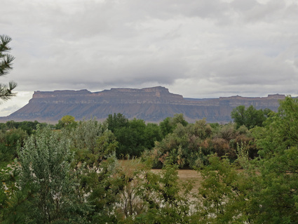 View of the Book Cliffs from the museum patio.
Lynn and Lisa wanted to head back to Moab to look around the shops since the weather was too undecided for hiking. But we started with a tour of the John Wesley Powell Museum, which is just across the street from the River Terrace. Very interesting set of exhibits. We started with the 20-minute introductory video, which gave a good overview of Powell’s expedition from down the Green River from Wyoming to the confluence with the Colorado and on through the Grand Canyon. Quite the feat! The museum also includes a hall of fame for river runners and explorers, although I did not spend too much time on that. And there were a few dinosaurs in the lower level. It was certainly worth the time we spent there (maybe an hour). I think I enjoyed the placards outside the building just as much as the museum itself (more general history of the area and Green River). Here's the review.
I reckon it was a little after 10:00 when we started toward Moab under clearing skies. Once we turned south on to 191 from the Interstate we could see that all of the gullies were full of water, some to the point of overflowing. This is by far the most water that we had ever seen in the desert. We also saw another herd of about ten pronghorn very near the road; probably the most of these critters we’re seen for during a trip to Utah. But the clouds were parting a bit and blue sky was peeking through in spots. Got me thinking that there could be some nice photo ops in Arches as there had to be some pools and puddles on the slickrock for reflection shots. Too bad I only brought the SX280, but it is a good little camera and I've had good success with it in the past.
I reckon it was a little after 10:00 when we started toward Moab under clearing skies. Once we turned south on to 191 from the Interstate we could see that all of the gullies were full of water, some to the point of overflowing. This is by far the most water that we had ever seen in the desert. We also saw another herd of about ten pronghorn very near the road; probably the most of these critters we’re seen for during a trip to Utah. But the clouds were parting a bit and blue sky was peeking through in spots. Got me thinking that there could be some nice photo ops in Arches as there had to be some pools and puddles on the slickrock for reflection shots. Too bad I only brought the SX280, but it is a good little camera and I've had good success with it in the past.
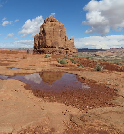 Sandstone Reflections at the La Sal Mountain overlook.
I dropped the girls in town and I headed back to Arches. I knew I would not have a lot of time, so I was thinking maybe around Courthouse Tower and Park Avenue would be a likely place. I also tried the La Sal Mountain overlook and found plenty of puddles on the slickrock, but it was also breezy so no mirror finish today. Plus there were a lot of tourists milling about so it was tough to get a clear shot, but I can probably clean them out with Photoshop if needed. The puddles made sort of a patchwork quilt of reflections on the slickrock, but it was difficult to get the right alignment to capture the sandstone monuments in the water. Still, it was fun experimenting.
Next I headed over to the Courthouse Tower View Point and walked into Park Avenue and found several small puddles and a few reflection options. I also saw two old guys that I also saw at the La Sal view point meandering about, this time toting their tripods. They were sort of oblivious in that they would just set up wherever regardless of someone else already lining up a shot. I guess they thought their tripods gave them special privilege. Whatever. Plus there were a couple busloads of tourists, all snapping away with their cameras. Fine by me, as that’s why I’m here as well. Shoot, I was sitting on the sandstone, reclining at times, to try and get the reflections views.
I toyed with the idea of going to Delicate Arch, but that would have taken too long. I was just thinking that there might have been a nice pool in the basin below the arch. Maybe another time. Instead I stopped back at the La Sal Mountain view point to try again, and there were fewer tourists this time. I did have to wait for the young couple and their toddler who had to stick his toe in every puddle (and there were many puddles), but he was having a fun time, so I just watched him meander about, laughing and giggling as he collected thick, red mud on his sneakers…much to Mom’s chagrin.
 Lunchtime refreshment.
I got a few more shots, and then the rain returned. Softly at first, so I tried to get an image of the puddles with the ripples of the raindrops. Then the rain started to fall for real so I retreated to the Explorer just before the heavy stuff started. It was a hard rain right over me, but sunny elsewhere. Where’s that rainbow? There has to be one somewhere in the area. But the rain did give me an excuse to end the photo shoot and head back to town to find the Lynn and Lisa. I did see one more truly amazing spectacle on the drive back to Moab. Just as I was making the curve heading into the bridge across the Colorado I got a great view up the canyon next to the river canyon. There were a dozen or more waterfalls gushing off the top of the sandstone cliffs. It was quite an impressive display.
I gave Lynn a call and we decided to meet at Zax for lunch (review); we’ve never eaten there, so might as well give it a try. I lucked into a parking spot just around the corner. Timing was perfect as I was walking up to the door right behind the girls. We arrived about 1:00, so near the end of the lunch rush, and we were seated right away out on the patio. The service was outstanding; our server gave us the rundown on the menu and answered all of our questions. OK, I know that buffets are bad for me as I always each too much, but I went for the pizza and salad bar anyway. Yeah, I ate too much, but man was it good! The pizzas on the buffet were excellent with a lot of variety and some fairly unique combinations. Plus they had some decent bottled beer (no 3.2 crap this time). I went with the Off Duty IPA by Squatters Brewing (still a Utah beer). Not bad. I guess it could be considered a session beer, at 6.5% ABV, but it still had a good flavor.
While we were eating another squall came through. It simple deluged. The water was running a couple inches deep down Main Street. At one point it started hailing! But we were nice and comfy on the covered patio. Just enjoying lunch and waiting for the storm to pass. Life is good!
After lunch, we hit a few more shops then headed back to Green River at about 2:40. The rain had stopped and the sky was showing some patches of blue amongst the tall, white clouds. The Book Cliffs were well lit, so I dropped the girls off at their hotels then found a decent vantage point along the Frontage Road to get a panoramic view. Fairly dramatic with the big clouds.
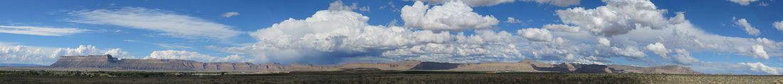
The Book Cliffs.
Once back in the hotel, Lynn and I packed our gear in preparation for an early departure tomorrow then headed to the terrace for a beer…or two. This was really the first chance we had to just sit and relax on the terrace. To be honest, the view is nothing to write home about, but the seats are comfortable and the area is shaded, so it is a nice setting overall.
At 6:00 we congregated for the champagne toast to celebrate David’s and Roz’s wedding anniversary (30th, I think). While we had 26 folks make their way to the meet-up this year, the herd was now down to nine: David and Roz, Howie and Deb, Hans and Antoinette, Lisa, Lynn and me. We thought Danny was still in the area, so Howie and I cruised down to Robbers Roost to look for him, but apparently he checked out early and headed home this morning. Esty and Walt also scooted back toward Arizona as the conditions around Green River just were not conducive for hiking.
So the remnants of the group had a nice social hour on the terrace. Even Hans and I, the beer drinkers, had a glass of champagne (we didn’t like it, but we toasted the happy couple nonetheless). We all gave out goodies for other to take with them; chocolate from Roz, we gave our remaining bottles of Hop Nosh to David, someone ended up with a extra bottle of wine. Looks like the only beer that I'll be transporting home will be the can of pumpkin ale. But our time outside was cut short as the skies once again opened up and we had to retreat to the lower lobby area. We watched the rain turn into a serious hail shower. Pea-sized or better hail fell for several minutes. Whacky weather this trip.
For our final meal we again headed next door to Tamerisk. Good food but still lousy beer. Roz and I split a piece of pecan pie for dessert. Apparently ala mode is an American thing; who knew. We said our good-byes as we will be leaving early in the morning for our flight out of Grand Junction then headed back to the hotel to finish packing and get some rest. It has been a wonderful trip, but it is time to wrap it up. And here's the photographic wrap-up for today.
Day 10 – Monday, September 29: Homeward bound. One more early start. I was hoping to be on the road shortly after 0600 to start the trek back to Grand Junction. I know it is an easy drive and we have plenty of time to make our mid-morning flight, but I’d rather get moving and get there, just in case. Besides, I prefer to sit around the airport than sit in a hotel room. We were able to grab an early breakfast at the River Terrace; the crew there let us get in before the official opening time and even offered to get us something from the grill, but we just wanted juice and a bagel in order to keep it simple today. But a good ending to a great stay at River Terrace (review).
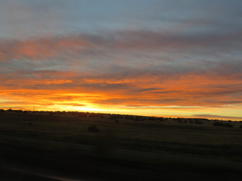 Sunrise along I-70 heading into Colorado.
We tossed our stuff in the truck, picked-up Lisa and were on the road at 6:15. As expected, it was a very easy drive to Grand Junction. We were at there about 7:40. Shoot, after fueling the truck, dropping it off, checking in at United and breezing though security, we were at the gate at 8:05 (just missed the 8:00 flight to Denver). I like these small airports; so much less hassle that the major hubs.
So nothing to do now other than just go with the flow from Grand Junction to Denver to CLE. No issues with the trip and we were safely home unpacking and downloading photos by early evening. I spent the time on the planes getting my trip notes together for the journal. I also finally had time to work out the words to the theme some for the meet-up. Remember the old TV show “Green Acres”? Green River – Green Acres; seemed like a natural parody to me, and I had been rolling ideas around in my noggin all week, so I finally came up with the new lyrics during the flight home. It might take a little polish, but I think I can do something with it.
So nothing to do now other than just go with the flow from Grand Junction to Denver to CLE. No issues with the trip and we were safely home unpacking and downloading photos by early evening. I spent the time on the planes getting my trip notes together for the journal. I also finally had time to work out the words to the theme some for the meet-up. Remember the old TV show “Green Acres”? Green River – Green Acres; seemed like a natural parody to me, and I had been rolling ideas around in my noggin all week, so I finally came up with the new lyrics during the flight home. It might take a little polish, but I think I can do something with it.
Final Thoughts… Great trip, but great to be home, particularly after this hectic summer of travel. But I’m now done for the year. Time now to reflect on the miles traveled and dream about the road ahead. This adventure was yet another sensational visit to the desert southwest. We revisited some old favorite places and found some new ones during this trip. Moab remains one of my top destinations explore; seems like each visit we find more outstanding hikes and we added Corona Arch, False Kiva and Sand Dune/Broken Arch to that list. And now we can add Green River to the list of great meet-up locations. We saw a lot of great territory in The Swell but there is a lot more to cover. I’m sure we’ll be back. Of course the real highlight to the meet-up is seeing all those crazy cats that make up the herd.
While the logistics of Green River were a bit of a challenge, particularly the lack of VRBO lodging that could act as a base for the herd, we made the best of what we had and in the end the meet-up turned out to be another grand success. The River Terrace became our default morning meeting point, which worked out well. The park in Green River was ideal for the opening cook-out. And while the rest of our evening meals were in the local restaurants, we were still able to socialize and mingle with all the cats in the herd. We’ll just have to remember the lessons learned from this event in case we have a future meet-up that has similar logistical “opportunities.” But this herd of cats is nothing if not adaptable. That’s part of the fun!
My best guess as to our hiking total is about 32 miles on the trails. The total distance from the GPS for a couple of the trials just seemed off (7 miles in Little Wild Horse seemed high and both Oscar and I showed over 9 miles for Horseshoe Canyon while the hiking guides indicate between 6 and 7 miles…go figure). Lots of variety along the trails between Arches, Canyonlands and The Swell. We enjoyed every step along each trail and would hike them all again.
On all of our trips, we are looking for critters; that’s Lynn’s game. While we don’t do as well in the desert southwest as we do in places like Yellowstone, Grand Teton or Glacier, we actually ended up seeing a lot on this trip. We saw pronghorn more days than not, plus a couple of large herds along the interest (the biggest was probably around 30 animals). Plus we saw mule deer up Nine Mile Canyon and that coyote along route 128 heading into Moab on the first day. And there was just a swarm of small critters: all sorts of lizards, toads, chipmunks, ground squirrels and rabbits. And plenty of birds, although most would not sit still long enough for a photo, so they just fell under the general category of “gone bird" (that's a species we identified in Yellowstone; it is a bird that won't sit still and before you can get a good look at it, it is gone!). But there were Ravens, vultures, several raptors, Scrub Jays, Magpies, Flickers and the fly-by of two Sandhill Cranes. All very cool. Here's the summary page for the hikes we completed and the animals we saw along the trails.
|
To close this long and rambling report on our adventures in southern Utah, here’s the link to my musical tribute to the meet-up in Green River. I was able to make good use of my Green Acres parody and used the song and the background music for a Green River slideshow (thanks to the lovely and talented Laura S. for providing the vocals). Here’s the final version of “Green River, the Video” (the lyrics are listed below the video feed on the linked page).
Oh, yeah, Lynn and I finally sampled that pumpkin ale. Not bad, not bad at all. But I'm an IPA guy, so I'll be sticking with the Hop Nosh when in Utah. |
|