Trip Journal: San Francisco, CA; May 12-13, 2014
So this was my second trip to the west coast in four weeks, and three weeks of traveling in the past four including a week in DC in the middle, so I’m going to take a day out of this hectic business schedule and spend it exploring the city of San Francisco; another Free Day by the Bay like I had back in the spring of 2009. I figured the focus for this “free day” would again be the Presidio as I still had much to explore, but I knew that I would also do some walking through the city just to see the sights. As usual, I took advantage of the expert advice from Trip Advisor, mostly through simply searching the San Francisco forum, but I did ask a couple questions and posted a possible route for my urban hike (here's the link to that thread; the map is in post number 9), although the final route bore little resemblance to the draft. I scouted out the beer options as well and had a couple in mind depending on what route I took and the timing of the trip. I also did a little homework on the public transportation so I was ready to use the BART the buses and the cable cars as needed (hey, I did not grow up with public transportation, so I have to learn the system and ease in to it when it comes time to travel). Overall I had a general plan in place but I figured that I would be sort of going wherever the spirit moved me… and that is exactly what ended up happening. But I’m getting ahead of myself.
Day 1 – Monday, 12 May, 2014: Just like any workday, I’m up at 0500 although I was out the door earlier than usual at 5:55 in order to get the airport on time. But it was a pretty relaxed morning getting out the door. I was at the Center at 6:30 so I had time to pick up a few things in the office and confirm my shuttle ride. Glad I did confirm the shuttle as it was running late due to the crowds at Hopkins. While check-in at the United counter went smoothly enough the lines through Concourse C security were extremely long. Even trying the Concourse B security check point which generally has much shorter lines proved to be a bust. But the United Elite Access line, while long, did move fairly quickly so I was through the check-point in only about 20 minutes. While in line, I commented to the TSA K9 handler that his four-legged partner was probably looking for bacon. His reply was a sign of the times, “I wish that were the case.”
I had plenty of time for a bagel and a smoothie before heading to the gate (Lynn had turned me on to smoothies just yesterday). Boarding was the standard cattle car process but we were all loaded and rolling down the runway with an on-time departure. I had a window seat near the back of the bus. I like the window seat for a couple reasons. First, it is nice to look out and see the sights, if there are any to see. But more importantly, I can just sit there against the wall of the tin can and not have to worry about folks having to climb over me to get to the facilities. I had packed a few snacks for the flight, but I knew that I would be looking for something tasty once I got to San Francisco, so I was not fretting too much about food. I just listened to my tunes, worked a few cross sums and went over the notes for the meetings that would be occurring later in the week.
Good grief this is a long flight. It seems like we’ve been in the air for 5 hours already and the best I can tell is that we’re over Utah, as the terrain seems to contain the red rocks that I so enjoy exploring. Eventually the formations turn more to mountains, so I’m guessing the Sierras and we past right over a nice size lake that I later confirmed was Mono Lake on the eastern edge of Yosemite. Now we’re getting close to our destination.
While it seemed like a long flight, we were actually a few minutes early on the arrival into SFO and from there everything ran like clockwork getting to Union Square. I even figured out the BART by myself! (Yeah, I know, I’m an engineer, but that just means I sometimes try to make things more complicated than they really are). I was at The Herbert Hotel before noon, which was way too early for check-in, but I already confirmed that they would hold my bags so that I could go our touring. Seems that this is a common thing as the storage room was packed with bags when I took mine inside. So with my bags secured, I headed out the door with my camera slung around my neck and my wide-brim hat atop my noggin. OK, let’s go back and get some sunglasses out of my backpack before getting too engrossed in this urban hike. With my sunglasses now perched upon my nose, I am on the “trail” at 11:45. Time to have some fun.
It is just a spectacular day! The sun is shining (thus the need for he sunglasses) and the temperature is in the 80s, just perfect. It is a welcome change after the long and lingering winter we have had in northern Ohio. I paused for a moment outside the Herbert to get my bearings and to fire up the EveryTrail app on my phone so that I can track my path (I also turned on the GPS function on my back-up camera as my phone has been a bit flaky of late…probably time for an upgrade).
I start out north on Powell, just sort of meandering
aimlessly to start; basically just enjoying the day, watching the cable cars
and doing a little people-watching as well.
There are folks from all over in the city; it is just an amazing mix of folks
and language and culture. I think it is
just fascinating. Of course there was
probably someone who spotted a not-so-young hillbilly wearing hiking pants and
a wide-brimmed hat, seemingly out of place in an urban environment…oh wait,
that would be me.
|
Up Powell Street I climbed. Man that is a steep hill! So the phone is still trying to get a clue as to where we are and what direction to go, but that’s OK. We’ll get there, wherever that may be, eventually. The Cable Car Museum is the planned destination and I did get there but only after a lap around the block. But I got a few good views, including a nice view of a cable car coming up Jackson Street with the Bay Bridge off in the distance. I did finally get on track and found the Cable Car Museum. A bit of a roundabout path, but worth it.
The museum is on the corner of Mason and Washington. It has small assortment of historical displays. The most interesting to me were the signs talking about the near demise of the entire cable car system back in the late 1940s and 50s. I found it interesting that the Mayor and the Public Utilities Commission (I think that was the title) were the municipal entities trying to scrap the cable cars, basically to make more room for the automobile (more parking garages and the money associated with their building and the subsequent use was one angle the city government was focusing on). But the citizens and media banded together to save the cable cars, although it was a battle that had to be fought more than once during that period and there were cable car lines that did fall prey to the shortsightedness of the city. But in the end, the citizen activists led by Friedel Klussman (she was one tough lady!) were able to save four of the cable car lines. As one exhibit stated, the cable cars are an iconic part of San Francisco, like the Statue of Liberty is to New York or the Eiffel Tower is to Paris.
The museum is located inside the Washington-Masan powerhouse
and carbarn. The machinery used to move
the cables is there for all too see. It
is quite the industrial display. Plus
there are exhibits in the museum area that explain the operation of the
powerhouse and how the cables are used as the motive force to get the cable
cars around their routes. As simple as
the concept is, there is obviously some skill and touch needed by the gripman
as he controls the speed of the car along the tracks.
|
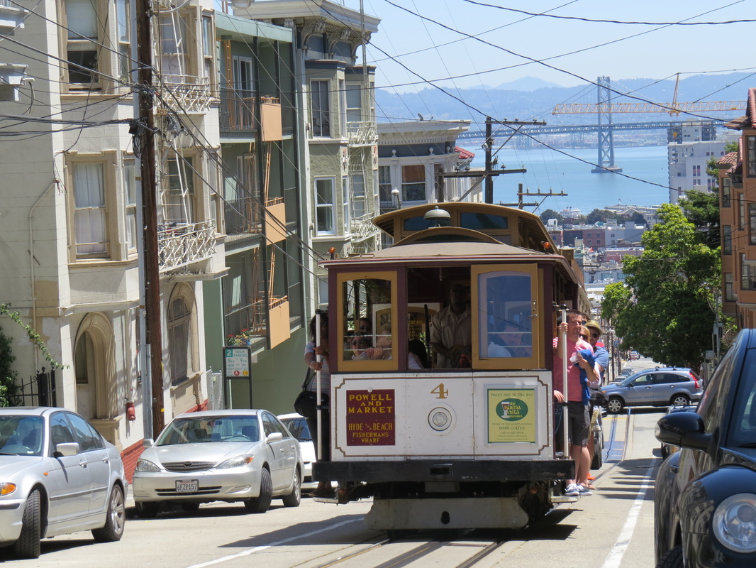
Looking down toward the Bay Bridge as a cable car comes up the hill along Jackson Street.
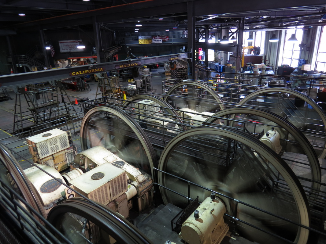
The works with in the Washington-Mason power house.
|
The Cable Car Museum was not a long stop, maybe 30 minutes, but I did get a lot out of that time there; definitely worth the visit to get the historical perspective and the technical understanding of these iconic vehicles (here's my review). But back outside, I decided it was time for lunch and I knew that Rogue Ales Public House was not too far away. Besides, a beer was sounding pretty good right about now. By now my phone had a better idea of where we were, so north on Mason to Union and just about a block east to my goal, enjoying the architecture and views toward the bay as I walked along.
It was just before 1:00 when I walked in the door of the pub. The place was open, but apparently deserted, which did not seem to be a good sign this close to lunch time. But I grabbed a stool at the bar and checked-out the beer list scrawled on a nearby blackboard and also found a menu. Shortly the bartender came in from the back where he had been helping with stocking. We talked a bit about Rogue and the many options for beers on tap at the Ale House. As I’m an IPA fan, he suggested The Brutal IPA, so I had a pint of that. He also provided some guidance on the menu. There are a lot of great sounding options. I had looked at the menu on-line prior to the trip, so I had a few ideas in mind already. I figured I would enjoy this first beer then worry about the food.
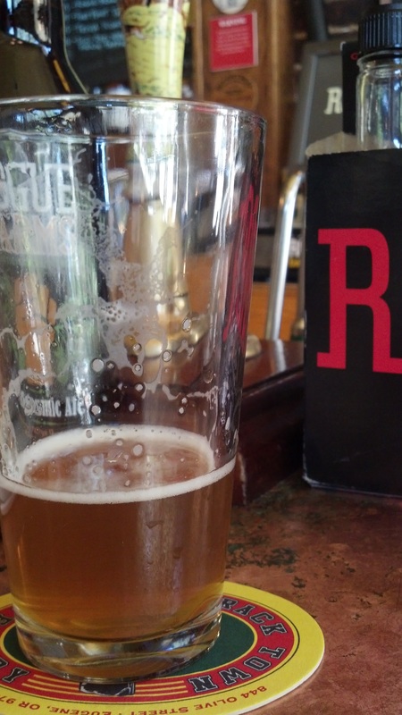
Almost time for another beer at Rogue Ale House.
|
This is an interesting tavern. It definitely has that “neighborhood pub” kind of feel, but also with a bit of an eclectic vibe with the murals and other decorations. The variety of tap handles arrayed behind the bar was the most interesting feature to me, of course. My perch at the corner of the bar near the main entrance was a good choice as I could enjoy the comings and goings into the bar and along the intersection just outside; another great people watching opportunity. But this afternoon the overall atmosphere was rather relaxed, but I can imagine that this is a hopping place in the evening and on weekends. I’ll take relaxed.
In the meantime, the crowd had started to pick up and there were 6 or 8 folks around the bar. Everyone else was getting flights of beer. Well there’s a capitol idea! So I flagged down the bartender and got an order in for a flight of five that included an assortment of Ales and IPAs: Single malt ale, Sigs Red IPA, Dad’s Black IPA, XS I-squared-PA and the Chipotle Ale. All were good, but none were really great. For lunch I opted for the Kobe bacon, cheeseburger (hey, I’m going to be walking all day, I think I can afford the calories). The burger was outstanding. (Review page)
While I was working my way through my flight, another patron walked in and pulled up a stool just around the corner of the bar from me. Chunky was his handle, although he wasn’t. Turns out that he was visiting from Ohio as well; small world. His wife and daughter were off shopping in the area, so he did what all good husbands should do and got out of their way.
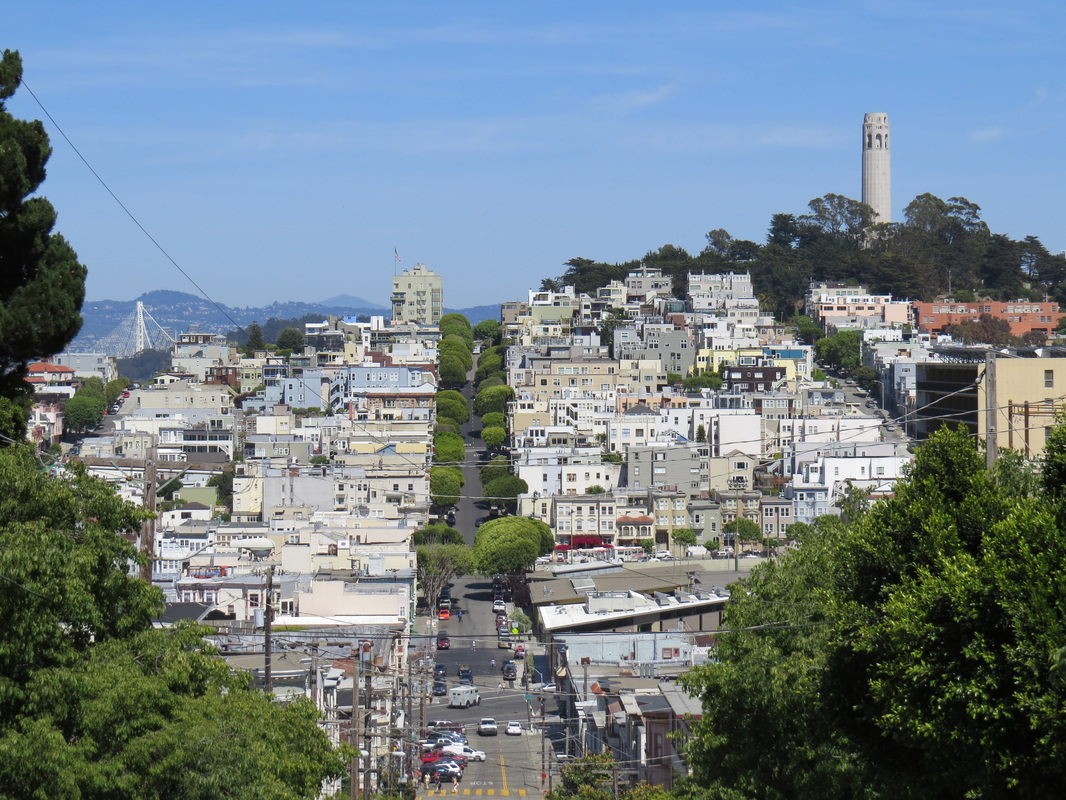
After lunch, I figured I would walk on up Telegraph Hill as I so close (I spied Coit Tower as I was walking up Union to Rogue Ale House). After crossing Columbus Avenue, I walked along Powell then right on Lombard Street and made the steep trek up to Pioneer Park and the Tower. I paused for the view over the waterfront and the Bay Bridge before making the last assent into the park. Turns out that the Tower was closed (this is the third time I have visited Coit Tower and it was closed two of those trips…oh well). Still nice views over the city from the top of Telegraph Hill.
|
Before heading out of the park, I found the public restroom. Let me tell you, this was the most space age outhouse I have even come across! Lighted signs with instructions, automatic doors, self cleaning. Quite the engineering marvel. I saw a second technology novelty on the way out of Pioneer Park as a Google Maps car cruised past; I wonder if they got my picture?
So back down Lombard Street. Decision time. The original plan was to just continue walking around the city, probably ending up along the waterfront for dinner and saving the Presidio for tomorrow. However, I got to thinking that I should head over to the Presidio this afternoon. One of the views I was looking for was of the Golden Gate Bridge from the beaches to the west of the bridge and it looked like the light for that shot would be better in the late afternoon rather than in the morning. Also, the weather for tomorrow was calling for much warmer temperatures (not as conducive for a long walk). Besides, after that monster burger at Rogue I doubted that I was going to be too hungry this evening. OK then, let’s just keep going west on Lombard, check out the “crookedest street” then trundle on to the waterfront and into the Presidio.
As I was climbing Lombard toward the famous section of that road, I past a couple who were wondering why they seemed to be the only people going up the hill. We chatted a bit; turns out they are from Florida, and commented that they are not used to steep hills like this. I told them that I’m from West Virginia and these hills are steep even by my standards. But we all made it to the curvy stretch of the street where there were a few dozen folks milling about talking photos as well as a steady stream of cars coming down through the short section of switchbacks.
After talking a photo for the Florida couple, I continued up the walkway adjacent to the brick twisty road to Hyde Street where I could see the historic ships at the Maritime Museum at Aquatic Park. As I was walking down the hill, I decided that I should give Lynn a call since she should be home from work by now, so I stopped adjacent to a semi-open area, which the map indicated was Russia Hill Park, and reported in. All was well at home, but big storms are expected tonight.
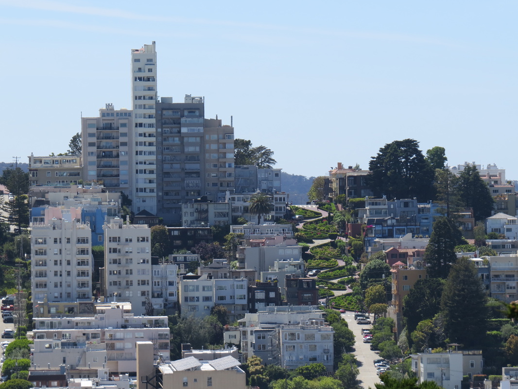
Looking west to the crooked part of Lomard Street from Telegraph Hill.
|
And looking west from the top of the switchbacks toward Coit Tower.
|
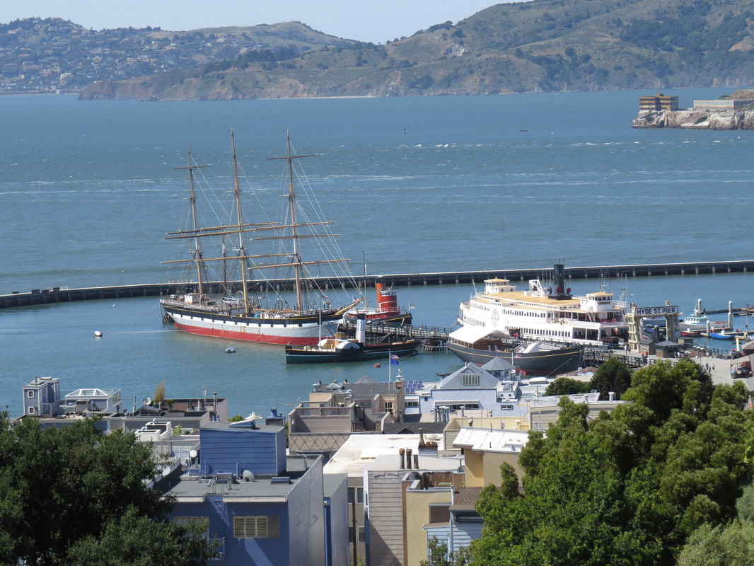
Aquatic Park from the heights along Hyde Street.
|
Once down at Aquatic Park, I headed west toward Fort Mason, with a detour out onto the Aquatic Park pier for a few panoramic views of the Maritime Museum with the city in the background and a look at Alcatraz. I used Alcatraz as a model to play with the zoom on my SX50, getting a few close-ups of some of the features (just testing out the abilities of the camera). Plus I snapped a few shots of the seagulls in the area. They were flitting about “helping” the fishermen on the pier.
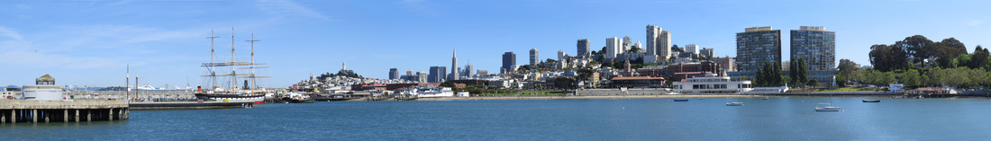
Vista including the Maritime Museum with the San Francisco skyline in the background, from Aquatic Park pier.
|
By now it was nearly 4:00 PM, so I figured I should get moving if I wanted to get that beach view of the bridge. So I chugged around Fort Mason, past the yacht clubs, through Crissy Field and finally up the hill to the Visitor Center at the Golden Gate Bridge Pavilion. Fortunately I was just in time to snag a couple bottles of water at the Beach Hut Café as I started along the Golden Gate Promenade. Along the way I saw a few interesting birds, including a Snowy Egret strutting in the swallow water.
Crissy Field was sporting a collection of huge steel sculptures. These really were ginormous pieces of art (well, depends on your tastes in art, I reckon). There were a couple that looked like dragons or dinosaurs; another reminded me if a huge antiaircraft gun (appropriate for a military park). While interesting I was glad to learn that they are temporary.
|
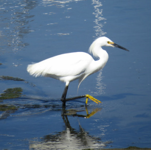
Snowy Egret (wetlands east of Crissy Field).
|
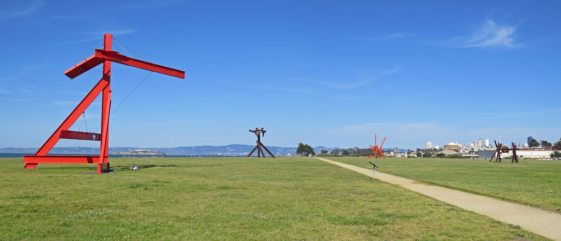
Some of the huge steel sculptures by artist Mark di Suvero. There are eight of these works of art arrayed around the field as part of a free, year-long exhibition that ends shortly (May 2014).
Finally at the Visitor Center, I asked one of the volunteers there about the trails down not the beach areas along the Pacific Coast. She wanted to send me to Baker Beach, but I was pretty sure that Marshall Beach, more to the north and closer to the bridge, was the place to be. She pointed out the trails on a map, just saying that the trail down to the beach was steep. I took a quick look through the gift shop, then over to the little snack shop for more water before hitting the trail again. The trail from the Pavilion area goes under route 101 so that you get a view of the underside of the bridge then connects to the Coastal Trail and the Batteries and Bluff Trail that weaves through the old coastal batteries. There are some great viewpoints from atop of some of the old concrete gun emplacements.
Once past the batteries, I took the trail that worked down the bluffs toward the beach. I could see a few folks on the beach well below the top of the bluffs. OK, that will be a haul getting there…and back up. But I’m here now, so time to get crackin’. This is a great hike and the trail is in wonderful shape. There are terrific views all along the trail, looking back toward the bridge, along the coast and out over the ocean. I took only about 30 minutes to get from the Visitor Center to the Marshall Beach, including time to stop for photos and climb around on the old gun emplacements. Once down on the beach, I headed north up the coast toward the bridge, looking for “the shot.” I saw a gazillion pelicans flying about and perched out on the big rocks just out off the beach as well as a couple long-billed curlews.
|
To get to the part of the beach to get the angle I was hoping for I had to navigate around a rocky area that sort of divided the beach into two areas. As I was walking around one large rock a beach-goer was approaching from the other direction. Did I mention that he was a nude beach-goer? I was NOT expected that. To each their own, I guess.
Once around the rocks, I had the view of the Golden Gate Bridge that I was looking for. And I had pretty good light on the bridge, so the plan was working out. There were also a few more beach-goers in various states of dress, so I opted to stay around the rocks to get my photos of the bridge. I got the shot of the bridge and the shore that I was looking for and I kept the sun-worshipers out of the frame.
By the time I was done with the photo ops on the beach (bridge and birds, not sunbathers!) it was after 6:00, so I figured I should start heading back to the Herbert. Plan is to head back to Aquatic Park and catch the Powell-Hyde cable car back to Union Square.
|
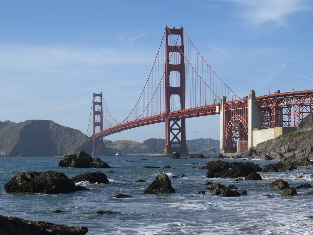
Golden Gate Bridge from Marshall Beach.
|
So I’ll be retracing my steps back through along the Coastal Trail, under the bridge and through Crissy Field but I’ll have different lighting and maybe new things to see along the way. And I was ready to head back after walking for about 5 hours. I did tweak the return route just a bit and walked along
Lincoln Boulevard to the Crissy Field overlook, which did provide a great view
over the historic airfield.
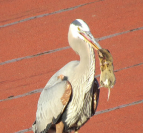
Great Blue Heron and friend (click the photo to see video of how this encounter ended).
|
My little detour to Crissy Field Overlook paid off as I saw a very unique sight from the animal kingdom. As I was enjoying the vista, a Great Blue Heron flew into view and landed on the roof of the old hanger directly in front of me. As he was gliding in, it was apparent that the big bird had captured dinner as he had something in his bill. No, wait, not in his bill but rather impaled on his bill. And it is not a fish, it is some sort of little mammal, maybe a muskrat? Anyway, I stood there and watched as the Heron worked to get his next meal unstuck, which he finally did, and once he did, it was quickly swallowed whole. That was no small critter, but it went right down. I got a decent video of the ordeal (click the photo at left to get to the video). Marlin Perkins would have been proud.
After the nature show, I headed down the hill to Crissy Field and saw another animal adventure, this time a huge hawk landed in one of the pine trees and from that vantage point located his dinner which he drove on then flew off to one of the light poles with his snack. It must be “Wild Kingdom” night here in the Presidio!
|
On down the field there were folks flying some pretty high-tech kites which made sort of an interesting combination with the hulking steel sculptures. But I did not hang around too long as I was starting to drag and my usually reliable feet were starting to complain. But there was still more to see with the pelicans, gulls, egrets and hawks along the wetlands. I also saw several photographers setting up along the shore, aiming at the bridge. Duh, they’re after the sunset (I must be getting tired, as I was not even thinking of that!). It did turn out to be a nice sunset, not spectacular from a big view perspective, but I did get a nice shot of a tighter view of the golden sky with the bridge and a pelican in silhouette.
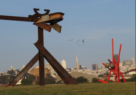
Crissy Field: sculptures, kite and skyline.
|
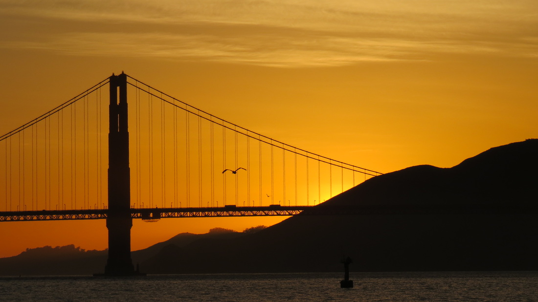
Golden Gate sunset.
|
It was getting dark by the time I was hiking by Fort Mason but there were still bikers, hikers and walkers out on the trails. Fortunately the line at the cable car terminal was short, but unfortunately long enough that all the outside seats were taken. That’s fine; it is just nice to sit for a while. Even at this time of night, there were plenty of folks jumping on and off the car all along the route. More people watching to end the evening.
I was back at the Herbert about 9:40. I just checked-in, headed to the room and crashed. It was a great day of see the sights of a wonderful city and I covered a lot of good ground. Tomorrow was meant to be the big hike through the Presidio and around to Lands end, but I’m thinking that that I’ll cut back and just focus on the Presidio in the morning then head on to Mountain View in the afternoon so that I can catch up with colleagues for dinner. But now it is time for a well-deserved rest.
Below is the map for my meandering today. Yeah, I’m sort of all over the place…stream of consciousness certainly applies. The yellow trace is my outbound trek (from The Herbert, to Coit Tower, then all the way over to Marshall Beach) and the orange is the return trip from Marshall Beach to the Hyde-Mason cable car terminal at Aquatic Park (the green trace is the cable car route back to The Herbert). Some of the vista points and the key points-of-interest are identified by the blue markers (click on the map to get a larger image). I also posted the track I took today on EveryTrail (the story is a slightly abridged version of this journal and only part of the photos are linked to that map; go to the fullscreen view to focus just on the map, photos or track data). I reckon this was a 16-mile urban hike (plus a couple miles on the cable car getting home). Good ground covered today!

Day 1 route and main points-of-interest. Click on the map for a larger image.
Day 2 – Tuesday, May 13: Up at 0400 when Lynn called to report the damage from the storms that rolled through last night (she forgot about the time difference, but that is completely understandable with the storm issues). The driveway was washed out! Worse flooding ever, but no water in the house. I offered to cut the trip short and come home, but she has it covered. With the drive way out, Lynn will not be going anywhere until the repairs are in place; fortunately she already has the repair crew mobilized. It is a great advantage to be married to an engineer! Good thing that I did come out on Monday or I would have been stranded at home.
New plan for today. I’m taking the bus to the Presidio this morning (I’m a bit out of sorts, probably from the big hike yesterday and knowing that all is not in order at home, but there’s nothing to do for it, so on we all go…). Since my plans have evolved and I’m making an easier day of today, I was in no great rush to get rolling. I checked the bus route and schedule in the handy 511 app I installed on my phone prior to the trip and figured out that the number 38L bus would pick me up at Geary and Powell and deposit me near enough to the Presidio that I could either walk in or transfer to another bus (number 43) that would take me into the park.
|
After packing, check-out and storing my gear in the closet at the Herbert (review page), I headed up to Geary Street to catch the 38L westbound. Two bucks seems like a deal to me to cover that ground out to the Presidio. Plus this is another great opportunity to people-watch and to see more of the city. Seems that everyone uses the bus: many young professionals, the women dressed nicely but wearing comfy walking shoes (I suppose that their heels were stashed in the over-sized bags that each one carried), school kids mostly of the junior high age and of course tourists from all over. I reckon the ride took about 30 minutes to get from Powell Street to Masonic. Once off the bus, I decided not to wait for the transfer as it was only a few blocks to the park entrance. Besides, by walking I’ll get to cover more of the ground in the park on foot this morning and perhaps have a better chance of seeing more critters (I know, if I were really serious about seeing birds or whatever, I would have been on the move a little earlier). Anyway, I was at the park entrance at the southeast corner of the Presidio right at 8:30 and started my exploration by walking along Lover’s Lane.
|
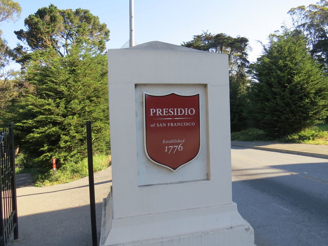
Entrance to the Presdio. Lover's Lane is the trail going down the hill to the left.
|
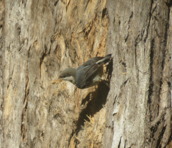
Pygmy Nuthatch along Lover's Lane in the Presidio.
|
It was another lovely day for a walk, albeit a bit warmer and muggier than yesterday. Still pleasant enough this morning, but I could tell that it was good to have done the major walk on Monday with the more tolerable temperatures (the forecast for today was mid-90s F). But the next three hours were quite nice and gave be time to check out a few more miles of trails in the park.
Lover’s Lane is a nice walk through a mostly wooden area. It seems to be a favorite of joggers. The trail was named as it was the path taken by the young military men stationed at the Presidio to get to town to visit their sweethearts. Near the north end of the lane I came across a small brick bridge that crossed a little ditch and there were several birds flitting around the area. Of particular interest were Western Tanagers, a Pygmy Nuthatch, and some sort of hummingbird. The hummingbird was hovering around a large tree and appeared to be really studying the bark of the tree. Not sure exactly what it was up to.
|
|
After Lover’s Lane, I meandered through the heart of the Presidio, including walking the perimeter of the Main Post area. I wanted to check out the Visitor Center on Montgomery Street, but it was closed today as were the other museums along the street (everything was closed on Tuesday). Then I walked along Lincoln Boulevard past the National Cemetery and down the hill to the old stables. I wanted to turn north on McDowell Avenue to get to Crissy Field, but there was construction off in that direction and the signage in the area was not clear if there was a safe path through. So I took the longer route back up the hill to the Crissy Field overlook and back down the path that I had taken last evening. No worries as there were more birds to see along the route; more hummers and Tanagers plus a few sparrows. My goal for this part of the walk was the Warming Hut to get a light breakfast and a couple bottles of water for the remainder of the morning. I spent a little time looking through the gift shop and the books, especially the bird books. Hey, that was a Snowy Egret I saw yesterday.
|
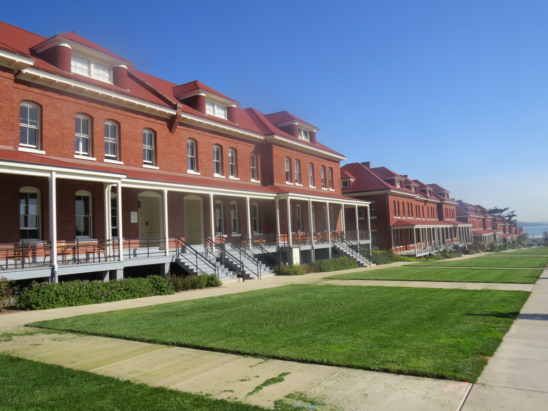
Historic buildings along Montgomery Street in the Main Post section of the Presidio.
|
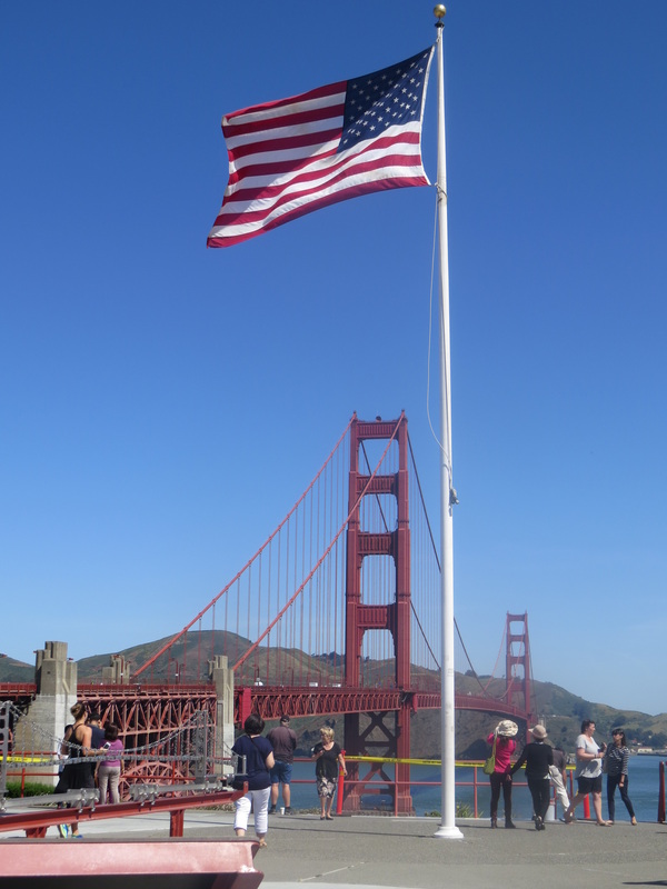
Old Glory flying above Battery Lancaster at the Golden Gate Pavilion.
|
After breakfast and a few shots of the bridge from the shore (Fort Point was closed so I opted not to walk down there) I walked up to the Visitor Center at Golden Gate Pavilion. I just wanted to get an opinion on hiking options. However, the lady I talked with was focused on sending me to the Palace of Fine Arts; just not what I was in the mood for (I’ll save that for a trip with Lynn). So I just struck out on my own along the Presidio Promenade, past the Crissy Field overlook, down the hill along Crissy Field Avenue (there is a wide gravel walkway adjacent to the road), under the bridge construction (there was a safe route after all) and along McDowell Avenue to the start of the Park Trail.
The Park Trail roughly parallels Veterans Parkway and cuts through part of the golf course then bends around Mountain Lake. The golf course looked to be a popular track and also looked to be in very good shape with lots of elevation change in the few holes that I saw. I should check this out next time I visit (maybe I can send Lynn to the Palace of Fine Arts and I can play golf…no, that will never work).
As I was nearing the end of the trail, almost to Mountain Lake, I came upon a steep bank that was somewhat overgrown. But the grounds crew at the park had a very good solution for getting the tall weeds in order: goats! Hey, the critters seemed very happy to trim the verge, as it were.
My walk in the park ended with a loop around Mountain Lake. A pretty setting and there were a few birds in the area (Stellar Jays and a few ducks, mostly), but overall it was a bit underwhelming. Eh, but not every place in any park will speak to you, right? Still, it provided a nice, shady bench for a short sit before heading to the bus stop. I took that break as my opportunity to get my bearings and timing for the bus schedule.
|
As I sit back now and think of my visits to the Presidio, it seems there are areas that always have a fair number of folks, like Crissy Field and the Golden Gate Bridge Pavilion, but many of the trails that I walked in the interior of the park and even along the western coast were fairly quiet in term of other folks. I did pass a few people along the trail down to Marshall Beach (and most had clothes), but I had most of the other trails pretty much to myself, which was very nice and a little unexpected, given the population of the area. Maybe that was due in part to visiting on a weekday.
I exited the park along Veterans Parkway and headed along Funston Avenue toward Geary for the bus stop. This was a 7.4-mile jaunt from the time I got off the 38 bus until I hopped on the 38L. Just after I crossed Lake Street an emergency siren sounded; just like the tornado warning sirens we have in northern Ohio. Holy crap, what could that be about!?! As I ascertain the situation, I note that no one else is reacting to the blast. The horn goes silent as I was passing by a couple locals who had been standing patiently waiting to resume their conversation. I quipped to them as I past by that there should be a “this is a test” message with the siren. The reply was that this was just the regularly schedule monthly test, so not a big deal. Yeah, I guess our monthly test of the tornado sirens is not accompanied with any description either. I reckon it is just whatever you’re used to.
The map below shows the route I took through the Presidio, from bus stop to bus stop (click on the image to get a full-screen version). I also have an interactive map on EveryTrail for my Day 2 excursion (the description is very similar to this journal).

Day 2 walking route through the Presidio. Click on the map for a larger image.
|
I left the Presidio about 12:15, caught the number 38 bus back to Powell Street, grabbed my bags at The Herbert and was on my way to the BART station just before 1:00. The BART got me back to SFO where I jumped on the AirTran to the rental car terminal, again hitting it lucky as there was no line at the Enterprise counter. They had adopted a wireless tablet system for check-in on the garage level which really sped up the entire process. I was on the road in no time. One last stop before transitioning from “free day” to a work trip, and that was lunch at Chipotle in Millbrae. It is impossible to have a bad meal at Chipotle.
So the return free day by the bay was another great adventure and an outstanding couple of urban hikes (close to 24 miles for the two days). I covered a lot of ground, saw some interesting sites and a few interesting birds and sampled a few beers. Yeah, overall a very good time. But there is still more to see and do. Next trip I’ll have to check out Land’s End and spend some time in Golden Gate Park, plus I should explore the area at the northern end of the Golden Gate Bridge. So many places to explore!
|