Trip Journal: Return to Glacier
Thursday, August 3, through Sunday, August 13, 2017
Part I: Based at Rising Sun; Along the Going to the Sun Road and Two Medicine
Getting Ready to Get Ready. We really enjoyed our first trip to Glacier National Park in August 2009, so much so in fact that we knew we wanted to return. There are just so many wonderful hikes, beautiful vistas and wildlife galore in this rugged park. But there were also a lot of other wonderful places on our list, so Glacier went to the back burner for a few years, just waiting for the right time for our return. The right time occurred in August 2017, eight years after our first visit, a year later than originally planned, with about three years of discussion and planning since we started really getting serious about our return trip.
The discussion for a return to Glacier officially started on June 28, 2014, when Lynn stated that she wants a trip to Glacier that will focus on Many Glacier but also include a couple of nights at Sperry Chalet. We talked about options while sitting on the front patio over a White Rajah (after two Dirt Wolf IPAs). We decided to shoot for the second half of August 2016 for this trip and while we were originally thinking of returning to Sperry Chalet, the starting plan will focus primarily on the Many Glacier area.
Our next serious discussion on the trip was not until December 22, 2014, but I had been working on the plan a bit since our last talk. Looks like we will lock in on August 2016 for this trip. Lynn and I discussed it a bit and looked at options for including Waterton and perhaps even Banff (per a TripAdvisor forum thread that had all three destinations in a trip, using Calgary as the entrance/exit point). But after further review, we decided that perhaps it was a bit much for a week-plus trip particularly with the border crossing logistics (what to do with the bear spray?). So now we are back to just a Glacier trip with the focus on Many Glacier (4 or 5 nights, give or take) with maybe a day trip to Waterton (Red Bus excursion would be perfect; I thought they used to do that when we were there in 2009, but I could not find it listed on the Xanterra website). We will also include a couple days elsewhere in the park (maybe Rising Sun along GTTSR or perhaps the Polebridge area on the west side of the park…more research required). Lodging reservations for August 2016 open on 1 August 2015, so we have some time to figure out the details of the plan before we make commitments. Lynn asked about inviting Lisa. Fine by me.
By the end of March 2015, we had our plan sketched out. We're thinking 3 or 4 nights at Rising Sun (east side of Logan Pass near St. Mary Lake along GTTSR) and 5 nights at Many Glacier staying at the Many Glacier Hotel. We'll include a day trip to Waterton National Park from Many Glacier (Lynn wants to go to high tea) and perhaps a day trip to the Two Medicine area from Rising Sun. Depending on the flight schedule we may have to stay a night at the start and/or end of the trip in Kalispell or Whitefish.
By the end of April our plan was coming together in terms of dates, locations and durations. We're thinking four nights at Rising Sun then five nights at Many Glacier and probably a night at either end in Whitefish for travel. As for dates, August is wide open (no conflicts with AIAA as P&E is in July and Space is in September; the only other thing to try and avoid will be Zoovies which will be on either the 19th or 26th). So a 12 day/11 night trip, perhaps target starting on a Friday (5th or 12th), but we can let the lodging availability dictate the actual dates. Starting on the 5th of August is preferred.
Now that we had starting plan in place, it was time to get into more detailed research. So in June 2015 while doing that very research for the trip, I found out that the Many Glacier Hotel will be undergoing major renovations during the summer of 2016 which could greatly impact our enjoyment of the trip (no access to the lake around the hotel, the deck will most likely be closed, limited availability of rooms, etc.). That was a major part of the attraction to the area as we so enjoyed our time out on the back deck of the hotel during our 2009 trip; hike in the morning and relax with a beer enjoying the view in the afternoon. Therefore, we decided to postpone the Glacier trip for a year and shoot for August 2017 or 2018 (depends on if we want to stick with Yellowstone and Grand Teton in 2017 or bump that trip back a year as well). That still left us with where to go for our major trip in 2016, but a quick check of our wish list led us to creating a tour of the National Parks in southern Oregon and northern California with Crater Lake as the focal point. We had the rest all sorted out by the end of December 2015 and decided that Glacier will be our 2017 trip followed by Yellowstone and Grand Teton in 2018, with the excursion to Alaska to follow in 2019 (or maybe 2020). I updated my calendar showing that Glacier lodging reservations for August 2017 open on August 1, 2016, at 0700 Mountain Daylight Time, so that I can get on-line as quickly as I can to secure our lodging options. With a park like Glacier, you have to get to the trough early or you will go hungry!
Over the course of the summer, Lynn and studied the lodging options and had our preferences set a week or so before the reservation period opened so that I was ready with my picks on August 1. We decided to shoot for a little on the higher end at Many Glacier with lake view, shared balcony rooms. Location is everything in the parks, in my opinion and getting rooms in the park is the way we like to go whenever possible. Getting a room with a nice view is just that much better. We opted for a motor lodge room at Rising Sun. Now we'll just see what we get.
August 1, 2016, rolled around and I was ready to make reservations. You never know how this is going to work in terms of getting through either on-line or via the phone. It seems that the reservations work a little differently for each park and with visitation on the increase that also adds to the unknowns. But I was able to get on the Xanterra website, reserve the exact rooms that we wanted and for the dates we planned. I love it when a plan comes together!
Now that the hard part was out of the way, I started looking at the rest of the travel logistics. Flights and a rental car were next. I looked at several options but none were ideal and the fares were rather steep. We ended up deciding to go out a day early in the evening and staying in Kalispell for the night before heading into the park. I found a good deal on a SUV from Enterprise at an off-airport location, and a hotel within walking distance to the rental car pick-up. By early February we had everything locked in.
Of course I was also looking at the fun part of the trip while working the logistical details, the fun part being the trails that we'll be hiking and other possible excursions. We had a few hikes on the list already, like the Highline Trail, Hidden Lake and Grinnell Glacier. But there were plenty more to explore. There's plenty of information online about hiking in Glacier. As usual, the TripAdvisor forum was my starting point, following by the Glacier pages from the National Park Service website. TA pointed me to hike734.com, a site set up by a guy named Jake who hiked all 734 miles of trails in Glacier in a single season! His site had great information and I bought his trail map (plus the maps for Yellowstone and Grand Teton). That map was very helpful. I came up with a general plan, knowing full well that it would likely change based on weather, fires, bear sightings, etc. I also knew that we'd check in with the Rangers once we were in the park to get the most current hiking suggestions.
Speaking of bears, bear spray is a requirement for hiking in Glacier. For our first trip to Glacier and our two Wyoming trips, we just bought bear spray when we arrived then just donated the canisters to the Park Service when we left. As I was looking for some place to buy bear spray for this trip, I found out that it is possible to rent the canisters for $32 each from Glacier Outfitters in Apgar Village which would save us a little money and should be fairly convenient.
I followed Glacier's Facebook entries during the spring and summer. They got a lot of snow this winter and spring was late arriving so the GTTSR did not open until nearly July. There were also a LOT of visitors. Over 600K in June which crushed the old record (while we were at the park the July visitation was posted: over a million which was another record-breaking total!). Parking lots are filling very early. The park was using their Twitter feed to let folks know when parking lots are full. I set up a new account just to track the parks. Through early July Logan Pass parking has been filling by 9:30 at the latest and usually much earlier. That will be one day we will be on the road early for sure!
The Plan is Set. On Friday, July 14, we officially started the packing process as the hiking gear boxes where brought up to our "staging area." We did get our passports out of the lockbox last Wednesday in case we decide to make the drive to Waterton (Lynn wants to go for "high tea." If we do that, I just hope they have decent beer…something other than Labat's, please). A few days before the trip I posted our planned the itinerary on the TA Glacier Forum. As always I received some good comments. The regulars on the forum all felt that we had a good starting plan in place with a nice assortment of hikes, so there were just a few suggested tweaks. Sounds like Super 1 in Columbia Falls is the place to stop for supplies on the way to the park. Supposedly has a great craft beer selection. Several folks suggested Patamakin-Dawson loop for our Two Medicine hike, citing it as maybe the best hike in the park, but at 18 miles that is more than Lynn wants to attempt. Still, it sounds like a great hike. Of course the standard plan for each day in the park is to get out on the trail early for a great hike, then come home and chill during the afternoon with a cold beer and finally dinner. We'll keep breakfast simple and lunch will mostly be trail snacks. Here's our going in plan (the actual order of the hikes listed could change depending on weather and how tired we are from day to day):
Day 1: Thursday, 3 August - travel day. We'll arrive in Kalispell in the evening and stay in Kalispell at the Greenwood Inn and Suites as it is fairly close to the rental car pick-up (2 miles, so walkable or I can grab a cab which I confirmed do exist in Kalispell). Lynn and I depart CLE late afternoon with a short layover in Denver before continuing to FCA, arriving at 9:15. Lisa is coming from PIT through Minneapolis and should get to Kalispell just a few minutes after us. We'll take the hotel shuttle to Greenwood Inn and crash for the night.
Day 2: Friday, 4 August - supplies and on to the park. No rush this morning. I'll pick up the rental car at Enterprise when it opens at 0800. Buy supplies at the Super 1 either in Columbia Falls or Kalispell (that location is very close to the Greenwood Inn, so it might be more convenient) then head into the park. We'll renew our America the Beautiful pass when we enter the park and stop in Apgar to get our rented bear spray. After that, we'll just take our time and enjoy the drive across the GTTSR. Night 1 of 4 at Rising Sun Motor Lodge (Motor Inn rooms reserved). Plenty of time to get to Rising Sun as check-in is not until 4:00. Once we are settled, we might try for an afternoon hike (Hidden Lake or maybe a waterfall hike or Otokomi Lake since the trailhead is right behind Rising Sun).
Day 3: Saturday, 5 August - Logan Pass. We'll get an early start (OK, this should be standard procedure for each day) to beat the crowds and avoid the parking woes at Logan Pass. We'll hike the Highline Trail from Logan Pass down to The Loop then ride the shuttle bus back. Depending on how we feel we might also try Hidden Lake (if we did not complete this trail on Friday). Night 2 of 4 at Rising Sun.
Day 4: Sunday, 6 August - Two Medicine. I figure is it about an hour drive time from Rising Sun to the Two Medicine Ranger Station. Our best bet looks like Scenic Point but we'll check at the Ranger Station before hitting the trail to get the latest conditions, closures and advice. Depending on what time we get back, perhaps we'll have dinner in St. Mary somewhere. Night 3 of 4 at Rising Sun.
Day 5: Monday, 7 August - Hiking somewhere along the GTTSR. This is a bit of on open day, although we will hike somewhere. My going in thinking is Siyeh Pass and/or Piegan Pass. Night 4 of 4 at Rising Sun.
Day 6: Tuesday, 8 August - Transfer to Many Glacier. Maybe a short hike near Rising Sun (along St. Mary Lake, to one of the waterfalls; probably not enough time for Otokomi Lake). Check-out is at 11:00 and check-in at Many Glacier Hotel is not until 4:00, so plenty of time and no rush. This will be shopping day for the girls as we'll hit the Visitor Center at St. Mary (if we have not already been there) and the shops in St. Mary. We'll grab lunch in St. Mary or Babb as well (Two Sisters most likely). Night 1 of 5 at Many Glacier (Lake view rooms with shared balcony for the view!)
Day 7: Wednesday, 9 August - We'll hike somewhere in Many Glacier. There are plenty of options for hiking in the area. Iceberg Lake and/or Ptarmigan Tunnel are high possibilities for today. We'll also make a few evening walks out to Fishercap Lake to look for moose while we are in Many Glacier. We'll check in at the Ranger Station for the most up to date conditions and trail suggestions. We'll figure out dinner as we go, but I know that we'll head over to Swiftcurrent Lodge for pizza at least one night (most likely more!). Night 2 of 5 at Many Glacier.
Day 8: Thursday, 10 August - Grinnell Glacier. I already have tickets reserved for the three of us for the 0830 hiker’s shuttle boat rides for the Ranger-led hike to Grinnell Glacier. Night 3 of 5 at Many Glacier.
Day 9: Friday, 11 August - Waterton National Park. We'll take a day off from hiking and drive up to Waterton for a look around and high tea. Perhaps we'll get dinner in St. Mary or Babb since we are already out of the park. Night 4 of 5 at Many Glacier.
Day 10: Saturday, 12 August - One last hike in Many Glacier. Whatever trail we have not done already will be on the docket for today. Last hike for the trip. Night 5 of 5 at Many Glacier.
Day 11: Sunday, 13 August - Travel day. On the road from Many Glacier by 0730 as it is about 2.5 hours from Many Glacier to the airport (Glacier International, FCA) and we'll have to return the bear spray and the rental car. Our flight departs at 12:30 and we get back to CLE about 7:50 after a stop in Chicago.
Plus we already decided to add Monday as a vacation day so that we can have a day to rest a little and start getting caught up at the house instead of just jumping straight back into work!
Tuesday evening before we left was just prep work and a few chores but in general no rush. We'll have a long list of items for Wednesday but that is just the way travel works. But tonight it was just mowing, some cleaning, normal cat chores and a little more packing. We opted for dinner at Lager Heads where we talked about options for our 30th anniversary next year: Disney, Death Valley, Sedona, Florida Keys, San Diego, St. John; one of the last two is probably the most likely. We were almost too calm with a big trip just around the corner. And while Wednesday evening was a little more hectic, we were done with the chore list at 8:40. Time to kick back with a pre-vacation beer. Turns out that the timing for this trip is ideal as the past three months have been quite hectic at work. I have not started to wind down yet, that might take a few days. And I'm a little concerned about the tight flight schedule tomorrow as I have experienced a number of delays during my past few business trips so I'm in a bit of a funk this evening. But that will pass once we get to the park and out on the trails.
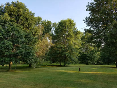 Neatly manicured front yard at the ranch as we were leaving this morning.
Day 1, Thursday, August 3, 2017 - Heading west. We finished the final details of prepping the ranch and the last bits of packing. We'll get in half a day at the office then go over to Hopkins. No issues other than the round-about, construction-impacted route to work. One meeting, a telecon and a few quick action items completed and it is time to go. At 12:40 I was walking to the car to go and collect Lynn. She was standing curbside. Let's get this vacation started!
Once at Hopkins we had a minor bad break as the onsite parking was full so we cruised over to the nearby offsite Park Place lot on Snow Road. Their shuttle got us back to CLE in short order. The few minutes of additional time parking offsite is balanced by the couple bucks we'll save on the parking cost. Minimal lines at United check-in and through security (we had TSA pre-check but honestly I bet the premier line for United would be shorter, but at least this way I don't have to take off my shoes) so we were in the concourse at 1:15. Pretty quick. Yes, we are at the airport much earlier than need be based on our 4:55 departure time, but I think we are both just ready to get out of the office and into vacation mode. Besides, we have time to grab a late lunch since we won't have time to get anything in Denver due to the short layover. Plus we have a couple United Club passes to burn before they expire.
Once at Hopkins we had a minor bad break as the onsite parking was full so we cruised over to the nearby offsite Park Place lot on Snow Road. Their shuttle got us back to CLE in short order. The few minutes of additional time parking offsite is balanced by the couple bucks we'll save on the parking cost. Minimal lines at United check-in and through security (we had TSA pre-check but honestly I bet the premier line for United would be shorter, but at least this way I don't have to take off my shoes) so we were in the concourse at 1:15. Pretty quick. Yes, we are at the airport much earlier than need be based on our 4:55 departure time, but I think we are both just ready to get out of the office and into vacation mode. Besides, we have time to grab a late lunch since we won't have time to get anything in Denver due to the short layover. Plus we have a couple United Club passes to burn before they expire.
Once through security we made a stop at the bookstore for Lynn but she was not ready to make a decision. That's the downside of being early, she knows we have plenty of time to kill so she can come back after lunch and browse some more. We continued down the C concourse to Bar Symon, the new place in CLE. Basically pub food but a great selection of craft beers on tap. And today is National IPA Day, a perfect way to start vacation. We each had our favorites, Lynn a White Rajah and a Headhunter for me. That is tasty! Yep, perfect start to the trip. Turkey sandwich on sourdough with fries for me. Lynn had the chicken sandwich and a salad since she is not a fan of shoestring fries. I should have had a salad as well, but it is now vacation so I get a little splurge.
We discussed hiking options over lunch. Looks like our trails are mostly in the 6 to 10 mile range so if we stick to that we will rack up some serious mileage and see some wonderful scenery. We also wondered how Lisa would make out as she is not feeling well. Even though she was at the doctor this morning she is still coming along. As predicted, we went back to the book store after lunch. This time Lynn found a couple paperbacks to add to the ones already in her backpack. She's a crazy fast reader. Me? I would rather take a nap.
Back down the C concourse to the United Club as we have two hours before boarding starts. Not very crowded in the lounge and certainly more comfortable than hanging at the gate. I had been watching the weather and while there was nothing of concern that I could see I still got the dreaded flight delayed text from United. Bummer. And we have a tight connection in Denver. Nothing to do for it but wait and see. We are still scheduled to arrive in time to make our connection. I guess we will be running to the gate for the flight to Kalispell. Good thing that I got that nap while at the United Club!
We wandered over to the gate a little before 5:00. No additional delay of any significance. Still on track for arrival at 7:00 PM local time. This will be close. The flight was uneventful but long. Cap could not make up any time this trip. We touched down just after 7:00, made a mad dash from B25 to A33, arriving just in time to see our plane taxi to the runway. So close and yet so far. I was really ticked for about eight seconds, telling Lynn that I'm catching the next flight back to Cleveland, but I quickly settled into problem-solving mode and started looking for options to get on to Glacier. We were not alone in our travel woes. There was a gentleman delayed arriving from Florida due to weather and missed the Kalispell flight. Options for tonight were limited. We listened as the gate agent went through the choices with our fellow stranded traveler. We could either fly standby to Missoula with a 110-mile drive to Kalispell or take a confirmed flight to Helena which is 200 miles away from our desired destination. This second option was only available because the flight to Helena was nearly 2 hours delayed. We opted for Helena (pronouced HEL-en-uh when referring to the state capitol of Montana, as opposed to heh-LAY-nuh that I have always heard). The funny thing is after initial disappointment in missing the flight then getting the flight rerouted I actually felt fine, happy even. The funk that I had been in due to the flight delay was gone. I think my mood was due to the tight flight schedule and the high possibility of our travel being completely SNAFU'd. Now that we are on a more controlled situation, even if not per the original plan, I am ready to roll. Plus the gate agent told us that our flight delay was due to a medical emergency so United will owe us some compensation (we ended up getting $150 each in travel vouchers that I applied to our flights to San Diego for our 30th wedding anniversary trip).
Now that the new flight was secure we wandered back over to the Bravo Concourse to catch our winged bus to Helena. Well, we are getting our steps in today just trudging through the airports and we did not have to run on the return trip. Hey look, it's Rick Harrison from "Pawn Stars." He was exiting the train that runs between the concourses just as we were boarding. Inconceivable! No, wait, that was from the celebrity sighting coming back from Santa Fe. Still sort of cool.
Once at the gate I started working on logistics for our reroute. The hotel voucher that the gate agent provided was not helpful (neither the phone number nor website seemed to work). Not worrying about that. I just snagged a room near the airport in Helena. I canceled our room in Kalispell at the Greenwood Inn. They don't charge a cancellation fee so the room cost is a wash, so other than a little time, the only cost is the extra day for a rental car. I spent an extra 10 bucks to get the compact SUV at Budget which was the low-cost provider tonight. So we will have a 3-hour-plus drive in the morning, but we really won't lose any time since we were just winging it on Friday anyway. But on the bright-side, we'll see a little bit more of Montana when we drive from Helena to Kalispell.
Since we were seated at the front of the aircraft we were off first and quickly in the small terminal. The place certainly had the small, regional airport feel to it. Reminded me of Medford, Oregon, where we flew in for our Crater Lake trip last summer. It had a rustic, ski lodge look. But I like regional airports as they are easy to navigate and everything is right there in close proximity. The rental car desks were adjacent to the single luggage carousel, which was apparently out of order. I went to get the car while Lynn waited for the bags.
So I was expecting a Ford Escape or some similar smaller sized SUV. The only "similar" vehicle available was an Expedition. SUV, yes, compact, not even close. Sort of overkill, but any port in a storm. Quick and easy process getting the monster truck. I got the keys and walked over to where Lynn was standing with the rest of the weary travelers waiting for bags. One of the ground crew announced that all bags would come through the oversize baggage door as the belt was broken. We moved down with the rest of the herd. First bag off was a bright red one, just not Lynn's. I took a position where I could see the two loaded baggage carts through the open door. Hmmm, looks like the good news is that we made it to Helena, but the bad news is the luggage did not. Once all the other bags were dispersed and we were left holding nothing, we spoke with the lady in charge for the evening. She was extremely helpful and very nice but new to United so she did not know how to track our bags. We'll have to call in the morning but my bet is we won't see our gear until Saturday afternoon. But I have a credit card so we will just buy a few things to get us through a couple days if need be. The United agent did provide us with overnight kits which was very nice and helpful. OK, maybe the airlines don't care about Joe Traveler, but it seems that most of the employees still do. The adventure continues.
Off we went to get our ride. The big, grey SUV was parked right where the agent said it would be. We did a cursory inspection for damage, saw nothing of note in the dark of the parking lot, loaded up and drove the mile to the Comfort Suites. Nice truck with all the bells and whistles, including navigation. I think I would like to have this for the rest of the trip but this battleship might be a tight fit on the Going to the Sun Road. We were soon at the hotel, checked in and in our room at 11:20. Straight to bed...
Day 2, Friday, August 4 - On the Kalispell. I was awake about 0515. While we are in Montana we are still about 200 miles southeast of our desired location, but that's OK, we'll get there. Lynn called the airport about the bags but they were in the midst of the morning rush (the "rush" here is three active flights; I guess it’s all relative). The agent she spoke with said she would call us back once things calmed down. I did a quick search for stores in case the bags are still in limbo. Looks like Kalispell is a full service berg so we can pick up anything we might need when we get there.
Lynn was hungry so we opted for breakfast. Shoot, no wonder she was hungry since we had not eaten since 2:00 PM yesterday other than snack pack of pretzels on the flight. We went down to the lobby about 0615. Mediocre breakfast bar; maybe that's not fair as it was no better or worse than the last dozen or so complimentary breakfast arrangements for this class of lodging. We were ready to go about 0715, but not rushing this morning while we are trying to locate our stuff. The Helena airport staff seems to be working it.
At 0740, Tammy from United called. Our wayward bags were found still in Denver but they will be on the morning flight to Kalispell, arriving at 10:32. Shoot, our stuff is going to beat us there! We were on the road at 0750. Looks like 3.5 hours to cover the distance. Let's see what the Dreadnaught can do. Once out of town the speed limit went up to 70 mph. You have to like the west. Engine Room, this is the Captain. All ahead full!
OK, this kind of thing unfortunately happens during a trip; delayed flight, missed connection, misplaced luggage. But in this case it all worked out. In the grand scheme of things, our schedule really was not impacted, there was minimal cost since we did not get charged a cancelation fee for our room at Greenwood Inn and United will be ponying up some bucks for the hassle. Plus the folks we dealt with at United in Denver and Helena were very helpful so high marks on customer service. Lynn and I just decided to look at this as an opportunity to see a little more of Montana that we would not otherwise have toured. We just plugged Kalispell in to the Dreadnaught's navigation computer and wove our way through Helena to get to route 12 heading west out of town.
The route the Dreadnaught selected took us from route 12 along routes 141, 200, 83 and 35 to Kalispell. When we made the turn onto route 141, I stopped just to check that we were not heading off in the wrong direction since we seemed to going into an even more rural road, but the GPS had us on the most direct route so we kept cruising. Much of the early part of the drive was through rolling ranch land. Looked like lots of cattle and hay operations in this area. We just cruised along, taking in the sights. Hmmm, I wonder if they have catfish in Dog Creek?
The drive gave us an opportunity to get an early start on the critter list and we saw a fair amount of wildlife along the road. In fact, a few of the sightings were from the little varmints running across the road in front of us. Fortunately they all made it safely to the other side. The most interesting of these was a mink. We saw a lot of birds: American Pelican, Osprey, Great Blue Heron, Common Loons and a Belted Kingfisher were the highlights.
Once we turned north on route 83 the character of the landscape changed as we were driving up a valley past a series of long narrow lakes. This is also where we encountered smoke from the forest fires in the area. As we entered Seely Lake we drove right by the staging area for the fire fighters, a large area with a few olive drab tents. The field had the look of having seen a lot of activity and it was well trampled, but there was not much happening there this morning. I suspect that plans for the day had already been developed, orders given and the crews were already out doing battle. There was a lot of smoke in the area so the fires must have been close by, although we never saw any. The speed limit through this section was reduced to 25 mph in placed, I guess in part due to visibility. Lynn was a little concerned that we might hit a point where the road would be closed and we would have to turn back due to the fire. We could just barely discern the mountain ridges that defined the valley. It was just very smoky. But the situation improved as we continued north. We ran out of the smoke and into a sunny, blue sky. We rolled past more scenic lakes. There were some very nice cabins and small resorts at some of these, but not a lot of activity. In fact several looked empty. The largest of the lakes was near the north end of route 83, Swan Lake and there was more activity here with a few larger power boats out and folks enjoying the lovely day
While we enjoyed the drive and saw some nice scenery, we only made one brief rest stop in order to get to Kalispell as quickly as we could. The slowdown around Seely Lake added a little time to the drive but by 11:45 we were gassing up the Dreadnaught in Kalispell, so just under four hours from Helena. Next stop was Enterprise to get our next rental car. Lynn called them shortly after we were on the road this morning to let them know that we would be late, but they indicated they would hold our SUV. We ended up with a white Santa Fe which looked like it would work nicely for the three of us. Not as well appointed as the Dreadnaught, but I'm just looking for transportation not the Starship Enterprise. From the rental car place we drove to the airport to return the Dreadnaught and find our luggage. No issues with either. I just parked the Expedition in the rental car return area of the parking lot, dropped the keys at the counter in the terminal and found Lynn near the baggage claim. She was already hot on the trail of our stuff. We could see our bags in the locked cage area. Fortunately the attendant was walking up the hallway so we had no wait. She seemed happy to see us having heard of our travel SNAFU and she quickly got our bags for us. By 12:15 were had our bags loaded in the back of the Santa Fe and were on our way to collect Lisa. Lynn called to give her a heads-up that we were on the way.
It took us a couple tries to find the Greenwood Inn. The GPS on my phone got us in the right area, but the signage to the motel was lacking so we missed it on the way in. It is sort of snuggled up in a trailer park behind an industrial area. Now I understand the comment on the TA forum about this not being the nicest area of town. There was a stuffed bison in a glass case along the driveway leading to the main building. Sort of odd. Lisa was waiting in the lobby for us. I loaded her suitcase into the Santa Fe. Hey, this thing has a lot of room. With the third row of seats folded down there is plenty of space for our bags and Lisa is not cramped in the back. A much better vehicle for us than the Jeep Patriot we drove during the Oregon-California trip last summer.
Before driving off, I did a quick search on the phone for a place for lunch that featured local beer and good food. Blackslope Brewing in Columbia Falls looks like a winner and is close to Super 1 Foods. I locked that into the GPS and we were off. OK, now that the three of us and our bags are all together in our rental car in Kalispell I think we can call this vacation officially back on track. As we drove away from Greenwood Inn, Lisa told us of her travel adventures. While there were no issues getting to Kalispell, she had sort of a struggle getting to the hotel. She called about the hotel shuttle but was told that you had to reserve that ahead of time. I don’t recall that in my conversation with the hotel. They told me to just call and they would come and get us. She eventually sweet talked herself into a shared shuttle and got to the Greenwood. Nice enough place, she said, but nothing particularly special. But all of the travel woes are behind us now, time to find some lunch, get our supplies and head for Glacier!
"Baby" led us right to Backslope. We got there just after 1:00, so I was a little worried that that place might be packed, particularly after seeing that it was not a large facility. But there was space in the parking lot for the Santa Fe, so we parked and headed inside. Seat yourself, so we took a table in the corner. Once of the young lady servers arrived shortly to greet us and give us the rundown on the place and the beers. They had a couple IPAs on tap so Lynn and I each tried one. I had the Freedom and Lynn the Crooked Wind. Both were good by not great. The Freedom was pretty smooth for 75 IBU but a bit on the malty side for my taste. Hmmm, fried pickles. OK, let's try an order of those as well. They were a hit with the group. For lunch I ordered the red beans and rice which also had shrimp, Lynn had the lemon grass bowl and Lisa a burger, well done (she's weird). Quite tasty. OK, Backslope is a definite keeper.
After lunch backtracked the short distance to Super 1 to pick up supplies (simple stuff for breakfast, hiking snacks and most importantly beer and wine). I'm glad the folks on the TA forums recommended this place, it is one stop shopping and had everything we needed. The best news was that there was an excellent selection of local craft beers and we could mix and match to build our own six-packs. We built two! Lots of IPAs, in fact, I think all IPAs. Now we can have some fun! We finished our shopping, iced down the beer and wine and headed to the park.
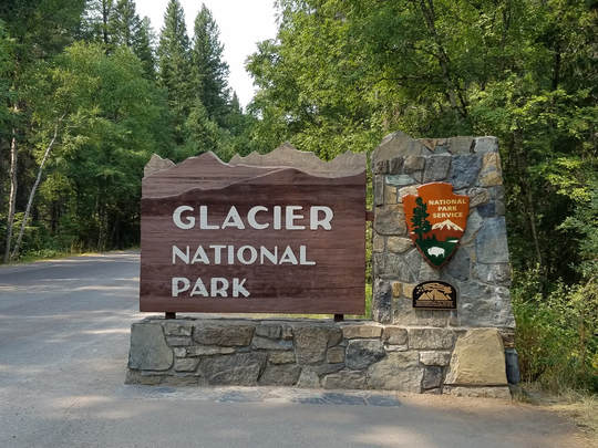
From Columbia Falls to the west entrance was only about 30 minutes, so it was about 3:00-ish when we arrived. Negligible wait at the entrance station, maybe one or two cars ahead of us. My park pass had expired so I spent the $80 for a new America the Beautiful pass. Best. Deal. Ever. After a quick stop to get our park entrance sign passport photo, we zipped into Apgar Village to pick up our bear spray and check out the shops. It was right at 3:15 by now and a lovely day; sunny and breezy at Apgar Village with the temperature reading of 71 F (for the record, it was 56 F when we left Helena this morning and 84 F in Columbia Falls). I guess it was more than breezy as there were whitecaps out on Lake McDonald. One of the staff at Glacier Outfitters said that they were not renting any kayaks this afternoon due to the hazardous conditions. Once the girls had finished their shopping we loaded up and headed east into the park.
I reckon it was about 3:30 when we left Apgar Village. Time for our first drive across the Going to the Sun Road for 2017. This road is an engineering marvel. It is also one of the most harrowing roads I have ever driven! GTTSR stretches 52 miles across the park, taking in some of the most spectacular scenery imaginable. Starting from the west side like we did, the road is pretty tame as it winds from the west entrance, past Lake McDonald and along McDonald Creek with the forested mountain side on your right hand side. This late in the afternoon there was not much in the way of traffic. There were a few sections of road construction, but they were quiet now on Friday.
We had thought about stopping at Lake McDonald Lodge just to let Lisa take a look but opted just to keep rolling along. Even though there was not a lot of traffic on the road, the parking at Avalanche Lake and Trail of the Cedars was packed. As we continued along, I saw our first big critter sighting in the park, a black bear on the hillside just above the road. I glanced in the rearview mirror to make sure that there was no one behind me (there wasn't) then slowed so that the girls could see. Lynn grabbed my camera and Lisa pulled out her phone, but the bear was quickly out of sight behind a tree. All they got was a bear butt. I rolled forward a bit, but the bear did not reappear on the other side of the tree. But we all saw it. First bear for the trip. Maybe that's a good omen for sightings later in the trip. As we pulled away Lynn commented that the tourists walking on the creek side of the road just a few yards away had no idea that there was a bear so close.
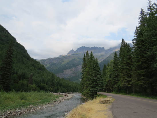
We made one other stop along McDonald Creek before the serious climb started. This was along a stretch where the view out the windshield showed the GTTSR climbing up the side of the mountain as it approached Logan Pass. That's way the heck up there. Since Lisa could not appreciate where we were headed from the backseat, I stopped at a pullout along the creek to let her get the perspective. While it was bright and sunny to the west of the pass, we could see clouds and fog pouring over the ridge from the east which gave a somewhat ominous look to the route we were about to travel. That is really quite the sight, looking up at that sliver of road carved into the mountain side a couple thousand feet above us. Just below us was the creek with its multicolored rocks lining the bed. But we have to get up and over the pass. Onward.
Shortly after our stop we started to make the climb. Traffic going with us up to Logan Pass was not too heavy but there was a steady stream of cars, shuttle buses and Jammers coming down the mountain. Parking was packed at The Loop and there were plenty of folks waiting at the shuttle stop. We'll be there sometime in the next day or two. On up we went, the road continuing its winding nature as it clings to the sheer side of the mountain. No speeding on this road. In fact, this is a road on which to pay attention. Whose idea was this anyway? The road I mean. It is an engineering marvel, that is a certainty, but it also seems to be the vision of a mad man! Honestly, it is a bit of a hairy drive. You really have to be aware of your surroundings; the edge, the overhang and the oncoming traffic. Hopefully everyone else is also paying attention. Actually, when you think of it, the Going to the Sun Road is a great example of a National Park adventure, with the wonderful views along every stretch of the route but no guarantee of your safety, just like out on the trail. But by following the rules and using common sense you should have fun and safe adventure.
As we continued up to the pass we could still see the clouds rolling over the ridge. This was looking to be just the opposite of the first time I drove this road. In 2009, when we drove from Lake McDonald Lodge to the Gunsight Pass Trailhead it was cloudy on the west side and completely socked-in at the Pass, but a hundred yards or so east of the Pass it was a beautiful, blue sky morning. Today the clouds were all to the east of the pass. The temperature has dropped significantly as we climbed the GTTSR to Logan Pass, down to 55 F under increasingly overcast skies. We saw an orange sign just short of the entrance to the parking lot at Logan Pass indicating that the lot was full, but there seemed to be several open spaces available that we could see as we cruised past. Maybe the sign had just not been updated?
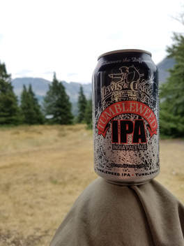 First beer in the park.
We arrived at Rising Sun at 5:25. Not much happening here. Cool and cloudy. Quick check-in and we were moving into our rooms just 10 minutes later. We are in room 07 and Lisa on 08. The rooms back up to each other and adjoin which was quite convenient. Lisa's room faces the lake so we sat on her porch for our first drink in the park. A Tumbleweed IPA from Lewis and Clark Brewing for me. Not bad with just a mild bite. We decided not to hike today. Lynn and I were feeling a little tired from running through the Denver airport last night and the additional driving this morning. No one appeared distraught at having an easy evening. Jackets were in order this evening as it was on the chilly side sitting here on the porch. The view was nice, but obscured due to the clouds. We could see the mountains across the lake, well most of them as the clouds were hanging low. We chatted briefly with the neighbors. They were from Oregon and had been in the park a few days; today was their horseback ride over in Many Glacier. We also discussed our plans for tomorrow. Since Logan Pass has been filling up early we'll try to be on the road by 0700 to ensure that we get a spot plus that will get us on the Highline Trail early as well.
We went down to dinner at Two Dog Flats about 7:00. Lynn and I split a roast beef sandwich and a farmer's salad. Pretty good grub. Not a huge beer selection but the Hat Trick IPA was pretty good. We made a quick stop at the general store on the way to dinner and looked through the gift shop after. I snagged a book and a souvenir pin to add to our display. Back at our room we found that our keys had crapped out so we walked back to registration to get them rescanned. That was enough for today and Lynn and we crashed at 8:35. It has been a long day in getting here and we were exhausted. I read my newly acquired book, Death in Glacier National Park, by Randi Minetor. I've read a couple other books that recount the tragic events in other National Parks and found them to be very interesting as well as a good reminder of what not to do in the parks. This book looks to be equally fascinating. Drowning is the leading cause of death, with 58 of the 264 recorded deaths in the parked between 1913 and 2014. Many of the bodies have never been found even after decades. Several of those seem to be lost to the depths of Lake McDonald.
Lights out while there was still a hint of twilight in the sky from our east facing window. While it was cool this evening, we did open the window to get some fresh air. This is the only means to cool the room (National Park, so no AC). But there are other advantages to an open window besides the cool air as we were serenaded by the night critters. I heard an owl calling not too far away: whooowho-who….whoooo..whooo. The call repeated several times. Pretty sure it was a Great Horned Owl.
It has been a long day, but in the end, a good day. It is great to be back in Glacier….
As usual, we kept track of our animal sightings throughout the day. Here's the list from the drive north and our first day in the park:
|
|
|
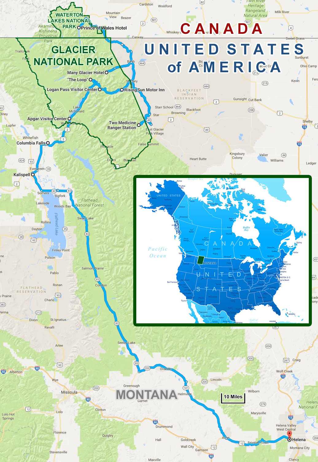
Day 3, Saturday, August 5 - Highline Trail. I was awake at 0400, but Lynn was still snoozing so I just catnapped a while longer. I gave my ankle a little wiggle which precipitated a cramp in my calf, but the ankle felt fine (my Achilles tendon was tender yesterday, probably due to running through DIA in the futile attempt to catch our flight). Around 0515 Lynn finally stirred and we eased into our first full day in the park.
The plan for today is simple. Get on the road at 0700 for the drive up to Logan Pass from where we will hike the Highline Trail to Granite Park then down to the Loop where we will catch the shuttle for a ride back to the pass. If we feel up to it we may also walk the Hidden Lake Overlook trail although we might save that for later in the week. My thinking is to do both today so that we only have to add to the crowd and parking woes at Logan Pass once during the trip. Per the Glacier Twitter feeds, the parking at Logan Pass fills as early as 0800 (usually more like 0830, but getting there earlier is better).
I started getting ready for the day, providing my usual less than subtle clues that it was time to move. Lynn is used to that and went on with her coffee but she was gathering her gear before 0600. Good deal. We were trying to keep things simple so that we can get going quicker. Pop-Tarts and nut bars for breakfast which is perfect for me. At 0640 I walked to the restaurant for ice. Brisk, overcast morning, say mid-50s. The valley is clear but the surrounding peaks are bathed in fog and clouds. Not much stirring this morning, either human or critter. Maybe a half dozen folks having breakfast in the restaurant but they all look like they are going hiking. I spotted a squirrel and a gone bird on the way back to the room.
Our plan this morning worked out pretty well. On the road at 7:05. It was 54 F at Rising Sun according to the Santa Fe. I drove past the long line of cars waiting for campsites. Probably 15 vehicles queued-up already. The start of the drive was easy but I knew we were heading for limited visibility based on the low hanging clouds. Decent views along the lake, but the light was so subdued that it was not worth stopping for a morning photo. It was still clear as we drove through Siyeh Bend. There were already a lot of cars parked at the Piegan Pass Trailhead and several folks getting ready for a hike. OK, let's keep that in mind if we end up hiking this trail. By this point we were really close to the cloud deck and heading into the Nothing. The clouds closed in quickly. Visibility was dropping rapidly and 25 mph was the absolute maximum speed and I was well under that. We had already passed a couple bicyclists which was a good reminder that there could be more ahead, and there were. I had to be very cautious getting around this guy due to the short windows of opportunity in terms of straight sections of road, a break in the clouds and lack of oncoming traffic, but I was able to safely get by just before the tunnel. The fog was getting thicker and the visibility lower the higher we went. I joked that in these clouds we might not know that we reached Logan Pass until we are dropping in elevation on the other side and I was almost correct since I had to really watch the road and almost missed the entrance to the parking lot. The sign indicated that the lot was full was the clue that I needed that the entrance was approaching. Obviously the signs were not being used correctly as we could see several open spaces in the lot, but it was filling fast. I guess it was already about three-quarters full when we arrived at 7:30.
I found a parking spot and we got our gear in order and saddled up for the hike. Logan Pass was completely socked-in and the temperature was a balmy 44 F. I'm glad to have an extra layer to wear and my gloves are also a plus. We could not see anything at Logan Pass and there really did not seem to be any signs of the sky breaking. There was no sign of the peaks that surround the Logan Pass parking lot as the clouds had swallowed everything. But I was hopeful there would be vistas to be seen once we were on the trail and out on the other side on the continental divide. The initial part of the trail works generally downhill from the GTTSR through a meadow and had given us wonderful views of Mount Oberlin, Clements Mountain and down into the valley to the west but at present all was obscured by the fog. We gave Lisa the quick tutorial on the trail, well as much as we knew from our first visit since we only hiked out a mile or so just to get the views and so I could experience the narrow section of the trail. Exposed edges with steep drops are not my thing. To say I get the willies is putting it very mildly, so I wanted to challenge myself back in 2009. But I had no issues at all that first time and I was looking forward to hiking more of this trail as it is listed as one of the top trails (often the best trail) in Glacier. Maybe having the chain to hold on to helped back then and maybe just knowing it was there this time was enough as I did not use it since I had my trekking poles in hand this morning. I thought to myself that maybe I could make it to Angel's Landing in Zion since this trail was proving to cause no anxiety. Apples and watermelons, so maybe not.
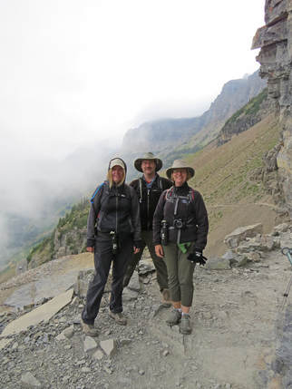
We were soon to the narrow section of the trail, the part that had been carved into the rock face of the mountain, just like the GTTSR below us. We paused here to take it all in. A pair of young lady hikers asked if we could take their picture and they did likewise for us. A good shot to show the conditions as the trail is visible wiggling off beyond us, but the clouds shroud all else over our shoulders. But just as I figured, once out on the trail a bit there was brightening to the sky and we started to get glimpses into the valley looking west. Logan Pass and the surrounding peaks were still invisible, although Mount Oberlin was peeking out from time to time but we could now see the lush, green valley floor far below us. The Going to the Sun Road snaked along the sheer face of the mountain. Traffic was still light but that would not last long. As we continued out along the trail the views to the west got better. There were clouds over these peaks as well but the sun was shining through and the visibility was greatly improved providing us with wonderful vistas. Looking westerly down the trail we could see the Garden Wall looming above Highline, clouds and fog still rolling over the ridge line but the towering rock wall was in full view. But those clouds over Logan Pass were stubborn only giving an occasional glimpses of the formations along the divide and they were fleeting when they finally did occur.
While the big vistas were not in play as much early in the hike, there was still plenty to see along the trail. Our timing was nearly ideal for wildflowers as there were cascades of color painting the mountainside above and below us. We are on a roll with these type of blooms having experienced grand flowers in Yellowstone in 2015 and catching the tail end of the 2016 "super bloom" in Death Valley last year. We were treated to miles of flowers stretching all the way to Granite Park Chalet and a little beyond. Wonderful stands of multicolored petals. The Indian Paintbrush varied from pink, salmon, orange to crimson. Just an amazing variety. Plus we finally saw Bear grass in bloom. Early in the hike we passed tall stalks that I think were the past prime remnants of these white flowers but later beyond Haystack Butte there were large stands of Beargrass in full bloom covering the slope adjacent to the trail. There were also huge swatches of purple fireweed and close to the chalet yellow flowers started to dominate. Yellow, orange, red, blue, purple, pink, white...all the bright colors from a box of Crayola 64 were on display today. It was a wonderful display and it went on for miles.
While the big vistas were not in play as much early in the hike, there was still plenty to see along the trail. Our timing was nearly ideal for wildflowers as there were cascades of color painting the mountainside above and below us. We are on a roll with these type of blooms having experienced grand flowers in Yellowstone in 2015 and catching the tail end of the 2016 "super bloom" in Death Valley last year. We were treated to miles of flowers stretching all the way to Granite Park Chalet and a little beyond. Wonderful stands of multicolored petals. The Indian Paintbrush varied from pink, salmon, orange to crimson. Just an amazing variety. Plus we finally saw Bear grass in bloom. Early in the hike we passed tall stalks that I think were the past prime remnants of these white flowers but later beyond Haystack Butte there were large stands of Beargrass in full bloom covering the slope adjacent to the trail. There were also huge swatches of purple fireweed and close to the chalet yellow flowers started to dominate. Yellow, orange, red, blue, purple, pink, white...all the bright colors from a box of Crayola 64 were on display today. It was a wonderful display and it went on for miles.
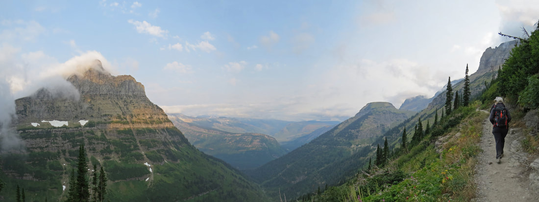
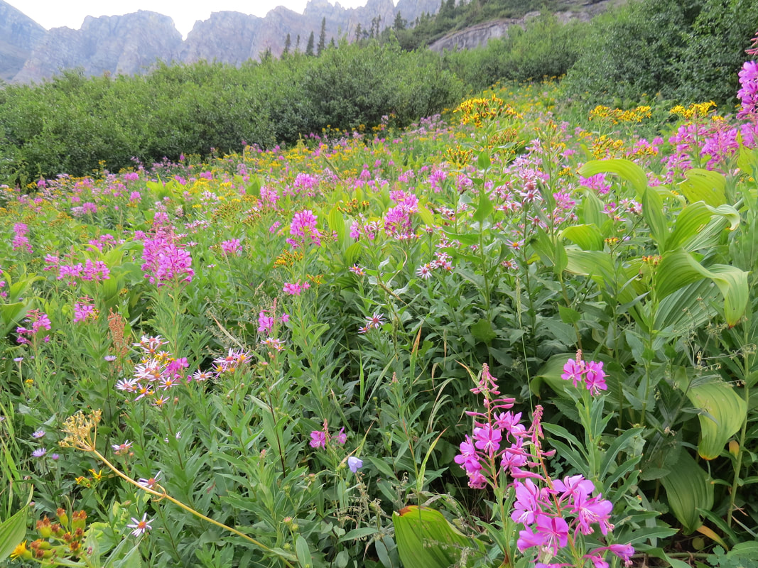
|
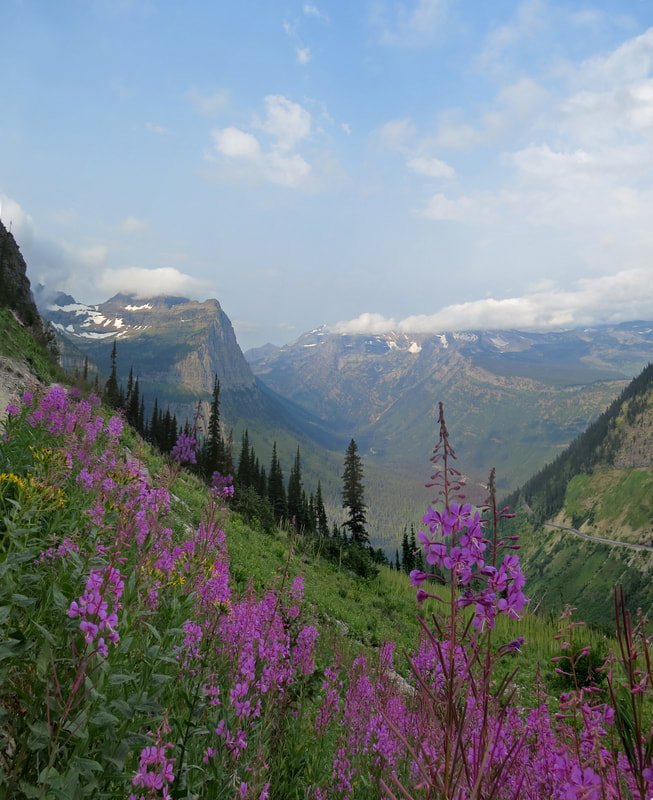
|
I think that everyone on the trail had a plan similar to ours, that is start from Logan Pass and hike out along the trail either to some convenient turn-around point or continue down to The Loop to catch the shuttle back up the mountain, as we did not pass an oncoming hiker for many miles and the very few that we did pass were speedier folks who went by us earlier in the outbound direction. Due to the exposed nature of the trail we could see the much of the length of the trail and could keep track of the number of hikers out with us this morning. This is a popular trail and there were a lot of folks, but with our early start it never really felt crowded. There were a couple groups that we played leap frog with for short stretches but eventually we gained some separation. Surprisingly, we were the faster hikers in most of these instances!
I was not sure how far we would actually go along the trail today. Yes the plan was to hike down to the loop but I always let Lynn set the pace and adjust the length of the hike as needed. If she got tired or her knee started to bother her we could turn back and make this a shorter out-and-back route. I thought that might be the case as we approached the saddle at Haystack Butte when we saw the switchback heading up the slope. But as usual, she was game for the challenge and after a short pause for a snack and to enjoy the scenery, we continued out the trail. The blueberry Luna bar was quite tasty and as usual provided some words of inspiration: "It’s a brilliant day to believe in you."
While the wildflowers were thick all along the trail, the animals were rather sparse although we did end up with a decent list of sightings for the hike. There were a few birds along the trail, mostly gone birds but we did manage a few photos so maybe I can identify a couple of them. Maybe the critters were just sleeping in today as the best sightings did not occur until we were at Haystack Butte or beyond. We got our only mega-fauna sighting when we stopped for our snack beside Haystack Butte, a Mountain Goat a ways up the mountain side above us. There were also several Columbian ground squirrels scurrying about, looking for handouts from the hikers and just generally being cute. Fortunately, I did not see anyone feeding the little varmints. But I did see a young lady wearing a NASA meatball tee-shirt. I had to ask if she had any affiliation with NASA but it was just a shirt.
After our break we continued toward Granite Park with the trail climbing to its highest point (7200 feet above sea level). Most of the critter sightings were between Haystack Butte and Granite Park, particularly toward Granite Park where there was a more gradual slope to the terrain and again large meadows of wild flowers. As we were coming out of the steep rocky section. There were a couple Hoary Marmots perched on a rock spire overlooking the trail. I also heard a persistent squeaking call from the boulder field. Maybe Pikas? I wonder if this is high enough elevation for those little fluff balls. But the short, high-pitched called continued. I kept an eye out and sure enough after a while I spotted one scurrying about between the cover of the rocks. I saw a couple others along this section of the trail but heard more than those I saw.
The flowers and trees were bringing in a variety of birds. There were several Clark's Nutcrackers in the pine trees, disassembling the cones to get to the nuts. Spotted a Townsend's Solitaire sitting at the top of a pine tree. Again a lot of birds in some of the meadows attracted to seeds I supposed. We added a new bird the life list with a Ptarmigan, actually several. I guess a hen and chicks. They wandered across the trail then were pecking about in the short underbrush along the trail, so we got a decent view of them and a few nice photos. Later, as the trail wound through a more open meadow on a more gently sloping section of the mountain side, there were a bunch of little birds flitting about in the flowers and tall grass, looking for seeds and/or bugs. They were a little far off for a good photo, but I got an image or two that will probably allow for an ID. If I can't find a match in the bird book, I'll post the image to BirdForum and let the experts figure it out. Turns out that is exactly what I did and found out these little bundles of energy were Pine Siskins, another new addition to our overall bird list.
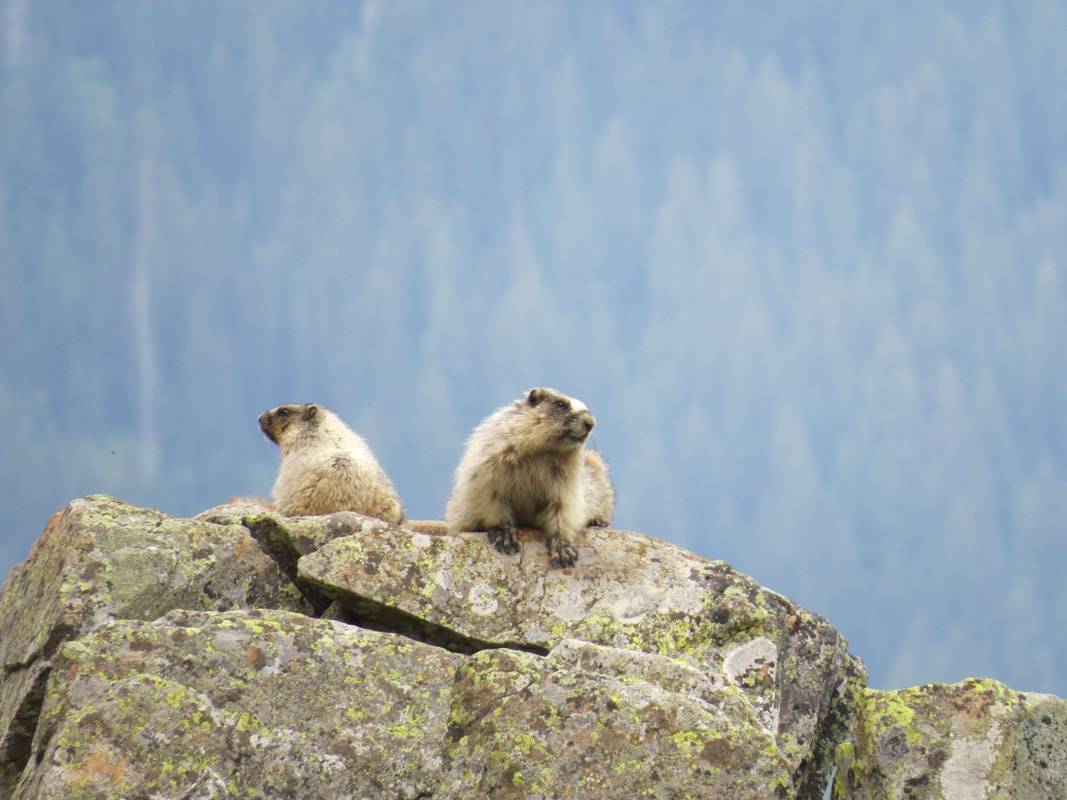
|
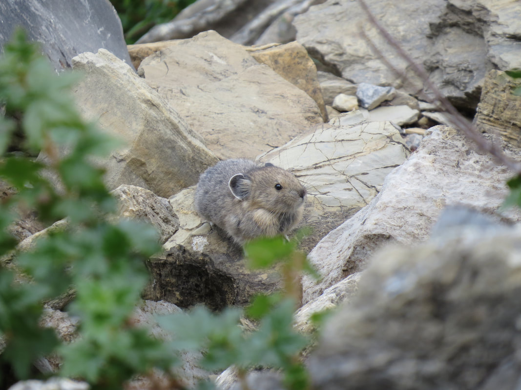
|
The most impressive critter sighting we had was of a Sasquatch. We'll that was Lisa's determination from a distance when she spotted a tall, bipedal and furry looking animal running down the steep incline above the trail. Lynn was having trouble picking up where Lisa was looking, Lisa just put her hand on top her sister's head and turned it to the correct vector. Ah, there it is! Those two are fun to watch. OK, obviously NOT a Sasquatch. Rather an off-trail hiker taking a rather direct route back to the Highline Trail at a much higher than safety would support rate of descent. Best we could figure is that he might have went up the spur trail that leads to the overlook into Many Glacier and opted for a social trail return. He was not the only person we saw scrambling up the rather steep sections above the trail. These guys might be the subject of a future edition of Death in Glacier.
Also along this section of the trail is when we got our first glimpse of Granite Park Chalet off on a low knob in the distance. That made a good marker for where we were headed, but it was still a long way off. I pointed it out to Lynn and Lisa. "Cool! Let's go!" Alright, the girls are on the ball today! However, while they were good with the trek to the chalet, the detour along the spur trail going up the face of the Garden Wall for the view of Grinnell Glacier and the Many Glacier area was not in the cards. We had enough on our plate today with just the hike from Logan Pass to The Loop (yeah, Hidden Lake will also have to wait for later in the trip). Once we saw the steepness of the side trail we were out for sure.
It took us just a few minutes more than four hours to reach Granite Park Chalet, including our short break near Haystack Butte and our frequent photo stops. As the outhouse was the first structure we came to, that was our first stop, particularly as there was only a very short line. I ended up holding Lynn's backpack in order to keep the rodents away as there was a number of chipmunks and ground squirrels in the area. I joked with another fellow that this was just like going shopping as I've ended up holding the wife's "purse." We wandered up to the main building for a look around. There were several hikers scattered about, mostly lounging and having a snack. We found a bench on the front porch and had a seat to enjoy the view and have another Luna bar (these things aren't bad at all). "Great things never come from comfort zones" were the words of wisdom on this wrapper.
Granite Park Chalet is certainly well located, being at the crossroads, or "crosstrails," of several foot paths. This might explain some of the additional traffic in the area as well as the few folks taking a break who have serious backcountry packs. The setting of the chalet provides nice views from the little knoll it is perched upon. Not as inviting as Sperry Chalet, but certainly a welcome stop for the weary backpacker. The stone structures of the chalet complex are rustic but do provide the Swiss flavor that the designers were looking for when the chalets were built in the 1910s.
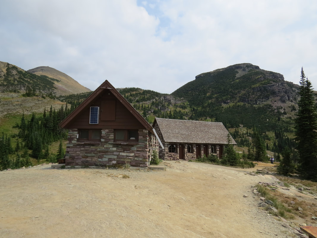
|
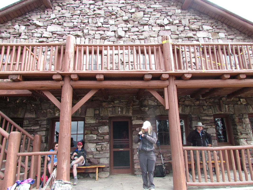
|
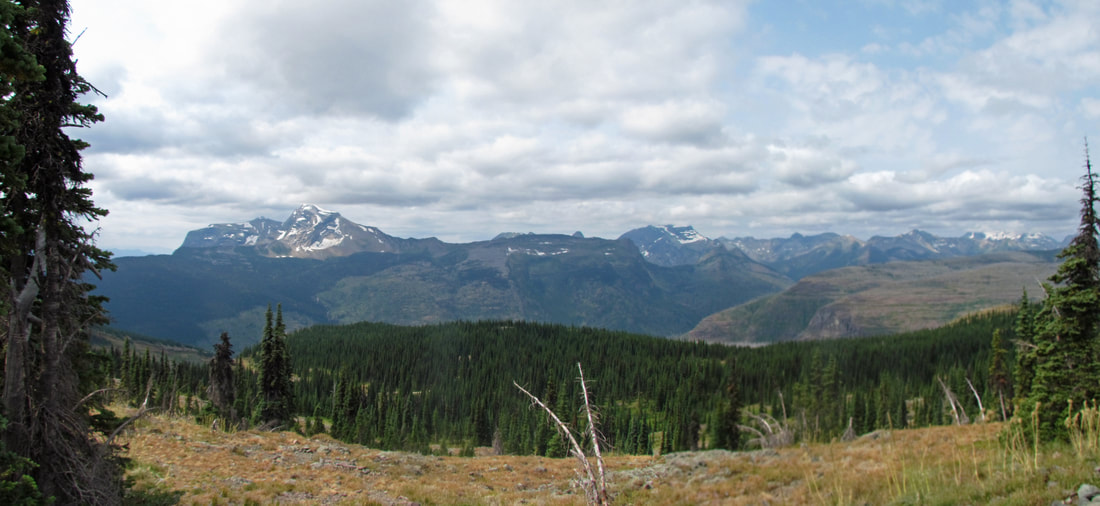
The view from the front of Granite Park Chalet.
We only paused at the chalet about 20 minutes, if that, as we still had some distance to go to complete our hike. We were almost eight miles along the trail so there was still four to go to get to The Loop, but it was all downhill from here so how bad could it be. It was much warmer than when we started, now that it was midday and the sun was shining along then end of the trail. But the early part of the trail leading down to The Loop from the chalet was wooded and shady with a few open breaks for small meadows, so pretty comfortable. I guess it was in one of the open areas along the trail that we spotted in interesting feature on the ridgeline above the chalet. It was very square and sitting sort of by itself on the highest part of the ridge; too regular for just a big rock. This is where the SX50 comes in handy with its nice zoom. OK, it is a structure, but for what? Probably a watch tower for fire spotting. That will be a good question the next time we see a Ranger. Closer to the trail there were still sprigs of wildflowers and even a cool breeze as we walked past the spur leading to the campground. But it was a rather significant decline from the chalet to the shuttle stop down at the GTTSR (over 2300 feet decrease in elevation over four miles). Even though it was all downhill it was by far the toughest part of the hike. And the further we went down the trail the warmer it got and the more the sun came out. We were soon walking through a burnt out section of forest which provided no cover for the trail or the weary hikers. The trail was becoming dusty and dry. We figured the temperature was in the mid-80s F by now. It was also becoming less crowded. There was not a lot of traffic following us down from Granite Park Chalet and there were only a few folks hiking up the trail. One was a young couple, around 30, give or take. She was cruising. He was struggling and did not look happy at all. Another was an older couple with one water bottle between them and not the best choices for footwear. We saw them just as we were exiting the steep section, so I'm betting they probably turned back once they saw what they were getting into.
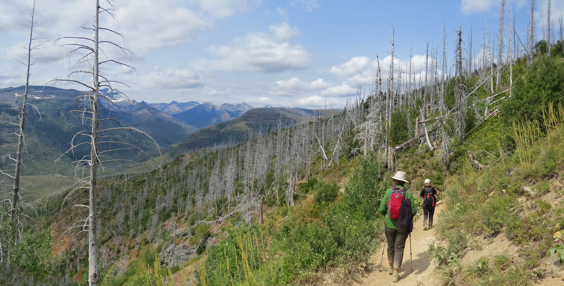
On the trail down from Granite Park, heading to The Loop.
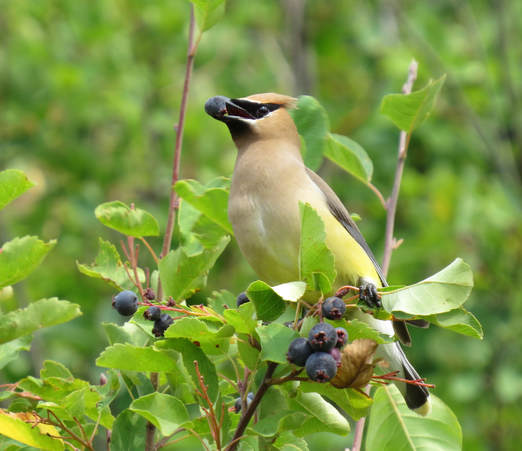 Cedar Waxwing
While the hike down was a bit on the grueling side, I did get one of my favorite photos of the trip in this area. We were walking through a stand of berry bushes (so on the watch for bears, of course) where there were several Cedar Waxwings swooping about. I got a pretty nice image of one of these aerial acrobats as it was sitting in brush with its treasure in its beak. That shot will make the highlight reel for the trip.
Nearly seven hours after we set out this morning from Logan Pass we have arrived at the shuttle stop at The Loop. There was bus there, but it was already packed so we had to wait for the next one, but it arrived in very short order. There was a good bit of traffic on the GTTSR here during mid-afternoon. Hats off to the shuttle driver as he expertly negotiated his little bus along the winding road and by the downhill traffic. Once back at Logan Pass we noticed that the shuttles working the west side of the road we considerably smaller than those coming up from the east side. That made sense though due to the tighter nature of the west side of the GTTSR. Lynn also commented on how it took us over six-and-a-half hours to get to The Loop and only 22 minutes for the trip back to Logan Pass. Here's the gallery of images from our time on the Highline Trail.
Nearly seven hours after we set out this morning from Logan Pass we have arrived at the shuttle stop at The Loop. There was bus there, but it was already packed so we had to wait for the next one, but it arrived in very short order. There was a good bit of traffic on the GTTSR here during mid-afternoon. Hats off to the shuttle driver as he expertly negotiated his little bus along the winding road and by the downhill traffic. Once back at Logan Pass we noticed that the shuttles working the west side of the road we considerably smaller than those coming up from the east side. That made sense though due to the tighter nature of the west side of the GTTSR. Lynn also commented on how it took us over six-and-a-half hours to get to The Loop and only 22 minutes for the trip back to Logan Pass. Here's the gallery of images from our time on the Highline Trail.
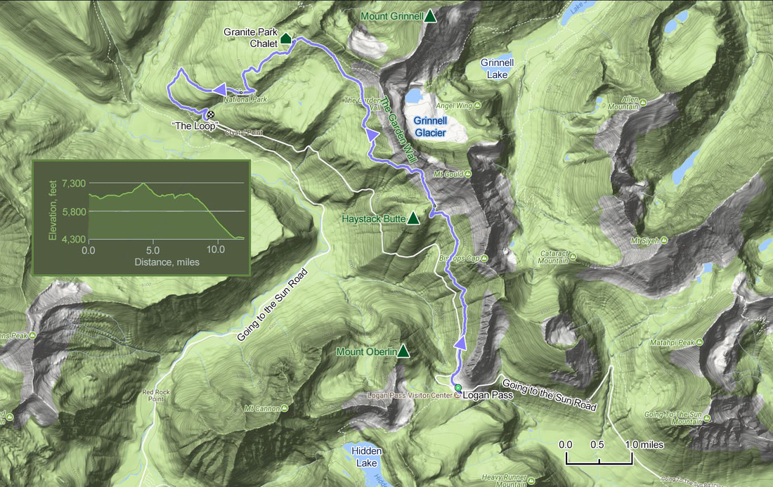
Logan Pass was still clouded over this afternoon and the temperature was only 55 F, so there was no much use is lingering. Besides, we'll be back up here again since the Hidden Lake overlook is very high on our list of hiking options. So once off the shuttle we walked to the Santa Fe for the drive down from the pass. As we neared our parking slot, I waived at the driver of a big Ford pick-up indicating where our spot would soon be vacant. He seemed very appreciative. No idea how many laps folks were making around the lot to find an empty slot, but it was certainly packed here at Logan Pass this afternoon. In fact, all the parking lots for trailheads and scenic overlooks along the east side of the GTTSR were filled to capacity when we made our return drive. But that's OK, as our next stop is back at Rising Sun where I'll get these boots off and will soon have a cold beer in hand.
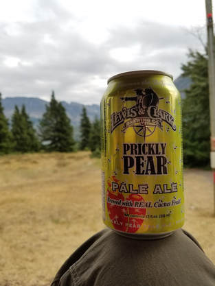
|
We were back at Rising Sun about 3:30. It was still on the gloomy side here along St. Mary Lake, with overcast and temperature in the 60s. But still more than pleasant enough to sit out on Lisa's porch and enjoy a cold beer. That's the best thing to wash down the trail dust. I started with a Prickly Pear Pale Ale, another offering from Lewis and Clark Brewing, which was on the sweet side but still pretty good, followed by a Bitter Root Brewing's IPA which I thought was extremely average. The artwork on the can is the best part of this beer. I guess the Oregon family had moved on today as our new neighbors rolled in, a pair of older Japanese gentlemen. They were very friendly and talkative, just that none of us can speak Japanese. The one fellow did list off the places that he had visited including several of the large National Parks in the US, but otherwise it was just smile and nod. He also brought over some rice cakes and some sort of dried seaweed wrap to share. Another nod and a smile then I choked one down just to be sociable. Glad I still had a beer to wash that down. Nice guys, though, and obviously quite excited to be in the park.
We were all beat after 12 miles on the trail. But it was a great hike, particularly from Logan Pass to Granite Park Chalet. The big vistas improved as the day progressed but the star for today was the spectacular display of wild flowers all along the trail. Lynn and I also complied our critter list for today. |
We all got cleaned up for dinner. Yep, the shower felt great. Two Dog Flats again for dinner at 5:30. The limited menu just was not appealing to me, but I tried the turkey meatloaf sandwich with mac and cheese. Not a bad choice but just this side of OK. Lynn liked her burger as did Lisa the roast beef sandwich. We discussed options for the next couple of days. I think we have a plan in place for tomorrow. If the weather continues to improve, and it is now a beautiful evening, we can return to Logan Pass to hike Hidden Lake Overlook, check out the visitor center there then explore the visitor center at the east entrance. Monday we will head over to the Two Medicine area. But as always, we'll make the final flight plan in the morning.
After dinner, we sat out on the porch by Lisa's room a while longer. The sky was nearly clear now, just a couple fluffy white clouds hanging over the peaks on the far side of the lake. Quite a difference from this afternoon with the significant overcast. Maybe Hidden Lake will work for tomorrow. We added a hummingbird to the critter list, a female Rufous I believe. It was just buzzing about in the trees. It was attracted to the red emergency siren on a post at the edge of the parking lot. The girls both gave up shortly after 7:00. Lynn said it was almost 9:30 back home so close enough to bedtime. I stayed out until nearly 9:00, enjoying the peace of the evening. The clear skies were allowing the light from the setting sun to bathe the peaks across the lake in a rosy glow. I also continued to read about the sad demise of folks on Glacier. The chapter on Grizzly Bear maulings was particularly sad and disturbing. The park was in existence for 57 years before the Night of the Grizzly when two nighttime attacks occurred at camp grounds 20 miles apart leaving two young women dead. It was very interesting to read how the Park Service has matured over the decades, from the days when bleachers were set up so that the visitors could watch the bears feeding in the garbage dumps in the evening to today where conservation is king and trying to keep everyone (human and bear) safe is the goal.
No bear sightings for us today. I'm just as happy to not see a bear while out on the trail. But there were other critters to add to the tally for today, including two new additions to our overall bird list. I did not include Sasquatch.
|
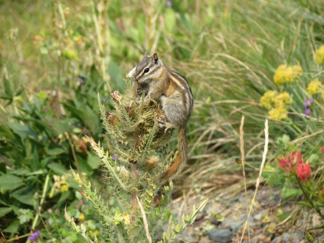
|
Day 4, Sunday, August 6 - Hidden Lake. I was awake early again, as usual. I spent a little time reading about the tragedies in the park and working on my journal while waiting for Lynn to stir. I made the daily trek down to the main building for ice as we'll want a cold beer later this afternoon. At 0655 we were loaded up and on the road. The morning was brisk at 46 F but the sky was generally clear over Lake St. Mary and looked to be clear leading up to Logan Pass. The line for campsites at Rising Sun was shorter than yesterday morning but still 10 or so cars. Light traffic along the road heading up to the pass. The trailhead parking was starting to fill but there was still room at Siyeh Bend. We reached Logan Pass at 0720. The sky was clear and blue and it was very chilly (46 F up here as well). Where yesterday was completely socked in with visibility of nearly zero, today there was not a cloud to be seen. None, nada, zilch. Just a lovely day for our hike to the Hidden Lake Overlook. The parking lot was surprisingly less full than yesterday morning, but not by much. Having learned about the traffic issues (it was tough getting out of the lot yesterday afternoon with all the cars jockeying for any open slots), I close a spot very near the exit so that we could just roll out of the lot and stay out of the way. We collected our packs and cameras and made our way to the trailhead.
The trailhead starts behind the visitor center, first paved then along a railed boardwalk. But don't let the trail surface fool you. While this is an easy trail, it is not flat and level by any means. Come prepared for a little workout! But it is well worth the effort, particularly at this time of year. The vistas are grand, dominated as they were by Clements Mountain and Reynolds Mountain, peaks that we could even see yesterday. But the show was stolen again by the meadows full of wildflowers. There were not the thick blankets made from a single type of flower like we saw yesterday along the Highline Trail, but rather a patchwork of colors from an incredible variety of flowers scattered cross the meadows. But the range of colors in the flowers was just like what we experienced along the Highline Trail, again just like someone went nuts with a big box of crayons. Purple, red and yellow dominated, but the variation of hues was amazing. There were times when adjacent Indian paintbrush plants would vary from dark red to salmon to orange to pink in the space of a few feet. Add to this the colorful rocks that were scattered about and the wide horizontal bands of green and purple strata in Clements Mountain plus the brilliant blue sky and dark green pine trees. It was an outstanding show.
The trailhead starts behind the visitor center, first paved then along a railed boardwalk. But don't let the trail surface fool you. While this is an easy trail, it is not flat and level by any means. Come prepared for a little workout! But it is well worth the effort, particularly at this time of year. The vistas are grand, dominated as they were by Clements Mountain and Reynolds Mountain, peaks that we could even see yesterday. But the show was stolen again by the meadows full of wildflowers. There were not the thick blankets made from a single type of flower like we saw yesterday along the Highline Trail, but rather a patchwork of colors from an incredible variety of flowers scattered cross the meadows. But the range of colors in the flowers was just like what we experienced along the Highline Trail, again just like someone went nuts with a big box of crayons. Purple, red and yellow dominated, but the variation of hues was amazing. There were times when adjacent Indian paintbrush plants would vary from dark red to salmon to orange to pink in the space of a few feet. Add to this the colorful rocks that were scattered about and the wide horizontal bands of green and purple strata in Clements Mountain plus the brilliant blue sky and dark green pine trees. It was an outstanding show.
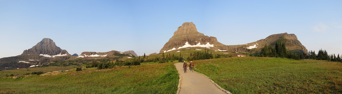
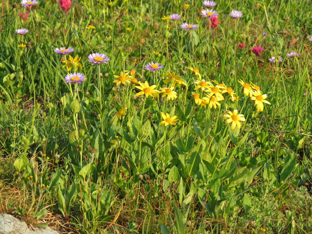
|
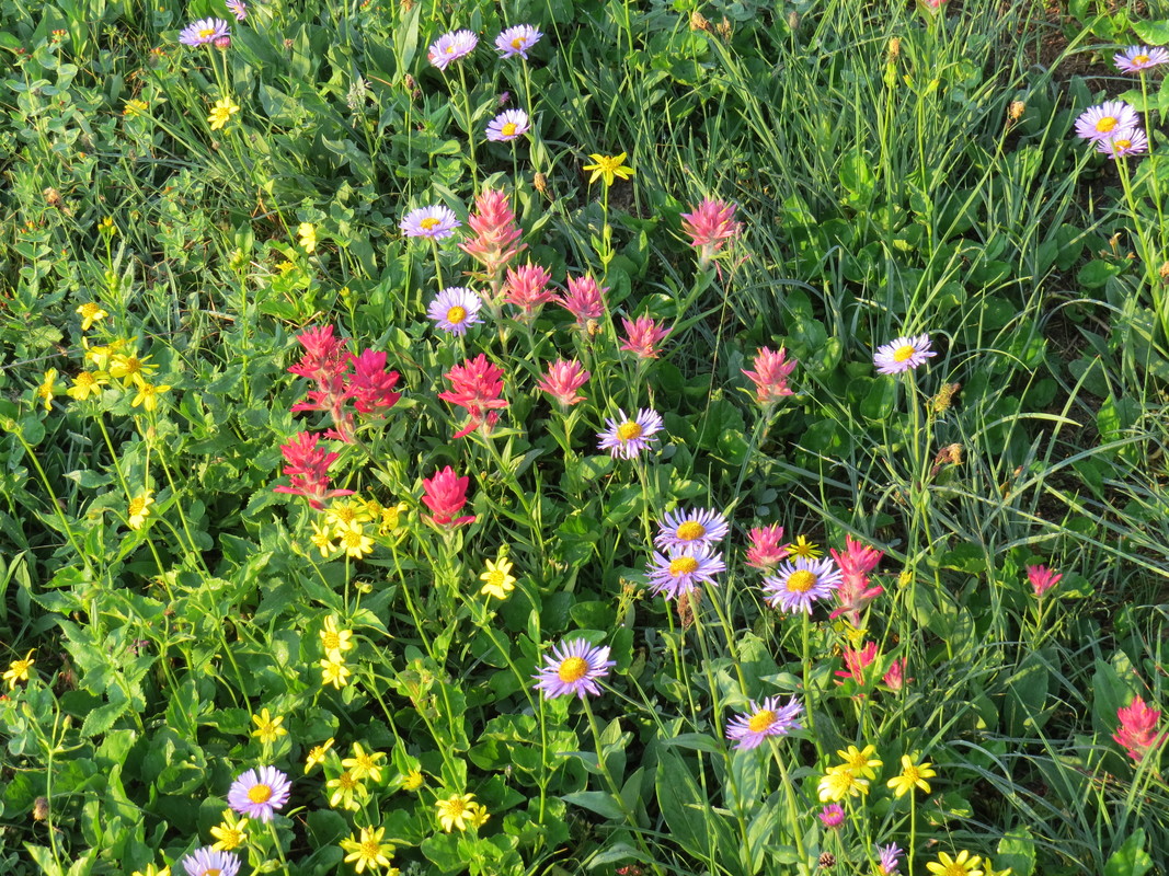
|
While the stars along the trail were the flowers, we also spotted a few critters. The ever present Columbia ground squirrels were everyone, and cheeky as always. There were a few youngsters wrestling with each other near one of their burrows; quite cute. There were marmots out in the meadow along the boardwalk. We saw a small herd of deer walking through a meadow on our way out to the lake. There were a couple Mountain Goats on the slope of Mount Clements above the trail. Plenty of birds as well, including Robins, White-crowned Sparrows and a few that I'm trying to identify from the photos. There were a few little-brown-birds, sparrows of some sort that I'll probably never figure out, but the BirdForum folks identified one as an American Pipit (that's a new one for our list).
I can see why this relatively short hike is so highly regarded and ranked so high (number 5 overall in the Hike734 rankings and the number 1 short (under 5 miles) hike, so that's saying something). Wonderful views every step of the trail, excellent opportunity for animal sightings and at the right time of year these amazing displays of wildflowers. Not a strenuous trail, just a constant uphill for the first mile, gaining about 500 feet in elevation, then it levels out and is generally flat for the last half mile (give or take) to the overlook. Overall pretty easy. Certainly family friendly, but not a path for a stroller due to the steps along the boardwalk section.
This was a very popular trail as well. Plenty of hikers out this morning. I would not consider the trail crowded but there were a lot of folks sharing the views. Even with the high number of hikers the trail had a friendly nature. The hikers coming back from the viewpoint (and there were several already on their way back, so even earlier birds that we were) were cheerful and friendly, plenty of “good mornings” and many were quick to mention that there were Mountain Goats along the trail ahead.
The wildflowers were with us pretty much the entire way, giving way just at the end where the trail enters a stand of pines. But Hidden Lake is aptly named, as you can't see it until right at the overlook, although you can tell where it is coming up. As you near the overlook, you start to see the edges of the valley holding the lake and of course Bearhat Mountain is visible from a distance. From the photos I had seen of the area while doing my trip research, I knew that Bearhat was the backdrop for the lake. Still being there and seeing that view down into the valley and over the lake and surrounding peaks is so much better than even the best photo.
The lake was very calm, with a nice mirror finish for reflections, but just too far away for great photos of the details around the water. We spotted a couple people down at the lake and a few others on the trail leading down from the viewpoint, but most were taking in the view and turning back. It is a steep trail down to the water, which means a tough climb back up. Plus there was reportedly bear activity beyond the viewpoint, so we decided not to push it.
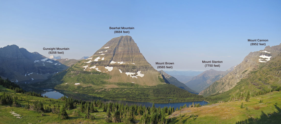
As always, I read the informational signage. There are usually very interesting notes, so a great opportunity to learn. This one was talking about climate change:
"A New Forest: Melting glaciers are just one effect of Earth's warming. As the temperature rises, the treeline is rising with it. Take a look at how the forest has grown around Hidden Lake since 1930, especially at the foot of Bearhat Mountain. This new growth might seem good, but it can have a devastating effect on the fragile alpine environment. As the treeline moves up, alpine meadows are lost. Species that depend on these meadows for food or protection from predators are increasingly threatened. Some animals, like the ptarmigan, have already migrated farther up the mountains. As the treeline continues to rise, where can they go when even these areas become inhospitable?"
Obviously climate change is an important issue particular here at Glacier as it is a fact that the glaciers are shrinking. I just wish that this topic had not become so politicized as it is next to impossible to get an unbiased, "just the facts, ma'am" report on climate change. There is too much opinion and not enough science in most of the information that is reported from both sides of the argument. OK, I’m getting off my soapbox.
We lingered only a few minutes at the overlook then retraced our route back along the trail. I tend to prefer loop hikes so that you are always covering new ground during the hike, but out-and-back tracks also provide opportunities for new views or perspectives when you make the return trip. The lighting will change, animals move in and out of the area, and just seeing something from the opposite direction often provides an interesting juxtaposition. We again were treated to the stands of wildflowers (they obviously weren't going anywhere). The Mountain Goats were still on the hillside above the trail. We snapped a few more photos when we crossed the little streams and the adjoining waterfalls. But there were a few features that I had not paid as much attention to or just missed during the outbound hike. There were some wetlands areas scattered out in the meadows to the east of the trail. These were just far enough off the trail that I was unable to see any differences in the plants or what type of critters might be visiting, but I guess this marked an additional habitat. We saw a few more shades of red, pink and orange in the Indian Paintbrush. I'm just amazed at the variety of hues in this single type of flower. I think I have run out of colors. Did I use crimson yet?
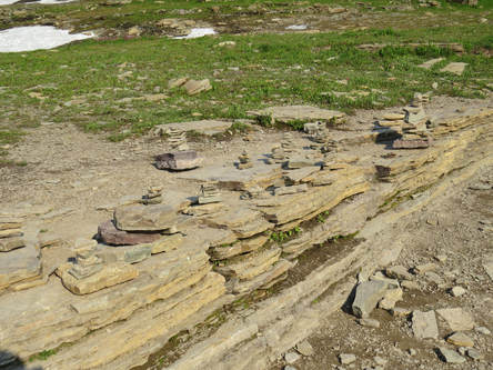 Buddha Beach along the Hidden Lake Trail.
There was also one tourist-made feature that we did not pay much attention to until the hike out, a collection of little cairns and similar statues made of the native stones all sitting on a low rock ledge adjacent to the boardwalk. I guess this is Glacier's "Buddha Beach."
Back at the visitor center there were throngs of folks meandering about. The parking lot was beyond full and more cars were coming in. Just cruising in circles, like we did as teenagers on a Saturday night, everyone looking for tail lights signaling that a parking spot was coming open then jockeying for position. This is why I get an early start in the parks. Lynn and Lisa went inside to check out the gift shop and displays. I lingered along the railing just enjoying the day and watching the tourists. There was a young Ranger nearby talking to a few folks. He pointed out some Big Horn Sheep lounging on the game trails in the loose rock at the base of Pollock Mountain, across the GTTSR from the parking area. They were just hanging out and were scattered all along the trails. Apparently this young fellow was also a newly minted Ranger and he was talking with his family. My clue to this was when an older lady walked up, barked a name in that "mom voice" then took a picture when the Ranger instinctively snapped to attention. Mom rules. As I review this, and realize that I called this mom an "older lady" but she was probably my age at most. Dang, I'm in the "older" category now.
Back at the visitor center there were throngs of folks meandering about. The parking lot was beyond full and more cars were coming in. Just cruising in circles, like we did as teenagers on a Saturday night, everyone looking for tail lights signaling that a parking spot was coming open then jockeying for position. This is why I get an early start in the parks. Lynn and Lisa went inside to check out the gift shop and displays. I lingered along the railing just enjoying the day and watching the tourists. There was a young Ranger nearby talking to a few folks. He pointed out some Big Horn Sheep lounging on the game trails in the loose rock at the base of Pollock Mountain, across the GTTSR from the parking area. They were just hanging out and were scattered all along the trails. Apparently this young fellow was also a newly minted Ranger and he was talking with his family. My clue to this was when an older lady walked up, barked a name in that "mom voice" then took a picture when the Ranger instinctively snapped to attention. Mom rules. As I review this, and realize that I called this mom an "older lady" but she was probably my age at most. Dang, I'm in the "older" category now.
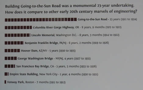
Since there was a sheep sighting, I went inside to get the girls so that they could see. The sheep weren't going anywhere so I made a loop through the facility to check out the displays. Some interesting notes on the construction of the Going to the Sun Road, particularly the comparison with other engineering marvels of the same time. Back outside, I pointed out the sheep then suggested that we walk out along the initial part of the Highline Trail so that Lisa can take in the views that we missed in the fog yesterday. We made a quick detour to the Logan Pass sign for a team photo, swapping photographer duties with a mom and her kids, then continued along the trail. We passed the new Ranger and his kin across the road at the start of the trail. He was giving them a little history or geology lesson, but the clan was more interested in the photo ops. The wildflowers were popping all along this section of the trail that works through the meadows. The flowers were more brilliant today than yesterday morning, probably due to the higher temperatures and ample sun today. We hiked over to the start of the narrow section of the trail as this spot affords an amazing view. Simply gorgeous looking out over the valley to the west. What a lovely vista stretching from Clements Mountain to Mount Oberlin, down through the valley then the Garden Wall providing the frame to the north.
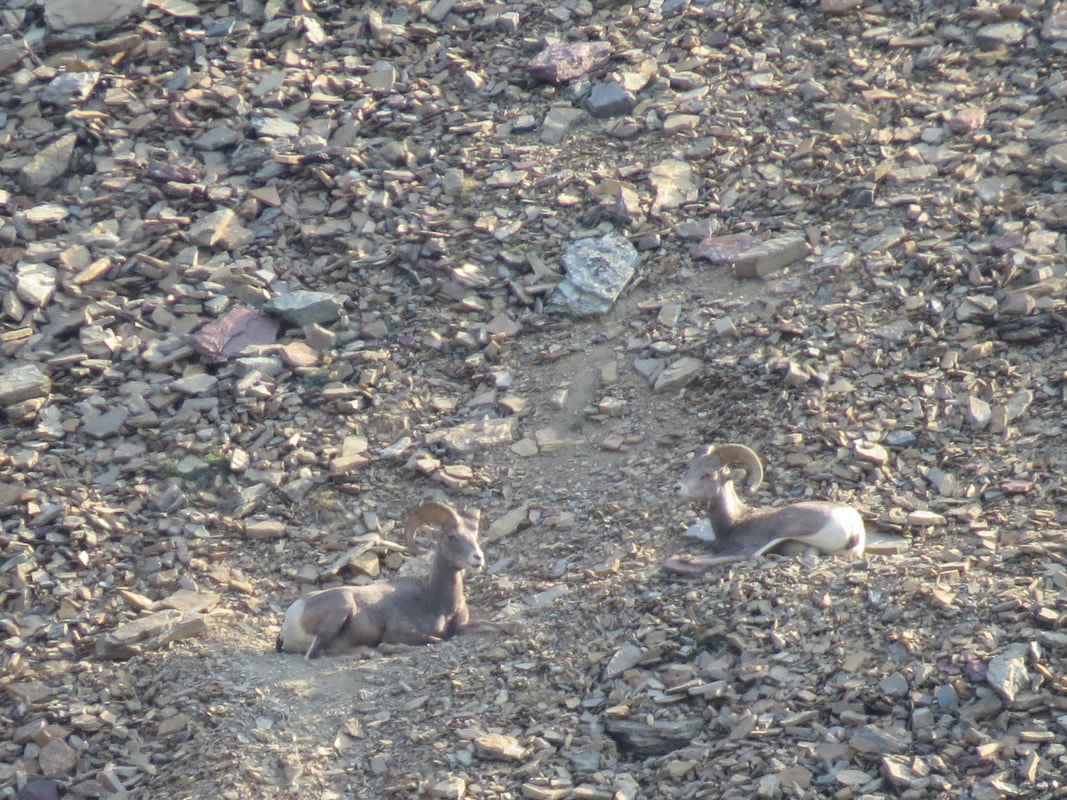
|
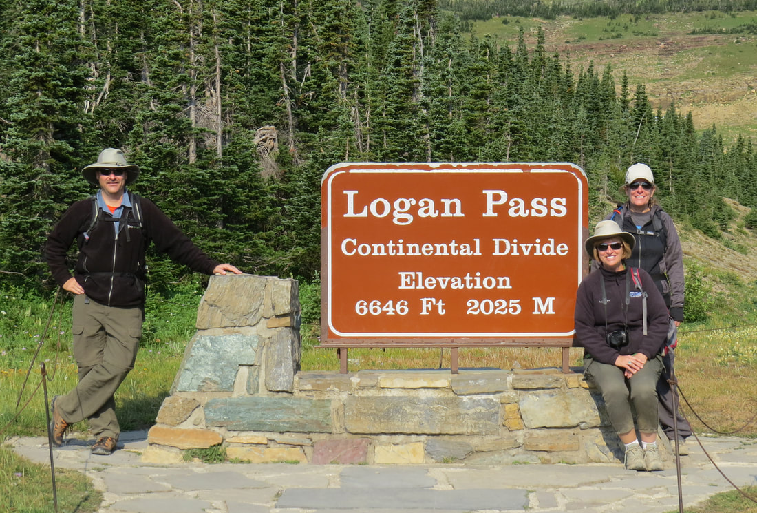
|
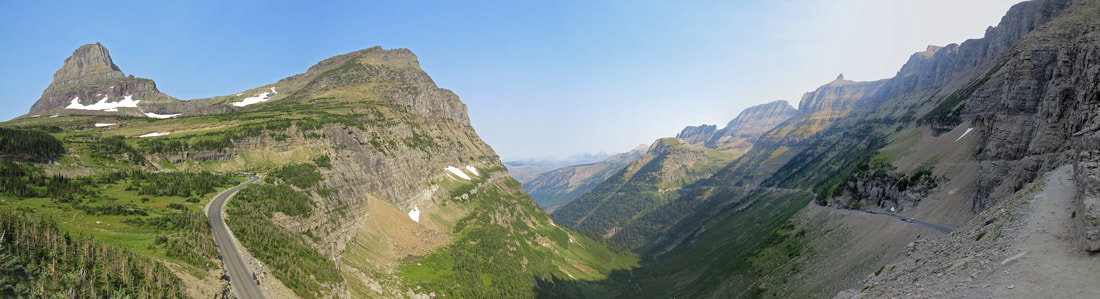
We turned back at this point and headed back to the parking area. It was a little after 10:00 and time to move on to something new and to give someone else a chance at a parking spot. And there were plenty who wanted a spot. It was quite the zoo. As we were walking up the row of cars with our Santa Fe, two teenage girls ran up and asked if we were leaving then asked if they could have our parking spot. Fine by me, but good luck with that as I have no idea where their vehicle is in the queue. We threw our gear in the back, jumped in the car and maneuvered toward the exit. The girls jumped into our spot to try and save the space until their parents drove around. I'm sure that did not go over well with the drivers at the head of the line.
Here's the link to the rest of our photos from our morning at Logan Pass.
Here's the link to the rest of our photos from our morning at Logan Pass.
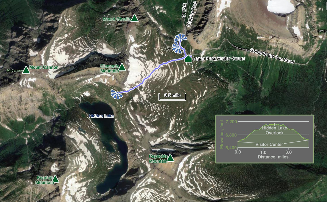
So a couple of interesting points as we drove down the east side of the GTTSR. First thing was that as I was pulling back onto the GTTSR, the Santa Fe alerted me that there was a low tire pressure warning, specifically the rear, driver's-side tire was a little lower than the other three (but only 1 psi lower than two of the others). It must just be me as I get this all the time at home with my Edge and have had similar issues with other rental cars. Something to keep an eye on now.
Just as we were going into the Siyeh Bend, a motorcyclist was coming out of the turn. He (guessing it was a he) was riding sort of high-tech, dirt bike looking machine and was wearing an equally interesting helmet with a couple of mechanical protuberances (one was probably a Go-Pro). We dubbed him Boba Fett.
The trailhead and viewpoint parking areas were all again full, but we were not planning on stopping anywhere anyway. We were figuring on checking out the visitor center at the east entrance. As we approached the east entrance we could see a bit of a back-up to get into the park. Not significant, but two lines of vehicles, each about ten cars deep. We swung onto the driveway leading to the visitor center. The parking lot here is not nearly large enough and today it was packed. We made a lap through, but there was no use in making a second as there were a dozen cars in line behind us. We turned left onto the GTTSR and headed out of the park.
We headed south on route 89 toward Two Medicine, just to get a handle on the road since the plan is to drive this way tomorrow. The road took us along the east boundary of the park. Honestly this was not the prettiest of drives, but it was interesting to note how quickly the terrain changed. Just a very short distance to the west was the rugged and mountainous landscape of Glacier while immediately around us was a more rolling and hilly terrain. More agricultural in nature. Certainly grazing was in play as there were plenty of beef cattle scattered along the road. Fortunately none were in the road this afternoon. We turned around at the bridge crossing the South Fork of Milk Creek and headed back to St. Mary.
I was keeping an eye on the tire pressure since that low pressure alert was flagged up at Logan Pass. Interesting that the pressure reading in all four tires was 3 or 4 psi higher here at lower elevation. The tire that was flagged as having low pressure was still in alarm but now reading higher than the other tires were when we were at Logan Pass. I'm thinking that the sensor is now completely confused.
The time was creeping up on noon. Probably time for a break so we'll head back to Rising Sun after a beer run at the grocery store in St. Mary. Plus I was looking for a candy bar. Scored on both counts. The supermarket in St. Mary has a very nice selection of craft beer and I found two favorites from our last excursion to Yellowstone. Lynn was delighted when I returned to the car with six-pack of Sweetgrass, the American Pale Ale from Grand Teton Brewing that she has been pining for since last year. Lisa and I were delighted with the Carmel M&Ms that I found. Glad I got the sharing size package. Those were good and they went fast!
We were back at Rising Sun right about noon. Time for a break and a beer. Our side of the building was shaded at present so we sat out there enjoying the view and the company, Lynn, Lisa, me and the Columbia Ground Squirrel that was hanging out with us. Our beautiful day is continuing. We have a pretty nice view out back, now that we can see it. Up to this point the clouds and fog had obscured the ridgeline of Otokomi Mountain to our north. While our little furry companion was cute, the interesting animal sighting was high about the mountain behind us. We saw a large bird soaring above the ridge. I mean a really large bird. Too far to make an identification at first. Then a second big bird arrived. The two started soaring together, moving closer in tighter circular paths. Finally they are very close together, turning nearly in unison, almost like a fighter pilot and his wingman. The next thing we knew they were locked together and tumbling out of the sky. They fell probably for a few hundred feet it seemed then broke their grip and soared high above the ridgeline only to repeat their aerobatic maneuver. But this time as they fell I used the reach of my trusty SX50 to get a better look. Still way too far for a good photo, but between the long-distance images and the behavior being displayed I am pretty certain that these were a pair of Golden Eagles flying through their mating dance. How cool is that!
A little after 1:00, Lynn suggested that we try another hike, perhaps down along the edge of Lake St. Mary. I'm in. Her thought was to drive up to Sun Point and hike around the lake to check out a waterfall or two. We left Rising Sun about 1:10, made the short drive to Sun Point and pulled into the jammed parking lot. OK, this is the problem with a late start or in our case, heading to the second activity of the day. We made a loop through the lot. There were a lot of folks enjoying a picnic, but there seemed to be a few folks packing up and heading to their vehicles. We slowed crawled around the lot waiting for a parking slot to open. There's a guy heading to his car, no wait, he's meandering the other direction, and now back to the sidewalk. False alarm. OK, this has to be it. Young family loading the kids in their F-250 in a space next to the slots reserved for the Red Buses. I rolled over and asked if they were loading up to leave. They are and were quickly on the road, so we pulled in to the vacant slot. Less than 10 minutes wait so not bad at all.
Much warmer compared to our morning hike, considering the time of day and the lower elevation. I converted my hiking pants to shorts and ditched the over shirt. Guessing it was in the low 80s F and kind of dry and dusty but along the trail to Sun Point it smelled of pine so that was quite pleasing. The short trail from the parking lot to Sun Point branches out into several social and spur trails. I'm not sure there really is a main trail to get out on the point. If there was one, I was sure that we were not on it as the route we ended up taking was a little on the steep side and not in the greatest of shape. But once we negotiated the short, steep trail we were out on the open of the rocky point. We walked around the point for a while, taking in the views both large and small. The big views were looking up and down the lake which were simply wonderful vistas and highlighted the glacier-carved nature of the valley holding Lake St. Mary. The blue sky and fluffy, white cumulus clouds provided a very nice backdrop to the hard edges of the mountains. I particularly liked the view of the peaks and ridges looking northwest from Sun Point. I think this was Going to the Sun Mountain that was dominating the view with a smaller ridge in front and a taller peak in the background (Mount Siyeh, maybe). Whatever the specific mountains, peaks and ridges, I just liked the view and the subtle hues of the rocks and trees. It had the feel of on old postcard from the 1950s or 1960s. The near views were of the colors and textures in the rock of the point and of the grey hulks of the twisted dead trees that were scattered about the point. These made for interesting subjects against the blue-green background provided by the lake.
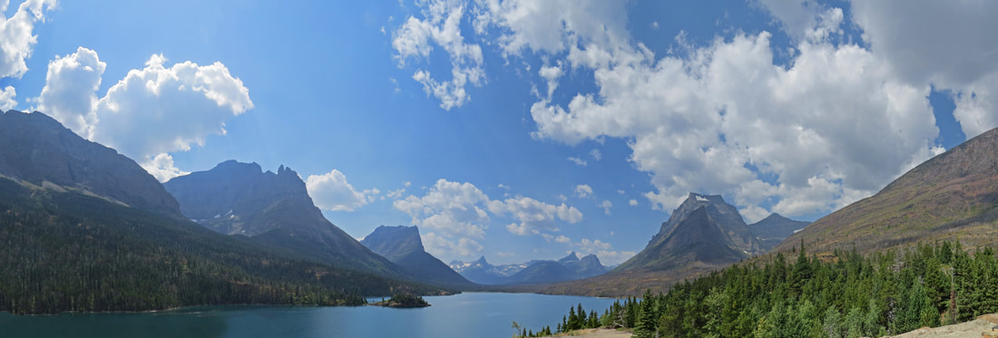

After enjoying the views and the warmth out on the open space of Sun Point, we went back to the main trail and started off west along the lakeshore. The trail is tree-lined so it is cool and pleasant but the visibility out to the lake was limited to bits and pieces. While very pretty but not very photogenic in terms of capturing the big vistas. Still the smaller views that we got highlighted the amazing shades of blue and green of the water in Lake St. Mary, nearly the hues one would expect to see around the islands of the tropics.
We continued along the north side of the lake until we reached the trail leading up to Sunrift Gorge and decided to check that out for Lisa's benefit. Lynn and I had visited the gorge during our last trip as it was a stop on our Red Bus tour. Today we'll have to work a little harder to get there. The trail works up the steep slope of the hillside, more or less along Baring Creek. We reached the intersection with the Sunrift Gorge Trail right with a family coming from the other direction, mom, dad and pre-teen boy and girl. We paused to let then go first as they seemed pretty energetic. Mom said that she wished we had gone first to maybe slow them down a bit as Dad and the kids will just run up the trail and Mom is a bit tuckered-out. Yep, there went Dad and the kids. Sorry Mom! We lost sight of them as they hustled up the hill. As we continued there were a few folks coming down the hill. There was another family unit, but something familiar about this group. Not the people but rather the tee-shirts. These folks were most likely from the Cleveland area as there a few Indians baseball logos in the mix. I gave them a "Go Tribe!" when we passed by. While the trail was uphill all the way and sort of steep, as we neared the top we received a nice reprieve. The point where the trail goes under the GTTSR is very cool and shady. I guess the narrow channel and the swiftly flowing water and air currents all work together to create a sort of air conditioning. Whatever the mechanisms this was a very nice area to literally chill and take a rest, which is exactly what several folks were already doing. There were a few little groups lounging right along the creek edge cooling off from their adventures.
We walked under the road and on up the short path taking in the views down into the little stream just below us. The water is crystal clear and shallow which provides a good look at the colorful rocks in the creek bed. The bright red rocks dominate the picture but there are purple, green, grey and yellow stones as well. Above this section, the creek crashes over a little fall. We went on up to the end of the trail, perhaps 50 yards above the road. There were nice stands of bright yellow flowers along the creek and clinging to the walls of the gorge. From the end of the trail there is a great view up the gorge. This section seems almost manmade as it is so straight and well defined. Again this was a cool spot with the water rushing down this natural sluice and cooling the air. Very pleasant.
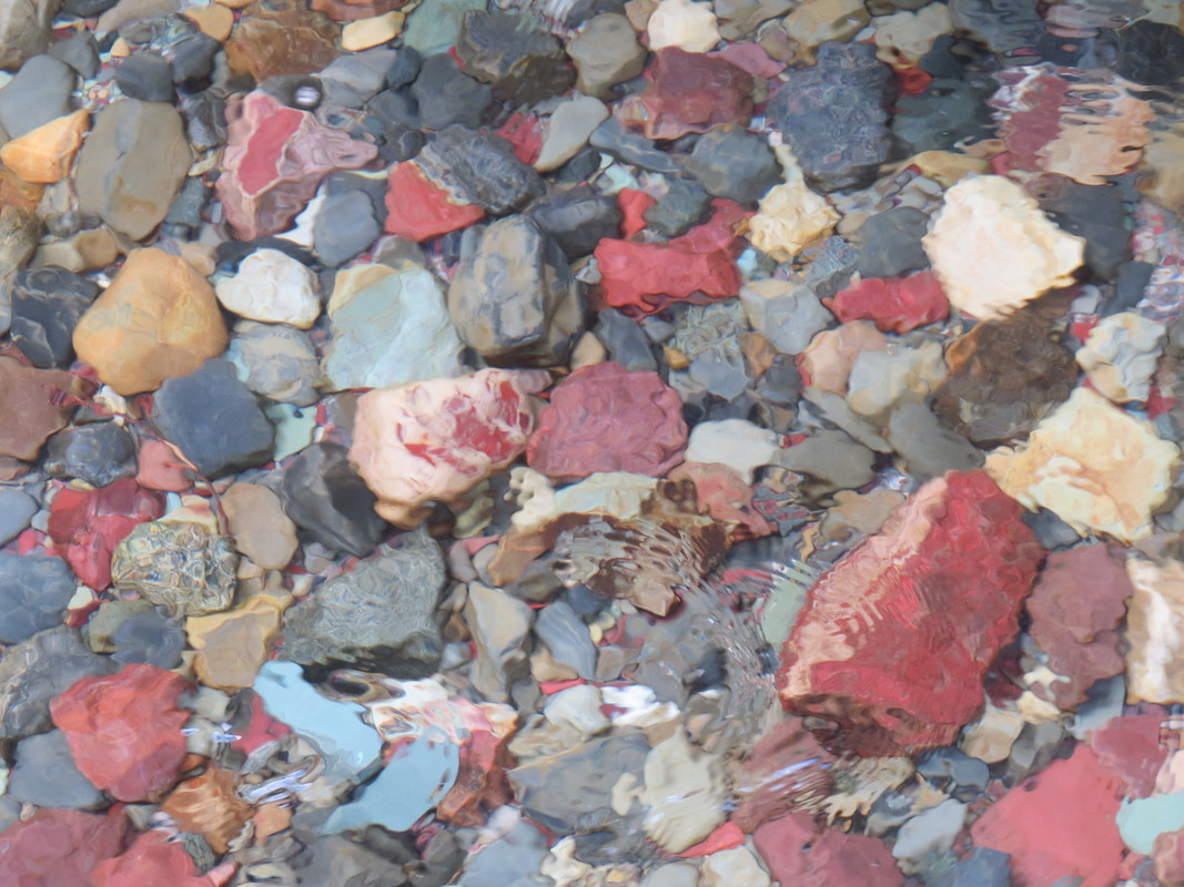
|
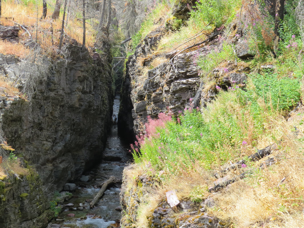
|
As we were retracing our steps from the end of the Sunrift Gorge trail, I noticed a sign for the Siyeh Pass trail. That's on our list of possible hikes, so having that little bit of reconnaissance in place is very helpful. As we passed under the GTTSR bridge, I witnessed one of the few stupid people tricks of the trip. Part of another family unit that we had seen on the trail was over the wall and down on the edge of Baring Creek. Granted, this was not a really treacherous section of water but who's to say what could happen. There are stretches that move just swift enough that a person, especially a kid could get washed downstream. You may not die but if you went over the little falls there would be bumps and bruises at the very least. C'mon folks, let's try and stay safe in the Park.
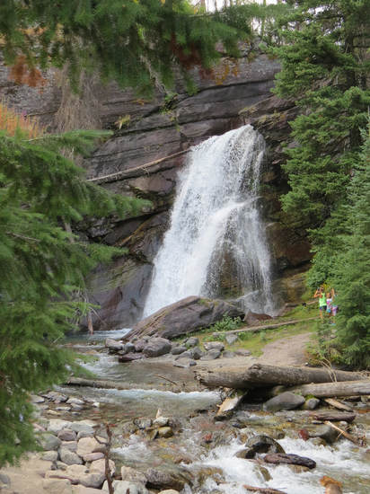 Baring Falls
Back at the main trail we turned right and continued westerly a short distance to Baring Falls. This is a popular stop, as it is a very scenic waterfall and easily accessible from the road. Lots of folks arrayed around the pool at the base of the falls. This was another cool spot on the trail due to the shade and the mist. We walked up to the edge of the pool for a better look and to get a photo or two without other tourists in the frame. Then we continued along the trail.
A short distance past Baring Falls the trail took us right down to the edge of the lake where the tour boats dock. There were two boats there when we arrived, debarking passengers along with a Ranger. Apparently they were going on an interpretive hike. We did not stick around to find out where, but I bet to Baring Falls and maybe Sunrift Gorge. Onward. The thinking was that perhaps we would hike on to St. Mary Falls up around the head of the lake. The character of the trail was changing as we were starting to enter a burnt out area of the forest. The good news was there were better view out over the lake but that was at the expense of the forest which was standing black and barren. The lack of tree cover made for hot and dusty conditions on the trail from this point on into the burnt forest. The trail at some points was completely exposed and was also hanging on the edge of the cliff face above the lake surface. We could now see the head of the lake. Across the lake there were shallow areas where the water had a beautiful turquoise color. We also spotted a waterfall on the opposite mountain side. Most likely Virginia Falls. That looks like a long way and the map concurred with that assessment. We won't go that far to day. In fact, St. Mary Falls came off the list as well when we came to the next trail marker that indicated we were still about a mile from that destination. That was more that Lynn had planned for our short afternoon walk (uncharacteristic for her as generally her short, easy hikes end up being 12-milers! I remember that time in Yosemite…).
About face, forward…OK, you get the idea. Retracing our route back to the Sun Point area. The boats were both gone when we arrived back at the dock so we made a short stop there to get some water level views across the lake. I was hoping for some of those brightly colored rocks along the water's edge to be the foreground for the image I had in my head, but as it happened all the rocks along the shore were covered in some sort of moss. I guess there was not enough current to keep these rocks shiny and clean. But it was still a nice view. We also briefly stopped again at Baring Falls as there were fewer folks standing around this time. Then we just marched on down the trail toward the parking lot. Plenty of folks on the trail this afternoon, well between Baring Falls and Sun Point, but not crowded and there were still stretches that we had to ourselves. I gave a "Let's go Mountaineers" to a young lady wearing a blue on gold tee-shirt with that familiar WVU logo. We stopped and chatted for a minute. It's always old home week when you meet folks from West Virginia on the trail (or anywhere for that matter). A little bit later two little, blonde-haired girls came skipping by. The older one was probably 10 and the younger 6, I'm guessing. Cute as could be as they frolicked along the trail. But they were getting well ahead of the rest of their group which consisted of more kids, moms, and grandma and grandpa. I suggested to grandpa that for safety sake they should keep the kids together on the trail. Hey, it's all fun and games until someone gets eaten by a bear. Maybe I should keep my mouth shut, but there's no reason to start a new chapter of Death in Glacier.
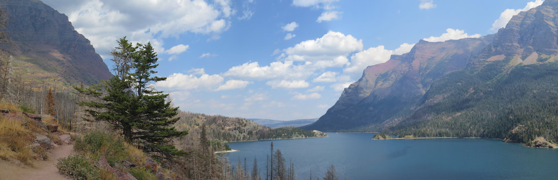
Back at Sun Point area, we took the first trail marked to the parking lot which saved us a few steps. There was an interesting black and grey beetle scurrying across the trail but it was out of view before I could bring my camera to bear. Shoot that was probably the best critter sighting we had on this little afternoon jaunt. There were a couple gulls floating on the lake at Sun Point and maybe a gone bird or two, but otherwise nothing for the list. It was about 4:00 by now. Still a sunny, blue sky with several big, white clouds floating by and a toasty 78 F. While the crowd had subsided a bit and there were a few empty slots for cars in the lot, the Red Bus parking was full when we arrived so we got to see a few of these old classics up close. But we did not lollygag long and were soon on the way out of the parking lot and headed back to Rising Sun. Photo gallery from our hike along Lake St. Mary.
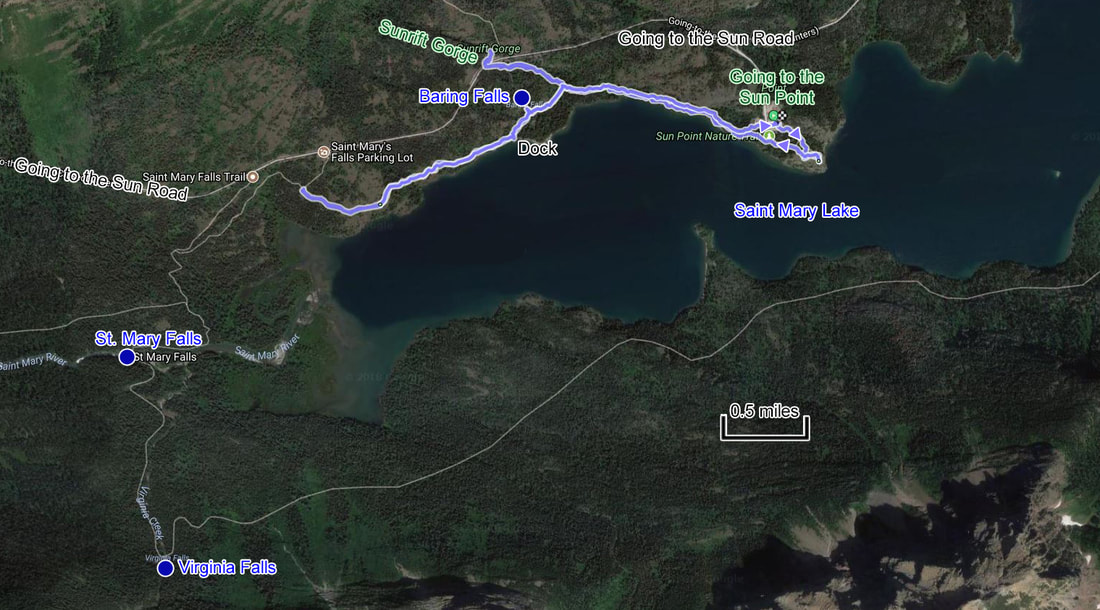
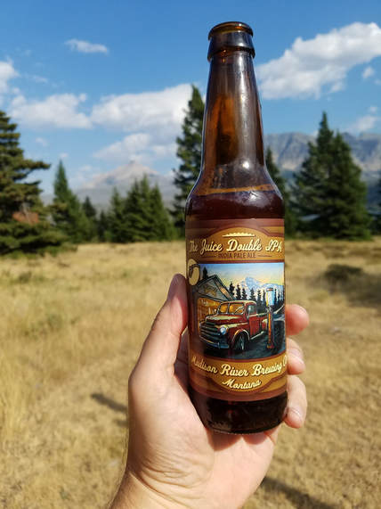
We were out on the porch on Lisa's side of the building (now the shady side) with a beer or glass of wine by 4:15. While we were lounging on the porch, a tour group arrived and filled up most of the rooms on Lisa's side of the building and a few on our side. This was a hike-bike-adventure type of tour. If we had been part of this group, we would have certainly been the "kids." We talked a bit to the lady in the room next to Lisa. They had been out hiking today and were scheduled to bike tomorrow. It sounded like they were planning on biking up to Logan Pass. The one lady said that she would probably just ride in the van. I'm not sure that any of the folks I saw would be able to make that ride (I know that I would NOT!). But it seemed they had more realistic expectations, so perhaps they'll find another place to ride. It was a little after 5:00 by now and the tour group folks were hurrying about getting cleaned up for dinner at Two Dog Flats. Seems they were scheduled for 6:00. OK, this sounds like a great evening to go into St. Mary for dinner (the tour group crowd that would soon descend on Two Dog Flats was just the excuse I needed to get a break from the menu there).
At 6:00 or slightly after we departed for dinner, having decided on Rising Sun Pizza in St. Mary. The joint was jumping, but there was one high-top table open inside so we were seated there (unfortunately the patio seating was all taken). We were warned up front that they were running behind this evening due to the large crowd and the fact that they were low on staff (looked like only three servers and one busperson trying to cover the packed house). But we were in no hurry so a little wait was not a problem, particularly since they gave us fair warning on the situation. Shoot, they even ran out of plates and silverware (I guess they were also short on dishwashers) but most distressingly they were out of the IPA. OK, that's just completely uncalled for! But they had the Prickly Pear Pale Ale which was a very good substitute. Since they were running behind and we were hungry, we started with an order of breadsticks. Those were out fairly quickly and were piping hot and quite tasty. We went with the "build your own masterpiece" option for our pizza, going all veggie. Sort of a medium thick crust, that was on the soft side, which is the way I like it, and plenty of toppings. Excellent. And we ate the whole thing. Yeah, we were hungry. We discussed options for tomorrow's adventure. While there were still trails to hike along the GTTSR we decided to head over to the Two Medicine area as this would be new for all of us.
We were back from at the motor lodge a little before 8:00. Lynn and I sat out on the porch on our side of the building for a while and chatted with the neighbors. Nice folks from Delaware. He wants to see a moose. I hope that he does. We crashed early again. No reason to stay up as the clouds again rolled in to mask any chance of a starry night.
Day 5, Monday, August 7 - Two Medicine. I was up just before 6:00. Apparently sleep is a good thing. My legs were stiff this morning. Lynn appreciated seeing me struggling. A misery loves company scenario. But I was moving better by the time I made my morning stroll to the restaurant for ice. I ate my blueberry Pop-tarts on the way. It was a beautiful, clear sky but brisk morning. Looks like a great day for a hike.
The plan is to cruise down to the Two Medicine area of the park. I have a couple trail options in mind, the top pick being Scenic Point. But we'll check with the Rangers once we get there to get the most recent trail conditions and for their recommendations. Perhaps a trail that is a little less steep. We were a little slower this morning but Two Medicine is not filling up as fast as Logan Pass. Two Medicine should not be as busy or crowded and besides we will still be there pretty early as it is only about an hour drive time from Rising Sun. We were on the road about 0730. The temperature reading from the Santa Fe's gauge was 51 F.
Easy drive south along 89 to route 49. We just had to watch out for the free range cattle. Mostly Black Angus so these future hamburgers would be next to impossible to see at night just like bison and even during the day they have a complete disdain for vehicular traffic. Other than the cows there is not much to see, just scrubby, dry grassland. The park is off to the west and our route took us through ho-hum terrain. Not much traffic this morning. I took advantage of one of the turnouts to let a tailgating Subaru pass. I was doing the speed limit but that was not enough for her. While 89 is in great shape, albeit quite winding, route 49 is a little rougher and the access road to Two Medicine really needed some work. Not potholes so much as the road surface was wavy with lots of dips seemingly from subsidence of the road bed from under the unbroken asphalt. Think Ruffles potato chips.
We arrived at the entrance station at 8:25 and were shortly parked at the shore of Two Medicine Lake. I had spotted the trailhead for Scenic Point along the road as we drove in. There were maybe two cars in the trailhead lot so that would be a quiet hike. Lynn located the Ranger Station at the beginning of the road leading to the campground so we will check there shortly. Here at Two Medicine Lake the parking was starting to fill but there was still plenty of space at present. I pulled into the first convenient slot, grabbed my camera and walked the few feet to the edge of the lake to take in the amazing view of the glacial carved rocks reflecting in the calm surface of the lake. Not quite a mirror surface but close. The preparations on the boat dock were causing a little ripple in the water as the tour boat, fishermen and kayakers were getting ready for the day on the lake. I snapped a few photos, stood a while longer just admiring the view then went looking for the girls. Lisa was nearby as she also was getting the reflection shot. We met Lynn at the General Store. Turns out that this structure is one of the original chalets that were build circa 1910 by the Great Northern Railroad to promote tourism (really to give folks from the east a reason to ride the train and visit the park). The girls made a quick scout of the wares but saved the detailed shopping for later as it is time to get on the trail. I did the important reconnaissance work determining that there was quality looking beer available for sale. That intelligence will come in handy for the post-hike break.
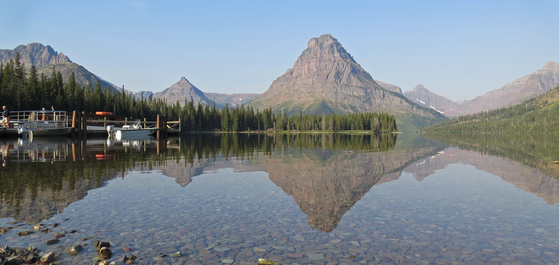
Next stop was the Ranger Station, staffed by three twenty-somethings, two young ladies and the fellow who greeted us. Ranger William provided some insight to the area trails. He admitted that he was not fluent in Two Medicine since he does not pull duty there often and he had not hiked Scenic Point, but he outlined one of his favorite routes that provides nice views, was not steep and did not have a lot of elevation gain. His route worked around the end of the lake then connected with the trail to Pitamakin Pass. This was called the Old Man Lake trail, leading to the namesake lake in 6.6 miles. Maybe we have a chance of doing that but the last section does have a serious uphill character. Worst case is we'll hike out a piece then just turn around when we feel like it. The Ranger also mentioned that there were a few creek crossings to deal with, but nothing over ankle deep and by now the seasonal hiking bridges should be deployed. We asked about bears and there was a good chance of seeing them out there but since there were three in our group and we all had bear spray he was confident that we would be just fine. Ok, one last check of the map and off we went.
We drove into the campground and on to the trailhead. The temperature still read 51 F under clear skies. Looks like a fine day for a hike. We arrived at the little parking area just ahead of a monster RV. They were looking for a place to set up camp but were having major issues navigating the behemoth through the narrow and tight turns of the campground. It was quite a mess. But we are where we want to be so not a problem for us. Our gear collected, we set off for an adventure. Not a lot of traffic on the trail early in the hike. There was a family gathered at the trail sign who started just after we passed by, but we quickly lost sight of them. A single hiker cruised by us a short time later and we never saw him again. I don’t think the bears got him. We did not see another soul for three miles or so until we ran into a trail crew. I'll come back to that.
This was a nice hike, fairly easy overall and provided nice variety along the trail. The route was just as Ranger William described. We crossed the bridge over the creek near the foot of the lake and hit the intersection with the Northshore trail. Our only option was to turn right as the Northshore trail was closed due to bear activity. Bumper crop of huckleberries and the grizzly bears were not letting them go to waste. As mentioned, Ranger William said that there was a good possibility of seeing bears along our route as well but since we had bear spray and kept up the noise on the trail that we would be fine.
The trail worked along the creek going past the campground climbing as we went. This was a wooded area so shaded and cool. Just before we crested the high point of this part of the trail we spotted something black on the trail, at first we thought a small varmint but as we approached we determined it was a huge pile of bear scat and it was fresh. This dump was as big as a pile of horse manure, so I reckon it was a big bear. OK, let's keep up the chatter. The only bear I want to see should be at least a quarter mile away.
We had the trail to ourselves after we lost sight of the fast, single hiker. We walked past the camp ground, through a couple meadows, out into the valley, across a creek or two and then back in the woods before we met another soul. Probably close to three miles. That's when we came up on a work crew clearing brush along the trail. Prototypical 20-something, outdoors types. Nice guys. We talked with the one fellow for a few minutes (he was swinging a rake, so he could hear us coming; the other two guys were wielding industrial-grade string trimmers, so we had to get right up on them to get their attention). They were trimming back the growth along the trail to provide better field of vision. Last thing you want to do is to stumble upon and surprise a bear, so this should give the hiker and the bear better visibility (usually if a bear hears and sees a hiker it will skedaddle). We asked about bear sightings and he said that he's been out there on the trail nearly every day for three months and has only seen two or three bears. But he also commented that we seemed well prepared since we were in a group of three and were all carrying bear spray. OK, at least we look like we know what we're doing.
At this point we are basically hiking through the valley that leads to Old Man Lake. The trail is on the north side of the valley, so not through the bottom of the valley but a little higher up. There is general uphill characteristic to the trail but nothing significant, just a gentle slope. We just walked along enjoying the views and watching for critters. Not much to be seen, however, just a smattering of butterflies and a few gone birds. We met two young lady backpackers (college-age is my guess) coming down the trail and stopped briefly to chat. They said they had spotted a bear back up the trail, which was good information to have. We gave them a heads-up on the trail crew they would be running into shortly, in case they could not figure out what was making that weird noise. These two were toting serious packs so they had obviously been out in the backcountry for a few days. The packs were bigger than they were. But they were smiling and chatty so obviously having a nice time out in the park.
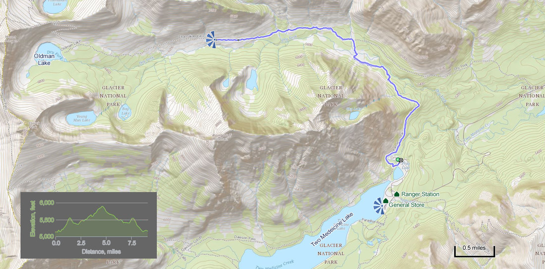
We crossed another creek, this one tumbling down the side of the valley. Pretty scene with the rocks and wildflowers. We paused for a few minutes to enjoy the views up and down the slope. From here the trail went through a couple more wooded areas, a stretch or two with tall plants encroaching (the trail crew will be busy) and more meadows. Then we hit a point where you could see down the trail for a ways. We seemed to have leveled out a bit and were more or less in the open looking up the valley. Lynn asked about location on the trail. The Ramblr app on my phone had us at about 4.5 miles, so well over a mile and probably closer to two to go to reach Old Man Lake and that would require a steep climb. I gave her the data and she suggested that perhaps we should head back. That's fine. We're going to get in over nine miles today by the time we get back to the trailhead, which was more distance that I was expecting, although the part of the trail that we covered was pretty flat. Still a good workout. Besides it was starting to really warm up now and it looked as if we would be hiking out in the open for a while during the hot part of the day. OK, it's unanimous, time to turn around.
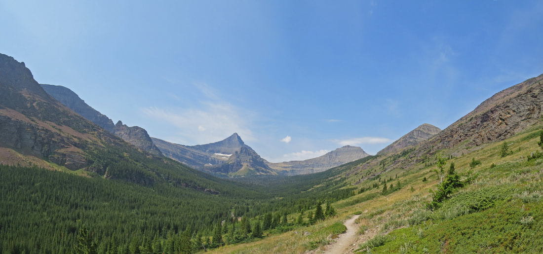
Our view at the point where we turned around. I think the tall horn is Flinsch Peak (9,226 feet) which sits above Oldman Lake. To its left is Mount Morgan.
So here's the funny part, we had seen next to no one on the trail for most of this hike, but almost as soon as we started back there were hikers coming out of the woodwork. In very short order, probably in the span of 5 minutes or so we meet three sets of hikers, all 20-somethings. The first were a couple guys who were well geared for a day hike. They stopped us to say that they saw a grizzly bear back at the creek crossing but that it had moved off when they approached. OK, better keep our eyes open as we were approaching. When the second pair approached, a guy and a girl, Lynn asked if they had seen the bear. "We saw both of them," was the girls reply, but she was just joking. They had seen nothing. Just a bit later, and not far from the creek crossing, a single female hiker warned us that she had seen a bear at the creek. Wow, the bear must be working its way up and down the slope such that the timing was just right that the middle set of hikers did not see it. I wonder if this was the same bear that the young lady backpackers had seen. I pulled my canister of bear spray from the holster just to be one step closer to ready. But we continued along the trail, talking loudly, crossed the creek and made it back to the trail crew with no bears in sight. We let the guys in the trail crew know what we had been told and moved along. They were taking a well-deserved break. Their peanut butter sandwiches might draw the bear to them.
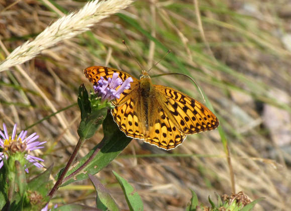
While the number of hikers increased slightly on the return hike, the animal sightings were still pretty scarce today. No megafauna spotted at all, just little guys. Chipmunks and the ever present Columbia ground squirrels, plus a Douglas squirrel or two. We saw several butterflies in the meadows but the only one that would pose for a portrait was a Checkerspot of some kind, maybe a Sagebrush Checkerspot. There were a few gone birds, but nothing we could identify for sure. Well, except for a Ptarmigan that we saw crossing the trail at one point. The most interesting bird sighting was most likely a woodpecker by the way that it flew with that sine wave trajectory when they pull their wings in and coast. It was a big, black bird with white trailing edges on its wings. I could not find a reasonable match for it in my bird book when doing my post-trip study and unfortunately did not get a picture. We'll just go with indeterminate woodpecker.
Back along the creek and through the meadows we were getting hot and the trail was getting dusty as the sun was hanging high in the clear sky and the temperature was definitely on the rise as we were approaching midday. I think we were all pleased to get back in to the shade of the trees along the last section of the trail even though this was the only real uphill section remaining on the return trip. The number of fellow hikers on the trail had dwindled considerable since we past the trail crew as we hiked back, so in terms of solitude this was a great hike. Overall it was a nice, easy hike with a lot of variation along the trail and a nice view where we turned around. I'm sure that the pay-off at Old Man Lake would have been worth the additional miles and elevation gain, but that will have to wait for another day.
We were back at the trailhead just at 2:00. The little lot was full compared to this morning when we were the only car there. There were a couple guys just getting their packs together to hit the trail. Looked like they were going to be out for a couple days at least. The campground was packed as well as best we could tell. No idea whatever happened to the big camper from this morning, but it looks like everyone is settled in for the afternoon. We loaded our gear in the Santa Fe and headed back toward the General Store. It was time to see what kind of beer they might have. The temperature gage now read 78 F as we were driving to the campground exit.
Lots of activity in and around the lake. The campground was humming. There were kayaks and canoes out on the lake. As we were leaving the campground we passed a car with two kayaks mounted on a roof rack. These were undoubtedly the prettiest and probably most expensive kayaks I have ever seen. They were wood and had just a lovely grain and finish to them. They looked more like artwork than functioning watercraft, but I doubt the folks in the car would lug them all the way to Two Medicine Lake just to look at them so I'm sure they will be floating soon.
Over at the General Store, the lot was nearly full when we arrived. There were cars parked everywhere, quite the difference from this morning. But timing is everything as another tourist was backing out of a slot very near the store just as we arrived, so we whipped right in. As expected, the girls wandered off looking at earrings and sweatshirts. I scouted the beer. Plenty of cold Going-to-the-Sun IPA in the cooler, plus a few other interesting bottles, so we're good to go. Lynn met me at the cooler and we made our choices. The IPA of course for me but Lynn decided to give the huckleberry lager a whirl. We also picked out a huckleberry muffin to split for a snack. We went to pay and the clerk asked for $4.95. We pointed out that we had two beers in addition to the muffin, thinking that he had only rang-up the bakery sale. Nope, that was the total cost. I was expecting bar prices for the beers and was figuring at least triple for the total tab. We should shop here more often. Lisa of course had a Coke; I think it cost more than the beer. The outdoor tables in the shade were all taken, but there were still a few inside. It was nice to take a break particularly with a cold beer. The IPA was very good, especially after a dusty return hike. Lynn rated her lager very highly as well. The muffin did not survive very long.
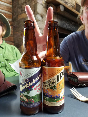
While enjoying our drinks at the general store, we discussed the plan for the rest of the day. We decided that one hike today was enough. I didn't think we would tackle Scenic Point, but there was a short trail to a waterfall that sounded like a nice add-on, but in the end we figured it was time to head back to Rising Sun. So we loaded back into the Santa Fe and started the drive back. We had not gone far out of the lot when we spied a couple hitchhikers carrying large backpacks, one with a makeshift sign on a piece of cardboard that simply stated their desired destination, "St. Mary." Hey, I know them! Those are the two young lady backpackers we chatted with on the trail. They seemed nice enough so I stopped and backed up and we offered them a ride. They were tickled! Introductions all around: They were Sara and Stevie, sisters from the Seattle area. They stacked their gear in the hatch then climbed into the backseat, sandwiching Lisa in the middle. We had a nice chat on the drive back. They had been out for four nights on a backcountry backpack. They had started their trek at the St. Mary trailhead and were hoping to get a ride back to their truck. This was their lucky day as we were going right by there. Nice girls, both in collage, Washington State, I think. Sounds like they had a grand time out on the trail. The time in Glacier was part of a road-trip. Next they were going someplace in Wyoming I think to look for wild horses. What is it with girls and horses? They said that their mom tells them to get out and do, while Dad worries about them. That's what dad's do. But these two seem to have each other's backs. Good kids. Maybe a little ripe after four nights in the backcountry (at least that's what Lisa said, but then she was stuck between them during the drive). We dropped them at their red Ranger (I used to have one of those) and wished them well. I reminded them to call home, their folks will be wanting to hear from them.
Here's the gallery of images from our day in Two Medicine.
The line at the park entrance was only a few cars deep, the pause there let us scope out the visitor center parking. There looked to be some open slots so we swung in for a short tour. As we did not have any questions for the Rangers at the information desk at this time we were able to skip the line there and just made a quick walk through of the exhibits and the small gift shop. Then it was back to the Santa Fe and on to the motel. Sara and Stevie were driving in as we were driving out.
Back at Rising Sun we were quickly out on porch with a cold drink. We started out on our side of the building but there were a few rain showers and even a stray thunderstorm passing through this afternoon which chased us to the over side of the building. It was pretty quiet with no other cars in the lot at the moment. But that soon changed as a new set of neighbors starting rolling in. Lisa was chuckling at "Running Dad" since this guy seemed to scurry about quickly everywhere he went. He was running back and forth between the room and the car as he unloaded his gear then he cantered off down the road toward the general store as he returned later at the trot with a bag of supplies. Lisa was urging the guy to slow down and relax. Hey, maybe this was slow for him. We also had some four-legged neighbors as a pair of deer walked through. They were meandering at a more vacation-like pace.
The girls decided it was time to get cleaned up in case there was a rush on water now that the lodge was filling. I continued to drink my beer. Another local craft brew. The Highlander Mount Jumbo Northwest IPA from Missoula Brewing. Very good. For some reason untappd was not saving my ratings, but this one would have been at least a 4, probably 4.25. The catch phrase under the bottle cap was "Taste Montana." I guess Montana tastes like a quality IPA.
Before she ran off, Lynn and I reviewed our critter sightings for today. Not a long list.
|
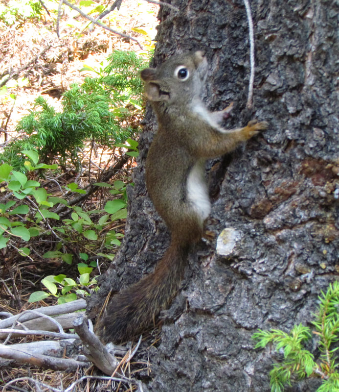
|
|
Once we were all spiffy and sweet smelling, we reconvened on the porch before heading down to Two Dog Flats for dinner about 6:00. We were ahead of the crowd, not that we've seen a significant crowds since we've been here at Rising Sun, and again were seated by the window. The girls had burgers and I tried the southwest bison sausage sandwich. Horrible. I gave up on it. At least the mac and cheese was good. We splurged on desert this evening. The huckleberry cheesecake was the highlight of the meal.
The passing storms continued into the evening. It poured during dinner, but let up so that we could walk back to our lodge building without getting drenched. The storms were short but packed a punch with thunder and lightning. It seemed that the wet weather had settled in for the night thus once again masking any chance of stargazing. We just called it a night.
Day 6, Tuesday, August 8 - Moving to Many Glacier. Today is a travel day, as we transition from the St. Mary area to Many Glacier. I figured we would make this an off day in terms of hiking as well, since we have logged nearly 30 miles over the past three days. We'll just have a leisurely morning, get breakfast at the restaurant then meander through St. Mary and Babb on our way to Many Glacier. I'm thinking a milkshake at Two Sisters is probably on the “to do” list as well. But since we have nothing pressing on the agenda today, we are in absolutely no hurry this morning.
Even though this was a relaxed day in terms of schedule, I was still up early. Once Lynn was awake, I finished off most of my packing. I went down to Two Dog Flats for ice at 7:15. The morning was very grey and cool. While the rain from last evening had moved on, those clouds had been replaced by fog all through the valley. The ridges on either side of Lake St. Mary were completely obscured once again. On the way down to the registration building, I spotted a rabbit. I figured it was a jack rabbit. I told Lynn once back in the room; she suggested it might be a snowshoe hare. Well, I'm no expert so I reckon it could.
We headed down to breakfast at 7:30. It was nice to have a slower paced morning, although the habit of getting out early for a hike was tough to break. Good crowd at Two Dog Flats, largest I have seen for breakfast, but it is an hour later than when I would usually stop by for ice each morning. But not so crowded that we again scored a window seat, not that there was much to see this morning with the low clouds draping the mountains. Lisa grilled the host about the quality of the hot chocolate; must be made with milk, not the instant powder with water. I reckon we all have our quirks. The breakfast menu is sparse but while limited offers a good variety. I kept it light with oatmeal (OK, call me quirky but I like oatmeal), Lisa went really light with just a bagel while Lynn had traditional bacon and eggs. Nothing special but still very good.
Back in the room I packed, Lynn and Lisa read. Shoot, we forgot the second bag of ice so back to the registration/ restaurant building. It was now nearly 0900 and the sky was trying to clear above us and to the east but was still very grey up the valley and on toward Logan Pass. I could now see the ridge behind the lodge. It was still a bit hazy but visibility was much better. I was now packed and went out to just enjoy the morning on the porch, still reading about death and destruction in Glacier (this really is a fascinating if somewhat gruesome read). However, Lisa was a bit antsy and wanted to get on the road. "Chill out, man; have a beer!" She was not buying it. OK, we'll get rolling…eventually. We did take a walk around the grounds of Rising Sun, up the hill through the cabins and found the trailhead to Otokomi Lake. We'll have to save that hike for the next trip.
Here are a few more pictures from our time at Rising Sun (plus a few other random snapshots from around the park).
At 10:00 we were packed and heading to check out which took a few minutes due to only having one agent and several tourists, but even then we were back in the Santa Fe with our last bag of Rising Sun ice in the cooler and on the GTTSR heading toward the east entrance at 10:15. We opted not stop at the Visitor Center on the way out the east entrance. But we did have a few stops to make, starting in St. Mary. The girls wanted to check out the gift shops and the Santa Fe needed some fuel. Plus we probably need to restock the beer supply just a bit. I was going to just head to the gas station adjacent to the stores and let the girls shop but the lines at the pumps were rather long so I went into the tourist traps (not really) for a look around. Plenty of souvenirs but nothing that I was looking for. I think the girls walked away with a little loot. When we came out the lines at the gas station had subsided so I fed the Santa Fe then we drove down to the grocery store. There was a motorcycle tour there, probably 30 bikes and a support vehicle. They must have beat me to the caramel M&Ms as there were none to be had inside. Very distressing. But there was still a 6-pack of Bent Nail, so all was not lost. I bought the beer, added it to the Trip Advisor travel cooler and then we were headed north on route 89.
We quickly ran out of civilization in terms of the town of St. Mary and out into the rolling open country. Still sort of a grey day, but not near as gloomy as earlier this morning. We spotted a huge Red-tailed Hawk perched on a power pole along the road. Had to be a female due to the size. There was also a Bald Eagle sighting near Two Sisters. We were starting to get a little hungry and now we know the location for Two Sisters which was high on our list of places to try (this was a short list; Two Sisters was the only entry), but we figured we would scout Babb just to see what is there. The short story on what is in Babb is not much. When we visited Many Glacier in 2009, we just drove to Babb and turned left onto the park access road, so the only business we saw was Cattleman's. We drove through town today and there really is not much more than that, an old motel or two, gas station, couple of questionable looking bars, school and the municipal building. Basically Babb is a wide spot in the road. But that made the choice for lunch easy. Back to Two Sisters.
There were a few more cars at Two Sisters than when we passed by just a short while ago, but still plenty of room for us. Sort of an eclectic looking place. I mean the building is simple but the paint scheme and murals on the exterior are quite eye catching. The inside décor is approaching sensory overload. There is a little bit of everything and it is very colorful. One wall is covered in license plates from all across the US. One of the plates is still attached to a bumper, then whole thing is mounted on the paneling. Almost every square inch of the exhaust hood above the grill is adorned with bumper stickers. There were inflatable animals hanging from the rafters and duct work. Signs and photos were scattered all around the dining room. There was plenty to read while enjoying a meal here. We grabbed a table in the corner. The service was quick and the server was very friendly.
Our original thinking was just to grab a milkshake but I guess breakfast was wearing off so we opted for something from the lunch menu as well. Since the fried pickles went over so well earlier in the trip I got us and order of those to start. Excellent choice. Lynn had the quiche, which was HUGE. Probably four times a normal portion. But she said it was very good even though there was no way she could finish it. I really enjoyed my bison burger. It was also a preposterously sized. I did not realize that it came with a fried egg on it. That seems to be a more standard burger topping these days. I liked it. But we all ate way too much to have any chance of fitting in a milkshake. We'll just have to come back for that. As I was paying the tab at the front counter, I noticed their bumper sticker: "We got hucked up at Two Sisters!" Clever.
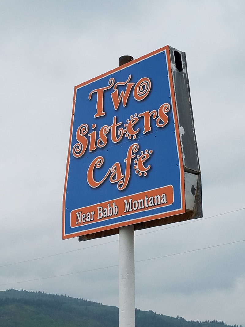
|
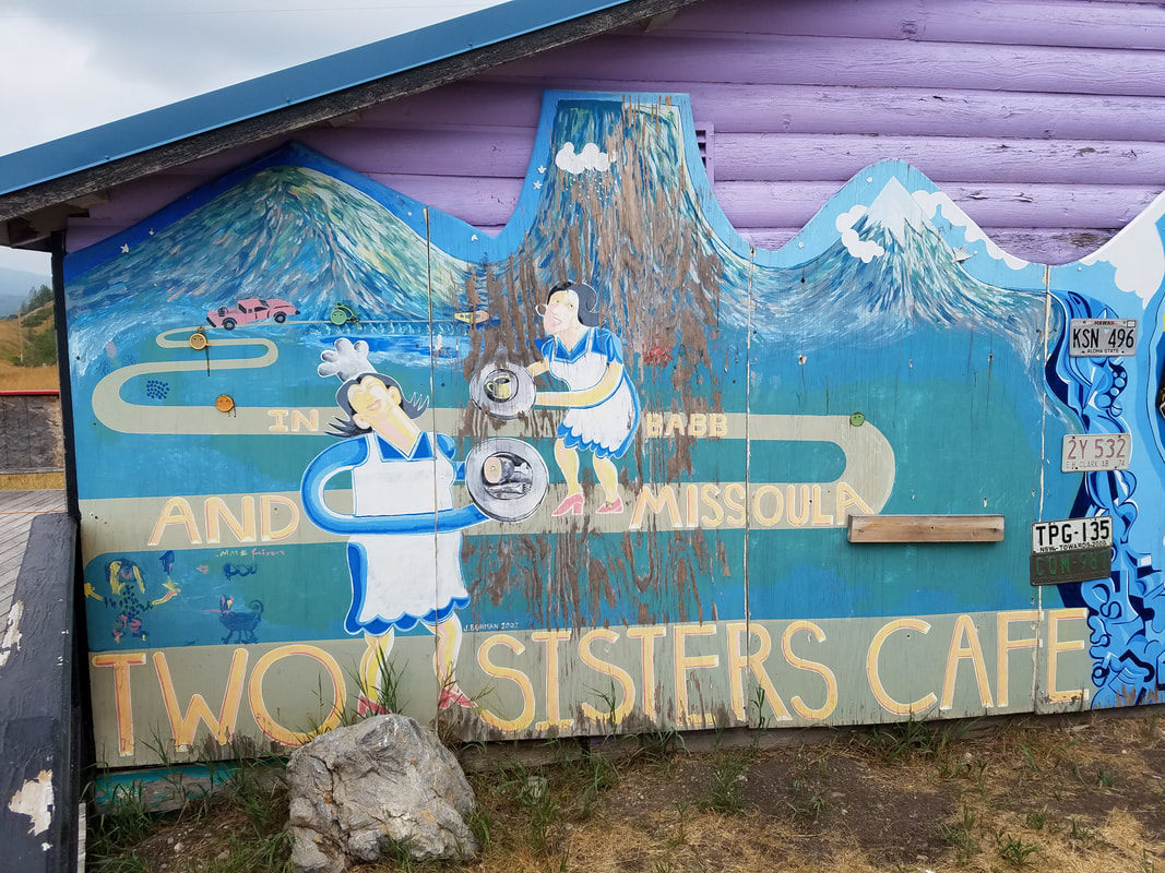
|
|
|
We've basically seen all there is to see along this stretch of route 89, so we decided just to head on into Many Glacier even though it was way too early to check in at the hotel. Worst case we'll just hang out in the great hall or out on the back deck and enjoy the views for a while. The tricky part will really be finding a parking spot as the reports on the Glacier Twitter feed indicate that Many Glacier is also filling up and is usually packed by late morning. Continue on to Part II of the journal to see if we found a place to park….