Trip report: Utah Meet-Up in Escalante
Escalante, Utah, and Sedona,
Arizona; October 1 through 11, 2013
The
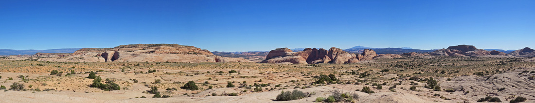
2013 Utah meet-up was held in Escalante with exploration in the Grand Staircase-Escalante National Monument and along scenic byway 12 the primary activity for
our four days of fun. We hit it lucky with
our selection of Escalante and the GSEMN as most of the areas we wanted to
explore were not affected by the government budget issues that closed the
National Parks. MsHick and I had
toured along scenic route 12 and had driven through Escalante a couple of
times, but we had never explored the area in any detail. This was all new for us! Of course spending time with our friends was the main attraction.
Danny
and powerglut worked out most of the details for the hikes and
canyoneering. SouthJerseyGirl found us a
nice rental cabin. And of course
slickrockwalker was our mother hen. Everyone pitched in to make the 2013 meet-up a
great success.
After the meet-up, MsHick and I continued our vacation in Sedona (described in part II of this journal). We explored the state parks and spent an enjoyable day in Jerome but still did not do any serious hiking. I reckon we’ll just have to head back there and try again. Overall, it was a great trip.
After the meet-up, MsHick and I continued our vacation in Sedona (described in part II of this journal). We explored the state parks and spent an enjoyable day in Jerome but still did not do any serious hiking. I reckon we’ll just have to head back there and try again. Overall, it was a great trip.
|
Logistically, we did a point-to-point route, flying into Las Vegas then driving to Escalante, then Sedona and finally to Phoenix for the flight home. All the details are listed below. Be prepared for another long report!
Day 1 - Tuesday, October 1, 2013: Heading West
Sort of an odd first day of vacation. I mean it’s not every trip that start with being furloughed! But that’s what happened today, 10/1/2013, the Federal government shutdown, so NASA is closed so MsHick and I are both “unemployed”…at least until the budget is passed. But that’s OK, we’re heading out on vacation as planned anyway. Shoot, the folks at work think I’m a genius for scheduling vacation to coincide with the shutdown. Just pure dumb luck really since this trip has been on the books since early this year.
Oddly enough I commented to Kamana that a shutdown for today would be OK so I could start vacation early, but I’m actually kind of ticked that the boneheads in DC could not do their jobs so that I and everyone else could not do ours. Whatever. We now have all day to do our final packing and chores. Shoot we even had a nice walk on the Chippewa Inlet Trail this morning from about 11:00 to 12:25 around the north wetlands and the nature trail; about a 4-mile walk and a good start to the trip.
Once back at the house we cleaned up the final few chores. I submitted my timecard and down loaded the meet-up phone list to my Droid and we were off and running to the airport just before 1:30. No worries about getting to Hopkins too early as we have United Club passes to use. The passes are a annual perk with my United credit card; might as well use them.
|
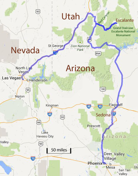
Our route during for the 2014 Utah meet-up. Started in Vegas and ended in Puh-hone-nix.
|
So from home through security in just under an hour…must be a record! Our flight is listed as on-time so no worries there and the weather looks great so I doubt there will be any issues. Now we’re just hanging out in the lounge with a Great Lakes Dortmunder and a plate of snacks….life is good!
Just like Kimbo used to always say, “look for people we know.” I saw Chris Pestak in the United Club. He was heading off on a business trip to Boston, I think. Boy is he psyched about the Tribe making the post-season. Good for Cleveland.
We lounged in the United Club until about 5:15 then headed to the gate. The United Club is comfy but no great shakes. Sure there was Dortmunder on tap, but I need hops!
Flying in an old 757. I think the serial number was 003. Shoot this was not even a full flight; what’s up with that? I haven’t been on flight that wasn’t overbooked in years. I checked Facebook before turning off the phone. Esty is in Escalante! I guess we have officially started the meet-up as Danny should be there soon if not already, plus Kbec and Pixie are doing an overnight hike along the Escalante River starting today.
Alright, first class seats! Great use of frequent flyer miles. Hot towel and roasted cashews and almonds. I needed the salt to counter the chocolate-coated raisins from the United Club. I’m not sure how the margarita I had on the plane fit into the equation but it was pretty good.
I’m finally starting to unwind. Weird day…but good times are coming in Escalante with dear friends who I have not seen since the last meet-up or longer, plus a few who I have not met yet!
On time arrival in Las Vegas. We got lucky with airfare and rental car rates flying into Las Vegas and departing from Phoenix. This gave us the best access to southern Utah plus the opportunity to visit Sedona for a few days following the Escalante meet-up. We had a bit of a hike to the baggage claim area. I don’t remember the train and the claim area used to have a lot of bright advertising signs for the shows on The Strip. I reckon there had been some serious renovations since we last flew through Las Vegas.
We had a short wait for the hotel shuttle. I had checked with the hotel prior to leaving and was instructed to simply call when ready and they would dispatch the van to pick us up. The driver filled us in on the airport updates. This was not a renovation but an entirely new terminal. Well that explains it.
Right at an hour from touchdown to being in the room. So far the logistics are working well. I picked the hotel to further facilitate our trip logistics. We stayed at the Homewood Suites at the Las Vegas Airport (review) which is just a short walk from the rental car terminal. This worked out well, plus the hotel was very nice. As neither of us were hungry (the meal on the airplane wasn’t that good, but it was at least filling) and it was after 11:00 PM Cleveland time, we opted just to stay in and watched some TV. Tomorrow we head to Utah.
Day 2 - Wednesday, October 2, 2013: On to Escalante
The government is still shutdown. I’m on vacation. We’ll figure it out when we get home.
I was awake at 4:00…that’s sleeping in based on east coast time. We headed downstairs for breakfast about 6:00. Great food and free. Bonus! I made a sausage and egg bagel; much better than anything from McDonald’s. But I resisted the temptation to have a second sandwich. I’ll go with a banana instead. Let’s try to be somewhat healthy, at least until we get to Utah.
We reviewed the map and route. We’ll go with the most direct route from Google maps in order to get to Escalante as soon as possible. I called Hertz at 7:30 to see if I could get the call early; our scheduled time was 9:30. No answer. I’ll just chance it and headed on over to the rental car terminal. As soon as I stepped outside I felt that the vacation was on! It was a warm, sunny, desert morning, even if it was in Las Vegas. The warm, arid air and sun on my face just kicked my into vacation mode.
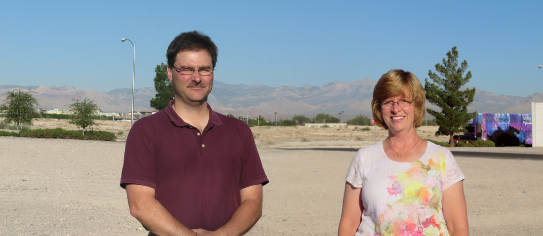
Photoshop got us in the same photo, but the sun was still blaring in my eyes!
|
After a quick walk across the highway overpass, I breezed through the Hertz check-in. Shoot, I could have shortened the process even further as the lady at counter said that I was registered as “gold” and could go straight to my car. Shoot, I was back at the hotel with our Chevy POS sedan by 8:00 (it was a Cruze and fine for this trip, but it was not a great vehicle). We packed the car, took a couple of photos in the parking lot and pulled out at 8:24. Let the road trip begin!
|
No issues with the drive. Minor slow down due to construction as we were leaving Las Vegas and a few bottlenecks with truck traffic on I-15 in Nevada, but overall a smooth sail. We stopped in Mesquite for hiking snacks for the week plus a Chic-o-stik for the drive. I got a call from my credit card questioning the charge and stating they are putting a hold on the card to avoid any further fraudulent charges. Excellent that they are watching out for me, but I’m going to need that card for the rest of the trip! I finally got through the myriad of menus and get a human on the other end of the line. She was quite helpful and we got the situation in order.
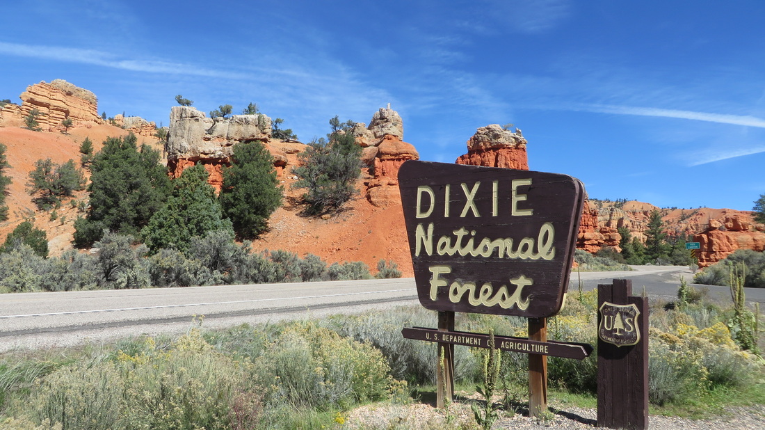
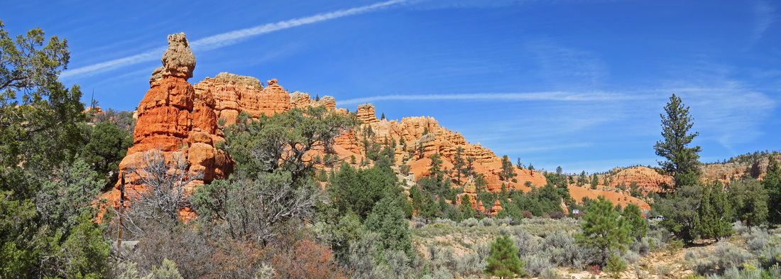
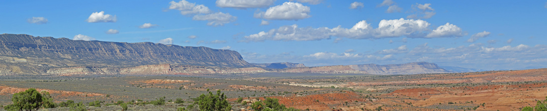
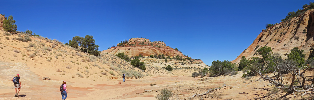
It was a dull drive until we hit the Virgin River where the scenery improves. The GPS on my phone (we call her “Baby”) took us north on I-15 to route 20 then south on Route 89 and finally east on scenic byway 12. We stopped on Panguitch, the first town on 89 south of the intersection with 20, for fuel and a short break. This is where we got the call from SJGirl that the house would not be ready until about 4:00 due to the current renters not leaving on time. Seems there was some sort of confusion on their departure date. I’m sure there’s an interesting story in there somewhere. So we slowed our pace as we approached our destination and made a few more stops along the way. Bryce Canyon would have been an ideal place to hang-out for a while, but it is closed. But there are plenty of other scenic options along route 12.
Our first stop was at the start of Red Canyon, part of the Dixie National Forest. We pulled in at the first view point and snapped a few photos. We then walked the trail up to the second view point then hiked up into the hoodoos a short distance. Wonderful views and amazing colors in the rocks. The views at these two viewpoints provided the most dramatic views.
Since we had time, we also stopped at Ruby’s, just outside of Bryce Canyon. There was still a decent crowd here, including a few buses of tourists milling about. Many foreign accents in the store; Aussies, English, French, German and many Asians; I felt sorry for them all as they were shutout of the primary places they came to see, the US National Parks. Oh well. We had an ice cream sandwich and enjoyed the crisp, clear air at 8000 feet. Then it was on to Escalante.
|
|
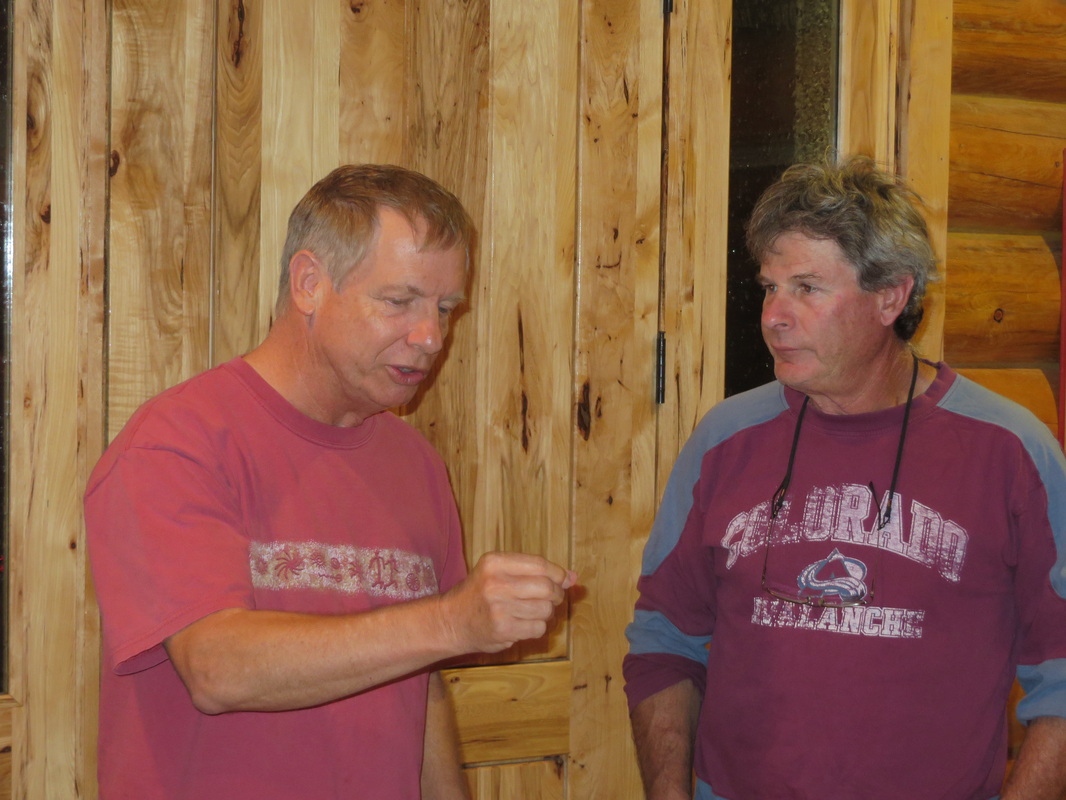
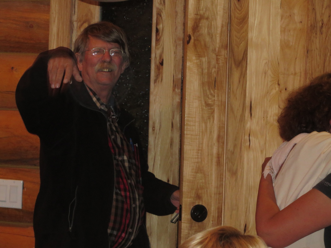
We rolled into town right about 3:30 and easily found the house. Escalante is laid out in such a logical manner that it is impossible to get lost as long as you have an accurate address. SJGirl, SJGuy, wings and Mrwings had just rolled in as well. Redirtdawg and slickrockwalker were there as well since they had convoyed in from Grand Junction. RedRox was also in attendance. Everyone was just hanging out in the driveway as the house was still being cleaned. In fact, there was still one couple who had not yet checked out from the house; they were still out hiking and not yet aware that they had been “evicted” and relocated to the Prospector Inn. Best we could figure out was that there were three or four couples from Europe staying in the house. They showed up a day late for their stay but decided that they would stay the same number of days. That obviously was not going to work. The owner got it sorted out and had the Europeans moved out. Seems they made a bit of a mess of the house, but it was spic-and-span by the time we moved in.
The delay gave us some time for hellos and a beer while we waited. MsRedPony came over with the pups; she and RedRox are staying in the B&B just next door. Kmesaaz was also with MsRedPony. The party is starting! Powerdrglut and MsPG rolled in not long after we got into the house. We got settled into the house. SJGirl, SJGuy, wings and MrWings took the upstairs bedrooms and MsHick and I headed downstairs so that Howie and Deb could have the main floor master suite. Seemed like the fair arrangement since pg had done a lot of the legwork for this meet-up. Sometime during the course of the afternoon, RedRox mentioned that he had seen a bison just down the road from the cabin. My catch phrase for our Yellowstone trip was "look for bison" and I tried in out as we were driving into Utah earlier today, only to get shotdown by MsHick. Now I have to find that freakin' bison.
|
The downstairs had two bedrooms, both were small, so we slept in the one with the double bed and used the bunk bed room for our luggage and hiking gear. That worked out well. We even had a living room downstairs as well as direct access to the lower level patio.
The rest of the evening was just the gang gathering at the house and renewing did friendships and starting new ones. There were three newbies for this meet-up: Kmesaaz (who a few of us knew; MsHick and I had met her at Yellowstone a couple years ago), Esty (RedRox and MsRedPony had already met her) and PNJM (or PB&J; another Jersey Girl; she and SJGirl had met earlier this summer on the east coast). We also found out that mtnwriter did not make the trip; the closing of the National Parks had kept him away. The last to arrive were Pixie and Kbecjeans; their hike took longer than expected.
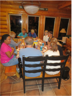
It was a grand evening with gang, old and new. Howie was the grill master and had the burgers, brats and chicken sizzling. The ladies were working on the sides in the kitchen. The rest of us were scatter around the house. The whole place was humming. I chatted a bit with MrZig and also talked photography with Rdd and MrWings. There were 19 cats in the herd tonight, a pretty good turnout. We had a skull session later in the evening. Danny used the huge drum in the corner of the living room to get everyone’s attention; Donna followed up with the dinner bell when the attention of some folks started to stray!
|
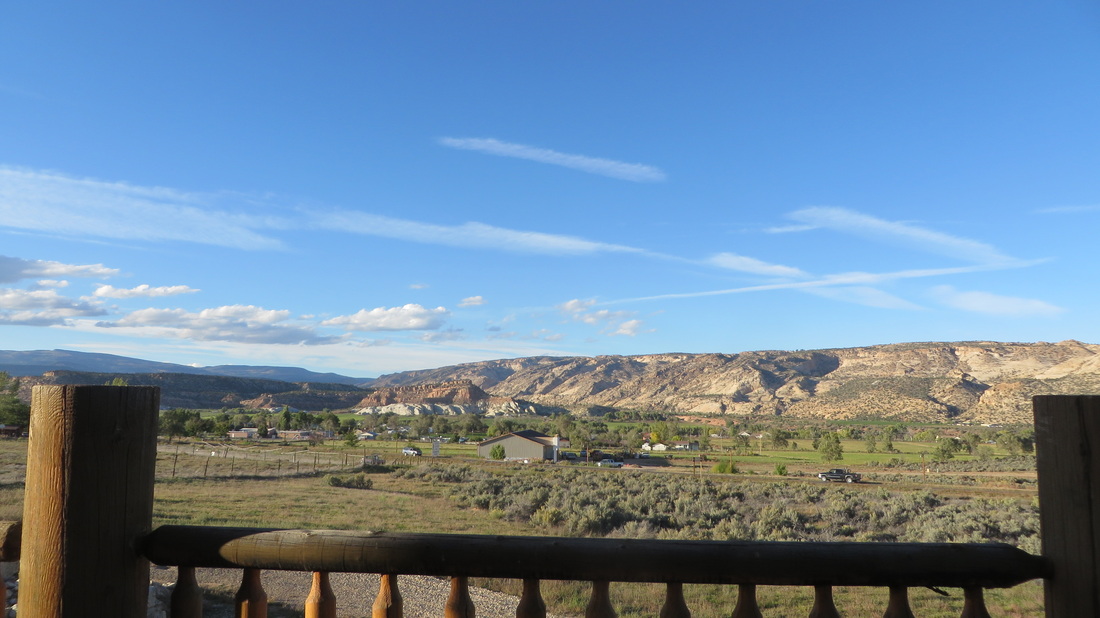
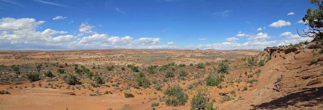
The view from the back porch of the cabin.
|
We came up with our general plan for the first day of the meet-up. The main event would be the hike to Spooky and Peek-a-boo slot canyons, with the herd congregating here at the house at 0900. Rdd suggested an evening excursion to Devil’s Garden tomorrow evening for a photo op.
It has been a long day but a great evening; still everyone was heading home by 9:40. We all turned in shortly thereafter. Before heading to bed, I spent a little time on the porch just being amazed by the stars. Sublime.
Here's the link to a few more photos from today.
Day 3 – Thursday, October 3, 2013: Spooky and Peek-a-boo
We were up at 5:00 once we heard movement upstairs; it was pg of course. I headed outside and again enjoyed the wondrous stars before the morning sun broke over the horizon. Back inside the rest of the crew was starting to stir. We all had breakfast, got our gear together and finalized plans for the day. We have a 26-mile drive down the Hole-in-the-Rock Road to get to the trailhead for Spooky and Peek-a-boo slot canyons. There is still a little concern that we’ll be allowed down the road, since it is an access to the BLM controlled Grand Staircase- Escalante National Monument (GSEMN). However, the intel that we had gathered thus far indicated that the BLM lands were still open to the public and there it was just the units under the jurisdiction of the National Parks Service that were physically closed. We had also heard that there was a National Park employee stationed on the Hole-in-the-Rock Road, just checking to make sure that folks were not driving the entire distance of the road (about 50 miles of washboard and ruts) to gain entrance to the Glen Canyon National Recreation Area. Seriously?
As I’m getting ready for the hike, I try to set up my phone to map the hike on EveryTrail. Looks like the phone has been wiped out; complete reset and reboot. WTF! Could this be an example of Big Brother doing a remote wipe and reload so that I cannot access NASA email? Could be, I reckon. Glad this is a company phone and not a personal device, as having a personal device wiped would really be a drag. Not that I was going to be checking email anyway; besides the fact that we’re furloughed and not allowed to even access email, I’m on vacation. Besides, there is very limited signal at the house, so any kind of internet access is iffy at best. The only loss is that I won’t be able to track the trails since I won’t be able to reload EveryTrail with wifi. Oh well, no great loss.
Danny was the first of the hiker’s to arrive at the house, right about 8:00. The rest of the cats were all on site by 9:00. Amazing! We were on the road out of town shortly after 9:00, heading to the turnoff to the Hole-in-the-Rock road. It is a beautiful, blue-sky day; a bit cool this morning but it should be in the upper 60s for the hike. We were only on the HITRR a few miles when we hit the check point. Yep, sure enough, there stood a NPS employee checking the destination of each car, just to make sure no one is trying to sneak in the back door to the National Recreation Area. How’s that for crazy? Anyway, we let the ranger know that we were heading to Spooky and he waved us through. Simple as that.
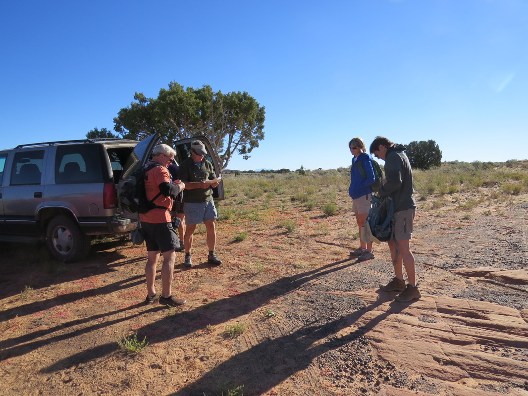
The road was actually in pretty good shape. We were making very good time in MrZig’s brand new Jeep Cherokee. We made pretty good time to along the route. Shoot, the vibrations from the washboard set up a nice massage through the backseat of the jeep. Not bad at all. The only minor trouble spots were where the road had washed out at the culverts due to the heavy rain over the summer. There were several severe washouts; all of which had been made passable, so there was no real issue in passing. Then the problems hit.
Danny and MrZig made it to the trailhead parking area with no issue, but on the spur road up to the parking area we could not see any of the rest of our vehicles. Sort of curious as it was an open flat area. It took a little while, but we finally figured out what transpired. If this were a military operation, the after-action report might read something like this:
Operation Slot Canyon – The column was underway at 0900, traveling southeast along the Hole-in-the-Rock Road. The column suffered a 20% loss in vehicles when the transport commanded by Captain SJGuy was disabled due to unknown mechanical or electrical system failure. By this time the head of the column had reached the objective; the remainder of the column had stopped with the disabled transport. Communication between the two sections of the column was limited due to poor mobile phone service, but contact was finally made. The reminder of the column continued to the objective point while the personnel in the disabled transport waited for a salvage expedition to be sortied from the base in Escalante.
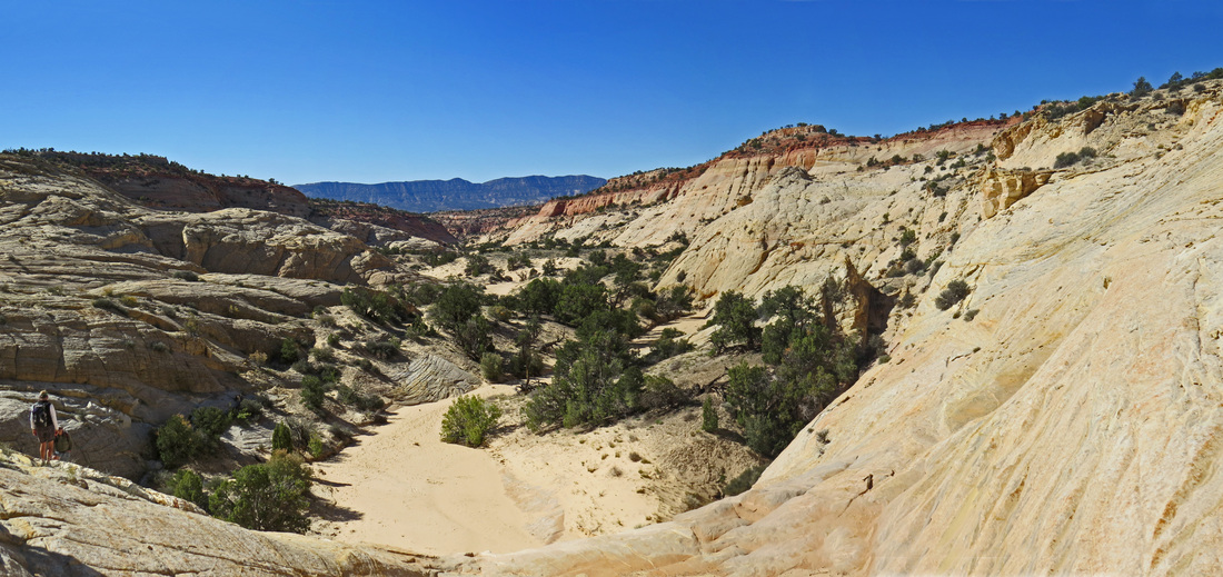
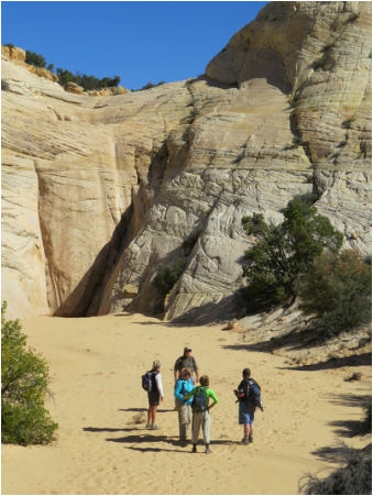
Rdd ferried the rest of the group in his Jeep as RedRox’s car did not have the ground clearance to back the final mile to the trailhead. So, there are now 14 hikers and two dogs for our slot canyon excursion. We were finally on the trail about 11:00, a little later than planned, but not bad all things considered. It was a very pretty day as we started down into the Dry Fork of Coyote Gulch. The terrain in the area was reminiscent of the trail into The Wave. The trail was generally downhill in the gulch. There were a couple of places where we had to spot for the weaker hikers as we crossed the steeper sections of slick rock but with good teamwork we all made it down to the slots.
Vista from the trailhead heading down to the slots. The Straight Cliffs are off to the left.
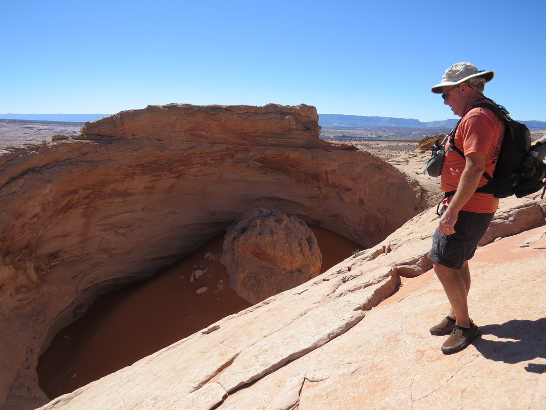
We first looked into Peek-a-boo slot. I guess the usually route is to go up Peek-a-boo and come down Spooky, but several of the group had gone that route, so Howie wanted to try going first up Spooky and back down Peek-a-boo. We did spy a trouble spot at the end of Peek-a-boo, a deep hole of water that will make the exit more difficult. We’ll see how that plays out when we get to that point.
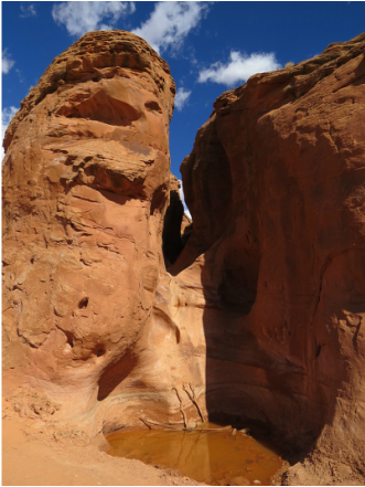
Lower end of Peek-a-boo slot canyon. Note the water hole at the base of the fall; this ain't usually there.
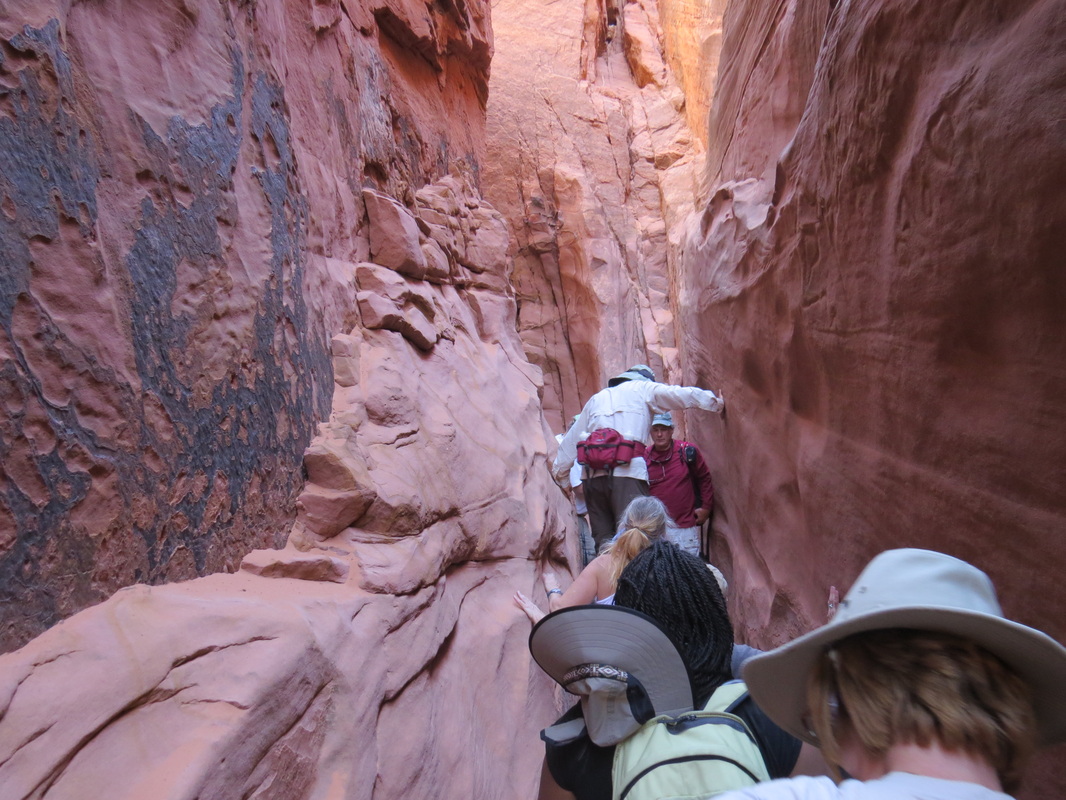
Working our way through Spooky slot.
|
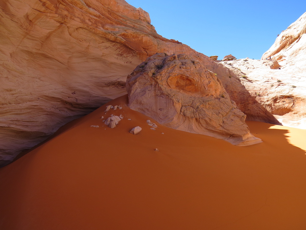
Off we went along the creek bed toward Spooky. The creek bed had a greenish tint which just added to the overall rainbow of color in the rocks. We took a short break in the shade before entering the slot. Danny had a story to share with the group before we headed in; this one was about the young lady who died while hiking in this are earlier in the year…I’m not sure the group really wanted to hear that.
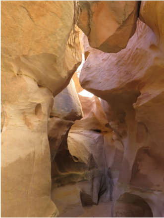
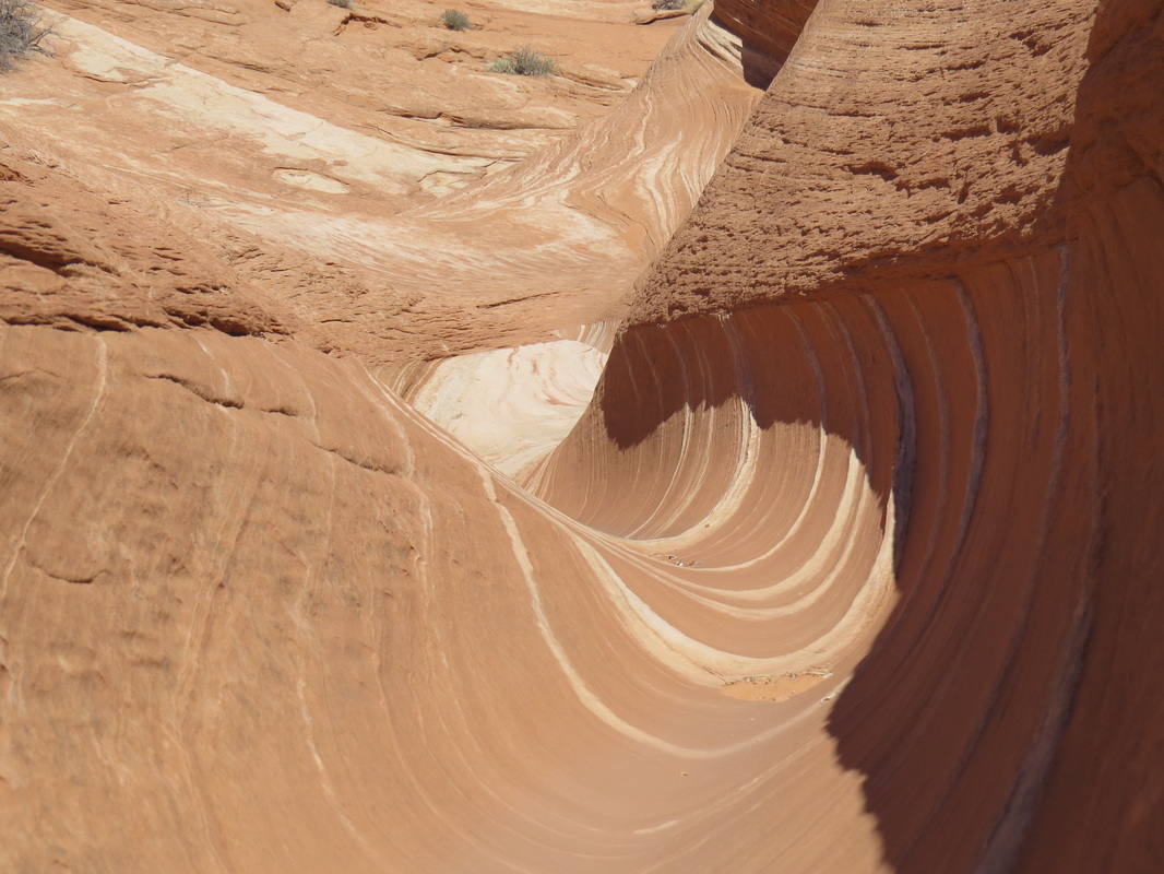
A bit of a slow go as we entered the slot with folks posing for photos, but that’s all part of the fun. Then we had to figure out how to get the herd through the tight spots and over the small technical obstacles; a few high steps but nothing we could not handle. Everyone helped with the packs and pooches. The slot got progressively more narrow, but we got through those pinch points as well. By this point I was the last person in line, which was fine as it made for better photos. Spooky is a very photogenic slot canyon with interesting contours and nice color plus plenty of light so no problem shooting hand-held (darker slots require a tripod to get quality images).

Colors and contours in Spooky slot canyon.
|
It did not take long for the column to come to a halt. The work came back that the way was blocked so we would need to reverse and back out the way we came. So MsHick and I did just that. Then the word came that we could move forward…no strike that, let’s turn back. Hey, what the heck is going on up there?!?
OK, seems that there was a significant obstruction in the slot. The path had been altered due to the heavy rain over the past several weeks. Some of the folks at the head of the line opted to push on through the slot, but most of the rest had to reverse course as the obstructions were too much to majority of the group. Since MsHick and I were at the end of the line, we had no choice but to turn around at retrace our steps. So out we went and back toward to Peek-a-boo to wait for the hiker’s who kept moving. Rdd, pg, Esty, MrZig and lvziggy where the team moving on through Spooky.
|
It was a nice walk. We enjoyed the views and checked out the wildflowers and spotted a good size lizard. We made one stop for a break and to water the dogs then it was on to Peek-a-boo. We watched a couple of guys enter Peek-a-boo. The first guy at already scrambled up the fall and into the slot but the time we arrived. The second guy needed a rope and some help to gain access. This was not a good sign for our intrepid hikers who would be exiting this way.
While we waited, Danny, Pixie, PB&J and I made a short walk into the Dry Fork, a much wider slot that provides the primary drainage for the gulch. It was not nearly as pretty as the tighter slot canyon.
|
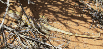
Western collared lizard - color variation
|
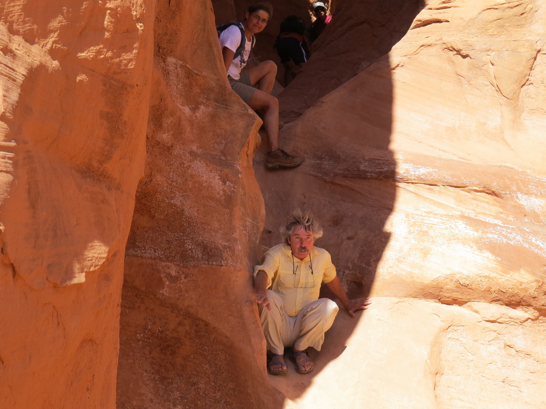
Here comes F Troop working their way out of Peek-a-boo.
|
Finally we heard our missing explorers coming down Peek-a-boo. Rdd was in the lead followed closely by Esty. Rdd skillfully worked his way down the fall to the puddle at the base of the slot’s inlet. This was a tricky climb. Esty and pg were also able to extricate themselves from the slot without too much difficulty and limited swearing (mostly from Esty). MrZig and lvziggy doubled-back up the slot. We got the rest of the troop mounted and moving back to the trailhead, knowing that the fast-moving Zigs would catch us on the trail, which they did. Howie had cold beer waiting for us at the trailhead once the slower hiker’s were ushered back up the hill.
We found the rest of our housemates back at the cabin. They had a long wait for a tow truck, but did finally get the truck back to town. SJGuy and MrWings were still working the logistics of rental cars and replacement parts. SJGuy ended up with a off-road Jeep, dubbed the Ultimate-POS (that is probably the best possible description). He will be cruising over to Panguitch early tomorrow morning to get a new fuel pump….go figure.
|
One finally look at the desert as we returned to the trailhead from the Dry Gulch of the Coyote.
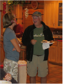
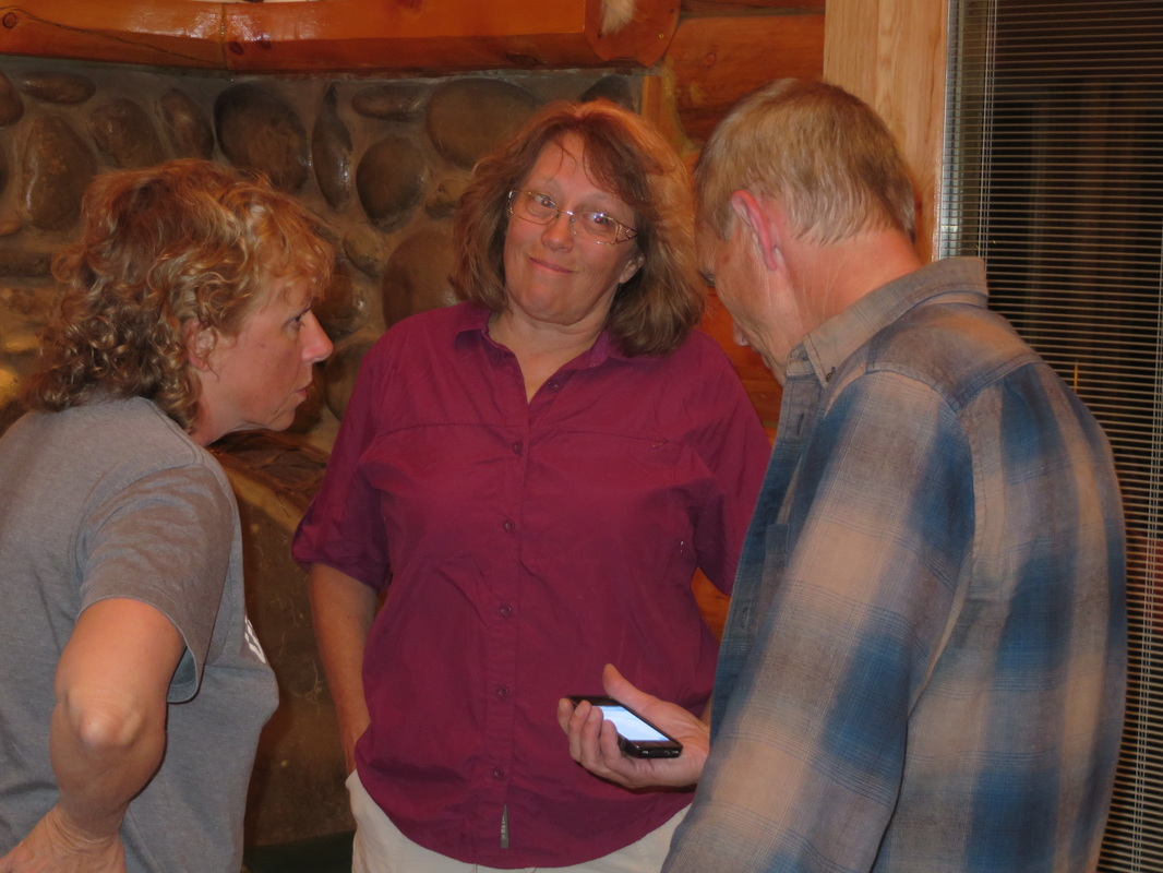
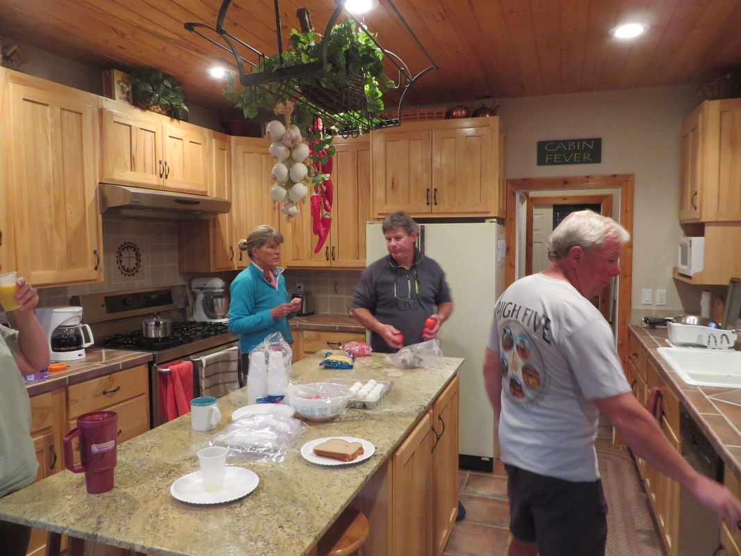
I had time for a shower before dinner; man did that feel good! Folks started showing up about 6:00 for the evening cookout, this one with a southwest flare. The grill master was at it again, with steak, chicken and shrimp on the barbie and the ladies were preparing a wide variety of accompaniments; the kitchen was a flurry of activity! Alison had brought some homemade salsa; very tasty with a nice kick.
The trip to Devil’s Garden was nixed due to the overcast night sky. No worries. We spent the evening visiting with the gang. I think we had 21 cats tonight. MrWings and SJGuy captured the group photo. One of the herd is leaving in the morning, so we all said our good-byes to Kmesaaz. It was great getting to see her again and I certainly hope that she gets to participate in these events in the future.
|
|
|
|
So RedRox was the Master-of-Ceremony this evening, starting with the impromptu “Hi Dad!” from the gang to his father who was on the phone. Then there was the presentation of the walking sticks for the primary planners for this trip. pg got one for all of the thought that he had put into the various hikes and for the onsite investigation in Escalante during his spring trip to the area. All that work really paid off. A second staff was presented to Danny in part for his work in planning the Escalante outing, but more so because he is the founder of these meet-ups. He started it all with is invitation to meet in Bluff and go hiking with him and Cousin Jerry. That was in 2010 and these events are just getting better.
RedRox did a show of hands to see who had attended each of the events. There were several of us who have attended the annual autumn gathering, but only three who have made it to the four fall events plus the 2011 Fourth of July mini-meet-up in Torrey: Danny, Kbecjeans and Pixie. Hats off to you and for that matter to anyone who has attended any of these wonderful reunions
Additional photos from today's adventures are linked here.
Day 4 – Friday, October 4, 2013: Calf Creek Falls
Note to self: Remember to buy stock in Kleenex before the next meet-up as we are all going through it. The low humidity is playing havoc with my sinuses. Is it possible to bleed to death from bloody boogers?
We woke up this morning to the sound of an owl hooting not too far from the house; most likely a Great Horned Owl. Later I went out and heard coyotes yipping off in the distance. While we’re not seeing a lot of wildlife, we certainly know they are out and about.
While the closure of the National Parks had no significant impact on the meet-up plans, we did decide to change our hiking plans a bit just to make sure that we stay out of National Park Service land. The Willow Gulch hike that pg had suggested for Sunday would be in the Glen Canyon National Recreation Area, which is closed, so we did a little juggling. So we decided to move the Red Breaks/Cosmic Ashtray/Escavolcano hike to Sunday and changed the Saturday hike to Big Horn Canyon off the Schaffer Road in the GSEMN. That sounds workable.
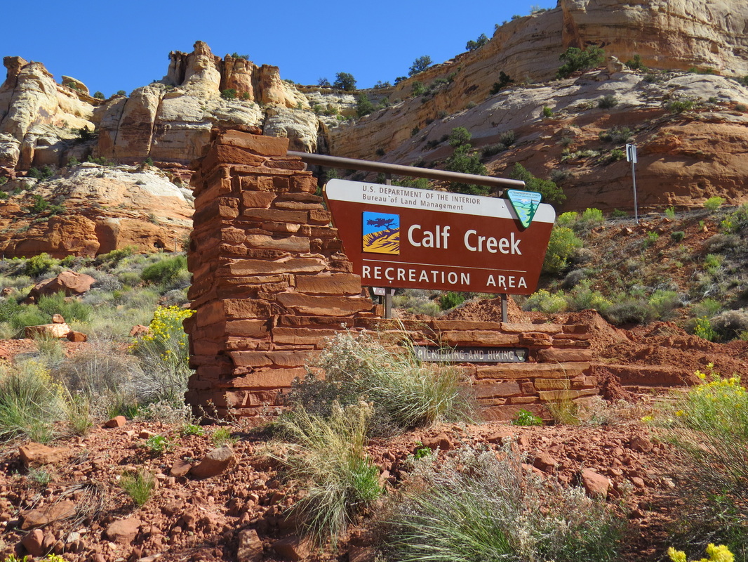
As for today, well this is sort of an open day for folks to do as they please. The planned activity is the canyoneering for eight of the gang. Another group will be taking a drive up to Boulder. The rest of us decided to hike Calf Creek Falls, assuming that we can get into the area since the campground is closed but the area is in BLM managed land and should still be open to hikers. We’ll see when we get there.
We had an easy morning at the house since we were waiting for SJGuy to get back from his auto parts a run to Panguitch. MsHick and I made a run to the garbage dump and had a little drive around the sprawling metropolis that is Escalante. That took about 4 minutes. We looked for the bison that RedRox had spotted, but no luck. The Boulder drive crew all converged on the ranch house as their point of debarkation. We all chatted a bit, then they got organized and rolled east out of town on route 12.
Once SJGuy got back from his errand, we got our gear together. Wings and MrWings piled into the Chevy POS with MsHick and I while SJGuy and SJGirl drove the UPOS. I was on point, but I was not sure how fast to go since the UPOS was reported to have a top speed of about 35 mph. The drive out route 12 was outstanding. The scenery is unparalleled and the vistas are huge.
We arrived right about 11:00 and as predicted the road into the recreation area and campground was closed due to the federal government shutdown. We parked at the top of the hill with about 20 other vehicles and got our gear together. We were walking past the Calf Creek Falls entrance sign at 11:15 and heading to one of the best easy hikes I have experienced.
|
I had heard a lot about this hike and how it is one of the best in the region, but I really had no appreciation for truly how outstanding the hike was until this morning. I found the variety of scenery to be wonderful as we marched along the trail that alternated between running along Calf Creek and the surrounding rocks. The cottonwoods in the floor of the valley were starting to don their fall wardrobe. There were wildflowers all along the trail. In fact this is probably the best fall I have seen for flowers. Lots of purple asters, several types of bright yellow flowers and some Indian paintbrush in bright red. All the colors of the flora and foliage really complemented the red and brown hues of the sandstone cliffs. Add to this the brilliant blue sky and the white clouds and there is an amazing palate for this truly great hike. We took our time, stopped often for photos and read all the information from the trail brochure at each of the interpretive markers along the trail.
|
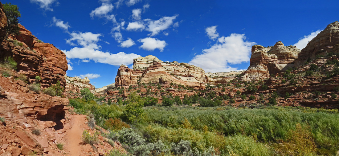
A beautiful desert palate on the Lower Calf Creek Falls Trail.
|
In addition to the wonderful colors in the vegetation and the rocks, there were also some other interesting sites along the trail and a few critters as well. SJGuy saw a bear; well not a real bear but a face of a bear in the rocks above us. There was a panel of rock art on the other side of the canyon; these must have been very large images for them to have been visible from across the valley. And there was a granary high up on the cliffs above the trail when we made one of the final turns along the creek.
No big animals were spotted along the hike, but we did see several small critters: trout in the creek, a ground squirrel, a few birds including an American Dipper in Calf Creek and a Monarch butterfly or two. There was also an interesting blue striped caterpillar crossing the trail; I just took a picture and let him continue on his way (hey, I only swat mosquitoes when hiking!).
|
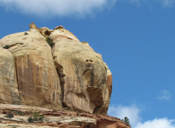
See the bear? I think it is a Griz.
|
The map and trail guide we picked up at the trailhead was very handy. We stopped at each of the markers along the trail and learned a little about the geology, flora, fauna and history of the area. This way we saw a few things we might have missed like the petroglyphs on the far side of the canyon. The three are figures are painted with red dye and are typical of Fremont-style rock art.
Lower Calf Creek Falls.
|
We came to the payoff of the hike after about 2 hours. What an amazing sight to see this tall waterfall out in the middle of the desert southwest. It is amazing to me how the plants in the desert take advantage of every drop of water and the hanging gardens in the cliff face are perfect examples. It was also noticeably cooler here at the lower falls due to the shade from the cliff and the mist from the falls. Plus our bright blue sky was turning overcast. Too cold for swimming today. Perhaps the advantage to the cooler temperature is that we had the falls almost to ourselves so it was easy to get decent photos without a lot of people in the frame.
We paused at the falls to enjoy the peace of the setting and to have a snack before retracing our steps back along Calf Creek to the trailhead. We were now under completely overcast skies and the temperature was falling a bit. But still very pleasant for the return hike.
|
We stopped to talk to a pair of volunteers who were surveying the creek for beavers; we had noticed the man down in the creek when we passed by this morning. They said that there were a number of beavers in the creek, but that most of the activity was further downstream.We were back at the trailhead about 3:05, so almost four hours to cover nearly eight miles. There was still a pack of cars parked along the road and a number of folks still coming into the area to enjoy the hike to the falls. Here's my review of the hike.
The temperature was continuing to fall, so SJGuy and SJGirl just jumped into the UPOS and headed for the cabin. We made a quick stop at Kiva Koffeehouse to get MrWings some coffee (talk about an addict!). As we crossed the high point in the road we encountered…are you ready for this…SNOW! Yikes, I was not expecting that! But it was just spitting and very localized on the high ground. Shoot, the sun had returned to the sky by the time we got back to the cabin, but it was still cool. That could be an issue for dinner as we will be in an outdoor setting this evening.
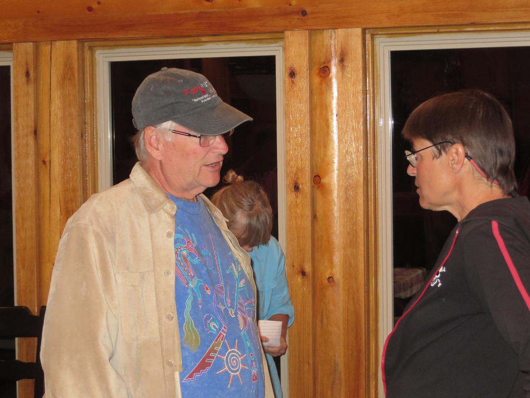
At 5:30, we headed over to the North Creek Grill (review) for the group dinner. The overcast had dissipated. Good for stars, but bad for temperature as the cool afternoon was evolving into a very chilly evening, not the best situation for an outdoor dining setting. Fortunately our hosts were prepared for this as they were setting up three propane heaters and there was a fire pit around which we were seated. Still PB&J bailed due to the cold and the fumes from the heaters. And Rdd was feeling poorly so he did not make it to dinner. But the rest of the herd was in attendance and we added to very special people as Tet13 and Tet14 arrived at the meet-up this evening. Such a joy for everyone to rekindle friendships with these dear folks.
|
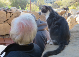
Good food, great friends and a lovely setting made for a very special night. Plus Roscoe the hound and the hotel cats were a nice addition and were very affectionate; OK, Roscoe was looking for food and the cats just wanted a warm lap, but it’s all good!
We used the time to make our plans for tomorrow. Talk about cat herding. First up is the group photo. We had to negotiate on the time and location. We went with the original thought of the “welcome to Escalante” sign at the east end of town. We can just park at the Heritage Center and walk down to the sign. But we shifted the meeting time to 9:30 as some folks wanted to sleep in. OK, hopefully most folks will be there.
|
I highly recommend the tuna.
|
As for activities, most of the gang will take the hike into Big Horn Canyon off of the Old Sheffield Road, immediately following the group photo. RedRox, MsRedPony and Tet14 will find something less strenuous, probably a driving tour somewhere along route 12. Dinner tomorrow will be in Boulder at the famous Hell’s Backbone Grill; the 5:30 reservation will be a bit of a time crunch. A few folks have bailed on dinner; I’m thinking that might be a good option for me and MsHick. We’ll see how tomorrow plays out before making a final decision.
We were home about 8:30 and spent the rest of the evening just chatting with the other cabin inmates. I spent a few minutes outside before bed. The stars are now out in full force. The Milky Way is…is…beyond description. This is really one of my favorite things about being out in the middle of nowhere. No light pollution so the sky is dark and the stars are bright. The longer you look the more you see.
Here are the rest of the Day 4 photos.
Day 5 – Saturday, October 5: Holy cat Herding, Batman!
Again an early “rise and shine” but it’s all good. Sort of an easy morning since we pushed the group photo back to 9:30. The cabin crew chatted about the events of the past two days and worked on the plans for the rest of the meet-up. Sounds like we have our act together; well you can never tell with this herd of cats.
The short story is that we got the group photo, actually three, once we accounted for all the cats. After the photo shoot, we returned to the cabin to get organized for the rest of the day. We ended up with four vehicles in the convoy for the Big Horn Canyon hike. It makes sense that Danny take point since pg is riding with him and those two are the only ones who really have a clue as to where we are going. Pixie piped in that she would bring up the rear. OK, sounds like a plan, let’s move ‘em out. Hey, wait a minute, isn’t that Pixie blasting down the driveway? What happened to bringing up the rear? Well, she’s gone now. I hope she knows where she’s going.
The cabin crew and Tet13 are in SJGuy’s newly repaired Expedition and we fell into line behind Danny’s Cherokee. East on route 12 through the beautiful scenery then right onto the Old Sheffield Road for a few more miles. The road is in pretty good shape, but SJGirl is holding her breath at every bump. She and wings are thinking only positive thoughts about the old Ford, as they still have to make the return trip back east. Danny has found the trailhead parking and we pull the column off the road. Hmmmm, I thought we had four vehicles? No Pixie. And PB&J is riding with her, so the newbie is lost as well. We took our time getting our gear together and worked out our plan to hike for two hours then turn around. Still no Pixie. MrZig volunteered to hang back for an additional 10 minutes to see if she makes it. If still a no-show, he can easily catch the rest of the troop. We were on the trail about 11:00.
The hike works down a sandy wash for maybe a mile with a gentle descent. Then we hit the one serious obstacle of the day, a fairly steep slickrock fall-off of 50 feet or so. This has us stumped for a bit. A few of the folks were uneasy about trying to work down the fall. By this time MrZig has caught up with us as Pixie and PB&J were still nowhere in sight, and he suggested looking for an alternate route around the fall. So he leads the majority of the group off to the left while a few of us make our way down the fall (pg, MsPG, Kbec, dez, lvziggy and me). The detour looks like it will be a longish route to get around the rock formation adjacent to the fall off. I started up the adjacent slickrock wash that the detour detachment should come down and sure enough there they are. I’m now on the high ground between the two groups so I signaled to pg to move his column forward to the intersection of our sandy wash and the detour route.
At the top of the fall looking down the wash.
So we’re all moving down the wash toward Big Horn Canyon. Did I hear something behind us? Not sure, but I turn around and there at the top of the fall off is a flash of pink. Holy hallucination, Batman, it’s Pixie and PB&J. OK, probably not a good idea for PB&J to try coming down there without help so SJGuy and I kick it into high gear and head back up the wash; MsHick was following us. I headed directly to the fall and SJGuy started up the detour route. I was able to get Pixie’s attention and told her to go around the fall instead of down it. She got it and she and PB&J headed for the detour. I followed SJGuy up the detour route to help search for our wayward cats. Easier said than done.
|
Waiting at the bottom of the fall.
|
I have no idea how we missed each other, but SJGuy went all the way around the detour without seeing this girls, and I tromped around with no luck either. Maybe Pixie misunderstood me and just headed back to the trailhead? Just as I was getting ready to give up, I saw them working down a steep section of loose rocks between the fall off and the detour trail. Oh for heaven’s sake. I again yelled to Pixie that she is on the wrong trail and that she needs to work around further to the left. She wanted to continue down the loose rock fall, but that was just not a good idea for poor PB&J, so she backed up the slope and went in search of the detour. I headed back up the detour trail and finally heard them coming from the opposite direction. Wow, that was fun! Not! We headed down the detour, met MsHick and SJGuy and the five of us continued on following the rest of the herd.
Poor PB&J was beat. She just wanted a shady place to sit and rest. So we found her a spot, left her with water and her phone so that she could play games and the rest of us continued down the wash. We knew we would be returning this way shortly.
|
We hustled on down the wash and found the rest of the gang at a little slot. MrWings was inside taking photos (surprise!). SJGuy and I climbed down into the slot for a couple of quick pics. The rest of the hikers were at the lower end of the slot getting ready for the return hike as we had reached our 2-hour time limit. The folks who still wanted to make dinner at Hell’s Backbone had to get moving. MsHick and I decided to opt out of dinner; the SJGs and wings were also skipping out, so we had a little more time to get back home.
MsHick was on a mission on the return trip as she wanted to make sure that PB&J was OK. pg and company found PB&J sitting just where we left her and took her back of the trail. I was able to watch them from a distance through the extended zoom of the camera. They all made it up the fall with no apparent problem. Hats off to PB&J; she’s doing very well in her first hikes in the desert.
Now that we were not rushing, I had time to enjoy the scenery. This is a very pretty area. The colors and formations are similar to those along the trail into The Wave. Add in the splash of color from the wildflowers for a nice little bonus. We also saw some interesting animal tracks, including cat tracks, probably bobcat. We also had some time just to chat along the trail. The primary subject was movies, particularly westerns and specifically the classics with John Wayne or Clint Eastwood. We discussed having a movie night this evening, if we can get a TV to work. MsHick noted that there is a VHS copy of McClintock in the downstairs TV room.
|
Heading back up the wash.
Back at the fall, everyone made it back up with no problem, but poor Tet13 sort of froze. No worries, SJGuy and I guided her back down the slickrock then up and around the detour trail. Then it was back up the wash to the trailhead. MsHick had a cold beer in hand when we arrived. I love her.
So back at the ranch it was time for a beer. We had a well stocked bar with all the wine and beer that folks had brought from all over. srw was nice enough to bring a case of Unita Hop Notch IPA for me from Grand Junction. That brew sure goes down well after a long day on the trail.
We all got cleaned up and ready for dinner. Those of us not heading to Boulder for Hell’s Backbone decided on the Circle D in downtown Escalante. It was just the SJGs, the wings and the Hicks. On the way to dinner, SJGuy stopped at Escalante Outfitters to ask for advice on our planned hike to the Cosmic Ashtray. The word we got was a little disconcerting. The lady at the shop stated that the hike was too complex to try and explain. She did say that it was a 9-mile round-trip hike and rated it as moderate to difficult. That information thinned herd a bit as SJGirl, and the wings all decided to skip the hike.
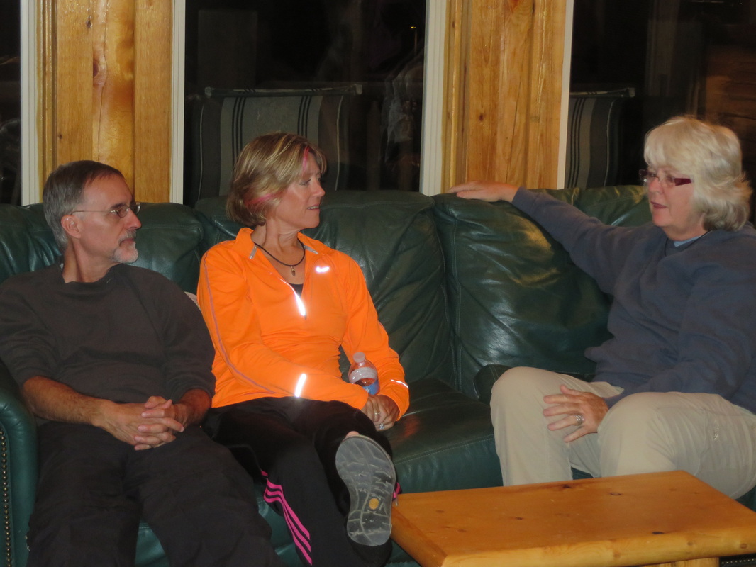
Next stop, dinner at the Circle D (review). Excellent service and the food was quite good. The brisket was a popular choice at our table; it is one of the house specialties. I opted for a burger which was very tasty. Then it was back to the ranch to chill for the evening. Most of the Hell’s Backbone diners congregated at the cabin upon their return to Escalante. Tet14 worked his road trip magic on a route for the SGJs and wings since their original return route included the now closed north rim of the Grand Canyon. Tet13 is simply amazing with his knowledge of the US. He was reciting roads and listing landmarks by mile markers. This guy knows more about America than most Americans. In the end he had developed a very interesting plan for our road trippers.
The party broke up about 9:30. It was time to say “so long” to another member of the group as dez was heading back to reality early tomorrow morning.
By the way, we never did watch the movie. But more photos from the hike are available here.
Day 6 – Sunday, October 6: Red Breaks and “the Volcano”
MsHick and I are feeling a little sore after running around the desert yesterday. Perhaps we should skip the Red Breaks hike and find an easier activity for today? We’ll see how we feel after a shower and some breakfast.
The plan for the Red Breaks hike is to meet here at the cabin at 9:00. That left us plenty of time to get ready and make a run to the dumpsters. Still no sign of that freakin’ bison.
pg and I discussed options for the 2014 meet-up. He suggested Green River as a base since it provided good access to the San Rafael Swell, the Horseshoe Canyon district of Canyonlands, Goblin Valley State Park and Little Wild Horse slot canyon. Green River should have the infrastructure to support our little band as well.
|
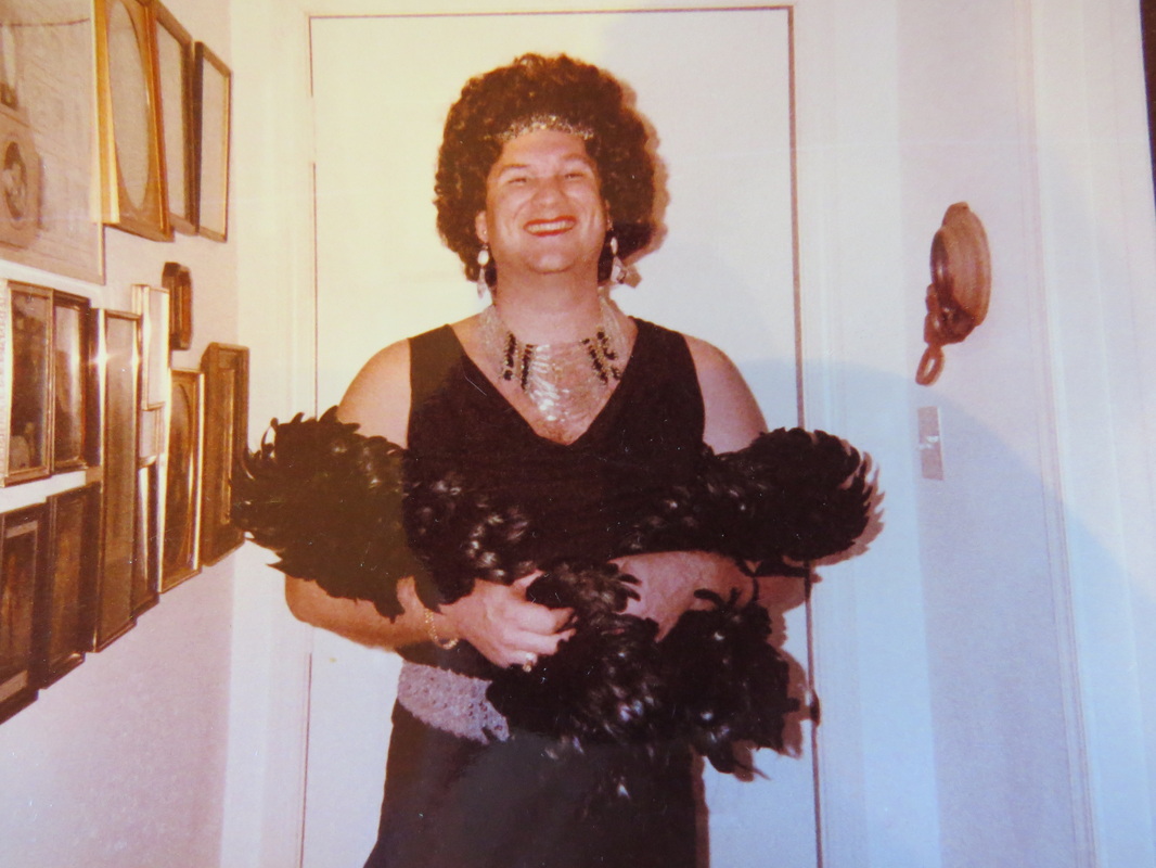
RedRox and MsRedPony stopped by at 8:30 to say good-bye to the group. They were heading out this morning on a little road trip to Denver. MRP brought us all a present. I don’t remember exactly how this came up during the planning, but is seems that MRP has photos of RR in drag. With all the fun of this week, we completely forgot about that, but MRP had remembered and brought them in for show and tell. My eyes! Some things just can’t be unseen. A round of hugs and heartfelt farewells and they are on the road. It is a little quiet in the cabin.
It is a great looking day for a hike. Already the skies are bright blue with not a cloud to be seen and it is warmer than the past couple of mornings. pg reported that the high today should be 69 degrees F. You know, I’m feeling pretty good now, so MsHick and I opt in for the hike. Besides, this one is supposed to be “THE” hike for the trip, our search for the Escavolcano, aka the Cosmic Ashstray.
There are only eight of us on the hike today. SJGuy, MsHick and I piled into Danny’s Jeep, while lvziggy and Esty ride along with MsPG and pg. Howie had billed this hike as requiring the A-Team, we’ll see if we fit that description.
Our two-truck convey is again heading down the Old Sheffield Road. The plan is to take the road as far as we can then hike to the volcano from there, and that’s exactly what we did. Shoot, Danny drove his Jeep right up to the “No vehicles beyond this point” sign that was placed squarely in the middle of the sandy “two track” trail. He and pg conferred briefly and decided to park at the wide spot at the beginning of the two-track, so Danny backed down the road and we all got our gear together. As we were getting ready, another Jeep pulled in at the trailhead parking. I was amazed to see another group of hikers out here in the middle of nowhere. Danny chatted with them a bit; seems they are also heading to the volcano. The new group got on the trail ahead of us.
|
Let's just say that's a handsome women and leave it at that....
Getting ready to get ready...
|
OK, there is no marked trail for this hike, but we had two GPS units with the final coordinate of the volcano plus a topo map and compass. Esty is an expert at orienteering from her cross-county equestrian events. Between her, Danny, pg and SJGuy we should be able to find our way. MsHick and I just had to keep up. The track that we were taking followed the other group of hikers. Apparently the other group did not like us following them and were overheard saying that they would deliberately lead us astray so that we could not find the volcano. Very neighborly of you, folks. No worries, we were planning on finding our own way. So we hung back for a few minutes to give the other group some space, then set out on the route that we thought was the right course. Turns out with the guides that we had there was little issue with finding our objective. The folks with the maps and GPS units did a fine job of keeping us on course and finding a route that avoided the steeper areas. Merit badges for you all!
This was a tough hike. The hardest in my opinion was the deep sandy slough along the two-track at the start and end of the hike. Most of the rest of the hike was on slickrock which makes for a much easier go. It was also completely exposed; no shade along the trail at all. So the cool temperatures and slight breeze were very much appreciated. In fact, it was a very pleasant day for this 9-mile tromp.
While the hike was challenging, it was also amazingly beautiful all along our route. Early on we were treated to big vistas of the multi-hued rock formations in the distance and as we continued into the drainages that make up the Red Breaks area we were treated to closer views of many fascinating formations. The colors in the rocks were unbelievably vibrant. Then throw in the explosion of wildflowers sporting yellow, white, red and purple plus a lot of green foliage, and finally that brilliant blue sky for a backdrop. Yeah, we have a rainbow in the desert.
The crags and patterns in the slickrock are interesting unto themselves; sort of reminded me of the hide of an elephant. And there were other interesting little details scattered about the desert. Danny pointed out the Moqui marbles. And powderglut became first the “finder of lost arches” as he noticed a couple of tiny formations in the soft dirt. He had a little fun naming his new discoveries. Unfortunately he also became known as “arch slayer” as he accidentally broke one while pointing it out to the rest of the troop. Oh well, it would have been washed away in the next big rain anyway.
While we were generally working our way around the canyons of Red Breaks, we still got a taste of the formations cut in the sandstone. There was one area in particular that we passed coming and going that was basically a sluice in the rock with interesting swirling bands of tan and dark red sandstone. The lighting was much better in the return trip and made for some interesting photos. There were also a few potholes still full of water and lot of little critters. We were able to get some interesting reflection shots as well.
We keep vectoring in on the coordinates of the volcano. From time-to-time we would see the other group off in the distance; we seemed to be going the same general direction but along different tracks. As we neared our objective we had one more wash to cross. We saw the other hikers up on a conical formation to our left, apparently taking a break. Our map readers reckoned that the volcano was just over the next rise off to our right. Off in that direction we spotted one hiker from the other group heading just where we decided we should be going. I think we are on the right track.
SJGuy and I were at the end of the line as we were taking a fair number of photos. We went higher up the final ridge than the rest of the crew and found an interesting rock that had the look of a ‘gator’s head. Unknown to us, this was a bit of foreshadowing. We figured we must be just above the volcano but could not see it as we were still not at the top of the ridge. In hindsight I wish we would have taken the time to try and get to a point where we might have seen the volcano from up here.
SJGuy peering into the Escavolcano. Something seems to be peering back...
|
Back down and around the ridge following the rest of the gang, we were still a ways higher than the others and worked over to the edge for a peek. Wow! I was NOT expecting that! The photos I’ve seen just do not do the fascinating natural feature justice. SJGuy and I snapped a few photos from the high ground and then headed down to join the rest of the group at the volcano.
This feature has a few names: the Escavolcano, the Cosmic Ashtray and the Red Breaks Crater. It is not a volcano, not even the remnants of one. This crater was carved out by wind and water over many, many eons. But it is awe-inspiring and the type of place that really gets the imagination in motion. The huge rock in the middle of the crater really got the group thinking. Maybe a dinosaur head? Ziggy had a whole story line going about a huge alien ant farm (no more limoncello for her). Remember the Sleestaks from the old Saturday morning show “The Land of the Lost”? Yeah, kinds looked like that. Maybe a slight resemblance to Ren, sans ears, from Ren and Stimpy. Lots of options.
|
|
We spent some time here, just marveling at the crater. The sand in the crater was a beautiful shade of dark orange and was so almost perfectly smooth, sort of like a bunker before the start of the US Open…pristine. There was one set of tracks in the sand, but we could not figure out what could have made them. Not really foot prints; maybe a snake or a big bug of some sort. We tossed a couple of stones into the crater to gage the consistency of the sand. The each landed with a solid thud and just sat there in their little impact craters. Esty and pg were thinking about going into the crater, but finally relented as the climb down in and back out was not straightforward and besides they would have ruined the zen of the crater. We left the sand unmarred from footprints for the next group to enjoy.
After a snack and a group photo at the rim of the crater, it was time to have the long trek back to the trailhead. We more or less retraced our steps, but there were a couple of stretches areas of new ground covered, most notably a couple of areas strewn with hundreds of moqui marbles. These made for some interesting photos, both of the marbles and the photographers.
So six hours later we are nearly back at the trailhead. This sand on the two-track is killer, but we kept plodding along because we know that pg has a few cold beers waiting for us. A just reward after nine miles of sand and slickrock. But it was an amazing day and a wonderful hike. Certainly one for the highlight reel. Here's the link to my review of the Grand Staircase-Escalante National Monument and the hikes we took.
We were home about a quarter ‘til five, which gave us just enough time to clean up and have a beer before dinner. Original plan was to make this pizza night, but we had so much leftover chow from the first two cook-outs that we just decided to rehash everything. A wonderful idea and there was plenty of burgers, brats and burrito fixings for the remaining crew.
The evening proved to be another great time with the gang, albeit all too short. We spent some of the time discussion options for the 2014 meet-up. Green River, Zion, Monticello, Bluff, Grand Canyon and Sedona were all bantered about. We’ll work on this over the next few months and see where the herd would like to converge. By 9:00 everyone had headed out. Some tearful and heartfelt farewells as folks headed out the door. There were some extra long hugs when it came time to bid the Tets vaarwel.
There are a lot of great memories and images from today; here's the link to the gallery.
Day 7 – Monday, October 7: Heading to Sedona.
|
What lives within the Red Breaks crater?
Fudge Ripple...
The king of road trips...
|
Last breakfast in Escalante...a scramble in the kitchen.
|
Today is departure day for those of us remaining in Escalante. The cabin is again a hive of activity with everyone packing, cleaning, and most importantly cooking. In what is now a meet-up tradition, pg is making leftover breakfast, just as he did on the last day of the Moab meet-up. This year it is a sort of southwest breakfast pizza with eggs in place of the dough. Whatever it is, it is pretty darn tasty! Slather on some salsa and roll it in a tortilla; now we’re talking! One final meal with the group; a nice way to end this segment of the trip.
The house is in order, the garbage is at the dump, the gear is all packed and the goodbyes are all said. Handshakes and hugs all around. We are all on the road about 9:30 heading for our next destinations. I reckon that brings to a close the 2013 Utah meet-up. MsHick and I are heading to Sedona for the rest of the week. But that’s a story for another trip report. Hey, we finally spotted that freakin’ bison on the way out of town. Go figure! |
One last look toward Escalante from the porch of the cabin, and then it is off to Sedona...