Trip Journal: Taking Mom to the Smokies
Thursday, May 22 through Monday, May 26, 2014
Lynn and I “kidnapped” Mom and headed to Gatlinburg and the Great Smokey Mountains National Park for the Memorial Day weekend. This gave us an opportunity to get away and visit with Mom, and gives her a bit of a vacation from taking care of everyone else. We rented a cabin in Gatlinburg for the weekend through HomeAway.com which worked out very well for us. But the main draw for the trip was the park. We spent minimal time in town and really maximized the time in the park with the rest of the time spent just chillin’ out at the cabin. The details of the long weekend are listed below. Links to additional photos, reviews and hiking tracks (coming soon) are also provided in the journal.
Day 1 – Thursday, May 22, 2014: Quarter after two and the fires at work are mostly extinguished; only 15 minutes after my planned departure, so not too bad. I fueled up the Edge on the way home then knocked out a few chores while waiting for Lynn: finished up the mowing, fed the critters, finished the packing and cleaned up the dishes…then it was just waiting. Seems that it took her a bit longer to put out her fires at work. I was hoping to be on the road by 5:00, but we were finally on the trail right at 6:00 PM, so not too terrible. I reset the trip odometer so I could get and overall total for the trip, and then we were off.
Day 1 – Thursday, May 22, 2014: Quarter after two and the fires at work are mostly extinguished; only 15 minutes after my planned departure, so not too bad. I fueled up the Edge on the way home then knocked out a few chores while waiting for Lynn: finished up the mowing, fed the critters, finished the packing and cleaned up the dishes…then it was just waiting. Seems that it took her a bit longer to put out her fires at work. I was hoping to be on the road by 5:00, but we were finally on the trail right at 6:00 PM, so not too terrible. I reset the trip odometer so I could get and overall total for the trip, and then we were off.
|
It was a pleasant evening for a drive and we made good time to Marietta for the night. We pulled in the Fairfield at 8:03, checked-in, dumped out stuff and went right back out for dinner as we already had a place in mind, The Galley in downtown.
We ate at The Galley the last time through and really enjoyed the place and we were not disappointed this trip either. Excellent selection of beer on tap and in bottles. I opted for a flight of IPAs, letting our server pick the specific beers. The flight has five 4-ounce samples and the server did a pretty good job on the choices, although there were only four IPA and DIPAs on tap, so she filled the flight with a hoppy lager, which was the weakest of the group. I believe the rest of the line-up was the Ranger IPA, Jackie O’s DIPA, Aprihop and a fourth IPA that I cannot recall the name (maybe the last one was from Brooklyn Brewing?). Anyway, they were all pretty good and the flight is a great way to sample the wares without getting hammered! The service and food delivery were exceptionally speedy tonight. For dinner I just could not help myself and wind for the Diablo burger: jalapeños, pepper jack cheese and an habanera sauce. Yeah, I should have been good and had a salad like Lynn, but this burger is just bursting with the heat and flavor that I do so enjoy! Well worth the calories. I’ll just have to hike a few extra miles in the Smokies. We made a quick stop at the Walgreens on the way back to the hotel for some candy and cold meds for Lynn (she’s just kicked the cold, but the cough in lingering). Back in the room and lights out (well after a large bag of M&Ms) as tomorrow is a bit more driving to get through West Virginia and into Tennessee. But mission accomplished on breaking up the drive by sleeping on the Ohio River. |
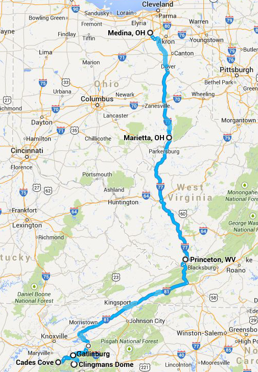
The route we took and the primary stops during our Smoky Mountain road trip.
|
Day 2 – Friday, May 23, 2014: No real rush this morning, so we took it slow getting up and ready. The complimentary breakfast at the Fairfield was satisfactory; actually it was one of the better “free” breakfast offerings I have had in a while but it was still not that great. It seems that the hotels that offer these “free” breakfasts are providing less and less in terms of quality and variety. Hey, you get what you pay for, I reckon. But it was enough to get us started. We were on the road at 0830, so just 30 minutes behind my planned departure.
No issues with the drive to southern West Virginia, other than a little traffic. I was expecting worse due to the holiday. The flow was sort of like a Slinky at times; speed up and slow down. But overall we made good time and we were at Mom’s at 11:40 and then quickly on the road again. We made a quick stop to see of the home folks on the way out of town, and were finally heading to the highway at 1:05. And then the road trip hit a few snags…
No issues with the drive to southern West Virginia, other than a little traffic. I was expecting worse due to the holiday. The flow was sort of like a Slinky at times; speed up and slow down. But overall we made good time and we were at Mom’s at 11:40 and then quickly on the road again. We made a quick stop to see of the home folks on the way out of town, and were finally heading to the highway at 1:05. And then the road trip hit a few snags…
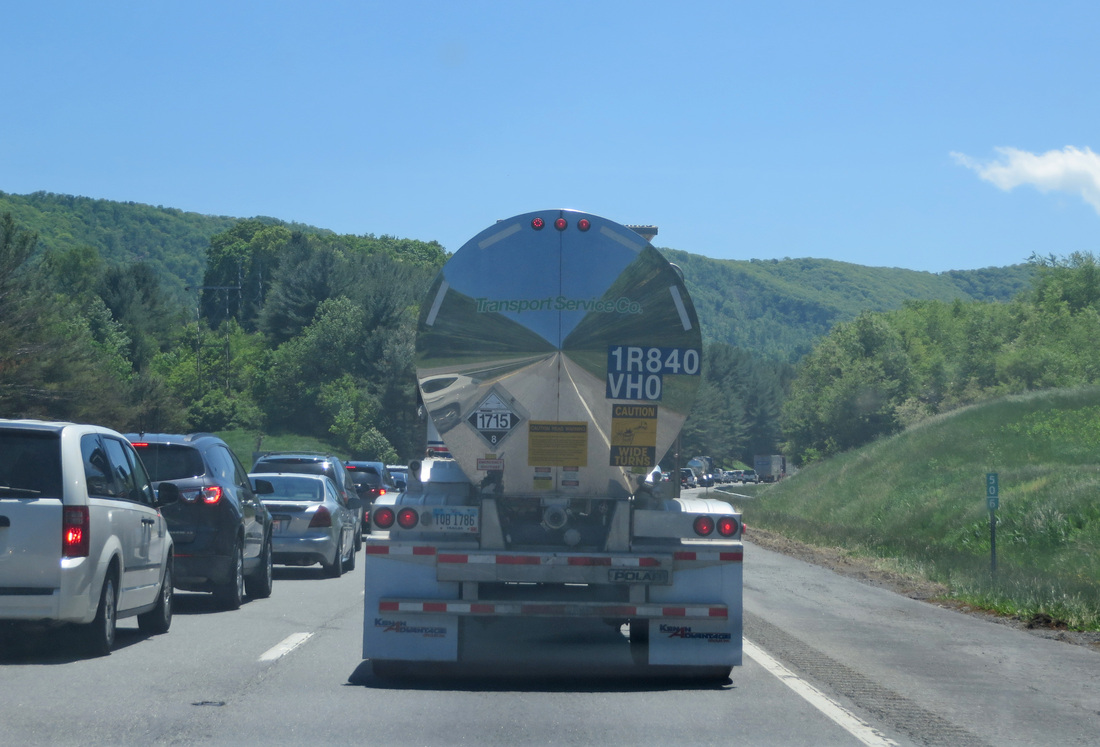
Reflecting on our traffic woes....
|
First we came to a dead stop on I-77 south just south of the Big Walker Mountain Tunnel. There was a sign up stating that there had been an accident at mile marker 46. Traffic crept along for those 9 miles. It took us about an hour to cover that stretch. When we got to the accident, it appeared that a truck hauling a load of paper had somehow managed to lose said load, as there was paper all over the place. The crews seemed to have corralled most of the loose material. As soon as we past that point it was clear sailing, well for a while at least.
We were good all the way down I-81, but as soon as we switched over to I-40 east, we had another dead stop, which caused about a 30-minute delay due to construction on the bridge over Douglas Lake. Oh well, we figured that was still better than trying to drive through Sevierville and Pigeon Forge. |
Once past the bridge construction, the drive was smooth and scenic. South of Newport, we departed the Interstate and headed west on route 321 to Gatlinburg, skirting along the edge of the Great Smoky Mountain National Park. We finally arrived at the cabin at 6:30, which is about the time I had expected considering the two delays in the highway. It took us a minute to find the cabin, as it was sort of tucked back of the main road, but once we referred to the map and the directions from the owner, we pulled right into the driveway. The location was not as rural as expected, as the place was situated next to a municipal service area. But the cabin itself was very nice and had a pleasant view off the back porch.
We had noticed a Food Lion as we were driving to the cabin just back up the road, so we made a trip there for provisions for the weekend; breakfast food, trail snacks and beer…the essential food groups! Then we headed down to Gatlinburg to look for dinner and to get our first taste of traffic. I was prepared for the traffic through Gatlinburg, so no surprises. But there were a lot of folks. Friday evening on a holiday weekend; it is what it is.
We drove the main drag looking for dining options and parking. Wow, this place has changed over the past 25 years. It is a lot more mainstream in terms of the dining options and way more touristy based on the store fronts. Lynn and I both remember that there were more galleries in town, but now there are mostly the “junk” stores. We had past signs for an Gatlinburg Arts and Crafts Trail when we were first coming into town so perhaps that is where all the art galleries have moved. We’ll probably have to check that out later this weekend.
As I always do, I did some scouting on-line for dining options and found a few interesting places, the highest on the list being the Smoky Mountain Brewery...I’m always looking for new brews to try. We finally found the brewery at the far end of the main drag. Good news is that there is parking available within the little shopping complex that includes the brewery. As packed as town was, we were seated immediately and that was arriving at 8:00 PM on a holiday weekend Friday; but the place is pretty huge with two levels of dining. Short story is that the service was marvelous, the food was outstanding but the beer was disappointing. I went with a sampler that included the pale ale, IPA and the porter. They were all drinkable, but none were memorable. Hey, it was worth a shot. There is a little more information in the review.
After dinner we walked a bit of the main drag just to get a bit of a stretch. Still throngs of folks on the sideways and the street was jammed with cars at 9:00. Lynn checked a couple of the shops, but our little walk did not last long and we headed back to the cabin for the night.
Day 3 – Saturday, May 24, 2014: So last night at dinner I got the girls to agree to an 0700 departure this morning so that we could try and beat the crowds to Cades Cove. So we were up early, had a quick breakfast at the cabin and miraculously were on the road at a quarter after.
No traffic this morning through town and very little along the park road at this time of day (and I still think we are getting a late start). But it was a lovely drive through the park. We spotted a Great Blue Heron in the river looking for breakfast. Looks like we’ll have a nice weather day as well. Once in the park, we spied the sign indicating that the Cades Cove loop road was closed to vehicle traffic on Saturday from 0800 – 1000; yeah, now I remember reading that, but had lost it somewhere in the planning for our multiple trips this summer. Well, we’re committed now, so let’s see what we can get into once we get there…certainly we can do some walking.
Traffic picked up a bit as we got nearer to Cades Cove. We arrived right around 8:15. The Ranger at the entrance explained that the loop road was closed to vehicles, only bikers and walkers allowed. No worries as we wanted to walk anyway. Turns out the Ranger was from Medina (I wish I could remember his name) so we had an “old home” moment and talked a few minutes while waiting for traffic to clear. This was his third posting, having also worked at Glacier and Big Bend. Nice kid. Anyway, he directed us to the parking area adjacent to the horse stable, which was packed with cars and folks heading out to walk or bike the loop.
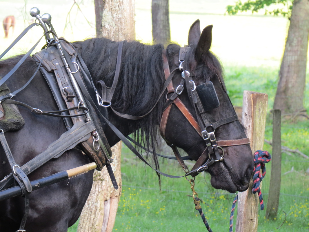
Just one of the park employees...
|
We hit the facilities located near the stables, then got “tacked-up.” I took a few shots of the horses in the pasture, along with a big Percheron waiting to pull a carriage around the loop. We also got our first wildlife shots, as there were a few deer grazing next to the stable as well as a couple turkeys out in the pasture with the horses. We chatted briefly with another Ranger on traffic duty. She gave us the run down on the walking options around the loop; Lynn’s the navigator, so I left her to sort it out, but I did hear that there are three loop options, but that the shortest one would include water to negotiate, so I bet that one is out. I reckon we were on the trail about 8:30.
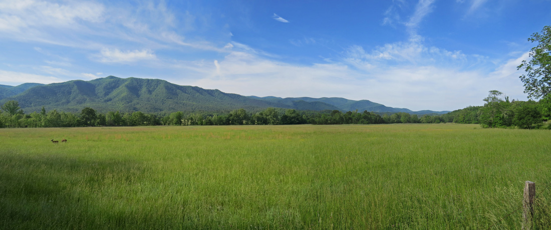
So this is really a walk in the park, as the trail was the paved driving loop around Cades Cove. It was a perfect day for a walk. Sunny with some high, white clouds, not overly warm and a bit of a breeze. There were a lot of folks walking but many more on bikes. This seems to be a popular activity, biking the loop, particularly on these “car-free” days.
|
We tended to stay to the left side of the lane, so that we had better views into the meadows in the center of the cove. That left the majority of the road for the bicyclists. There was a mix of “hardcore” cyclists, who seemed more intent on getting somewhere, rather than enjoying the day (in all fairness, perhaps that is how they enjoy the day) and “tourists” of all descriptions on rental bikes. There were a couple of near catastrophes when the hardcore and tourist bikers nearly met at times of highly one-sided momentum events…the slower moving tourists would sometimes stop in the middle of the lane to take in the natural wonders while the speedy hardcore riders whizzed by, sometimes with some words of, well, let’s just say “encouragement” for the tourists.
So we kept marching along, enjoying the day and the views along each side of the road. I was hanging back taking photos while Lynn was in “mission from God” mode with Mom in tow. They probably got a half mile ahead of me, but would wait at each decision point (where the roads crossed Cades Cove to make the short loops). Each time I caught up with them at one of those intersections, then decided to keep moving along the main loop. Fine my me…I need to pay more attention to what they are getting us into.
Not a lot in terms of wildlife. There were the deer and a few turkeys in the horse pasture, then another little herd of bucks early in the hike. I noticed when reviewing the photos after the trip that one of the bucks was missing an eye. There were songbirds all about, but they were hiding in the foliage for the most part. I did see a few interesting bugs and some butterflies, but they were flitting about too much for good photos. There were plenty of wildflowers along parts of the trail and a variety of nice views, especially over the meadows. Further into the hike we starting passing the historic buildings, starting with a couple old whitewashed churches.
A couple of the natives in Cades Cove.
|
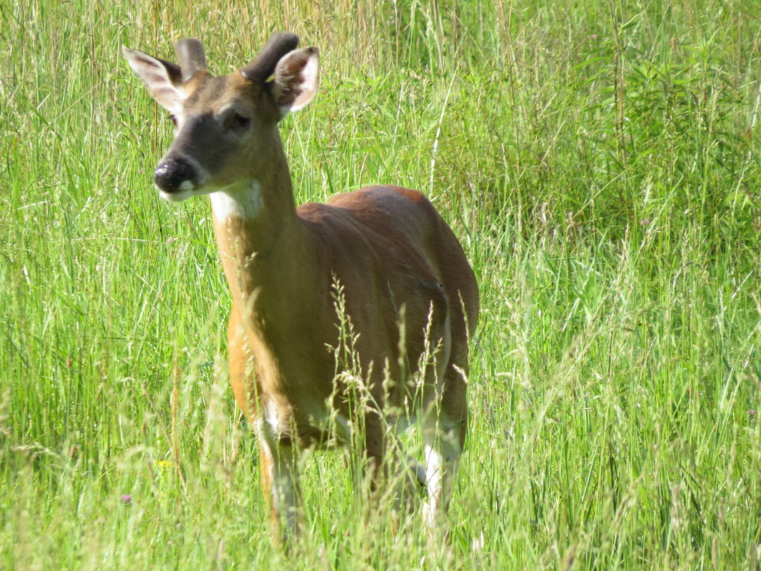
He got in a fight and lost.
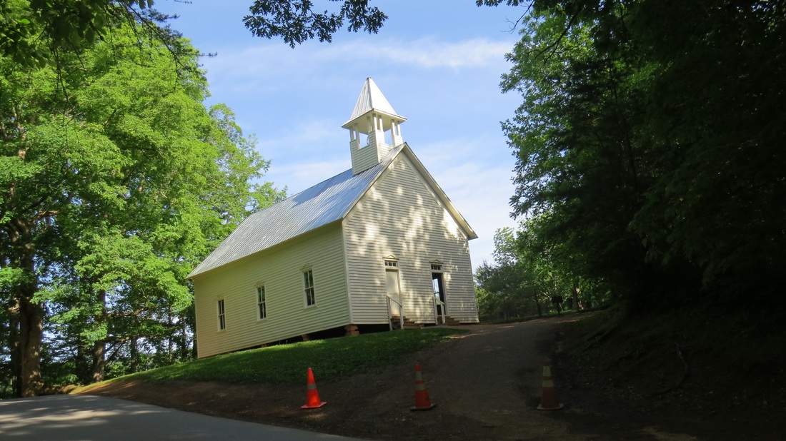
Methodist Church.
|
So by now we are committed to the full loop around Cades Cove, all eleven miles. That’s nice a nice walk for Lynn and me, so no worries there, but Mom is 75 years old. But she’s a trooper and she just kept going along. It was funny as we would have to herd her a little from time to time, as she tends to meander in the road. Lynn and I are used to walking single-file on most of the trails we hike, but that seemed like a foreign concept for Mom.
I guess we were approaching the spur out to Abrams Falls at about 10:00 AM when the road was reopened to vehicular traffic, but it took a while for the tourists to catch us. There were a few park and volunteer trucks that passed us, but I bet is was getting closer to 10:30 before the heavy traffic picked up, so we were about half-way around the loop. In hindsight, we should have gotten moving much earlier, and been on the trail about 0700, so that we finished walking the loop before any traffic was out. Next time.
The visitor center is about halfway around the loop; we opted not to stop, figuring we would drive back after we hiked our lap. On the south side of the loop we encountered more vistas and a little more elevation change along the road, but also more interesting old structures, including an old cantilever barn. I remember that old structure from our visit 25 years ago and it was one of the few photos that we took that trip (no digital cameras then, so we did not take the hundreds of the photos like we can on our more recent adventures). It was obviously a nicer day today, as the photos suggest, then when we visited back in ’89.
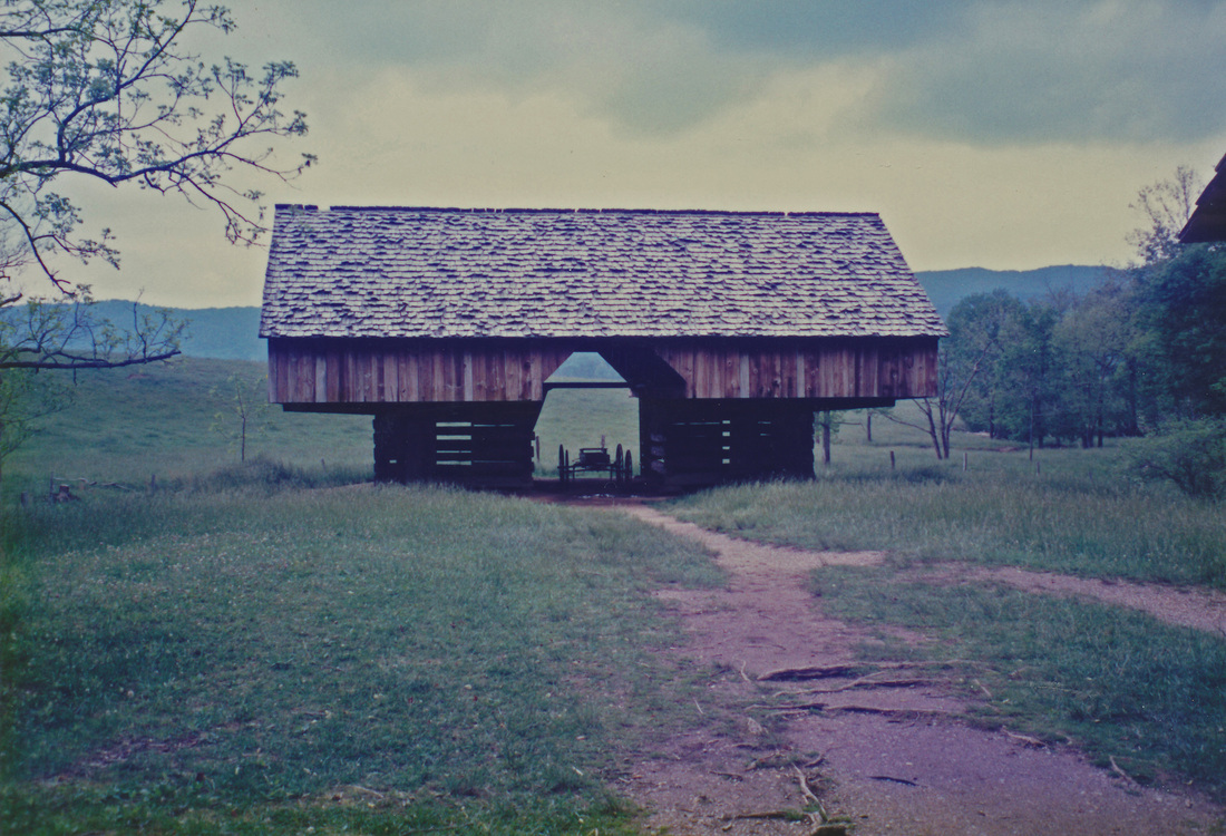
Cantilever Barn in 1989...
|
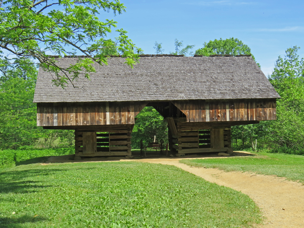
...and 2014.
|
Now the good news about the traffic starting to pick up was the opportunity for people watching, and there were plenty. The most interesting were the folks riding in the back of pick-ups, many with camp chairs and coolers. There were a few motorcycles and still some bicycles on the road as well. The traffic would come in spurts. Six or eight cars would pass by (all going slow) then there would be a gap of many minutes before the next set. But the motorists were all polite and gave us and the cyclists plenty of space.
We chatted with a couple of park volunteers who were riding bikes on the southern part of the loop. Apparently there had been a two or three bear sightings earlier this morning, but we were in the wrong place at the wrong time. We did see bear scat at a couple locations around the loop. The one volunteer pointed out a blackberry thicket, stating that this will be a prime bear area shortly. She said the bear focus on blackberries in June, cherries in July and acorns in August.
While the critters were scarce, we did get to see a stupid people trick; I guess they happen in all the National Parks. The loop is a one-way road, regardless of vehicle type, motorized or not. Seems that there was some jackass on a bike riding against traffic and he was just blowing past the volunteers trying to stop him. We did see him, he was just oblivious. Well, some people are just special, I reckon.
|
The hike took us four hours to cover the 11-mile loop. We were off the trail about 12:30. By the time we reached the overflow lot where we parked this morning there were only a couple of cars remaining, where this morning it was packed. We drove over to the camp store to grab some cold drinks (it was packed) then retraced our route around Cades Cove in the comfort of the Edge. It was a slow go with the traffic. We came to a dead stop a couple times; not sure why as there did not seem to be anything of particular note in the area, but I reckon it could have been an animal jam.
|
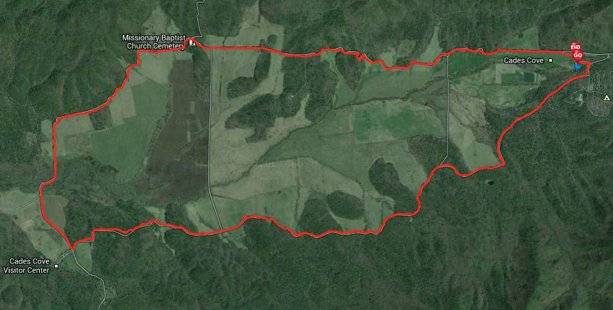
I tracked our hike around the loop road using my EveryTrail app. Click the map to go to the EveryTrail track.
|
The main goal was to check out the visitor center and old buildings in that area. Talk about a traffic jam! We slowly inched our way along the access road, hoping that a parking slot would open up on at the proper time. We did get lucky and snagged a spot. But there was a bad vibe in the parking lot. Looks like all the guys in a family jumped out of a car that was back in the queue and camped in an open parking spot to save the spot until their car made it to the opening. There were some unhappy folks with the maneuver. I did not think it particularly fair either, but I just let Karma take care of it. Interestingly, they were still standing in the parking spot waiting for their car to come around after we had crawled past them, found our spot and were walking toward the visitor center. We did see a Ranger heading in their direction and she was wearing a stern expression. Maybe her name was “Karma”?
By the time we fought through the throngs at the camp store and around loop road, it was about 1:30 when we walked into the Cades Cove Visitor Center. We spent a few minutes looking around, bought a trail map, then headed out to explore the old homestead buildings (houses, barns, old mill). I saw a bumper sticker for the cyclists who peddle around the loop road, but nothing for the hikers, so I modified one for the occasion. Lynn caught a glimpse of a copperhead in one of the barns, and we got a nice photo of a Five-lined Skink.
By the time we fought through the throngs at the camp store and around loop road, it was about 1:30 when we walked into the Cades Cove Visitor Center. We spent a few minutes looking around, bought a trail map, then headed out to explore the old homestead buildings (houses, barns, old mill). I saw a bumper sticker for the cyclists who peddle around the loop road, but nothing for the hikers, so I modified one for the occasion. Lynn caught a glimpse of a copperhead in one of the barns, and we got a nice photo of a Five-lined Skink.
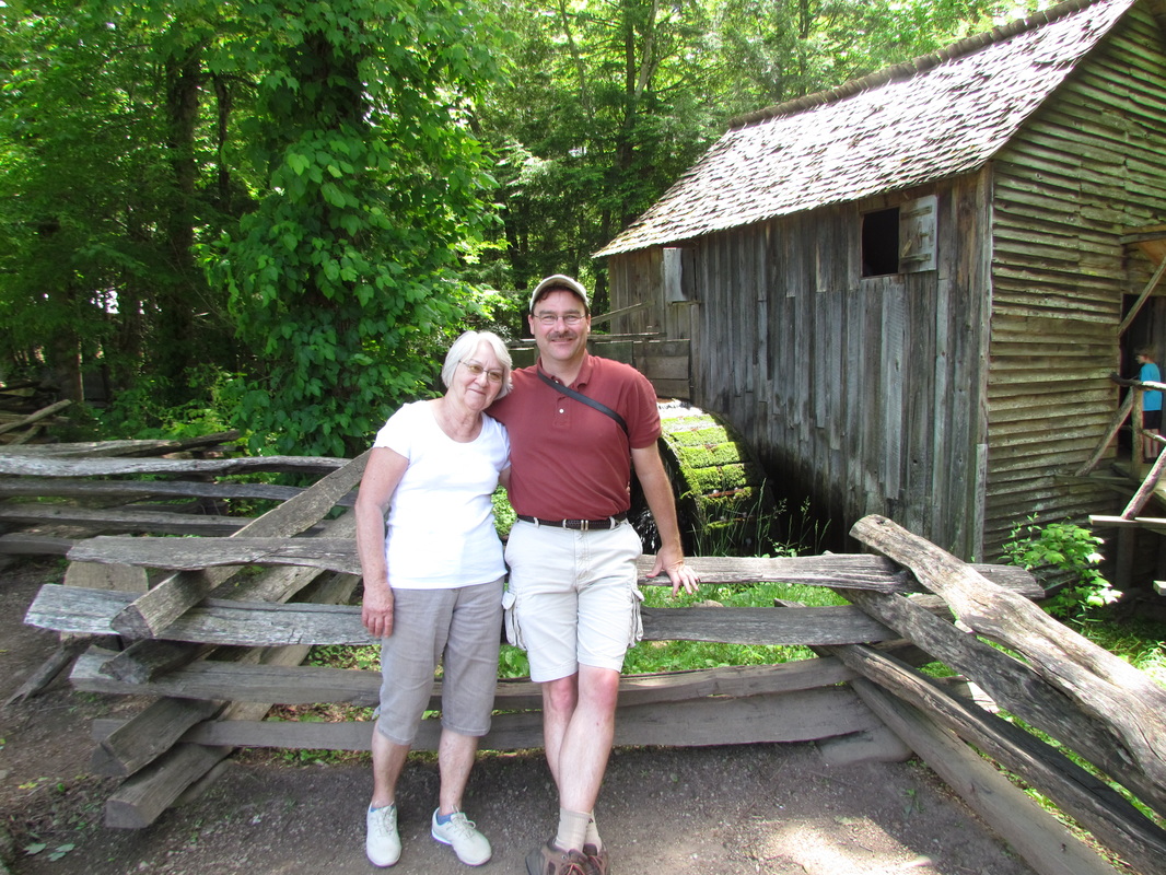
Mom and me at the mill in Cades Cove.
|
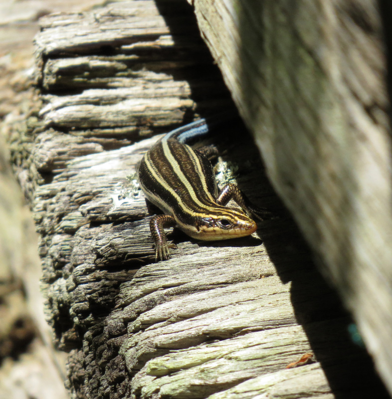
Five-lined Skink.
|
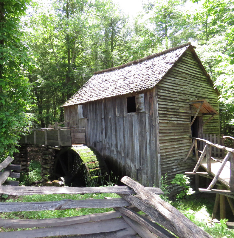
Cable Mill in Cades Cove.
|
We only stayed about 30 minutes; figured we should not linger and let someone else take a turn in the parking spot, and there was still a long line of cars coming. We slowly made our way back through the park, just flowing with the traffic through the park and back through Gatlinburg. The park traffic was really only bad around Cades Cove and at the junction by Sugarloaf Visitor Center, but the traffic pattern there was pretty efficient so the cars kept moving. We did notice that the parking at the trailheads along the way was all jam packed; at some, cars lined the road for at least a quarter-mile in either direction.
After the park, we drove the Arts and Craft Trail loop, but made no stops and were back at the cabin at 4:00. We just chilled at the cabin with a beer and chips and salsa for the rest of the afternoon. It was nice to have some wind-down time after the long hike before fighting our way back into Gatlinburg for dinner. But we did eventually head back into town. We had decided on Big Daddy’s Pizza. We had spotted the place last evening as we were driving about and Mom mentioned that Becky had eaten here and really liked it. OK, we’ll give it a shot.
Big Daddy’s is located at the south end of town just off the main drag. There is parking available right behind the building, which was a bonus. I reckon we got there about 7:00 and the place was basically empty; Saturday night in a holiday weekend, that is not a good sign. But that means we were seated right away and received excellent service. The side salad was crisp and fresh. The pizza was good, but not great. Still, it hit the spot. Pizza and beer…a good end to a great day. Here's the link to the review.
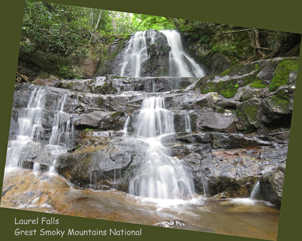
Day 4 – Sunday, May 25, 2014: This was a bit of a lazy morning, just taking it easy around the cabin. We were finally thinking about getting on the road at 8:30 and driving toward the park just before 9:00. The weather today was not as pleasant as yesterday; it was overcast and cool with a bit of a drizzle. But that could work to my advantage for photography when we reach the objective of our first hike, Laurel Falls.
But we had a stop to make at the park entrance to get the obligatory “passport” stamp at the Smoky Mountains National Park welcome sign. Lynn and I recreated the shot we took 25 years ago and the three of us also took a shot as well (thank goodness for the camera stand the NPS installed at the sign just for such occasions). After the photo op, it was into the park and on to Laurel Falls.
But we had a stop to make at the park entrance to get the obligatory “passport” stamp at the Smoky Mountains National Park welcome sign. Lynn and I recreated the shot we took 25 years ago and the three of us also took a shot as well (thank goodness for the camera stand the NPS installed at the sign just for such occasions). After the photo op, it was into the park and on to Laurel Falls.
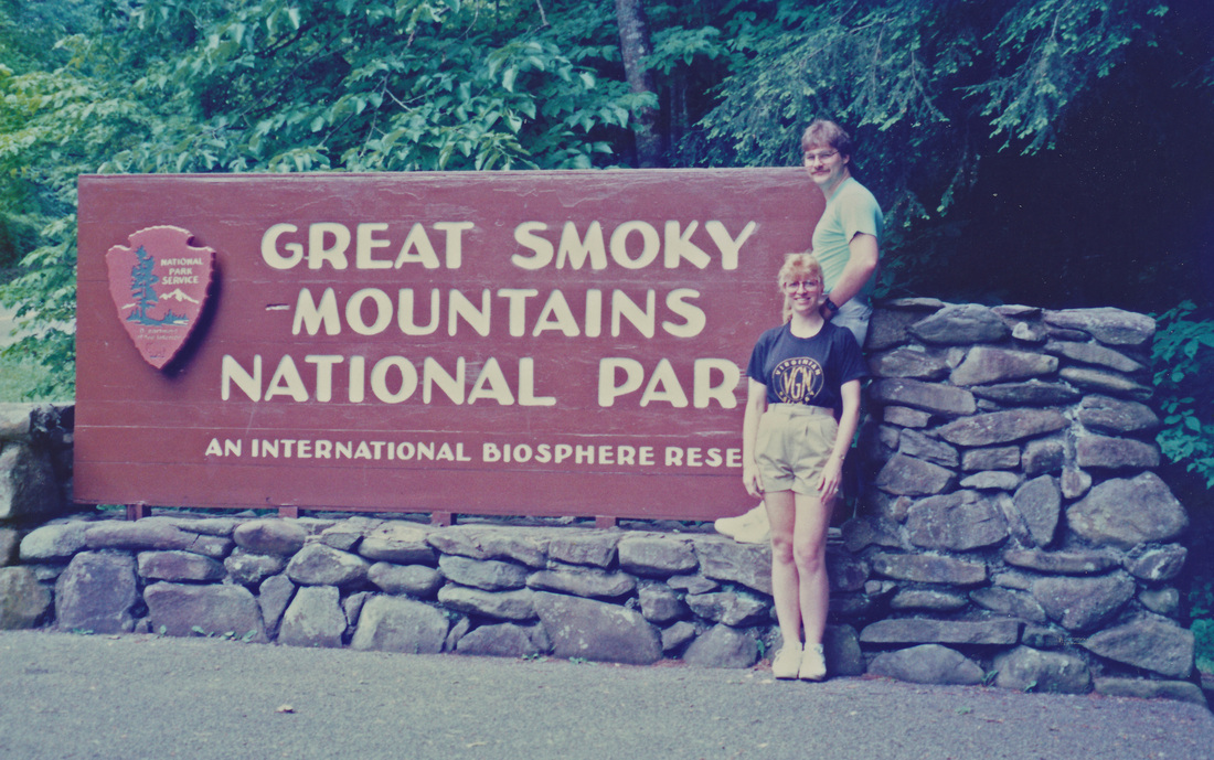
Another flashback moment from 1989...
|
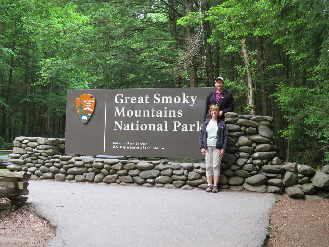
...and 2014.
|
|
Wow, what a zoo at the trailhead parking! It was packed. We were lucky to get a spot for the Edge on the wide shoulder just across from the main parking lot for the trailhead. We were quickly geared –up and heading across the trail to the Laurel Falls trail.
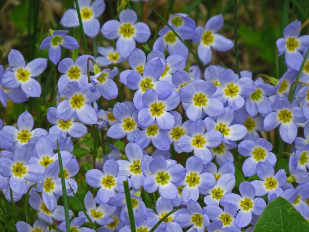
It is not a long hike; only a little over a mile from the trailhead to the falls, but it is a pretty steady climb most of the way to the falls. The trail is paved, well, sort of. The trail surface is broken along the edges for most of the route so you have to pay attention as there are plenty of places to twist an ankle or take a tumble due to tripping. Plus the rough edges make the effective trail a little narrower, so single-file is called for in order to not clog the trail, which called for a little “Mom herding” as the trail was crowded this morning. And of course there were a few stupid-people tricks as there were those “special” individuals who felt that they did not have to stay on the trail and cut across some of the switchbacks. But the joke was on those guys as the route these knuckleheads tried was actually longer and much more difficult due to the steepness of the hillside. Even with the choppy trail surface (which really was not that bad, just something to be aware of) and the high volume of folks, it was a very nice hike along the wooded hillside. There were still a few wildflowers in bloom, although the rhododendron was well past prime. There were no critters along the trail. |
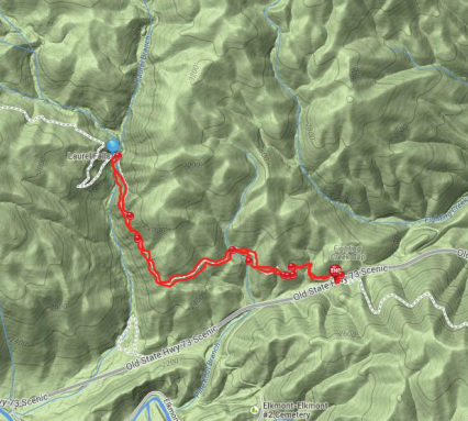
The track of our hike up to and back from Laurel Falls.
Click on the map for the link to the EveryTrail track of the hike.
|
|
The trail leveled out a bit as we got nearer to the falls, which made to easier going. The paved trail ends at the falls. Fortunately there is ample viewing area just below the falls to accommodate the folks milling about and taking photos. We enjoyed the falls for a few minutes and snapped several photos of the cascade above and below the trail. As I expected, the overcast allowed me to adjust my camera settings and get a decent capture of the falls (these Canon superzoom cameras make for a very versatile device in a pretty small package).
Lynn and Mom started back down the trail ahead of me, since I was still taking photos, so I had some catching up to do. The trail was really packed now. There were several families pushing strollers up the trail; that was going to be a hard slog! Tons of people of all shapes, sizes, ages and apparently from all over the planet. The Smokies seem to be just as popular with folks from Europe and Asia as the western National Parks. |
I caught up with the ladies eventually; they were making good time. I snapped a few more shots of the flowers and plants along the trail, but otherwise we just kept on descending to the trailhead. The hike only took about an hour; we were off the trail about 10:45. Once back at the car I broke into the trail mix and we discussed our next move. Clingman’s Dome has always a favorite stop going back to our first visits to the park when I was a kid. Here's the review for the Laurel Falls hike.
The drive from the Laurel Falls parking to Clingman’s Dome trailhead area took about an hour. The traffic was not bad, but there were a LOT of folks out in the park. We noted that the parking areas for Alum Cave and Chimney Tops were both full to overflowing, with cars lining the roads at both trailheads for probably a quarter-mile or more in each direction. That was not a good omen for us.
It was another pretty drive through the park, but the skies were becoming more ominous as we approached our destination. And the temperature was dropping as we increased our elevation. I had hopes that the weather and the lack of traffic might mean that it would not be too crowded at Clingman’s Dome, but that was just wishful thinking. When we pulled into the parking area, which is pretty large, we found a line of cars waiting and a full lot. It was late morning when we arrived (about 11:45 AM), so I was not shocked. So I just followed the queue through the lot and since I found nowhere to park in the official area, I just did what others had done at the trailheads we had passed on the way here and found a nice wide spot along the road beyond the parking lot. By the time we had our hiking packs ready there were already several cars that had followed our lead.
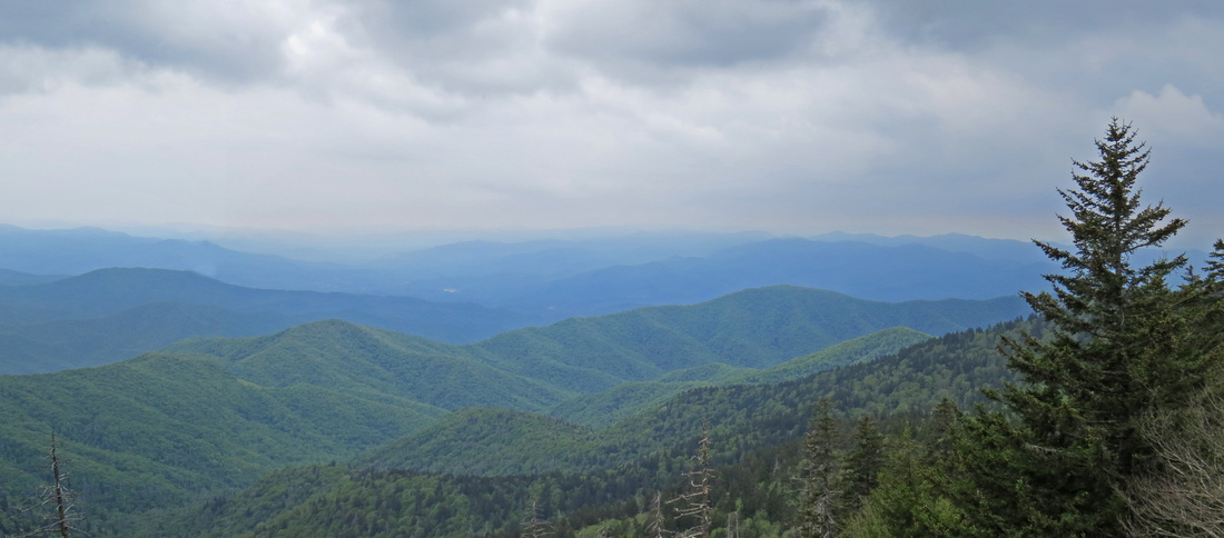
The overcast was increasing and rain was on the way. The vistas from along the trail were muted by the clouds, fog and mist, but were still pretty (tough to get a good photo; post-processing to bring out the highlights was definitely needed).
The drive from the Laurel Falls parking to Clingman’s Dome trailhead area took about an hour. The traffic was not bad, but there were a LOT of folks out in the park. We noted that the parking areas for Alum Cave and Chimney Tops were both full to overflowing, with cars lining the roads at both trailheads for probably a quarter-mile or more in each direction. That was not a good omen for us.
It was another pretty drive through the park, but the skies were becoming more ominous as we approached our destination. And the temperature was dropping as we increased our elevation. I had hopes that the weather and the lack of traffic might mean that it would not be too crowded at Clingman’s Dome, but that was just wishful thinking. When we pulled into the parking area, which is pretty large, we found a line of cars waiting and a full lot. It was late morning when we arrived (about 11:45 AM), so I was not shocked. So I just followed the queue through the lot and since I found nowhere to park in the official area, I just did what others had done at the trailheads we had passed on the way here and found a nice wide spot along the road beyond the parking lot. By the time we had our hiking packs ready there were already several cars that had followed our lead.
The overcast was increasing and rain was on the way. The vistas from along the trail were muted by the clouds, fog and mist, but were still pretty (tough to get a good photo; post-processing to bring out the highlights was definitely needed).
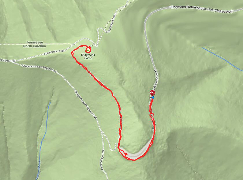
Track of our hike to the top of Clingman's Dome. The EveryTrail map is linked to the map.
|
We headed directly to the trail head, but we did snap a few photos from the walkway along the parking area. Again lots of folks from all over the place taking pictures to capture the moment. The trail to the observation tower at the top of the mountain starts at the upper end of the parking area. From that point it is a 1-mile, uphill trek to the top along a wide, paved trail which was in great shape. But it is a constant climb and fairly steep. According to the GPS on my phone which I used to track the hike, the elevation change is about 400 feet over the mile distance, starting at about 6300 feet above sea level and ending at almost 6700 by the time we made the walk up to the top of the concrete observation deck. Just as we reached the top, a light drizzle started, but did not last too long. A grey day up on Clingman’s Dome but that did not seem to stop anyone from making the hike as the observation deck was completely filled with folks getting a glimpse of Smoky Mountains. Here's the link to the review of our short visit at Clingman's Dome.
|
Not a lot in the way of critters along the trial, just a few songbirds: Robins, Juncos and a Least Flycatcher. There were a few patches of wildflowers as well. But plenty of people to watch and again from all corners of the globe it seemed. There was a Boy Scout Troop on an outing. There was a lady bemoaning the lack of cell service. There were hikers and there were a few folks in flip flops and other nonsensical shoes. Hey, it takes all kinds.
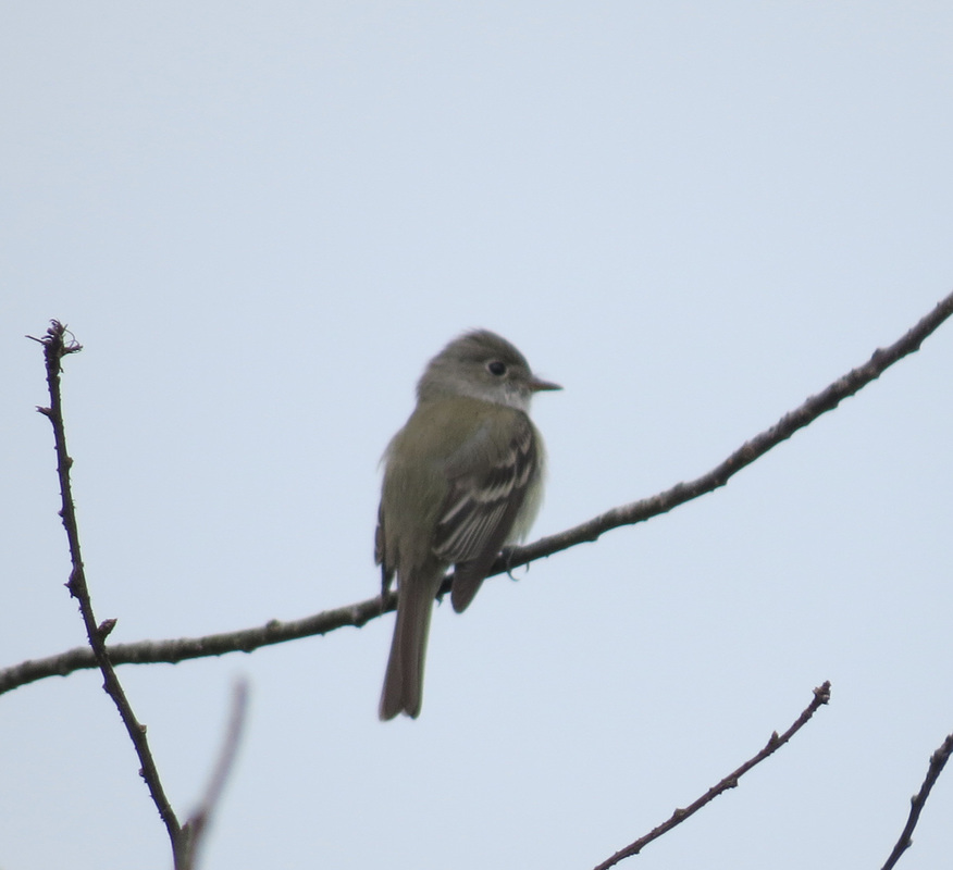
Least Flycatcher.
|
Wildflowers of some sort.
|
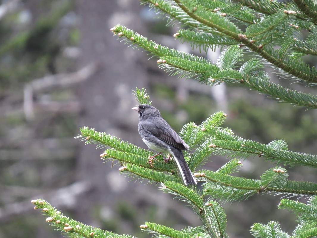
Junco.
|
We stopped at the small Visitor Center on the return trip, but did not linger long before heading back to the car. We thought about stopping at the Newfound Gap Overlook, but it was still packed, so we just cruised back down the mountain road toward the park entrance. We made a short stop at the Sugarlands Visitor Center; I was hoping to find a Great Smoky Mountain polo shirt, but no luck. And the short stop became a bit of a tactical blunder as the traffic getting out of the visitor center was completely SNAFU’d. Between that and the typical traffic snarl through Gatlinburg it took us 45 minutes to get back to the cabin from the time we left the Sugarlands.
The drive through Gatlinburg provided more examples of how the National Parks and their gateway cities have become melting pots. We saw many family groups in town and on the trails from India and the Middle East, lots of Asians, mostly Japanese and heard a variety of European dialects. Plus there were license plates from southern, east coast and Midwest and even out into the plains states. Yes, the park is quite a draw.
Gatlinburg was again a soon in terms of the traffic, but the drivers all tend to share, and take turns, just like in the park. The biggest concerns were the pedestrians who cross at just any old point along the road, even though there are ample crosswalks all along the main drag. Shoot, they sometimes don’t even look, jut step out in the traffic. We saw one lady “leading” with the baby buggy; she just stepped off the curb and figured the cars would stop for her. Fortunately, we all did.
We were back at the cabin around 3:00 and settled in for a nice quite afternoon snaking on chips and salsa and savoring a Lagunitas IPA (we also had a pale ale from Founders but it was not nearly as good). About 5:00, Lynn declared it was dinner time. We had driven past the Alamo Steakhouse several times and it looked interesting, so we headed there for an early dinner. Steak sounds pretty good.
We arrived at the Alamo at 5:20. No waiting for a table; I reckon we beat the dinner rush. The service was excellent, the menu had an outstanding variety of dishes and the food was great. The only disappointment was the beer selection; it was pretty basic except for the Saw Works Pale Ale which was just OK. It was a bit pricey as well, but overall a very good experience. Here's the review.
We were back at the house just after 6:30 and just chilled for the evening. Time to get some rest for the long drive home.
Here's the link to a collection of photos from our two days in the Great Smoky Mountains National Park.
Day 5 – Monday, May 26, 2014: Travel day. We were on the road at 8:20 and made it back to Medina at 5:55, with just a few brief stops, including dropping Mom in Princeton. The weather was ideal. There was a light fog over the mountains and the light was probably ideal for the classic shot of the ridges. If we had more time, I would have bad a trip back up to Clingman’s Dome to check the vistas. I reckon that will have to wait until the next trip.
This was short jaunt in terms of road trips, as the trip odometer read 1279 miles for our five days. We did drive through five states during the trip (Ohio, West Virginia, Virginia, Tennessee and just into North Carolina). It was a fun time and a good visit with Mom. The drive is really fairly easy, so I can see us making a return to the Great Smoky Mountains. I’m sure we’ll make it back sooner than 25 years this time.