Hiking in the High Sierra Back Country
Sequoia National Park - August 15 - 24, 2014
Gettin’ Ready… This was a bit of an impromptu trip, at least by my standards, particularly considering we were heading to the west coast for another National Park adventure. Lynn had seen the information about the Bear Paw High Sierra Camp posted at Wuksachi Lodge during our 2012 trip to Sequoia and she wanted to make that hike and experience the tent cabins since we had such a great time at Sperry Chalet in Glacier National Park. The trip was on our list, but I did not think that we would head back to Sequoia for another couple years. However, Lynn decided that we should make the hike to the Bear Paw High Sierra Camp sooner rather than later. She knows that all she has to do is say “let’s go here” and I will make a plan and set the wheels in motion. So we looked at the calendar, did some more research about the High Sierra Camp, looked into the weather implications and then with all this data set our sights on a late August trip, hopefully spilling just into September to take advantage of the Labor Day holiday. The High Sierra Camp at Bear Paw is not a “spur of the moment” destination as it is difficult to get reservations, but we did add this trip to the 2014 calendar after we had already scheduled our return to Grand Teton and Yellowstone as well as the annual Utah meet-up. We were inside a year away from the trip when we started getting serious about the planning.
The going in plan was to schedule the trip so that we could incorporate the Labor Day holiday and thus save a couple days of vacation time. I actually found a major deal on airfare from Cleveland to Fresno for our preferred dates, but did not pull the trigger in case we could not secure the Bear Paw reservations to match. Good thing I waited. While I called promptly on opening day for reservations (January 2, 2014, at 10:00 AM EST) and did not have a long wait on the phone, our first choice for dates were already booked. OK, plan B which was the week earlier (and if it came to it, plan C was the week before that, but that was the extent of our window due to business travel commitments…it was a busy summer). The very helpful lady on the other end of the phone indicated that there was such a block available the week prior to our first choice of dates, so I pounced on those dates. With the High Sierra Camp locked in, it was time to get the accompanying reservations. In short order we had nights at Wuksachi booked on either side of our Bear Paw time as well as a reservation at Silver City Resort in the Mineral King area of the park for the end of the trip.
The hard part of the planning was over now that the lodging was all in place. Next was the airfare which turned out to be more of a waiting game. Those under-$300 fares into Fresno that I had seen earlier in the fall were long since gone; now the rate was more like $800 per person. Flying into SFO was an option, as that is what we had done in 2012, but even that was well over $500. I looked at other airports in the region with Bakersfield being the next closest and really not that much more driving than from Fresno, once we factored in the Mineral King departure point. The best I could do was $500 round-tip (going through Denver outbound and through Houston on the return), but that was by far the best rate available. So be it.
As mentioned, it was a busy summer of travel for me. Mostly business related, but we did have some fun time schedule (in addition to the three big “out west” adventures, we made a long weekend road-trip to the Smokys with Mom). But when not on the road, Lynn and I tried to walk as much as possible to get in better shape for these big hikes to Bearpaw. We knew that these would be the toughest hikes we have done probably since our trek into Sperry Chalet, so we wanted to at least try to be ready. Due to the shower and meal schedule at the High Sierra Camp we also knew that we would have to really push it to get there in time. One point I made was that we should limit our photography time on the hike in so that we make better time; just keep moving. We would be coming out via the same trail so we could get photos on the return hike as we will not be pressed for time then. Besides, I knew that I would get photos ops on the inward hike when Lynn took breaks. The other thing we did to help us with pace was to purchase a handheld GPS hiking unit. We knew we would not need it for “trail blazing” as the Parks Service does such a wonderful job maintaining the hiking trails, so no chance of us getting lost. We thought we could use the GPS to show us our position along the trail so that we could gauge time and distance to our end point. Hey, the theory was sound at least. While I have GPS on my phone along with map and hiking apps, the battery life is limited and there is no way to charge the phone at Bearpaw, so the GPS unit with some spare batteries would certainly be better in that respect. After a little research on-line and conferring with my Utah hiking buddies I opted for the Garmin 62st, which ended up providing us very good service, well, other than the operator-induced errors…but we’ll get to that later.
Now that the overall plan was fixed, the rest of my research focused on the hiking options in each area (near Wuksachi, High Sierra from Bearpaw and in Mineral King). Interestingly, the only hikes I could really find originating from the High Sierra Camp were to Hamilton Lake and the Redwood Meadow Grove. The former sounded like a great hike while the latter was not highly recommended. Looking at the maps, there was also a trail to Tamarack Lake which seemed interesting, so I added that to the list, figuring that we could get details from the Rangers at the park if nothing else. Mineral King offered a lot of interesting hiking options, but we would really only have one day for any serious hiking. After weighing the options, Eagle Lake looked like the best for us; not too long, but advertised to have wonderful views and opportunities for critter sightings. If the hikes to Bearpaw don’t kill us, then we’ll at least have an idea of what to do in Mineral King.
The Going in Plan So the dates are set and the reservations are in place. Here’s the plan as we started to California. Like any trip, particularly one focusing on a National Park, flexibility is key, so the starting plan is just that, a place to start. Part of the fun is seeing how much the plan evolves over the course of the trip.
- Day 1 – Friday, August 15 – Heading West: Late afternoon flight to Bakersfield through Denver. We arrive sort of late evening, so we’ll just grab the rental car and stay overnight in Bakersfield.
- Day 2 – Saturday, August 16 – On To Sequoia: We’ll just mosey north to Sequoia. No plans for stops along the way so we’ll most likely start exploring once we hit the park. We’ll check in at Wuksachi this afternoon then hopefully find a short hike in the area so that we can start to acclimate to the elevation.
- Day 3 – Sunday, August 17 – Short Hikes: First full day in the park and at elevation. We’ll do a couple of short hikes to get us acclimated. I’m sure some of our hiking will be along the Congress Trail and will include a visit to General Sherman. We’ll also make our final preparations for the hike into the back country. Staying again at Wuksachi.
- Day 4 – Monday, August 18 – The Hike to Bearpaw: Today starts our back country adventure, and while we are not exactly roughing it, this won’t be “glamping” either. An early start is in order so that we can get to the High Sierra Camp by mid afternoon. We’ll stay the next three nights at Bearpaw High Sierra Camp.
- Days 5 and 6 – Tuesday, August 19, and Wednesday, August 20 – Two full days to explore using the High Sierra Camp as a base. We’ll hike at least one day to Hamilton Lake and maybe we’ll also sortie out to Tamarack Lake as well.
- Day 7 – Thursday, August 21 – The Hike Back: Well, we walked in to Bearpaw so we have to walk out. Today’s the day for that. Hope we can make it. Overnight at Wuksachi Lodge.
- Day 8 – Friday, August 22 – Transition to Mineral King: More new ground for us as we visit to another rather secluded part of the park, Mineral King. We’ll stay two nights at Silver City Resort in the Shooting Star Chalet.
- Day 9 – Saturday, August 23 – One More Hike: We’ll get in one more hike for the trip, most likely to Eagle Lake.
- Day 10 – Sunday, August 24 – The Journey Home: Back to Bakersfield for the flight back to CLE.
That’s the plan. It gives us a general framework. Now let’s see how close we were to the plan.
Day 1 – Friday, August 15, 2014 - Heading West Basically business as usual this morning, get ready for work, feed the cats, etc., except for some minor packing, washing up the breakfast dishes and a few other miscellaneous chores to get the ranch in order for a week away. The one thing we were sure to do was leave the key for Sue, following our Wyoming trip debacle (see day 2 of the Wyoming 2014 trip journal for details on that). We did all the heavy lifting on packing and trip prep over the weekend, so we were not rushing around today.
We put in almost a full day at work and fortunately there were no last minute emergencies so we were able to get away cleanly. Per plan, I called Lynn to give her the 30-minute warning. She had he Edge and said she would be by in 15 minutes to get me so we had an on-time departure from the base right at 2:00. No issues with getting to the airport, snagged a prime parking spot at CLE and no crowds at all in Hopkins. Still check-in lagged, even with the absence of lines. United had changed a flight number on the return leg of our trip so the kiosk could not locate the reservation. I tried frequent flyer number, United credit card and reservation number to no avail. There was only one harried ticket agent at the counter and she said it would be a while before she could help. What? Since there was no one else in line, I tried another kiosk with the same result. Luckily, the agent was only a couple minutes before returning to help. She asked if I had changed the reservation. I had not, but told her about the alterations that United had made to the flight numbers and schedule. Bingo. That was the problem. Go figure. Seems the United system never misses an opportunity to charge the passenger for just about anything, but it cannot keep up with its own updates. OK, only minor annoyance and short delay from a travel perspective.
No line at all at security; man, Hopkins is becoming a ghost town. I did see Jon Gruden at the TSA check-in. He must have been in town scouting the Browns new QB, Johnny Football. Interesting as I also saw James Brown from CBS Sports a few weeks ago at Hopkins. He was probably in town for the same reason. We breezed through security and were seated at Great Lakes Brewery about 2:40, so not really that much time, just a little aggravated with United. However the first beer of vacation quickly worked its magic. Hello, Commodore Perry. IPAs and pale ales will be a continuing theme for this trip. The food at Great Lakes is excellent, particularly for airport fare. I went sort of light with a bowl of the gumbo and a salad while Lynn had the lobster mac and cheese.
We stopped by the bookstore to kill some more time. I’m not much of a reader, but one cover caught my eye so I added it to the stack of books that Lynn was buying. I mean there was a F4U Corsair streaking across the sky; that’s got to be a good book, right. The book was Lords of the Sky by Dan Hampton and it chronicled fighter pilots from WWI through current day. I ended up finishing it by the time the trip was over. It was an interesting read and a lot of great insight in the mindset of the pilots but there were some flaws in the discussion of the basic engineering.
Well, the rest of the trip was uneventful. On time departure from Cleveland but our flight to Bakersfield was delayed about 45 minutes to an 8:00 PM departure, so we arrived in Bakersfield about 10:00. But after that we sped through baggage claim and getting the rental car. Bakersfield airport is tiny but there was no congestion at this time of night so no hold-ups at all. We were checked-in at the La Quinta and in bed by 11:00. Of course that’s 2:00 AM to my body so I think we’ll be taking it easy tomorrow morning.
Day 2 – Saturday, August 16, 2014 – On to Sequoia Well, we did not sleep in that late after all. As it happens we were ready to roll at 8:50 which was pretty good after a late night. The La Quinta was a great choice for this one-night stand; the room was large and well appointed, friendly staff, quick check-in/out, and a good breakfast. That was all we were really looking for. I would certainly stay here in the future if I were visiting Bakersfield, although I’m not sure why I would be visiting Bakersfield unless is was again just a stop on the way to some other destination.
The drive to Sequoia was easy and less than 3 hours to Wuksachi. The drive north on route 65 out of Bakersfield was rather dull, almost depressing. A lot of the route, particularly early in the drive, is through a very arid region with not a lot going on other than drilling for gas and oil. A couple of the operations were quite expansive. Lynn was much more interested in these sites from an engineering perspective and made a few observations that sparked some technical discussion and helped to pass the time. There was a fair amount of farming and ranching along the route as well. Lots of citrus groves. They were lush and green, but I bet the there was a lot of irrigation happening as the area looked so dry. We went through a few very small towns, a couple of which looked to be on the verge of extinction. What industry there was certainly centered on either gas and oil or agriculture; drilling and distribution equipment and mom-and-pop produce stands were the predominant features in terms of stores. We noted one of the farms had a wooden tower near the house which sort of resembled a lighthouse. We did not think too much of it until we spotted similar towers at several other farm or ranch houses. The best we could figure is that this was a water tower of sorts.
Once we turned east onto route 198 the drive got a little more interesting in terms of scenery as we were heading toward the mountains and starting to gain a little elevation (Bakersfield is about 400 feet above sea level, Exeter, where we turned onto 198, is about 500 feet and Tree Rivers is about 840). Shortly after turning onto 198, we passed above Lake Kaweah; the road worked up the hillside above the lake which gave us a good view down onto the dam and the valley below. That view was certainly a testament to the drought that is plaguing the western United States in general and California in particular as the water was well below the obvious normal levels. The upper end of the lake was so low that the bottom was exposed creating a sort of island of mud and sand.
We continued on toward Three Rivers, climbing slightly along the highway and looking at the dry landscape that was dotted with many dead trees. Somewhere along this stretch of road we noticed a structure on the opposite hillside. It looked to be some pathway as it stretched all along the hillside and was basically level, but it really did not click what we were seeing until later in the trip.
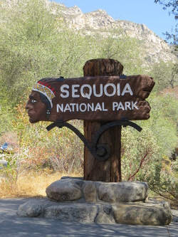
The only stop we made was for gas in Three Rivers, not that we needed much with the fuel-efficient little Soul, but we knew that gas would be hard to come by once we entered the park. There was a bit of a backup at the Ash Mountain Entrance to the park, in part due to a massive RV that had to make a u-turn as it was well beyond the allowable length for the road ahead. But we were soon in the park and the back-up quickly evaporated as we started climbing up the road into the park. Our first stop in the park, and our first photo of the trip, was at the Indian-head entrance sign. We were still at fairly low elevation and the area was brown and dry. Made a couple more quick stops to take in the views as well as to check out the Foothills Visitor Center, but we mostly just kept on chugging up the General’s Highway to Wuksachi. The best viewpoint along the route was at Amphitheater Point which provided a nice vista up the valley as well as views looking up at Moro Rock.
Once we turned east onto route 198 the drive got a little more interesting in terms of scenery as we were heading toward the mountains and starting to gain a little elevation (Bakersfield is about 400 feet above sea level, Exeter, where we turned onto 198, is about 500 feet and Tree Rivers is about 840). Shortly after turning onto 198, we passed above Lake Kaweah; the road worked up the hillside above the lake which gave us a good view down onto the dam and the valley below. That view was certainly a testament to the drought that is plaguing the western United States in general and California in particular as the water was well below the obvious normal levels. The upper end of the lake was so low that the bottom was exposed creating a sort of island of mud and sand.
We continued on toward Three Rivers, climbing slightly along the highway and looking at the dry landscape that was dotted with many dead trees. Somewhere along this stretch of road we noticed a structure on the opposite hillside. It looked to be some pathway as it stretched all along the hillside and was basically level, but it really did not click what we were seeing until later in the trip.
The only stop we made was for gas in Three Rivers, not that we needed much with the fuel-efficient little Soul, but we knew that gas would be hard to come by once we entered the park. There was a bit of a backup at the Ash Mountain Entrance to the park, in part due to a massive RV that had to make a u-turn as it was well beyond the allowable length for the road ahead. But we were soon in the park and the back-up quickly evaporated as we started climbing up the road into the park. Our first stop in the park, and our first photo of the trip, was at the Indian-head entrance sign. We were still at fairly low elevation and the area was brown and dry. Made a couple more quick stops to take in the views as well as to check out the Foothills Visitor Center, but we mostly just kept on chugging up the General’s Highway to Wuksachi. The best viewpoint along the route was at Amphitheater Point which provided a nice vista up the valley as well as views looking up at Moro Rock.
Welcome to Sequoia!
|
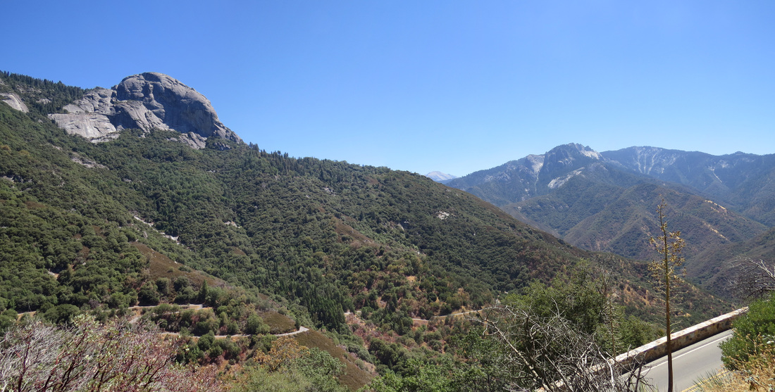
View from Amphitheater Point. To the left is Moro Rock, on the right are Castle Rocks and Mount Eisen is in the distance.
|
The road twists and turns basically from the Foothills Visitor Center all the way to Wuksachi, gaining significantly in elevation all the way, eventually climbing up to meet the huge trees for which the park is named. The dry scrub down in the valley has given way to the huge trees and other conifers as we reached elevations about 5000 feet (maybe a little higher). But the contrast was stunning. This was by far the best part of the drive as we slowly cruised through these stoic giants.
We arrived at Wuksachi about 12:20. Not only have we changed our elevation significantly since this morning, now that we are about 7000 feet above sea level, the temperature has also varied greatly. It was already 84 F when we left Bakersfield before 9:00 and had risen to 96 F at the Foothills Visitor Center at 11:00. But now that we are on higher ground, things are a bit cooler. The gauge in the Soul read 72 F as we rolled through the Giant Forest right at noon and now indicates 77 F as we pulled into Wuksachi.
We arrived at Wuksachi about 12:20. Not only have we changed our elevation significantly since this morning, now that we are about 7000 feet above sea level, the temperature has also varied greatly. It was already 84 F when we left Bakersfield before 9:00 and had risen to 96 F at the Foothills Visitor Center at 11:00. But now that we are on higher ground, things are a bit cooler. The gauge in the Soul read 72 F as we rolled through the Giant Forest right at noon and now indicates 77 F as we pulled into Wuksachi.
 Lunchtime beer.
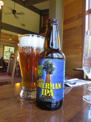
We checked in, but our room was not quite ready so we grabbed lunch in The Peaks Restaurant. There was no crowd to speak of in the dining room, so we were seated next to the large windows that provide a nice view of the pine trees surrounding the lodge building. We enjoyed watching the birds flit about in the pine boughs and the chipmunks and squirrels scampering about between the trees. There were a couple Yellow-rumped Warblers in the area, the flashes of yellow making them stick out a bit more against the green of the pine needles. We kept the meal light with chicken quesadilla and a salad since we were planning on a hike later this afternoon. Of course, no meal at Wuksachi would be complete without a General Sherman American IPA from Tioga-Sequoia Brewing Company in Fresno (7.5% ABV; 60 IBU). This is west coast style IPA with a great aroma and a tasty citrus flavor. Just a nice way to kick-off our stay at Wuksachi.
After lunch we were able to get into our room. We were in the Stewart building (most distant of the three lodge buildings from the main building), but we had a room on the entrance level, so no lugging baggage up or down the stairs (no elevators at Wuksachi). And our room was outstanding. Plenty of space and included a sitting area, and it had a view looking out of the back of the building which was nice for potential critter sightings.
Once we had settled in and relaxed a bit it was time for a little hiking to help with our acclimation to the elevation. We headed over to Lodgepole area a little after 3:00 to make the hike to Tokopah Falls. From the research I had done, this looked like a good starter hike for the trip. The trail starts just beyond the Marble Fork Bridge in Lodgepole Campground and works along the Marble Fork of the Kaweah River up through the granite cliffs in Tokopah Canyon.
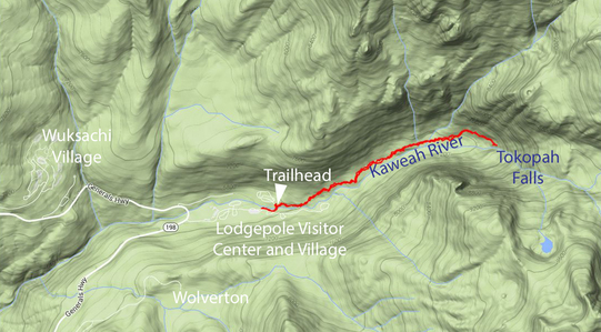 Our opening hike along the Kaweah River to Tokopah Falls.
This was a good starter hike; not too hard, but no push-over either as there was some elevation change involved. The park literature indicates that the hike to falls is 1.7 miles one way, but our walk was a bit longer as we had to park a ways away from the trailhead. I marked the distance at 3.8 miles from where we parked to the falls and back and it took us about 2 hours to complete this first hike. In terms of scenery, this short trail packs quite a punch and had a bit of variety. Just across the bridge is an area of exposed granite with several small boulders scattered about. Glacial erratics perhaps? The trail then works along the river through a wooded area with a few patches of wildflowers thrown in for color. Mostly yellows, but a few splashes of red and white as well. The trail gradually ascends through this section. Then the trail breaks into the open further up the canyon where the trail works through boulders and along the granite walls of the canyon. The payoff is cliffs and waterfall at the head of the canyon. Tokopah Falls is 1,200 feet high, but at this time of year it was basically a trickle. However it was a popular spot as we passed several folks along the trail and there were a couple dozen college-age kids using the pools at the base of the falls as the site of a beach party. Hey, good for them. This sort of reminded me of the scene at the top of Nevada Falls in Yosemite where there were scores of folks of folks lining the creek and many more coming of the Mist Trail to join the fun. Here at Tokopah Falls it was just a small gathering, but they were having a good time nonetheless.
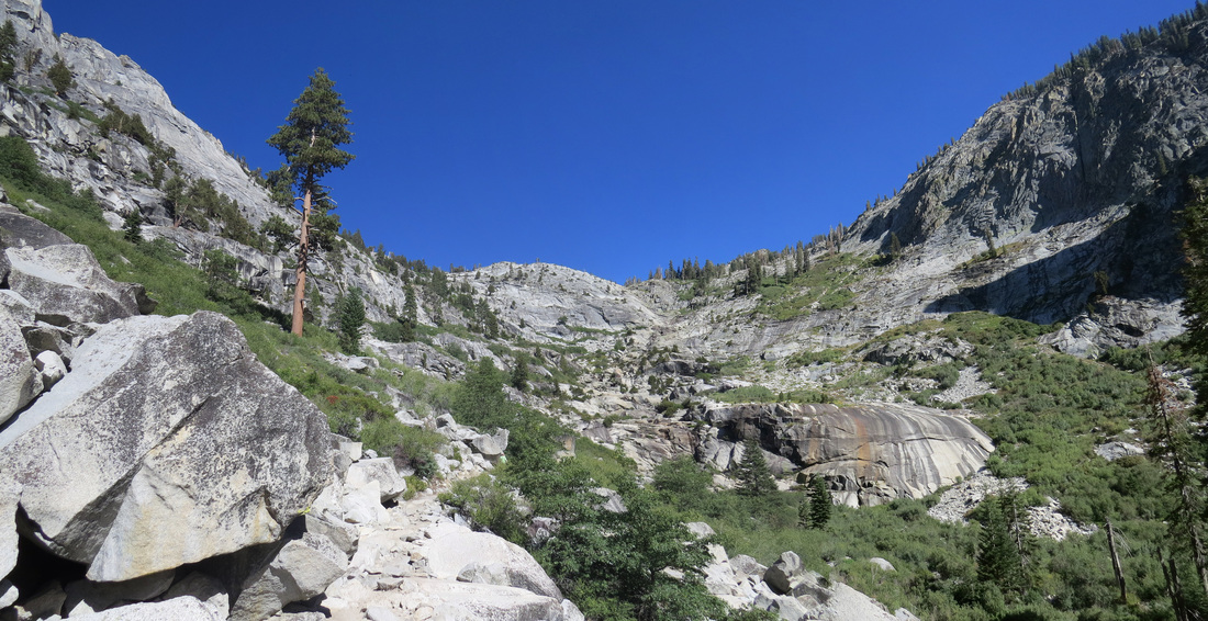
View looking up Tokopah Canyon.
On the return hike we walked down to the creek for a closer look. There were a few Ravens along the creek bank as well and we spotted some trout in the deeper pools. There were several other folks playing along the opposite bank as we got closer to the camp grounds. Not that I’m a camper, but these looked like nice locations, tucked back into the trees but still right along the river. That said, I still want a nice, comfy bed after a day in the park.
We were back at the Soul about 5:30, so we had plenty of time to get home and cleaned-up before our 7:15 dinner reservation at Wuksachi. We again had prime seating by a window but there were no big critters out this evening that we could see. Lynn had the flat iron steak and I tried the blacken steak Cajun pasta, and of course a General Sherman IPA or two. It was interesting that many of the server staff were international and quite varied in the origins and accents. For example, the young lady who waited on us at lunch and again at dinner, who was very nice and quite expedient was from somewhere in Eastern Europe. Yes, our National Parks are quite the melting pot.
After dinner we made a loop around the grounds and spotted a few birds. We walked down to the bridge across the gully where we spotted the mamma bear and her two cubs in 2012, but there was nothing of note there this time. Just the peace of the evening. Still, it made for a nice end to our first day in Sequoia. Here are the photos from our first day in the park.
Day 3 – Sunday, August 17, 2014 – Short Hikes The plan for today is to take a couple short hikes to continue to acclimate to the elevation so that he are hopefully ready for our first major trek of the trip when we hike into Bearpaw tomorrow morning. However, we are in no big rush today, but I was still up at 5:15. I went out for a walk around the grounds about 6:30 while Lynn was getting ready for the day. I was a little surprised by the litter I found along the trail. Granted it was not much, but it was still there. First I came upon a couple beer bottles that were left near one of the benches along the walk way and then another bottle a little further along the trail. I completed walking along the base of the hill to see if there were any critters about and then I reversed course to collect the bottles. All Coronas, so not only were these folks litterbugs, they did not even have good taste in beer. I collected the bottles and took them to the lodge to find a recycling containing and then returned to the walkway.
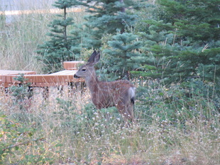 Mule deer fawn at Wuksachi Lodge.
On the positive side, I did spot a deer with a fawn and saw several birds, and got a decent shot of a Fox Sparrow. However, as I was making my way along one of the walkways near the lodge I came upon a glass complete with sizzle stick; this was obviously left by a guest who was too lazy to return it to the lodge. C’mon people, show a little respect for the National Parks and pick up after yourselves. So another jaunt to the lodge to return the glass. On the way out I saw a fellow with a camera literally chasing a squirrel down the sidewalk next to the parking lot. As we passed I commented that those little guys were hard to catch. He chuckled and agreed. We chatted briefly. Turns out he was from Belgium and he and his family were touring several of the National Parks and one of his interests was wildlife photography. He was at least on the right track by being out early, but his technique was a little unorthodox. I suggested a couple trails that he might try for animal sightings, such as Crescent and Log Meadow. We talked about other parks he would be visiting. I told him that the best parks for animal sightings, at least of ones that I had visited, were Yellowstone, Grand Teton and Glacier.
From here I headed back up to the room to collect Lynn and then we went down to breakfast about 7:15. Wuksachi puts on a nice spread for their breakfast buffet. On our way out, I confirmed luggage storage with the front desk; no issues there, just drop off the bags at checkout. After a slow morning, we were finally on our way to the trails just before 9:00.
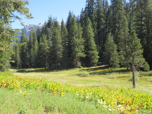
As mentioned, we wanted to get in a couple of short hikes today to help us acclimate without getting to worn out. I figured we would hike the Congress Trail at some point as that is just a pretty hike through the Sequoias. But this morning we started by heading to Wolverton with the thought of hiking the Long Meadow Trail. The drive out to Wolverton is pleasant as it winds through the forest. We saw a few birds along the way including a woodpecker of some sort. Very little traffic once we passed the access road to General Sherman.
This was new territory for us as we did not venture to Wolverton in 2012. This is where the western BBQ dinner and the living history events are held during the summer. While these sounded interesting, we are usually so tuckered-out by dinner time that a nice quiet meal and a beer is more what we prefer. Still, the facilities here look very nice, but at this time of day it was basically deserted. There were just a few other cars in the large parking lot near the trailhead as well as a big pickup with a five-horse trailer. Looked like the wranglers were getting the horses ready for action, but we did not see any riders about. Maybe a pack train? No mules. Oh, well, I have no clue what they’re doing.
We crossed the parking lot and headed up the hill along the connector trail that took us to the Alta Peak Trail. We turned right so that we could go clockwise around the meadow. We followed the Alto Peak Trail for a couple hundred yards (if that) then branched off down the hill to the southeast toward the meadow. The trail made a wide loop around the parking area and the Wolverton facilities and crossed Wolverton Creek once we were south of the parking area and buildings. This part of the hike was all wooded. We spotted a few little critters and a few “gone birds” along the way but the only photos we captured were of Juncos. We did have a couple of unfortunate encounters with some annoying little varmints along the trail as there were a few small swarms of mosquitoes, but we passed through those basically unscathed. Once out of the woods, the trail turns south and parallels the meadow. At this point, we were out in the open and were provided with some decent views, but nothing that spectacular. Shortly the trail ducks back into the woods that surround the meadow. The woods are thicker along the east side of the meadow and there was at least one spot in that stretch where the trail was sort of overgrown and easy to lose; I should know, we lost it. Near the south end of the meadow, the trail makes a sharp switchback up the hill. The problem was that there were a couple of downed trees and some tall grass that obscured the turn, so we stumbled along off the trail a few yards before we figured out our error. No worries as we were quickly back on track. I think this is just a symptom of a lightly used trail. I mean we did not see another soul on the trail around the meadow.
From here I headed back up to the room to collect Lynn and then we went down to breakfast about 7:15. Wuksachi puts on a nice spread for their breakfast buffet. On our way out, I confirmed luggage storage with the front desk; no issues there, just drop off the bags at checkout. After a slow morning, we were finally on our way to the trails just before 9:00.
As mentioned, we wanted to get in a couple of short hikes today to help us acclimate without getting to worn out. I figured we would hike the Congress Trail at some point as that is just a pretty hike through the Sequoias. But this morning we started by heading to Wolverton with the thought of hiking the Long Meadow Trail. The drive out to Wolverton is pleasant as it winds through the forest. We saw a few birds along the way including a woodpecker of some sort. Very little traffic once we passed the access road to General Sherman.
This was new territory for us as we did not venture to Wolverton in 2012. This is where the western BBQ dinner and the living history events are held during the summer. While these sounded interesting, we are usually so tuckered-out by dinner time that a nice quiet meal and a beer is more what we prefer. Still, the facilities here look very nice, but at this time of day it was basically deserted. There were just a few other cars in the large parking lot near the trailhead as well as a big pickup with a five-horse trailer. Looked like the wranglers were getting the horses ready for action, but we did not see any riders about. Maybe a pack train? No mules. Oh, well, I have no clue what they’re doing.
We crossed the parking lot and headed up the hill along the connector trail that took us to the Alta Peak Trail. We turned right so that we could go clockwise around the meadow. We followed the Alto Peak Trail for a couple hundred yards (if that) then branched off down the hill to the southeast toward the meadow. The trail made a wide loop around the parking area and the Wolverton facilities and crossed Wolverton Creek once we were south of the parking area and buildings. This part of the hike was all wooded. We spotted a few little critters and a few “gone birds” along the way but the only photos we captured were of Juncos. We did have a couple of unfortunate encounters with some annoying little varmints along the trail as there were a few small swarms of mosquitoes, but we passed through those basically unscathed. Once out of the woods, the trail turns south and parallels the meadow. At this point, we were out in the open and were provided with some decent views, but nothing that spectacular. Shortly the trail ducks back into the woods that surround the meadow. The woods are thicker along the east side of the meadow and there was at least one spot in that stretch where the trail was sort of overgrown and easy to lose; I should know, we lost it. Near the south end of the meadow, the trail makes a sharp switchback up the hill. The problem was that there were a couple of downed trees and some tall grass that obscured the turn, so we stumbled along off the trail a few yards before we figured out our error. No worries as we were quickly back on track. I think this is just a symptom of a lightly used trail. I mean we did not see another soul on the trail around the meadow.
 Long Meadow
The trail on the west side of the meadow is a little more open and probably provides slightly better views into the meadow. There were a few more birds flitting about and now that we were out of the more dense forest we could see that the morning haze had burned off and we were now under bright blue skies. But while the sky was clearing, the trail was not. As we neared the end of the trail where we thought we should be very close to the Wolverton facilities, we came upon construction. There was no activity there this morning; the big yellow, metal dinosaurs were napping peacefully in the sun. However, the trail seemed to disappear at this point. From our little trail guide, it seemed that we should drop down to creek level and head directly north to the parking area, but there was no clear trail through the thicket of reeds, grass and young trees and it was likely to be sort of swampy down in that lower lying area. Having bushwhacked through areas like this in the past, we opted to follow the dirt road from the construction site which did lead us back to the Wolverton road and eventually back to the parking lot. It was a little longer route in terms of distance, but I bet was no longer on the clock. Plus it was an easy walk along the road. We picked up a couple aluminum cans from the side of the road as we went. There was plenty of room along the shoulder of the Wolverton road so there was no danger from the cars that passed us (I think both were Park Service personnel, so they were driving sanely).
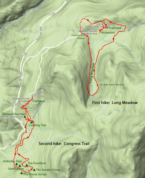 Our short hikes around the Long Meadow and along the Congress Trail.
It took us two hours to complete this 3.6 mile loop, including a detour down to the outhouse once we were back in Wolverton before returning to the trailhead parking lot. We arrived back at the trailhead parking just about the same time as a group of backpackers were coming off the Alta Peak Trail. Looked like they had been out for a few days. It was amazing how quickly they were out of their packs and changed from heavy boots to sandals. That might be us tomorrow. But so far today we had only done an easy hike. And this was an easy hike. Less than four miles including the construction detour, and generally flat. The trail around Long Meadow fit the requirements in terms of giving us a nice warm-up and an opportunity to acclimate a bit, but otherwise it was not a very interesting hike. The views were not that great and the meadow is not as scenic as say Crescent Meadow. There was not a lot of animal activity while we were there, but that is always a wildcard. Perhaps if we were here earlier? Even still, I do not think this would be a hike that I would repeat.
After taking a short break, we loaded into the Soul and returned along the Wolverton Road to the access road to the General Sherman Tree and the Congress Trail. Where Wolverton was nearly deserted, this parking lot was swarming with cars and people, but there was still a slot for our little rental. We made our way down the wide, paved path to General Sherman and paid our respects to the world’s largest living tree. There are taller trees, wider trees and older trees, but no living tree matches General Sherman by volume, which is the metric that counts for size. General Sherman is listed at 275 feet tall, and between 2,300 and 2,700 years old with a volume of over 52,500 cubic feet. It is an impressive sight. There was quite the crowd milling about the base of the huge tree, so we just took in the view from up the trail a bit and then continued on around the Congress Trail.
After taking a short break, we loaded into the Soul and returned along the Wolverton Road to the access road to the General Sherman Tree and the Congress Trail. Where Wolverton was nearly deserted, this parking lot was swarming with cars and people, but there was still a slot for our little rental. We made our way down the wide, paved path to General Sherman and paid our respects to the world’s largest living tree. There are taller trees, wider trees and older trees, but no living tree matches General Sherman by volume, which is the metric that counts for size. General Sherman is listed at 275 feet tall, and between 2,300 and 2,700 years old with a volume of over 52,500 cubic feet. It is an impressive sight. There was quite the crowd milling about the base of the huge tree, so we just took in the view from up the trail a bit and then continued on around the Congress Trail.
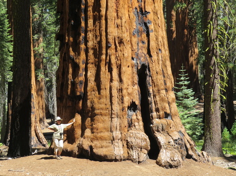 Lynn posing next to the one of the massive Sequoias; I think this is the McKinley Tree.
The crowd around General Sherman did not extend to the Congress Trail. There were a lot of folks on the trail, but it was not jammed (well, there were a couple of spots that were sort of packed, but overall it was not too bad). We again walked clockwise around the loop. We were just taking in the views as we strolled through the massive trees. The trail is well shaded which made for a very pleasant time in the Giant Forest. It was about 60 when we started our first hike, but it is in the low 80s now, so still very nice for a walk in the woods. The highlights were of course the named tree and groups: The President, The Senate Group, The House Group and the McKinley Tree. We spent a while in several locations trying to capture the color of the bark of the Sequoias with the camera. This is a more difficult task that it sounds. I’m not sure that either of us really got “the shot” but I think we got close.
The high traffic volume on the trail probably was the reason for the lack of critters. But we did see several chippers and squirrels attacking the pine cones and a Golden-mantled Ground Squirrel plus several birds. We also spotted several more “pine cone massacres” along the trail, very similar to the “crime scenes” yesterday on the hike to Tokopah Falls. But today we caught a couple of the furry perpetrators in the act is tearing the cones apart to get at the seeds. Those little guys sure make a mess, but I reckon that is part of the way the seeds get scattered so that new trees can sprout. But this little walk was again more about getting used to the elevation as we get nearer to our first real challenge. Our loop around the Congress Trail measured 3.2 miles and took us right at an hour to complete.
After the walk along the Congress Trail, we headed back to the Lodgepole area, arriving about 12:30. We were looking for a snack, supplies for the hike into Bearpaw and our back country permit for our time at the High Sierra Camp. A key item on our shopping list was Kleenex for the inevitable erosion of my nose due to the dry air (that’s usually the only drawback to vacationing “out west” as the arid conditions play havoc with our nasal passages…has anyone died from a nose bleed?…don’t answer that ). OK, this is vacation, so lunch today was an ice cream sandwich. Two big chocolate cookies and a slab of vanilla ice cream; that seems healthy enough.
Next stop was the Visitor Center to get our permit for the High Sierra Trail back country. We already had a permit secured as we took care of that detail on-line. We were lucky as the line was short; there was only one guy in front of us and he seemed to be more of a kibitzer than anything else. We just waited patiently as he jawed at the equally patient Ranger. But he did make some disparaging remarks about the Bearpaw campground to which the Ranger agree. Uh oh, I hope that does not spill over to the High Sierra Camp since the two are situation basically next to each other. That will be a question for the Ranger when our turn comes.
While we were waiting, a young couple carrying big backpacks and seeming ready to tackle the wilds of Sequoia walked in and took up the position behind us in line. These were certainly a pair that looked ready for a back country adventure. By my standards, they were “kids” probably in their mid to late twenties, but what really impressed me was their height. I mean, I’m right at 6-foot tall, but these two both were towered over me. They were just built to cover a lot of ground in a short amount of time.
Well Gabby finally left so it was our turn at the permit desk to talk the young lady staffing the permit counter, Ranger Liz Quall. She was extremely helpful and quite friendly. She quickly had us set up with our permit. “You’ll LOVE the High Sierra Camp!” was her comment when I asked about Gabby’s comments. Seems that the campground is not that great as it is poorly situated and lacks good water, but the High Sierra Camp is in fine shape. Alrighty then, no worries. Since the tall kids were also heading out along the High Sierra Trail, Ranger Liz gave us all the “pep talk” together. Turns out that the kids were heading to Mount Whitney. I was not clear on their overall route, but Ranger Liz thought it was a great plan. Ranger Liz asked them why they were lugging their packs around today since they were starting their hike tomorrow. Turns out that the kids just arrived in the park and don’t even have a car here (I’m not sure how they are getting around, other than via the park shuttle).
We asked about the best map for the area and Ranger Liz recommended the Tom Harris Mount Whitney Nigh Country map for the High Sierra Trail and the area around Bearpaw, the very map that was posted on the wall behind the permit desk. It took us a while to find a copy (we looked at the Visitor Center, then at the camp store and then back at the Visitor Center again, where we finally found it; seems that the staff restocked the shelves while we were at the camp store). But now we have our permit, supplies and a map, so we’re good to go.
Back at Wuksachi, we got cleaned up and relaxed in the room a while with a Mammoth Brewing Company 395 IPA (8% ABV; 50 IBU). Not a bad beer at all. We starting getting our gear in order for our hike to Bearpaw. Man, that’s a lot of stuff; I hope it fits into the backpack. As I was packing, I could not find my flashlight, something that will be needed at Bearpaw I’m certain. I know I packed it; must be around here somewhere. After packing, it was time for another beer, this time a Tuolemne Meadows IPA, also from Mammoth Brewing (this one is 6.5% ABV). Both were good, but I preferred the IPA.
Dinner at 6:15 at the lodge and we again scored a window seat so we could watch the birds flitting about in the pine trees. Included in the avian observations was a Red-breasted Nuthatch. I went with a salad and the quesadilla again to try and have a light meal, but I did add the chocolate mousse for dessert. Probably could have skipped that; it was OK, but nothing to write home about. After dinner I stopped in the tiny gift shop at the lodge and probably overpaid for a LED flashlight since I was unable to locate my travel MagLite. That will pretty much guarantee that my light turns up. But this is actually a pretty sweet little device and throws out a lot of light for such a small package. We were home by 7:15 and crashed for the night. Tomorrow is a big day and requires an early start. Here are a few more photos from our short hikes.
Day 4 – Monday, August 18 – The Hike to Bearpaw Up at 5:00, no need for the 5:30 alarm, and quickly ready to roll. We checked out of Wuksachi at 6:25 and dropped the luggage at the front desk. The guy at the front desk was a wreck, he said he’d been up for 22 hours; go get some sleep, Dude! I wonder if he’s a bit of foreshadowing for us; perhaps we’re going to be a couple of wrecks after the hard march to Bearpaw? I think we’re ready, but only time will tell. There were a few other early birds in the lobby this morning; as it happened, we’ll be seeing more of those folks over the next couple of days.
Looks like a great day for a hike into the back country. Very pleasant with clear, blue skies. The forecast posted in the Wuksachi lobby provided good news for the next few days as well as there was nothing draconian on the horizon. Other than a short construction delay, the drive from Wuksachi to Crescent Meadow was quick and easy. We were at the trailhead about 7:00 and on the trial by 7:15.
The hike to Bearpaw along the High Sierra Trail was amazing; tough and long, yes, but amazing nonetheless. There was only one hiccup along the way and that was early in the hike and that was hiccup was entirely my fault. Here’s the scene. We're walking along the trail around the south end of Crescent and Log Meadows, just starting to go up a gentle hill as the trail starts to curve slightly north away. This is a nice, wide, dirt trail and seems well marked. We’ve walked it before. We’ve taken this trail to the High Sierra Trail during our 2012 visit when Lynn as the inspiration for us to try the hike to Bearpaw. Yet I still fell into a trap, the lure of technology. Lost about 20 minutes backtracking due to trusting technology too much. I purchased handheld GPS specifically for this trip, primarily so we could keep track of how far along the trail we were rather than trying to find our way (we knew the trails would be well marked, but we also knew that we would be hiking on a bit of a schedule, so the idea was that the GPS would help us keep track of location and pace). I made the mistake of looking at the GPS early in the hike and our track just did not seem to match the trail. How is that possible, as we just started? There were no intersections that we missed…were there? We back tracked a little and then finally pulled out the paper map and lo and behold…we were on the right trail all the time. Trail map, 1 – Technology, 0. OK, that was my idiot move for the trip and we had no further issues with our heading for the rest of our time on the trails. Operator error, plain and simple. Well, at least I learned a bit more about how to use – and NOT use – a handheld GPS for a hiking trip.
Prior to making this trip, Lynn and I discussed our strategy for this hike. Get a fairly early start (no need to be on the trail at the crack of dawn, but we weren’t going to lollygag getting to the trailhead either). The other key point was to limit our picture taking on the hike to Bearpaw; we would focus on getting to the camp rather than on the camera. We needed to keep moving in order to get to Bearpaw in time to settle in, get a shower and be ready for dinner (they run on a tight schedule up there!). Besides, I knew that I’d still get time to take some photos as Lynn would be taking many short breaks. In the end, this plan worked out very well for us. Plus, we knew that we would not be under the same time crunch for the return hike, so we would have more time for photos and the hike back to Crescent Meadow.
Along the High Sierra Trail; Moro Rock is peeking over the ridge in the foreground.
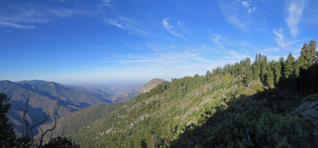
We had walked a mile or so out the High Sierra Trail during our 2012 visit, to Eagle View and beyond a bit, so we had some idea of what the trail was like. However, the part of the trail that we traversed then was all the same character as it ran along the exposed granite with little elevation change. We were in for a bit of a surprise as we started covering new territory along the trail. Much of the trail is wooded, which takes away from the views but also provides ample shade. The trail also has a lot of elevation change along its course (we were expecting that based on the research that we had done, but it is still quite different from the initial part of the trail). The trail itself was in outstanding condition. It is generally wide enough for two-way traffic. While a lot of the trail is sort of carved into the side of the granite mountain side with an exposed edge, there was really no place along the trail that an acrophobe, like me, would have any issues (OK, it is not the height that gets me so much as edges with steep drops to certain death that I have an issue with). The views all along the trail (well, the open parts) are magnificent, and while we were not taking a lot of photos, we did still enjoy the vistas as we hiked along.
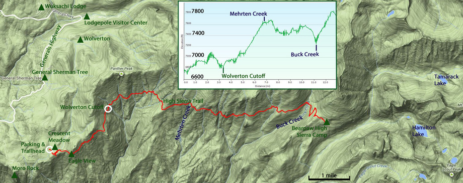
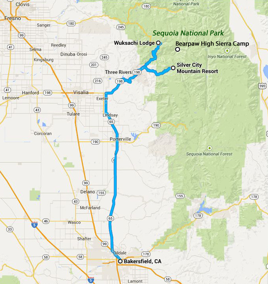
Map of the the route to and from Bearpaw along the High Sierra Trail as well as other points-of-interest from the trip. The inset is the elevation change along the approximately 12-mile route.
I was not sure what to expect in terms of traffic along the trail. I guess I would have to say that there was not much in the way of other hikers. We saw only 19 other folks scattered along the trail, a few single hikers and some small groups. There was a gaggle of twelve 30-something women in groups of three, five and finally four coming down the trail. There were all very chatty and we sort of figured they were all together. We found out from the last group that they had been at Bearpaw for the weekend; basically just rented out the whole place for a girls retreat. Probably the oddest sighting in terms of fellow trail users was the “running couple” who passed us going at a good clip when we were more than half-way to the camp. They had almost nothing with them; she had a couple of small water bottles and he had a very small pack. We surmised that they were heading to Bearpaw for the evening as well, but we never saw them again.
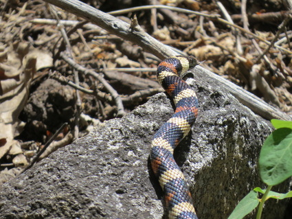 King Snake
While there were not a lot of other people on the trail, there was also not a lot critters either, but we did have a couple interesting sightings. There were of course the mandatory squirrels and chipmunks scurrying about as well as a few lizards. We also had a few birds sightings, the most interesting of which was an Anna’s Hummingbird on the climb out of Buck Creek Canyon that was very much attracted to Lynn’s backpack. Our “year of the snake” continued as well (we several snakes on the trails in Grand Teton and Yellowstone during our July trip; we rarely see snakes when hiking). We spotted a large King Snake on the trail before Buck Creek Canyon. Very pretty with the bands of red, yellow and blue. I guess is was probably a three footer. We just watched as it slithered across the trail about 20 feet in front of us and down over the hill into the rocks. Pretty cool.
There are a few significant elevation change stretches along the trail. The longest is the section between the Wolverton Cutoff (intersection with the trail that runs from Wolverton) to Mehrten Creek. This is about a 3-mile section with a 7.5% grade with about a 900 foot change in elevation (we were going uphill along this stretch as we hiked to Bearpaw). About a half mile further there is a steep downhill section for a short while then the trail sort of “levels out” for a couple miles. The last part is the toughest, as the trail dips down into Buck Creek Canyon, dropping about 300 feet over a mile down to the creek, followed by the steepest part of the trail gaining about 600 feet over a mile to gain the hill above Bearpaw. The grade here is about 10%. This was just a head-down and one-foot-in-front-of-the-other trudge up the hill. Fortunately this is a wooded section once across Buck Creek, so the shade helped. Still, we made several stops to catch our breath as we worked through the switchbacks.
When we crested the final incline coming out of Buck Creek, we met two 20-something young ladies. They were returning from a backpacking excursion and were taking a break before heading down the hill. We chatted with them a bit (we needed an excuse to take another break anyway). First question, was how much further to the High Sierra Camp? Turns out we were just a couple hundred yards away and all downhill. Hallelujah! The girls had been out for three nights and had one ore to go before returning to civilization. They were heading to the camp sites at Buck Creek, so not too much further for them either. They were impressed that we came all the way from Crescent Meadow in one day. “You came from Crescent Meadow today? That’s great!” was the quote from one of the girls. Made an old man feel pretty good after this long trek.
We made it, rolling into Bearpaw right about 3:00. That was 11-plus really tough miles and that final march up from Buck Creek was brutal. We are just not used to carrying “heavy” packs (and our packs were light compared to the folks who are really camping as we were not hauling camping gear or a lot of food, just mostly of water, snacks and clothes). We were the second group to arrive at Bearpaw, as one of the single hikers who passed us on the trail was also stopping here for the night.
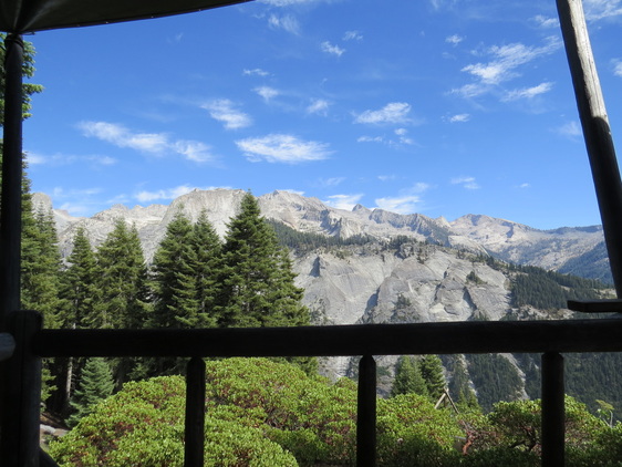 View of the Great Western Divide from the front porch of the Bearpaw dining hall.
When we arrived, the crew at the camp told us to pick which ever tent cabin we wanted (first come, first served). Tom, the guy who passed us near Buck Creek, had already claimed cabin 4, which is the one with the best view but is right on the edge of the cliff…did not want that! We opted for Cabin 2, which was near the top of the hill so convenient to the dining hall, showers and outhouse. As it turned out, this was a great choice for location. We also got the rundown on the schedule: breakfast is served at 7:30, hot showers are available from 2:30 until 5:30, and dinner is served at 5:30. No exceptions, no mulligans.
We ditched our gear in our tent cabin then headed back up to the dining hall for lemonade and freshly made brownies. We enjoyed the treats and relaxed on the porch just enjoying the amazing view of the Great Western Divide sitting right there in front of us. We were tired and sore, but still feeling pretty good about the hike we completed today. It took us about eight hours to complete the 11-plus miles from Crescent Meadow to the High Sierra Camp. Grueling miles at times, but a great hike! But we did not sit still too long as we still had to remove the trail dust from our weary, old carcasses, so we headed to the showers so there wouldn’t be a waiting line when the rest of the guests arrived.
This is a pretty sweet deal, having a hot shower out here in the back country. The water is heated using a wood-fired apparatus and the water supply is limited, so this is not like taking a steaming, soaker shower back home. In fact, as we were the first ones in the shower for today, the water was more than a little brisk as it takes some time for the fire to do its magic. Still, even just a lukewarm shower is a luxury out here on the trail and I felt pretty good afterwards.
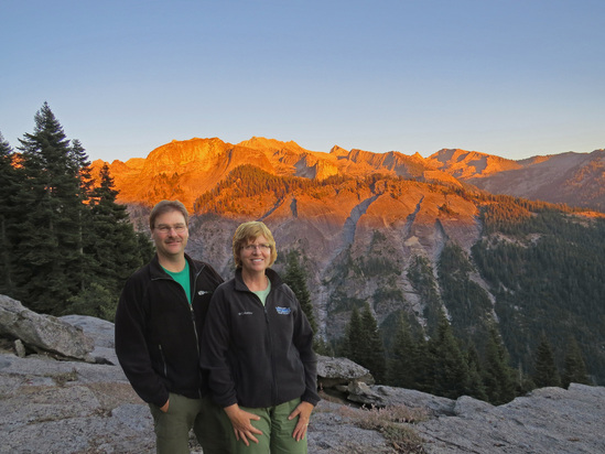 Lynn and me at Bearpaw with the Alpenglow on the Great Western Divide in the background.
We were hanging out on the front porch when the rest of the guests arrived. There were eleven total staying. In addition to Lynn and me, there was Tom (the single guy) and two groups of two couples each: Paul and Deb, and Robin and Kim were from the LA area, and Jim and Jean, and Mark and Belinda from Fresno. (actually Mark and Belinda live in Phoenix, but we'll call these four the Frenso Foursome for simplicity). All good folks and we all hit it off. Turns out that everyone except Tom is staying for three nights (Tom for just two), so we’ll have some time to get to know the one another.
As folks finished with their showers we all congregated on the porch of the dining hall. We all hung out there until dinner, going through introductions and reliving the events of the day. Turns out this is seasoned crowd, as only Kim was under 50 and just by a year. Also happens that many (maybe all) of the folks are repeat guests at Bearpaw except for Lynn and me. In fact, Tom has been here over 20 times! Belinda and I had photography in common and like me, she always had her camera close at hand. We did differ on our preferences for subject matter as she likes to take people pictures, while I use Photoshop to get the people out of my landscapes. Maybe someday I'll change my ways. For now I'll stick to rocks and critters.
The dinner bell rang promptly at 5:30. The spread the guys put out for us was nothing short of amazing: BBQ pork, mashed taters, asparagus, cinnamon-raisin bread and pound cake with strawberries for dessert. There was enough food there for a small army. Delicious! Lynn and I sat with Jim, Jean, Mark and Melinda for dinner. Just a great bunch of folks. After dinner, we sat on the porch a while with the group discussing plans for tomorrow; which hike to take, etc. I stated that after the hike in today that “I’m going to sit right here.” That got a nice laugh from the group. Belinda was hoping for good light on the Great Western Divide so that we would get the Alpenglow on the peaks. We were in luck as the conditions were ideal and the orange glow was surreal. That made for a nice end to a wonderful day.
We were out on the porch until after sunset. The Fresno crew had a very lively card game going on in the dining hall. While the sky was clear, the stars were not great due to the very bright moon tonight. Lynn ran out of steam and headed for the tent and I was not far behind her. We crashed at 8:30. Sort of surprised that we made it that long after the hike into Bearpaw! As mentioned, there were not a lot of photos taken today, but enough to cover the highlights of the hike.
Day 5 – Tuesday, August 19 – Hamilton Lake I was awake at 0500, but did not get up until 0600. A couple reasons for that. First, it was chilly and the bed was warm. Second, I did not hear anyone else stirring yet, so we did not want to make any noise that might wake folks.
We both slept well. The bunks are comfortable and plenty warm, granted I was sleeping in sweatpants, a heavy shirt and socks, but still I did not get cold. We did wake up once to the sound of an odd animal noise. At breakfast, the staff guys said it was just a mule deer doe, but it sure didn’t sound like a deer, but what do I know. Lynn’s thought was a cougar, but that is also unlikely, but makes for a much more interesting story.
Once we did roll out of bed, I went over to the granite outcropping that overlooked the valley to enjoy the morning. Some of the locals were also out there this morning, a couple chipmunks and a marmot. I also spotted a Red-tailed Hawk soaring above the canyon about at eye level. She (it was a big bird, so I think it was a female) landed in a dead snag below the camp, so I was able to get a decent long-range photo. The day was shaping up nicely as the morning sky was bright blue with just a few patches of high, white clouds. It was brisk this morning; crisp and bracing, but that would make for good hiking weather.
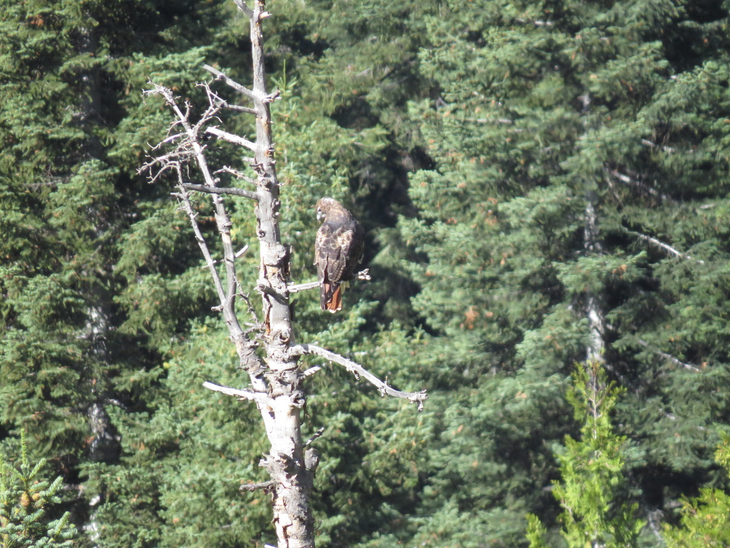
Red-tailed Hawk at Bearpaw.
|
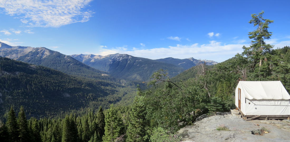
Morning view from Bearpaw.
|
Everyone congregated on the front porch, donning their layers to fight off the morning chill; did I mention it was a bit brisk at nearly 8000 feet above sea level. Coffee and hot chocolate were the order for this morning. We chatted about our plans for the day. The LA group is heading to Tamarack Lake, the Fresno foursome is going to Hamilton Lake and Tom is just sorting hanging around the camp area. Lynn and I also were opting for Hamilton Lake as that seems to be the signature hike from Bearpaw. The issue for all the trails today is the closure that is taking place between 10:30 and about 3:00 due to blasting required for trail maintenance along Lone Pine Creek. Ranger Liz had told us about this when we got our permit and there were signs posted along the High Sierra Trail, so this is not a surprise, but we do have to plan accordingly. The blasting is taking place along the trail to Tamarack Lake, but the trail to Hamilton Lake will also be affected due to possible rock slides. So we have to be past the bridge over Lone Pine Creek by 10:30 or we’ll be stuck, so we again have a schedule to keep both coming and going (outbound to beat the closure and inbound to be back in time for a shower and dinner).
7:30 and the dinner, well, breakfast bell has sounded. The crew has again prepared an amazing buffet: scrambled eggs, hashbrowns, sausage, oatmeal, fruit…wonderful! After breakfast and a little more time on the porch, everyone dispersed to get ready for the day’s activities. We were the last on the trail, leaving the camp at 9:05 and heading down the hill along the trail to Hamilton Lake.
7:30 and the dinner, well, breakfast bell has sounded. The crew has again prepared an amazing buffet: scrambled eggs, hashbrowns, sausage, oatmeal, fruit…wonderful! After breakfast and a little more time on the porch, everyone dispersed to get ready for the day’s activities. We were the last on the trail, leaving the camp at 9:05 and heading down the hill along the trail to Hamilton Lake.
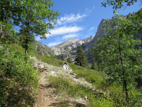 Heading down the hill from Bearpaw along the High Sierra Trail.
To get to Hamilton Lake we just continued along the High Sierra Trail for about five miles…five tough miles. But it was a great hike with wonderful scenery every step of the way. The trail is basically downhill for a little less than half the distance, then sharply uphill the rest of the way. The trail is carved into the side of the granite mountains for most of the distance to the lake and except for the wooded section right at Bearpaw and at the lake, it is exposed the entire hike. We made pretty good time down to the bridge across Lone Pine Creek and the closure point was just beyond that; I reckon we were by the checkpoint just after 10:00 so we easily beat the closure time. Since it was downhill all the way to the closure point, I figured we would make it with no problem, so we did pause a couple times to take in the views, which were spectacular. We stopped on the bridge to look up and down the deep, narrow chasm containing Lone Pine Creek. Tom told us about the wreckage of the previous bridge which we spotted down the canyon below our current perch.
We chatted with the Park Service crewman who had just posted the “trail closed” sign, complete with skull and crossbones (nice touch), on the Lone Pine Creek Trail. He said that the trail work was to remove some uneven steps from the Lone Pine Creek Trail to make the trail safer for horses. He also mentioned that there would be windows of opportunity to return before the official closure was over, probably starting about 1:00, and that there would be a Ranger at the other end of the closure area directing traffic. That was good news as it might mean we won’t be as pushed on schedule.
After saying goodbye, good luck and thanks for all the work you do to keep these trails in service to the crewman, we started up the mountain to Hamilton Lake. This is where the going gets tough, as it is an uphill march for pretty much the entire route to Hamilton Lake. The first part works through a series of switchbacks before returning to a constant track that along the cliff face. It was a challenging hike but the trail was in excellent shape. There were a few really tough sections coming up from the bridge and on up to the lake; a few stretches with rocky, uneven steps which are hard on the knees.
Not a lot of folks on the trail with us so far, but we did pass a young couple hiking out from the lake as we were starting up the switchbacks above the bridge. Lynn asked the guy how far to the next Ranger. “You’ll see when you get there.” Thanks, Jackass, that was very helpful. Fortunately he was the only example of rude hiker that we saw during our time at Bearpaw. He was the only black mark for the day and honestly quickly forgotten as we took in the vistas from along the trail. The views in all directions were just outstanding. From the switchbacks we could see up Lone Pine Creek Canyon; perhaps we’ll be up there tomorrow. The section above the switchbacks provided views of the bridge and trail on the other side of the creek leading to Bearpaw. Wow, that really is a testament to hard work and some engineering skill to build these trails and construct a bridge out here in the middle of the wilderness.
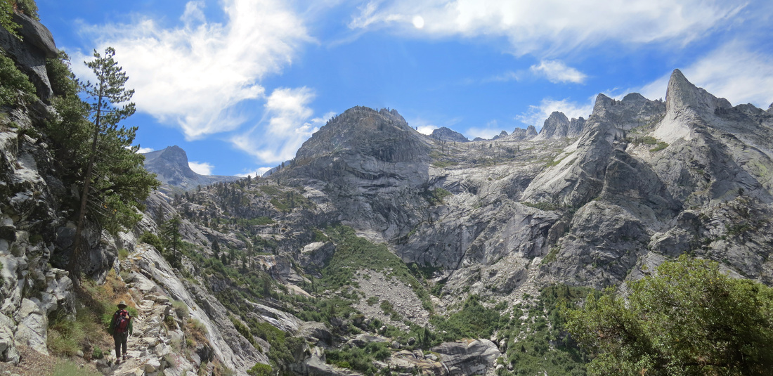
Working our way up the High Sierra trail to Hamilton Lake.
We finally saw the second gatekeeper on the trail ahead of us. He was stationed at the point where the trail turns east up the canyon toward Hamilton Lake. He confirmed that there will be some chance to an early return through the closure area starting about 1:00. Good to know. We continued along the trail and turned into the section that parallels Hamilton Creek, a several hundred feet in the canyon floor below. As we made that turn, we saw where the trail would eventually cross Hamilton Creek just above the point where is tumbles into the lower part of the canyon. The trail was still sort of hanging from the granite wall all the way around to the creek crossing which provided more wonderful views across and down the valley. Hamilton Creek was a tame flow of cold water here in the middle of August; I bet the scene might be quite different in the spring with the run-off from the melting snow. But today there were no hazards; shoot we barely got our boots damp and it was easy to pick our way across on the exposed rocks in the stream. The water did provide a nice habitat for wildflowers. Elsewhere along the trail there was not much in terms of flowers, but here it was an explosion of red, yellow, orange and white. We also spotted trout in the pools above the falls.
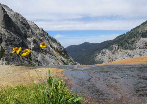 View from the Hamilton Creek crossing.
From here the trail works more or less along the creek, first gaining a little more elevation via switchbacks and crossing the creek again and then turning easterly up the valley toward the lakes. Now instead of the trail being etched into the cliff with views looking out or down into the valley, the track runs through heart of the valley with the canyon walls reaching a couple thousand feet above us in places. So again a new character along to the trail which just adds to the variety of scenery along this already amazing trail.
We actually got to see two lakes as we made our way up the valley. The first was Lower Hamilton Lake, which is much smaller than the primary lake but still very pretty. The trail runs above this little lake, providing views down into the crystal clear water as well as some interesting reflections of the granite monoliths in the lake. But now our primary destination for this hike is in reach as we are very near to Hamilton Lake. Just a short walk through a sparsely wooded area and there in front of us is the lake spreading out at the base of the cirque. This was worth all the effort as the view from the shore of the lake was spectacular. The surface was the water was not a perfect mirror finish, but there were still good reflections to capture. The setting was epic; the clear, smooth water of the lake surrounded by the towering granite walls and spires and covered by the bright blue sky and an assortment of white clouds.
We actually got to see two lakes as we made our way up the valley. The first was Lower Hamilton Lake, which is much smaller than the primary lake but still very pretty. The trail runs above this little lake, providing views down into the crystal clear water as well as some interesting reflections of the granite monoliths in the lake. But now our primary destination for this hike is in reach as we are very near to Hamilton Lake. Just a short walk through a sparsely wooded area and there in front of us is the lake spreading out at the base of the cirque. This was worth all the effort as the view from the shore of the lake was spectacular. The surface was the water was not a perfect mirror finish, but there were still good reflections to capture. The setting was epic; the clear, smooth water of the lake surrounded by the towering granite walls and spires and covered by the bright blue sky and an assortment of white clouds.
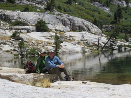 Proof that we made it to Hamilton Lake.
It was right at noon when we arrived, so about three hours to complete the mostly uphill hike to Hamilton Lake. We walked down the rock shelf to the water’s edge and found a place to sit down for a rest and take in the beauty of the location. This was also our spot for lunch. The bag lunch from Bearpaw is awesome. Anyone who does not like leftovers is missing the boat. The crew from the camp makes sandwiches out of the main course from the previous night’s dinner, so today we had barbeque pork sandwiches. Lynn and I each had our own sandwich; tomorrow we’ll split one. These things are HUGE! But I was hungry and ate every scrap of mine (I didn’t need it, but it was just that good!). We saw the Fresno foursome at the lake; they were also enjoying their lunch just down the shore from us. We also saw the tall kids from the Lodgepole permit desk. The Fresno crew also recognized them and we all chatted briefly. I think they said they had camped at Buck Creek last night and their plan was to hike several more miles yet today beyond Hamilton Lake, I think to Kaweah Gap. Regardless, it was going to be a long day for them.
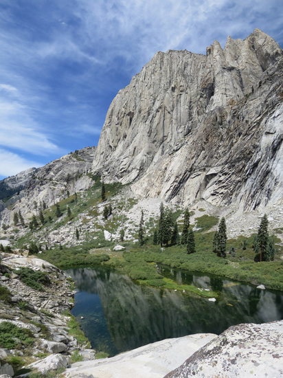 Granite reflection in Lower Hamilton Lake.
We did not have long to stay at Hamilton Lake, but we had enough time to enjoy our lunch, the views and to watch the fish foraging in the shallow water near the shore. But we decided to start the return trip at 12:30 as there was no time to dally since we have to be back in time for showers before dinner.
We retraced our route for the return to Bearpaw, getting a second chance to enjoy the wonderful vistas from the High Sierra Trail. The only downside was that we had a 40-minute delay as the trail was closed due to blasting. But the good news was that the view here was very nice, there was a little shade in the area and there were a couple other hikers there to chat with. There were also several lizards scurrying about all along the trail, which kept me entertained trying to get their portraits. Most of the lizards were blue (or mostly blue at least); I think these are western fence lizards. Eventually there was a break in the blasting (we could hear the explosions well off in the distance), so we were allowed to continue. We were back at Bearpaw about 4:15; we were the first of the hikers to return so we ditched our gear and headed for the showers. We were cleaned and pressed and sitting on the front porch by 4:40. Shower after a long day on the trail…PRICELESS!
As we later learned, the rest of the gang were hung up by the trail closures. The Fresno crew did not get back until almost 5:00 and the LA folks were later still. But everyone made it back safely and in time for the dinner bell. Good thing as the Bearpaw staff had prepared another outstanding dinner. After dinner we reconvened on the front porch to discuss the day’s events and the plans for tomorrow. We also watched the angry clouds working their way over the Great Western Divide. We could see the storm brewing and then the rain on the mountains across the valley, and it was coming our way. We could see several waterfalls pouring off the cliffs of the Divide. As we watched the storm unfold, our thoughts turned to the young hikers heading to Kaweah Gap. I hope they were able to get to someplace out of the rain. I guess we’ll never know. The storm reached us just after 7:00. The downpour started as rain, but soon changed to pea-sized hail which lasted for several minutes. That was impressive. But the storm quickly subsided leaving us with the eerie pink of the Alpenglow mixed in with the dark grey clouds over the Great Western Divide.
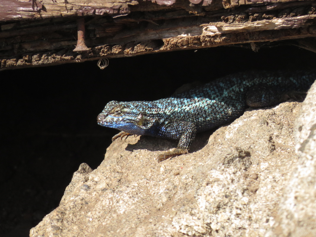
One of the many Western Fence Lizards we saw today, this one under the porch.
|
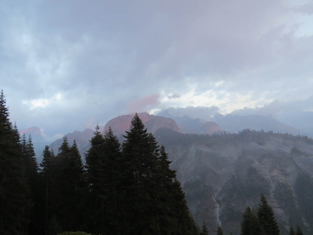
Stormy Alpenglow and temporary waterfalls on the Great Western Divide.
|
We spent the evening on the porch discussing the adventures from today and the plans for tomorrow. Paul provided some details on their day at Tamarack Lake, including seeing cougar tracks on the trail going up the hill above the camp. Up until that point I was not sure that Lynn would want to try that hike, but now that there was a chance of seeing a big cat, well, she was ready to go. The folks who went to Tamarack met the trail crew who were doing the blasting. The crew is camping out there, so if we do make the hike we are sure to see them.
No stars tonight due to the clouds, but the rain has moved out of the area. Hopefully the weather will not be an impact for our hikes tomorrow. Looking down the valley the sky was pink and lavender, so tending to red…red skies at night, sailors delight. Perhaps we’ll be in good shape for tomorrow after all. Here are the photos from today’s adventures.
Day 6 – Wednesday, August 20 – Tamarack Lake Another crisp morning at Bearpaw High Sierra Camp. Again I was awake early and again I waited until I heard other folks stirring before getting up. Well, that and the fact that the bed was nice and warm! But we had to get up sooner rather than later to start getting ready for another big hike, this time to Tamarack Lake. I was hoping that we would try both of the lake hikes while we were here, but I gave Lynn the option of taking it easy today. But she’s a trooper so we’ll don the hiking boots once again.
The camp staff had prepared another amazing meal for us. Given the location and conditions, you might think that the food here would just be sustenance, but these guys can cook. The food is outstanding. Hot meals at breakfast and dinner plus the hiker’s lunch made from last night’s leftovers (for a very small additional fee). In addition to the sandwich, there are also the homemade brownies as well as snack items (potato chips, fruit bars). It is a great deal and one less thing to worry about. They make up the sandwiches after breakfast so everything is ready to go well in time to get on the trail.
Based on the discussions on the porch and during breakfast, it seems that Lynn and I are the only ones heading to Tamarack today. The LA group was going to Hamilton and the Fresno foursome was planning on hiking part of the Lone Pine Trail. Tom was heading home today, so we all said our farewells before setting out on our own excursions. Since Tom is leaving, we'll have a couple of new camp-mates in Bearpaw this evening.
There are two routes to get to Tamarack Lake, either hike down the High Sierra Trail to the bridge then up the trail along Lone Pine Creek or take the trail up the hill behind the camp then down into the canyon containing Lone Pine Creek. From what little I had found during my research the latter option seemed like the way to go, plus it allows for seeing more new ground. Paul also recommended that route. Besides, the dirt track part of the trail up the hill is where they spotted the cougar tracks, so we had to go that way.
We got started just a little earlier than yesterday, stepping out of camp at 8:40. While we were going along a different trail to an different area, I really had no idea how completely distinct the character of the hike to Tamarack Lake was compared to taking the High Sierra Trail to Hamilton Lake. Recall that the trail to Hamilton Lake is carved high up on the side of the granite mountain face, so for most of the hike the views are out and across the deep valley and over to the Great Western Divide. The trail today starts out through the woods, first conifers then aspens, with a few glimpses of the valley and opposing peaks, but later settled into the floor of the wide valley containing Lone Pine Creek, so the vistas are contained within the tower walls of granite. The views are just as impressive as what we saw yesterday, but of a totally different character.
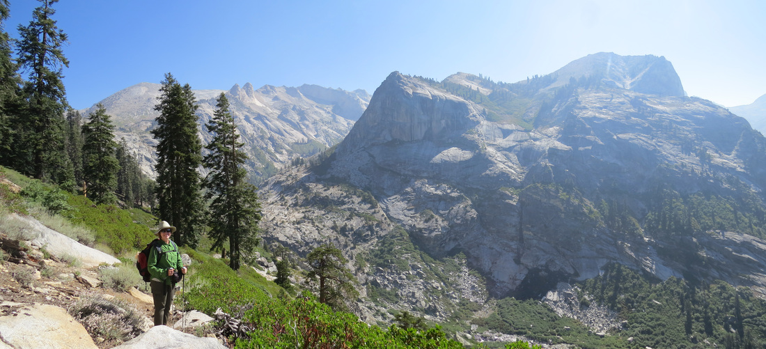
Lynn the trailblazer in the way to Tamarack Lake.
Another difference was the wildlife. Yesterday we were limited to blue-bellied lizards along the trail. Today, since we were walking through the valley floors where the critters live, so saw a few more varmints. Through the wooded section of the hike there were squirrels and we did find the cougar track (I was surprised that it has not been wiped out by the rain). Along this section of the trail we noted several rock outcrops that would make for a nice ambush point for a hungry predator. Once out in the open of the valley, we spotted three mule deer, several marmots sunning themselves on the rocks and several birds including a hawk with a long, banded tail cruising the area. My guess is a Peregrine Falcon although I would not rule out Merlin. The other interesting bird sighting was up on the wooded hill on the return trip when we came across several grouse. They spooked before I could get a photo, but we think they were Blue Grouse. I can tell you that they make quite the commotion when they take off and fly through the brush. Also, while we did not see any Red-breasted Nuthatches, we certainly heard a few as we were walking through the pine trees. I has read at one of the visitor centers to listen for their call which resembles a toy horn (hey, that’s what the sign said). I was not sure what to make of that, but when we heard it, well, it was pretty definitely the noise a toy horn would make.
We did not see many people on the trail today. We did see the trail crew working in the area where they were blasting yesterday. Then were making good progress in clearing the rubble and creating an even set of steps along the area being upgraded. Other than the work crew we had the trail entirely to ourselves for until we were nearly home when we passed two guys heading to the lake to camp for the night.
I thought this trail had three distinct phases. The first, as mentioned was the section working up the hill from Bearpaw through the pines and aspens. Second was the where the trail breaks back into the open and works down to the valley floor; this part seemed to be through more brush and grass and is where we saw the deer. Finally, once down along Lone Pine Creek the trail wove through a very rocky area, basically a boulder field, although there were a few stands of mature conifers along the stretch as well. The marmots liked this last section as there were plenty of places for them to bask on top of the rocks but still within very close cover under a nearby boulder. Each area provided nice views, but my favorite were the panoramic vistas up and down the valley once we were hiking along the creek with the granite walls towering over us. The valley is wide so the walls did not crowd us but there was still that feeling of being dwarfed by the massive granite structures.
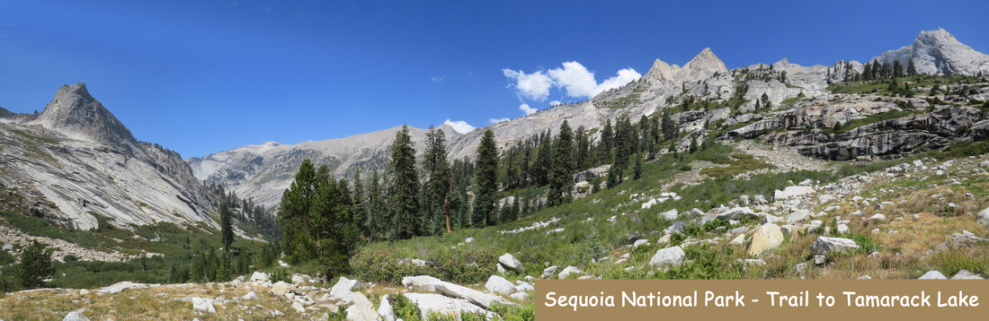
This was a tough hike. From Bearpaw to Tamarack Lake is literally uphill almost all the way. It is a constant uphill along Lone pine Creek once the trail turn east up the canyon. There were a few stretches that were over uneven steps, which are very tough for Lynn. I gave her the option of turning back any time she wanted, but she was determined to keep going. Like Lone Watie, we endeavored to persevere and we finally reached the lake just before 1:00, so a little over four hours.
We did not have long to spend at the lake. We started by finding a shady spot on the granite shore to enjoy our lunch and the solitude. There was not another sole around that we could see. Paul had mentioned that there is a waterfall on the other side of the lake, but you had to walk down the southern bank a bit to see it. I walked down the south shore a little ways to check out that view and did spot the falls.
We did not have long to spend at the lake. We started by finding a shady spot on the granite shore to enjoy our lunch and the solitude. There was not another sole around that we could see. Paul had mentioned that there is a waterfall on the other side of the lake, but you had to walk down the southern bank a bit to see it. I walked down the south shore a little ways to check out that view and did spot the falls.
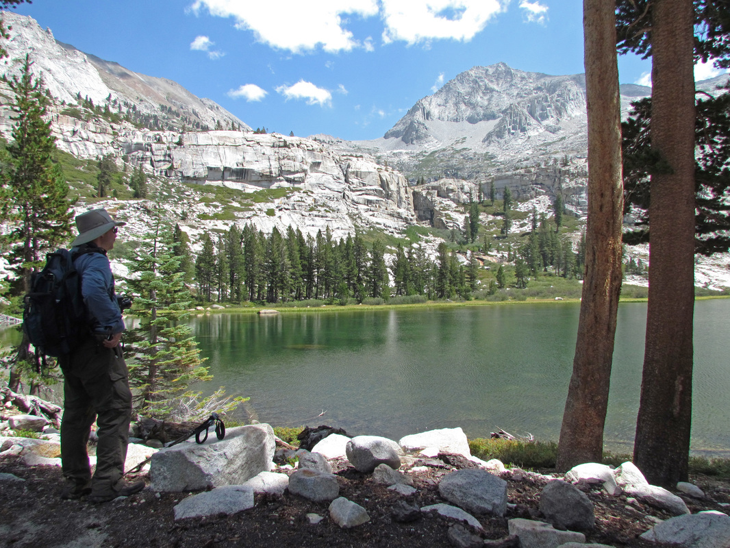
Lynn caught me just enjoying the vista across Tamarack Lake.
|
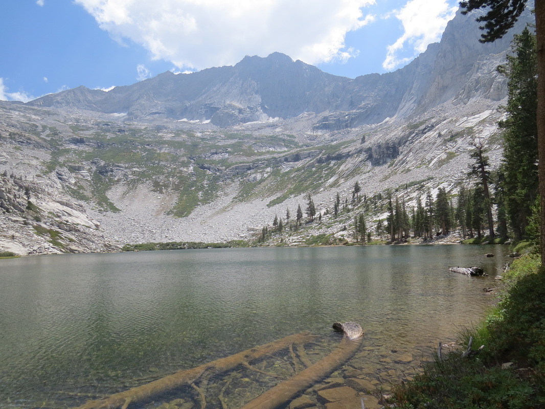
Tamarack Lake
|
We only stayed about 25 minutes at the lake to ensure that we made it back in time to get cleaned up for dinner (the schedule is tight, but the last thing we wanted to do was to miss a shower and dinner!). But Lynn put the afterburners on and we were back in camp in less than 3 hours, arriving about 4:00. In fact, we were the first ones to return, so we were first in the shower. Being first in the shower is a “good news, bad news” situation. Good in that you get cleaned up and have more time to relax, but bad in that the water is not yet hot. Let’s just call the shower “bracing.” Regardless of the temperature, the shower is a welcome luxury and it felt great to wash off 10 miles of trail dust. We were relaxing on the front porch by 4:30. More good news, bad news; good news for Lynn is that there is wine available at Bearpaw but the bad news for me is there is no beer.
So two outstanding back country hikes to beautiful alpine lakes over the past two days covering nearly 20 miles. Each was about ten miles, with the hike to Tamarack being a little longer, although the measured distance is device dependent as I used both the Garmin GPS as well as the EveryTrail app on my phone. We were about a thousand feet higher in elevation at Tamarack Lake (9260 feet above sea level compared to 8275 at Hamilton). There were wonderful vistas along every step of both trails, but as mentioned plenty of variety between the two. I was hoping that we would do both hikes, since we hiked all the way to Bearpaw in the first place. Hats off to Lynn for her sheer determination in completing both lake hikes. It was not easy, but I think it was worth it.
So two outstanding back country hikes to beautiful alpine lakes over the past two days covering nearly 20 miles. Each was about ten miles, with the hike to Tamarack being a little longer, although the measured distance is device dependent as I used both the Garmin GPS as well as the EveryTrail app on my phone. We were about a thousand feet higher in elevation at Tamarack Lake (9260 feet above sea level compared to 8275 at Hamilton). There were wonderful vistas along every step of both trails, but as mentioned plenty of variety between the two. I was hoping that we would do both hikes, since we hiked all the way to Bearpaw in the first place. Hats off to Lynn for her sheer determination in completing both lake hikes. It was not easy, but I think it was worth it.
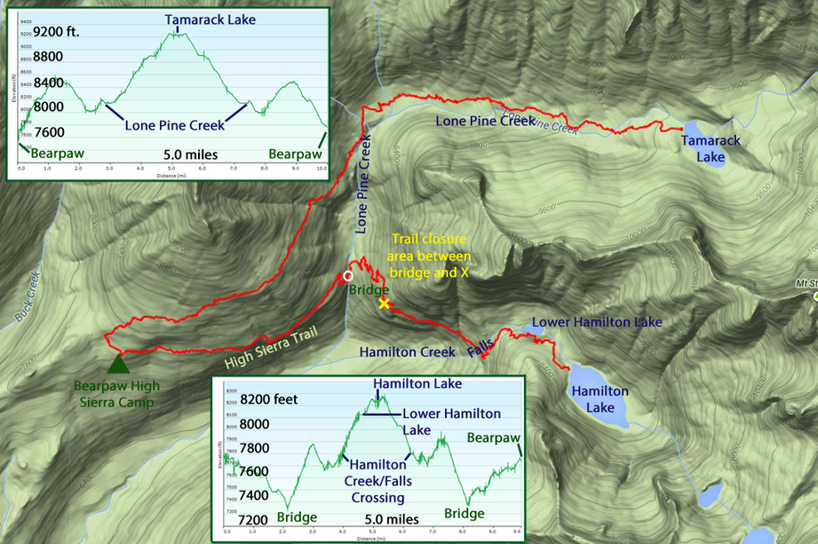
Tracks of our lake hikes from Bearpaw; we went to Hamilton Lake one day then Tamarack Lake the next.
We greeted the rest of the crew as they returned from their adventures. Paul mentioned that they met our new camp-mates at Hamilton Lake and that they would be here…eventually. They were an older couple but they had been backpacking in the back country for the past few days and were coming to Bearpaw for a well deserved night of relative luxury after roughing it. Everyone eventually drifted over to the porch as they returned to camp or after their shower. We again relived the day’s excursions, watched the wildlife around the camp and marveled at the sight of the Great Western Divide across the valley. There were a few mule deer just around the corner of the main building, a buck, some does and at least one fawn, plus a big ol’ marmot basking on the rocks in front of the porch. Mark used the big rodent as a model to check out my camera (everyone likes the SX50).
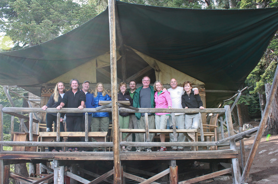 Our Bearpaw Gang: Deb, Paul, Robin, Kim, Lynn, Allen, Jim, Jean, Mark and Belinda (thanks to Belinda for the photo).
At some point we were discussing the various National Parks that we had all visited. Oddly, not everyone had been to Yellowstone or Grand Teton; Lynn and I strongly encouraged them all to make that journey. Acadia came up as park that was on our short list and someone mentioned visiting there and spending some time in Bar Harbor, to which I asked, in my best hillbilly-Yankee accent “you mean Bah Hahbah?” That quip rated a “nicely done” from Kim.
Turns out
that Paul and Deb have been to the Mineral King area of Sequoia and have stayed in
the same chalet that we have rented. We
discussed hiking options in that area.
Paul agreed that the hike to Eagle Lake is a very good choice. I also
shared with Paul who he reminded me of.
At first I was going with Kurt Russell due to the hair, but over the
past couple of days it became apparently that he has a great resemblance to the
Johnny Carson.
Looks like some activity down on the overlook. We have a couple extra guests at the camp tonight, father and son, Bill and Danny. Seems that they are regulars at the camp, particularly Bill who has stayed here nearly 30 times! They are trading chores for a place to bunk tonight and one of their tasks is to setup up a bonfire on the granite overlook for the evening’s entertainment. We watched for weather coming in over the mountains like it did last night, and for a while it looked like we might get another storm, but as the evening progressed the clouds dissipated and we got one more nice sunset and a little Alpenglow. That’s good news for hanging out by the fire, and maybe seeing some stars tonight.
Looks like some activity down on the overlook. We have a couple extra guests at the camp tonight, father and son, Bill and Danny. Seems that they are regulars at the camp, particularly Bill who has stayed here nearly 30 times! They are trading chores for a place to bunk tonight and one of their tasks is to setup up a bonfire on the granite overlook for the evening’s entertainment. We watched for weather coming in over the mountains like it did last night, and for a while it looked like we might get another storm, but as the evening progressed the clouds dissipated and we got one more nice sunset and a little Alpenglow. That’s good news for hanging out by the fire, and maybe seeing some stars tonight.
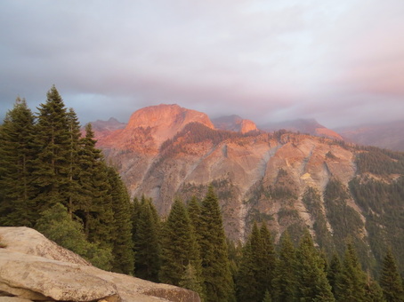 One last light show; Alpenglow on the Great Western Divide.
The crew outdid themselves again for dinner serving up chicken with peppers and rice, a fresh tossed salad and homemade banana bread (well, everything here is homemade!). Delish! We finally got smart and ordered one sandwich to split for lunch tomorrow (the leftover lunches the crew makes are HUGE!). After dinner, we regrouped on the porch for a while and then moved down to the overlook once the sun was setting. Lynn did not stay out long as she was beat from three days of hard hiking and we had one more to complete tomorrow. Bill and Danny tended the fire and entertained us with stories of their outdoor exploits. We were also joined by one of the camp crew, Timothy. He had the evening off. Nice kid from Eastern Europe, I forget from where exactly. Turns out that we had met his sister at Wuksachi as she works in the restaurant. We had a nice time just jawing and enjoying some time around the fire. But the best part, for me at least, were the stars. The sky was clear and there was no moon, so the heavens were glowing from a billion pinpricks of light. I moved off from the group a bit just to sit and enjoy the solitude under the celestial brilliance of the Milky Way. We had missed seeing the stars while in Wyoming due to smoke and cloud cover. While the sky here is not as big as at Roosevelt, since we are in valley, I still got an amazing view of the stars. It always seems to me that the longer you look into a night sky like this, the more you will see. We just can’t get this back east any more. Here are the rest of the images from today.
Day 7 – Thursday, August 21 – The Hike Out Our last morning at the High Sierra Camp and like the past two, I was awake early to a bracing morning. But the skies are crystal clear so it looks like a great day for our hike back to civilization. Once Lynn was up we spent some time packing then headed up to the porch to chat with the gang before breakfast. The bell rang promptly at 0730, calling us all in for scrambled eggs with peppers and cheese, bacon, fruit and scones. Another culinary masterpiece here in the back country.
After breakfast we were all busy getting ready for the hike out. We exchanged contact information and said our goodbyes, then folks started heading back along the High Sierra Trail. Everyone was staying at Wuksachi tonight, so we figured we might get together for a drink after dinner. Paul, Deb, Robin and Kim were the first on the trail at about 8:30. Lynn and I were not in any sort of rush, but as we were packed and ready, we left at 9:00. We figured the Fresno Foursome would catch us on the trail.
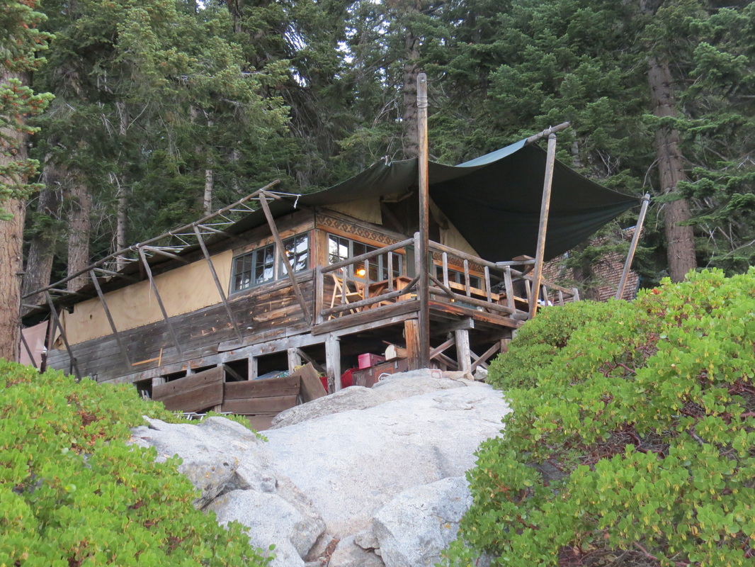
The main building at Bearpaw High Sierra Camp.
|
Packed and ready to go...
|
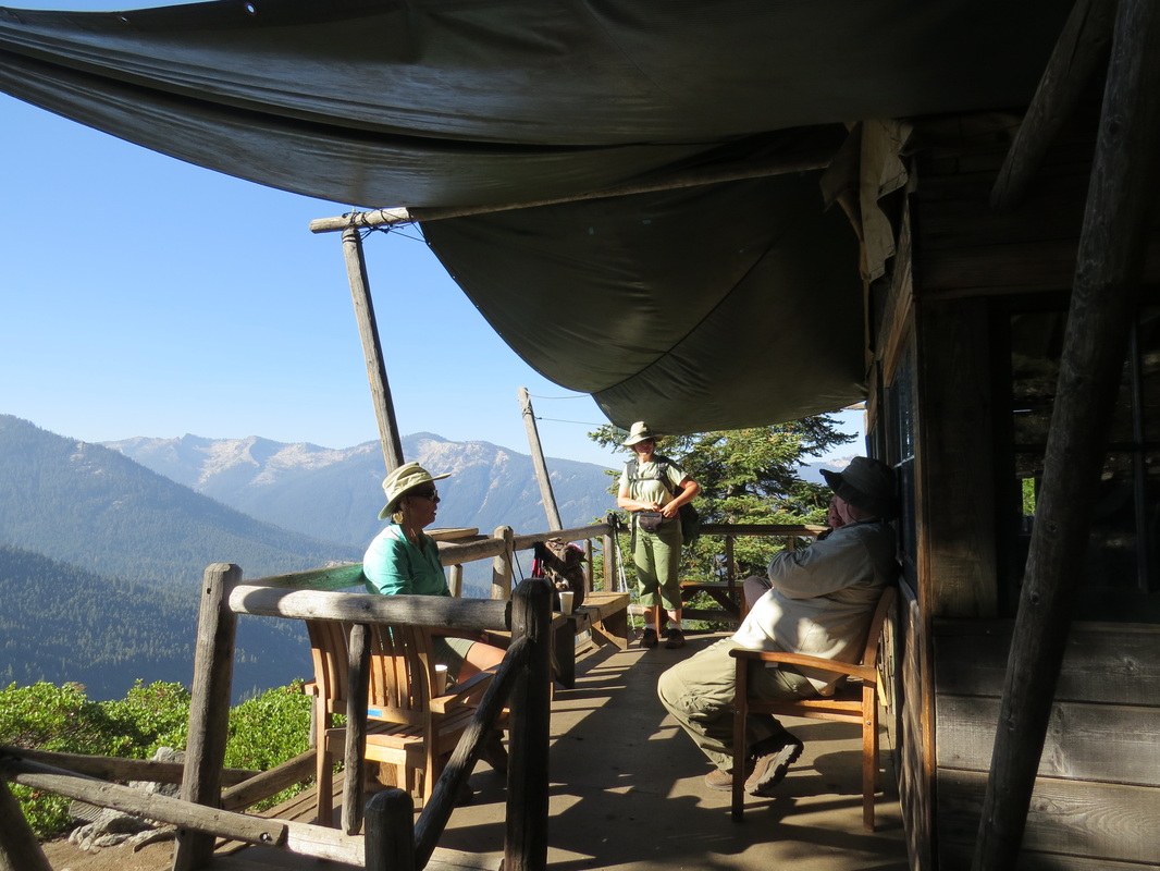
Jean, Jim and Lynn on the porch before the hike home.
|
The return hike was a bit more relaxed that the hike to Bearpaw. Even though we were starting later today than on the inbound hike, we were under no time constraints so we could spend a bit more time enjoying the views along the trail. Plus we got the hard part of the trail out of the way first, that being the steep downhill to and subsequent climb from Buck Creek.
Jim, Jean, Mark and Belinda eventually passed us; I reckon we are just slow. We leap-frogged them a couple times as one group would stop for a break and the other would pass, but inevitably they got in front of us to stay. Including the Fresno Foursome, we only saw about two dozen other folks on the trail today ranging from serious backpackers to folks just out for a stroll at the Crescent Meadow end of the trail.
Jim, Jean, Mark and Belinda eventually passed us; I reckon we are just slow. We leap-frogged them a couple times as one group would stop for a break and the other would pass, but inevitably they got in front of us to stay. Including the Fresno Foursome, we only saw about two dozen other folks on the trail today ranging from serious backpackers to folks just out for a stroll at the Crescent Meadow end of the trail.
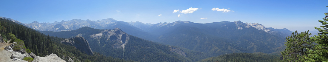
Vista from the High Sierra Trail as we hiked back from Bearpaw.
The excitement for the day was the black bear that ran across the trail about 15 yards in front of us. This was closer than the bear we encountered in Cascade Canyon in Grand Teton earlier this summer. It happened so fast that all we saw was a black blur running up the hill. Lynn noticed the bear coming because of the yellow tag in its ear. She thought she was seeing someone with a yellow shirt coming up the trail at first until the bear was in full view on the trail.
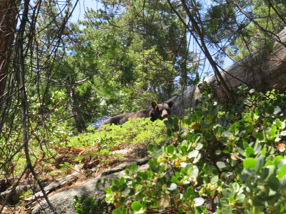 Black Bear just above the trail.
The bear stopped very briefly on the hill above us then continued trotting along the hillside parallel to the trail but coming in our direction. We kept an eye on him and kept up a nice conversation with him while he moved on out of sight. Since he was moving and in the brush, it was tough to get a good photo. The Fresno Foursome was out in front of us by this point and also saw the bear as we later learned and Belinda caught a nice image of him out in the open below the trail. We gave the next few hikers that we passed a heads-up that there was a bear in the area.
Other than the bear, we had a nice relaxed time along the trail. There were a few other litter critters about: squirrels and chipmunks, lizards, Stellar’s Jays, a few hummingbirds, several gone birds and butterflies plus a few patches of wildflowers, but mostly this was just a nice walk in the woods. We were back at the trailhead just before 4:00, so a little less than seven hours to cover the distance from the High Sierra Camp which was not too bad for us. Here's the link to the review I posted on our time at the Bearpaw High Sierra Camp, including commentary on the hike to the camp and the hikes to the lakes.
Other than the bear, we had a nice relaxed time along the trail. There were a few other litter critters about: squirrels and chipmunks, lizards, Stellar’s Jays, a few hummingbirds, several gone birds and butterflies plus a few patches of wildflowers, but mostly this was just a nice walk in the woods. We were back at the trailhead just before 4:00, so a little less than seven hours to cover the distance from the High Sierra Camp which was not too bad for us. Here's the link to the review I posted on our time at the Bearpaw High Sierra Camp, including commentary on the hike to the camp and the hikes to the lakes.
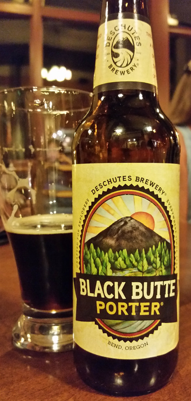
Dessert beer.
|
We tossed our gear in the Soul and headed to Wuksachi with a quick stop at the Lodgepole camp store for beer. By 5:40 we were in our room, showered and settled in to enjoy a Yosemite Pale Ale. A much deserved reward after hiking well over 40 tough miles over the past four days. We compared these hikes and the overall collection to our previous trips. I asked Lynn if the hike to Bearpaw or either of the lakes would be considered our toughest hike to date. Her opinion was that the hike from Gunsight Pass to Sperry Chalet in Glacier was the toughest, as it was longer, we had two major elevation changes to negotiate with Gunsight Pass and Lincoln Pass and the steps built into that trail were just killers. We had also made other trips with 50 miles of hiking (Glacier was the first, and we also did 50 miles last month in Wyoming), but we usually spread the hiking out more over the trip, so these last four days certainly made up our most challenging set of hikes over such a short period. We’ll never be hardcore, back-county back packers, but we did pretty well along the High Sierra Trail over these four days.
Originally we had later dinner reservations, I think at 8:00, but I moved them to 6:45 when we checked in. This worked out to be a very good move. First of all, we probably would have been falling asleep in our dinner plates if we had waited until later. And now we had time to have one last drink with our Bearpaw camp-mates after dinner. I went with comfort food; the burger with jalapeño peppers was very good particularly when accompanied by a General Sherman IPA. The rest of the gang was in the dining room as well so we did congregate out in the lounge area after dinner, but we were all beat so it was just one beer and off to bad. Robin and I had been talking beer a little while at Bearpaw, so we each had a Black Butte Porter from Deschutes Brewing. A great way to end a most excellent day. We bid our friends farewell and safe travels. Perhaps we’ll see them on the trail in the future. Here are a few more photos from the hike back from Bearpaw. I've also made a video of the hiking highlights to Bearpaw and back. |
Day 8 – Friday, August 22 – Easy day cruising to Mineral King We slept the sleep of the dead last night, having crashed before 10:00, but we were still up early. Surprisingly, neither of us was sore after four tough days of hiking and we felt pretty good to start the day. We were in no rush at all this morning, with no hiking plans for the day. We’ll just have a relaxed morning then a scenic drive to Mineral King. I think we have earned a little break!
We did a little packing this morning before heading over to breakfast at 8:00. There were a couple Mountain Quail out along the pathway between the lodge buildings along with the usual chipmunks and ground squirrels. We saw most of the Bearpaw gang either at breakfast or while checking out. They were all heading home this morning by Lynn and I still had a couple days of vacation remaining. Wuksachi made a great base for the days before and after Bearpaw, but it is time to move on (reviews: Wuksachi Lodge and The Peaks Restaurant).
After breakfast we finished packing, loading the car, check-out and were on the road at 10:15. We made a quick stop at Lodgepole for beer as we had no idea what we might find at Mineral King. The outside air temperature gage on the Soul read 65 F there as we were pulling back onto the Generals highway at 10:30. We had a pretty easy ride to Three Rivers, except for the Jackasses who knew NOT how to drive on a winding mountain road in a National Park. And there were several of these folks out on the road today.
First I had to jam on the brakes to avoid being pinched between a pair of Sequoias; one was a tree and the other was a Toyota. The Toyota was the problem as the driver obvious could not keep his truck within the painted lines marking his lane of the General’s Highway. We was clearly too busy gazing at the trees to worry about the fact that he was taking up half of my lane. Fortunately I was paying attention so no paint was exchanged between our vehicles.
The worst were the kids in the black Jeep SUV. The speed limit heading down the mountain along the General’s Highway from the Giant Forest to the Foothills Visitor Center is posted at 25 mph with some areas posted as low as 10 mph at some hairpin curves. With the turns in the road, the limited sight distance, the potential for animal darting into traffic and the idiots not paying attention to their driving in the oncoming lane, the 25 mph is a generous speed. Sure, if all of these issues were removed from the equation, I think it would be a fun road to drive and you could make better time, but not by much. But with all this going on, well, better safe than sorry is the way to go. But the Jackass in the Jeep (I’m guessing this was a group of college kids) was in a hurry. He would tailgate a while, then drop back out of sight then rush p on my bumper again. He nearly rear-ended me when I hit the brakes for a woodpecker that landed in the road right in front of me. Fortunately we all survived. He finally passed me coming out of one of the hairpin turns at about the 3000-foot elevation level. Moron. He sped away doing about 50. I was really hoping to see him pulled over by a Ranger, but no such luck.
We went drove into Three Rivers for gas, even though we were only down a quarter tank, but we had no idea what to expect once we started up to Mineral King so we opted to play it safe. Not much was happening in the sprawling metropolis of Three Rivers this morning so we just got our fuel and reversed course heading for Mineral King. We hit the turn off at 11:45 and reached our final destination of Silver City Resort at 1:00. That seems like a long time for cover 20 miles but this is an unbelievable road. I didn’t mind the road so much as I grew up on similar “highways” but it was not a fun drive. This is a road where you must pay attention at all times and hope that the drivers coming the opposite direction are doing the same. Fortunately there were not many vehicles on the road and all were on top of their game….well, except for the Jackass in the silver Audi who was “taking his half in the middle of the road”, as my mom used to say. No swapping of paint and no one went over the hill so I reckon we’ll just call it good.
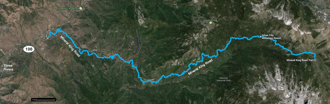
The route from highway 198 to Mineral King. This road is unbelievable!
We checked in early at Silver City Resort, but our chalet was not ready so we opted to have some lunch in the little diner. Burger for me and a salad for Lynn. The fries were excellent. We split a piece of apple pie that Lynn “the apple pie snob” thought was pretty good. That’s high praise coming from her.
Our chalet was ready before we finished lunch so the timing worked out very well. We had the Shooting Star Chalet which was lovely; nearly perfect for the two of us. Paul and Deb said it was the best of the chalets where at Silver City. I guess we were out by the fire pit with a beer in-hand by about 2:30 (no need for a fire however). Now we have a true “Life is Good” moment as we sat there in the serene, wooded area, just enjoying the peace of the day. The plan now is simply to chill. We can explore tomorrow.
We spent the afternoon sitting in the Adirondack chairs around the fire pit, just listening to the birds and squirrels, watching the trees spit seeds, drinking an IPA or two, reading a book, working a puzzle…basically just enjoying the serenity of the park. The only time we moved for the next couple of hours was for a refill or to shift our chairs back into the shade.
|
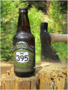
|
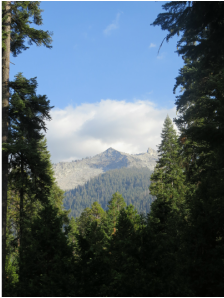
|
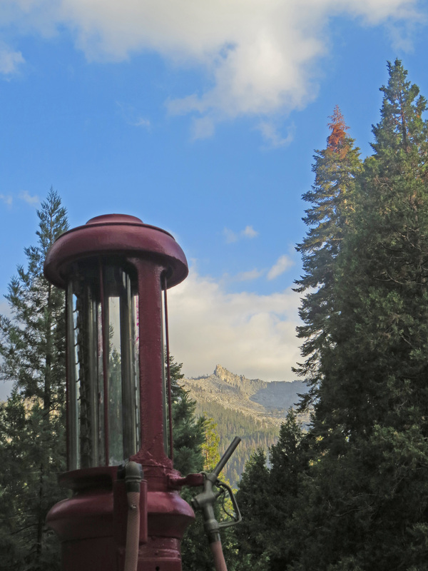
|
We finally headed down for dinner at about 6:00 Of course Lynn found the resident pooch, an Irish Setter named Timber. The food at Silver City was great. I had the pecan salad with a Sierra Nevada Pale Ale (not a lot of beer selection here for a hop head) and the brownie walnut pie for dessert. Lynn had the quesadilla with chicken, chardonnay and a slice of the fruit of the forest pie. In case you have not noticed, pie is the big deal at Silver City Resort.
We sat out on the porch after dinner, at least until the mosquitoes rolled in and chased us inside. Once it was dark we checked the stars which were great, but the sky here is small, so the effect was not as amazing as at Bearpaw. We watched “Despicable Me” on our portable DVD player for a while then crashed. Not a lot of photos from today, but here are the highlights from our time in Mineral King (includes the photos from tomorrow as well).
Day 9 – Saturday, August 23 – Let’s just relax. We were up about 7:00 but we were not in a hurry to go anywhere or do anything. It seems that we are both feeling sort lazy today. I reckon the 50 miles on the trail over the past week is really catching up with us. The original plan called for us to hike to Eagle Lake today, about a seven-mile jaunt, but after careful consideration we decided to skip that and just recover from the wear and tear of our Bearpaw excursion. I think we are getting old. We’re both a bit beat up and I’m feeling it in my joints a little as well. It’s always the second day when the soreness sets in, ain’t it.
An interesting point about the chalet. While we knew that the electricity was limited to certain times of day (they turn it on in the morning and turn it off in the evening, so a flashlight is a must). The interesting point was that there are no 110-outlets anywhere in the chalet. Good thing we charged the batteries and phones (not that we had any signal here) before we left Wuksachi.
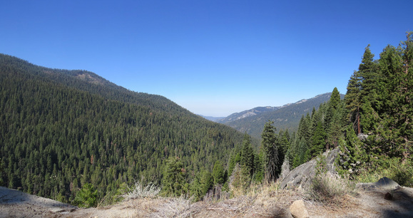 View from the road through Mineral King.
We had another blue sky, cloudless morning. The birds were singing and the squirrels were
romping about, but no big critters were seen around the chalet. We finally headed down to the diner for
breakfast. We both went with the
pancakes with pecans and bananas; short stack for Lynn and a tall stack for
me. About 10:00 we decided to look about
a bit and drove on up into Mineral King.
The temperature was 60 F, at least according to the rental car. The road is narrow beyond Silver City Resort
and only partially paved with some washboard in spots. We found the trailhead at the end of the
road. The parking lot was packed; this
is obviously a very popular hike. But we
were committed to having an easy day to recuperate so hiking was off the
itinerary. The road basically ended at
the trailhead, so we just reversed course and headed back to the chalet for
another take it easy kind of day. Unfortunately
there were no really spectacular views from the road but since we are not
hiking up into the mountains I guess the roadside views will have to do. We took a couple of drive by shots of the
terrain then headed back to the chalet for a nice quiet day.
To quote Hank Williams, Jr., we “spent the day doing nothing, just being Nature’s friend.” Just a nice quiet day split between the porch and the fire pit. We did venture down to the diner for lunch. I had the San Francisco burger and Lynn went with the cheese sandwich plus we split a piece of the apple pie. Did I mention that Silver City Resort is well known for their pies? Between lunch and dinner we were out on the porch reading and relaxing. We did see a few critters around the chalet today including mule deer, squirrels, Flickers, Stellar’s Jays as a couple hawks. The Stellar’s Jays were quite entertaining with their antics, including an immature one chasing its parents around looking for food. I think the older birds are trying to give Junior the slip, but he’s not getting the message. I kept chipping away at my fighter pilot book. The tales of the dogfights were enthralling, but I’m still wondering about some of the technical details. The author states that the wing section of the P-51 is symmetric. I don’t think that is correct. The Mustang had a laminar airfoil section, which is not a symmetric airfoil. Whatever. We did finish off the last of our beer but at least now we don’t have to worry about trying to carry it home. At 6:00 we went down to the diner for supper. Saturday night so there was live entertainment. Just a couple of local gentlemen playing old covers, but they were pretty good and it was nice to have a little music with dinner. The steak special was pretty good as well, and the pecan pie was worth every extra calorie. Their reputation for pies is well deserved. Back at the chalet we finished our movie and hit the sack at 9:00. We’ll have and early day tomorrow for the flight home. The review for Silver City Mountain Resort is on the reviews page.
Day 10 – Sunday, August 24 – Homeward Bound. We were up before dawn to finish packing and we were on the road at 0630. We had settled up the bill the previous night since the main building would not be open when we left. It was then that I noticed the hats for sale that highlighted the road to Mineral King: 70 minutes; 21 miles; 679 turns; 7,000 feet. It is quite the road. Fortunately there was no traffic to speak of on the Mineral King road and the return trip to Bakersfield was uneventful bordering on dull once we were on route 65 heading south. We did have one epiphany today as we were driving down the road. On the hillside above the road is what appears to be the remains of a sluice that we assumed was used for collecting the snow melt and directing it to the large metropolitan areas in southern California. Perhaps that is was the structure we saw stretching along the hillside as we were driving into the area at the start of the trip. That's our best guess anyway.
We arrived at the airport by 9:45, so in plenty of time for our flight. There were still issues with check-in due to flight number changes by United but the folks at the counter were extremely helpful and soon had us moving forward. There were no crowds at any point of the process (rental car return, flight check-in or security). I’m digging these little airports. Our flights went pretty much on schedule (Bakersfield to Houston from 11:30 to 4:55 then Houston to CLE, 7:05 to 10:55 PM). It was a long day of travel, but we made it home with no further issues.
And in conclusion… We had three wonderful vacations to the western National Parks this year, each one covering different regions and having slightly different themes, although hiking was a common thread through each. Day hikes to get away from the main roads and wildlife viewing were the objectives in Yellowstone and Grand Teton while seeing nature’s sandstone sculptures and rock art made by ancient cultures where the key points to the Utah trip (well that and visiting with the crazy folks in the meet-up herd!). In Sequoia we challenged ourselves with hikes into the back country as we explored along the High Sierra Trail while using the Bearpaw Camp as a base. This was perfect for day hikers like us as we got to hike and stay in the back country without actually roughing it like the real backpackers do. The hikes were long and tough, but each day we were treated to hot, homemade meals, a warm comfy bunk and a refreshing shower (not a hot shower, but still we were able to wash off the dust of a hard day on the trail). We had a wonderful time and would certainly do it all again.
Here’s the list, in the order made, of the hikes with the approximate distance. In some instances I had three measurements between published distance and what I measured with the Garmin GPS and the EveryTrail app on my phone. I think most of the difference is that I marked the distances from where we parked instead of the official trailhead, plus we had a few detours along some trails. I figure we put in over 50 miles on the trails in Sequoia, between our warm-up hikes and the back country adventures (the distances listed below add up to 55.2 miles). With the exception of Long Meadow, these were all excellent hikes with great scenery. The hikes are linked to EveryTrail maps and descriptions.

Along the trail to Tamarack Lake.
|
We are always on the lookout for animals while in the parks. Our July trip to Wyoming provided an unbelievable assortment of wildlife viewing so we were prepared for a less animal-centric visit while in Sequoia. However, we actually did much better than expected on the critter count, particularly with the little varmints and birds. Of course we did not get photos of everything we saw nor could we identify all the critters (lots of “gone” birds, just like we saw in Wyoming and Utah this year).
|
Mammals:
|
Birds:
|
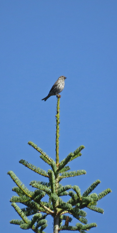
Cassin's Finch
|
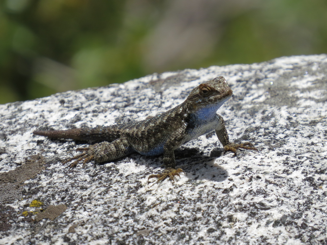
Western Fence Lizzard
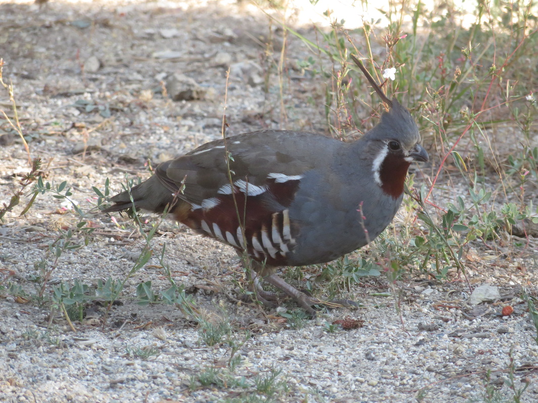
Mountain Quail
|
We’ve now visited Sequoia twice in the span of three years. Both were great trips and while there is still a lot to see, I think we covered the park in pretty good detail. Getting to hike a portion of the High Sierra Trail was a true treat and staying at the Bearpaw Camp was an outstanding experience. We were in the back country of the park without having to really rough it. How cool is that. Plus we met some really great folks while staying at Bearpaw. That just made the experience that much better.
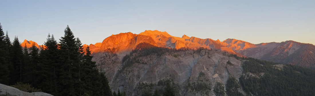
Alpenglow on the Great Western Divide as viewed from the Bearpaw High Sierra Camp.